夏威夷——英语课件
夏威夷PPT

对于他们来说,草裙舞是无字的文学作品,是他们的生命和灵感,也 是让外界了解他们的窗口。 For them, the hula dance is not the word of literary works, is their life and inspiration, but also let the outside world know their window.
• 夏威夷的冲浪运动至少已经有600年的历史了,1778年, 库克船长踏上这片海岸时,当地人高超的冲浪技艺就让这 群闯入者赞叹不已。
• Hawaii surfing at least have 600 years of history, in 1778, Captain Cook set foot on the coast, locals superb surfing skills let this group of the intruder with admiration.
夏威夷的草裙舞
草裙舞,又名“呼拉舞”,是一种注重手脚和腰部动作的舞曲。 Is a focus on the hands and feet and waist movement dance
草裙舞是夏威夷最有代表性的活动了,它的表演形式多种多样,一个 舞者可以表演,一队舞者也能表演。Hula is Hawaii most has the representative activity, its performance form many and varied, a dancer can perform, a team of dancers can perform.
(完整版)Hawaii夏威夷英文介绍

(完整版)Hawaii夏威夷英⽂介绍HawaiiUnited States GeographyThe Hawaiian archipelago is a string of islands and reefs, 3,300 kilometers long, that forms a broad arc in the mid-Pacific. The archipelago begins in the east with the island of Hawaii and ends almost at the international date line with a small speck in the ocean called Kure Atoll. Only the easternmost 650 kilometers of the state contains islands of any size, as well as almost all of the state's population. It is this portion that is usually considered as the actual "Hawaii."The eight main islands of Hawaii--Oahu, Hawaii, Maui, Kauai, Lanai, Molokai, Niihau, and Kahoolawe--contain more than 99 percent of the state's land area and all but a handful of its people. The island of Hawaii, at 8,150 square kilometers, comprises nearly two-thirds of the state's total area, and it is often referred to as simply the Big Island. The smallest of the eight, Kahoolawe, is 125 square kilometers and is uninhabited.LOCATION AND PHYSICAL SETTINGHawaii is near the middle of the Pacific Ocean. Honolulu, the state capital,is 3,850 kilometers west of San Francisco, California, 6,500 kilometers east of Tokyo, Japan, and roughly 7,300 kilometers northeast of the Australian coast. This might be viewed as a case of extreme isolation, and until the last few centuries this was probably true. But as countries around the Pacific Basin began to communicate more with one another and to use the ocean's resources, these islands became an important center of interaction.The Hawaiian chain is merely the visible portion of a series of massive volcanoes. The ocean floor in this area is 4,000 to 5,000 meters below sea level. Hence, for a volcano to break the water's surface requires a mountain already approaching 5 kilometers in height.The kind of volcanic activity that created the islands and that continues there today has, for the most part, not been of the explosive type in which large pieces of material are thrown great distances. Volcanic cones resulting from explosive eruptions do exist on the islands. Diamond Head, the Honolulu landmark, is the largest at about 240 meters. More common, however, are features formed from a gradual buildup of material as a sequence of lava flows piled one layer on top of another. The usual shape of volcanic mountains formed in this way is domelike, with the main feature being undulating slopes instead of steep cliffs.Several of the volcanos on the Big Island remain active. Mauna Loa pours out lava on the average of once every four years, and volcanic activity poses a constant threat to Hilo, the island's largest town. A 1950 eruption covered some 100 square kilometers. Another volcano, Kiluea, is usually active, but lava actually flows from it about once in every seven years. A 1960 flow from Kiluea covered 10 square kilometers, adding some 260 hectares to the island's size.Hawaii is a state of rugged slopes and abrupt changes in elevation. This is the result of the erosion of the volcanic surfaces by moving water. Sea cliffs cut by waves form a spectacular edge to parts of the islands. Such cliffs on the northeast side of Molokai stand as much as 1,150 meters above the water and are among the world's highest; others on Kauai exceed 600 meters. Some small streams on the northeast side of the Big Island drop over such cliffs directly into the sea.Stream erosion has heavily dissected many of the lava surfaces. Canyons lace many of the domes. The floor of Waimea Canyon, on Kauai, is more than 800 meters below the surface of the surrounding land. Waterfalls several hundred meters high are common on the islands. The Pali, on Oahu, is a line of cliffs where the headwaters of streams eroding from opposite sides of the island meet. Those flowing east have eroded the ridges separating them to cut a broad lowland;the westward-facing valleys are higher and remain separated by ridges.One important result of this intense erosive action is a limited amount of level land on the islands. Kauai is particularly rugged, with the only lowlands formed as a thin coastal fringe. Maui has a flat, narrow central portion separating mountainous extremities. Molokai is reasonably flat on its western end. Oahu has a broad central valley plus some sizable coastal lowlands. The island of Hawaii has only some limited coastal lava plains.Hawaii's oceanic location obviously has a substantial impact on its climate. It is the ocean that fills the winds with the water that brush the islands' mountains. The ocean also moderates the islands' temperatureextremes--Honolulu's record high of 31癈 is matched by a record low of only 13癈.The latitude of Honolulu, about 20癗, is the same as Calcutta and Mexico City. As a result, there is little change in the length of daylight or the angle of incidence of the sun's rays from one season to another. This factor, plus the state's maritime position, means that there is little seasonal variation in temperature.It is variations in precipitation that mark the major changes in season on the islands. During the summer, Hawaii is under the persistent influence of northeast trade winds, which approach the islands over cool waters located to the northeast and create characteristic Hawaiian weather--breezy, sunny with some clouds, warm but not hot. In winter, these trade winds disappear, sometimes for weeks, allowing "invasions" of storms from the north and northwest. Honolulu has received as much as 43 centimeters of rain in a single 24-hour period. Hawaiian weather stations have also recorded 28 centimeters in an hour and 100 centimeters in a day, both of which rank near world records.The topography of the islands creates extreme variations in precipitation from one location to another. Mount Waialeale, on Kauai, receives 1,234 centimeters annually, making it one of the world's wettest spots, and Waimea, also on Kauai, receives about 50 centimeters annually--yet these two sites are only 25 kilometers apart. Within the metropolitan area of Honolulu, it is possible to live near the beach in a semiarid climate with less than 50 centimeters of rainfall annually or inland near Pali on the margins of a rain forest drenched by 300 centimeters of precipitation a year. Unlike the Pacific Northwest, the greatest precipitation on the higher mountains in Hawaii occurs at fairly low elevations, usually between 600 and 1,200 meters. Much of the volcanic soil is permeable. This allows water to percolate rapidly, draining beyond the reach of many plants. Thus, many areas of moderate to lowprecipitation are arid in appearance.The isolation of the Hawaiian islands, coupled with their generally temperate climate and great environmental variation, has created a plant and bird community of vast diversity. There are several thousand plants native there and found naturally nowhere else; 66 uniquely Hawaiian land birds have also been identified. Interestingly, there were no land mammals on the islands until humans arrived.POPULATING THE ISLANDSThe Polynesian settlement of Hawaii was a segment in one of humankind's most audacious periods of ocean voyaging. These people set out on repeated voyages in open canoes across broad oceanic expanses separating small island clusters. Settlers who came to Hawaii 1,000 years ago, for example, are presumed to have come from the Marquesas, 4,000 kilometers to the southwest. There was some kind of pre-Polynesian population on the island, but it was probably absorbed by the newcomers. A second substantial wave of Polynesian migrants arrived 500 or 600 years ago.The massive effort required by these voyages apparently became too great. As a result, Hawaii spent several hundred years in isolation after the second migration period. During the isolation, the Hawaiians solidified a complicated social organization in their insular paradise. Hereditary rulers held absolute sway over their populations and owned all of the land. By the late 18th century, when Europeans found the islands, the benign environment supported a population that numbered about 300,000.The first European to visit Hawaii, which he dubbed the Sandwich Islands, was Captain James Cook in 1778. Cook was killed on the shore of the Big Island, but news of his discovery spread rapidly after reaching Europe and North America; it was quickly recognized that the islands were the best location for a waystation to exploit the trade developing between North America and Asia.In the 1820s, the whaling industry moved into the North Pacific and, for the next half-century, the islands became the principal rest and resupply center for whalers. About the same time, Protestant missionaries came to the islands. Like most of the whalers, they were from the northeastern United States. They were very successful in their missionary work, and for decades had a major influence on the islanders.The first Hawaiian sugar plantation was established in 1837, although the islands did not become a substantial producer until after the middle of the century. Between then and the end of the 19th century, Hawaii grew to the rankof a major world sugar exporter.This development led to a need for agricultural laborers. Native Hawaiians were used for a time, but their declining numbers provided nothing like the labor force needed. Thus, between 1852 and 1930, plantation owners brought 400,000 agricultural laborers, mostly Asian, to Hawaii. In 1852, ethnic Hawaiians represented over 95 percent of the population of the islands. By 1900, they were less than 15 percent of the total population of just over 150,000, whereas nearly 75 percent were Oriental. After 1930, the mainland United States became the main source of new residents in Hawaii. In 1910, only about one resident of Hawaii in five was of European ancestry (referred to in Hawaii as Caucasian). Now, nearly 40 percent of the state's population is Caucasian or part-Caucasian.The population of Hawaii fell from its pre-European peak to a low of 54,000 in 1876 before beginning to grow again. By the early 1920s, the state's population had reached pre-European levels, and in 1988, the state had 1.1 million residents. Because of immigration, Hawaii's annual rate of population growth is well above the U.S. average.The pre-European population was spread across the islands, with the Big Island occupied by the largest number of people. Since European discovery, the islands' population has been concentrated increasingly on Oahu. Honolulu, with its fine harbor, became the principal port city.The political history of Hawaii was turbulent during the 120 years after Cook's discovery. The various kingdoms of the islands were eliminated by a strong chief, Kamehameha, between 1785 and 1795. The missionaries' growing influence gradually made a sham of the authority of the Hawaiian rulers, and, during the 19th century, competing European political interests moved in to fill the resulting vacuum.But the increasing role of Americans made it inevitable that, if Hawaii was to lose its political independence, it would be annexed by the United States. As American plantation owners increased in number and influence, their dissatisfaction with the Hawaiian government grew. In 1887, they forced the monarchy to accept an elected government controlled by the planters. The monarchy was overthrown completely in 1893, and the new revolutionary government immediately requested annexation by the United States. Initially refused, they were finally accepted as a territory in 1898.No provision was made at the time of annexation for the eventual admission of Hawaii to statehood, and it was not until 1959, after Alaska was admittedto the union, that Hawaii became the 50th U.S. state.THE HAWAIIAN ECONOMYRoughly half of all land in Hawaii is government owned, with the state, not the federal government, controlling 80 percent of that land. Most of it is in the agriculturally less desirable portions of the islands, and the bulk is in forest reserves and conservation districts. Most federal lands are primarily in national parks on the Big Island and Maui, or in military holdings on Oahu and Kahoolawe.Seven-eighths of all privately owned land in Hawaii is in the hands of only 39 owners; each owns 2,000 hectares or more. Six different landowners each control more than 40,000 hectares out of a state total of about 1,040,000 hectares. Smaller unit ownership of private land is most extensive on Oahu, but even there the larger owners control more than two-thirds of all privately owned land. Two of the islands, Lanai and Niihau, are each nearly entirely controlled by a single owner, and on all of the other islands (except Oahu) major landowners control about 90 percent of all privately held property.Most of these large landholdings were created during the 19th century period of freewheeling exploitation on the islands. Land had previously been held entirely by the monarchies. This land passed into the hands of non-Hawaiian private owners during the political decline of the monarchy. With the deaths of the early owners, most estates have been given over to trusts to administer rather than passing directly to heirs. This has made it difficult to break up the ownership patterns, which has led to high land values and pockets of high population density.Sugar, and later pineapples, fueled the Hawaiian economy for many decades after the 1860s. The economy remained primarily agricultural until the late 1940s. In recent decades, agriculture has continued to show modest gains in income, but its relative importance has declined. Only one Hawaiian worker in 30 is currently employed in agriculture.However, Hawaii continues to provide a substantial share of the world's sugar harvest, and its production of pineapples is about 650,000 tons annually, making it the world's largest supplier of pineapples.Gross economic statistics overwhelmingly emphasize the position of Oahu, where more than 80 percent of the state's economy is concentrated. The role of agriculture remains great on the other islands. Both Lanai and Molokai depend on pineapples for much of their employment and income. Livestock and sugar form the backbone of the economy on the Big Island, as do sugar andpineapples on Maui and Kauai.As agriculture declined and lost its dominance over the Hawaiian economy, its place was first taken by the federal government. Over the past several decades, governmental expenditures have increased at a rate roughly comparable to the growth of the total economy, maintaining about a one-third share of all expenditures. Most of this has come from the military, which controls almost 25 percent of Oahu, including the land around Pearl Harbor, one of the finest natural harbors in the Pacific. Nearly one Hawaiian worker in four is an employee of the military, and military personnel and their dependents together represent over 10 percent of Hawaii's population. The armed forces are also the largest civilian employer in the state.Tourism is a major industry, with over 4.5 million people visiting the state each year. Tourism has become the principal growth sector of the economy, increasing its share of total island income from 4 percent in 1950 to over 30 percent today. INTER-ISLAND DIVERSITYThe major Hawaiian islands are part of the same state, they have similar geologic histories, and they are closely spaced in a vast ocean, yet each has its own character. Oahu is densely populated and intensely used, and it offers a view of bustle and confusion common to urban America. The island of Hawaii, the Big Island, by comparison has an air of relative space and distance, with large ranches, high, barren volcanos, and large stretches of almost treeless land. Its land area is dominated by five huge shield volcanoes. Sugar, cattle ranching, and tourism are its major industries.Kauai, sometimes called the garden isle because of its lush tropical vegetation, is heavily eroded into a spectacular scenery of mountains, canyons, cliffs, and waterfalls. Kauai is becoming increasingly popular with tourists because of its dramatic physical environment. Neighboring Niihau is privately owned and is operated as the Niihau Ranch Company. Most of its few hundred residents are native Hawaiians.Maui, the second largest of the islands, offers a contrast between the plantations of its central lowlands and the rugged mountains to either side. Tourist development, concentrated along the western coastal strip, has been intense, with the result that Maui had the most rapid rate of population increase of any of the islands in the 1970s and 1980s. Still, much of the rest of the island remains little changed and sparsely populated.Molokai is half ranchland and half rugged mountains. Its north coast is dominated by spectacular sea cliffs as much as 1,100 meters high, while thesouth shore is a broad coastal plain. It is perhaps the least economically developed of the populated Hawaiian Islands. Lanai and Kahoolawe are both in the lea of much higher Maui. As a result, both are dry. Neither have any permanent streams. Pineapple production is the only important economic activity on Lanai. The U.S. Navy administers Kahoolawe and uses it for military exercises.。
Friendship-in-Hawaii-高一英语新课标优秀课件

USEFUL STRUCTURE
It is + p.p+ that… :
It is said that... It is reported that… It is considered that… It is thought that… It is regarded that… It is believed that… ……
on the islands.
①
Living in peace, Hawaiians have developed a third sign of
friendship. This personal friendship is shown by giving leis to
one another. The lei, a string of flowers, is put over a friend's
aloha lokahi lei kokua ohana
READING SKILLS
Scanning: it is used when you want to quickly find some information which you need. In scanning you have a question in your mind and read the passage only to find the answer, ignoring useless information.
community from many smaller communities. all feel stronger. It is believed that the islands
Each person gives kokua can be a paradise(天堂)
用英语介绍美国夏威夷州

在这人间天堂没有陌生人。也许夏威夷人与生俱来地的热情才是这里真正魅力所在。我们称之为爱的精神。它是世界上最文明的地方之一,世界各地的文化都可以在这熔炉中找到共同点,生根发芽。
另一篇:
Hawaii is very far from other areas in the USA. It is more than three thousand kilometers from the state of California. It is more than six thousand kilometers from Japan.
For most of us, Hawaii begins to weave her spell(魅力)with some little glimmer(微光) of awareness. Golden beaches and golden people. Sun, sand, sea, and surf……And somewhere between the blue skies and the palm trees(棕榈树)……we're hooked(吸引).
夏威夷远离美国其它的州。它离加利弗尼亚州三千多公里远。它离日本六千多公里远
Hot liquid rock called lava formed the Hawaiian Islands millions of years ago. The lava flowed up from the sea through openings in the sea floor. Visitors today can watch this process continue on the Big Island where the world's most active volcano still produces lava.
夏威夷英文介绍ppt课件

• Most of Hawaii has only two seasons: the dry season from May to October, and the wet season from October to April.
• Local climates vary considerably on each island, grossly divisible into windward (Koolau) and leeward (Kona) areas based upon location relative to the higher mountains. Windward sides face cloud cover. Hawaii therefore concentrates resorts on sunny leeward coasts.
• Recently, Hawaii has garnered additional attention as the location where U.S. President Barack Obama was born and spent much of his youth. Obama is the only president to hail from the state.
夏威夷英文地方介绍(课堂PPT)
5
Some desigens from the
featrues of Hawaii~
• 夏威夷风情鼠 标设计~
6
Geology
• All the Hawaiian islands were formed from volcanic activity initiated at an undersea magma source called a hotspot. As the tectonic plate beneath much of the Pacific Ocean moves to the northwest, the hot spot remains stationary, slowly creating new volcanoes. Due to the hotspot’s location, Hawaii’s only active volcanoes are located around the southern half of the Big Island. Hawaii’s newest volcano, Lōihi Seamount, is located south of the Big Island’s coast.
夏威夷简介ppt课件

夏威夷有一个事实上的人口超过140万,部分原因是大量的军事移民 和旅游的居民。夏威夷的140万居民,分布在6000平方英里的土地上。
夏威夷是美国亚裔人口比例最高的州,日本人是夏威夷最大的
亚洲少数民族,其次是菲律宾人、土著人、中国人、朝鲜人、越南
人、老挝人和泰国人
2
3
climate
夏威夷的气候是典型的热带地区.夏威夷的自然风光,温暖的热带气 候,丰富的公共海滩,海洋环境和活跃的火山,使它成为一个受欢 迎的地方对于那些游客,冲浪者,生物学家,和火山学家。因为它 位于太平洋的中心位置以及19世纪的劳动力的迁移,夏威夷的文化 是由北美洲和亚洲文化的强烈影响,除了本土的夏威夷文化。夏威 夷拥有一百万多个永久居民,以及许多游客和美国军事人员。
4
5
haweiians
6
7
8
capital
Hawaii's capital, is also the largest city in Hawaii, Hawaii's political, economic, commercial and cultural center is located (Honolulu) is also called Honolulu,
夏威夷是美国亚裔人口比例最高的州日本人是夏威夷最大的亚洲少数民族其次是菲律宾人土著人中国人朝鲜人越南人老挝人和泰国人夏威夷的气候是典型的热带地区
美丽夏威夷
1
loaction
夏威夷州以其最大岛屿的名字而得名,夏威夷群岛位于2000英里 (3200公里)的美国大陆西南。夏威夷是第50个州,最近加入美国的 州,在1959年8月21日加入。夏威夷是美国唯一位于大洋洲的州,唯一 一个完全由群岛组成的州。最北部在波利尼西亚群岛,占据大部分太 平洋群岛的中央。这个州不遵守夏令时。
hawaii夏威夷英文
Hawaii
As one of the most beautiful places on earth, the 137 islands, islets and shoals that make up the Hawaiian Island chain sit at the northern tip of the Polynesian Triangle, an expanse of ocean roughly the size of Europe and North America combined.
Oahu Island
Take in turn-ol through Chinatown, or ride the trolley through Waikiki and you’ll see historical hotels such as the Sheraton Moana Surfrider and the Royal Hawaiian Hotel made famous in the early 1900’s.
Hawaii’s Attractions
The Big Island You can try dancing the hula and taking part
in an authentic luau (feast).
The Big
Island
Head upcountry and discover the uniquely blended Hawaiian, Portuguese, and Mexican cultures — still alive and well among Hawaiian paniolo (cowboys) on the island’s giant ranches.
State_of_Hawaii
STATE OF HAWAII (USA)INTRODUCTIONby Karin Z. Meier, James P. Laurel and James E. MaragosArea: 16,770 sq.km.Population: 1,250,000.Hawaii is the only tropical and only island state of the USA. Hawaii consists entirely of islands, mostly of volcanic basalts to the southeast and coral limestone caps atop extinct volcanoes to the northwest. The archipelago is long, stretching 2,600 km along a northwest to southeast axis in the central tropical Pacific, and consisting of about 35 coral or volcanic islands. The northwest end of the chain consists of coral atolls at longitudes 29° to 30° N and at latitudes 176° to 170° W. The large volcanic islands at the southeast end of the Hawaiian chain are situated at latitudes 19° to 23° N and longitudes 155° to 161° E. The largest island is Hawaii (10,500 sq.km), or the "Big Island", followed by Maui (1,900 sq.km), Oahu (1,573 sq.km), Kauai (1,444 sq.km), Molokai (676 sq.km), Lanai (367 sq.km), Niihau (187 sq.km) and Kahoolawe (117 sq.km).The Hawaiian archipelago has formed over a geological "hotspot" on the floor of the deep Pacific ocean. Over the past 50 million years, the earth's crust has been moving in a northwest direction over the hotspot, allowing a chain of volcanic islands to form and move to the northwest. The volcanic islands, thus, are progressively older to the northwest. As they age, the volcanic islands become eroded, subside, and eventually coral reefs form around their sides. Additional subsidence then causes the volcanic portion of the islands to submerge entirely to form atolls. Eventually the atolls drift out of the warm tropics, and when their upward growth can no longer keep pace with subsidence, they "drown", becoming seamounts. For example, the Emperor Seamounts off the east coast of Japan are the earliest of the Hawaiian volcanoes that have long since drowned many millions of years ago. The oldest of the existing Hawaiian islands are the atolls of Midway and Kure, approximately 25 million years old. At the opposite end of the chain, to the southeast, are found the youngest, and largest islands. For example, Hawaii (the Big Island) is less than one million years old, Maui and Molokai less than three million years, and Oahu less than six million years old. The young volcanic islands are also the highest; Hawaii's highest point is at 13,784 ft (4,202 m), Maui is 10,025 ft (3,056 m) high, Oahu is 4,025 ft (1,227 m) high, Kauai is 5,170 ft (1,576 m) high, Molokai is 4,970 ft (1,515 m) high, Lanai is 3,370 ft (1,027 m) high, Niihau is 1,281 ft (391 m) high, and Kahoolawe is 1,472 ft (449 m) high.Hawaii has a mild tropical climate with average temperatures varying between 20° and 30°C throughout the year. The high islands trap more rainfall because the prevailing trade winds must rise over them, cool off, and drop moisture. On the low islands and open ocean areas away from the high islands, precipitation averages about 20 inches (508 mm) per year, but off the windward sides and peaks of the high islands, precipitation averages 100-300 inches (2,540-7,620 mm) per year. Mount Waialeale on Kauai is reputedly the world's wettest spot, with an annual precipitation rate of 500 inches (12,700 mm). On the back or leeward sides of the same high islands, rainfall rates are much below average. For example, the leeward sides of the Big Island and Maui average only 10 inches (254 mm) or less of rainfall per year. These climatic factors profoundly affect the distribution and type of wetlands in Hawaii.Most of the people of Hawaii reside on Oahu (population 836,231), which also serves as the state's capitol. The other inhabited islands have much lower permanent populations, and in descending order of population size are Maui, Hawaii, Kauai, Molokai, Lanai and Niihau. A small Naval Air Station is situated at Midway Atoll, and a small research station is found on the atoll of French Frigate Shoals. The U.S. Coast Guard recently closed their navigation station at Kure, leaving the island abandoned. The remainingHawaiian Islands are uninhabited.The ancient Hawaiians were the first settlers to reach Hawaii, about 1,000 to 1,500 years ago. The Hawaiians occupied all of the main islands and some of the smaller islands to the northwest, including Kaula and Nihoa, at least for extended periods. The early Hawaiians practised a subsistence lifestyle relying heavily on fish, taro and other garden crops. Meaningful western contact began with Hawaii's "discovery" by Captain James Cook in 1778. In the subsequent 200 years, the population has become more cosmopolitan due to the importation of foreign workers and a decline in the Hawaiian population from exposure to diseases brought in by foreigners. Today, the major ethnic groups in Hawaii include Caucasian, mixed Hawaiian, Japanese, Filipino, Chinese, Samoan, Korean and other groups. No one group achieves a population majority in Hawaii. Over a century ago, the economy of the islands shifted from subsistence to agriculture, with cane sugar, pineapples and coffee being the main export commodities. Later, macadamia nuts, bananas, flowers and papayas were exported. However, since World War II, agriculture has steadily declined in Hawaii relative to the importance of government expenditure and tourism. Military expenditure and tourism now account for more than half of the economic foundation in Hawaii.Summary of Wetland SituationHawaii has many thousands of wetlands and a great variety of wetland habitats. In the compilation of information for the present inventory, most marine wetlands such as coral reefs and lagoons have been excluded, as well as many freshwater bodies such as highly modified or intermittent streams and most man-made reservoirs or ponds. Wetland types which have been considered in this inventory include perennial streams, natural lakes, a few reservoirs important for waterfowl, upland bogs, coastal marshes, mangrove swamps and anchialine pools (open brackish waters with tidal action but no visible surface connection to the sea). Over 450 significant wetlands have been identified throughout the islands.Coastal marshes are confined to the portions of high islands with floodplains or coastal plains. Upland bogs are also confined to the high islands, especially along the wetter windward slopes and mountain ridges. Anchialine pools in basalt rock are confined to the youngest islands (Maui and Hawaii), where the lava rock is porous and creates broad shallow shelves near the coast. Limestone anchialine pools are also found in karstic formations, consisting of fossilized coral reefs, now positioned above sea level, which have undergone extensive weathering and dissolution to form the anchialine pits and pools. Hawaii has only five large natural freshwater lakes, again all located on the high islands. Mangrove swamps are not native to Hawaii, and began to spread throughout Hawaii when residents brought in alien mangrove species at the turn of the century. Perennial streams are confined to the islands with elevations greater than 3,500 ft (1,078 m). Most streams are located along the wetter windward sides of islands where volcanic rocks have weathered to form more impermeable soils. Kauai, being the wettest and most weathered of the high islands, has the most freshwater wetlands in Hawaii.Prior to western contact, the human populations exerted little modification or control of wetlands with two notable exceptions: many low lying coastal marshes were walled and modified to support wet taro cultivation in ponds called lo'i. The downstream reaches of many streams were also walled and diverted to provide a constant supply of water to the taro patches through channels called auwai. The Hawaiians also constructed large rock-walled fishpond enclosures along broad shallow reef flats for the purpose of raising and corralling fish. Few of the taro fields, channels and fishponds are in use today, and many have been destroyed during modern urban development or have fallen into disrepair.Major reclamation of coastal wetlands occurred due to the expanse of plantation-style sugarcane and pineapple culture during the previous century. Large land areas were flattened and graded and irrigation ditches installed in the drier agricultural areas. Many coastal ponds, lakes and marshes must have been buried or drained at this time. Ranching and livestock production also resulted in soil erosion and infilling of many coastal wetlands during the past century. Water was also diverted from large perennial streams along thewindward sides of islands to provide irrigation water for agricultural fields on the leeward (drier) sides. Ditches and tunnels were dug or blasted through mountains, slopes and valleys, to convey the water to the plantations. Rice was grown in Hawaii during the early part of this century, resulting in major loss or modification of wetland habitat. Many marshes and abandoned taro ponds were converted to wet rice culture. Rice did not prove to be economically viable and agricultural operations ceased in the years following World War II. However, taro production never experienced a revival, and many wetland areas remained in a degraded state. Navigation projects in Hawaii, beginning at the turn of the century, also resulted in the destruction or modification of many coastal wetlands, including port development in Nawiliwili and Hanapepe on Kauai, Honolulu Harbor on Oahu, Kahului and Maalaea harbours on Maui, and Hilo Harbor on Hawaii. Military construction before, during, and after World War II also wrought additional destruction to reefs, fishponds and marshes at the Marine Corps Air Station at Kaneohe Bay, at Honolulu Harbor and at Pearl Harbor. Military airfield construction at Hickam Air Force Base and Bellows Air Force Base, both on Oahu, and channel dredging for Pearl Harbor and Honolulu Harbor modified the salinity and water quality conditions in those areas. Military seaplane dredging at Keehi Lagoon and southern Kaneohe Bay (both on Oahu) destroyed coral reef and estuarine habitats.Non-military construction for housing and civil works projects has caused the most destruction to Hawaii's coastal wetlands during the post-war era. Large marshes were drained and filled at Ala Wai, Waikiki, Honolulu, Hawaii Kai (Kuapa), Enchanted Lake (Kaelepulu), Kawainui and Salt Lake (all on Oahu), to accommodate major residential or resort projects. Fishponds along the southern shoreline of Kaneohe Bay and some along the coasts of Molokai and Maui were filled for housing projects. Major airfield projects at Keehi Lagoon, Kahului and Hilo resulted in damage or burial of marshes and other wetlands. For example, Kanaha Pond, adjacent to the Kahului airport, has been reduced to less that half its original size, although it still supports large native waterfowl populations.Stream diversion for agriculture and urban water supply has dried up many streams and degraded habitat for native species of fish which live in streams. Some of the species require migrations to and from the sea as part of their lifestyles, and the diversion of water now prevents these essential life cycle stages in many streams. Stream diversion has also degraded downstream estuarine habitat. The construction of wells and pumping of groundwater have diverted waters that would otherwise feed into streams. Few unmodified and undiverted streams now exist on Oahu, and many others face future diversion on the neighbouring islands (Maui, Molokai, Kauai and Hawaii).Some public works projects have also benefited wetland habitat. Wetland areas in Pearl Harbor were created as mitigation for airfield construction at Keehi Lagoon. These wetlands are managed by the U.S. Fish and Wildlife Service as successful wildlife refuges. Several reservoirs in the state, including Waita Reservoir on Kauai and the Nuuanu Reservoirs on Oahu, are important habitat for Hawaii's dwindling waterbird populations.Anchialine pools have been filled for residential or resort development, including a large pond complex at the Waikoloa Resort at Anaeho'omalu, on the island of Hawaii. Other proposed resorts along the western ("Kona") coast of the Big Island threaten additional anchialine pools.Trash disposal has been implicated in polluting Kawainui Marsh on Oahu. Industrial production of canec board using termicide additives has polluted ponds in Hilo Bay on Hawaii. Light and heavy industrial pollution in Honolulu has polluted the remaining waters of Keehi Lagoon and Honolulu Harbor. Sewage pollution has degraded habitats in Kawainui Marsh, Kaneohe Bay, Hilo Harbor, West Maui and Honolulu Harbor. Soil erosion and sedimentation from excessive grazing by feral ungulates on Molokai, and ranching and sugarcane culture on several high islands have degraded estuaries, marshes and coral reefs.Introduced plants (alien species), including mangrove and various weedy grasses, have encroached on fishponds and marshes, leaving only a fraction of the original habitat area. Introduced animals have also hadmajor impacts on native waterbirds. Mongoose, dogs, cats, rats and pigs are all potential predators of waterbirds or their eggs, and the access of predators to nesting areas severely depletes or eliminates breeding activity. The consequences of habitat degradation and predation have placed all four endemic Hawaiian waterbirds on the verge of extinction. The Hawaiian Duck (Arias wyvilliana), Hawaiian Coot (Fulica alai), Hawaiian Gallinule (Gallinula chlorvpus sandvicensis) and Hawaiian Stilt (Himantopus mexicanus knudseni) are all listed as U.S. Federal Endangered Species, and another common inhabitant of open grasslands and coastal areas, the Hawaiian Owl (Asio flammeus sandwichensis), is depleted on several islands. Two other endemic species include the Laysan Duck (Anas laysanensis), whose habitat is confined to a saltwater lagoon at Laysan Island, in the northwest end of the Hawaiian chain, and the Hawaiian Goose (Branta sandvicensis), which has evolved into a grassland, rather than a wetland species.The U.S. Fish and Wildlife Service and Hawaii State Division of Forestry and Wildlife have developed considerable resources and programmes to establish marsh and other wetland areas as refuges to protect the endangered waterbirds. Most of the established wildlife refuges on the high islands concentrate on wetland habitats and protection of waterbirds. The Hanalei National Wildlife Refuge on Kauai, the state wildlife preserve at Kanaha on Maui, and the several smaller national wildlife refuges on Oahu are essential for the preservation of Hawaii's endemic waterbirds. Wetlands which are either unprotected or unrestored, such as Kawainui Marsh on Oahu, Kealia Pond on Maui, Makalawena on Hawaii and several playa lakes on Niihau, are of much less importance for waterfowl.Wetland ResearchImportant information on waterbirds and their wetland habitats was first collected by ornithologists and members of the Hawaii Audubon Society, and much of the written findings of bird counts is published in a local journal, Elepaio, devoted to Hawaiian ornithology. Of particular importance was the tradition among the birding community to conduct simultaneous bird counts at all important bird habitats in Hawaii during a 1-2 day period during the holiday season. Over the years, these so-called "Christmas counts" have provided valuable insights on wetland habitat changes and losses, and trends in population levels for waterbirds, forest birds and seabirds which frequent Hawaii's wetlands. The state and federal fish and wildlife agencies have collected and continue to collect data on a regular basis on the status and condition of existing refuges or preserves and other wetland areas they desire to acquire and establish as refuges or preserves.Systematic research on Hawaiian wetlands began in earnest with the passage of U.S. laws designed to protect wetlands in the 1970s. The passage of the Clean Water Act and implementing regulations in 1977 and the U.S. Endangered Species Act in 1973 prompted the U.S. Army Corps of Engineers and the U.S. Fish and Wildlife Service to sponsor statewide inventories of selected wetland habitats. The Corps' inventories concentrated on coastal marshes, swamps and fishponds with emergent wetland vegetation, as well as describing a few upland bog areas. Each of about 70 sites on the islands of Oahu, Molokai, Hawaii, Maui and Kauai were surveyed in the field, photographed by air, mapped and evaluated. Wetland boundaries, vegetation zones, threats to wildlife and habitat, and species lists of animals and plants were compiled for each site (Elliott and Hall, 1977; Shallenberger, 1977; Elliott, 1981). These early surveys concentrated on wetlands greater than five acres (two hectares) in size. Later, the U.S. Fish and Wildlife Service concentrated on the inventory of a greater variety of wetland habitats and sizes, using high resolution colour aerial photography and mapping procedures. Their inventory classified and delineated all wetlands according to an ecosystem classification scheme devised by Cowardin et al. (1979), and produced a series of maps.The U.S. Fish and Wildlife Service also sponsored a statewide evaluation on streams in Hawaii (Maciolek and Timbol, 1978; Norton et al, 1978). This inventory resulted in mapping and evaluation of all streams in the state, which in turn led to the development of priorities to protect the most important stream systems. The U.S. Fish and Wildlife Service also sponsored the inventory of Hawaii's large natural lakes (Maciolek, 1969). More recently, the University of Hawaii Environmental Center evaluated the ecologically sensitive wetlands and associated groundwater resources responsible for maintaining those wetlands on the islands of Oahuand Maui (Miller et al., 1989). The Hawaii Heritage Program of the Nature Conservancy of Hawaii has also field evaluated some upland bog sites and has established a statewide database on certain wetlands, including upland bogs, anchialine pools, perennial streams and some estuaries and embayments. With time, the Heritage database is expected to expand to include other important wetland habitats.Some individual wetlands in the state have been surveyed because of their important functions as wildlife habitat, flood control and wastewater management. For example, studies have been conducted at Kahana Stream, Oahu's most important stream estuary (Timbol, 1979; Maciolek, 1972; Archer et al. , 1980), Nuupia ponds, an important wetland and fishpond complex under the jurisdiction of the Marine Corps on Oahu (Drigot, 1983; Aecos Inc., 1983), Kawainui Marsh, Hawaii's largest remaining wetland (U.S. Army Corps of Engineers, 1981; Smith, 1978; Drigot and Seto, 1982; Chun and Dugan, 1981), Pearl Harbor, Hawaii's largest estuary and only embayment estuary (Evans, 1974; Turner, 1975; U.S. Department of the Interior, 1969), and Keehi Lagoon, formerly an important coastal wetland and marine lagoon complex on Oahu (Harvey, 1970; Berger, 1971; Bathen, 1970). Other important wetland sites on Oahu subject to intensive study include the Kuapa Pond at Hawaii Kai and the Ala Wai Canal, both now severely degraded by extensive dredging and filling but formerly two of Hawaii's most important wetlands. Several National or State wildlife refuges or preserves on Oahu are monitored on a regular basis as part of their overall management programme. On neighbouring islands, wetlands that have been intensively studied include: Hanalei Stream and wetlands, Alakai Swamp and Waita Reservoir on Kauai; Kealia, Cape Kinau-Ahihi and Kanaha wetlands on Maui; coastal fishponds along the southeast coast of Molokai; Kaloko and Makalawena wetlands on Hawaii Island; and wetland habitats at Laysan Island and French Frigate Shoals in the Northwest Hawaiian Islands.Wetland Area LegislationBefore 1970, the most important U.S. legislation protecting wetlands included the River and Harbor Act of 1899 and the Fish and Wildlife Coordination Act of 1958. The first restricted the discharge of refuse and work in navigable waters of the United States, including wetlands in these waters. The second mandated the involvement of federal and state fish and wildlife agencies during the review and approval stages for civil works "water" projects (harbours, dams, channelization, hydro-power, water supply etc.).Mitigation requirements to compensate for fish and wildlife losses were introduced at this time.Passage of the National Environmental Policy Act (NEPA) on 31 December 1969 ushered in a new era of environmental protection in the United States, including significant emphasis on wetland protection. NEPA required federal agencies sponsoring or permitting projects to take into consideration the environmental consequences of their proposed actions, and required preparation of environmental impact assessments or statements for projects possibly resulting in significant impacts. The regulatory programme of the U.S. Army Corps of Engineers, which included administration of the River and Harbor Act (Section 10) permits, was substantially strengthened to evaluate the environmental consequences of proposed action.Passage of the federal Water Pollution Control Act of 1972, and later the Clean Water Act of 1977, authorized the Corps and the U.S. Environmental Protection Agency to administer a permit programme for the express purpose of protecting wetlands and other special aquatic sites in accordance with section 404 of the Clean Water Act. Federal jurisdiction now extended to inland waters, including streams, adjacent wetlands and isolated wetlands (i.e. the "waters of the United States"), as well as encompassing the traditional navigable water of the United States. The Clean Water Act and Section 404 programme allowed the Corps to deny permit actions involving the discharge of dredged and fill materials in wetlands and other important ecosystems on the basis of environmental concerns. Implementation of this Act has greatly curtailed but not eliminated the filling and draining of wetlands in Hawaii. For example, the remnant portions of Salt Lake wetland are now protected from additional filling. On the other hand, a substantial number of anchialine pools were allowed to be filled during construction of the Waikaloa Resort at Anaehoomalu, Hawaii. The loss of the ponds was partially compensated by the construction of new "artificial ponds" and protection of adjacent natural ponds.Although the Corps Section 404 and Section 10 permit programme has greatly curtailed the destruction of wetlands in Hawaii, more needs to be done to eliminate discretionary authority and other loopholes that may allow additional wetlands to be filled or drained.In response to this need, the state and county governments have tried to strengthen their environmental review process to protect wetlands, and have gone so far as to introduce wetlands protection legislation (which has not yet passed).Other important federal legislation protecting wetlands in Hawaii and the rest of the United States includes the Endangered Species Act of 1973 and the Coastal Zone Management Act of 1972. The Endangered Species Act resulted in the official designation of rare or depleted species as endangered or threatened; as noted earlier, all four endemic Hawaiian waterbird species are now listed as endangered. The listing protects these species from the adverse consequences of federal activities including projects sponsored or funded by the U.S. government, as well as others requiring federal permits.Section 7 of the Act requires federal agencies to consult with the U.S. Fish and Wildlife Service and the National Marine Fisheries Services during the planning stages of projects to insure that the protective provisions of the Endangered Species Act realized. For example, a Corps permit to a developer can be denied on the grounds that the proposed action could jeopardize the continued existence of an endangered species, according to the biological opinion of the lead federal fish and wildlife agency. The Endangered Species Act also allows funding to carry out research and protect endangered species, and strengthens other authorities which authorize the establishment and management of protected areas including wildlife refuges. A waterbird recovery plan for Hawaii has been developed to help guide future federal fish and wildlife efforts in protecting endangered waterbirds and their important wetland habitat (U.S. Fish and Wildlife Service, 1985).The Coastal Zone Management Act (CZMA) allows states and territories of the U.S. to develop and implement Coastal Zone Management programmes. Those conforming to federal guidelines are eligible for continuing federal funding under section 306 of the Act. The CZMA has been re-authorized several times during the past 20 years, and continues to serve a strong planning deterrent against unjustified destruction of important coastal habitats. Hawaii received authority for federal funding under the CZMA in 1978, and also passed its own coastal zone management legislation. Both the state and county governments have established permitting procedures to implement their coastal legislation. The counties have a Special Management Area permit system to control or influence development in the coastal zone (usually a zone 300 ft landward from the vegetation line). Also, no development is allowed within a smaller shoreline setback zone of about 40 feet. This ordinance is also administered by the counties. The state has also established a CZM consistency process for permit applications subject to federal approval. Each proposed action must be consistent with the state's CZM programme policies. If not, a permit cannot be issued until the matter is resolved, either by modifying the project in question or elevating the dispute to the lead federal CZM agency, the U.S. Department of Commerce, National Oceanic and Atmospheric Administration.Although the above account clearly demonstrates federal, state and county resolve in protecting wetlands, still many existing wetlands, especially those along the coast, may be destroyed or degraded by future development or pollution activities. More importantly, little legislation has been passed and funded to restore degraded wetlands, including removal of exotic (alien) species of plants, establishing protected nesting sites, predator removal and control (e.g. fencing moats, nesting islands, trapping etc.), and to develop a unified regulatory policy for wetland protection. The prospects are good that additional legislation will be passed and implemented in the next few years to provide comprehensive protection to wetlands in Hawaii and elsewhere in the United States.Wetland Area AdministrationWetlands in the State of Hawaii are administered by several state and one federal agency, and two agencies at county level. The U.S. Fish and Wildlife Service is responsible for managing National Wildlife Refuges in Hawaii, including refuges at the Campbell Complex (northeast Oahu), the Pearl Harbor complex (south Oahu), the Northwest Hawaiian Islands (all islands and reefs north of Kaula and south of Midway), Hanalei, Kilauea and Huleia (on Kauai), and Kakahaia (on Molokai). The State of Hawaii Department of Land and Natural Resources is responsible for administration of state refuges including the important wetland areas and Natural Area Reserves. Recently, administration of Kawainui Marsh was also transferred to the Department of Land and Natural Resources. The City and County of Honolulu is responsible for managing parks, some of which include wetlands, such as the man-made lake and marsh created on Hoomaluhia and the natural wetland and fishpond at Kualoa (both on Oahu). The county governments of the neighbouring islands may also be similarly involved with the management of parks with important wetlands. Upland bogs are found within several preserves administered by The Nature Conservancy of Hawaii, including reserves on Maui, Molokai and Oahu. The Alakai Swamp, Hawaii's largest upland bog and second largest wetland, is administered by the State of Hawaii Department of Land and Natural Resources. A number of other important wetlands in Hawaii are under private ownership.Organizations involved with Wetlandsa) Governmental Organizations(1) U.S. Federal Government•U.S. Department of the Interior, Fish and Wildlife Service-National Wildlife RefugesAdministration of Migratory Bird Treaties; renewal of federal permits for compliance with the Endangered Species Act and Fish and Wildlife CoordinationAct.•U.S. Department of Commerce, National Oceanic and Atmospheric Administration-National Marine Fisheries ServiceRenewal of federal permits for compliance with the Endangered Species Act and Fish and Wildlife Coordination Act.-Office of Oceans and Coastal ResourcesAdministration of the Coastal Zone Management Program; administration of the National Marine and Estuarine Sanctuaries.•U.S. Environmental Protection Agency-Review and veto power over Corps of Engineers Section 404 permits; Section 404(b)(1) guidelines on wetlands and special aquatic sites; oversight responsibility for state managedwater quality monitoring programme; various grants and research on wetlands and othervaluable ecosystems.•U.S. Department of Defense, Department of Army, Corps of Engineers Administration of the Section10 and Section 404 permit programme, wetlands research, mitigation and restoration as part of itscivil works mission.(2)State of Hawaii GovernmentDepartment of Land and Natural Resources•Division of Forestry and Wildlifeo Management of wildlife refuges.•Natural Area Reserve Commissiono Management of natural area reserves.•State Water Commission。
夏威夷简介课件

丰富的动植物生态
01
热带雨林
夏威夷的热带雨林拥有丰富的植被和生态系统,为众多濒危物种提供了
栖息地。
02
独特动植物
夏威夷的动植物群落非常独特,例如夏威夷鹦鹉、夏威夷银剑蕨等,它
们都是夏威夷特有的物种。
03
保护工作
为了保护这些珍贵的生态资源,夏威夷政府和各大保护组织积极开展动
植物保护工作,确保游客在欣赏自然风光的同时,也能意识到生态保护
夏威夷简介课件
汇报人: 日期:
contents
目录
• 夏威夷的地理位置和历史背景 • 夏威夷的自然风光 • 夏威夷的文化和社会活动 • 夏威夷的旅游产业 • 夏威夷的美食文化 • 总结与展望
01
夏威夷的地理位置和历史背景
地理位置
01
02
03
பைடு நூலகம்
太平洋中心
夏威夷群岛位于太平洋中 部,是北美洲和大洋洲之 间的群岛。
旅游业发展趋势
近年来,夏威夷的旅游业保持稳定增长,同时,夏威夷也 在积极推广一些新的旅游产品和服务,如生态旅游、文化 旅游等,以满足游客不断变化的需求。
热门旅游景点和活动
景点
钻石头山、恐龙湾、威基基海滩 、卡纳哈海滩公园、火山国家公 园等。
活动
冲浪、潜水、帆船、皮划艇、直 升机观光、骑马、徒步旅行、文 化体验等。
春节(Chinese New Year)
虽然夏威夷是一个美国州,但由于其多元文化背景,春节也是一个重要的庆祝活动,庆祝 方式包括游行、烟花和美食等。
梅里女王节(Merieanna Festiv…
纪念夏威夷最后一位女王梅里的节日,庆祝活动包括传统舞蹈、音乐和手工艺品展示。
夏威夷州纪念日(Hawaii Stateho…
unit 8课件含课文录音
夏威夷简介人口(Population):1054000在50个州内,列第40位。
面积(Area):6450平方英里(16705平方千米)在50个州内,列第47位。
海拔(Elevation):4,205米——0米州府(State Capitol):檀香山Honolulu州花(State Flower):芙蓉Hibiscus州树(State Tree):榛树Kukui州鸟(State Bird):夏威夷鹅Nene人文历史:夏威夷州名称来自波里尼西亚语,意为“原始的家”Origina l home。
一千多年前波里尼西亚人向该州各岛殖民。
1900年并入美国。
1959年8月21日成为美国第50个州。
该州的别名叫做“爱洛哈之州”Aloha State(夏威夷人向人问候或离别之时,常说:“爱洛哈”。
其意义为爱)。
该州的箴言:“守正义则存”The Life Of The Land Is Perpetuated In Righteousness。
地理环境:夏威夷州位於北太平洋,全是火山岛,是唯一的一个全由岛屿构成的州。
它有132个岛屿,这是太平洋海底上一座高大的火山锥,露出海面的部分。
太平洋底部发生大裂缝,熔岩外流,形成高大的火山,其上有许多火山口,形成许多山峰。
有些山峰露出海面,即成为海岛。
在太平洋延伸长达1500英里(约2400千米)。
这些岛屿有很久很久以前的火山形成,大多数岛屿被海洋长期冲刷变得很小,只有8个大岛残留下来。
这些岛屿距离加利福尼亚2000多英里(约3200千米)远。
夏威夷州距离加州西南方约有三千八百四十六公里。
该群岛由西北延伸到东南,约长两千四百五十一公里。
夏威夷的八个主要的岛屿是:尼豪岛(Niihau)、考爱岛(Kauai)、欧胡岛(Oahu)、莫洛凯岛(Molokai)、拉奈岛(Lanai)、茂宜岛(Maui)、卡胡拉威岛(Kahoolawe)以及夏威夷岛(Hawaii)。
这八个岛屿的总面积约为一万六千七百六十平方公里。
My favorite city__ Hawaii.ppt夏威夷.ppt1.ppt1
Food
The beaches
Language
• • • • English Japanese Hawaiian And___ • Aloha means “I love you”
• Enthusiastic • Friendly • Hospitable
People
At last ,I hope I can go to Hawaii one day!
• The state flower is Hibiscus.(芙蓉)
The flag
The state insignia(州徽)
The state tree
Weather
• Located in the tropical zone • Climate is wild and comfortable
Product
• Sugarcane • pineapple
The coconut
• • • • • • • • • • • • • •
• • • • • • • •
Salad--果蔬沙拉 Adoho --菲律宾鸡 Ahi--黄鳍鳟鱼 A’u--马林鱼 Char siu--中式烤猪肉 Chicken Long nice--加碎鸡肉的水晶面条 Crack seed--甜味热带干果 Haupia--椰奶沙司 Kalua Pork--卡卢阿烤猪(夏威夷式宴会的主菜。放在特制的罐子里烧烤,鲜嫩,有烟熏味) Kimchee--韩国辣腌圆白菜(请把水放在手边) Laulau--清蒸包在巨朱蕉叶中的猪肉、芋头和鲳鲈鱼 Lilikoi--西番莲果 Limu--夏威夷海藻 夏威夷特色菜肴
• • • •
Environment Scene View Sight
Hawaii

4.negotiate v.顺利通过;成功越过
5.hairpin curve發夹曲线,指一个非常尖锐的弯道,在这里,道路会向相反的方向转弯
Hawaii
作者:张祖平\译
来源:《今日中学生·初三版》2019年第08期
1959年8月21日,夏威夷正式成为美国第50个州,也是美国最新的州。作为唯一的岛屿“王国”,夏威夷有别于其他州,它的领土由8个岛屿组成,这促成了美国人对夏威夷的深刻印象:一个旅游天堂。
去夏威夷旅游的最佳时间是?
简而言之,这将因不同的活动、不同的岛屿以及不同的岛屿面积而存在差异。例如,莫纳克亚山的山顶在冬天可能会遭遇暴风雪,道路可能会封闭。然而,如果你想看座头鲸,冬天是最理想的旅游时间。
为什么要参加夏威夷旅游团而不是单独旅游呢?
参加夏威夷旅游团有几个好处。
首先,参团旅行很简单,没有烦恼。许多旅游团队提供接送服务,所以交通不是问题。另外,如果你不开车,你可以坐下来享受旅程,不用担心从A点到B点。
第二,参团旅行意味着你会有一个专业的导游。他知道在哪里可以找介于它们之间的一切。导游所掌握的当地知识是无价的。
另一个好处是安全。例如,如果你担心在去哈纳的路上要经过发夹曲线,同时又不想错过什么,那么有导游的团体旅行就是为你量身定做。你也可以考虑一下团队旅行能带来多少乐趣——与你同行的每个人都和你一样对这样的冒险感到兴奋。这是一个分享经验甚至结交新朋友的好方式。
1.realm n.领域;王国
2.in a nutshell adv.简而言之
英译汉学习11:夏威夷
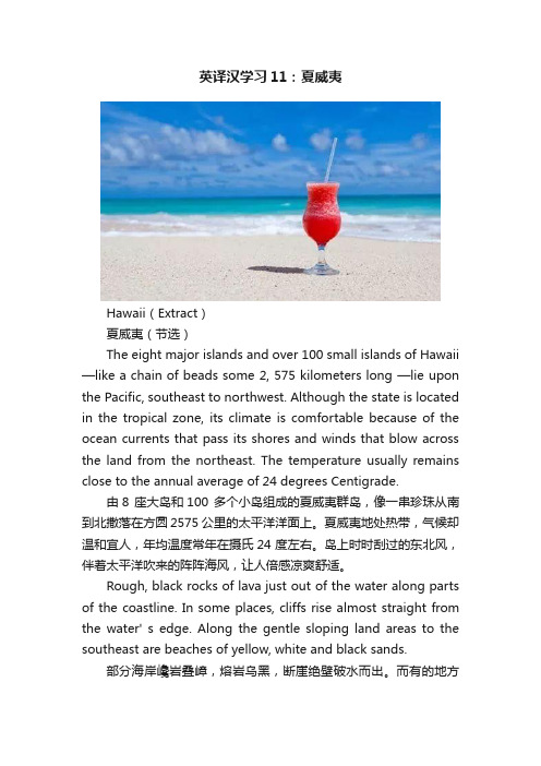
英译汉学习11:夏威夷Hawaii(Extract)夏威夷(节选)The eight major islands and over 100 small islands of Hawaii —like a chain of beads some 2, 575 kilometers long —lie upon the Pacific, southeast to northwest. Although the state is located in the tropical zone, its climate is comfortable because of the ocean currents that pass its shores and winds that blow across the land from the northeast. The temperature usually remains close to the annual average of 24 degrees Centigrade.由8 座大岛和100 多个小岛组成的夏威夷群岛,像一串珍珠从南到北撒落在方圆2575 公里的太平洋洋面上。
夏威夷地处热带,气候却温和宜人,年均温度常年在摄氏24 度左右。
岛上时时刮过的东北风,伴着太平洋吹来的阵阵海风,让人倍感凉爽舒适。
Rough, black rocks of lava just out of the water along parts of the coastline. In some places, cliffs rise almost straight from the water' s edge. Along the gentle sloping land areas to the southeast are beaches of yellow, white and black sands.部分海岸巉岩叠嶂,熔岩乌黑,断崖绝壁破水而出。
英语原版阅读:ThebigislandofHawaii
英语原版阅读:ThebigislandofHawaii今天分享⼀篇阅读理解。
可以学习地理知识的话题时进⾏同步阅读,也可以作为⽇常的阅读材料。
每⽇10分钟英语阅读,养成习惯,孩⼦的英语学习不⽤愁。
图⽚来源于⽹络先来读⽂章:图⽚来源于⽹络1.The big island of Hawaii was made by five volcanoes.夏威夷⼤岛是由五座⽕⼭组成的。
The big island of Hawaii 夏威夷⼤岛was made by 由......组成的five volcanoes 五座⽕⼭图⽚来源于⽹络2.One volcano called Kilauea is an active volcano.有⼀座叫基拉韦厄的⽕⼭是活⽕⼭。
One volcano ⼀座⽕⼭ an active volcano 活⽕⼭图⽚来源于⽹络3.Another volcano, Mauna Kea, is the tallest volcano on Earth.另⼀座⽕⼭莫纳克亚⽕⼭是地球上最⾼的⽕⼭。
Another volcano 另⼀座⽕⼭the tallest volcano 最⾼的⽕⼭on Earth 地球上图⽚来源于⽹络再来读⼀遍完整的⽂章:The big island of Hawaii was made by five volcanoes. One volcano called Kilauea is an active volcano. Another volcano, Mauna Kea, is the tallest volcano on Earth.根据短⽂,回答问题。
图⽚来源于⽹络What is the main idea?0 The big island of Hawaii was made by five volcanoes.0 Another volcano, Mauna Kea, is the tallest volcano on Earth.参考答案:The big island of Hawaii was made by five volcanoes.获得更多的原版英语学习资源,请关注@优质英语学习资源,每天都会有更新。
- 1、下载文档前请自行甄别文档内容的完整性,平台不提供额外的编辑、内容补充、找答案等附加服务。
- 2、"仅部分预览"的文档,不可在线预览部分如存在完整性等问题,可反馈申请退款(可完整预览的文档不适用该条件!)。
- 3、如文档侵犯您的权益,请联系客服反馈,我们会尽快为您处理(人工客服工作时间:9:00-18:30)。
The Hula
• If the people talk about Hawaii they must
• Know it, a story is that god of dancing
• Danced it first she wanted to cheer her sisters came back,so the people thought this kind of dance is a very sacred dance.
Discoverer and creators
• 1778 British explorer James Cook to find the shortest way between the Atlantic and the Pacific ,then, he named
• It with two friends name discovered the Hawaiian Islands .
Question time
• 1.who found Hawaii? • 2.where is it? • 3.what is the end of the Chain of Craters
Road ?
• About more than two thousand five hundred years to more than forty million years ago , the Hawaiian Islands, where the Pacific plate northwestward drift , collide with the Eurasian plate , accepted geological changes hit the edge of the area , to form hot underground
Chain of Craters Road
• This is an about 10 kilometers-long road . • And in the end of it is punier Coastal . • It will take the people about 45 minutes to • drive around it. On either side are many • trees and volcanos. it’s very beautiful .
them ,we can sea many towns are destroyed by • the anos.
This is the Hawaii volcanos national park
• 1.Creater rim drive • 2. Chain of Craters Road • 3. Holei Sea Arch
Crater Rim Drive
• Creater rim drive is a road around the volcanos, and you can enjoy driving around the volcanos,and watch the magma
• coming out of the them.
Holei Sea Arch
• It’s at the end of the Chain of Craters Road and the lava from there are very
• Brittle
• 1.the form of Hawaii. • 2.who find and creatived it .
• Hawaii is an islands in America ,and it is the most beautiful and the biggest islands in Hawaii islands.And it is situated in Tropical
• The most briskest volcanos are in Hawaii • including Mauna Loa and Kilauea .and the • Craters are like wounds and magma burst • out from it ,it’s amazing and wonderful and near