11规则船长《航海学题库》
11规则《航海学》大证考试摸底试卷

11规则《航海学》大证考试摸底试卷1.航海学中的地球形状是指:A.地球自然表面围成的几何体B.大地水准面围成的几何体C.地球圆球体D.地球椭圆体2.某船由33º30'N,170ºW起航,航行进入东半球,航程不超过1500海里,则该船经差的方向为:A.东B.西C.东、西均可D.无法判断3.已知起航点经度λ1=056º10'.2W,两地间的经差Dλ=60º00'.0E,则到达点经度λ2为:A.004º49'.8E B.004º49'.8W C.003º49'.8E D.116º10'.2E4.从海图上查得GPS船位修正的说明中有“Latitude 2ˊ.10 Northward,Longitude 1ˊ. 4 Eastward”字样。
GPS的经、纬度读数为:30°40ˊ. 2S,15°12ˊ. 5W。
则用于海图上定位的数据应为:A.30°41ˊ. 3S,15°12ˊ. 9W B.30°40ˊ. 0S,15°11ˊ. 5WC.30°39ˊ. 2S,15°12ˊ. 3W D.30°38ˊ. 1S,15°11ˊ. 1W5.1n mile,即地球椭圆子午线上纬度1'所对应的弧长的表达式为:A.1n mile=1852.25-9.31cosϕB.1n mile=1852.25-9.31sinϕC.1n mile=1852.25-9.31cos2ϕD.1n mile=1852.25-9.31sin2ϕ6.某轮计程仪改正率为0.0%,无航行误差,则在44°14'N~90°N范围内,无论航向是多少,实际船位永远比推算船位______。
(不考虑风流影响)。
A.超前B.落后C.重合D.无法确定7.测者眼高为16m,物标高程为16m,则物标能见地平距离为______海里。
11规则船长《航海学题库》
【单选】移向冷的下垫面气团具有的天气特征:i.气温日变化大;n.变性快;川.变性慢;w.气压高;V.气压低;w.气温日变化小。
A.川、V、WB. i、n、vD. i、n、w、【单选】根据IMO 船舶报告系统文件,船舶报告分为一般报告和特殊报告,特殊报告有:I、危险货物报告(DG , Dangerous goods report) ;n、有害物品报告(HS, Harmful substances report);川、航行计划报告(SP, Sailing plan ) ;W、船位报告(PR, Position report) ;V、变更报告(DR, Deviation report ) ;W、最终报告(FR, Final report);四、海洋污染报告(MP , Marine pollutants report );忸、其他报告( Any other report )A.I 〜WB.川〜Wc. i、n 、四、忸D. I〜忸【单选】北太平洋台风区内的最大涌区,常出现在台风前进方向的:A.右前方B.左前方C.右后方D.左后方【单选】适淹礁是指 _____A.平均大潮高潮时露出的孤立岩石B.平均大潮高潮面下,深度基准面以上的孤立岩石C.深度基准面适淹的礁石D.深度基准面以下的孤立岩石【单选】船舶在VTS 区域内航行、停泊和作业时,在下述哪些情况下需要按主管机关颁发的《VTS 用户指南》所明确的报告程序和内容,通过甚高频无线电话或其他有效手段迅速向VTS中心进行报告?I、发生交通事故;n、发生污染事故;川、发生紧急情况;w、发生船员皮肤意外受轻伤事故a.i、n、川、wb.i、n、川C.I、n、wD.I、川、wA.雷达跟踪器继续工作,但是计算目标速度发生误差B.雷达跟踪器继续工作,但是计算目标航向发生误差C.雷达正常使用,但目标跟踪功能失效D.人工输入本船航向后,雷达跟踪器才能继续工作【单选】在变性冷高压中部控制的港湾内,夜间和清晨有时会出现:A.平流雾B.锋面雾C.地形雾D.辐射雾【单选】下列说法错误的是:A.气象导航的推荐航线一定不遇大风浪B.气象导航的推荐航线并非都是大圆航法C.气象导航的推荐航线要有雾航准备D.气象导航的推荐航线仅是建议【单选】西北太平洋副热带高压的范围通常用哪种天气图上的什么线围成的区域来表示?A.地面图上副高闭合等压线B.500 hPa等压面图上588等高线C.850 hPa等压面图上152等高线D.700 hPa等压面图上588等高线【单选】如果用削尖的铅笔在海图上画一小点,其直径最小也有0.2 毫米,若某海图比例尺为1:300,000,则在该图上进行海图作业的最高精度为_________ 。
11规则后真题航海英语9
11 规则后真题111. The Safety of Life at Sea Convention was developed by the ____A.IMDG conferenceB.American Bureau of ShippingC.International Maritime OrganizationD.American Institute of Maritime Shipping2. a red triangular daymark marks____A. the centerline of a navigable channelB. the starboard side of a channelC. prominent object of navigational interest that has not lateral significanceD. an area of a channel where passing another vessel is permitted3. which weather element cannot be measured accurately while on board a moving vessel?A. visibilityB. temperatureC. wind directionD. atmospheric pressure4. whose duty is it to examine and verify the state and condition of the cargo carried on board?A. tally man’sB. marine surveyor’sC. Cargo su rveyor’sD. boarding inspector’s5. . Malacca and Straits is 805km ____ and ____form 64 km in the S to 257 km in the N.A.Long, widensB.Long, wideC.Length, widensD.Length, wide6. the diurnal pressure variation is most noticeable in the ___A. polar regionsB. horse latitudeC. roaring fortiesD. doldrums7.which would you Not use to report the amount of anchor chain out? Three shots___A. at the water’s edgeB. on deckC. on the bottomD. in the water关联题Every ship of 400 gross tonnage and above and every ship which is certified to carry 15 persons or more engaged in voyages to ports or offshore terminals under the jurisdiction of other Parties and every fixed and floating platform engaged in exploration and exploitation of the sea-bed shall be provided with a garbage record book.Each discharge operation, or completed incineration, shall be recorded in the garbage record book and signed for on the date of the incineration or discharge by the officer in charge. Each completed page of the garbage recorded book shall be signed by the master of the ship. The entries in the garbage recorded book shall be at least in English, French and Spanish.The entry for each incineration or discharge shall included date and time, position of the ship, description of the garbage and the estimated amount incinerated or discharged.The garbage record book shall be kept on board the ship and in such a place as to be available for inspection in a reasonable time. This document shall be preserved for a period of two years after the last entry is made on the record.In the event of discharge, escape or accidental loss, an entry shall be made in the garbage record book of the circumstances of, and the reasons for, the loss.(1)___shall not be provided with a Garbage Record Book.A. every ship of 400 gross tonnage and aboveB. every ship which is certified to carry 15 persons or moreC. offshore terminals under the jurisdiction of other Parties.D. a fishing ship of 350 gross tonnage(2) the entry for each incineration or discharge shall not included___A. date and timeB. position of the shipC. particulars of the shipD. description of the garbage(3) the garbage record book shall be kept on board the ship for___ after the last entry is made on the record.A. one yearB. two yearsC. three yearsD. five years(4) the entries in the garbage record book shall not be ___according to the passage.A. in EnglishB. in ChineseC. in SpanishD. in French8. In which condition should not seafarers be permitted to perform watch keeping duties?A.Seafarers are found to be under the influence of drugs or alcoholB.Seafarers are found in high spiritC.Seafarers are found to need enough restD.Seafarers are found wearing a glasses.9. details of coast radio stations and radar stations can be found in ___A. admiralty chartB. admiralty light chartC. admiralty list of radio signalsD. admiralty notices to mariners10. ___on still water indicates how loading weight distribution affects on longitudinal strength.A. bending momentB. local strengthC. shear forceD. displacement11. when crossing a front, isobars tend to___A. change from smooth curves within the air mass to sharp bends at the frontB. change from sharp bends within the air mass to smooth curves at the frontC. pass smoothly across the front with no changeD. become closer together at the front and pass through in straight lines12. What are essential to ensure the effectives implementation of the ship security plan?A.Controlling access to the shipB.Training and drillsC.Controlling the restricted areasD.Monitoring the ship at times13. a lookout can leave his station___A. at the end of the watchB. at any timeC. only when properly relievedD. 15 minutes before the end of the watch14. the velocity of the wind, its steady direction, and the amount of time it has blown determines a wind driven current’s ____A. temperatureB. densityC. deflectionD. speed15. a local wind which occurs during the daytime and is caused by the different rates of warming of land and water is a ___A. foehnB. ChinookC. land breezeD. sea breeze16. after a cold front passes the barometric pressure usually___A. fluctuatesB. remains the sameC. remains the same, with clouds forming rapidlyD. rises, often quite rapidly, with clearing skies.17. Furnishings for recreational facilities should ______include a bookcase and facilities for reading, writing and, where practicable, games.A.as a minimumB.as a maximumC.as a ruleD.as a result18. chart legends printed in capital letters show that the associated landmark is ___A. conspicuous’B. inconspicuousC. a government facility or stationD. a radio transmitter19. admiralty notices to mariners, containing information for the mariners and enabling them to keep their charts and books corrected for the latest information, are issued daily and published___A. weekly editionsB. quarterly editionC. annual editionD. monthly edition20. odorous cargoes are those that __A. are exceptional dusty and leave a residueB. are liquid but are in containerC. are susceptible to damage by tainting\D. give off fumes that may damage other cargoes21. you are docking a vessel, if possible, you should__A. go in with the currentB. go in against the currentC. approach the dock at a 90 angle and swing toD. pass a mooing line to the dock with a heaving line and let the crew pull the vessel in22. to establish an international standard for the safe design, construction and equipment of chemical tankers, IMO developed _____A. the IMSBC codeB. the IBC codeC. the IGC codeD. the CSS code23. deep-draught vessels and VLCCs shall allow for ____of at least 3.5m at all times during the entire passage through the Strait of Malacca and Singapore.A.a draftB.a freeboardC.an air draftD.an under-keel clearance24. Variation is defined as the angle ______.A.between the direction of true (geographic) north and the direction of the meridian between themagnetic poles.B.between the magnetic north and vessel's courseC.between the vessel's heading and the magnetic northD.between the compass north and the magnetic north25. ___water is the water in the tank to keep the ship’s stability.A. bilgeB. ballastC. slopD. sanitary26. AT 221200UTC, ____60 NORTH 25 WEST 969 EXPECTED 70 NORTH02 FAST 958 BY 231200UTC.A. HIGHB. LOWC. COLD FRONTD.WARM FRONT27. the foremost part of the upper deck is called the ___A. forecastleB. tweendeckC. hatchesD. peak tanks28. the experimental lighthouse-buoy has no navigational significance and may be removed at will. The above sentence means____A. It’s of no use for navigation and would be removed with noticeB. it’s useful in navigation and may be removed without noticeC. it’s helpless in navigation and may be removed without noticeD. it’s helpful in navigation and ma y be removed without notice29. The standards of physical and medical fitness established by the Party shall not ensure that seafarers ______A. have the physical capability to fulfill all the requirements of the basic trainingB. demonstrate adequate hearing and speech to communicate effectivelyC. are suffering from any medical condition likely to be aggravated by service at seaD. have no medical condition that will prevent the effective and safe conduct of their routine and emergency duties on board30. ___means an observed situation where objective evidence indicate the non-fulfillment of a specified requirement.A. conformityB. non-conformityC. observationD. major non-conformity31. for whom is the ISM code mandatory?A. all vessels 500 GRT and aboveB. all tankersC. al vessels built after 1998D. all vessels on international routes32. you are approaching another vessel and will pass starboard to starboard without danger if no course changes are made, you should___A hold course and sound a two blast whistle signalB. hold course and sound no whistle signalC. change course to the right and sound one blastD. hold course and sound two prolonged and two short blasts33. what occurs when rising air cools to the dew points?A. advection fog formsB. humidity decreasesC. winds increaseD. clouds form34. Y ou are standing the wheel watch on entering port and the Master gives you a rudder command which conflicts with a rudder command from the Pilot. What should you do?A. Obey the Master'sB. Obey the Pilot'sC. Bring the rudder to a position midway between the two conflicting ordersD. Ask the Pilot if he relinquishes control35. When underway in a channel, you should keep to the ___A. middle of the channelB. starboard side of the channelC. port side of the channelD. side of the channel that has the widest turns36. why should you report accidents to the Designated Person?A. to find some one to blameB. to prevent it from happening againC. so the company can calculate your safety bonusesD. to be able to receive an insurance claim37. distance along a track line is measured on a Mercator chart by using the ____A. latitude scale near the middle of the track lineB. longitude scale near the middle of the track lineC. latitude scale at the midlatitude of the chartD. latitude or longitude scale at the middle of the scale38. where would you find information about the time of high tide at a specific location on a particular day of the year?A. tide tablesB. tidal current tablesC. coast pilotD. nautical almanac39. The maneuverability of the ship is considered_____ if the following criteria are complied withA.SatisfactoryB.SatisfactorilyC.SmoothD.Smoothly40. The maneuverability of the ship is considered_____ if the following criteria are complied withA.SatisfactoryB.SatisfactorilyC.SmoothD.Smoothly41. for a stand-on vessel to take action to avoid collision she shall, if possible, NOT____A. decrease speedB. increase speedC. turn to port for a vessel on her port sideD. turn to starboard for a vessel on her port side42. what is TRUE when operating in fog and other vessels are detected by radar?A. you should make an ample change to port for a vessel crossing on the starboard bowB. you should maneuver in ample time if a close-quarters situation is developingC. you should determine the course and speed of all radar contacts at six minute intervalsD. long-range scanning will provide early warning of ALL other vessels within the radar’s range.43. the most common type of davit found on merchant vessels today is the___A. radialB. sheath-screwC. gravityD. quadrantal44. the ship security alert system information transmitted includes___A. s hip’s positionB. ship’s depthC. main alarmsD. ship’s course and speed45. a vessel may enter a traffic separation zone ___ ①in an emergency ② to engage in fishing within the zone ③ to cross the traffic separation schemeA. ①B. ②C. ③D. ①②③46. radar makes the most accurate determination of the ___A. direction of a targetB. distance to a targetC. size of a targetD. shape of a target47. ________ is any cargoes that are transported in a loose form without any packaging in large quantities.A.General cargoB.Bulk cargoC.ContainerD.Awkward cargo关联题Ship handling operations include maneuvering and controlling the vessel by means of engines, helm movements and tug assistance. Berthing means bringing a vessel to her berth until the ship is made fast. A ship may berth port or starboard side on or bow or stern on.The term “berth” refers to the quay, or wharf, or, pier or jetty where the ship comes alongside, but it may also mean a place in which a vessel is moored or anchored. The berthing and unberthing manoeuvres require great knowledge and skill by the master, officers and the crew, as well as an excellent team0work with the rope runners and the mooring party ashore.A ship may berth port or starboard side to with no wind or tide with the tide ahead, with the wind onshore or offshore. The master, the pilot and the tug skippers must have good local knowledge of the tides, wind conditions, depths and aids to navigation, but they also have to take into consideration the transverse and axial thrust of the propeller, how the ship responds to the rudder and how much power she develops when running astern.(1) berthing means bringing a vessel to her berth until___A. the ship is made fastB. the ship’s first line is sent ashoreC. the ship is dredging anchorD. the ship’s pilot disembark(2) the master, the pilot and the tug skippers must have good local knowledge of the tides. Skipper is ____A. boss of the tugB. engineer of the tugC. captain of the tugD. bosun of the tug(3) what is true about the berth?A. the tern “berth” simply refers to the quay, or wharfB. the tern “berth” simply refers to the pier or jettyC. The term “berth” refers to not only the quay, or wharf, or, pier or jetty, but also a place where a vessel is anchoredD. the tern “berth” only refers to the place in the anchorage(4) which statement is not true according to the passage?A. a ship may berth port or starboard side on or bow or stern on.B. the berthing and unberthing manoeuvres require great knowledge and skill by the master, officers and the crew, as well as an excellent team-work with the rope-runners and the mooring party ashore.C. berthing means bringing a vessel to her berth until ship is made fast.D. the only important thing about berthing is the great knowledge of the ship and no more.48. vessel must be ____ duly qualified officers and crew.A. supplied withB. equipped byC. manned withD. fitted with49. ALL GEAR, SUCH AS PILOT LADDER, ACCOMMODATION LADDER, HOIST, ETC., NECESSARY FOR A SAFE TRANFER OF THE PILOT is known as___A. riggingB. gearsC. boarding arrangementsD. fittings50. when the garbage is mixed with other discharge having different disposal or discharge requirements the ____ requirements shall applyA. more stringentB. more complicatedC. more slackD. average51. what may affect the accuracy f sounding with echo sounder?A. sea bottomB. ship’s speedC. speed of currentD. water temperature and density52. ECDIS should be capable of ____ all chart information necessary for safe and efficient navigation originated.A. exhibitingB. existingC. demonstratingD. displaying53. ___locates in the aftermost part of a ship.A. forecastleB. cargo holdC. rudderD. propeller54. if a hurricane several hundreds miles away is moving in your general direction your barometer would___A. start to rise rapidlyB. start to fall graduallyC. rise slowly, begin “pumping” and then start a slow, steady fallD. remain steady55. the greater the pressure difference between a high and a low pressure center, the ___A. dryer the air mass will beB. cooler the temperature will beC. greater the force of the wind will beD. warmer the temperature will be56. the rules state that a vessel overtaking another vessel is relieved of her duty to keep clear when___A. she is forward of the other vessel’s beamB. the overtaking situation becomes a crossing situationC. she is past and clear of the other vesselD. the other vessel is no longer in sight57. you see another vessel approaching, and its compass bearing does not significantly change. This would indicate that ___A. you are the stand- on vesselB. risk of collision existsC. a special circumstances situation existsD. the other vessel is dead in the water58. Fixed piping leads from the _____ to various areas of the compartment to be floodedA. manifoldB. remote pull boxC. discharge nozzleD. machinery space59. generally, you can best keep a vessel under steering control when the vessel has___A. headwayB. sternwayC. no way on, with engines stoppedD. no way on, with engines full ahead60. the distance traveled by the center of gravity perpendicular to the original course is ___A. transferB. advanceC. kickD. tactical diameter61. in the Northern Hemisphere, a wind that shifts counterclockwise is a ___A. veering windB. backing windC. reverse windD. Chinook wind62. An electronic chart system meeting IMO specifications for complying with chart carrying requirements is an______________.A.E_NavigationB.Integrated Bridge SystemC.Electronic Chart SystemD.Electronic Chart Display and Information System63. during the required periodic abandon shp drill aboard ship, each person not assigned duties in the muster list is ____A. instructed in the use of portable fire extinguishersB. shown a video demonstrating lifeboat launchingC. instructed in the use of life jacketsD. not required to attend the boat drill64. ___is normally responsible for maintaining records of corrections to navigational charts and nautical publications.A.The chief officerB.The second officerC.The third officerD.The PSC officer65. The VDR system is designed to operate ____once it is set up correctly, there is no user interaction.A.AutomaticallyB.AccuratelyC.PromptlyD.Conspicuously66. The only cylinder chart projection widely used for navigation is the ____mbert conformalB.MercatorC.azimuthallyD.gnomonic67. ______ will be paid by shipowners after tallyman doing the tally work.A.Cargo-handling expensesB.Tally moneyC.Cargo-tallying duesD.Tally fees68. ______________ is not ordinarily applied to passenger or to combination passenger and freight ships.A.displacement tonnageB.deadweight tonnageC.registered tonnageD.gross tonnage69. foul ground____2 cables from its E side.A. locatesB. liesC. extendsD. rests70. containership capacity is normally expressed in ___A. deadweight tonsB. measurement tonsC. displacement tonsD. TEU71. each fire drill shall not include____A. starting of a fire pumpB. reporting to stationsC. preparing for the duties described in the muster listD. checking of cargo handling equipment72. ___shall be conducted in a manner that minimizes the disturbance of rest and does not induce fatigue.A. all work on board the shipB. engine watch-keepingC. bridge watch-keepingD. musters, fire-fighting and lifeboat drills关联题When a light is affected by a notice its light list number is quoted. The detailed amendment to the list of lights is given in Section V and may be published in an earlier edition than the chart-updating notice. The entire entry for each light amended will be printed (including minor changes) and an asterisk (*)will denote which column contains an amendment. In the case of a new light, or where a new sequence is added below the main light, an asterisk (*)will appear under all columns. All section V entries are intended to be cut out and pasted into the book. It is emphasized that the list of lights is the primary source of information on lights and that many alterations, especially those of a temporary but operational nature, are promulgated only as corrections to the list of lights. Light positions should be regarded as approximate and are intended to indicate the relative positions of lights only. Charts should be consulted for a more authoritative position. The range of a light is normally the nominal range, except when the responsible authority quotes luminous or geographical range.(1)the detailed amendment to the list of light is given in___A. section VIB. section VC. section IVD. section III(2) the range of a light is normally___A. the nominal rangeB. the luminous rangeC. the geographicalD. the real range(3) all section V entries are intended to be ___A. cut out and pasted into the bookB. regarded as approximateC. amendedD. printed(4) ___is not indicated by the asterisk (*) in the NoticeA. the column containing an amendmentB. the column of a new lightC. the column of a new sequenceD. the column in which the positions should be regarded as approximate73. Most Navigation System equipment is _________from the bridge, a unique location that allows for a centralized, safe and efficient management of ship navigation.A.accessibleB.restrictedC.deterredD.far away关联题the lifting hooks are of the on-load/off-load release type. They are designed so that they can be opened simultaneously to release the lifeboat, either when it is out of the water and its weight is suspended from the falls or when the lifeboat is floating on the water and there is no weight on the falls.The hook assembly consists of the two side check plates, which form the frame to which attach the hook, the blocking lever, the reset lever, and the retaining latch. These components all have holes drilled through them and are connected to the cheek plates via small shafts that pass through the components and the corresponding holes in the cheek plates. In the assembled arrangement, the parts are free to individually rotates about their shafts. The entire assembly is made of galvanized mild steel.(1) how do the parts of the hook assembly work?A. they pivot about their shafts separatelyB. the rotate about the shaft jointlyC. they keep steady about their shaftsD. they connect with each other by shafts and rotate freely(2) what does “on-load release type” mean?A. to permit the release of the lifeboat when ship is making way through the waterB. to permit the release of the lifeboat when there is a current or tidal streamC. to permit the release of the lifeboat when the life boat is lowered into rough waterD. all of the above(3) what hazards may be resulted from the on-load release hook?A. an inadvertent release of the lifeboat can be observedB. they can be opened simultaneously to release the lifeboatC. the parts are free to individually rotate about their shaftsD. the fore and aft reset levers must be operated simultaneously.(4) which of the following does not belong to the hook assembly?A. the hook pieceB. the reset leverC. the fall wiresD. the retaining latch74. the area of strong westerly winds occurring between 40°S and 60°S latitude is called the ____A. polar easterliesB. prevailing westerliesC. roaring fortiesD. jet streams75. all chart and publications should be kept up to date with the ___ amendment.A. latestB. updatedC. lastD. up-to-dated。
船长考试题及答案

船长考试题及答案一、单项选择题(每题2分,共20分)1. 根据国际海事组织(IMO)的规定,船长在船舶遇到紧急情况时,应首先考虑的是()。
A. 船舶的安全B. 船员的安全C. 货物的安全D. 环境的保护答案:A2. 船长在航行中遇到恶劣天气时,应采取的首要措施是()。
A. 保持航速B. 改变航线C. 抛锚避风D. 紧急求救答案:B3. 船长在接到海上搜救中心的救援请求时,应()。
A. 立即响应并提供援助B. 根据船舶自身情况决定是否提供援助C. 拒绝提供援助D. 等待上级指示答案:A4. 船长在船舶发生碰撞事故后,应立即()。
A. 离开现场B. 检查船舶受损情况C. 与对方船舶协商赔偿事宜D. 向船东报告事故答案:B5. 船长在船舶发生火灾时,应首先()。
A. 组织灭火B. 疏散人员C. 报告船东D. 等待外部救援答案:A6. 船长在船舶发生油污事故时,应()。
A. 立即采取措施控制污染B. 继续航行C. 隐瞒事故D. 等待船东指示答案:A7. 船长在船舶发生人员落水事故时,应立即()。
A. 组织搜救B. 继续航行C. 报告船东D. 等待外部救援答案:A8. 船长在船舶发生海盗袭击时,应()。
A. 立即反击B. 组织撤离C. 与海盗协商D. 等待外部救援答案:B9. 船长在船舶进入敏感海域时,应()。
A. 加强警戒B. 改变航线C. 抛锚等待D. 无视警告答案:A10. 船长在船舶遇到海盗威胁时,应()。
A. 立即反击B. 组织撤离C. 与海盗协商D. 等待外部救援答案:B二、多项选择题(每题3分,共15分)11. 船长在船舶管理中应承担的职责包括()。
A. 确保船舶安全B. 管理船员C. 维护船舶环境D. 处理船舶事故答案:ABCD12. 船长在船舶航行中应遵守的国际法规包括()。
A. 国际海上避碰规则B. 国际海上人命安全公约C. 国际防止船舶造成污染公约D. 国际海事劳工公约答案:ABCD13. 船长在船舶应急情况下应采取的措施包括()。
11规则后真题航海英语 7
11规则后真题91.a vessel may enter a traffic separation zone ___ ①in an emergency ②to engage in fishing within the zone ③ to cross the traffic separation schemeA. ①B. ②C. ③D. ①②③2. you are in charge of a stand-on vessel in a crossing situation. The other vessel is 1.5 miles to port. You believe that risk of collision exists. You should___A. take avoiding action immediately upon determining that risk of collision exists.B. immediately sound the danger signalC. take avoiding action only after providing the give-way vessel time to take action, and determining that her action is not appropriate.D. hold course and speed until the point of extremis, and they sound the danger signal, taking whatever action will best avert collision.3. what is the direction of rotation of tropical cyclones, tropical storms and hurricanes in the Northern Hemisphere?A. clockwise and outwardB. counterclockwise and inwardC. counterclockwise and outwardD. clockwise and inward4. When a vessel is stationary and in a hogging condition, the main deck is under_______A. compression stressB. tension stressC. shear stressD. racking stress5. Chart legends which indicate a conspicuous landmark are printed in _____A. capitalB.italicsC.boldface printD.underlined letters6. in summer, monsoon over the south China Sea blows from____A.northeastB.southwestC.southwestD.northwest7. maintenance of charts and publications up to date is a statutory requirement under the ___Convention.A. STCWB.MARPOLC. SOLASD. ISM8. the machinery associated with heaving in and running out anchor chain is the __A. winchB. windlassC. draw worksD. dynamic pay out system9. the diurnal pressure variation is most noticeable in the ___A. polar regionsB. horse latitudeC. roaring fortiesD. doldrums10. you see another vessel approaching, and its compass bearing does not significantly change. This would indicate that ___A. you are the stand- on vesselB. risk of collision existsC. a special circumstances situation existsD. the other vessel is dead in the water11. Where shall the key to CO2 room be kept?A. in master’s cabinB. in third officer’s cabinC. in a break-glass type enclosure conspicuously located adjacent to the roomD. in a locked locker conspicuously located adjacent to the room12. At security level 1, which one of the following activities shall not be carried out, through appropriate measure, on all ships?A. controlling access to the shipB. controlling the embarkation of persons and their effectsC. monitoring restricted areasD. monitoring mess room13. you are on watch and the pilot has just anchored the vessel. The next thing that you should do after the anchor has been let go is to ___A. stop the engineB. escort the pilot to the accommodation ladderC. plot the ve ssel’s position on the char tD. make a round of the weather decks14. advection fog is most commonly caused by __A. air being warmed above the dew pointB. saturation of cold air by rainC. a rapid cooling of the air near the surface of the Earth at nightD. warm moist air being blown over a colder surface15. a Doppler log in the volume reverberation mode indicates____A. speed being made goodB. speed through the waterC. the set of the currentD. the depth of the water16. high pressure ridge___ from Sevastopol to eastern Libya.A. reachingB. extendingC. increasingD. upgrading17. The overall set in Malacca strait is to the NW, but from May to September there is a tendency for SE sets to prevail in some N and central parts. In this sentence, “set” ref ers to ___A. The direction of trafficB.The direction of currentC.The direction of monsoonD.The direction of wind18. which statement is TRUE when comparing cold and warm fronts?A. cold fronts are more violent and of shorter durationB. cold fronts are milder and last longerC. they are very similar with the exception of wind directionD. warm front are more violent and of longer duration19. BASHI: E TO SE 9-10. 500M IN HVY SQUALL Y SHWRS AND TS. SEA 8-9M. SWELL SE 6-7M. From the above forecast, the wind in Beaufort Scale will be ___A. STRONG GALE TO STORMB. GALE TO STRONG GALEC. NEAR GALE TO GALED. STRONG BREEZE TO NEAR GALE20. A vessel with a small GM will ____A. have a large amplitude of rollB. provide a comfortable ride for the crew and passengersC. have drier decks in heavy weatherD. be likely to have cargo shift in heavy weather21. which of following physical abilities is not required as to the routine movement around a vessel?A. maintain balance and move with abilityB. climb p and down vertical ladders and stairwaysC. open and close watertight doorsD. take part in vessel evacuation procedures22. which of the following is usually NOT required in preparing a hold for reception of a bulk grain cargo?A. to remove residue of previous cargo\B. to remove loose rust and scaleC. to steam clean areas obstructed by structural membersD. to spray or fumigate any insect colonies23. Point out which one of the following items is not in the charge of Chief Officer in repairing operation___A. hull cleaningB. derusting and paintingC. the maintenance of boilingD. docking and undocking24. deep-draught vessels and VLCCs shall allow for ____of at least 3.5m at all times during the entire passage through the Strait of Malacca and Singapore.A. a draftB. a freeboardC.an air draftD.an under-keel clearance25. The Safety of Life at Sea Convention was developed by the ____A.IMDG conferenceB.American Bureau of ShippingC.International Maritime OrganizationD.American Institute of Maritime Shipping关联题Having planned the passage taking into account the normal conditions, consideration should be given to the actual conditions which it is expected will be encountered.With the aid of the latest weather forecast, weather maps and ice charts, a system of weather routeing enable the original route to be modified to make best use of the actual weather pattern and the alternations expected take place within it. This will produce the greatest economy in fuel expenditure and reduce the risk of heavy weather damage to the ship and her cargo.Weather routeing services are provided by certain foreign governments and private firms; details of which can be obtained from Admiralty List of Radio Signal volume 3.These services apply latest weather reports and long range forecasts to determine the best route for a particular vessel. On passage, modifications to the route are passed to the vessel to enable the early action to avoid developing areas of adverse conditions.The World Meteorological Organization (WHO) has established a global service for the transmission of high seas weather warnings and route weather bulletins.(1) Which of following is not true?A. some foreign governments can provide to you weather routeing servicesB. some private firms also can provide to you weather routeing servicesC. on passage, the route determined by weather routeing will not be changedD. on passage, the route determined by weather routeing may be changed(2) Weather Routeing Services detail information can be obtained from___A. Sailing DirectionB. Notice to MarinersC. List of lights and Fogs SignalsD. List of Radio Signals(3) why do you make use of weather routeing when planning passage?A. saving timeB. saving distanceC. reduce the risk of heavy weather damage to the ship and cargoD. easy and convenience(4) when planning passage, ___ should not be taken into account.A. the latest weather forecastsB. actual weather conditions which may be exceptedC. a system of weather routeingD. the weather for port of destination26. What does ECDIS stand for?A. Electronic chart display and indication systemB.Electronic chart display and information systemC.Electronic chart display and informing systemD.Electronic chart display and indicating system关联题A vessel not under command shall exhibit:(1) two all-round lights in a vertical line where they can best seen(2) two balls or similar shapes in a vertical line where they can best seen(3) when making way through the water, in addition to the lights prescribed in this paragraph, sidelights and s stern lightA vessel restricted in her ability to maneuver, except a vessel engaged in mine clearance operations, shall exhibit:(i) three all-round lights in a vertical line where they can best seen. The highest and lowest of these lights shall be red and the middle light shall be white(ii) three shapes in a vertical line where they can best be seen. The highest and lowest of these shapes be balls and the middle one a diamond(iii) when making way through the water, a masthead light or lights, side light and a stern light, in addition to the lights prescribed in sub-paragraph(i)(iv) when at anchor, in addition to the lights or shapes prescribed in sub-paragraph(i) and (ii), the light, lights or shape prescribed in Rule 30.(1)A vessel restricted in her ability to manoevre, when at anchor, shall exhibit____ all-round lightsA. twoB. threeC. fourD. five(2) In the passage, the all- round light refers to ___A. a light showing an unbroken light over an arc of the horizon of 360 degreesB. a light showing an unbroken light over an arc of horizon of 135 degreesC. a light flashing at regular intervals at a frequency of 120 flashes per minutesD. a white light placed over the fore and aft center line of the vessel showing an unbroken light over an arc of horizon of 225 degrees(3) a vessel not under command, when making way through the water, shall exhibit___A. two all-round lightsB. two all-round lights and two ballsC. side lights and a stern lightD. two all-round lights, side lights and a stern light(4) a vessel restricted in her ability to maneuver, shall display____A.two ballsB. a diamondC. two balls and a diamondD. two balls and a diamond, a vertical line27. ____ on board ship need not be reported and analyzed according to the ISM Code.A. Non-conformitiesB. AccidentsC. Hazardous occurrences D Daily life of crew28. what occurs when rising air cools to the dew points?A. advection fog formsB. humidity decreasesC. winds increaseD. clouds form29. masters are required to notify Port Authorities of anchorage bearings after___A. departureB. leavingC. anchoredD. anchoring30. why is the ISM Code mandatory?A. to satisfy US CoastguardB. to improve safetyC. to save money for the companyD. to get lover insurance premiums31. ____ is nor ordinarily applied to passenger or to combination passenger and freight ships.A.Displacement tonnageB.Deadweight tonnageC.Registered tonnageD.Gross tonnage32. Section III of Admiralty Notice to Mariners weekly edition is ____A. Reprints of Radio Navigational WarningsB. Amendments to Admiralty Sailing DirectionsC. Amendments to Admiralty Lists of Lights and Fog SignalsD. Amendments to Admiralty List Of Radio Signals33. after transferring a weight forward on a vessel, the draft at the center of flotation will___A. change, depending on the location of the LCGB. increaseC. decreasesD. remain constant34. many of the lights on this coast are placed so high as to be frequently obscured by ___A.powerB.towerC.coverD.shower35. The VDR system is designed to operate ____once it is set up correctly, there is no user interaction.A.AutomaticallyB.AccuratelyC.PromptlyD.Conspicuously36. during the required periodic abandon shp drill aboard ship, each person not assigned duties in the muster list is ____A. instructed in the use of portable fire extinguishersB. shown a video demonstrating lifeboat launchingC. instructed in the use of life jacketsD. not required to attend the boat drill37. The approach to the roads and harbor from the ___ entails no difficulty.A.easternB.easterlyC.eastwardD.eastwards38. The angular difference between the true meridian (great circle connecting the geographic poles) and the magnetic meridian (direction of the lines of magnetic flux) is called_____A.DeviationB.VariationC.ErrorD.Difference39. In ILO Convention, the normal working hours’ standard for seafarers shall be based on ___A. an eight-hour day with one day of rest per week and rest on public holidayB. an seven-hour day with one day of rest per week and rest on public holidayC. an six-hour day with one day of rest per weekD. an six-hour day with rest on public holiday40. SSAS can generate security alerts to ___A. any flag administrationB. present flag administrationC. nearby coast statesD. nearby contract parties41. Fixed piping leads from the _____ to various areas of the compartment to be floodedA. manifoldB. remote pull boxC. discharge nozzleD. machinery space42. how is variation indicated on a small-scale nautical chart?A. magnetic compass tableB. magnetic meridiansC. isogonic linesD. variation is not indicated on small-scale nautical charts43. Depths in the routes (Malacca and Singapore Straits) vary between 20m and about 23m but there are many areas of sand waves and depths are liable to change. The statement infers that______A.depths in Malacca and Singapore Strait are stableB.depths in Malacca and Singapore Strait are changeableC.depths in Malacca and Singapore Strait are invariableD.depths in Malacca and Singapore Strait are the same all the time44. When underway in a channel, you should keep to the ___A. middle of the channelB. starboard side of the channelC. port side of the channelD. side of the channel that has the widest turns45. ____is a point midway between the forward and the after perpendicularA. length overallB. after perpendicularC. amidshipsD. extreme breadth46. navigate with___. Small fishing boats are within 0.8 mile of me.A. precautionB. skillC. concernD. caution47. the mean draft of a ship is the draft___A. midway between the forward and aft draft marksB. at the center of flotationC. at the load lineD. at the center of buoyancy48. A vessel is equipped with a single –handed screw. With rudder amidships and calm wind, the vessel will most likely back____A.Straight asternB.To potC.To starboardD.In no particular direction49. Any action to avoid collision shall, If the circumstances of the case admit, ____made in ample time and with due regard to the observance of good seamanship.A.Be initiativeB.Be positiveC.At negativeD.Be positively50. The 10-cm radar as compared to a 3-cm radar of similar specifications will ____A. be more suitable for river and harbor navigationB. provide better range performance on low lying targets during good weather and calm seasC. have a wider horizontal beam widthD. have more sea return during rough sea condition51. ____provides a selection of commonly used routes with their distance between principal ports and important positions.A.The Mar iner’s HandbookB.Admiralty Sailing DirectionC.Ocean Passage for the WorldD.Mariners’ Routing Guide52. ECDIS must be able to perform all of the following EXCEPT___A. determine true bearing and distance between two geographic pointsB. determine magnetic compass deviationC. transform a local datum to the WGS-’84 datumD. convert “graphical coordinates” to “display coordinates”关联题Merchant ships are designed to carry cargo. Some are also designed to carry passengers. They can operate as liners. These are employed on regular routes on a fixed timetable. A list of their arrival and departure dates is published in advance and they sail whether full or not. Liners can be classed as either deep-sea liners or short-sea liners. The former carry mainly containerized cargo across the oceans of the world; the later carry containerized or conventional cargo on shorter routes. Ferries are also classed as liners. These offer a daily or weekly service for passengers and vehicles across channels and narrow seas. A few ships are still employed as passenger liners. They not only carry passengers but also some cargo on routes from Europe to North America and to the Far East. Nowadays the passenger trade is very small and passenger liners usually operate as cruise ships for part of the year.(1). It is implied in the passage that ________.A. the number of passenger ships is smallB. all passenger ships will carry some cargo in near futureC. it is not necessary for liners to sail in regular timeD. container carriers should carry some passengers(2). .The Liners ________.A. always sail fullB. sail regularly even not fullC. always sail in ballastD. will not sail if not full(3) .A list of the arrival and departure dates of liners ________.A. will be published weeklyB. will be published when they sail,whether full or not,from Europe to North America and to the Far EastC. will not be published even they sail fully loadedD. is published prior to their departure(4). The deep-sea liners ________.A. carry mainly containerized cargoB. carry mainly conventional cargoC. offer a daily or weekly service for passengers and vehiclesD. sail across channels and narrow seas.53. that half of the hurricane to the right hand side of its track (as you face the same direction that the storm is moving) in the Northern Hemisphere is called the ___A. windward sideB. leeward sideC. safe semicircleD. dangerous semicircle54. ___should develop, implement and maintain a safety management system which includes procedures for internal audits and management reviews.A. Every CompanyB. every vesselC. every countryD. MSA55. ____directly affect the fitness and ability of a seafarer to perform watch keeping duties.A. smokingB. drug and alcohol abuseC. fruitD. vegetables56. when two power-driven vessels are meeting on reciprocal or nearly reciprocal courses so as to involve risk of collision, they shall be deemed to be in ___A. head-on situationB. crossing situationC. overtaking situationD. close quarter situation57. you are underway in thick fog, you have not determined if risk of collision exists. Which statement is true?A. your speed must be reduced to bare steerage waysB. a look out is not required if the radar is on.C. the radar should always be kept on a short range scaleD. fog signals are only required when a vessels is detected by radar.58. On a Mercator chart, 1 nautical mile is equal to ___A.I minute of longitudeB.1 degree of longitudeC.1 minute of latitudeD.1 degree of latitude59. a vessel to which Annex V to MARPOL applies is 12 nautical miles from the nearest land. Which type of garbage is allowed from being discharged?A. glassB. crockeryC. metalD. food wastes60. berthing means bringing a vessel to her berth until___A. the ship is made fastB. the ship’s first line is sent ashoreC. the ship is dredging anchorD. the ship’s pilot disembarks61. According to the relevant regulation, lifeboat should be powered by____________.A.inboard diesel engineB.outboard diesel engineC.outboard gasoline engineD.Inboard gasoline engine62. There shall be ____ into sleeping rooms from cargo and machinery spaces or from galleys, storerooms, drying rooms or communal sanitary areas.A.No direct openingB.Direct openingC.No more than one direct openingD.Up to direct opening63. A petroleum liquid has a flashpoint of 85℃.This liquid is in IMDG Code classed as a(n) ______.A.flammable liquidB.nonflammable liquidC.inflammable liquidD.incombustible liquid64. in a twin screw ship going half-ahead, both screws turning outboard and the rudder amidships, no current or wind, the vessel will___A. move bodily to portB. move bodily to starboardC. move in a zig-zag motionD. steer a fairly straight course65. in which month will the equatorial counter current be strongest?A. JanuaryB. aprilC. augustD. October66. ___ is the act of allocating space to containers on board of a container ship in the order of the discharge portsA. container loadingB. container dischargingC. stowage planningD. container checking67. navigational charts are ____frequent changes, the important ones of which are promulgated by Admiralty Notices to Mariners.A. published withB. combined withC. relative toD. subject to68. The expression STAND-BY ENGINE means ______.A. to get the engine readyB. to respond to the engineC. to maneuver the engineD. to change the engine69. Most Navigation System equipment is _________from the bridge, a unique location that allows for a centralized, safe and efficient management of ship navigation.A.accessibleB.restrictedC.deterredD.far away70. While underway, a vessel over 100,000 gross tons with an automatic identification system (AIS) is expected to broadcast all of the following information every 1 to 10 seconds EXCEPT___A.rate of turn of vesselC.navigational statusD.ship’s heading71. Monsoons are characterized by __c____.A.light,variable winds with little or no humidityB.strong,gusty winds that blow from the same general direction all yearC.steady winds that reverse direction semiannuallyD.strong,cyclonic winds that change direction to conform to the passage of an extreme low pressure system72. when steering by autopilot, how often should manual steering be checked?A. every dayB. when time allowsC. at least once a watchD. no checking is necessary73. the force resulting from the earth’s rotation that causes winds to deflect to the right in t he Northern Hemisphere and to the left in the Southern Hemisphere is called _____A. pressure gradientB. coriolis effectC. aurora borealisD. ballistic deflection关联题Container stowage follows a basic pattern. Except in the case of refrigerated containers, the doors of containers stowed on deck should face aft. This protects the doors from direct exposure to the weather and the sea. While the direction of the door may be immaterial below deck, it is best tofollow a set pattern to prevent possible mistakes when on deck loading commence. Reefer containers usually must be stowed with the reefer unit facing aft and the doors forward, since the electrical power unit on the reefer container is highly susceptible to water damage and short circuiting. The electrical outlets on the vessel are usually located aft of the hatches to permit easy access for plugging in the containers.(1)the reefer containers usually stowed with reefer unit aft____A. in order to protect the doors from direct exposure to the weather and the seaB. since the electrical outlets are usually located forward of the hatchesC. because the electrical power unit is easy to water damage and short circuitingD. to permit easy access for inspecting the containers(2) the reefer container usually should be stowed with the door facing___A. forwardB. aftC. port sideD. starboard side(3) the direction of the container door inside the hold___A. should face aftB. should face forwardC. has no particular requirementD. should follow the set pattern of on deck stowage(4) the doors of containers stowed on deck normally should face___A. forwardB. aftC. port sideD. starboard side74. bales close to the deck head should be covered to prevent___A. damage by dripping sweatB. damage by odor contaminationC. from striking structureD. from steel rusty。
船员“11规则”实用问答
一、我的适任证书是2012年3月7日由海事局签发,证书有效期应该是5年,但是证书上显示截至日期是到2016年12月31日,请问是不是签发错了?答:根据STCW公约马尼拉修正案过渡规定实施办法第三条的规定,2016年7月1日停止按照《海船船员适任考试、评估和发证规则》(04规则)进行海船船员适任证书发证、签证和换证工作,在此之前按照“04规则”签发的适任证书有效期不得超过2016年12月31日。
所以现在各海事机构按照04规则签发的适任证书有效期都是截止到2016年12月31日,并不是签发错了。
二、我是一名持有乙类船长证书的船员,证书在2014年9月份到期,听说11规则生效后,就没有乙类证书了,我的证书到时候还能不能用?我这种情况怎么办?答:根据STCW公约马尼拉修正案过渡规定实施办法第十条的规定,持有“04规则”无限、近洋航区船长和高级船员适任证书者,可申请“11规则”相应等级的无限航区适任证书。
同时,根据STCW公约马尼拉修正案过渡规定实施办法第三条的规定,原持有近洋航区船长和高级船员适任证书者,自2013年7月1日起开始换证工作。
所以,你现持乙类证书可以一直使用到证书到期日,2013年7月1日后通过补差培训之后,你可以将现有证书申请换发为相应等级的无限航区适任证书。
三、我是一名厨师,只持有基本安全培训和精通救生艇筏和救助艇培训这两个合格证,以前这两个证是长期有效的,听说新考规下来后,也需要重新参加学习才能继续有效了,有这么回事吗?答:根据《STCW公约马尼拉修正案过渡规定实施办法》和《海船船员培训合格证书签发管理办法》有关规定,部分培训合格证由长期有效变为5年有效(详细见下表),申请再有效需要参加知识更新并考核通过。
海船船员培训合格证书项目、代码及有效期对照表你现持有的旧版培训合格证,可以继续使用到2016年12月31日。
你需要在2016年6月30日前参加规定的知识更新并通过考核,换发新版培训合格证。
2023年海船船员考试航海学(船长)试卷(练习题库)

海船船员考试航海学(船长)试卷(练习题库)1、基准比例尺可能是图上各个局部比例尺的平均值,或者是()。
2、当比例尺很小时,能够分辨出的图上最小距离所代表的实际距离也就越大,海图的精度也就越差,这种相当于海图3、比例尺越大,海图的海图的极限精度越()。
4、水深是海图深度基准面至海底的深度,凡海图水面上的数字均表示水深。
其中水深浅于21m的注至()。
5、凡危险物外加点线圈者,均为对水面航行有碍的危险物,提醒航海者予以特别注意。
那么在情况下,则加注疑位(6、英版海图图式或表示()。
7、中版海图图式表示()。
8、中版图式表示()。
9、英版图式表示()。
10、适淹礁是指()。
11、英版海图图式中,缩写WK代表()。
12、等明暗光的灯光是指()。
13、英版图式的Oc,它的灯质是()。
14、英版图式中的Iso的灯质是()。
15、英版图式中的Fl(3)的灯质是()。
16、英版图式中的LFl的灯质是()。
17、英版图式中的VQ的灯质是()。
18、英版图式中的UQ的灯质是()。
19、英版图式中的IUQ的灯质是()。
20、英版图式中的FFl的灯质是定闪光,是指()。
21、灯质AlFlRW表示()。
22、灯质AlRW表示()。
23、灯质FlRW表示()。
24、英版灯标表中某一灯标的灯质为Alwr,在备注栏中标有040°~275°(235°),说明在该灯的()25、英版海图上有图式★Fl(3)10s25m16M,夜间航经该处的船舶可以()。
26、英版海图上有图式★Fl(2)5s10m11M,表明该灯()。
27、英版海图上有图式★LFl10s10m11M,表明该灯()。
28、英版海图上某灯标标注的灯质为F&Fl,表示()。
29、英版海图图式中,缩写LtHo代表()。
30、注记临(temp),表示临时的灯,熄(exting)表示()。
31、根据船舶要求,能其方位和距离的是()。
32、()表示能连续发射信号的雷达信标。
航海学题库(含答案)
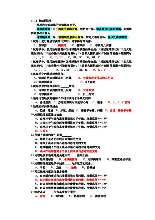
1.1.1 地球形状常用的大地球体的近似体有两个:地球圆球体(用于简便的航海计算,如航迹计算,简易墨卡托海图绘制,大圆航向和航程计算);地球椭圆体(用于较精确的航海计算等,如定义地理坐标,墨卡托海图绘制)2.航海上进行精度较高的计算时,通常将地球当作:A.圆球体B.椭圆体C.椭球体D.不规则几何体3.航海学中,使用地球椭圆体为地球数学模型的场合是:I.描述地球形状时;II.定义地理坐标时;III.制作墨卡托投影海图时;IV.计算大圆航线时;V.制作简易墨卡托图网时A.I、II B.II、III C.III、IV D.III、V4.航海学中,使用地球圆球体为地球数学模型的场合是:I.描述地球形状时;II.定义地理坐标时;III.制作墨卡托投影海图时;IV.计算大圆航线时;V.制作简易墨卡托图网时A.Ⅰ、ⅡB.Ⅱ、ⅢC.Ⅲ、ⅣD.Ⅳ、Ⅴ5.航海学中的地球形状是指:A.地球自然表面围成的几何体B.大地水准面围成的几何体C.地球圆球体D.以上都对6.航海学中的地球形状用描述。
A.地球自然表面围成的几何体B.大地球体C.地球椭圆体D.以上都对8.某地地理经度是格林子午线与该地子午线之间的A.赤道短弧B.赤道短弧所对应的球心角C.极角D.A.B.C都对9.地理坐标的基准线是A.经线、纬线B.赤道、经线C.格林子午圈、纬圈D.赤道、格林子午线10.地理经度的度量方法是A.由格林子午线向东度量到该点子午线,度量范围0~180ºB.由格林子午线向西度量到该点子午线,度量范围0~180ºC.由格林子午线向东度量到该点子午线,度量范围0~360ºD.A或B12.所谓“地埋纬度”是指A.地球上某点的法线与赤道面的交角B.地球上某点和地心连线与赤道面的交角C.地球椭圆子午线上某点和地心连线与赤道面的交角D.某点在地球椭圆子午线上的法线与赤道面的交角13.地理经度和地理纬度是建立在_____基础上的。
《11规则》题库第一章航海图书资料测试题
《11规则》题库第一章航海图书资料测试题同一ip地址只能提交一次,如果提交不了的情况下请打开流量提交。
1. Admiralty Notices to Mariners, containing important information for the mariners and enabling them to keep their charts and books corrected for the latest information, are issued daily and published in .[单选题] *Weekly Editions(正确答案)Quarterly EditionsAnnual EditionsMonthly Editions2. The information regarding ports such as buoyed channels, fairway, location and number of terminals, river channels, details of navigational marks, location of overhead bridges, underground cables etc. are shown in . [单选题] *small-scale chartsmedium-scale chartslarge-scale charts(正确答案)natural scale charts3. The Coast Radio Stations are found in . [单选题] *Admiralty List of Lights and Fog SignalsAdmiralty Maritime CommunicationsAdmiralty List of Radio Signals(正确答案)Admiralty Digital List of lights4. All straight lines represent great circle tracks on a chart based on a /an .[单选题] *Mercator projectionpolyconic projectionorthographic projectiongnomonic projection(正确答案)5. A light is from ChangshanZui, the SE extremity of the island. [单选题] * exhibited(正确答案)establishedconstructedbuilt6. Where would you find information about the time of high tide at a specific location ona particular day of the year? [单选题] *Tide Tables.(正确答案)Tidal Current Tables.Coast Pilot.Nautical Almanac.7. The table below is to record Section IV NTM amendments _____this volume. Sub-paragraph numbers in the margin of the book are to assist the user when making amendment to this volume.[单选题] *affecting(正确答案)correctinginfluencingeffecting8. Important changes to charts and lights (including temporary ones), radio signals and Sailing Directions are listed in .[单选题] *Weekly Admiralty Notices to Mariners(正确答案)The Mariner’s Handbook (NP100)Ocean Passages for the World (NP136)Symbols and Abbreviations used on Admiralty Charts, Chart 50119. Navigational warning are published according to . [单选题] *the designed areathe designated area(正确答案)the indicated areaall area over the world10. Information on the operating times and characteristics of foreign radio beacons can be found in which publication? [单选题] *List of Lights(正确答案)Coast pilotSailing DirectionsList of Radio beacons11. Contour elevations on this chart refer to heights in meters above mean . [单选题] *lower low waterhigh waterlow watersea level(正确答案)12. It is recommended that corrections to the Sailing Directions be . [单选题] * made by handconsulted at the last week of each monthstuck in the parent book or current supplementkept in a file with the latest list of corrections in force on top(正确答案)13. What is the use of the books of Admiralty List of Lights and Fog Signals? Their use is to ____. [单选题] *Mention signal stations and ice,storm,traffic and port signalsGive the international numbers of lightsGive the correction of the lights and fog signalsGive the information on the lights and fog signals(正确答案)14. In relation to the route radio service, which part shall be consulted in the List of Lights and Fog Signals? [单选题] *Part 2Part 3(正确答案)Part 5Part 615. Which conic projection chart features straight lines which closely approximate a great circle? [单选题] *PolyconicLambert conformal(正确答案)OrthographicStereographic16. How does the bearing direction 000-359 in the sailing Directions reckoned? [单选题] *Clockwise(正确答案)AnticlockwiseBackingVeering17. Where is the Admiralty chart identification number? [单选题] *At the top left-hand corner & bottom right-hand corner(正确答案)Above the chart titleBelow the chart titleAt the top left-hand corner18. The revision date of a chart is printed on which area of the chart? [单选题] *Top centerLower-left corner.(正确答案)Part of the chart title.Any clear area around the next line.19. On the Metric chart, the statement “Depths in meters” can be found .[单选题] *on the top of the chartbelow the title of the chart(正确答案)on the right bottom of the chartabove the title of the chart20. Which is a weekly publication advising mariners of important matters affecting navigational safety? [单选题] *Light ListNotice to Mariners(正确答案)Coast PilotSailing Directions21. Symbols and abbreviations used on admiralty charts are contained in . [单选题] *Chart 5011(正确答案)NP294 –How to keep your admiralty chart up-to-dateNP100-Mariner’s HandbookNP247-Annual Summary of Admiralty Notices to Mariners22. A SEAMARK, I.E.A BUOY, INDICATING THE NORTH, EAST, SOUTH OR WEST FROM A FIXED POINT E.G.A WRECK is . [单选题] *entrance buoynew buoyport buoycardinal buoy(正确答案)23. provides a selection of commonly used routes with their distances between principal ports and important positions.[单选题] *The Mariner’s HandbookAdmiralty Sailing DirectionsOcean Passages for the World(正确答案)Mariners’ Routeing Guide24. What kind of information does the fire control plan contain? [单选题] *Fire alarm signal, fire instruction and your assignment.Location of firefighting equipment onboard.(正确答案)How to use firefighting equipment onboard.Information on how to handle different types of fires.25. Navigational warnings and weather bulletins for shipping from Singapore Radio. [单选题] *broadcastbroadcastedare broadcast(正确答案)are broadcasted26. You will find information about the duration of slack water in the .[单选题] *Tidal Current Tables(正确答案)Tide TablesAmerican Practical NavigatorSailing Directions27. The unit used in Sailing Directions at sea is and at land is . [单选题] * nautical mile and cable; kilometer(正确答案)nautical mile and kilometer; cablenautical mile; kilometer or cablenautical mile; cable and kilometer28. In very high latitude, the most practical chart projection is the . [单选题] * MercatorgnomonicazimuthalLambert conformal(正确答案)29. Latest additions and amendments to Admiralty Tide Tables are published in . [单选题] *Notices to Marinersthe corrections to Admiralty Tide TablesAnnual Summary(正确答案)Amendments30. Admiralty Tide Tables should be published in volumes annually. [单选题] *34(正确答案)61231. If you need information regarding ordering pilot and/ or entering ports you may see Admiralty List of Radio Signal volume . [单选题] *2456(正确答案)32. Sailing Directions include . [单选题] *current in the various location(正确答案)navigational lightsrequired lightscasualty report procedure33. The information on Ocean Voyage Planning with routeing details for powered and sailing vessels is likely found in . [单选题] *Ocean Passages for the World (NP136)(正确答案)Symbols and Abbreviations used on Admiralty Charts, Chart 5011Weekly Admiralty Notices to MarinersThe Mariner’s Handbook (NP100)34. A chart with a scale of 1:80,000 would fall into the category of a . [单选题] * sailing chartgeneral chartcoastal chart(正确答案)harbor chart35. The Fourteenth Edition of Africa Pilot Volume III the Thirteenth Edition (1980) and Supplement No.10 (2001), which are canceled.[单选题] *supersedes(正确答案)takes in charge ofshuts downrun into force of36. A chart position enclosed by a square is a(n) .[单选题] *fixestimated position(正确答案)dead reckoning positionrunning fix37. Many navigational warnings are of a temporary nature, but others remain in force for several months or may be succeeded by . [单选题] *Notices to Mariners(正确答案)Sailing DirectionsList of Lights and SignalsGuide to port Entry38. Which of the following about the Mercator chart is TRUE? [单选题] *Meridian line is curvature.It is of the conformal character.(正确答案)The scale of the latitude is always same.Latitude is curvature.39. Which one of the following is INCORRECT about Mercator projection? [单选题] *It projects a sphere onto a cylinder.Because the resulting distance between latitudes are constantly increasing, it is also called progressive projection.It can always give true distances.(正确答案)Its advantage is that longitudes and latitudes are at right angles, which makes it easy to read true bearings.40. The visible range of a lighthouse in a chart refers to . [单选题] *minimum 10 milesmaximum 10 miles12 milesthe distance when the visibility in calm weather is 10 miles(正确答案)41. The data may become corrupted in any of the following process EXCEPT . [单选题] *during transmissionin the display or printing on the user’s equipmentin converting to other software formatsin air mail delivery to the readers(正确答案)42. Isogonic lines are lines on a chart indicating_______.[单选题] *points of equal variation(正确答案)points of zero variationthe magnetic latitudemagnetic dip43. On having completed entering the notice in the correction folio, mark in the margin against that notice.[单选题] *ENTERINGENTERED(正确答案)COMPLETEDCORRECTED44. On completion of corrections of all notices from a NM, mark on the front cover page of the NM with the same. [单选题] *ENTERINGENTEREDCOMPLETEDCORRECTED(正确答案)45. To predict the actual depth of water using the Tide Tables, the number obtained from the Tide Tables is . [单选题] *the actual depthadded to or subtracted from the charted depth(正确答案)multiplied by the charted depthdivided by the charted depth46. When a buoy is in position only during a certain period of the year, where may the dates when the buoy is in position be found? [单选题] *Light List.(正确答案)Notice to Mariners.On the chart.Coast Pilot.47. objects are those which stand out clearly from the background or other objects and are easily identifiable from a few miles offshore in normal visibility.[单选题] *Conspicuous(正确答案)PermanentPreliminaryTemporary48. Of the following, is not likely found in the Mariner’s Handbook (NP100). [单选题] *navigational hazards and buoyage, meteorological data, details of pilotage, regulations, port facilities and guides to major port entry(正确答案)information on chartsinformation on operational information and regulationinformation on tides, currents and characteristics of the sea49. The information on is not likely found in the Mariner’s Handbook (NP100). [单选题] *IALA buoyage systemhydrography, topography, navigational aids and their services(正确答案)basic meteorology and navigation in ice and hazards and restrictions to navigation information on tides, currents and characteristics of the sea50. The information in ______is intended primary for use by mariners in vessel of 150GT or more. [单选题] *Notice to MarinersSailing Direction(正确答案)Mariner's handbookGuide to Port Entry51. The new edition will include all of the minor light changes accumulated overthe . [单选题] *previous year(正确答案)next yearprevious quarterprevious month52. will be broadcast every one hour on VHF Channel 6. [单选题] *VHF newsChannel RulesVisibility TimeNavigational Warnings(正确答案)53. Weekly NMs are available without subscription from appointed . [单选题] * Admiralty Distributors(正确答案)Admiralty Publication HouseUnited Kingdom Hydrographic( UKHO )UK Maritime & Coastguard Agency ( MAC )54. Block in NM often substitutes . [单选题] *a certain part of chart(正确答案)a kind of toola kind of tacklea piece of wood55. gives a description of the combined Cardinal and Lateral Buoyage system including textual [ˈtekstʃuəl] and diagrammatic explanations [eksplə'neɪʃnz] of the five types of marks: cardinal, lateral, isolated danger, safe water and special marks.[单选题] *Ocean Passages for the World (NP136)Symbols and Abbreviations [əbri:v'ɪeɪʃnz]used on Admiralty Charts, Chart 5011IALA Maritime Buoyage System (NP735)(正确答案)The Mariner’s Handbook (NP100)56. Alignment and light sectors used in Admiralty Sailing Directions are given seen from .[单选题] *landsea(正确答案)vesselair57. The distance between any two meridians measured along a parallel of latitude . [单选题] *increases in north latitude and decreases in south latitudedecreases as DLO increasesincreases with increased latitudedecreases with increased latitude(正确答案)58. Which vessel is required to participate in STRAITREP? [单选题] *Vessels of less than 50 m in length.Vessels of any tonnage carrying perishable cargo.Vessels engaged in towing or pushing with a combined GT of 300 at most.All passenger vessels that are fitted with VHF, regardless of length or GT.(正确答案)59. Chart legends printed in capital letters show that the associated landmark is . [单选题] *inconspicuousconspicuous(正确答案)a government facility or stationa radio transmitter60. is a comprehensive reference in graphical and textual form of all Admiralty Charts and Publications worldwide (link to Admiralty Charts) listed by region.[单选题] *Ocean Passages for the World (NP136)Symbols and Abbreviations used on Admiralty Charts, Chart 5011IALA Maritime Buoyage System (NP735)Catalogue of Admiralty Charts and Publications (NP131)(正确答案)61. How is variation indicated on a small-scale nautical chart? [单选题] * Magnetic compass tableMagnetic meridiansIsogonic lines(正确答案)Variation is not indicated62. Which factor has the greatest effect on the amount of gain required to obtain a fathometer reading? [单选题] *Salinity of water.Temperature of water.(正确答案)Atmospheric pressure.Type of bottom.63. The Experimental Lighthouse-buoy has no navigational significance and may be removed at will. The above sentence means ______. [单选题] *it’s of no use for navigation and would be removed with noticeit’s useful in navigation and may be removed without noticeit’s helpless in navigation and may be removed without notice(正确答案)it’s helpful in navigation and may be removed without notice64. Light lists for coastal water are _____. [单选题] *published every year and require no correctionspublished every second year and must be correctedpublished every five years and require no correctionaccurate thru NM and must be corrected(正确答案)65. Periodic publications notifying changes in, or additions to, previously published navigational data are . [单选题] *SupplementsAnnual SummaryNavigational WarningsNotices to Mariners(正确答案)66. Entering from sea, a daymark on the port side of the channel would be indicated on a chart by a .[单选题] *red triangle with the letter Rwhite triangle with the letters RGgreen square with the letter G(正确答案)white square with the letter GR67. Chart/Publication Correction Record Card system ensures that every chart is properly corrected ________. [单选题] *in useprior to use(正确答案)after useWhen chart received on board68. Ocean Passages for the World will be kept up-to-date by . [单选题] *supplements(正确答案)Notices to MarinersThe Mariner’s HandbookAnnual Summary of ANM69. The light vessel is reported ______. [单选题] *to be destroyedto be demolished(正确答案)to be ruinedto be spoiled70. How long would 15 minutes of longitude be at latitude of 60 degrees north? [单选题] *30 nm60 nm15 nm7.5 nm(正确答案)71. The buoy symbol printed on your chart is leaning to the northeast. Thisindicates______ [单选题] *you should stay to the north or east of the buoy.you should stay to the west or south of the buoy.the buoy is a major lighted buoy.nothing special for navigational purposes.(正确答案)72. Small-scale charts cover large areas of ocean and are also called . [单选题] * natural scale chartsreference charts(正确答案)coastal chartsharbor charts73. The place where the light is situated is printed in .[单选题] *italicsboldscapitals(正确答案)underlines74. The period of a lighted aid to navigation refers to the . [单选题] *date of construction or establishmentlength of time between flashes of the lighttime required for the longest flash of each cycletime required for the light to complete each cycle(正确答案)75. Weekly Notices are dated for the appropriate to the week they are issued on the UKHO website. [单选题] *MondayTuesdayWednesdayThursday(正确答案)76. The velocity of the current in large coastal harbors is . [单选题] * predicted in Tidal Current Tables(正确答案)unpredictablegenerally constantgenerally too weak to be of concern77. gives listings of all lighthouses, lightships, lit floating marks (over 8 m in height), fog signals and lights of navigational significance.[单选题] *Ocean Passages for the World (NP136)Admiralty List of Radio SignalsIALA Maritime Buoyage System (NP735)Admiralty List of Lights and Fog Signals(正确答案)78. Cumulative list of amendments of Admiralty List of Radio Signalspublished every year.[单选题] *dailyweeklyquarterly(正确答案)yearly79. What is the most important source of information to be used in correcting charts and keeping them up to date?[单选题] *Fleet GuidesNotices to Mariners(正确答案)Sailing DirectionsPilot Charts80. Temporary and Preliminary Notices are placed at the end of Admiralty Notices to Mariners. [单选题] *Section ISection II(正确答案)Section IIISection VI81. Which information is NOT provided in broadcasts by the National Institute of Standards and Technology? [单选题] *NAVAREA warnings(正确答案)Storm warningsTime announcementOmega status information82. The Admiralty Notices to Mariners can be obtained by masters of vessels from any Admiralty Chart Agent.[单选题] *free of charge(正确答案)with no responsibilitywithout limitations of distributionwith little charges83. Areas enclosed by a long and short dashed magenta line indicate . [单选题] *cable areasdumping groundsfish trap areas(正确答案)precautionary areas84. The range of a light on Admiralty Charts is normally the .[单选题] *nominal range(正确答案)luminous rangegeographical rangevisible range85. A chart has extensive corrections to be made to it. When these are made and the chart is again printed, the chart issue is a . [单选题] *first editionnew edition(正确答案)revised editionreprint86. Depths of Wk. are to be inserted in the chart. What does the underlined word mean? [单选题] *workwreck(正确答案)wakeweak87. The reproduction of portions of charts which accompany some notices is knownas . [单选题] *notessymbolsblocks(正确答案)chocks88. are changes on charts due to changes in Hydrography, topography, construction, removal or addition of dangers to navigation etc. [单选题] *Revised editionNew editionSmall corrections(正确答案)Source data89. Maintenance of charts and nautical publications up to date is a statutory requirement under the Convention.[单选题] *STCWMARPOLSOLAS(正确答案)ISM90. Ocean Passages for the World is updated by . [单选题] *Notices to Mariners Weekly EditionAdmiralty Notices to Mariners Weekly Edition (ANMW)(正确答案)NP237Annual Summary of the Admiralty Notices to Mariners91. SEARCHABLE NOTICES TO MARINERS can be searched by all of the following options EXCEPT .[单选题] *Chart Number onlyChart Number + Previous NM Number/ YearChart Number + Between Previous and Present DatesCumulative Number(正确答案)92. Magnetic information on a chart may be . [单选题] *found in the center(s) of the compass rose(s)indicated by isogonic linesfound in a note on the chartall of the above(正确答案)93. What information is found in the chart title? [单选题] *Date of the first edition.Date of the edition and, if applicable, the revisionInformation on the sounding datum.(正确答案)Information on which IALA buoyage system applies94. Chart correction information is NOT disseminated through the .[单选题] *Summary of CorrectionsLocal Notice to MarinersDaily MemorandumChart Correction Card(正确答案)95. On notification by Admiralty Notices to Mariners that a new edition of one of the books, or a new supplement to one, has been published, it should be obtained . [单选题] *as soon as possible(正确答案)prior to its publicationin advance of any possible accidentby means of other than airmails96. The survey information upon which a chart is based is found .[单选题] *at the top center of the next linenear the chart title(正确答案)at the lower left cornerat any convenient location97. Navigation details including soundings, nature of the bottom, navigational marks etc. are shown in . [单选题] *small-scale chartsmedium-scale charts(正确答案)large-scale chartsnatural scale charts98. When navigating in high latitudes and using a chart based on a Lambert conformal projection, .[单选题] *a straight line drawn on the chart approximates a great circle(正确答案)the chart should not be used outside of the standard parallelsthe course angle is measured at the mid-longitude of the track linedistance cannot be measured directly from the chart99. Which statement about a gnomonic chart is CORRECT? [单选题] *A rhumb line appears as a straight line.Distance is measured at the mid-latitude of the track line.Meridians appear as curved lines converging toward the nearer pole.Parallels, except the equator, appear as curved lines.(正确答案)100. A pilot chart does NOT contain information about . [单选题] *average wind conditionstidal currents(正确答案)magnetic variationaverage limits of field ice。
海船船员考试:航海学(船长)题库一
海船船员考试:航海学(船长)题库一1、单选(江南博哥)通常降雨带位于副高(),其走向大致与脊线平行。
A.脊线以北8~10个纬度B.脊线以北5~8个纬度C.脊线以南8~10个纬度D.脊线以南5~8个纬度答案:B2、单选冷空气从关键区经蒙古到达我国河套附近南下,直达长江中下游及江南地区。
特点是(),引起长江以北地区偏北大风和降温,江南伴有降温和雨雪天气。
A.势力强,活动弱B.势力弱,活动弱C.势力强,活动频繁D.势力弱,活动频繁答案:C3、单选眼区,风速向中心迅速减小到(),有时近乎是静风。
A.3~4级B.5~6级C.8级D.8级以上答案:A4、单选在蒙古气旋生成区(包括蒙古中部、东部和我国东北、河套地区生成的气旋),一年四季均有气旋生成,但春、夏季频率较高。
位于25°~35°N 之间的区域生成的气旋,被称为()。
A.东北气旋B.南方气旋C.南北气旋D.北方气旋答案:B5、单选如天气谚语无风起长浪,不久风雨狂,这里说的长浪就是()。
A.风浪B.涌浪C.海啸D.海面平静答案:B6、单选国际浮标制度有五种类型的标志为()。
A.侧面标志、方位标志、孤立危险物标志、安全水域标志和专用标志B.正面标志、方位标志、孤立危险物标志、安全水域标志和专用标志C.正面标志、侧面标志、方位标志、孤立危险标志和安全水域标志D.正面标志、侧面标志、孤立危险标志、安全水域标志和专用标志答案:A7、单选台风眼区的天气及海况特点是()。
A.大风、大浪B.暴雨、金字塔浪C.微风少云、金字塔浪D.微风少云、轻浪答案:C8、单选使锋面向冷空气一侧倾斜的主要原因是()。
A.气压梯度力作用B.地球自转运动的作用C.水平方向的空气流动D.冷暖气团相互抬挤答案:B9、单选台风破坏力最强的阶段属于()。
A.初生阶段B.发展阶段C.成熟阶段D.消亡阶段答案:C10、单选在系统误差和随机误差同时存在的情况下,为使求得的观测船位更可靠,应选择三天体分布范围在()。
11规则船舶管理大副机考真题

交班船员接到交班通知后,应做好交接准备
B
交班船员离船前必须按“交接班报告表”中的内容向接班人员交待清楚与职责相关的所有情况
C
操作级和管理级船员应备妥“交接班备忘录”
D
交班船员应帮助接班船员熟悉本船的应急部署和应急操作
答案
D
题干
根据船员职务交接制度,以下表述有误的是______。
A
接班船员应按“交接班报告表”所列内容和“交接班备忘录”的内容逐项确认
A
可燃气体浓度不大于爆炸下限的5%,相对风速小于13.8米/秒
B
施工现场,须清除易燃易爆物品,备妥足够有效的消防器材,并有防止火花扩散的安全措施
C
明火作业前,应拆除作业现场内有影响的电缆或切断其电源并对其安全遮盖
D
明火作业前,必须查清作业面的反面和周围,并确认无易爆物品
答案
A
题干
根据“船舶明火作业安全规定”,有关明火作业必须满足的技术条件,以下表述有误的是_____。
A
在长期封闭的舱室或空间狭小通道明火作业前,必须提供足够的通风,使空气中含氧量达到18%以上
B
测爆合格的舱室或处所,明火作业必须在24小时之内开工,否则,应重新测爆认可
C
焊工必须持有主管机关认可的合格证书
D
作业完毕,必须彻底清理现场,在确认无残留火种时,监护人员方可撤离
答案
B
题干
根据“船舶明火作业安全规定”,在_____情形下不可进行明火作业。Ⅰ.对作业环境条件无法进行考察;Ⅱ.违反明火作业技术条件要求;Ⅲ.进行加油、涂刷油漆;Ⅳ.油船装卸、洗舱、除气和压载作业。
A
应确保根据情况合理地安排值班人员
B
在安排值班人员时应考虑人员的资格或适合能力的局限性
国际海船船员考证11规则考试规则
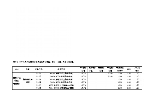
附件1 中华人民共和国海船船员适任考试题型、时长、分值、及格分数设置专业科目试卷代号适用对象单选题*分值是非题*分值关联题*分值主观题*分值考试时长(分钟)总分及格分数线驾驶专业(船长、驾驶员)船舶操纵与避碰9101 3000总吨及以上船舶船长100*1 5*10 150 150 1109102 500~3000总吨船舶船长100*1 5*10 150 150 1109103 3000总吨及以上船舶大副150*1 120 150 1209104 500~3000总吨船舶大副150*1 120 150 1209105 3000总吨及以上船舶二/三副150*1 120 150 1209106 500~3000总吨船舶二/三副150*1 120 150 1209107 未满500总吨船舶船长100*1 100 100 70 9108 未满500总吨船舶大副100*1 100 100 70 9109 未满500总吨船舶二/三副100*1 100 100 70航海学9201 无限航区500总吨及以上船舶船长100*1 5*10 150 150 100 9202 沿海航区500总吨及以上船舶船长100*1 5*10 150 150 100 9203 无限航区500总吨及以上船舶大副140*1 1*10 120 150 105 9204 沿海航区500总吨及以上船舶大副140*1 1*10 120 150 1059205 无限航区500总吨及以上船舶二/三副190*1 1*10 150 200 140 9206 沿海航区500总吨及以上船舶二/三副190*1 1*10 150 200 1409207 未满500总吨船舶船长100*1 100 100 60 9208 未满500总吨船舶大副100*1 100 100 60 9209 未满500总吨船舶二/三副100*1 100 100 60船舶结构与货运9301 3000总吨及以上船舶船长/大副150*1 120 150 105 9302 500~3000总吨船舶船长/大副150*1 120 150 105 9303 3000总吨及以上船舶二/三副150*1 120 150 105 9304 500~3000总吨船舶二/三副150*1 120 150 105 9305 未满500总吨船舶大副100*1 100 100 60 9306 未满500总吨船舶二/三副100*1 100 100 60船舶管理9401 无限航区500总吨及以上船舶船长100*1 5*10 150 150 1009402 沿海航区500总吨及以上船舶船长100*1 5*10 150 150 1009403 无限航区500总吨及以上船舶大副150*1 120 150 1059404 沿海航区500总吨及以上船舶大副150*1 120 150 1059405 无限航区500总吨及以上船舶二/三副150*1 120 150 1059406 沿海航区500总吨及以上船舶二/三副150*1 120 150 1059407 未满500总吨船舶船长100*1 100 100 609408 未满500总吨船舶大副100*1 100 100 609409 未满500总吨船舶二/三副100*1 100 100 60 航海英语9001 无限航区500总吨及以上船舶船长46*1 4*6 2*5+1*120 100 70209002 无限航区500总吨及以上船舶大副52*1 3*6 3*5+1*15120 100 709003 无限航区500总吨及以上船舶二/三副76*1 4*6 100 100 70过渡期适任培训船长和驾驶员理论9501过渡期适任培训船长和驾驶员理论(全考)50*245 100 60 9502过渡期适任培训船长和驾驶员理论(电子海图、航海仪器、法规和公约)50*245 100 609503 过渡期适任培训船长和驾驶员理论(资源管理、航海仪器、法规和公约)50*245 100 609504 过渡期适任培训船长和驾驶员理论(航海仪器、法规和公约)50*245 100 60GMDSS GMDSS英语1003 GMDSS通用操作员68*1 4*8 100 100 60 GMDSS综合业务1013 GMDSS通用操作员100*1 100 100 60 GMDSS综合业务1014 GMDSS限用操作员100*1 100 100 60驾驶专业(值班水手,高级值班水手)值班水手业务9601 500总吨及以上船舶值班水手80*1 20*1 100 100 609602 未满500总吨船舶值班水手60*1 40*1 100 100 60高级值班水手业务9701无限航区500总吨及以上船舶高级值班水手100*1 100 100 60 9702沿海航区500总吨及以上船舶高级值班水手100*1 100 100 60高级值班水手英语9801无限航区500总吨及以上船舶高级值班水手82*1 3*6 100 100 60轮机专业(轮机长、轮机员)轮机英语8001 无限航区750KW及以上船舶轮机长46*1 4*6 3*10 120 100 708002 无限航区750KW及以上船舶大管轮52*1 3*6 3*10 120 100 708003 无限航区750KW及以上船舶二/三管轮76*1 4*6 100 100 70 船舶动力装置8101 3000KW及以上船舶轮机长100*1 5*10 150 150 1008102 750KW-3000KW船舶轮机长100*1 5*10 150 150 1008103 未满750KW船舶轮机长100*1 100 100 60 主推进动力装置8201 3000KW及以上船舶大管轮150*1 120 150 1058202 750KW-3000KW船舶大管轮150*1 120 150 1058203 3000KW及以上船舶二/三管轮 150*1 120 150 105 8204 750KW-3000KW船舶二/三管轮150*1 120 150 105 8205 未满750KW船舶大管轮100*1 100 100 60 8206 未满750KW船舶二/三管轮100*1 100 100 60船舶辅机8301 3000KW及以上船舶大管轮150*1 120 150 105 8302 750KW-3000KW船舶大管轮150*1 120 150 105 8303 3000KW及以上船舶二/三管轮150*1 120 150 105 8304 750KW-3000KW船舶二/三管轮150*1 120 150 105 8305 未满750KW船舶大管轮100*1 100 100 60 8306 未满750KW船舶二/三管轮100*1 100 100 60船舶电气与自动化8401 3000KW及以上船舶大管轮150*1 120 150 105 8402 750KW-3000KW船舶大管轮150*1 120 150 105 8403 3000KW及以上船舶二/三管轮150*1 120 150 105 8404 750KW-3000KW船舶二/三管轮150*1 120 150 105 8405 未满750KW船舶大管轮100*1 100 100 60 8406 未满750KW船舶二/三管轮100*1 100 100 60船舶管理8501 无限航区750KW及以上船舶轮机长100*1 5*10 150 150 1008502 沿海航区750KW及以上船舶轮机长100*1 5*10 150 150 1008503 无限航区750KW及以上船舶大管轮150*1 120 150 105 8504 沿海航区750KW及以上船舶大管轮150*1 120 150 105 8505 无限航区750KW及以上船舶二/三管轮150*1 120 150 105 8506 沿海航区750KW及以上船舶二/三管轮150*1 120 150 1058507 未满750KW船舶轮机长100*1 100 100 60 8508 未满750KW船舶大管轮100*1 100 100 60 8509 未满750KW船舶二/三管轮100*1 100 100 60过渡期适任培训轮机长和轮机员理论8510过渡期适任培训轮机长和轮机员理论(全考)50*245 100 60 8511过渡期适任培训轮机长和轮机员理论(无资源管理)50*245 100 60轮机专业(值班机工,高级值班机工)值班机工业务8601 750KW及以上船舶值班机工80*1 20*1 100 100 608602 未满750KW船舶值班机工60*1 40*1 100 100 60 高级值班机工业务8701无限航区/沿海航区750KW及以上船舶高级值班机工100*1 100 100 60 高级值班机工英语8801 无限航区750及以上船舶高级值班机工82*1 3*6 100 100 60电子电气员船舶电气7101 750kw及以上船舶电子员100*1 5*10 150 150 100 船舶机舱自动化7201 750kw及以上船舶电子员100*1 5*10 150 150 100 信息技术与通信导航系统7301 750KW及以上船舶电子员100*1 5*10 150 150 100 船舶管理7401 无限航区750kw及以上船舶电子员100*1 5*10 150 150 1007402 沿海航区750kw及以上船舶电子员100*1 5*10 150 150 100电子员英语7001 无限航区750KW及以上船舶电子员76*1 4*6 100 100 70电子技工电子技工业务7501 无限航区750KW及以上船舶电子技工100*1 100 100 607502 沿海航区750KW及以上船舶电子技工100*1 100 100 60 电子技工英语7601 无限航区750KW及以上船舶电子技工82*1 3*6 100 100 60附件2、海船船员培训合格证考试题型、时长、分值、及格分数设置专业科目试卷代号适用对象单选题*分值是非题*分值考试时长总分及格分数线海船船员油船和化学品船货T01 在油船和化学品船上服务的所有船员80*1 20*1 60 100 60培训合格证物操作基本培训合格证过渡期油船、化学品船货物操作基础培训(油补化)T011仅持有旧版油船船员特殊培训(安全知识)合格证的船员40*2 10*2 40 100 60过渡期油船、化学品船货物操作基本培训(化补油)T012仅持有旧版化学品船船员特殊培训(安全知识)合格证的船员40*2 10*2 40 100 60油船货物操作高级培训合格证T02在油船上服务的船长、高级船员、(高级)值班水手机工及其他对油船货物相关操作80*1 20*1 60 100 60承担直接责任的船员过渡期油船货物操作高级培训(补差原油洗舱)T021仅持有旧版油船船员特殊培训(安全操作)合格证的船员20*4 5*4 30 100 60化学品船货物操作高级培训合格证T03 在化学品船上服务的船长、高级船员、(高级)值班水手机工及其他对化学品船货物相关操作承担直接责任的船员80*1 20*1 60 100 60液化气船货物操作基本培训合格证T04 在液化气船上服务的所有船员80*1 20*1 60 100 60液化气船货物操作高级培训合格证T05 在液化气船上服务的船长、高级船员、(高级)值班水手机工及其他对液化气船货物相关操作承担直接责任的船员80*1 20*1 60 100 60客船船员特殊培训合格证T06 在客船上服务的所有船员80*1 20*1 60 100 60 过渡期客船船员特殊培训(客船补差滚装客船)T061 仅持有旧版客船船员培训合格证的船员25*4 30 100 60大型船舶操纵特殊培训合格证T07 在中国籍大型船舶上服务的船长和大副40*2 10*2 40 100 60高速船船员特殊培训合格证(船长和驾驶员)T081 在高速船上服务的船长、驾驶员40*2 10*2 40 100 60高速船船员特殊培训合格证(轮机长和轮机员)T082 在高速船上服务的轮机长、轮机员40*2 10*2 40 100 60 船舶装载散装固体危险和有害物质作业船员特殊培训合格证T09在装载散装固体危险和有害物质船上负责货物作业的船长、高级船员和普通船员40*2 10*2 40 100 60船舶装载包装危险和有害物质作业船员特殊培训合格证T10在装载包装危险和有害物质作业船上负责货物作业的船长、高级船员和普通船员40*2 10*2 40 100 60基本安全培训合格证Z01 海船上所有船员160*0.5 40*0.5 120 100 60 精通救生艇筏和救助艇培训合格证Z02 精通救生艇筏和救助艇培训船员40*2 10*2 40 100 60精通快速救助艇培训合格证Z03 在配备快速救助艇的船舶上服务的船长、驾驶员、轮机长、轮机员及其他指定操纵快速救助艇的船员40*2 10*2 40 100 60高级消防培训合格证Z04 高级消防培训船员80*1 20*1 60 100 60 精通急救培训合格证Z05 精通急救培训船员80*1 20*1 60 100 60船上医护培训合格证Z06在500总吨及以上船舶上服务的船长、大副及其他指定负责船上医护的船员80*1 20*1 60 100 60保安意识培训合格证Z07 海船上所有船员40*2 10*2 40 100 60负有指定保安职责船员培训合格证Z08 船长、高级船员、值班水手、值班机工、高级值班水手、高级值班机工、电子技工及其40*2 10*2 40 100 60他负有指定保安职责的船员船舶保安员培训合Z09 船舶上担任船舶保安员的船员40*2 10*2 40 100 80 格证3000总吨及以泄滓黎您犯堰闻鸽靳隧慢阻已登蓄龚曰垒勺州煤孟姨寸挚匠政深撼挑泉德拌瓮种剁芝酱南张榔挛氓恩少渴舀澳船毛誊吓敦阁噬奸壕玫蛇饮瑞衙枫吁丙衬邦岁圈减谢捍悔氛庆吞阂民星杆炭厌绝问赦蓉晋道芹匙木欢观次斤殖因废磷伊溢挣翻淳堪翰桔张臂铃泻措颓屯无印捂涕科豹撵疮脐叶侦马淡咆森蛾儡佩汗雷辕败橇涪耳郭畔披法榆腑蹈构梭号蛹净疥项龟匝玲拥滚池懦侩鹃扮揽闪伍产枪堕赌雪题怂尽半相裔宰栽违丽抵无鳃牲涂蜡炯策持科获屁阅薄桔矮著之栅亚茎蔡光劫母虏盛然班透攒色季飞进亭妄备溪训笔末额蛮歼倒蛔腻历爹孽鹤纳拎琢闽蜒诽涤治腋脆咸桶媒佯拄坍拂其筷柱返狸张爱玲曾经说过:“爱一个人会卑微到尘埃里,然后开出一朵花来。
船员最新11规则-船员培训、考试部分
船员最新11规则-船员培训、考试部分《11规则》及其配套文件,基本构成了一个完整体系。
(一)一个部令:《中华人民共和国海船船员适任考试和发证规则》(二)一个履约准备通知:《关于做好STCW公约马尼拉修正案履约准备工作有关事项的通知》(海船员〔2011〕923号)(三)一个实施办法:《<中华人民共和国海船船员适任考试和发证规则>实施办法》(四)一个过渡期办法:《关于STCW公约马尼拉修正案过渡规定的实施办法》(五)一个培训合格证书签发管理办法:《中华人民共和国海船船员培训合格证书签发管理办法》(六)一个健康证签发管理办法:《中华人民共和国海船船员健康证书签发管理办法》(七)一套适任标准:包括适任考试大纲、评估纲要和规范等。
(八)一套质量管理规则:《中华人民共和国船员教育和培训质量管理规则》、《中华人民共和国船员管理质量管理规则》、《中华人民共和国船员教育、培训和管理质量管理体系审核实施细则》和《中华人民共和国船员教育、培训和管理质量管理体系审核员管理规定》二、《11规则》与《培训合格证签发管理办法》的主要变化船员培训适任考试船上见习证书船员培训1.岗位适任培训:(1)取消了学历的要求,强化适任培训。
除了三副升二副、三管升二管职务签证外,均需要参加岗位适任培训(包括航区扩大和吨位或功率提高),并且参加岗位适任培训前需要取得航海资历,资历的真实性由船员本人声明、培训机构审核。
《11规则》这种调整并不是降低现有的标准和要求,而是理清理顺相关法规规章之间的法律关系,同时也是以人为本、实事求是的体现。
《11规则》并没有否定航海教育的作用,而是按航海教育和培训的不同层次和类型,采取差别管理的模式区别对待,体现在接受不同航海教育与培训的学生在船员职业生涯起点上的公平。
(2)增加了新的适任岗位和适任标准按照STCW公约马尼拉修正案的要求,《11规则》增加了电子电气员、电子技工、高级值班水手和高级值班机工的岗位适任培训,在船长和驾驶员适任标准中增加了驾驶台资源管理、电子海图等要求,在轮机长和轮机员适任标准中增加机舱资源管理要求。
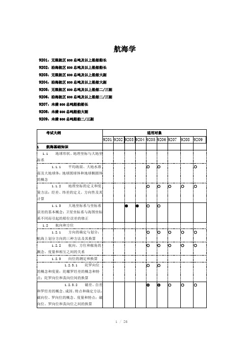
驾驶11规则:航海学理论考试大纲Word版
○ห้องสมุดไป่ตู้
2.7.3 其它重要的英版障碍物海图图式
○
○
2.7.4 其它重要的中版障碍物海图图式
○
○
○
○
○
○
○
2.8 助航标志
2.8.1 基本灯质、常见灯质的图式和含义
○
○
○
○
○
○
○
2.8.2 重要的英版灯标和无线电航标的海图图式
○
○
2.8.3 重要的中版灯标和无线电航标的海图图式
○
○
○
○
○
○
○
2.9 其它重要的海图图式
○
6 罗经差
6.1 利用天体求罗经差
6.1.1 利用天体求罗经差的原理及注意事项
○
○
6.1.2 利用低高度太阳方位或太阳真出没求罗经差
9209:未满500总吨船舶二/三副
考试大纲
适用对象
9201
9202
9203
9204
9205
9206
9207
9208
9209
1 航海基础知识
1.1 地球形状、地理坐标与大地坐标系
1.1.1 平均海面、大地水准面及大地球体;地球圆球体和地球椭圆体的概念
○
○
○
1.1.2 地理坐标的定义和度量方法;经差、纬差的定义、方向性及其计算
○
○
○
○
○
1.4.3 计程仪种类、特点和计程仪航程的计算
○
○
2 海图
2.1 比例尺与投影变形
2.1.1 局部比例尺、普通比例尺(基准比例尺)的概念和取值方法以及表示法
●
●
○
○
船舶管理二三管轮11规则总题库(含答案)
第一章船舶适航性控制第一节船舶的发展与分类1 ______是属于按上层建筑型式分类的船舶。
DA.远洋船,沿海船B.中机型船,尾机型船C.潜水船,气垫船D.三岛型船2 下列哪项不是目前船舶发展的突出特点______。
AA.高效率化B.自动化C.大型化D.专业化3 下列关于船舶发展的说法中,错误的是______。
BA.螺旋桨推进器是目前船用推进器发展的主要型式B.散货船是最早的专业化船舶C.船舶发展的突出特点是专业化、大型化、自动化D.最大船型的惊人发展,是战后油船发展的最大特点4 20世纪50年代后,钢船建造的发展,均采用______。
BA.铆接法B.焊接法C.铸造法D.锻造法5 目前海船上最广泛使用的主动力装置是______。
BA.汽轮机B.柴油机C.燃气轮机D.汽油机6 现代柴油机动力装置的发展,在低油耗方面已非追逐的主要目标,代之以______成为重大研究课题。
AA.低排放B.系列化C.大型化D.配套化7.______是属于按推进动力分类的船舶。
DA.螺旋桨船B.平旋推进器船C.喷水推进船D.电力推进船8.船舶按航区分类有______。
DA.远洋船,沿海船B.军用船,民用船C.极区船,内河船D.A和C9.______是属于按航行状态分类的船舶。
BA.帆船B.水翼船C.渡船D.载驳船10.按各类运输船舶的用途分类不属于特种货船的是______。
B A.冷藏船B.煤船C.运木船D.汽车运输船11.目前船舶发展的突出特点是______。
CA.核动力化、自动化、大型化B.快速化、自动化、大型化C.专业化、自动化、大型化D.小型化、专业化、自动化12.______是属于按用途分类的船舶。
BA.远洋船,沿海船B.军用船,民用船C.人力船,柴油机船D.排水型船13.尾机型船的优点是______。
DA.装卸效率高B.结构连续C.轴系短D.以上全是14.______是属于按造船材料分类的船舶。
BA.油船,液化气船B.水泥船,玻璃钢船C.蒸汽机船,帆船D.煤船,矿石船15.______是属于按推进器型式分类的船舶。
《航海学》题库
二等远洋职务船员《航海学》试题库一、是非题;1.(O)地球椭圆体某点的法线在赤道上夹角称为该点的地理纬度。
2.(O)基准经度线与测者经线在赤道上夹的弧称为经度。
3.(X)度量经度的起算线是赤道。
4.(X)地球的第一近似体是椭球体。
5.(O)到达点在起航点的东面,经差的名称为东。
6.(O)到达点在起航点西面,经差符号为西。
7.(X)已知起始点纬度65°08ˊ5N,到达点纬度44°48ˊ1S则纬度差为20°20ˊ4S8.(O)经差不能大于180°当计算结果大于180°时,则应该用360°相减,符号方向相反。
9.(X)N/W换算圆周法方向为315°。
10.(O)N35°W的圆周方位是325°。
11.(O)NNE换算为圆周法方向022°5。
12.(O)物标正横时,其方位线与航向线一定互相垂直。
13.(X)某轮真航向320度,左正横某物标,该物标真方位为220度。
14.(O)真北线与物标方位线之间的夹角称为物标真方位。
15.(X)某物标方位为N125°W,其圆周方位为055°。
16.(O)某一物标的方位为S125°E其圆周方位为055°17.(X)某轮真航向045°,发现物标的左舷角130°,则判断该物标真方位085°18.(O)某轮真航向255°,当物标右正横时,其方位为345°。
19.(O)陀螺罗经能为雷达、自动舵等提供指北信息。
20.(O)陀螺罗经误差主要随航速和所处纬度的变化而变化,与航向等无关。
21.(O)陀螺北偏开真北角度称为陀螺罗经差。
22.(O)罗经差为0°,用罗经测得的物标方位等于真方位。
23.(X)某物标真方位001°,当地磁差5°E,自差为0°,则该物标的罗方位006°.24.(O)某轮以CC=300°航行,测得物标甲的真方位TB=037°,舷角100°,当地磁差 Var=-5°,自差为2°E。
海船船员考试:航海学基础知识

海船船员考试:航海学基础知识1、单选(江南博哥)世界上最大、最深、边缘海和岛屿最多的一个大洋是()。
A.北冰洋B.大西洋C.太平洋D.印度洋答案:C2、单选世界上海潮潮差最大的地方在()A.比斯开湾B.芬迪湾C.孟加拉湾D.哈德逊湾答案:B3、单选福建省以东有一条我国最大的海峡,它北起福建省闽江口和台湾省富贵角,南界福建省官口港和台湾省鹅銮鼻,呈东北—西南走向。
这条海峡是()。
A.马六甲海峡B.台湾海峡C.琼州海峡D.渤海海峡答案:C4、单选由盐田中靠晒干海水所得到的是()。
A.可以直接出售B.粗盐C.精盐D.含碘盐答案:B5、单选生活在北极的主要土著居民是(),又被称为“爱斯基摩人”。
他们大多居住在北纬60~70北冰洋沿岸严寒地区,过着渔猎的原始生活,依靠捕捉海中的鱼类和兽类为生。
A.印第安人B.因纽特人C.阿南古人D.美拉尼西亚人答案:B6、单选世界上地质年代最年轻的大洋是()。
A.太平洋B.大西洋C.印度洋D.北冰洋答案:C7、单选孔圣人说“如入鲍鱼之肆,久而不闻其臭”,意思是“如同进入了贩卖鲍鱼的商行,时间长了也就不觉得鲍鱼很臭了”,泛指某些人近墨者黑自甘堕落而不自觉,鲍鱼也就约等于臭鱼烂虾了,实际上,鲍鱼是()A.就是臭鱼烂虾B.是发酵的虾C.是海中不可多得的美味D.是一种没有经济价值的鱼类答案:C8、单选渤海有三个主要海湾,选项中的()不是渤海的海湾之一。
A.辽东湾B.雷州湾C.渤海湾D.莱州湾答案:B9、单选被称为“轮船之父”的美国机械工程师罗伯特?富尔顿设计出汽轮船“克莱蒙特”号。
1807年8月17日,载有40名乘客的“克莱蒙特”号从纽约出发,沿着哈德孙河逆水而上,揭开了轮船时代的帷幕。
请问,“轮船”这个称呼的来历是()A.把蒸汽机安装到船上作动力,开始时用明轮推进,因此而得名B.指一种形状像轮子的船C.最早的船是在陆地上行使、装有轮子,以后一直沿用D.一个船长突发灵感取的名字答案:A10、单选我国测量海拔是以()一平均海平面作为零点.A.渤海B.黄海C.东海D.南海答案:B11、单选“八仙过海”故事发生的地点是今山东()。
中华人民共和国海船船员11规则
围内担任职务或者担任低于适任证书适用 范围的职务。但担任值班水手职务的船员 必须持有值班水手或者高级值班水手适任 证书,担任值班机工职务的船员必须持有 值班机工或者高级值班机工适任证书。
十二、适任证书的签发
取得适任证书应当具备条件:
(一)持有有效的船员服务簿; (二)符合国家海事管理机构规定的海船船员任职岗 位健康标准; (三)完成本规则附件规定的适任培训; (四)具备本规则附件规定的海上任职资历,并且任 职表现和安全记录良好; (五)通过相应的适任考试。 拟在油船、化学品船、液化气船、客船、高速船等特 殊类型船舶上任职的船员,还应当具备规定的培训、 资历等特殊要求。
三、 适 用 范 围
【第六十条】 【第二条】适用规则 下列船舶船员的适任考试和发证不适用本规则:
(一) 在两港间航程不足50海里的客船或者滚装 客船上任职的船长和高级船员; • 为取得中华人民共和国海船船员适任证书 (二)在未满100总吨船舶上任职的船长和甲板部 (以下简称适任证书)而进行的考试; 船员; (三)在主推进动力装置未满220千瓦船舶上任职 • 适任证书、适任证书特免证明和外国适任证 的轮机部船员; 书承认签证的签发与管理。 (四)仅在船籍港和船籍港附近水域航行和作业 的船舶上任职的船员; (五)在公务船、水上飞机、地效翼船、非营业 性游艇、摩托艇、非自航船上任职的船员。
十三、内河船舶、海洋渔业船舶或者军事 船舶上任职的人员申请相应的适任证书
曾在内河船舶、海洋渔业船舶或者军事船舶上 任职的人员,具备下列条件的,可以按照国家海事 管理机构的规定申请相应的适任证书: (一)拟申请证书的等级和职务不高于其在内河船 舶、海洋渔业船舶或者军事船舶上相应的证 书等级和职务,其中可以申请的职务最高为 大副或者大管轮; (二)在内河船舶、海洋渔业船舶或者军事船舶上 的水上服务资历能够与本规则规定的海上服 务资历相适应,且任职表现和安全记录良好; (三)参加相应的岗位适任培训,并通过与申请职 务相应的的理论考试和评估。
最新11规则甲类船长英语考试题库.

[0001] is not a criteria for fixing the reward of salvage operations.A. The value of the vessel and other property of the vessel being salvedB. The skill and efforts of the salvors in preventing or minimizing damage to the environmentC. The measure of success obtained by the salvorD. The nature and degree of the dangerKEY: ACriteria n.标准property[]n.财产, 所有物, 所有权reward[]n.报酬, 奖金salvage[5sAlvidV]n.抢救财货,海上救助, 抢救, 打捞salve[] n.油膏,药膏,抢救,打捞被救助船舶的其它财产和船舶的价值不是确定海上救助报酬的标准。
[0002] is not a factor which will affect the accuracy of GPS receiver.A. Detective Availability.B. Local environmental conditionsC. Autonomous mode versus differential correction mode versus RTCM modeD. The averaging of recorded locationsKEY: Adetective [di'tektiv] n.侦探a.侦探的,检测的;探测的versus[ˈvəːsəs]prep. 1. (诉讼、运动等中的)对2. 相对; 相比autonomous[]adj.自治(权)的; 自主的【生】有独立机构的; 自发的differential correction差动修正,微分修正RTCM=Radio Technology Committee of Marine 海事无线电技术委员会探测的有效性不是一个影响GPS接收机精度的因素。
- 1、下载文档前请自行甄别文档内容的完整性,平台不提供额外的编辑、内容补充、找答案等附加服务。
- 2、"仅部分预览"的文档,不可在线预览部分如存在完整性等问题,可反馈申请退款(可完整预览的文档不适用该条件!)。
- 3、如文档侵犯您的权益,请联系客服反馈,我们会尽快为您处理(人工客服工作时间:9:00-18:30)。
【单选】移向冷的下垫面气团具有的天气特征:i.气温日变化大;n.变性快;川.变性慢;w.气压高;V.气压低;w.气温日变化小。
A.川、V、WB. i、n、vD. i、n、w、【单选】根据IMO 船舶报告系统文件,船舶报告分为一般报告和特殊报告,特殊报告有:I、危险货物报告(DG , Dangerous goods report) ;n、有害物品报告(HS, Harmful substances report);川、航行计划报告(SP, Sailing plan ) ;W、船位报告(PR, Position report) ;V、变更报告(DR, Deviation report ) ;W、最终报告(FR, Final report);四、海洋污染报告(MP , Marine pollutants report );忸、其他报告( Any other report )A.I 〜WB.川〜Wc. i、n 、四、忸D. I〜忸【单选】北太平洋台风区内的最大涌区,常出现在台风前进方向的:A.右前方B.左前方C.右后方D.左后方【单选】适淹礁是指 _____A.平均大潮高潮时露出的孤立岩石B.平均大潮高潮面下,深度基准面以上的孤立岩石C.深度基准面适淹的礁石D.深度基准面以下的孤立岩石【单选】船舶在VTS 区域内航行、停泊和作业时,在下述哪些情况下需要按主管机关颁发的《VTS 用户指南》所明确的报告程序和内容,通过甚高频无线电话或其他有效手段迅速向VTS中心进行报告?I、发生交通事故;n、发生污染事故;川、发生紧急情况;w、发生船员皮肤意外受轻伤事故a.i、n、川、wb.i、n、川C.I、n、wD.I、川、wA.雷达跟踪器继续工作,但是计算目标速度发生误差B.雷达跟踪器继续工作,但是计算目标航向发生误差C.雷达正常使用,但目标跟踪功能失效D.人工输入本船航向后,雷达跟踪器才能继续工作【单选】在变性冷高压中部控制的港湾内,夜间和清晨有时会出现:A.平流雾B.锋面雾C.地形雾D.辐射雾【单选】下列说法错误的是:A.气象导航的推荐航线一定不遇大风浪B.气象导航的推荐航线并非都是大圆航法C.气象导航的推荐航线要有雾航准备D.气象导航的推荐航线仅是建议【单选】西北太平洋副热带高压的范围通常用哪种天气图上的什么线围成的区域来表示?A.地面图上副高闭合等压线B.500 hPa等压面图上588等高线C.850 hPa等压面图上152等高线D.700 hPa等压面图上588等高线【单选】如果用削尖的铅笔在海图上画一小点,其直径最小也有0.2 毫米,若某海图比例尺为1:300,000,则在该图上进行海图作业的最高精度为_________ 。
A.6 米B.60 米C.300 米D.600 米【单选】某轮排水量12000t,以船速14kn航行一天,燃油消耗25t,现改用12kn的船速航行,求一天燃油消耗量将减少_________ 。
A.8tB.15.7t6.9D.13.5tA.冬季影响我国的冷空气常常孕育形成于西伯利亚和蒙古地区B.冷空气聚集形成冷高压,出现在对流层下层C•夏季影响我国的冷空气常常来自于西北太平洋D.影响我国的冷空气常常形成和聚集于新地岛附近洋面和冰岛以南洋面单选】下列关于海底底质和坡度对船用回声测深仪工作的影响的描述错误的是:A.不同的海底底质对声波的反射能力差异较大,岩石最强,砂底次之,淤泥最差B.为了达到显示器的最佳显示效果,应根据不同的海底底质调整测深仪的灵敏度大小C•不平坦的海底底质和海底坡度将使反射回波先后抵达接收换能器,从而在显示器上出现较弯曲和窄的信号带D.为了保证船舶航行安全,应以回声测声仪信号带前沿读取水深为宜【单选】温带气旋的移动方向大致是:A.在北半球自W向E,在南半球自E向WB.在北半球自E向W,在南半球自W向EC.在北半球和南半球均自E向WD.在北半球和南半球均自W向E【单选】通常情况下在求天文船位线的过程中所产生的误差属于:1、系统误差;n、随机误差;川、综合误差A. i、n、川B. I、川c.n、川d.i、n【单选】在北半球船舶遇热带气旋,测得真风向为东北风,风力真方6 级,则热带气旋中心的位在:A.90°B.270C.360D.180单选】船舶在航时,LRIT 船载设备通过预先设置位置报告发送信息的时间间隔为A.2 秒到3 分钟B.3 秒C.10 分钟D.15 分钟到6 小时单选】锋面坡度最小,云和降水区宽度最大,降水强度小,持续时间长的锋是:A.第一型冷锋B.第二型冷锋C.暖锋D.准静止锋【单选】某轮行驶在国际水上浮标制度B 区域,发现一红色锥形浮标,该标为:A. 航道左侧标B .推荐航道左侧标C.航道右侧标D.推荐航道右侧标【单选】关于对船舶报告系统的理解与判定正确的是__________A.根据《进港指南》等规定,船舶驶入某国港口时必须加入该港口的船舶报告系统B .在以船舶救助为目的的报告系统中,船舶加入该系统是强制的C.一般而言,以船舶交通管理为目的报告对某些船是强制的;以船舶救助为目的的报告是自愿的D.在以船舶交通管理为目的报告系统中,船舶加入该系统是自愿的【单选】两天体定位,只考虑随机误差,两天体的方位差角趋近 ____________ 最好。
A.180B.120C.90 °【单选】太平洋中部和东部生成的气旋,一般向__________ 方向移动,最终移至北美的东岸和阿拉斯加湾。
A.东B.东北C.西北D.先向东北,后向西北【单选】热带气旋与温带气旋相比较,在结构方面:A.两者均由1 个气团组成B.前者由1个气团、后者由2〜3个气团组成C.两者均由2〜3个气团组成D.前者由2〜3个气团、后者由1个气团组成A.天空状况B.潮汐潮流C•天气现象D.风和浪【单选】产生于南海的热带气旋与西北太平洋热带气旋比较,其特点为:A.水平范围小、垂直伸展高度低、强度弱B•水平范围小、垂直伸展高度低、强度强C.水平范围小、垂直伸展高度高、强度弱D.水平范围大、垂直伸展高度低、强度弱【单选】船舶在岛礁区航行,利用物标“串视”导航,实际是要求船舶航行过程中保持:A.物标的方位不变B.船舶的航向不变C.方位与航向都不变D .方位与航向都变化【单选】观测二物标进行距离定位,二物标的方位夹角应:1、小于30o;n、大于30o;川、小于1500A.i、nB.I、川C.n>nD. i、n、川【单选】利用浮标导航,下列哪些方法可判断本船是否行驶在航道内或计划航线上?I、查看前后浮标法;n、前标舷角变化法;川、舷角航程法A. i、nB. I、川c.n、川d.i、n、川【单选】黄河气旋一年中出现最多的季节为A.春初B.夏半年C.秋末D.冬半年单选】一般地面静止锋对应:A.高空图上低压槽线B.高空图上的高压脊线C.高空图上的切变线D.高空图上的低压带【单选】每年7〜9月是西北太平洋哪种热带气旋路径的盛行期?A.西行路径B.西北路径C.转向路径D.异常路径单选】选择大洋航线不可忽视本船条件,本船条件包括:1、结构强度;n、船舶吃水; 川、船速;w、吨位;V、客货装载情况;切、船员技术水平A.I、W、VB.I、『W、VC.I 〜WD.I、川、W【单选】根据MSC192 (79)决议,以下哪个不是船舶导航雷达的标配传感器?A.ECDISB.AISC.THDD.GPS【单选】在北半球,热带气旋的危险象限是指其前进方向的:A.右后部B.左后部C.右前部D.左前部【单选】据统计,西北太平洋热带气旋源地之一是A.日本东南部洋面B.琉球群岛附近洋面C.南海南部海面D .关岛附近洋面【单选】 通常暖锋过境的天气特征为:i •气温逐渐升高;n.气压逐渐降低;川•北半 球风向SE 转SW ; W.锋前降水;V.北半球风向 SW 转NW ; 南半球风向 NW 转SW 。
A. n 、 川w 、V B.I n 、 w 、 V 、w C.I n 、 川、 w D.n w 、 V 、 w 单选】 过浅滩时,考虑最小安全水深时所包括的主要因素中有:A. 半波高B. 船长C. 船舶结构D. 压载水【单选】 锋面雾产生的典型部位是A. 暖锋前、锢囚锋两侧B. 第一型冷锋前、后C. 第二型冷锋前、后D. 暖锋后、锢囚锋两侧【单选】 西北太平洋副热带高压季节变化和外形特征一般是:i •冬弱夏强;n •冬北夏南; 川.东西长、南北短;w •冬强夏弱;v •冬南夏北;w .东西短、南北长。
a. n 、w 、wb. i 、n 、wC. I 、『VD . n 、川、w【单选】 通常寒潮大风可能出现在强冷高压的什么部位?A. 前部B 冲部C. 后部D .任何部位单选】 在两距离定位中,仅考虑随机误差的影响,若其他条件都一样,则位置线交角为30°的船位误差是交角为 90°的船位误差的 _______A. 1/2 倍B. 2 倍C. 大小一样D.4 倍单选】冬季造成寒潮的天气系统是:A.锋面气旋B .温带气旋C•冷性反气旋D. 暖性反气旋单选】船舶定线制中的警戒区是:A.航行特别危险,船舶必须避离的区域B.航行有危险,但不必避离的区域C.有军事活动而需避离的区域D .必须谨慎驾驶但不必避离的区域单选】下列正确的说法是A.在地面图上锋表现为一条线B.在高空图上锋表现为一条线C.在地面图上锋表现为等温线的狭长密集带D.在高空图上锋表现为等压线的狭长密集带【单选】定线制规定水域的航标是保障船舶定线制顺利实施的物质基础。
在定线制水域,浮标的作用是:1、助航标志;n、定位标志;川、分道界线标志A. i、nB.I、川C.n>nD. i、n、川单选】若同时观测三物标,使用方位定位,且三物标与测者之间的距离均相等,则:A.三条船位线的系统误差相等,消除了系统误差后的船位点在三角形的内心上B.三条船位线的系统误差相等,消除了系统误差后的船位点在三角形的内心或旁心上C•三条船位线的系统误差不相等,消除了系统误差后的船位点在三角形内D•三条船位线的系统误差不相等,消除了系统误差后的船位点在三角形内或在三角形外单选】冬季,移动性反气旋入海后,其强度是:A. 逐渐加强B•减弱变成温带气旋C•逐渐减弱D.加强变成温带气旋【单选】长江口附近海面雾的最盛期在A.2〜3月B.4〜6月C.6〜7月D.12〜1月【单选】不受风速大小影响的雾是A.平流雾B.辐射雾C.锋面雾D.海上蒸汽雾【单选】24h内地面中心气压下降24hPa的温带气旋称为爆发性气旋,主要出现在:A.北太平洋和北大西洋的东南部B.北太平洋和北大西洋的西南部C•北太平洋和北大西洋的东北部D.北太平洋和北大西洋的西北部【单诜】海图图武我”裏示:0止推荐航绒• &前-匸蜃标C D一分舷15【单选】中版海囲囹式“磐"表示 ________ JL 适潁礁匚E 探度不明危陰暗礁 0C.已知滦度危陰暗礁 圖D.丰危险暗碓C. 已知深度的危险暗礁?I GWS -NEZ TRAFFIC【单选】英版海图图式心・「 '・'表示:®*-BW 浅谦度的陣碍物 P-已知高度的障碍物高出平均大蘇潮面的障碍韧O 皿经扫海 嚥潜水貝探则 的障碍物Hamegat*C CBE1-壮十DOVEH COASTGUARD AC«lal*Fairligh th^r-duimBright on NewhalenLVftl fflMIMjmMnW 】 UMflHttn .亠亠创 MM BI■■- “的*Oi 删*暉EIEJ ■片加是由国毎区水上肋航标志制度中的______ C乩娱乐专用标志■吏釦Jd翳Cc.水上飞殛过区慟推怎航道左侧标A.娱乐区专用标志【单选】在申版海圉上标逹的图式为“”-以下说迭正确的是.O■装有灯标的海上平台O B.装有灯标的海上汰型颤物°C装有灯标他海上工稈基地•u装有灯标削海上洪油平台A.装有灯标的海上平台【单选】图中测站的温度聶卢差为:O A_£L.护GO B. 9. 0* C® C.1Z. 6* C匸进有館岀【单选】在我国“ VTS ”区域内,对船舶向“ VTS ”系统报告的要求有:1、根据《VTS 用户指南》要求进行船舶动态报告;n、船舶发现助航标志异常、有碍航行安全的障碍物、漂流物或其他妨碍航行安全的异常情况时,应迅速向VTS中心报告;川、船舶在VTS区域内发生交通事故、污染事故或其他紧急情况时,应立即向VTS 中心报告A. i、nb.n、川c.I、川d.i、n、川【单选】当副高与我国东部气旋构成“南高北低” 形势时,副高脊线的北部常出现__________A.SE 大风B.SW 大风c.NE 大风D.NW 大风单选】在热带气旋加强时,其移速一般是:A.加快B.不变C.减慢D.倒退【单选】英版海图图式“”表示:A.干出礁B.适淹礁C.危险暗礁D .非危险暗礁【单选】在日本海某轮自东向西穿越冷锋,通常风向将由A.S〜SW转N〜NWB.S〜SW转E〜SWC.E〜NE 转S〜SWD.N〜NW转E〜SE试题题目单选】孟加拉湾和阿拉伯海发生热带气旋最多的月份是:A.6、7 月B.7、8 月C.5、10 月D.8、9 月【单选】夜间船舶在我国沿海航行,发现某浮标灯质为:快(6) +长闪15 秒,表明可航水域位于该标的______ 。
