PDF文档制作导航菜单
使用Adobe Acrobat Pro 制作PDF文档

使用Adobe Acrobat Pro 制作、编辑PDF文件我们除了使用Adobe Acrobat Pro阅览PDF文件外,还可以使用它很方便的将图片、OFFICE文档、网页、文本文件、CAD文档、多媒体文件等制作成PDF文档,并可以进一步编辑已制作好的PDF文档。
Adobe Acrobat Pro 下载>>(提取码:ceb4)(说明:本文的PDF版以及相关软件见上面的下载链接,PDF版不再更新,新修改见本文。
)一、创建PDF文件使用Adobe Acrobat Pro创建PDF有两种途径:1、可以新建一个空白文档,然后在其中编辑文字。
2、将已有文件转换成PDF文档1)、直接打开Adobe Acrobat Pro软件,点击菜单:文件/创建,再根据组成文件来源方式选择相应的菜单项目。
如果要把多个文件合并创建为一个PDF文档的话,也可以直接使用菜单:文件/合并/合并文件到单个PDF。
2)Adobe Acrobat Pro在安装时,还会安装插件到系统右键和OFFICE、CAD中,也可以使用Adobe插件来直接制作PDF文档。
①系统右键菜单:② OFFICE中的插件:③ CAD中的插件:二、编辑PDF文件使用Adobe Acrobat Pro 的强大编辑功能可以对PDF文档编辑页面、书签、注释、多媒体等。
1、编辑PDF文档时,是不能直接粘贴图片的,为了方便,可以先使用Word编辑好文档后再转成PDF文档。
如果非要使用Adobe来编辑文档,可以使用“工具/高级编辑/TouchUp对象工具”来插入图片,以后仍只能使用该工具(可以调整大小)或Enfocus的选择对象工具(不能调整大小)来选择到它。
另外,使用图章工具也可以达到一样的效果。
裁剪页面:本功能仅针对PDF文档中的图像页面使用2、有些PDF文档的一页内容是由多张图片拼接而成的。
如果你想把它们合成一张图片,可以使用PhotoShop软件打开文档来编辑(注意相对应的PS版本要高);如果对清晰度要求不严格的话也可以使用菜单“文件/导出/图像”工具即可合成为一张图片(该功能是导出文档全部内容,每页一张图片,导出的图像质量会降低,导出后,再将导出的图片重新合并成一个新的PDF文档即可)。
PDF格式文档制作说明
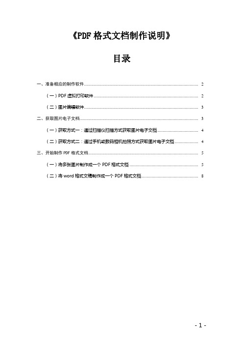
《PDF格式文档制作说明》目录一、准备相应的制作软件.......................................................................................................... - 2 -(一)PDF虚拟打印软件................................................................................................... - 2 - (二)图片编辑软件.......................................................................................................... - 3 - 二、获取图片电子文档.............................................................................................................. - 3 -(一)获取方式一:通过扫描仪扫描方式获取图片电子文档...................................... - 4 - (二)获取方式二:通过手机或数码相机拍照方式获取图片电子文档 ...................... - 4 - 三、开始制作PDF格式文档...................................................................................................... - 5 -(一)将多张图片制作成一个PDF格式文档.................................................................. - 5 - (二)将word格式文稿制作成一个PDF格式文档........................................................ - 8 -一、准备相应的制作软件(一)PDF虚拟打印软件建议采用TinyPDF、FoxitPhantom或类似功能的PDF虚拟打印软件。
在pdf文件中添加索引的方法_解释说明
在pdf文件中添加索引的方法解释说明1. 引言1.1 概述在日常工作和学习中,我们经常会遇到需要使用PDF文件进行阅读与查找的情况。
当PDF文件较大且内容繁杂时,要快速准确地找到所需信息可能会变得困难。
而添加索引可以有效地解决这个问题。
1.2 文章结构本文将介绍在PDF文件中添加索引的方法,并详细说明两种常用的添加索引方法:使用Adobe Acrobat和使用PDF编辑器。
文章将从定义索引的概念开始,逐步讲解每个方法的步骤和注意事项。
最后将总结两种方法的优缺点及适用场景,并展望未来发展方向。
1.3 目的本文的主要目的是帮助读者了解如何在PDF文件中添加索引,使其更加易于阅读与搜索。
通过学习本文提供的两种常用方法,读者可以根据实际需求选择合适的方式来添加索引,并能够快速准确地在大型PDF文件中定位所需内容。
以上为“1. 引言”部分内容,请根据需要进行适当修改和调整。
2. 正文在PDF文件中添加索引是一种常见的需求,它可以帮助读者更快地定位和浏览文件中的内容。
通过添加索引,我们可以为PDF文件创建一个可供用户点击跳转的目录,以便更方便地导航和阅读文档。
正文部分将介绍如何在PDF文件中添加索引的两种方法:使用Adobe Acrobat 和使用PDF编辑器。
首先,我们将详细介绍第一种方法,即使用Adobe Acrobat添加索引。
Adobe Acrobat是一款功能强大的PDF编辑软件,它提供了丰富的工具和功能来处理PDF文件。
要添加索引,您可以按照以下步骤进行操作:1. 打开需要添加索引的PDF文件并在Adobe Acrobat中加载它。
2. 在“工具”栏中找到“编辑”选项,并选择“添加书签”或“创建导航点”。
3. 在弹出的窗口中输入书签或导航点的相关信息(例如标题)。
4. 点击确定保存所创建的书签或导航点。
您可以重复这个过程直到完成所有需要添加的索引项目。
接下来,我们将介绍第二种方法,即使用PDF编辑器添加索引。
《如何在WPS中制作互动式PDF文档》
《如何在WPS中制作互动式PDF文档》在现代科技的时代,互动式PDF文档成为了一种越来越流行的交流和分享资料的方式。
WPS作为一款全面且易于使用的办公软件,提供了制作互动式PDF文档的功能。
本文将向您介绍如何使用WPS来制作一份精美且具有交互性的PDF文档。
第一步:创建新文档打开WPS软件并选择创建一个新的文档。
您可以选择空白文档或使用模板来开始。
对于制作互动式PDF文档,建议选择一个适合您目的的模板,以节省您的时间和精力。
第二步:添加内容接下来,您可以开始添加您想要在互动式PDF文档中展示的内容。
您可以插入文本、图片、表格、图标等元素来丰富您的文档。
这些元素不仅可以帮助您表达清晰的信息,还可以增加文档的视觉吸引力。
另外,您还可以使用WPS提供的各种插件和功能来增加交互性。
比如,您可以插入超链接,使读者可以点击跳转到其他页面或网站;您也可以添加音频和视频,使文档更加生动和多样化。
第三步:设置互动功能一旦您完成了文档内容的添加,接下来,您需要设置一些互动功能,以增强PDF的交互性。
WPS提供了一系列的工具和选项,可以帮助您实现这一目标。
您可以设置书签和目录,使读者可以轻松地导航和查找文档中的特定部分。
您可以添加批注和评论,以便读者可以与您的文档进行实时的交流和反馈。
您还可以设置表单和调查问卷,以收集读者的意见和数据。
第四步:导出为PDF当您完成文档的编辑和设置后,接下来就是将其导出为PDF格式的文件。
WPS提供了导出为PDF的选项,您只需点击菜单栏上的“文件”选项,然后选择“导出为PDF”,即可生成一个互动式的PDF文档。
通过使用WPS,您可以轻松制作出精美且具有交互性的PDF文档。
无论是个人、教育、商务还是其他领域,互动式PDF文档都能为您的内容增添更多的魅力和实用性。
希望本文对您有所帮助,祝您在使用WPS制作互动式PDF文档时取得优秀的成果!。
Adobe Acrobat PDF编辑操作方法及界面介绍

Adobe Acrobat PDF编辑操作方法及界面介绍Adobe Acrobat是一款功能强大的PDF编辑软件,被广泛应用于日常办公和学术领域。
本文将介绍Adobe Acrobat的操作方法以及界面布局,帮助读者更好地使用这一工具。
一、Adobe Acrobat的界面介绍Adobe Acrobat的界面主要分为菜单栏、工具栏、导航窗格和查看窗格四部分。
1. 菜单栏Adobe Acrobat的菜单栏包含了各类功能和操作选项。
其中,文件、编辑、视图、工具、窗口和帮助等六个主要菜单提供了一系列的子菜单和操作命令。
2. 工具栏工具栏位于菜单栏下方,提供了常用的编辑和查看工具。
它包含了选择工具、文本编辑工具、图像编辑工具、标注工具和表单工具等。
用户可以根据具体需求,在工具栏中进行工具的添加、删除和调整。
3. 导航窗格导航窗格位于左侧,用于管理文档的各个部分和页面缩略图。
在导航窗格中,用户可以查看和导航到特定的页面,进行书签的管理和创建,以及进行页面的缩放和旋转等操作。
4. 查看窗格查看窗格位于导航窗格右侧,用于展示PDF文档的内容。
通过查看窗格,用户可以进行页面的放大和缩小、全文搜索、分页预览、批注和标记等操作。
二、Adobe Acrobat的PDF编辑操作方法Adobe Acrobat提供了丰富的编辑工具和操作方式,方便用户对PDF文档进行修改和处理。
以下是几种常用的编辑操作方法:1. 文本编辑点击工具栏中的文本编辑工具,然后在文档中选择需要修改的文字内容,即可进行编辑。
用户可以修改字体、大小、颜色等文本属性,还可以添加、删除和移动文本内容。
2. 图像编辑通过工具栏中的图像编辑工具,用户可以对PDF文档中的图像进行编辑。
可以调整图像大小、旋转角度、亮度和对比度等参数,甚至还可以提取、移除或替换图像。
3. 页面管理用户可以在导航窗格中选择特定的页面,然后通过右键菜单或工具栏中的页面操作工具进行页面的插入、删除、移动和替换。
PDF文档添加书签导航的步骤
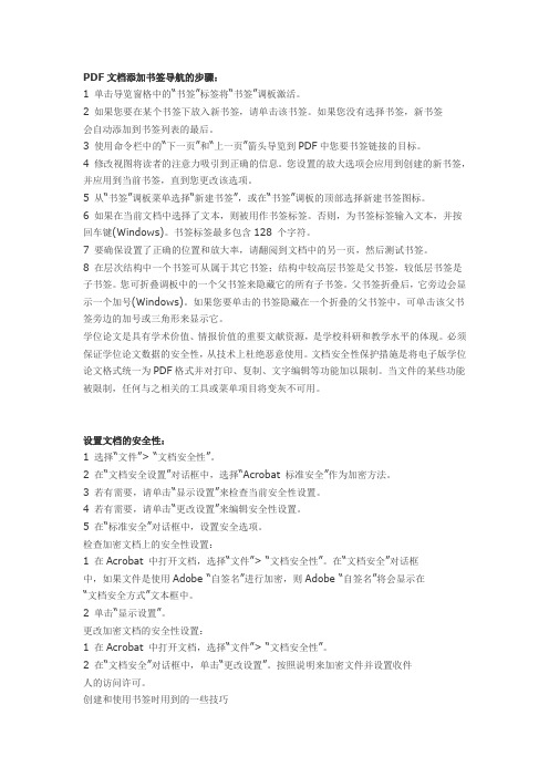
PDF文档添加书签导航的步骤:1 单击导览窗格中的“书签”标签将“书签”调板激活。
2 如果您要在某个书签下放入新书签,请单击该书签。
如果您没有选择书签,新书签会自动添加到书签列表的最后。
3 使用命令栏中的“下一页”和“上一页”箭头导览到PDF中您要书签链接的目标。
4 修改视图将读者的注意力吸引到正确的信息。
您设置的放大选项会应用到创建的新书签,并应用到当前书签,直到您更改该选项。
5 从“书签”调板菜单选择“新建书签”,或在“书签”调板的顶部选择新建书签图标。
6 如果在当前文档中选择了文本,则被用作书签标签。
否则,为书签标签输入文本,并按回车键(Windows)。
书签标签最多包含128 个字符。
7 要确保设置了正确的位置和放大率,请翻阅到文档中的另一页,然后测试书签。
8 在层次结构中一个书签可从属于其它书签;结构中较高层书签是父书签,较低层书签是子书签。
您可折叠调板中的一个父书签来隐藏它的所有子书签。
父书签折叠后,它旁边会显示一个加号(Windows)。
如果您要单击的书签隐藏在一个折叠的父书签中,可单击该父书签旁边的加号或三角形来显示它。
学位论文是具有学术价值、情报价值的重要文献资源,是学校科研和教学水平的体现。
必须保证学位论文数据的安全性,从技术上杜绝恶意使用。
文档安全性保护措施是将电子版学位论文格式统一为PDF格式并对打印、复制、文字编辑等功能加以限制。
当文件的某些功能被限制,任何与之相关的工具或菜单项目将变灰不可用。
设置文档的安全性:1 选择“文件”> “文档安全性”。
2 在“文档安全设置”对话框中,选择“Acrobat 标准安全”作为加密方法。
3 若有需要,请单击“显示设置”来检查当前安全性设置。
4 若有需要,请单击“更改设置”来编辑安全性设置。
5 在“标准安全”对话框中,设置安全选项。
检查加密文档上的安全性设置:1 在Acrobat 中打开文档,选择“文件”> “文档安全性”。
pdf页面设置在哪里?哪里可以调整pdf页面?
pdf页面设置在哪里?哪里可以调整pdf页面?
作为公司的文职,往往需要处理大量的文本,比如WORD、EXCEL、PPT、PDF等,如果不知道一些办公软件的使用技巧,便会大大降低办公效率。
比如笔者遇到批量的PDF文本需要调整页面尺寸时,会用到一些编辑器软件,下面给大家介绍一下迅捷PDF编辑器的使用方法。
准备的工具:
一台电脑
一个迅捷PDF编辑器软件
一个或多个PDF文本
首先,我们打开迅捷PDF编辑器,进入窗口后在对应的位置添加文本,操作步骤和其他办公软件是相通的。
文件导入后,先来熟悉一下窗口菜单导航栏,它有【文件】、【编辑】、【视图】、【文档】、【注释】、【表单】、【工具】、【窗口】按钮,我们点击其中的【文档】即可,它下面的子级菜单也有很多,在【更多页面】中的【页面大小】便能设置页面大小。
接着,在【调整页面大小】的窗口下,我们可以进行个性化设置啦,如果当前的页面大小和其他页面不一致,那就点击【页面范围】中的【当前页】,随即在【页面大小】中选择对的尺寸就好了。
好了,大家以后还遇到前后页面大小不一致的PDF文档的话,就采纳上面的建议吧,操作步骤也很简单哦,谢谢你们的耐心阅读!。
foxit pdf reader 使用方法
foxit pdf reader 使用方法Foxit PDF Reader是一款功能强大且受欢迎的PDF阅读器。
它支持多种操作系统,包括Windows、Mac和Linux等,提供了许多实用的功能和工具,使用户可以方便地阅读、批注和编辑PDF文件。
本文将为您介绍如何使用Foxit PDF Reader。
1. 下载和安装:Foxit PDF Reader可以在官方网站上免费下载。
根据您使用的操作系统,选择相应的版本进行下载。
安装完成后,双击图标以打开软件。
2. 打开PDF文件:在Foxit PDF Reader的主界面上,点击"文件"菜单,选择"打开"选项或使用快捷键Ctrl+O,然后选择要打开的PDF文件。
您也可以直接将PDF文件拖到Foxit PDF Reader的界面中以快速打开。
3. 阅读和导航:打开PDF文件后,您可以使用鼠标滚轮或快捷键Ctrl+滚轮来缩放页面。
通过点击左侧的缩略图,您可以导航到其他页面。
在页面底部的工具栏上,还提供了放大、缩小、适应页面宽度等工具,以满足您的不同需求。
4. 批注和标记:Foxit PDF Reader提供了丰富的批注和标记工具,方便用户在PDF文件中做笔记和添加标记。
在顶部的工具栏上,您可以找到各种批注工具,如文本框、箭头、文本标记、印章等。
选择所需的工具后,点击页面上的相应位置进行批注和标记。
5. 文档编辑:Foxit PDF Reader允许用户对PDF文件进行编辑。
在工具栏上,您可以找到删除、添加、移动和调整页面等编辑工具。
选择相应的工具后,按照指示操作以完成编辑。
6. 文本搜索:Foxit PDF Reader提供了强大的文本搜索功能,帮助用户快速找到关键词或短语。
在顶部的搜索栏中,输入要搜索的内容,然后点击回车或搜索按钮。
Foxit PDF Reader将会在文档中标出所有匹配的结果,并且还可以自动滚动以显示匹配的位置。
pdf-xchange editor使用方法

pdf-xchange editor使用方法PDF-XChange Editor是一款功能强大的PDF编辑工具,以下是一些基本的使用方法,主要以英文为基础,但提供中文翻译。
1. 打开文件:-在菜单栏上选择“文件”(File)>“打开”(Open)来打开一个PDF文件。
2. 查看和导航:-使用滚动条滚动页面,或者在左侧的导航面板中选择特定的页面。
-你也可以使用放大和缩小工具来调整页面的大小。
3. 文本选择和编辑:-使用选择工具(Selection Tool)来选择文本。
-如果你有编辑权限,可以直接在文本上进行编辑。
在菜单栏上选择“工具”(Tools)>“文本工具”(Text Tool)。
4. 注释和标记:-在工具栏上选择注释工具(Annotation Tools),如批注、高亮、下划线等。
-你可以在文档中添加注释,用于标记重要信息。
5. 添加页面:-在菜单栏上选择“页面”(Page)>“插入页面”(Insert Pages),可以添加新的页面到文档中。
6. 删除页面:-选中要删除的页面,然后在菜单栏上选择“页面”(Page)>“删除页面”(Delete Pages)。
7. 保存和导出:-使用“文件”(File)>“保存”(Save)保存对文档的更改。
-若要导出为其他格式,如Word或图像,选择“文件”(File)>“导出”(Export)。
8. 搜索和查找:-使用搜索工具(Search Tool)在文档中查找特定的内容。
9. 设置页面布局:-在菜单栏上选择“视图”(View)>“页面布局”(Page Layout)来更改页面的显示方式,例如单页、连续页面等。
10. 添加水印:-在菜单栏上选择“工具”(Tools)>“水印”(Watermark),可以添加水印到文档中。
11. 批量处理:-使用批量处理工具(Batch Processing)来同时处理多个文件,如合并、拆分、加密等。
福昕PDF 电子文档处理套件使用指南

红色页面查看框表示正在显示的页面区域。调整某个页面缩略图的大小,右击选择“放大缩
4
福昕 PDF 电子文档处理套件
查看注释和附件
注释面板显示了 PDF 中所有已添加的注释,您可以方便、快捷地浏览它们。该面板包括全 部展开、全部折叠、上一个、下一个等选项。附件面板显示了 PDF 中所有已添加的附件。 您可以打开、保存、添加、删除附件等。注释面板和附件面板默认隐藏,点击左侧导航栏中 的注释或附件按钮显示面板。
Microsoft Word 中的福昕 PDF 标签
从 Windows 记事本、IE 和 Outlook Express 中生成 PDF 文档
1. 2. 3. 打开文件。 选择“文件” > “打印”。 从打印机列表中选择“福昕 PDF 套件打印机”。
注释和审阅
您可以使用福昕 PDF 套件的“注释工具”输入文字信息,或使用“图形标注工具”添加线 条、 圆或者其它形状并在关联的弹出式注释框里输入信息。 大多数注释工具会自动弹出附注 框,附注框上会显示名字,以及创建附注的日期和时间。你可以随时对附注框里的信息进行 编辑、回复、删除或者移动。而且,您还可以导出所有添加的注释并保存成 PDF 文件用于 审阅。
证书加密:作者可为每个用户设置唯一的许可权限。例如,作者可允许一个用户填写表单及 添加注释,而允许另一用户编辑文本或删除页面。证书包含着一个公钥以及其他具体信息, 用于保护文档安全或验证电子签名。被证书保护的文档只有对应的私钥才能将其解密。 一般情况,用于保护文档的证书由第三方供应商提供。如果证书丢失或被偷窃,可由发行官 方进行更换。 查看文件安全性,点击“文件”菜单 > 属性 > 安全性。
添加表单注释
您可以在 PDF 表单中添加注释,其操作过程与普通的 PDF 文件一样。请注意,只有在您获 得表单作者的同意下,才可以对其添加注释。请参阅注释和审阅。
pitstop使用手册
pitstop使用手册PitStop是一种功能强大的软件工具,用于PDF文档的编辑和修复。
本手册将为您提供关于PitStop使用的详细指导和提示,以帮助您熟练掌握该软件的各项功能。
1. 界面介绍PitStop的界面简洁直观,主要分为菜单栏、工具栏和工作区。
菜单栏包含各种功能命令,工具栏提供了快速访问常用工具的按钮,而工作区则是您编辑和查看PDF文档的主要区域。
2. 文档加载与导航在PitStop中加载PDF文档非常简单。
您可以使用菜单栏的“文件”选项或快捷键Ctrl+O导入文档。
一旦文档加载完成,您可以使用工具栏上的导航按钮快速定位和切换页面,以便进行编辑工作。
3. 基本编辑功能PitStop提供了各种基本的编辑功能,例如选择、插入、删除和修改文本。
您可以轻松地选择PDF中的文本,更改字体、字号和颜色,甚至添加新的文本块。
此外,您还可以插入、删除和替换图像,调整图像的大小和位置。
4. 预检与修复PitStop是一款专业的预检工具,能够帮助您发现并修复PDF文档中的问题。
通过使用预设的检查规则或自定义规则,您可以轻松地检测出可能存在的错误,如缺失的字体、低分辨率的图像或页面边界超出限制等。
一旦问题被检测到,您可以使用PitStop的修复功能来解决它们。
5. 批量处理如果您需要处理大量的PDF文档,PitStop还提供了批量处理功能。
您可以使用现有的操作序列或自定义操作序列来自动化处理过程,从而节省时间和劳动力。
例如,您可以批量更改文本、添加水印、裁剪页面等。
6. 自定义动作除了现有的操作序列,PitStop还允许您创建自定义动作。
自定义动作是一系列操作的组合,您可以将其保存并在需要时重复使用。
这极大地提高了您的效率,并确保处理的一致性和准确性。
7. 输出设置在进行PDF编辑和修复后,您可以使用PitStop的输出设置功能来保存您的工作成果。
您可以选择不同的输出选项,如输出为PDF、优化PDF文件大小、创建印刷预览或打印等。
Foxit PhantomPDF Express for HP 用户手册说明书

© 2016福昕软件保留所有权未经福昕公司授权,此文档禁止以任何形式复制、转移、分配或储存。
Anti-Grain Geometry -Version 2.3Copyright (C) 2002-2005 Maxim Shemanarev ()在所有副本中的版权提示允许的情况下,您可以复制、使用、修改、出售和分配该软件。
此软件不含任何隐藏条款,对于使用本软件所产生的任何后果,均由用户本人承担。
目录目录 (2)第一章–概述 (4)Foxit PhantomPDF概述 (4)关于手册 (6)快速安装指南 (6)第二章–使用入门 (7)工作区域 (7)偏好设置 (10)第三章–阅读 (11)打开/关闭/保存PDF文档 (11)与IFilter的绑定 (12)阅读 (12)SharePoint集成 (28)选择&复制 (30)其他 (32)第四章–创建 (35)用不同方式创建PDF文档 (35)第五章–编辑 (41)撤销和重做 (41)链接 (41)附件 (45)书签 (48)图像 (50)多媒体 (56)第六章–注释 (63)注释工具 (63)更改注释外观 (74)管理注释 (76)第七章–表单 (83)交互式表单和非交互式表单 (83)填写PDF表单 (83)添加表单注释 (85)导入&导出表单数据 (86)第八章–签名 (87)PDF快速签名 (87)数字签名 (88)第九章–打印 (91)打印PDF文档 (91)设置“打印”对话框 (92)设置Foxit PhantomPDF Printer属性 (94)第十章–附录 (96)键盘快捷键 (96)命令行 (99)支持 (100)用户反馈 (100)技术支持 (100)第一章 – 概述Foxit PhantomPDF 概述Foxit PhantomPDF ,是一套专业、安全、实用的PDF 解决方案,功能强大且运行快速。
Foxit PhantomPDF 分两个版本:Foxit PhantomPDF Express 和Foxit PhantomPDF Business 。
foxit pdf reader 使用方法
foxit pdf reader 使用方法1. 下载与安装:首先,打开你的网络浏览器并搜索“Foxit PDF Reader下载”来下载安装程序。
找到合适的版本后,下载并运行安装程序,然后按照提示进行安装。
2. 打开PDF文件:安装完成后,可以直接双击电脑上的PDF文件,FoxitPDF阅读器会自动打开并显示文件内容。
也可以打开Foxit PDF阅读器,然后点击顶部菜单栏的“文件”,选择“打开”来选择并打开一个PDF文件。
3. 阅读模式:Foxit PDF阅读器提供了多种阅读模式,可以根据个人喜好进行选择。
点击顶部菜单栏的“查看”,然后在下拉菜单中选择“阅读器布局”来切换不同的阅读模式,如单页、连续、双页等。
4. 文档导航:在Foxit PDF阅读器中,可以使用多种方式进行文档导航。
可以使用滚动条来上下滚动页面,或者点击页面上方的按钮来切换上一页和下一页。
还可以使用键盘上的方向键或滚轮来导航页面。
如果打开的是长篇目录较多的文档,可以点击左侧的书签按钮来显示文档目录,点击目录中的项可以直接跳转到相应页面。
5. 放大与缩小:可以使用Foxit PDF阅读器提供的工具来放大或缩小页面。
在顶部菜单栏中选择“查看”,然后在下拉菜单中点击“放大”或“缩小”来改变页面的大小。
也可以使用键盘上的快捷键“Ctrl”+“+”来放大页面,“Ctrl”+“-”来缩小页面。
6. 文本选择与复制:Foxit PDF阅读器允许用户选择文本并将其复制到剪贴板中。
可以使用鼠标左键点击并拖动来选择文本。
选择完成后,右键点击选中的文本,然后选择“复制”,或者使用快捷键“Ctrl”+“C”来将文本复制到剪贴板。
然后可以粘贴到其他应用程序中进行编辑或保存。
7. 注释与标记:Foxit PDF阅读器还提供了一系列的注释和标记工具,用户可以使用这些工具来在PDF文件中做出标记并添加注释。
可以选择顶部菜单栏的“注释”,然后在下拉菜单中选择适当的工具,如文本框、箭头、批注等。
WPSOffice如何进行PDF文档阅读模式和全屏浏览

WPSOffice如何进行PDF文档阅读模式和全屏浏览WPS Office如何进行PDF文档阅读模式和全屏浏览WPS Office是一款功能强大的办公软件,它不仅支持文档编辑和制作,还能够轻松阅读PDF文档。
本文将介绍如何在WPS Office中进行PDF文档的阅读模式和全屏浏览。
一、打开PDF文档在WPS Office主界面,点击“文件”菜单,选择“打开”选项。
在弹出的文件浏览窗口中,找到并选择你想要打开的PDF文档,点击“确定”按钮即可打开。
二、PDF文档阅读模式1. 单页阅读模式WPS Office默认的PDF阅读模式是单页阅读模式。
在该模式下,每次只能显示一页的内容,方便用户逐页阅读。
在这个模式下,可以通过鼠标滚轮或者键盘上的方向键进行翻页。
同时,点击界面右侧的缩略图按钮,还可以在缩略图视图中进行快速导航和页面选择。
2. 连续阅读模式WPS Office还提供了连续阅读模式,该模式下可以连续地显示多页内容,方便用户流畅地浏览整个文档。
要切换到连续阅读模式,可以点击界面右上方的“阅读视图”按钮,然后选择“连续阅读”选项。
三、全屏浏览模式WPS Office还支持全屏浏览模式,让你在阅读PDF文档时能够获得更加沉浸式的体验。
在该模式下,WPS Office会自动隐藏工具栏、菜单栏和侧边栏,使得PDF页面占据整个屏幕。
这样可以减少干扰,专注于文档内容。
要进入全屏浏览模式,可以通过以下两种方式之一进行操作:1. 点击工具栏上的“全屏”按钮,即可切换到全屏模式。
2. 使用快捷键F11,也能实现全屏切换。
在全屏浏览模式下,可以通过鼠标滚轮或者方向键进行上下翻页,或者按下空格键进行下一页翻页。
四、其他阅读设置WPS Office还提供了一些其他的阅读设置,以满足不同用户的需求。
在PDF文档中,你可以通过菜单栏上的“阅读”按钮,打开阅读设置窗口。
在阅读设置窗口中,你可以选择是否显示文档背景颜色、选择不同的阅读视图、设置页面布局方式等等。
acrobat教程 第2章 浏览与导航
第二章浏览与导航一、页面切换1、快速页面切换●单击工具栏上的“上一页”或“下一页”按钮。
●选择“视图”>“跳至”>“[位置]”。
●按“Page Up”和“Page Down”键。
●输入页号来替换当前显示在“页面导览”工具栏中的页号,并按回车键。
●单击书签面板选择内容。
●单击页面缩略图。
●拖拽垂直滚动条。
2、自动滚动整个文档:选择“视图”>“自动滚动”,按Esc 键停止滚动。
以固定的速率自动向前滚动PDF页面,如果使用滚动条向前向后移动到其它页面或位置,自动滚动从该点继续向前滚动。
在PDF的结尾处自动滚动停止。
按数字键1—9可更改滚动速度,1表示最慢,9表示最快,或者按向上箭头表示加快向下箭头表示减慢滚动速度。
二、调整文档视图1、缩放文档视图●“选择和缩放”工具栏;“视图”>“缩放工具”。
“选框缩放”工具:在您要得页面的一个部分周围拖画方框以填满查看区域。
“动态缩放”工具:向上拖动时放大,向下拖动时缩小。
如果您使用鼠标轮,本工具在您向前滚动时放大,向后滚动时缩小。
“放大”和“缩小”按钮:通过预设等级更改文档放大率。
“缩放值”:根据输入或从弹出菜单选择的百分比改变页面视图。
“实际大小”:以100% 放大率显示页面。
“适合宽度”:调整放大率以便PDF水平充满文档窗格。
“适合页面”:调整放大率以便PDF 垂直充满文档窗格。
“平移和缩放窗口”工具:调整放大率和视图区域的位置来与“平移和缩放”窗口中的页面的缩略图视图的可调整的矩形区域匹配。
●使用页面缩略图调整视图大小单击窗口左边的“页面”标签来查看页面缩略图。
页面缩略图中的红色页面查看框表示正在显示的页面区域。
找到当前页面的缩略图,然后将指针置于页面查看框右下角直到指针改变为双头箭头。
拖动该角来缩放页面的视图。
按需要在缩略图里拖动框来查看文档窗格中页面的不同区域。
2、改变页面布局:“页面显示”工具栏;“视图”>“页面显示”单页:一次显示一页,其它页面的部分不可见。
Acrobat高级编辑与交互式PDF创建技巧

Acrobat高级编辑与交互式PDF创建技巧Acrobat是一款功能强大的PDF编辑和浏览软件,可以用于创建、编辑和共享PDF文件。
本文将介绍一些Acrobat的高级编辑技巧和交互式PDF创建方法,帮助您更好地利用这款软件。
第一部分:高级编辑技巧1. 文本编辑:Acrobat提供了一系列文字编辑工具,可以对PDF文件进行修改。
您可以使用文本工具更改现有文本的内容、字体、大小和颜色。
此外,Acrobat还提供了自动识别文本工具,可将扫描的文档转换为可编辑的文本。
2. 图像编辑:Acrobat还提供了图像编辑工具,可用于调整、裁剪、旋转和删除PDF文件中的图像。
您可以通过点击“编辑”选项卡来访问这些工具,并选择“编辑图像”来进行相应的编辑操作。
3. 链接添加:如果您想在PDF文件中添加链接,以方便读者跳转到其他页面或网站,Acrobat提供了添加链接的选项。
您可以选择需要添加链接的文本或图像,然后点击“添加链接”按钮进行设置。
4. 注释和批注:Acrobat不仅支持基本的文本和图像编辑,还提供了注释和批注工具,以便用户进行更直接的交流和意见反馈。
您可以在PDF文件中添加各种批注,比如标注、评论和高亮。
第二部分:交互式PDF创建方法1. 表单创建:Acrobat允许您创建交互式的表单,使得用户可以直接在PDF文件上进行输入和选择。
您可以使用表单编辑工具在PDF文件中添加文本框、复选框、单选按钮和下拉菜单等元素,并设置其属性和验证规则。
2. 视频和音频嵌入:如果您希望在PDF文件中添加视频或音频,Acrobat可以满足您的需求。
您可以使用嵌入多媒体工具将音视频文件嵌入到PDF中,并设置其自动播放、循环和音量等属性。
3. 导航菜单创建:Acrobat支持创建导航菜单,以方便用户浏览PDF文件的不同部分。
您可以使用书签工具来添加书签,并设置链接到特定页面或位置。
另外,您还可以创建自定义的导航按钮,以实现更灵活的导航方式。
pdf卡片的两种常用索引
pdf卡片的两种常用索引PDF卡片是我们平时电子文档中常用的一种格式,它的特点是可以将多页文档缩减成一张或者几张卡片大小的文档,因此在查看笔记以及展示文档时非常方便。
但是,当你有很多PDF文件时,如何快速查找到想要的文件呢?这就涉及到了PDF卡片的两种常用索引方法——目录索引和书签索引。
一、目录索引目录索引的作用是用一种根据文档的逻辑结构建立索引的方式,让用户通过一张概览性的目录,了解到整个文档的结构和关系,可以快速定位到所需内容。
1.新建目录:在菜单栏上点击[窗口]->[标准工具栏]->[导入/导出],在工具栏上点击[目录]按钮,弹出“目录”窗口,然后点击窗口上的[新建]按钮,就会自动在当前PDF文件的第一页添加一个目录页。
2.编辑目录:在目录窗口中点击[编辑]按钮,打开“编辑目录”窗口,可以手动加入目录标题,对应的页码和坐标等信息,也可以选择“导入标题”自动从文件中读取目录。
注意:为了方便查找和快速导航,应该尽量在PDF文件的开始处加入目录页,并保证目录页的内容和文档导航一致。
二、书签索引书签索引是一种基于PDF文档中的内容建立的索引,通常是将文档中的章节或者特定内容的页码标记为书签,方便用户在阅读过程中快速跳转或者标记感兴趣的内容。
1.创建书签:选中要创建书签的内容后,利用快捷键"Crtl+B"或通过鼠标右键,在弹出窗口中选择“添加书签”,即可在目录中添加对应的书签。
也可以在菜单栏中选择[查看]->[导航窗格]->[书签]打开左侧“书签”窗格,直接在窗格内新增书签。
2.编辑书签:选中书签并右键点击“编辑书签”或者在左侧“书签”窗格中选中书签后点击“Ctrl+Shift+E”键,可在弹出窗口中编辑书签的名称和样式等。
注意:书签的添加应该根据文档的内容进行分类,尽量不要遗漏重要内容的书签,以便用户更方便或得到所需的内容。
综上所述,PDF卡片的两种常用索引方法——目录索引和书签索引,是非常实用的工具,可以大大提升用户的阅读效率和体验。
Adobe Acrobat制作交互式PDF表单

们 选 择 这 一 项 后 ,会 自动 转 到 P D F 配 套 的 一个 软 件 ,叫做 F o r m s C e n t r a l ,选择创建新文档后创建一个空 白档。 此命令打开后类似 于一个文稿 , 最上面是导航 , 有着非常 简洁的几个选 项,像 黑底 白字 的 “ F ¨e ”等,分别有下拉的菜 单,包含全面 的操作功能 。设计 部分是字体 的基本属性 , 如字 体、黑体 、斜体、下划线 , 颜 色和 排列位置 等。中问就 是文档 部分,主要分头部与主体部分 。具体如下 : 1 . 头部 ( H e a d e r ) 。可看到的属性,可选 有 ( 1 )T e x t O n l y ;( 2 )I m a g e O n l y ;( 3 )T e x t  ̄ I m a g e 。此 处 以 ( 3 ) 为例 , 由本 地导入一张 l o g o ,大小调整后位 置居 中,再键入标题 。 图文可排列 ,也可设置背景色 。 2 . 利用控件做表单的主体部分,这一版 面上 列出了多个 I t e m ,方 便 添 加 ( A d d I t e m ) , 当添 加 某 个 I t e m时 ,会 有 提 示 编辑标签 ( E d i t L a b l e ) ,这些 I t e m分别有三大类 : 第一类有 :( 1 )文本域 ;( 2 )文本域 ( 多行) ;( 3 )日期 域 ;( 4 )单选域 ;( 5 )复选域;( 6 )下 拉菜单 ;( 7 )单一复选 框 ;( 8 )问卷调查 ( 李克特 五黠 ) ;( 9 )电子邮件 第一类主要是实现一些基本 要素,只要输入文字 、数字 , 就会用到文本域 , 单行文本域还可 限制字数 ; 几个选项 中选一 , 表 单的吧。 可用单选域 ,几个选项 中选几个 ,可用 复选域 ;下拉菜单可为 二、从 现有 文档创建交互式 P D F表单 ( 以W o r d为例) 用户提供某一系列固定选 项,且表单 中又 比较节约空间 。 ( 一)打开文档 ,会有几个任务供你选择 :“ 创建 P D F ” 、 第二类有 :( 1 )文字 ;( 2 )图片 ;( 3 )水平线 “ 编辑 P D F ” 、“ 创建表单 ” 、“ 将多个文件合并为 P D F ” 、“ 将文 第二类 主要针对 界面 的美化 ,文字、图片 ,水平线都是对 档签 名” 。选择 “ 创建 P D F ”后就有提示说 :您要 如何创建表 界面的点缀 。 可填写一些简要说 明和插入 图片 , 水平线可分 割 单 ?给 出两个选项 : 表单 ,使整张表单看起 来更系统 。 1 .“ 从头 开始或从模板开始 ” ,从头开始或使用模板创建 第三类 有:新起 一页。 表单 。 ( 三 )从模板 开始 创建 :F o r m s C e n t r a l 中,选择 创建 新 2 . “ 从现有文档创建 ” , 从扫描的纸质表单或现有的 W o r d 、 文档可使用现有模板 。 E x c e l 或P D F文件创建。 接着我们就会看 到, 左侧有一系列 的分类, 右侧是 各分类 这 里 选 择 了第 2项 。 下具体模板 ,颜色搭配 ,界面布局 ,要素设计和图片应用,都 ( -) 打开后我们可以看 到文件 页面 : 主页面 中的空 白处, 非常的好 ,可供选择使用 。 自动 的黑框 叫做域 , 它就 是可交互 的部分 , 可供我们填写数 据, ( 四) 文件 的保存及 P D F文档的生成。表单没有做完,准 可根据 实际需要进行增 减,右边状态栏 是任务和域 的详细列 备保 存好 下回再修 改,选择菜单 中 “ F i l e ”一 “ S a v e ” ,默认 表。 为以 日期保存 ,如 “ N e w F o r m 6 / 2 0 / 1 3 ” 。保存后 ,你会觉得 域则是在页面 1 的 下 拉上 显示 所 有 的名 称 , 对 这 些 域 进 行 页面没变化 ,再次打开 F o r m s C e n t r a l时,页 面已排列着 已保 编辑 ,不需要的地方删 除,需要的可 以增 加。域名初始值一般 存 文 档 。 类似 “ n1 1 . 1 ” ,点右键可看属性 。 当完成 了一份表单 , 准备导 出 P D F表单时, 可选择菜单“ F 文本域 的属性框 ,默认为 “ 一般 ”选项卡 ,若需要文本域 i l e ”一 “ S a v e a s P D F F o r m ” ,直 接 生 成 P D F 表 单。 可填写 ,将表单域属性改为可见,“ 必须 ”前打勾 。另外你还 四 、结 束 可 以在其他 选项 卡作 更进 一步 的设置 。 对于 A d o b e A c r o b a t X I 制作交互式 P D F表单 ,现在我仍 ( 三)当各 个文 本域进行 设置后 ,域都会高亮显示红色 。 在进 一步 摸索 中,尚有 一些实 际操作 问题 没有得到很好 的解 原文本域黑框变 红,是因为设置 了 “ 必填 ”属性 ,这样编辑过 决 。设计一份表单看起 来容易,但要做好却并不容易。如何将 程 完成 。 P D F表单溶入到 日常的学习生活,充 分发挥它 的优势,甚至融 三、从头开始或从模板 开始创建交互式 P D F表单 ( 以W o r d 合到学 院的数字化校园系统,在 0 A中能多加使用 ,如何利 用 为例) 好它 , 与W o r d 一起取长补短 , 仍是我们 需要 不断努力 的方 向。 ( 一)任 务中选择 “ 创建 P D F ” ,相较 前例 ,我们选择第 ①项 ,“ 从头开始或从模板开始” [ 作者简介] 陈杏 黎 ( 1 9 8 1 一 ) ,女 ,江苏南通人,南通航运 ( 二) 从头开始创建 :这和 由现有文档生成文档不 同,我 职业技术学院现代教育技术中心工程师 。
WPSOffice如何进行PDF文档批量和表创建
WPSOffice如何进行PDF文档批量和表创建WPSOffice是一款功能强大的办公软件套装,广泛应用于文档处理、表格制作、演示文稿等方面。
本文将重点介绍如何利用WPSOffice进行PDF文档的批量处理和表创建的操作方法。
一、PDF文档批量处理PDF(Portable Document Format)是一种跨平台的文件格式,常用于文档的多平台共享和保护。
而WPSOffice提供了便捷的PDF文档批量处理功能,能够快速地对多个PDF文档进行操作。
1. 打开WPSOffice软件,并选择顶部菜单栏上的“文件”选项。
2. 在下拉菜单中,点击“批量处理”选项。
3. 在弹出的窗口中,点击“添加文件”按钮,选择需要处理的PDF文档。
4. 在“批量处理设置”中,可以选择合适的操作选项,如合并、拆分、加密、解密等。
5. 确认设置无误后,点击“开始”按钮,WPSOffice将自动完成批量处理操作。
通过以上简单的步骤,我们可以轻松地对多个PDF文档进行批量处理,提高工作效率和文档处理质量。
二、表的创建表格是办公软件中常用的工具之一,用于数据的整理、计算和展示等。
在WPSOffice中,我们可以利用其强大的表格编辑功能来创建表格,并进行数据处理和样式设置。
1. 打开WPSOffice软件,并选择顶部菜单栏上的“表格”选项。
2. 在下拉菜单中,点击“新建”选项,将打开一个新的空白表格。
3. 在表格中,可以通过鼠标点击每个单元格来输入数据,也可以通过快捷键的方式进行输入。
4. 在表格中,可以对数据进行格式化、排序和筛选,以满足不同需求。
5. 在表格中,可以设置公式和函数,进行数据计算和分析。
6. 在表格中,可以对样式进行设置,包括字体、颜色、边框等,以使表格更加美观。
通过以上的操作,我们可以轻松地创建、编辑和处理表格,使数据处理更加方便和高效。
总结本文主要介绍了WPSOffice的两个重要功能:PDF文档批量处理和表的创建。
福昕风腾 pdf 电子文档套件 说明书

Copyright © 2009 Foxit Corporation. All Rights Reserved.未经福昕公司授权,此文档禁止以任何形式复制、转移、散布或储存。
Anti-Grain Geometry -Version 2.3福昕风腾PDF电子文档套件Copyright (C) 2002-2005 Maxim Shemanarev ()在所有副本中的版权提示允许的情况下,您可以复制、使用、修改、出售和散布该软件。
此软件不含任何隐藏条款,对于使用本软件所产生的任何后果,均由用户本人承担。
目录第1章使用入门 (4)安装注册福昕风腾PDF电子文档套件 (4)福昕风腾PDF电子文档套件插件 (5)如何购买福昕风腾PDF电子文档套件 (5)软件更新 (5)界面介绍 (6)查看文档属性 (9)卸载福昕风腾PDF电子文档套件 (10)第2章查看PDF (11)打开PDF (11)浏览文档 (12)页面导览 (12)调整PDF视图 (14)播放影像或声音剪辑 (15)图层 (15)搜索 (16)东亚语言包 (16)电子邮件发送PDF文档 (16)文档对比 (17)保存PDF (17)第3章编辑PDF (18)撤销及重做 (18)创建书签 (18)创建链接 (20)添加附件 (21)插入图片 (22)添加多媒体 (23)编辑对象 (25)第4章 PDF阅读操作 (28)复制文本 (28)复制图像 (28)使用标尺和参考线 (28)测量对象 (30)使用福昕文本查看器 (31)第5章添加注释 (32)注释工具概览 (32)添加附注 (32)使用文本标记注释工具 (33)使用文本选择工具 (34)使用图形标注工具 (34)使用打字机工具 (35)更改注释外观 (37)管理注释 (37)第7章表单 (39)概述 (39)填写PDF表单 (39)第8章导入和导出数据 (41)导入和导出注释 (41)导入和导出表单数据 (41)第9章附录 (42)键盘快捷键 (42)命令行 (44)联系我们 (45)第1章使用入门欢迎使用福昕风腾PDF电子文档套件——最具使用价值的商务PDF工具!福昕风腾PDF 电子文档套件是一款为商务必备的PDF工具包,帮助你创建最专业的PDF文档,使您的业务流程高效,快速,简易且流畅。
- 1、下载文档前请自行甄别文档内容的完整性,平台不提供额外的编辑、内容补充、找答案等附加服务。
- 2、"仅部分预览"的文档,不可在线预览部分如存在完整性等问题,可反馈申请退款(可完整预览的文档不适用该条件!)。
- 3、如文档侵犯您的权益,请联系客服反馈,我们会尽快为您处理(人工客服工作时间:9:00-18:30)。
Introduction to ArcPlot and AML
2014-3-1 – UT Dallas
POEC 6382 Applied GIS Software
1
5 Steps to Create a Map in ArcPlot
– Arcplot: help
2014-3-1 – UT Dallas
POEC 6382 Applied GIS Software
5
Layout
width
Graphics Page = pagesize
ymax maplimits height
ymin
xmin
2014-3-1 – UT Dallas
– Arcplot: pageunits <inches | cm | pageunits_per_inch> – By default, the PAGEUNITS is INCHES. This means that the MAPLIMITS and PAGESIZE commands are given in inches, as are the coordinates for graphic elements (for example, BOX, LINE, PATCH) and cartographic symbols (LINESIZE, TEXTSIZE).
&ON - enables &FULLSCREEN mode. This is the default. &OFF - disables &FULLSCREEN &NOPAGING or &POPUP mode. &NOPAGING - enables &FULLSCREEN mode; however, text scrolls by through the dialog area or popup window without paging. &POPUP - displays dialog in a scrollable window.
– Arcplot: units page – Arcplot: units map
7
2014-3-1 – UT Dallas
POEC 6382 Applied GIS Software
Layout Commands: Graphics Page
The graphics page is that part of your device display canvas where graphics can be drawn. By default, this is the entire display area. • PAGEUNITS: Specifies what coordinate units will be used to specify location points on the device display page.
2014-3-1 – UT Dallas
POEC 6382 Applied GIS Software
4
Getting Help
ARCPLOT contains more commands than any other ARC/INFO program.
• Get a complete listing of commands with COMMANDS:
&TERMINAL:
You can set these parameters interactively at the beginning of an ArcPlot session, or store them in a station file. Station files are text files with ―stat_‖ prefix, for example, stat_9999
xmax
POEC 6382 Applied GIS Software 6
Page Units versus Map Units
• PAGE UNITS are the units of measurement for the graphics page, usually given as inches (default) or centimeters. • MAP UNITS are based on the real world coordinate system (projection) of the coverage(s) being displayed. They are nearly always specified in meters or feet. • Some graphics commands (for example, BOX, CIRCLE, and LINE) can draw features based on either the currently set page units or map units. The command to switch between these units in Arcplot is UNITS.
– Arcplot: commands
• Get a listing of commands using a partial name:
– Arcplot: commands text (will return all commands starting with text)
• Get a listing of commands using a wild card:
•
PAGESIZE: The graphics page area can be specified with the PAGESIZE command. All ARCPLOT graphics will be clipped to this page dimension.
– Arcplot: pagesize < device | width height> – The page size default is the device display page. – PAGESIZE sets the width and height of the graphics page in the current PAGEUNITS. – In this way, you can design a large map on a small screen (and of course, when you output the final map, the hardcopy is at the correct larger format).
graphics are sent to your workstation‘s display (9999) or to a graphics file (1040). the directive &TERMINAL is required to invoke any AML menus during your session.
• MAPLIMITS: specifies the area on your graphics page where data is drawn.
– By default, the entire PAGESIZE is used. – Given in page units: Arcplot: maplimits xmin ymin xmax ymax – If you don‘t specify a scale for your map (MAPSCALE), the data will draw to fit neatly inside your specified MAPLIMITS area.
•
PAGEEXTENT: Portion of the graphics page to be displayed.
– By default, PAGEEXTENT is set to the current graphics page size.
8
2014-3-1 – UT Dallas
POEC 6382 Applied GIS Software
2014-3-1 – UT Dallas
POEC 6382 Applied GIS Software
2
Establishinn Arc/INFO that use menus and display graphics on the screen (such as in ArcPlot or ArcEdit) require you to establish the display environment. DISPLAY: The command DISPLAY controls whether
• Indicate the display method for the map -- on the computer screen or on a graphics plotter. • Specify parameters about the size and layout of your map to translate coverage features from the computer to the display surface. These include the final size of the printed map, the position of the geographic features on the map, and the scale of the map. • Specify the portion of the Earth‘s surface to include in your map. • Draw the geographic features you want on your map, and specify which symbols to use for drawing and labeling them. • Add additional cartographic elements to make your map easier to read and understand. These include titles, legends, scale bar, north arrow, and graphics.
