暑期考研集训营教案 英语地理名称
暑期考研集训营教案英语动名词及形容词词缀
暑期考研集训营教案英语动名词及形容词词缀一、教学目标:1. 让学生掌握动名词和形容词词缀的概念及用法。
2. 培养学生运用动名词和形容词词缀进行有效沟通的能力。
3. 提高学生考研英语词汇分数。
二、教学内容:1. 动名词词缀:如-ing, -ation, -ment等。
2. 形容词词缀:如-ive, -able, -ful等。
3. 动名词和形容词词缀的典型例子。
三、教学过程:1. 导入:通过举例介绍动名词和形容词词缀的概念。
2. 讲解:详细讲解动名词和形容词词缀的用法及构成。
3. 练习:学生分组进行练习,用所学的词缀构成新词。
4. 拓展:引导学生运用词缀识别和构造词汇。
5. 总结:对本节课的内容进行总结。
四、教学方法:1. 讲授法:讲解词缀的概念和用法。
2. 练习法:学生分组练习,巩固词缀用法。
3. 任务型教学法:引导学生运用词缀解决实际问题。
五、教学评价:1. 课堂参与度:观察学生在课堂上的发言和互动。
2. 练习完成情况:检查学生练习题的完成质量。
3. 课后作业:布置相关作业,巩固所学内容。
注意事项:1. 确保学生掌握动名词和形容词词缀的基本概念和用法。
2. 鼓励学生在课堂上积极发言,提高课堂互动性。
3. 课后及时批改作业,给予学生反馈。
六、教学资源:1. PPT课件:展示动名词和形容词词缀的例子和用法。
2. 练习题:提供相关的练习题供学生巩固知识点。
3. 词汇卡片:制作动名词和形容词词缀的词汇卡片,方便学生随时查阅和记忆。
七、教学步骤:1. 第一步:引入动名词和形容词词缀的概念,让学生了解它们的定义和作用。
2. 第二步:讲解动名词和形容词词缀的用法,通过PPT课件和实例进行说明。
3. 第三步:进行课堂练习,让学生分组用所学的词缀构成新词,并互相交流。
4. 第四步:进行任务型教学,引导学生运用词缀解决实际问题,如阅读理解、写作等。
5. 第五步:总结本节课的重点内容,提醒学生课后复习和练习。
八、教学反思:1. 是否有效地讲解了动名词和形容词词缀的概念和用法?2. 学生是否积极参与课堂练习和互动?3. 任务型教学是否有助于学生运用词缀解决实际问题?4. 课后作业的布置是否合理,能否巩固所学内容?九、课后作业:1. 复习动名词和形容词词缀的概念和用法。
自然地理——专业英语电子教案
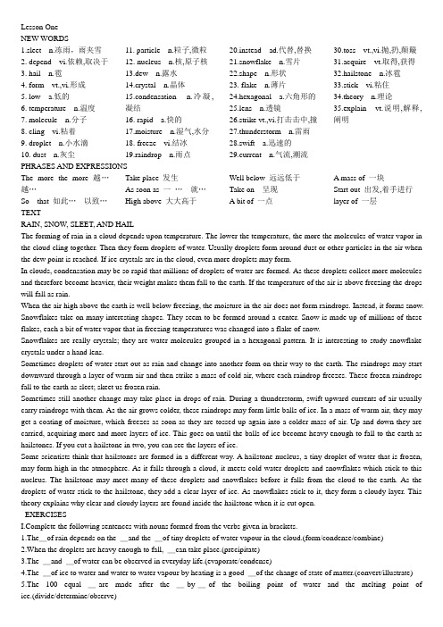
Lesson One NEW WORDS1.sleet n.冻雨,雨夹雪2. depend vi.依赖,取决于3. hail n.雹4. form vt.,vi.形成5. low a.低的6. temperature n.温度7. molecule n.分子8. cling vi.粘着9. droplet n.小水滴10. dust n.灰尘11. particle n.粒子,微粒12. nucleus n.核,原子核13.dew n.露水14.crystal n.晶体15.condensation n.冷凝,凝结16. rapid a.快的17.moisture n.湿气,水分18. freeze vi.结冰19.raindrop n.雨点20.instead ad.代替,替换21.snowflake n.雪片22.shape n.形状23. flake n.薄片24.hexagonal a.六角形的25.lens n.透镜26.strike vt.,vi.打击击中,撞27.thunderstorm n.雷雨28.swift a.迅速的29.current n.气流,潮流30.toss vt.,vi.抛,扔,颠簸31.acquire vt.取得,获得32.hailstone n.冰雹33.stick vi.粘住34.theory n.理论35.explain vt.说明,解释,阐明PHRASES AND EXPRESSIONSThe more the more越…越…So that 如此…以致…Take place 发生As soon as 一…就…High above 大大高于Well below 远远低于Take on 呈现A bit of 一点A mass of 一块Start out 出发,着手进行layer of 一层TEXTRAIN, SNOW, SLEET, AND HAILThe forming of rain in a cloud depends upon temperature. The lower the temperature, the more the molecules of water vapor in the cloud cling together. Then they form droplets of water. Usually droplets form around dust or other particles in the air when the dew point is reached. If ice crystals are in the cloud, even more droplets may form.In clouds, condensation may be so rapid that millions of droplets of water are formed. As these droplets collect more molecules and therefore become heavier, their weight makes them fall to the earth. If the temperature of the air is above freezing the drops will fall as rain.When the air high above the earth is well below freezing, the moisture in the air does not form raindrops. Instead, it forms snow. Snowflakes take on many interesting shapes. They seem to be formed around a center. Snow is made up of millions of these flakes, each a bit of water vapor that in freezing temperatures was changed into a flake of snow.Snowflakes are really crystals; they are water molecules grouped in a hexagonal pattern. It is interesting to study snowflake crystals under a hand lens.Sometimes droplets of water start out as rain and change into another form on their way to the earth. The raindrops may start downward through a layer of warm air and then strike a mass of cold air, where each raindrop freezes. These frozen raindrops fall to the earth as sleet; skeet us frozen rain.Sometimes still another change may take place in drops of rain. During a thunderstorm, swift upward currents of air usually carry raindrops with them. As the air grows colder, these raindrops may form little balls of ice. In a mass of warm air, they may get a coating of moisture, which freezes as soon as they are tossed up again into a colder mass of air. Up and down they are carried, acquiring more and more layers of ice. This goes on until the balls of ice become heavy enough to fall to the earth as hailstones. If you cut a hailstone in two, you can see the layers of ice.Some scientists think that hailstones are formed in a different way. A hailstone nucleus, a tiny droplet of water that is frozen, may form high in the atmosphere. As it falls through a cloud, it meets cold water droplets and snowflakes which stick to this nucleus. The hailstone may meet many of these droplets and snowflakes before it falls from the cloud to the earth. As the droplets of water stick to the hailstone, they add a clear layer of ice. As snowflakes stick to it, they form a cloudy layer. This theory explains why clear and cloudy layers are found inside the hailstone when it is cut open.EXERCISESplete the following sentences with nouns formed from the verbs given in brackets.1.The_of rain depends on the _and the _of tiny droplets of water vapour in the cloud.(form/condense/combine)2.When the droplets are heavy enough to fall, _can take place.(precipitate)3.The _and _of water can be observed in everyday life.(evaporate/condense)4.The _of ice to water and water to water vapour by heating is a good _of the change of state of matter.(convert/illustrate)5.The 100 equal _are made after the _by_of the boiling point of water and the melting point of ice.(divide/determine/observe)6.The best _of what takes place is the _of good examples.(explain/provide)7. A lake which is used for water_is sometimes high enough for the _of _by gravity to transport the water along the pipes to the houses below.(store/exert/press)8.In science, the Centigrade thermometer is used for the _of temperature.(measure)II. Answer the following questions based on information found in the text.1.How is rain formed?2.When does the moisture in the air from snow?3.What is snow made up of?4.What is the difference between rain and sleet?5.Why are clear and cloudy layers found inside a hailstone when it is cut open?III. Give the English equivalents of the following expressions.1.取决于温度2.使雨点落到地面3.呈不同形状4.冷到足以形成小冰珠5.切成两半IV.Explain the different uses of the word “form” in the following sentences:1.The forming of rain is discussed in the text.2.The molecules of water vapor form droplets.3.If ice crystals are in the cloud, even more droplets may form.4.Sometimes droplets of water start out as rain and change into another form on their way to the earth.5.Some scientists think that hailstones are formed in a different way.6.The molecules if water vapor come together, forming droplets of water.V. Replace each dash _with the proper form of the verb “freeze”.1.When the air is well below_,the moisture in the air forms snow.2.In _temperatures water vapor will be changed into snowflakes.3.In a mass of cold air each raindrop_.4.Sleet is _rain.5.A hailstone nucleus is a tiny droplet of water which is _.VI. Translate the following sentences into English.1.水滴开始在空气中形成时的温度叫露点.2.空气越热,它能容纳的水分越多.3.雾是靠近地面的云.4.地球表面夜晚通常要比白天冷.5.当含有水分的空气接触到寒冷的地面时,水汽开始从空气中跑出来并以水滴的形式聚集在它所接触到的任何东西上面.6.没有雨,就不能有植物,没有植物,也就没有动物.XII. Translate the following passage into Chinese.In some regions, particularly the dry ones ,there is water vapor in the air, but the conditions may seldom be right for this vapor to condense and fall as rain or snow. Rain, snow, hail, dew, and are known as precipitation. Even where rainfall is usually moderate, there is at times a lack of rain. A drought may lead to serious water shortages, as it did in New York City in 1949 and 1950 and again in 1963 to 1966.In the summer of 1949, New York City’s res ervoirs were down to one third of what they normally held. Several billion gallons of water were being used each day. So serious was the water shortage that people were asked to have one bathless, shaveless, and washless day a week. Cars went unwashed, lawns and parks unsprinkled. Even a glass of water was not served in restaurants unless asked for.Lesson TwoNEW WORDS1.mineral n.矿物2.property n.性质,特性3.naked a.裸露的4.detail n.详情5.reveal vt.暴露6.magnify vt.放大7.magnification n.放大率8.hang vt.,vi.悬挂,吊9.particularly ad.特别,格外10.distinguish vt.区别,辨认,把…区别分类11.define vt.规定,下定义12.unique a.唯一的,独特的13.grain n.颗粒14.quartz n.石英15.quality n.质量plex a.复杂的,复合的17.mixture n.混合物18.vary vi.变化,不同19.precise a.精确的20.garnet n.柘榴石position n.构成组成22.variety n.多种,异种种类23.range n.范围,领域24.proportion n.比例25.hence ad.因此26.immense a.无限的, 广大的27.bewilder vt.使为难,使手足无措28.array n.排列29.classify vt.分类30.sort vt. (out)分类,划分31.major a.较重要的,主要的32.division n.分类,划分33.divide vt. (into)划分,把…分成为…34.igneous a.火成的35.sedimentary a.沉淀的,沉积的36.metamorphic a.变形的,变质的37.kingdom n.领域王国,界38.distinctive a.特殊的,有特色的39.earmark n.记号40.remarkable a.值得注意的,显著的41.accurate a.精确的42.dozen n.一打,若干,许许多多43.simplification n.简单化,单一化44.rare a.稀少的,少见的45.unusual a.不平常的,少见的46.subspecies n.亚种47.recognize vt.承认,认出48.sophisticate n.世故的人49.glean vt.苦心搜集,选集50.explanation n.解释51.professional a.职业的,本职的52.petrologist n.岩石学家53.mineralogy n.矿物学PHRASES AND EXPRESSIONSFor example例如Because of 由于,因为Regardless of不管,不顾(to) be faced with …面对着…,面临(to)make order 整理despite of 不管,任凭even if 即使either…or…或…或…on the one hand…on the other hand…一方面…另一方面…TEXTROCKS ARE MADE UP OF MINERALSMost of a rock’s properties are easily seen with the naked eye, though the details are better revealed with a low-power magnifying glass (magnification of 5 × to 10×) —the hand lens that field geologists usually have hanging around their necks. From the characteristics show, particularly the physical and chemical properties we can distinguish several thousand minerals, each defined by its unique set of properties. Thus all grains or crystals of quartz have just about the same qualities, regardless of the kind of rock in which they are found. Some minerals, particularly those that have a more complex mixture of atoms, vary slightly in their properties, depending on their precise composition. A mineral like garnet, for example, has a number of varieties, each with its own range of composition, such as the proportions of iron and other elements, and hence, properties. Rocks are not as uniquely defined by their properties as minerals are. Because of the immense number of ways in which the thousands of minerals can be combined, the geologist is faced with a bewildering array of rock types. The only way for us to make order out of this array is to classify like with like and to sort out by general type. The major division of rocks into igneous, sedimentary, and metamorphic is just such an aid. Within each major division there are many groups and types. Using characteristic properties, we can divide the rock kingdom into several hundred general types, each with its own more or less distinctive earmarks.Despite all of these numbers, it is remarkable how much can be done even if only a small number of the most common minerals and rocks are known. In most parts of the world a field geologist can make an accurate geologic map by knowing only a few dozen major minerals and even fewer common rock types. This simplification is possible because most of the thousands of known minerals are either rare or unusual on the one hand or subspecies or varieties on the other. Thus the geologist who can recognize garnet will do well, even though a mineral sophisticate who can distinguish the many varieties of garnet by their slightly different chemical compositions might do better. Naturally, the more we can distinguish, the more the information gleaned, and the greater the power of our theories of explanation. Than is why professional petrologists have to know a great deal about mineralogy.EXERCISESI.Match the words in Column A with their definitions in Column B, placing the appropriate letters in the blanks:Column A Column B_1. Reveal a. Change_2. Quality b. Put into groups_3. Regardless of c. Distinguish_4. Vary d. Unusual_5.depending on e. gather_6. Classify f. Property_7. Precise g. Show_8. Rare h. According to_9. Recognize i. Negligent_10. Glean j. AccurateII.Answer the following questions in English.1.How can we distinguish different kinds of minerals?2.Why is the geologist faced with a bewildering array of rock types?3.What are the three major divisions of rocks?4.How many types can the rock kingdom be divided into?5.How can a field geologist make an accurate geologic map by knowing only a few dozen major minerals and even fewer common rock types?6.Why do professional petrologists have to know a great deal about mineralogy?III.Give the English equivalents of the following expressions.1.用肉眼可以看到2.面临一些问题3.具有相同的特性4.把相似的东西归为一类5.几十种主要矿物6.差别微小的化学组成IV. Give nouns corresponding to the following adjectives or verbs.1.magnify2.define3.depend4.precisepose6.dividebine8.simple9.explain10.accurateV. Fill the blanks with appropriate prepositions.If the nature _rocks can give us a clue _many _the tings we want to know _the earth, how do we go about it? We need an interpretive key. First _all we want to find out just what the minerals are made up _and how the rock is put together from its constituent minerals. _its composition we should be able to say something _where the parent material came _and what it was like. _the composition and the texture _the rock we should also be able to tell something of the pressures and temperatures _which the rock was formed _comparing them _the artificial rocks and mineral made _experimental petrologists _the laboratory.VI. Translate the following sentences into English.1.有些岩石很硬,有些轻轻一敲便成碎片.2.不能用化学或物理方法容易地分离开来的矿物称为造岩矿物.3.岩石的矿物组成千差万别,这种差别是岩石分类的基础.4.石英结晶时,如果有足够的空间,会形成美丽的六角形晶体.5.大部分沉积岩是在海水下面形成的.6.矿物有几千种,每种有它自己的组成.VII.Translate the following passage into Chinese.Rocks and the minerals that make them up are the tangible record of geologic processes. The varied minerals of the earth are understood in terms of their architecture — the way in which their atoms are arranged to make crystal structures. The kinds of atoms and their type of chemical bonding determine not only the crystal structures but the chemical and physical properties of minerals, all of which are used for their identification. Rocks are divided into the three major groups, igneous, metamorphic, and sedimentary on the basis of origin. They are further subdivided within each group according to mineral composition and texture, which provide the data that allow us to interpret details of their origin.Lesson ThreeNEW WORDS1.volcanism n.火山活动2.crust n.地壳3.fracture vi.破碎,断裂4.molten a.熔化的5.extend vi.延伸,延展6.interior n.,a.内部的7.volcano n.火山8.behavior n.行为,举止,情况9.volcanology n.火山学10. crystallization n.结晶(作用)11. fluid n.流体,液体12.escape vi.,vt.逃走,漏出,逸出,避免13. crack n.裂隙14.volcanologist n.火山学家15. refer vt.,vi将…归入,认为…属于,提到16.extrusive a.,n.喷出的17. toothpaste n.牙膏18. extrude vt.挤出,使喷出19. eruption n.喷发,爆发20. occur vi.发生,出现21. magma n.岩浆22. dissolve vt.,vi.溶解23. fissure n.裂缝24. atmospheric a.大气25. explosively ad.爆炸(爆发)性的26. chill vt.使冷却27. atmosphere n.大气28. froth vt.,vi.,n.(使)起泡沫,泡沫29. burst vt.,vi.破裂,爆发,喷出30. bubble n.泡,泡沫31. vent n.喷口32. cone n.圆锥形(物)33.glow vi.燃烧,放光34. column n.圆柱PHRASES AND EXPRESSIONS(to) be charged with …充满着less and less 越来越少at all 完全,根本(常用在否定句中)in much the same way以大体相同的方式TEXTVOLCANISMWhen the earth’s crust fractures, molten matter may flow from the break if it extends deep enough into the interior of the earth.A volcano may form. Earth scientists have studied the behavior and composition of molten rock materials and the forms that are produced . This branch of earth science is called volcanology.Some igneous rocks are formed by crystallization of fluid matter that has escaped through deep cracks in the earth’s crust. V olcanologists refer to these rocks as extrusive rocks, or extrusives. If a tube of toothpaste has a crack in it and you press on the tube, some of the paste is pushed out. That is, the paste has been extruded. V olcanic eruptions occur in much the same way. The magma within the earth may be heavily charged with gases and steam. These are under such great pressure that they are dissolved in the magma. If a fissure develops in a region where the magma is heavily charged with steam and other dissolved gases, the fluid magma rises through the fissure. As it rises, the pressure on it becomes less and less. The gases and steam expand, producing a force that helps to move the molten materials to the surface of the earth.When they reach the surface of the earth, the only pressure against them is atmospheric pressure— 14.7 pounds per square inch. The steam and gases now expand suddenly and explosively , producing additional great force. The molten materials, laden with rapidly expanding gas and steam, may be thrown high into the air in a wild and noisy eruption.In this kind of an eruption, the molten materials are quickly chilled by the much cooler atmosphere. They fall back to the earth as solid fragments of extrusive igneous rocks. During an explosive eruption the molten fluids may be so heavily charged with gas and steam that they froth. Bursting of the bubbles in the molten froth produces billions of tiny fragments of mineral matter, which were once part of the bubble walls. These tiny fragments may be carried upward into the atmosphere by the explosive force of the eruption. These they form great clouds of volcanic dust. Slightly larger fragments of the froth may fall back around the vent, or opening, in the crust to make a cone-shaped pile of volcanic ash.The light produced during volcanic activity is the result of the glowing of gases and molten fluids. The “smoke” of a volc ano is not smoke at all, but the column of volcanic dust, steam, and other gases that are given off from the molten fluid. EXERCISESI. Explain the meaning of these words in English.1.volcanologist2. Fracture3. crust4. Interior5.eruption6. magma7.froth8. Atmosphere9.vent10.ashII. Give the word with opposite meaning to .1.deep2.same3.dissolve4.heavily5. rise6.expand7.chill8.rapidly9.noisy 10.upward III. Give the English equivalent of the following expressions .1.从裂口流出来2.深及地球内部3.通过裂缝逸出4.以同样的方式进行5.充满了溶解的气体6.每平方英寸7抛入高空8.落回地面9.在爆发期间10.稍大一些的碎片IV. Answer the following questions in English .1.How does a volcano form ?2.What does volcanology deal with ?3.What happens when you press on a tube of toothpaste with a crack in it ?4.What happens when a fissure develops in a region where the magma within the earth is heavily charged with gases and steam ?5.What makes molten fluids froth ?6.Why do we say that the “ smoke “ of a volcano is not smoke at all ?V. Fill the blanks with appropriate prepositionsMen have come to know a great deal _the surface _the earth _direct or fairly direct observation .They have explored it ,surveyed it and mapped it _the air ;they have analysed its rocks . One could not apply such methods _the study _the earth’s interior . The deepest mines penetrate less than two miles ; the deepest boreholoes do not go down such farther. These are the merest pinpricks _a planet the size _the earth , _an average radius _3,960 miles .Indirect means must be used , therefore , to infer the internal structure_the earth . The geophysicist , or earth scientist , gathers his evidence _various source . He analyzes data bearing_earthquakes and the rotation _the earth . He measures the tides ; he considers variations _the earth. He measures the tides; he considers variations _gravity at various parts _the earth’s surface. He also tries to reproduce _his laboratory the conditions that he believes to exist _the interior _our planet.plete the following sentences with nouns formed from the verbs given in brackets.1.Everytning around you seems to be in _.(move)2.A _in the density of air masses is partly a result of their _.(differ/compose)3.The heat energy in the magma flows by _to the cooler crust .(conduct)4.The hot _rises and spreads out across the surface.(mix)5.Folds in the earth are produced by forces of _, or the pushing together of the crust.(compress)6.Molten matter is extruded because it is under _.(press)VII. Translate the following sentences into English.1.岩浆是矿物质,气体和水在高压和高温下的混合物。
地理专业英语教案

许昌学院城市与环境学院教案课程名称:地理专业英语课程类型:□理论课■理论、实践课□实践课学时:32 学分: 2授课教师:李中轩授课班级:08级地理科学授课学期:2010 至2011 学年第2学期教材名称:地理专业英语参考资料:1.地质学基础2.自然地理学3.地理学专业英语2011年 2 月 20 日《地理专业英语》教材分析本课程以培养学生地理科学专业英语文献阅读和翻译能力为主要目的,以岩石圈、大气圈、水圈、生物圈、土壤圈、人类社会圈系统和地理信息系统理论为主要内容,分为三大部共16个单元,其中技术地理部分涉及较多的3S技术方面内容,因而将其作为自学内容。
第一部分为自然地理学的基本原理,第二部分为人文地理学的基本理论,第三部分为地理信息系统的基础知识和应用。
每单元分为四个部分内容:基础知识文献、专业单词表、课后习题和补充阅读材料。
基础知识文献部分属于必学内容,涉及的地理学知识大多已经在专业课中学过,对于大三同学而言并不陌生。
关键是文献中使用大量专业词汇,这对学生而言需要花费更多的力气去过单词关,对于一个将来需要进一步深造的本科生来说是必须的和必要的知识储备。
文献部分需要认真阅读,并能复述出文献的主要观点,同时在课堂讨论中有自己的认识和独到观点,并且能够进行口语表达。
课后作业内容可以提前在预习时完成,将疑难问题放到课堂上经过讨论后解决。
每个课时都安排约30分钟作为学生的讨论和回答问题时间,也可以按照单元进度开展对应的口语交流,以提高对专业英语文献的理解和应用技能。
《专业英语》是地理科学专业的一门必修课。
本课程的目的是使学生在进行了两年的公共英语学习后,在巩固已有知识的基础上,掌握科技英语的特点,具备教好的英语资料查阅及专业英语交流的能力。
也就是说,开设本课程,主要是让学生具备“以英语为工具通过阅读获取专业所需信息的能力”。
通过本课程的学习,学生应在科技词汇、专业英语文献阅读速度、准确理解和翻译专业文献、摘要写作上有较大的提高。
暑期考研集训营教案英语表名词副词形容词词缀
暑期考研集训营教案英语表名词、副词、形容词、词缀一、教学目标1. 掌握英语名词、副词、形容词的基本概念和用法。
2. 学会使用常见的词缀来构造新词。
3. 提高学员的词汇量和语言表达能力。
二、教学内容1. 名词:名词的定义、名词的分类、名词的数和格、名词的用法。
2. 副词:副词的定义、副词的分类、副词的用法。
3. 形容词:形容词的定义、形容词的分类、形容词的级、形容词的用法。
4. 词缀:前缀、后缀、中缀的概念和用法。
三、教学方法1. 采用讲授法,讲解名词、副词、形容词的基本概念和用法。
2. 通过举例和练习,让学生熟练掌握各类词的用法。
3. 采用小组讨论法,让学生在学习词缀时进行互动交流,提高学习效果。
4. 利用多媒体教学,展示词汇的图片和例句,增强学生的记忆。
四、教学步骤1. 讲解名词的概念和分类,让学生了解名词的基本用法。
2. 通过举例,讲解名词的数和格,让学生掌握名词的变换规则。
3. 讲解副词的概念和分类,让学生了解副词的用法。
4. 通过练习,让学生熟练运用副词修饰动词、形容词等。
5. 讲解形容词的概念和分类,让学生了解形容词的级和用法。
6. 通过练习,让学生熟练运用形容词描述名词和代词。
7. 讲解词缀的概念和用法,让学生了解如何构造新词。
8. 通过练习,让学生学会使用词缀来扩展词汇。
五、教学评价1. 课堂参与度:观察学生在课堂上的发言和讨论情况,评估学生的参与度。
2. 练习完成情况:检查学生完成练习的情况,评估学生对知识点的掌握程度。
3. 课后作业:布置相关作业,要求学生巩固所学内容,评估学生的学习效果。
4. 期末考试:设置有关名词、副词、形容词、词缀的试题,评估学生的综合运用能力。
六、教学内容1. 名词属格的使用规则,包括人名、地名、所有格的表达方式。
2. 名词的复合结构和派生名词的形成规则。
3. 副词的比较级和最高级的构成及用法。
4. 形容词的比较级和最高级的构成及用法,包括形容词的级的变化规则。
地理教案英语专业大学版
Course: English Language and LiteratureLevel: UndergraduateDuration: 2 hoursObjective:To introduce students to the geographical characteristics, challenges, and cultural aspects of the Arctic region, fostering their critical thinking and research skills.Materials:- Projector and screen- Maps of the Arctic region- Powerpoint presentation- Handouts on Arctic geography and culture- Writing materials- Internet access for research purposesActivity 1: Introduction to the Arctic (10 minutes)1. Begin with a brief presentation on the Arctic region, highlighting its geographical location, size, and the five countries that claim territory in the region (Canada, Russia, Norway, the United States, and Denmark).2. Use maps to illustrate the Arctic's unique geographical features, such as the Arctic Circle, the North Pole, and the surrounding seas.3. Discuss the importance of the Arctic in global climate and environmental issues.Activity 2: Group Research and Discussion (30 minutes)1. Divide the class into groups of three or four students.2. Assign each group a specific topic to research:- The climate and weather patterns of the Arctic- The natural resources found in the Arctic- The impact of global warming on the Arctic region- The indigenous peoples of the Arctic and their cultures3. Provide each group with handouts and access to the internet to conduct their research.4. Allow each group 15 minutes to present their findings to the class, emphasizing the geographical aspects of their topic.Activity 3: Arctic Case Study: The Inuit People (20 minutes)1. Introduce the Inuit people, the indigenous inhabitants of the Arctic region, focusing on their culture, way of life, and geographical adaptations.2. Discuss how the Inuit people have adapted to the extreme conditions of the Arctic, such as their traditional hunting practices, clothing, and housing.3. Encourage students to think about the challenges faced by the Inuit people in the context of climate change and environmental degradation.Activity 4: Arctic Conservation and International Policies (20 minutes)1. Discuss the importance of preserving the Arctic region's natural resources and biodiversity.2. Introduce the concept of international policies and agreements aimed at protecting the Arctic, such as the Arctic Council and the Paris Agreement.3. Have students engage in a debate on the effectiveness of these policies and the need for further action to safeguard the Arctic environment.Activity 5: Writing Assignment (10 minutes)1. Assign a short writing task to the students: Write a 500-word essay on the following topic: "How can the global community work together to protect the Arctic region and its inhabitants?"2. Provide guidelines on how to structure the essay, including an introduction, body paragraphs, and a conclusion.3. Encourage students to use the information they have learned during the lesson to support their arguments.Assessment:- Participation in group discussions and debates- Quality of research and presentation- Completion of the writing assignmentHomework:- Students are required to submit their 500-word essay by the next class session.Conclusion:The lesson aims to provide an in-depth understanding of the Arctic region's geographical, cultural, and environmental significance. By engaging in research, discussions, and writing activities, students will develop critical thinking skills and gain a broader perspective on global issues.。
地理一对一暑假辅导教案
地理一对一暑假辅导教案Title: One-on-One Summer Geography Tutoring Lesson Plan。
Introduction:Welcome to our one-on-one summer geography tutoring session! In this lesson plan, we will cover a variety of topics in geography to help you strengthen your understanding of the subject. Whether you are preparing for an upcoming exam or simply want to enhance your knowledge, this tutoring session will be tailored to meet yourspecific needs and goals. Let's dive into the lesson plan and get started!Lesson 1: Introduction to Geography。
Objective: To understand the basic concepts and principles of geography.Overview of geography as a discipline。
The five themes of geography: location, place, human-environment interaction, movement, and region。
Introduction to map reading and interpretation。
Activities:1. Discussion on the importance of geography in understanding the world around us。
暑期培训英语活动单导学教案
暑期培训英语活动单导学教案Title: Summer English Training Activity PlanObjective:- Enhance students' English language skills in speaking, listening, reading, and writing- Develop students' confidence in using English- Nurture cultural understanding and appreciation- Encourage teamwork and collaborationDuration: 2 weeks (5 days a week)Materials Needed:- Whiteboard and markers- Projector and screen- Worksheets and handouts- English books and novels- Audio and video resourcesWeek 1:Day 1: Introduction to English Language and Culture- Warm-up activity: Icebreaker games to help students get to know each other- Cultural discussion: Exploring different English-speaking countries and their traditions- Assignment: Students prepare a short presentation about their own culture to be presented on Day 3Day 2: Listening and Speaking Skills- Speaking practice: Engaging in role play activities to improve conversational skills- Assignment: Students write a dialogue using the newly learned vocabulary for a role play on Day 4Day 3: Cultural Presentations and Reading Skills- Cultural presentations: Students share their presentations about their own culture- Reading activity: Reading short stories or articles related to different cultures- Assignment: Students write a short summary of the reading materials for Day 5Day 4: Writing Skills and Grammar Practice- Grammar review: Review various grammar structures and rules through interactive exercisesDay 5: Speaking and Group Activity- Speaking activity: Engaging in group discussions on specific topics- Recap of the week: Reviewing the topics covered throughout the first week- Assignment: Students prepare oral presentations on a given topic for Day 8Week 2:Day 6: Listening and Vocabulary Expansion- Vocabulary expansion: Introducing advanced vocabulary words related to specific fields or interests- Word games: Engaging in vocabulary games to practice the newly learned words- Assignment: Students create a word bank with the new vocabulary for Day 8Day 7: Writing and Grammar Practice- Writing skills: Students write an argumentative or persuasive essay on a given topic- Grammar exercises: Practice grammar structures through exercises and writing drills- Assignment: Students revise their essays based onteacher's feedback for Day 9Day 8: Public Speaking and Debating- Oral presentations: Students deliver their prepared oral presentations on a given topic- Judging and feedback: Teacher and peers provide constructive feedback on presentation and debate skills - Assignment: Students prepare a group presentation for Day 10- Discussion: Analyzing the themes and messages conveyed in the reading material- Assignment: Students write a reflection on the reading material for Day 10Day 10: Final Presentation and Recap- Group presentation: Students deliver their group presentation on a chosen topic- Recap of the program: Reviewing the topics covered throughout the two weeks- Feedback session: Students provide feedback on the program's strengths and areas for improvementBy following this two-week summer English training activity plan, students will have the opportunity to improve their English language skills, gain cultural understanding, and develop their confidence in using English in various contexts.。
地理教案万能模板英语初中

Subject: GeographyGrade Level: Junior High School (e.g., 7th, 8th, 9th grade)Duration: 1 hour (adjustable)Objective:- Students will be able to identify and describe key geographical features of a given region.- Students will understand the impact of human activities on the environment.- Students will develop critical thinking skills through analysis of case studies.Materials:- Interactive whiteboard or projector- Maps of the selected region- Handouts or worksheets- Internet access (optional)- Geographical models or visuals (optional)Preparation:- Familiarize yourself with the geographical features and human activities of the selected region.- Prepare handouts or worksheets with relevant questions and activities.- Ensure that the interactive whiteboard or projector is working correctly.- Optional: Prepare geographical models or visuals to enhance student understanding.Lesson Procedure:1. Introduction (5 minutes)- Greet students and briefly introduce the topic of the lesson.- Explain the objective of the lesson and its relevance to their studies.- Ask students if they have any prior knowledge about the selected region.2. Guided Discussion (10 minutes)- Present a map of the selected region on the interactive whiteboard or projector.- Discuss the geographical features of the region, such as mountains, rivers, lakes, and climate.- Encourage students to share their observations and ask questions.- Provide additional information about the region, emphasizing key features and their significance.3. Interactive Activity (15 minutes)- Divide the class into small groups.- Provide each group with a worksheet or handout that includes a series of questions related to the region's geographical features and human activities.- Instruct students to work together to answer the questions and complete the worksheet.- Encourage students to use their critical thinking skills to analyze the information and draw conclusions.- Optional: Use geographical models or visuals to aid students in their understanding.4. Case Study Analysis (10 minutes)- Present a case study that explores the impact of human activities on the environment in the selected region.- Discuss the case study with the class, focusing on the following:- The problem or issue at hand- The causes and effects of the problem- Possible solutions or mitigation strategies- Encourage students to think about how they can apply what they have learned to real-world situations.5. Group Presentation (10 minutes)- Instruct each group to prepare a short presentation summarizing their findings from the worksheet or handout.- Allow each group to present their findings to the class.- Facilitate a discussion among students, encouraging them to ask questions and provide feedback.6. Conclusion (5 minutes)- Summarize the key points covered in the lesson.- Reinforce the importance of understanding geographical features and human activities.- Assign a homework assignment that reinforces the lesson's content (e.g., a research project on a specific geographical feature).Assessment:- Observe students' participation in class discussions and group activities.- Evaluate the quality of the group presentations.- Check the completed worksheets or handouts for understanding and critical thinking skills.- Assess the homework assignment for accuracy and depth of research.Extensions:- Organize a field trip to a local geographical feature or landmark.- Have students create a project or presentation on a specific aspect of the region's geography.- Invite a guest speaker from a relevant field to discuss current environmental issues.Note: This template can be adapted to various geographical topics and regions, ensuring that the lesson plan remains flexible and engaging for students.。
初中地理教案模板英语版
Subject: GeographyGrade Level: Grade 8Course Title: Introduction to World GeographyDuration: 1 hourObjective:- To introduce students to the basic concepts of world geography, including the study of different countries, cultures, and natural resources.- To enhance students' ability to locate and understand key geographical features on a map.- To foster critical thinking skills through discussion and analysis of global issues.Materials:- World map- Country profiles (handouts)- Markers and colored pencils- Projector and computer for PowerPoint presentation- Interactive whiteboard- Class set of "Where in the World?" game cardsPreparation:1. Prepare a PowerPoint presentation covering key geographical concepts and countries.2. Create handouts with country profiles for each student.3. Prepare a "Where in the World?" game with cards labeled with geographical locations.4. Arrange the classroom with desks in a circle for group discussions.Lesson Outline:I. Introduction (5 minutes)- Begin with a brief review of the previous lesson's main points.- Introduce the topic of the lesson: "An Introduction to World Geography."- Explain the importance of understanding different cultures and geographical features around the world.II. Presentation (20 minutes)- Use the projector to display a PowerPoint presentation covering:- The basics of world geography- Key geographical features (rivers, mountains, deserts)- Major countries and their cultural highlights- Natural resources and their distributionIII. Group Activity: Country Profiles (15 minutes)- Divide the class into small groups.- Each group receives a handout with a country profile.- Students research the country's location, culture, and key geographical features.- Groups present their findings to the class using the interactive whiteboard.IV. Interactive Game: "Where in the World?" (15 minutes)- Distribute "Where in the World?" game cards to each student.- Students take turns identifying geographical locations on the map.- Correct answers earn points for the student's team.V. Discussion and Analysis (15 minutes)- Lead a class discussion on global issues, such as climate change, population growth, and economic development.- Encourage students to think critically about the impact of these issues on different countries and cultures.- Ask students to share their opinions and suggestions for potential solutions.VI. Conclusion and Assessment (5 minutes)- Summarize the key points of the lesson.- Assign a homework assignment, such as:- Drawing a map of a chosen country, highlighting its geographical features and cultural landmarks.- Writing a short essay on a global issue and its potential solutions.Assessment:- Participation in group activities and discussions- Completion of the "Where in the World?" game- Quality of the homework assignmentExtension Activities:- Organize a "World Culture Day" where students can share traditional foods, music, and clothing from their home countries.- Create a classroom map with pins representing each student's home country.Note: This template can be adapted to fit different grade levels and specific geographical topics.。
暑期考研集训营教案英语表名词副词形容词词缀
暑期考研集训营教案英语-名词、副词、形容词、词缀教案章节一:英语名词的用法和词缀识别1.1 教学目标:让学生掌握英语名词的基本用法。
让学生能够识别常见的英语词缀。
1.2 教学内容:英语名词的单数和复数形式。
英语名词的所有格形式。
常见英语词缀的识别和理解。
1.3 教学方法:通过讲解和示例,让学生理解英语名词的用法。
通过练习和游戏,让学生巩固对英语名词的理解。
通过识别和练习,让学生掌握常见英语词缀的识别。
教案章节二:英语副词的用法和词缀识别2.1 教学目标:让学生掌握英语副词的基本用法。
让学生能够识别常见的英语词缀。
2.2 教学内容:英语副词的位置和功能。
英语副词的比较级和最高级形式。
常见英语词缀的识别和理解。
2.3 教学方法:通过讲解和示例,让学生理解英语副词的用法。
通过练习和游戏,让学生巩固对英语副词的理解。
通过识别和练习,让学生掌握常见英语词缀的识别。
教案章节三:英语形容词的用法和词缀识别3.1 教学目标:让学生掌握英语形容词的基本用法。
让学生能够识别常见的英语词缀。
3.2 教学内容:英语形容词的位置和功能。
英语形容词的比较级和最高级形式。
常见英语词缀的识别和理解。
3.3 教学方法:通过讲解和示例,让学生理解英语形容词的用法。
通过练习和游戏,让学生巩固对英语形容词的理解。
通过识别和练习,让学生掌握常见英语词缀的识别。
教案章节四:英语词缀的识别和应用4.1 教学目标:让学生能够识别常见的英语词缀。
让学生能够应用词缀来理解和构建新的词汇。
4.2 教学内容:常见英语前缀的识别和理解。
常见英语后缀的识别和理解。
词缀的应用和练习。
4.3 教学方法:通过讲解和示例,让学生理解常见英语词缀的识别。
通过练习和游戏,让学生巩固对词缀的理解。
通过应用和练习,让学生能够使用词缀来理解和构建新的词汇。
教案章节五:综合练习和复习5.1 教学目标:让学生巩固对英语名词、副词、形容词和词缀的理解。
提高学生的应用能力和解决问题的能力。
地理教案英语笔记大学版
Subject: Physical GeographyGrade: University LevelCourse Duration: 2 HoursLearning Objectives:1. Students will be able to identify and describe the key geographical features of the Himalayas.2. Students will understand the geological processes that have shaped the Himalayas.3. Students will analyze the impact of the Himalayas on regional climate and biodiversity.4. Students will be able to discuss the cultural significance of the Himalayas in different societies.Teaching Methods:- Lecture- Interactive discussions- Group work- Visual aids (slides, maps, videos)Materials:- Powerpoint presentation- Maps of the Himalayas- Geological diagrams- Videos about the Himalayas- HandoutsLesson Outline:I. Introduction (10 minutes)- Briefly introduce the topic: The Physical Geography of the Himalayas.- Explain the importance of the Himalayas in global geography and their significance in various aspects of human life.II. Geographical Features (15 minutes)- Discuss the geographical features of the Himalayas, including their location, size, and the main mountain ranges.- Use maps and slides to illustrate the topography of the region.- Highlight key landmarks such as Mount Everest and the Brahmaputra River.III. Geological Processes (20 minutes)- Explain the geological processes that have formed the Himalayas, such as the collision of tectonic plates.- Present geological diagrams to show the formation of the Himalayas over millions of years.- Discuss the effects of these processes on the landscape and the resulting geographical features.IV. Climate and Biodiversity (20 minutes)- Analyze the impact of the Himalayas on regional climate, including temperature and precipitation patterns.- Discuss the unique ecosystems and biodiversity of the Himalayas, emphasizing the importance of conservation efforts.- Show videos that illustrate the diverse flora and fauna of the region. V. Cultural Significance (15 minutes)- Explore the cultural significance of the Himalayas in different societies, including Hinduism, Buddhism, and local communities.- Discuss the role of the Himalayas in mythology and religious practices.- Share examples of traditional customs and festivals that are tied to the mountains.VI. Group Work (15 minutes)- Divide students into groups and assign them to research a specific aspect of the Himalayas (e.g., a particular mountain range, a cultural practice, or a conservation issue).- Each group will prepare a short presentation to share with the class.VII. Conclusion (10 minutes)- Summarize the key points discussed during the lesson.- Encourage students to reflect on the importance of the Himalayas in global and local contexts.- Assign a follow-up task, such as writing a short essay on the environmental challenges faced by the Himalayas.Assessment:- Participation in class discussions and group work.- Completion of the follow-up essay.- A quiz on the geographical features and geological processes of the Himalayas.Additional Notes:- Encourage students to ask questions throughout the lesson to foster an interactive learning environment.- Provide additional resources, such as books and online articles, for students who wish to explore the topic further.- Use visual aids effectively to enhance understanding and engagement.By the end of this lesson, students will have gained a comprehensive understanding of the physical geography of the Himalayas, their geological formation, and their cultural and environmental significance.。
初中英语夏令营教案
初中英语夏令营教案一、教学目标:1. 提高学生的英语听说能力,加强语音语调的准确性。
2. 扩大学生的英语词汇量,提高词汇运用能力。
3. 培养学生的英语阅读兴趣,提高阅读理解能力。
4. 加强学生的英语写作技巧,提高写作水平。
5. 提升学生的团队协作能力和自主学习能力。
二、教学内容:1. 英语口语交流:通过各种游戏和活动,让学生在实际交流中提高英语口语能力。
2. 英语词汇学习:通过词汇游戏、记忆卡片等方式,帮助学生扩充词汇量,提高词汇运用能力。
3. 英语阅读理解:通过阅读英文文章、故事书等,提高学生的阅读理解能力,培养学生对英语阅读的兴趣。
4. 英语写作技巧:通过写作练习和指导,提高学生的写作水平,培养学生的写作思维。
5. 团队协作和自主学习:通过小组活动和讨论,培养学生的团队协作能力,鼓励学生自主学习,提高学习效率。
三、教学方法:1. 任务型教学法:通过各种任务和活动,让学生在实际操作中学习和应用英语。
2. 交际式教学法:通过模拟实际场景,让学生在交流中提高英语口语能力。
3. 游戏教学法:通过趣味游戏,激发学生的学习兴趣,提高学习效果。
4. 小组合作学习:通过小组活动和讨论,培养学生的团队协作能力,提高学习效果。
四、教学评价:1. 学生口语表达能力的提高:通过课堂参与、角色扮演等方式评价学生的口语表达能力。
2. 学生词汇量的扩大:通过词汇游戏、记忆卡片等方式评价学生的词汇掌握情况。
3. 学生阅读理解能力的提高:通过阅读测试、回答问题等方式评价学生的阅读理解能力。
4. 学生写作水平的提高:通过写作练习、作文修改等方式评价学生的写作水平。
5. 学生团队协作能力和自主学习能力的提高:通过小组活动、课堂参与等方式评价学生的团队协作能力和自主学习能力。
五、教学计划:1. 第一周:英语口语交流,通过各种游戏和活动,让学生在实际交流中提高英语口语能力。
2. 第二周:英语词汇学习,通过词汇游戏、记忆卡片等方式,帮助学生扩充词汇量,提高词汇运用能力。
地理夏令营 教案初中
地理夏令营教案初中课时安排:2天教学目标:1. 让学生在夏令营活动中,加深对我国地理知识的了解和认识。
2. 培养学生的地理实践能力和团队协作能力。
3. 提高学生对地理学科的兴趣和热情。
教学内容:1. 我国地理概况2. 地形地貌特征3. 气候类型及特点4. 地理现象探究5. 环保意识培养活动安排:第一天:上午:1. 开营仪式,介绍夏令营活动安排和注意事项。
2. 地理知识讲座:我国地理概况、地形地貌特征。
下午:1. 实地考察:选择当地具有代表性的地貌地形进行考察,如山脉、河流、湖泊等。
2. 考察成果分享:学生分组讨论,总结考察过程中的发现和感悟。
晚上:1. 地理知识竞猜:组织学生进行地理知识竞猜活动,增强学生对地理知识的记忆。
2. 观看地理纪录片:选择一部关于我国地理的纪录片,让学生在观看中深入了解我国地理特点。
第二天:上午:1. 气候类型及特点讲座:讲解我国主要气候类型及其特点。
2. 实地考察:选择当地具有代表性的气候区域进行考察,如热带雨林、沙漠等。
下午:1. 地理现象探究:学生分组讨论,分析地理现象产生的原因,如季风、地震等。
2. 环保知识讲座:讲解环保意识在地理学习中的重要性,引导学生关注环境保护。
晚上:1. 地理主题班会:让学生分享自己在夏令营活动中的收获和感悟。
2. 闭营仪式:总结夏令营活动,颁发优秀营员证书。
教学评价:1. 学生参与度:观察学生在夏令营活动中的参与情况,了解学生对地理知识的兴趣。
2. 学生成果展示:评估学生在实地考察、知识竞猜、主题班会等环节的表现。
3. 学生反馈:收集学生对夏令营活动的意见和建议,不断优化活动方案。
教学资源:1. 实地考察场地:选择具有代表性的地貌地形和气候区域。
2. 地理知识讲座PPT:制作详细的讲座PPT,便于学生理解和记忆。
3. 地理纪录片:选择适合学生观看的地理纪录片。
4. 环保宣传资料:制作环保宣传资料,提高学生的环保意识。
教学建议:1. 在活动安排中,注重实地考察和实践活动,让学生在实践中掌握地理知识。
《Journey Across a Vast Land》 教学设计
《Journey Across a Vast Land》教学设计一、教学目标1、知识与技能目标学生能够理解并掌握与旅行、地理相关的词汇和表达,如“landscape”(风景)、“destination”(目的地)、“journey”(旅程)等。
提高学生的阅读理解和写作能力,使其能够描述自己的旅行经历或想象中的旅行。
2、过程与方法目标通过阅读文本、观看视频和图片等多种方式,培养学生获取信息、分析问题和解决问题的能力。
组织小组讨论和合作学习,提高学生的团队协作和交流能力。
3、情感态度与价值观目标激发学生对探索广阔世界的兴趣和热情,培养其开放的视野和包容的心态。
让学生体会不同地域的文化和风情,增强文化意识和跨文化交流能力。
二、教学重难点1、教学重点理解文章中关于旅行经历和感受的描述,掌握重点词汇和句型的用法。
引导学生运用所学知识,有条理地描述自己的旅行经历或梦想之旅。
2、教学难点如何帮助学生理解文中较复杂的句子结构和文化背景知识。
培养学生在写作中准确表达情感和细节,使文章生动有趣。
三、教学方法1、任务驱动法布置一系列与旅行相关的任务,如阅读、写作、讨论等,让学生在完成任务的过程中掌握知识和技能。
2、情景教学法创设生动的旅行情景,通过图片、视频等多媒体资源,让学生身临其境地感受旅行的魅力。
3、合作学习法组织学生进行小组合作学习,共同探讨问题、完成任务,培养团队协作精神。
四、教学过程1、导入(5 分钟)播放一段世界各地美丽风景的视频,引起学生的兴趣。
提问学生是否喜欢旅行,以及最想去的地方是哪里。
2、词汇学习(10 分钟)展示与旅行相关的图片,引出本节课的重点词汇,如“journey”“destination”“landscape”等。
通过例句和简单的练习,帮助学生理解和掌握这些词汇的用法。
3、阅读文本(15 分钟)分发阅读材料,让学生快速阅读文章《Journey Across a Vast Land》。
设计几个简单的问题,检查学生对文章大意的理解,如:“Where did the journey take place?” “What was the main purpose of the journey?”4、深入理解(15 分钟)带领学生仔细分析文章中的重点句子和段落,讲解语法结构和文化背景知识。
初中英语夏令营教案
初中英语夏令营教案第一章:夏令营介绍教学目标:1. 让学生了解夏令营的基本情况,包括时间、地点、活动内容等。
2. 提高学生的英语听说能力,增强他们对英语学习的兴趣。
教学内容:1. 介绍夏令营的基本情况,如时间、地点、活动内容等。
2. 引导学生进行英语自我介绍,增强他们的自信心。
教学步骤:1. 引入话题:询问学生对夏令营的看法和经历。
2. 介绍夏令营:向学生介绍夏令营的基本情况,包括时间、地点、活动内容等。
3. 学生自我介绍:让学生用英语进行自我介绍,增强他们的自信心。
4. 小组讨论:让学生分组讨论夏令营的活动内容,促进他们的交流与合作。
第二章:英语游戏教学目标:1. 让学生通过参与英语游戏,提高他们的英语听说能力。
2. 培养学生的团队合作精神,增强他们的自信心。
教学内容:1. 英语游戏的设计和规则。
2. 学生参与英语游戏,提高他们的英语听说能力。
教学步骤:1. 引入话题:向学生介绍英语游戏的重要性和乐趣。
2. 游戏设计:向学生介绍英语游戏的设计和规则。
3. 学生参与:让学生参与英语游戏,提高他们的英语听说能力。
4. 总结反馈:对学生的表现进行总结和反馈,鼓励他们继续努力。
第三章:英语电影欣赏教学目标:1. 让学生通过观看英语电影,提高他们的英语听力能力。
2. 培养学生的电影欣赏能力,增强他们的文化素养。
教学内容:1. 英语电影的选择和欣赏技巧。
2. 学生观看英语电影,提高他们的英语听力能力。
教学步骤:1. 引入话题:向学生介绍英语电影的重要性和欣赏技巧。
2. 电影选择:向学生介绍英语电影的选择标准。
3. 学生观看:让学生观看英语电影,提高他们的英语听力能力。
4. 讨论反馈:对学生的讨论进行总结和反馈,鼓励他们继续努力。
第四章:英语歌曲学唱教学目标:1. 让学生通过学唱英语歌曲,提高他们的英语发音和语调。
2. 培养学生的音乐素养,增强他们的综合素质。
教学内容:1. 英语歌曲的选择和学唱技巧。
2. 学生学唱英语歌曲,提高他们的英语发音和语调。
地理拓展课计划
地理拓展课计划(中英文版)英文文档内容:Geography Enrichment Course PlanIntroduction:The geography enrichment course aims to provide students with a deeper understanding of geographical concepts, enhance their spatial thinking skills, and broaden their knowledge of the world"s physical and human geography.The course is designed to complement the regular geography curriculum and offer students a more comprehensive understanding of the subject.Objectives:1.Develop a strong foundation in geographical concepts and principles.2.Improve spatial thinking and mapping skills.3.Explore the relationships between humans and their environment.4.Enhance students" ability to analyze and interpret geographical data.5.Foster an appreciation for the diversity and interconnectedness of the world"s cultures and landscapes.Course Structure:1.Introduction to Geography: Students will learn about the scope andsignificance of geography, the key concepts and themes in the discipline, and the different branches of geography.2.Physical Geography: Students will study the Earth"s physical features, weather systems, climate patterns, and natural resources.This unit will emphasize the spatial distribution of these elements and their interactions.3.Human Geography: Students will explore the spatial aspects of human activities, including population distribution, migration patterns, urbanization, and economic development.They will also learn about the cultural and social dimensions of geography.4.Maps and Spatial Analysis: Students will develop their mapping skills and learn to interpret maps and spatial data.They will also be introduced to basic geographic information systems (GIS) techniques.5.Fieldwork and Research: Students will participate in field trips and practical exercises to apply their geographical knowledge in real-world settings.They will also conduct research projects, analyzing geographical issues and proposing solutions.6.Global Issues: Students will examine current geographical issues such as climate change, resource scarcity, environmental degradation, and inequality.They will explore the causes and consequences of these issues and discuss possible mitigation strategies.Teaching Methods:1.Lectures: The instructor will deliver lectures to provide students with a solid foundation in geographical concepts and theories.2.Discussions: Students will engage in class discussions to deepen their understanding of geographical issues and share their perspectives.3.Group Work: Students will collaborate in groups to complete assignments, projects, and practical exercises.4.Fieldwork: Students will participate in field trips to observe and study geographical features and phenomena in their natural environment.5.Guest Lectures: Experts in the field of geography will be invited to deliver guest lectures and share their insights and experiences.Assessment:1.Examinations: Students will take periodic examinations to assess their understanding of geographical concepts and theories.2.Assignments: Students will complete written assignments, including essays and research papers, to apply their knowledge and critical thinking skills.3.Projects: Students will participate in group projects, involving research, data analysis, and presentation, to demonstrate their practical skills and understanding of geographical issues.4.Participation: Students" active participation in class discussions and fieldwork will be taken into account in their assessment.Conclusion:The geography enrichment course is designed to provide students with a comprehensive understanding of the subject, fostering their spatial thinking skills and enhancing their appreciation for the world"s diverse geographical landscapes.Through a mix of theoretical knowledge and practical applications, students will develop a deeper understanding of the complex interactions between humans and their environment.。
地理教案模板英语初中
Subject: GeographyGrade Level: 7th GradeDuration: 2 hoursTeaching Objectives:1. Knowledge Objective:- Students will be able to identify and describe the major geographical features of China, including mountains, rivers, deserts, and seas.- Students will understand the significance of these geographical features in shaping China's climate, economy, and culture.2. Skill Objective:- Students will develop their map reading skills by locating and labeling key geographical features on a map of China.- Students will improve their ability to work in groups to research and present information on a specific geographical feature.3. Emotional Objective:- Students will develop a sense of pride and appreciation for their country's natural beauty and geographical diversity.- Students will understand the importance of protecting and preserving China's natural resources.Teaching Aids:- Projector and screen- Physical map of China- World atlas- Handouts with key geographical information- Computers with internet access- Group work materials (markers, paper, etc.)Teaching Procedures:1. Introduction (10 minutes)- Begin with a brief discussion on the importance of geography in understanding our world.- Ask students what they already know about China's geography.- Introduce the topic for the lesson: "The Geographical Features of China."2. Presentation (30 minutes)- Use a PowerPoint presentation to introduce the major geographical features of China.- Discuss each feature in detail, including its location, size, and significance.- Use images and videos to enhance understanding.- Key topics to cover:- The Great Wall- The Yangtze River- The Yellow Mountains (Huangshan)- The Gobi Desert- The Bohai Sea3. Map Reading Activity (20 minutes)- Distribute physical maps of China to each student.- Guide students through identifying and labeling the geographical features discussed in the presentation.- Encourage students to work in pairs or small groups to complete the task.4. Group Research and Presentation (30 minutes)- Divide the class into groups, each assigned a specific geographical feature to research.- Provide each group with a handout outlining the research process and requirements.- Allow students to use computers with internet access to gather information.- Each group will prepare a short presentation to share with the class.5. Class Discussion (20 minutes)- Invite each group to present their findings.- Facilitate a class discussion on the importance of each geographical feature and how it affects China.- Encourage students to ask questions and share their opinions.6. Conclusion (10 minutes)- Summarize the key points discussed during the lesson.- Highlight the importance of geographical features in shapingChina's identity.- Remind students of the importance of preserving and protecting these features.Assessment:- Evaluate students' participation in group activities and discussions.- Assess the accuracy of their map labeling and research findings.- Grade the group presentations based on content, clarity, and presentation skills.Homework:- Assign a reflective writing task where students describe theirfavorite geographical feature of China and explain why it is significant.- Encourage students to explore additional resources to learn more about China's geography.Note: This template can be adapted to fit different teaching styles and student needs. Adjust the duration of activities and the depth of content based on the specific requirements of your curriculum and class.。
暑期研修高一英语The Earthquake教学设计
第四,完成文本思维结构图,填写关键词,分段确定大意。
第五,回答各段设置的细节问题。配置简短视频片段以展示地震真实影像。
第六,启示,交流讨论。小组代表发言。关于如何看待大自然与社会的关系。如何预防和应对地震。展示相关图片。
第七,小组作业,形成海报,下节课分享展示。
七、教学总结
有一定相关知识,但缺乏典型事件的分析和了解;以思维图分析文本能力缺乏。
五、教学设计意图
从多种感官出发,以思维和探讨引领阅读和交流,感受大自然力量,深刻理解人类团结互助的力量,人与自然的关系。
六、教学过程
第一,询问学生有关地震的储备知识,地震相关资料片片段导入,学生感受地震的力量及对社会的影响。
第二,询问学生关于唐山的地理知识。展示唐山市的城市风貌。引出地震事件。
注重启发学生深度思考和及时运用新学知识和尝试新技能来解决问题,创建积极自由的课堂话语氛围。
教学设计
课题
The Earthquake教学设计
科目
英语
提供者
课时
1
年级
高一
一、教材内了解自然灾害及预防知识。
二、教学目标
了解地震词汇;增加地震知识;感受社会力量;敬畏大自然力量。
三、教学重难点
梳理文章结构,形成思维图;找到关键信息。
四、学习者特征分析
地理考研教案模板范文
一、课程名称:地理学综合二、授课对象:地理考研学生三、教学目标:1. 知识与技能目标:使学生掌握地理学基本概念、基本原理和基本方法,提高地理学素养。
2. 过程与方法目标:培养学生独立思考、分析问题和解决问题的能力,提高地理学思维水平。
3. 情感、态度与价值观目标:激发学生对地理学的兴趣,培养热爱地理、关心环境、关注社会发展的责任感。
四、教学内容:1. 地理学基本概念、基本原理和基本方法2. 地理学主要分支学科及其研究内容3. 地理学发展历程和趋势4. 地理学在实际应用中的案例分析五、教学过程:(一)导入1. 利用多媒体展示地球风光图片,激发学生学习兴趣。
2. 提问:什么是地理学?地理学的研究对象是什么?(二)讲授新课1. 地理学基本概念、基本原理和基本方法(1)介绍地理学的基本概念,如地理位置、地理环境、地理现象等。
(2)阐述地理学的基本原理,如地理规律、地理过程、地理格局等。
(3)讲解地理学的基本方法,如实地考察、数据收集、统计分析等。
2. 地理学主要分支学科及其研究内容(1)介绍地理学的主要分支学科,如自然地理学、人文地理学、地理信息系统等。
(2)阐述各分支学科的研究内容和方法。
3. 地理学发展历程和趋势(1)回顾地理学的发展历程,介绍重要地理学家及其贡献。
(2)分析地理学发展的趋势,如学科交叉、技术创新、应用拓展等。
4. 地理学在实际应用中的案例分析(1)展示地理学在实际应用中的成功案例,如城市规划、环境保护、灾害防治等。
(2)引导学生分析案例中的地理学原理和方法。
(三)课堂练习1. 学生分组讨论,分析地理学在实际应用中的问题。
2. 每组派代表分享讨论成果,教师点评。
(四)总结1. 总结本节课所学内容,强调重点和难点。
2. 布置课后作业,巩固所学知识。
六、教学评价:1. 课堂表现:观察学生在课堂上的发言、讨论、提问等表现。
2. 作业完成情况:检查学生课后作业的完成质量。
3. 考试成绩:通过地理学综合考试,评价学生对地理学知识的掌握程度。
地理中英互译教案
地理中英互译教案教案标题:地理中英互译教案教学目标:1. 学生能够掌握一些地理相关的中英互译词汇。
2. 学生能够运用所学的词汇进行简单的对话和交流。
3. 学生能够通过互译练习提高自己的地理学科知识和语言表达能力。
教学准备:1. 地理课本和教学资料。
2. 中英互译的练习题。
3. 学生的课本和笔记本。
教学过程:步骤一:导入(5分钟)1. 向学生介绍本节课的主题:地理中英互译。
2. 引导学生回顾之前学过的地理词汇,并与他们讨论地理词汇的重要性。
步骤二:词汇学习(15分钟)1. 准备一些常见的地理词汇,例如:mountain(山)、river(河流)、ocean(海洋)、continent(大陆)等。
2. 使用图片或实物展示这些地理要素,并向学生教授相应的中英互译。
3. 通过师生互动和学生之间的合作,让学生熟悉这些词汇,并进行口头练习。
步骤三:练习活动(20分钟)1. 分发中英互译的练习题给学生,并让他们在规定的时间内完成。
2. 鼓励学生相互合作,讨论并解决问题。
3. 收集学生的答案,并进行讲解和讨论,纠正他们可能存在的错误。
步骤四:拓展应用(10分钟)1. 让学生利用所学的地理词汇,进行小组或全班讨论。
2. 提供一些与地理相关的问题,例如:What is the highest mountain in the world?(世界上最高的山是什么?)等,让学生用英语回答。
3. 鼓励学生积极参与讨论,并提供正确的回答和反馈。
步骤五:总结与作业布置(5分钟)1. 总结本节课所学的地理词汇和互译技巧。
2. 布置作业:要求学生编写一篇关于自己所在城市或国家的简短介绍,并使用所学的地理词汇进行中英互译。
3. 鼓励学生积极参与作业,提高他们的地理学科知识和语言表达能力。
教学反思:通过本节课的教学,学生能够通过中英互译的练习,掌握一些地理相关的词汇,并能够运用所学的词汇进行简单的对话和交流。
同时,通过与他们的互动和合作,学生的学习兴趣和积极性也得到了提高。
