纽约城市战略发展规划-16滨水规划
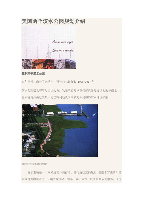
美国两个滨水公园规划介绍
美国两个滨水公园规划介绍查尔斯顿滨水公园查尔斯顿,南卡罗来纳州设计/完成时间:1978/1987年滨水公园建设和邻近街区的再开发是政府对城市旅游资源进行调配的举措之一,将旅游资源由过度集中的巴特利地段向未被充分利用的滨水地区扩散。
查理斯顿滨水公园鸟瞰查尔斯顿是一个规模适宜并保存着大量传统建筑的城市,是南卡罗来纳州最具吸引力的城市之一。
随着旅游者、中小公司、旅馆、饭店和商店的增多,改造废弃的城市滨水地区成为城市发展的一个重要问题。
滨水地区重建的意图是通过更新和引进一系列项目为该地区带来活力,成为城市中有吸引力的一个滨水环境,从而吸引居民、旅游者、购物者和商人来到查尔斯顿。
总平面示意图为了振兴这座有历史意义的城市,查尔斯顿实行了一项改造滨水地区的长期计划。
像许多其他城市一样,查尔斯顿市位于库匹河沿岸的码头设施都已经荒废,原来岸边的机构都已经迁走,只留下废弃的土地和建筑物,而这里距离查尔斯顿城市中心仅有十分钟的步行路程。
码头周围的街区是在以往码头兴盛时期形成和发展起来的,它们是这一历史城市中重要的部分,但是随着码头的废弃而衰败,滨水地区甚至变成了停车场。
由于木桩的腐烂和长期缺乏疏浚,港口河道水域逐渐变浅并长出了大片的沼泽植物。
中央喷泉重建滨水地区使其成为吸引公众的一个去处,这是查尔斯顿市市长实施的若干城市市区更新计划之一。
对这一滨水地区的重建一定要考虑历史因素和当地的特征,设计构思必须尊重这些使查尔斯顿有别于其他城市的要素。
在过去的20年间,这一滨水地区被改造成公园和公众休憩场所,包括查尔斯顿滨水公园和航海中心,并在周围的历史街区中修建了几处停车设施。
橡树林和散步道市政当局设想建成一条环绕半岛的滨水步行路线将城市中心与城市的两条河流联系起来,并根据这个设想形成了总体规划来控制具体的设计和开发。
滨水公园建设和邻近街区的再开发是政府对城市旅游资源进行调配的举措之一,将旅游资源由过度集中的巴特利地段向未被充分利用的滨水地区扩散。
城市滨水空间的规划原则与实施策略
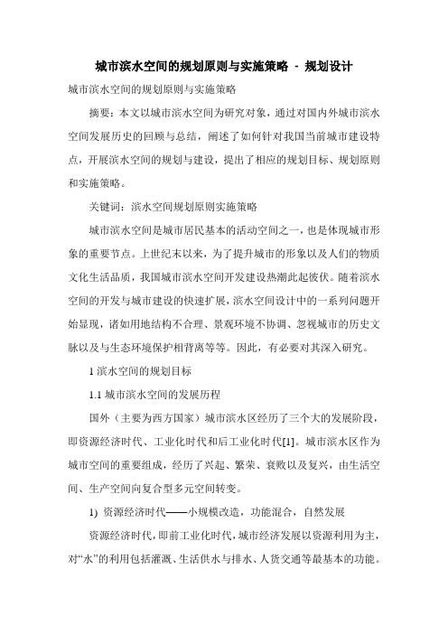
城市滨水空间的规划原则与实施策略- 规划设计城市滨水空间的规划原则与实施策略摘要:本文以城市滨水空间为研究对象,通过对国内外城市滨水空间发展历史的回顾与总结,阐述了如何针对我国当前城市建设特点,开展滨水空间的规划与建设,提出了相应的规划目标、规划原则和实施策略。
关键词:滨水空间规划原则实施策略城市滨水空间是城市居民基本的活动空间之一,也是体现城市形象的重要节点。
上世纪末以来,为了提升城市的形象以及人们的物质文化生活品质,我国城市滨水空间开发建设热潮此起彼伏。
随着滨水空间的开发与城市建设的快速扩展,滨水空间设计中的一系列问题开始显现,诸如用地结构不合理、景观环境不协调、忽视城市的历史文脉以及与生态环境保护相背离等等。
因此,有必要对其深入研究。
1滨水空间的规划目标1.1城市滨水空间的发展历程国外(主要为西方国家)城市滨水区经历了三个大的发展阶段,即资源经济时代、工业化时代和后工业化时代[1]。
城市滨水区作为城市空间的重要组成,经历了兴起、繁荣、衰败以及复兴,由生活空间、生产空间向复合型多元空间转变。
1) 资源经济时代——小规模改造,功能混合,自然发展资源经济时代,即前工业化时代,城市经济发展以资源利用为主,对“水”的利用包括灌溉、生活供水与排水、人货交通等最基本的功能。
对城市发展而言,贸易能力是直接决定城市地位的一个重要因素。
因此,世界上许多地处大江大河或海陆交汇之处的城市,突破了仅仅作为商人和手工业者社区的局限,获得快速发展,成为前工业化时代人口集聚和商品交易的中心。
这一时期城市滨水区的典型特征是码头、仓库大量集聚,港口与城市生活混合,成为城市的交通中心和商业文化中心。
当然,受到生产能力的限制,人们对滨水区的改造行为规模较小,功能混合,更多的是一种自然发展的态势。
2) 工业化时代——大规模改造,生产为主,环境恶化工业革命带来生产力的巨大飞跃,大量资本要素积聚于滨水区,城市产业资本的发展极大地推动了滨水区的发展。
纽约城市规划—水路
•
In 2011, we are poised to certify system-wide attainment of Clean Water Act secondary wastewater treatment standards for the first time ever. And water quality in New York Harbor is cleaner now than at any time in the last century. Over 130 square miles, or 95%, of New York Harbor is available for boating. New Yorkers also have access to swimmable waters adjacent to the city’s 14 miles of public beaches in the Bronx, Brooklyn, Queens, and Staten Island. More than 116 square miles, or 75%, of the New York side of the harbor meets pathogen standards for swimming. • 【在2011年,我们正有史以来第一次准备通过在全国范围内实施 的清洁水法案二级污水处理标准。现在纽约市水的质量已经变 得比上个世纪任何时期都要高。95%的纽约港口,大约超过130 平方英里,都可供划船适用。纽约人也在布朗克斯、布鲁克林、 皇后区和斯塔顿岛,在毗邻城市14英里的公共海滩周围拥有了 适合游泳的水域。纽约一侧的港口中,有75%的港口,超过116平 方英里海域达到了适于人类游泳水域的细菌标准。】
纽约南街港滨水历史街区
1
纽约南街港滨水历史街区再开发—开发背景
早在19世纪上半叶,坐落于下曼哈顿东河(East River)河畔的港口地区就巳成为国际航运和渔业贸易 批发的门户,繁华的南街港亦被誉为“船之 街”(Street of Ships) 19世纪末,由于新型船舶逐渐使用曼哈顿西边的哈得 逊河深水港。所以南街港地区的商业活动逐渐减少, 开始衰落,到20世纪中叶,南街港口区建筑已经非常 破败 1967年,—个名为“南街港之友”(Friends of South Street Seaport)的民间组织开始募集资 金.准备筹建南街港博物馆。次年,该组织通过规划 沦证,形成初步的开发计划 该计划得到了纽约市政当局的支持。政府与拥有港口 区地产的银行、开发商和私人业主进行厂广泛接触和 谈判磋商,最终获得了南街港地区的土地,并进行相 应的功能转换。这项复杂的转换工作从1973年始历经 5年之久 1977年,爱德华·科克(Edward Koch)当选为纽约市 长。他认为,南街港具有巨大的改造与再开发潜力。 次年,科克政府为港口区颁发了联邦开发许可 (Federal Urban Development Action Grant),创立 都市经济发展的战略框架 1979年9月27日,科克市长与劳斯公司、南街港博物 馆和纽约州城市开发公司签署开发协议。自此.酝酿 10多年的南街港开发与改造工程终于拉开序幕,全面 2 展开
专家咨询
劳斯公司委托昆西市场的 设计者本杰明·汤普生建筑 事务所为南街港进行全面规 划。这个规划在保护历史街 区的前提下,提出3条建议: ① 使 富 尔 顿 街 ( Fulton Street)成 为社区的 步行中 心.以加强其与华尔街,东 河的联系; ②在富尔顿街与南街角上建 设新的市场; ③重建17,18号码头(Pier 17 and Pier 18), 并 在 其 上 增 建 滨 水 购 物 廊 (Pavilion)
滨水城市空间规划设计(美国AOA案例研究)

3,250m2 z 地区人口规模 : 23,000
approx z 近期住宅销售价格 : 93m2
(1,000ft2) = USD394,000 (i.e. USD4,240 per m2)
温哥华南部滨水区现状
历史背景 History
案例七: 大阪道顿堀滨水区
道頓堀のルーツを探る~道頓堀の歴 史~
道頓堀の「景観」は、この街が開拓さ れ繁華街として有名になり、それを求 めて人び集うようになったことで、その 価値が認められるようになった。この 街の「景観」はように生まれたのだろう か。本節では歴史を紐解き、道頓堀が 代表的な繁華街としてした経緯を述べ たい。
本区域特点: 水网体系自由穿插在规则的城市 格网中。路网和河道叠加在一起 形成丰富有趣的城市空间。 Free waterways combine with inerratic urban grids. 沿河布置公共步行区域和滨水活 动空间。Place pedestrian paths and recreation space along rivers. 城市开放空间与当地节事文化与 休闲活动相结合。Put culture events and recreation activities into public open space.
本区域特色景点
案例三: 荷兰阿姆斯特丹
荷兰王国的首都阿姆斯特丹 (Amsterdam)位于艾瑟尔湖西南 岸,人口73.5万(2003 年)。阿姆斯特尔河从市内流过, 从而使该城市成为欧洲内陆水运 的交汇点。
阿姆斯特丹的水上面积超 过了这座城市总面积的四 分之一,运河数量超过了 威尼斯,桥梁总数则超过 了巴黎。市内地势低于海 平面1—5米,被称为“ 北方威尼斯”.全市共有 160多条大小水道,由 1000余座桥梁相连。 漫游城中,桥梁交错,河 渠纵横。从空中鸟瞰整个 水系状似蛛网。
纽约城市战略发展规划-16滨水规划

170WATERFRONTNew York is a waterfront city. Four of our five boroughs are on islands, and the fifth is a peninsula. That translates into 520 miles of shoreline, which is more than Seattle, San Francisco, Chicago, and Portland have combined. Our water’s edge is home to a maritime industry that supports 31,000 jobs and generates $1.3 billion in tax revenue. It is the location for criti-cal infrastructure such as power plants, airports, and waste-water treatment plants. Our shoreline includes a diverse mix of commercial and residential developments, natural habitats for hundreds of species of birds and fish, and 220 miles of public space.Our waterfront is an invaluable asset, but for decades New Yorkers have had access to too little of it. Recently, we have engaged in a wide-ranging effort to reclaim our waterfront. We have opened access to miles of shoreline that had been closed to the public, developed new parks in all five boroughs, built thousands of units of new housing, created new maritime jobs, and cleaned our waterways. To continue this revitaliza-tion, we released Vision 2020: New York City Comprehensive Waterfront Plan in 2011 to establish a long-range vision for the entire shoreline. Vision 2020 built on the initiatives first presented in PlaNYC in 2007. In turn, this update of PlaNYC builds on Vision 2020.INITIATIVES Housing and Neighborhoods • Develop new neighborhoods on underutilized sites • Create new units in existingneighborhoods | Parks and Public Space • Create and upgrade flagship parks • Convert former landfills into public space and parkland • Increase opportunities for water-based recreation • Improve collaboration between City, state, and federal partners • Create a network of green corridors • Conserve natural areas • Support and encourage stewardship • Incorporate sustainability through the design and maintenance of all public space | Brownfields • Increase participation in the NYC Brownfield Cleanup Program by partnering with lenders and insurers • Enable the identification, cleanup and redevelopment of brownfields | Waterways • Upgrade wastewater treatment plants to achieve secondary treatment standards • Upgrade treatment plants to reduce nitrogen discharges • Complete cost-effective grey infrastructure projects to reduce CSOs and improve water quality • Expand the sewer network • Optimize the existing sewer system • Expand the Bluebelt program • Build public green infrastructure projects • Engage and enlist communities in sustainable stormwater management • Modify codes to increase the capture of stormwater • Provide incentives for green infrastructure • Actively participate in waterway clean-up efforts • Enhance wetlands protection • Restore and create wetlands • Improve wetlands mitigation • Improve habitat for aquatic species | Transportation • Expand and improve ferry service • Improve freight movement | Air Quality • Retrofit ferries and promote the use of cleaner fuels • Work with the Port Authority to implement the Clean Air Strategy | Solid Waste • Reduce the impact of the waste system on communities | Climate Change • Regularly assess climate change projections • Partner with the Federal Emergency Management Agency (FEMA) to regularly update Flood Insurance Rate Maps • Develop tools to measure New York City’s current and future climate exposure • Update regulations to increase the resilience of buildings • Work with the insurance industry to develop strategies to encourage the use of flood protections in buildings • Protect New York City’s critical infrastructure • Identify and evaluate citywide coastal protective measures • Integrate climate change projections into emergency management and preparedness • Work with communities to increase their climate resilienceWe will enhance areas along the water and increase access to the water itself. By reducing Combined Sewer Overflows (CSOs), decreasing nitrogen discharges, removing contami-nated sediments, and restoring wetlands, we will strengthen our coastal ecosystems and provide more opportunities to use our waterways not only for people but for blue heron and bass as well. We will also transform underutilized areas along the water into destination parks in all five boroughs, includ-ing Brooklyn Bridge Park, Governors Island, Soundview Park, Rockaway Beach Park, and Freshkills Park.We will continue to enliven the waterfront with a range of attractive uses. We will build new residential neighborhoods at Hunter’s Point South and Willets Point. We will explore zoning changes for under-utilized areas to create opportunities for more productive uses. Development along our shores can help meet the need for housing and other services for a grow-ing population as well as provide jobs, generate tax revenues, and bring more people to the water. To make more under-utilized land available for redevelopment, we will implement programs to ensure a more effective process for cleaning up contaminated land.Our waterways will remain increasingly important blue high-ways for moving goods and people. An increase in water-borne transportation will relieve the burden on our streets and transit system. Ferry service on the East River will give more people a sustainable transportation alternative, while increas-ing tug-and-barge use to move solid waste out of the city will improve air quality and reduce congestion by taking trucks off the road. We will achieve cleaner air for waterfront communi-ties by increasing the use of cleaner fuels in maritime vessels and reducing emissions from the ships, trains, and trucks that use our ports.We will assess and respond to the impacts that sea level rise, storm surge, and increased precipitation levels will have on our coastal areas. By developing tools to measure New York City’s current and future climate risks, we will make more informed decisions in terms of how we design and adapt criti-cal pieces of coastal infrastructure and other elements of our built environment.Our effort to revitalize New York City’s waterfront extends beyond the initiatives in PlaNYC. Vision 2020 seeks not only to create new residential areas and parks where opportuni-ties exist but also to maintain a vibrant working waterfront where water-dependent industries can grow and thrive. We are developing waterfront infrastructure to enable the expan-sion of critical economic activities such as port commerce and shipping.Our waterfront is a crucial component of our physical, eco-nomic, and social fabric. We will revitalize our city’s edge to reconnect New Yorkers and visitors to the water and reclaim New York City’s standing as a premier waterfront city. With smart and sensitive planning, we will create a waterfront that will be cherished for generations to come.171A GREENER, GREATER NEW YORKPLANYC。
美国滨水区规划案例之达拉斯三一河通道总体规划

达拉斯,得克萨斯州设计时间:2000年三一河通道总体实施规划是一项长期的远景规划,第一阶段实施长约32公里的沿三一河路段。
该项目是促进城市南北车辆交通从而振兴城市经济的一项重要基建程。
以往曾提案过的沿三一河岸的车行道建设项目被重新加以考虑,实际上正是该河岸将三一河与达拉斯市分隔开来。
该项目内容包括挖土扩建河岸堤坝,抬高新建道路,新建桥梁跨越滩涂区,同时挖土将形成一些人工湖。
根据环境特征,设计构想强调整个通道地区以湖泊、沿河车行道、新建桥梁、娱乐区、湿地和数英里长的自然道路为其特色。
同时还计划在开发中恢复泻洪道并加以利用。
新产生的湖泊的最终形态将严格取决于水文上的要求,同时也要考虑到尺度和城市景观。
整个通道工程的核心区域由两部分组成:下游区和上游区。
下游区面向中心城区,上游区南面朝向住宅区、北面朝向轻工业区。
出于格局上的考虑,下游区被设计为娱乐区,有一块大的水面,可以划船、扬帆,举行大型聚会,观赏城市天际线在水中的倒影。
与此相对,上游区由若干的湖泊组成,是为社区服务的自然公园区,由湿地和草地组成,在洪水到达市区之前起阻隔作用。
关于沿河约8公里长朝向中心城区的部分,具体构思涉及城市结构和相关区域的开发,涉及建立一套联系沿河通道与临近社区的公共空间系统,确定河道外湖泊的位置和形状,改建河堤和建设一系列娱乐设施,包括步道、市民聚会区、公园、草地和湿地。
规划还设想了将来的城市形态和主要开发基地的区域特色。
该设计构想正在逐步实施之中,该项目计划耗资300亿美元,历时30年。
达拉斯始建于1841年,最初是一个交易点,1871年正式建市,20世纪初成为石油工业和畜牧业的金融中心。
现在达拉斯已经成为所在区域的商业、运输、金融和工业中心。
城市面积约969平方公里,城市人口1070000(1998年)。
美国区划对城市公共空间的控制及对中国的启示——以纽约区划控制体系和纽约滨水空间为例
1.1 美国区划控制体系控制内容 随着区划体系的逐步完善,当代美国区划在传统区划条例的基础上,通过引入新的功
能性和美学区划指标与技术,变得更加综合灵活(李恒,2007)。美国的区划如今分为设计 政策编制和设计控制实施两个板块。在内容上,涉及政策编制主要包括导则和要求制定、 设计意向说明等;设计控制实施则以实施机构建立、评价标准确定为主。区划控制以建成 环境及设计过程参与者为对象,从政策、制度、程序、公众参与角度,以区划法和城市设 计导则为手段来对城市设计及开发决策过程进行动态指导和弹性控制。
除了居住、工业、商业外,纽约区划还有一系列规划工具及补充性条款,从而规定开 发的类型和公共空间的设计,如大区域地区、低密度地区和滨水地区允许区划条例的调整 等。这些区划工具包括大尺度地区开发、街景改善、滨水地区区划调整、私属公共空间、 食物摊位控制、低密度增长管理区域。
2.2 纽约区划对城市公共空间的控制
1 美国区划控制体系概述
1891 年法兰克福市通过“分级建筑规则”20 世纪初期,区划法规控制体系(Zoning) 由德国引进美国(王珺,2009)。如今,美国区划法规已成为美国城市法规体系中控制开发 的重要环节,以尊重并维护私有财产、平衡社会利益关系为前提,形成了一套独立的管理 体系。
纽约城市规划
纽约市是美国最大城市及第一大港,同时大纽约也是世界第四大都会区,仅次于东京、 首尔、墨西哥城。位于美国大西洋海岸的东北部。该市有曼哈顿区、皇后区、布鲁克 林区、布朗克斯区、斯塔滕岛区五个区。拥有人口827万,也是全美国人口最密集的 重要城市,全市总面积为1214.4平方公里,其中陆地面积789.4 平方公里
• 2.合理迚行区域内产业结构调整,使区
域经济得以整体、协调发展。纽约都市圈 产业 结构调整的整体效应, 首先表现为 都市圈内合理的产业结构和区域分工格局, 都市圈内的中 心城市以其科技、资本和 产业的优势,在产业结构调整中起着先导 的创新作用,通过合理的 产业结构调整, 既成功地增强了中心城市的实力和地位, 也使周围地区获得了良好的发展契 机。
是住房、开放空间、棕地整治、水质、供水网络、交通、能源、空气 质量和应对气候变化。提出了四个基本策略:抑制蔓延、提高能源清 洁度、建筑节能、可持续发展交通。
• 第五次:纽约市城市总体规划(2008 — 2030)
• 具体措施:规划认为要达到“抑制蔓延”的目的,需要制定以下六方
面的政策,它们分别是可持续发展住房、公园植树、大运量公交、棕 地整治、增加娱乐水域以及确保可靠的水源能源。(1)建造可持续发 展、可支付性住房。(2)为所有纽约人提供公园,提高公共领域的品 质。(3)增加大运量公交。(4)棕地整治。(5)增加娱乐休闲的水域。 (6)确保可靠的水源和能源。
• 关于纽约的城市规模有不同的理解 • 是一个不少于四个相邻的标准大城市统计区(Standard 纽约都会区:美国人口普查认为,纽约一东北新泽西标准联合地区,
•
Meh'opolitan Statistical Areas)再加上新泽西州(New Jersey)的两 个郊区县的联合地区,面积为7000平方公里,有1900万人口,包括 17个县。 纽约大都市区:即“三州纽约大城市区域”,包括纽约市 5 区及其周 边 26 个县所组成的一个社会和经济区域,区域范围涉及美国康涅狄 格州、新泽西州和纽约三个联邦州,人口约 2000 多万人,土地面积 约 10745平方公里,它是早在1922年由一个非官方组织——纽约区 域规划协会(RegionalPlan Association of New York,简称RPA)所 拟定的(图)
纽约的全球城市发展战略与规划_王兰
Global City Development Strategy and Planning of New Y ork City纽约的全球城市发展战略与规划王兰 刘刚 邱松 布伦特·D ·瑞安Wang Lan, Liu Gang, Qiu Song, Brent D. Ryan文章编号:1673-9493(2015)04-0018-06 中图分类号:TU984.712; F299.712 文献标识码:A经济全球化给世界大都市带来新的发展机会,并在很大程度上改变了城市的发展方式。
全球城市不仅是学术界描述某种城市的概念,更成为很多城市竞相追求的目标。
在试图成为全球城的城市中,产业结构均从工业为主导转变为依赖新兴的高附加值产业,例如金融、保险、房地产、文化娱乐和旅游业,并对发展战略和规划提出新的要求[1]。
全球城市发展策略可划分为:(1)形成跨国公司的全球或区域总部;(2)建立全球或区域的金融中心;(3)发展高度发达的生产性服务业(核心策略);(4)建设科技创新和文化创意基地;(5)打造国际性的旅游和会展目的地(支撑策略);(6)形成精英人才的汇聚地;(7)建构信息、通信、交通枢纽(基础策略)①。
本文将分析典型全球城市纽约在这三个维度和七个方面的现状和发展趋势,并剖析相关规划和政策,探讨全球城市发展战略和规划应对。
1 全球城市发展策略七个方面的现状及发展1.1 跨国公司的全球或区域总部纽约与伦敦并称世界顶级的全球城市,历来是世界跨国企业总部的所在地。
许多跨国企业都将全球或区域公司总部设在纽约,其中包括法律服务、广告业、时尚设计业和传媒业等生产性服务部类的企业。
在2014福布斯全球企业2000强中,有74家将总部设置在纽约,对比2005年的85家有所下降,但均因企业排名下滑出2 000,而不是因为总部另外选址。
同期伦敦的福布斯2000强企业总部数量从72减少为70。
在2014年的74家企业中,排名在1 000~2 000名的企业所占比例最大,为39%;其次为排名101~500名、501~1 000名和1~100名,分别占27%、23%和11%。
城市滨水功能区发展国际案例
城市滨水功能区发展国际案例滨水功能区是指位于城市河流、湖泊或海滨等水域附近的区域,通过合理规划和开发,将水域资源与城市建设相结合,实现人与自然的和谐发展。
下面列举了十个国际案例,展示了不同城市在滨水功能区发展方面的成功经验。
1. 悉尼港湾(澳大利亚):悉尼港湾是澳大利亚最大的天然港口,通过开发滨水功能区,打造了国际知名的旅游景点。
悉尼歌剧院和海港大桥成为悉尼的地标建筑,吸引了大量游客和投资。
2. 阿姆斯特丹运河(荷兰):阿姆斯特丹拥有众多运河,通过修复和开发这些运河,打造了美丽的滨水景观。
运河旁的建筑以及人行道和自行车道的设置,使得阿姆斯特丹成为了一个步行和骑行友好的城市。
3. 温哥华滨水区(加拿大):温哥华位于太平洋沿岸,通过开发滨水功能区,将城市与海洋紧密相连。
滨水区内有众多公园、步行街和娱乐设施,提供了丰富的休闲和娱乐选择。
4. 波特兰滨水公园(美国):波特兰在城市规划中注重保护和利用水资源,建设了一系列滨水公园。
这些公园不仅提供了休闲和娱乐场所,还帮助改善了城市的生态环境。
5. 上海滨江区(中国):上海滨江区是中国最具国际化的滨水功能区之一。
通过开发滨江区,上海打造了世界级的金融中心和滨江旅游区,吸引了大量国内外投资和游客。
6. 渥太华运河(加拿大):渥太华运河是加拿大最古老的人工运河,通过修复和开发,成为了渥太华的一大亮点。
运河沿岸有众多公园和景点,吸引了游客和居民。
7. 柏林斯普雷河滨水区(德国):柏林斯普雷河滨水区是柏林的新兴滨水功能区,通过河岸改造和建设,打造了休闲、娱乐和文化活动的场所。
滨水区内有众多美食街区和艺术展览,吸引了年轻人和艺术爱好者。
8. 多伦多滨水区(加拿大):多伦多位于安大略湖边,通过开发滨水区,打造了一个充满活力的滨水城市。
滨水区内有众多购物中心、餐厅和娱乐场所,吸引了大量游客和投资。
9. 伦敦滨水区(英国):伦敦滨水区是伦敦市中心的重要滨水功能区,通过河岸改造和开发,打造了众多公园和文化设施。
纽约滨水区域综合评估体系研究及借鉴意义
纽约滨水区域综合评估体系研究及借鉴意义作者:周广坤庄晴来源:《国际城市规划》 2019年第3期周广坤庄晴摘要:进入21 世纪以来,滨水区域越来越成为城市的重要发展资源。
如何有效引导滨水区域建设,实现对建设质量的有效监督和管理,成为许多城市面临的难题。
本文首先深入研究了纽约滨水区域综合评估的经验,对其评估历程、评估对象、评估机制、评估指标、评估认证等方面进行分析和总结;然后结合我国实际情况,对我国滨水区域综合治理的问题,提出若干具有针对性的建议:一是建立水陆一体的滨水区域空间分类体系;二是加快滨水区域精细化建设管理模式转型;三是构建科学的滨水区域评估框架和技术路径;四是实现滨水区域建设质量的动态认证。
Abstract: Since entering the 21st Century, the waterfront area hasbecome an increasingly important resource for urban development.How to effectively guide the construction of waterfront area, andhow to effectively supervise the construction quality, these two issuesare important for many cities. This paper studies the experience ofthe comprehensive assessment of the waterfront area in New YorkCity, and analyzes its overall process, evaluation scope, assessmentmechanism, assessment index, and assessment certification. After indepthanalysis and with referring to the actual situation in China,this paper puts forward countermeasures for China’s comprehensivemanagement of waterfront area: (1) establish integrated waterfrontspatial classification system; (2) promote the transformation of finemanagement of waterfront construction; (3) build scientific andtechnical assessment framework; (4) create dynamic certification ofwaterfront construction quality.关键词:纽约;滨水区域;综合评估;指标体系;精细化管理Keywords: New York; Waterfront Area; Comprehensive Assessment;Indicator Framework; Refined Management滨水区域是城市中一个特定的空间地段,系指与河流、湖泊、海洋毗邻的土地或建筑, 亦即城镇邻近水体的部分[1]。
纽约市城市规划
• 纽约城市规划的特点
• 1 前瞻性:超前的规划理念,一是长远的规划理念;二是可持续发展 的规划理念。 • 2 整合性:借助大都市圈规划实现城市间协调发展 • 3 导向性:公共利益取向 • 4 广泛性:公众参与程度高
• 对中国城市规划的启示
• 1 规划理念与模式更新:从功能主义规划模式转向以提高生活质 量为核心的规划模式 • 2 规划导向和目标转型:从产业城市规划转向循环城市规划 • 3 规划视野拓展:从单个城市规划转向城乡统筹规划及都市圈规 划 • 4 形态扩张规划控制:从郊区化扩张转向紧凑型城市规划和建设 • 5 规划实施:从政府主导到全民参与
• 第一次纽约区域规划(1 921—1929年) ——纽约大城 市区域
• 从对中心区功能进行疏散和为机场建设预留土地的规划策略,到纽约 大城市空间结构的设想,可以看出,尽管当时纽约的工业仍处于上升 期,通过为商务活动留出空间和提高纽约与世界的联系来增强纽约在 全球经济中地位,已成为纽约城市发展中重视的因素之一。这时生产 性服务业还没有成为经济的主导,所以由全球化经济所导致的社会极 化问题和移民问题并没有被第一次纽约区域规划列入考虑的范围内。 • 由于区域规划涉及的范围跨越了州行政界线,导致了此规划的大部分 建议最终流产。
• 第二次纽约区域规划(1968年) ——纽约大城市区域
• 规划背景:在这一时期生产性服务业已经开始成为纽约经济的主要增 长点,而且经济的转型在空间和社会构成上都产生了较大的反映,包 括中心区的集聚与社会阶层的分化、郊区化导致的环境问题和交通问 题,形成了铺开的城市 • 规划主题: 抑制城市的蔓延 • 规划目标:纽约正处于经济和社会飞快的转变阶段,因此解决这些转 变引起的土地开发问题就成为这次规划的基本目标所在
• 第五次:纽约市城市总体规划(2008 — 2030) • 规划背景:伴随经济整体水平提升仍面临着以下几个问题:1、人口
纽约城市规划分析

纽约市城市规划分析——City of New York目 录·城市概况·城市区位·城市性质·城市现状·城市印记·城市特色·城市布局·城市绿化系统·城市棕地·城市道路系统·城市交通系统·城市能耗·城市规划历程·城市水系—居住用地—地铁系统—公交系统—慢行系统—商业及停车用地—工业及基础设施用地—开放空间—闲置土地—现状与规划—滨海空间—产业结构—人口规模—种族分布—人口分布纽约(New York City),世界最大的城市,于1624年建城,位于纽约州东南部,隶属纽约州管辖,下辖五个区。
即:曼哈顿区(Manhattan)、布朗克斯区(Bronx)、布鲁克林区(Brooklyn)、皇后区(Queens)、斯塔腾岛(Staten Island)从2006年计算,纽约市占地面积785平方公里,人口821.4万,水域面积428.8平方公里,人口密度10464.2人/平方公里。
纽约是整个美国的金融经济中心、最大城市、港口和人口最多的城市,在四个传统“全球城市”中位居首位。
1626年之前,纽约地区是印第安人的居住地,直到荷兰人从印第安人手中买下曼哈顿岛辟为贸易站,将其称之为新阿姆斯特丹。
1664年英荷战争之后,被英国约克公爵占领,英国国王将其作为生日礼物送给约克公爵,从此正式更名为纽约。
美国独立战争之后,联邦政府曾有五年时间都是定都与纽约。
1789年,乔治.华盛顿就是在这个城市就任美国总统。
一年后,华盛顿特区被选定为美国首都,纽约则成为资本汇集的中心,纽约的金融机器将证明,它对这座城市的成功起到了举足轻重的作用。
纽约市位于西经74度,北纬40.43度,美国东海岸,濒临大西洋,全市平均海拔10米。
纽约还是联合国总部所在地,总部大厦坐落在曼哈顿岛东河河畔。
曼哈顿岛是纽约的核心,在五个区中面积最小,美国最大的500家公司中,有三分之一以上把总部设在曼哈顿。
- 1、下载文档前请自行甄别文档内容的完整性,平台不提供额外的编辑、内容补充、找答案等附加服务。
- 2、"仅部分预览"的文档,不可在线预览部分如存在完整性等问题,可反馈申请退款(可完整预览的文档不适用该条件!)。
- 3、如文档侵犯您的权益,请联系客服反馈,我们会尽快为您处理(人工客服工作时间:9:00-18:30)。
170WATERFRONTNew York is a waterfront city. Four of our five boroughs are on islands, and the fifth is a peninsula. That translates into 520 miles of shoreline, which is more than Seattle, San Francisco, Chicago, and Portland have combined. Our water’s edge is home to a maritime industry that supports 31,000 jobs and generates $1.3 billion in tax revenue. It is the location for criti-cal infrastructure such as power plants, airports, and waste-water treatment plants. Our shoreline includes a diverse mix of commercial and residential developments, natural habitats for hundreds of species of birds and fish, and 220 miles of public space.Our waterfront is an invaluable asset, but for decades New Yorkers have had access to too little of it. Recently, we have engaged in a wide-ranging effort to reclaim our waterfront. We have opened access to miles of shoreline that had been closed to the public, developed new parks in all five boroughs, built thousands of units of new housing, created new maritime jobs, and cleaned our waterways. To continue this revitaliza-tion, we released Vision 2020: New York City Comprehensive Waterfront Plan in 2011 to establish a long-range vision for the entire shoreline. Vision 2020 built on the initiatives first presented in PlaNYC in 2007. In turn, this update of PlaNYC builds on Vision 2020.INITIATIVES Housing and Neighborhoods • Develop new neighborhoods on underutilized sites • Create new units in existingneighborhoods | Parks and Public Space • Create and upgrade flagship parks • Convert former landfills into public space and parkland • Increase opportunities for water-based recreation • Improve collaboration between City, state, and federal partners • Create a network of green corridors • Conserve natural areas • Support and encourage stewardship • Incorporate sustainability through the design and maintenance of all public space | Brownfields • Increase participation in the NYC Brownfield Cleanup Program by partnering with lenders and insurers • Enable the identification, cleanup and redevelopment of brownfields | Waterways • Upgrade wastewater treatment plants to achieve secondary treatment standards • Upgrade treatment plants to reduce nitrogen discharges • Complete cost-effective grey infrastructure projects to reduce CSOs and improve water quality • Expand the sewer network • Optimize the existing sewer system • Expand the Bluebelt program • Build public green infrastructure projects • Engage and enlist communities in sustainable stormwater management • Modify codes to increase the capture of stormwater • Provide incentives for green infrastructure • Actively participate in waterway clean-up efforts • Enhance wetlands protection • Restore and create wetlands • Improve wetlands mitigation • Improve habitat for aquatic species | Transportation • Expand and improve ferry service • Improve freight movement | Air Quality • Retrofit ferries and promote the use of cleaner fuels • Work with the Port Authority to implement the Clean Air Strategy | Solid Waste • Reduce the impact of the waste system on communities | Climate Change • Regularly assess climate change projections • Partner with the Federal Emergency Management Agency (FEMA) to regularly update Flood Insurance Rate Maps • Develop tools to measure New York City’s current and future climate exposure • Update regulations to increase the resilience of buildings • Work with the insurance industry to develop strategies to encourage the use of flood protections in buildings • Protect New York City’s critical infrastructure • Identify and evaluate citywide coastal protective measures • Integrate climate change projections into emergency management and preparedness • Work with communities to increase their climate resilienceWe will enhance areas along the water and increase access to the water itself. By reducing Combined Sewer Overflows (CSOs), decreasing nitrogen discharges, removing contami-nated sediments, and restoring wetlands, we will strengthen our coastal ecosystems and provide more opportunities to use our waterways not only for people but for blue heron and bass as well. We will also transform underutilized areas along the water into destination parks in all five boroughs, includ-ing Brooklyn Bridge Park, Governors Island, Soundview Park, Rockaway Beach Park, and Freshkills Park.We will continue to enliven the waterfront with a range of attractive uses. We will build new residential neighborhoods at Hunter’s Point South and Willets Point. We will explore zoning changes for under-utilized areas to create opportunities for more productive uses. Development along our shores can help meet the need for housing and other services for a grow-ing population as well as provide jobs, generate tax revenues, and bring more people to the water. To make more under-utilized land available for redevelopment, we will implement programs to ensure a more effective process for cleaning up contaminated land.Our waterways will remain increasingly important blue high-ways for moving goods and people. An increase in water-borne transportation will relieve the burden on our streets and transit system. Ferry service on the East River will give more people a sustainable transportation alternative, while increas-ing tug-and-barge use to move solid waste out of the city will improve air quality and reduce congestion by taking trucks off the road. We will achieve cleaner air for waterfront communi-ties by increasing the use of cleaner fuels in maritime vessels and reducing emissions from the ships, trains, and trucks that use our ports.We will assess and respond to the impacts that sea level rise, storm surge, and increased precipitation levels will have on our coastal areas. By developing tools to measure New York City’s current and future climate risks, we will make more informed decisions in terms of how we design and adapt criti-cal pieces of coastal infrastructure and other elements of our built environment.Our effort to revitalize New York City’s waterfront extends beyond the initiatives in PlaNYC. Vision 2020 seeks not only to create new residential areas and parks where opportuni-ties exist but also to maintain a vibrant working waterfront where water-dependent industries can grow and thrive. We are developing waterfront infrastructure to enable the expan-sion of critical economic activities such as port commerce and shipping.Our waterfront is a crucial component of our physical, eco-nomic, and social fabric. We will revitalize our city’s edge to reconnect New Yorkers and visitors to the water and reclaim New York City’s standing as a premier waterfront city. With smart and sensitive planning, we will create a waterfront that will be cherished for generations to come.171A GREENER, GREATER NEW YORKPLANYC。