河道采砂条件下堤防工程边坡稳定风险分析(英文)
外文翻译外文文献英文文献国际建设工程风险分析
外文文献:This analysis used a case study methodology to analyze the issues surrounding the partial collapse of the roof of a building housing the headquarters of the Standards Association of Zimbabwe (SAZ). In particular, it examined the prior roles played by the team of construction professionals. The analysis revealed that the SAZ’s traditional construction project was generally characterized by high risk. There was a clear indication of the failure of a contractor and architects in preventing and/or mitigating potential construction problems as alleged by the plaintiff. It was reasonable to conclude that between them the defects should have been detected earlier and rectified in good time before the partial roof failure. It appeared justified for the plaintiff to have brought a negligence claim against both the contractor and the architects. The risk analysis facilitated, through its multi-dimensional approach to a critical examination of a construction problem, the identification of an effective risk management strategy for future construction prject and riskThe structural design of the reinforced concrete elements was done by consulting engineers Knight Piesold (KP). Quantity surveying services were provided by Hawkins, Leshnick & Bath (HLB). The contract was awarded to Central African Building Corporation (CABCO) who was also responsible for the provision of a specialist roof structure using patented “gang nail” roof trusses. The building construction proceeded to completion and was handed over to the owners on Sept. 12, 1991. The SAZ took effective occupation of the headquarters building without a certificate of occupation. Also, the defects liability period was only three months .The roof structure was in place 10 years At first the SAZ decided to go to arbitration, but this failed to yield an immediate solution. The SAZ then decided toproceed to litigate in court and to bring a negligence claim against CABCO. The preparation for arbitration was reused for litigation. The SAZ’s quantified losses stood at approximately $ 6 million in Zimbabwe dollars (US $1.2m) .After all parties had examined the facts and evidence before them, it became clear that there was a great probability that the courts might rule that both the architects and the contractor were lia ble. It was at this stage that the defendants’ lawyers requested that the matter be settled out of court. The plaintiff agreed to this suxamined the prior roles played by the project management function and construction professionals in preventing/mitigating potential construction problems. It further assessed the extent to which the employer/client and parties to a construction contract are able to recover damages under that contract. The main objective of this critical analysis was to identify an effective risk management strategy for future construction projects. The importance of this study is its multidimensional examination approach.Experience sugge be misleading. All construction projects are prototypes to some extent and imply change. Change in the construction industry itself suggests that past experience is unlikely to be sufficient on its own. A structured approach is required. Such a structure can not and must not replace the experience and expertise of the participant. Rather, it brings additional benefits that assist to clarify objectives, identify the nature of the uncertainties, introduces effective communication systems, improves decision-making, introduces effective risk control measures, protects the project objectives and provides knowledge of the risk history .Construction professionals need to know how to balance the contingencies of risk with their specific contractual, financial, operational and organizational requirements. Many construction professionals look at risks in dividually with a myopic lens and donot realize the potential impact that other associated risks may have on their business operations. Using a holistic risk management approach will enable a firm to identify all of the organization’s business risks. This will increas e the probability of risk mitigation, with the ultimate goal of total risk elimination .Recommended key construction and risk management strategies for future construction projects have been considered and their explanation follows. J.W. Hinchey stated th at there is and can be no ‘best practice’ standard for risk allocation on a high-profile project or for that matter, any project. He said, instead, successful risk management is a mind-set and a process. According to Hinchey, the ideal mind-set is for the parties and their representatives to, first, be intentional about identifying project risks and then to proceed to develop a systematic and comprehensive process for avoiding, mitigat and its location. This is said to be necessary not only to allow alternative responses to be explored. But also to ensure that the right questions are asked and the major risks identified. Heads of sources of risk are said to be a convenient way of providing a structure for identifying risks to completion of a participant’s pa rt of the project. Effective risk management is said to require a multi-disciplinary approach. Inevitably risk management requires examination of engineering, legal and insurance related solutions .It is stated that the use of analytical techniques based on a statistical approach could be of enormous use in decision making . Many of these techniques are said to be relevant to estimation of the consequences of risk events, and not how allocation of risk is to be achieved. In addition, at the present stage of the development of risk management, Atkinson states that it must be recognized that major decisions will be made that can not be based solely on mathematical analysis. The complexity ofconstruction projects means that the project definition in terms of both physical form and organizational structure will be based on consideration of only a relatively small number of risks . This is said to then allow a general structured approach that can be applied to any construction project to increase the awareness of participants .The new, simplified Construction Design and Management Regulations (CDM Regulations) which came in to f 1996, into a single regulatory package.The new CDM regulations offer an opportunity for a step change in health and safety performance and are used to reemphasize the health, safety and broader business benefits of a well-managed and co-ordinated approach to the management of health and safety in construction. I believe that the development of these skills is imperative to provide the client with the most effective services available, delivering the best value project possible.Construction Management at Risk (CM at Risk), similar to established private sector methods of construction contracting, is gaining popularity in the public sector. It is a process that allows a client to select a construction manager (CM) based on qualifications; make the CM a member of a collaborative project team; centralize responsibility for construction under a single contract; obtain a bonded guaranteed maximum price; produce a more manageable, predictable project; save time and money; and reduce risk for the client, the architect and the CM.CM at Risk, a more professional approach to construction, is taking its place along with design-build, bridging and the more traditional process of design-bid-build as an established method of project delivery.The AE can review to get the projec. Competition in the community is more equitable: all subcontractors have a fair shot at the work .A contingency within the GMP covers unexpected but justifiable costs, and a contingency above the GMP allows for client changes. As long as the subcontractors are within the GMP they are reimbursed to the CM, so the CM represents the client in negotiating inevitable changes with subcontractors.There can be similar problems where each party in a project is separately insured. For this reason a move towards project insurance is recommended. The traditional approach reinforces adversarial attitudes, and even provides incentives for people to overlook or conceal risks in an attempt to avoid or transfer responsibility.A contingency within the GMP covers unexpected but justifiable costs, and a contingency above the GMP allows for client changes. As long as the subcontractors are within the GMP they are reimbursed to the CM, so the CM represents the client in negotiating inevitable changes with subcontractors.There can be similar problems where each party in a project is separately insured. For this reason a move towards project insurance is recommended. The traditional approach reinforces adversarial attitudes, and even provides incentives for people to overlook or conceal risks in an attempt to avoid or transfer responsibility.It was reasonable to assume that between them the defects should have been detected earlier and rectified in good time before the partial roof failure. It did appear justified for the plaintiff to have brought a negligence claim against both the contractor and the architects.In many projects clients do not understand the importance of their role in facilitating cooperation and coordination; the desi recompense. They do not want surprises, and are more likely to engage in litigation when things go wrong.中文译文:国际建设工程风险分析索赔看来是合乎情理的。
堤防工程施工风险评估方案
堤防工程施工风险评估方案1. 项目背景堤防工程是为了防止河流、湖泊、海洋等水体泛滥而建设的一种重要工程。
在施工过程中,受天气、地质、水文等因素的影响,存在着一定的风险。
因此,对堤防工程的施工风险进行评估是非常必要的。
2. 施工风险评估的意义通过对堤防工程施工风险的评估,可以及早发现潜在的危险,制定相应的风险防控措施,减少事故的发生,确保施工工程的安全进行。
同时,风险评估还可以为项目的安全生产提供参考依据,保障施工人员生命财产安全,避免造成不可挽回的损失。
3. 施工风险评估的内容堤防工程施工风险评估主要涉及以下内容:(1)地质条件评估:包括地质构造、地层特征、地形地貌等方面的评估,评估可能存在的滑坡、崩塌、沉陷等地质灾害风险。
(2)水文气象条件评估:对施工区域的水文、气象条件进行评估,预测可能出现的水患、风暴潮、风暴等自然灾害的影响。
(3)施工现场安全评估:对施工现场的安全条件进行评估,包括现场交通、作业环境、设施设备等方面的安全状况。
(4)人员素质与技术水平评估:对施工人员的素质和技术能力进行评估,确保施工人员具备相应的技能和安全意识。
(5)外部环境评估:包括项目所在地的社会、政治、环境等方面的评估,预测可能对施工造成影响的外部因素。
4. 施工风险评估方法为了全面评估堤防工程施工风险,可以采用以下方法:(1)文献资料分析:收集与施工地区相关的地质、水文气象、安全管理、工程勘测等方面的文献资料,进行综合分析。
(2)现场实地调查:对施工区域进行实地调查,获取相关现场数据,了解实际情况。
(3)专家咨询:邀请相关领域的专家进行咨询,获得专业意见。
(4)风险评估工具:使用专业的风险评估工具,对施工风险进行定量化评估。
5. 风险评估结果分析在完成风险评估后,需要对评估结果进行分析,识别出可能存在的风险点和风险因素,确定风险的等级和程度,为风险防控提供依据。
(1)风险点识别:根据评估结果,识别出可能的风险点,包括地质灾害、水患、安全事故等方面的风险。
基于Geo-Studio的堤防渗流与稳定分析
AutoBank软件分析河道堤防的渗流稳定性
AutoBank软件分析河道堤防的渗流稳定性李宇【摘要】我国河流众多,河系情况十分复杂.目前大部分河道堤防存在严重的渗漏问题,威胁水利工程及沿岸人民群众生命财产安全.AutoBank软件是对水利建筑物进行渗流分析的重要软件,文章以应用钠基膨润土防水毯作为防水材料的抚河河道为例,利用AutoBank软件计算渗流场,计算典型断面的单宽渗流量、水力梯度及浸润线,分析及评价钠基膨润土防水毯的实际防渗效果.【期刊名称】《中国水能及电气化》【年(卷),期】2019(000)001【总页数】5页(P50-54)【关键词】AutoBank;钠基膨润土防水毯;渗流分析【作者】李宇【作者单位】江西省赣抚平原水利工程管理局,江西南昌 330096【正文语种】中文【中图分类】TV223.41 概述AutoBank软件是用于渗流计算和稳定性分析的重要软件,其研究对象为堤防、水库大坝等水工建筑物,它既能计算稳定渗流场问题,又能处理非稳定饱和渗流场的问题。
AutoBank软件将三维的空间问题巧妙地简化为二维平面问题,其主界面是依托AutoCAD的界面设计的,使用者可以在界面中直接绘制简化模型。
在构建模型时,使用者应定义其宽度、高度、边坡比等,确定土层的材料和渗透系数,绘制出临界水位的高度,根据这些数据AutoBank软件利用有限元的原理进行渗流计算,求解渗流场,并将渗流场的计算结果以图表或数值的型式直观显示出来,包括等势线、浸润线、流速等值线图、流速矢量图、水力坡降等值线图等 [1]。
本文以江西省抚河河道为研究对象,防渗材料采用钠基膨润土防水毯,利用AutoBank软件进行渗流计算,分析其实际的作用效果。
钠基膨润土防水毯是新型的复合材料,是由两层土工合成材料夹封膨润土,利用针刺、黏结或缝合工艺等制作而成的,其中起防水作用的主要成分为蒙脱石[2]。
在遇水情况下,膨润土颗粒会迅速膨胀,挤压颗粒间存在的空气,形成一层致密的不透水层,从而起到挡水作用。
水位骤降和降雨条件下生态护坡稳定性分析

本, 还更利于渠坡和水体生态安全。 丰田等[4] 以乔 型) 、 Plate( 水平根型) 和 Heart( 散生根型) 3 种类型
木根和红黏土为材料开展了一系列大型直剪试验, 对 ( 见图 1) [14]。 其中: 油松、 云南松、 栓皮栎、 侧柏等
植被护坡中根土复合体抗剪强度与树根和土体间组合 植物的根系垂直向下延伸, 多为 Tap 型; 刺槐、 椎栗
Байду номын сангаас
Stability analysis of eco-slope protection under conditions of water level sudden drop and rainfall HU Wei1,2, CHEN Jianling3, LI Weihua3, SU Jingyi3, JIANG Zhongming1,2
况和工程成本合理选择生态护坡类型。
关键词: 生态护坡; 水位骤降; 降雨; 渗流场; 安全系数
doi: 10. 13928 / j. cnki. wrahe. 2021. 05. 018
开放科学( 资源服务) 标志码( OSID) :
中图分类号: TV 223
文献标志码: A
文章编号: 1000- 0860(2021)05- 0167- 08
Water Resources and Hydropower Engineering Vol.52 No.5
167
胡 炜, 等 / / 水位骤降和降雨条件下生态护坡稳定性分析
influencing degree of the frontal rainfall is to be as well. The eco-slope protection can effectively alleviate the adverse impacts from water level sudden drop and rainfall on the seepage field and stability of the slope, for which the effect of the turf + arbor slope protection is the best, and then are arbor slope protection and turf slope protection; which is because the root systems of most of trees are Tap typed with more larger covering ranges. In the actual project, it is necessary to reasonably select the type of eco-slope in combination with the specific condition and the relevant construction cost. Keywords: eco-slope protection; water level sudden drop; rainfall; seepage field; safety coefficient
堤防工程服务中的风险评估与管理
堤防工程服务中的风险评估与管理堤防工程是为了保护河流、湖泊、海岸线等区域免受洪水、海潮侵袭的重要设施。
然而,在堤防工程的建设和运营过程中,存在着一定的风险,包括自然灾害、设计、施工和维护等方面的风险。
因此,进行堤防工程服务中的风险评估与管理是非常重要的。
首先,在堤防工程服务中进行风险评估是为了了解并识别潜在的风险,以便采取预防措施来降低风险的发生概率和影响程度。
风险评估应该综合考虑自然灾害、气候变化、地质条件和工程设计等因素,并对可能的风险进行定量或定性评估。
评估的结果应该提供给相关的决策者和利益相关者,以便他们可以制定相应的应对措施。
其次,堤防工程服务中的风险管理是指根据风险评估结果,制定并实施相应的管理措施,以减少风险的发生和影响。
风险管理包括风险控制、监测和应急响应等方面的内容。
在风险控制方面,可以采取一系列的技术措施来降低堤防工程的风险。
首先,在设计阶段应该考虑到各种可能的自然灾害情景,并根据设计要求和标准进行合理的设计。
其次,在施工阶段应该严格按照设计要求进行施工,确保堤防工程的质量和稳定性。
此外,对于一些特殊情况,如水位异常上升、土壤松动等,应该制定相应的应对措施,比如加固堤坝、排水等。
在监测方面,应该建立健全的监测系统来实时监测堤防工程的运行状态和变形情况。
这样可以及时发现堤防工程存在的异常情况,并采取相应的措施来进行修复和加固,以保证工程的安全运行。
在应急响应方面,应该建立完善的应急预案,制定应对不同风险情景的措施和紧急行动计划。
当发生风险事件时,可以快速、有效地进行救援和应急处置,减少损失和危害。
此外,堤防工程服务中的风险评估与管理还需要进行定期的评估和审核,以确保风险管理措施的有效性和可行性。
这样可以根据实际情况对措施进行调整和改进,提高风险管理的能力和水平。
总之,堤防工程服务中的风险评估与管理是非常重要的,它可以帮助我们识别风险、降低风险的发生概率和影响程度,并制定相应的措施来减少损失和危害。
水利危险源辨识与风险评价报告范文
水利危险源辨识与风险评价报告范文英文回答:Water resources are essential for human survival and development, but they can also pose risks and hazards if not properly managed. The identification and assessment of water-related hazards and risks is crucial for effective water resource management. In this report, I will provide a sample framework for identifying and evaluating water hazards and risks.Firstly, it is important to identify potential water hazards. These can include natural hazards such as floods, droughts, and landslides, as well as human-induced hazards such as water pollution and dam failures. By conducting a thorough assessment of the local environment, climate, and infrastructure, we can identify the specific hazards that are relevant to a particular area.Once the hazards are identified, the next step is toassess the risks associated with these hazards. Risk assessment involves evaluating the likelihood of a hazard occurring and the potential consequences it may have. This can be done through various methods, such as historical data analysis, modeling, and expert judgment.For example, let's consider the risk assessment for flooding in a coastal city. By analyzing historical flood data, we can determine the frequency and magnitude of past floods. We can also use hydrological modeling to simulate different flood scenarios and assess the potential impact on infrastructure, agriculture, and human lives. Additionally, consulting with local residents and experts can provide valuable insights into the vulnerabilities and coping capacities of the community.Based on the risk assessment, it is then possible to prioritize and develop appropriate risk management strategies. These can include structural measures like building flood defenses and reservoirs, as well as non-structural measures like early warning systems and land-use planning. The effectiveness of these strategies should beregularly evaluated and adjusted as necessary.In conclusion, the identification and assessment of water hazards and risks are essential for effective water resource management. By understanding the potential hazards and their associated risks, we can develop appropriate strategies to mitigate these risks and ensure the sustainable use of water resources.中文回答:水资源对于人类的生存和发展至关重要,但如果管理不当,也可能带来风险和危害。
河道施工安全风险评估
河道施工安全风险评估
对于河道施工的安全风险评估,可以考虑以下几个方面:
1. 河道水流:评估施工期间的水流情况,包括水流速度、水位变化等因素。
高速水流和水位变化可能导致施工人员被冲走或淹没的风险。
2. 地质和土壤条件:评估施工区域的地质和土壤条件,包括土质稳定性、滑坡、坍塌等风险。
地质条件差的地方可能存在施工过程中地面塌陷或滑坡的风险。
3. 施工设备和材料:评估使用的施工设备和材料是否符合安全标准,确保设备正常工作并防止发生意外事故。
4. 交通安全:评估施工期间的交通安全情况,包括道路交通是否受到影响、交通管制措施是否到位等。
5. 环境保护:评估施工对周围环境的影响,包括水污染、噪音污染等,确保施工不会对周围环境造成损害。
6. 人员安全培训:评估施工人员的安全培训情况,确保他们具备必要的安全意识和应对紧急情况的能力。
评估中还应考虑特定的施工方案和具体情况,根据评估结果采取相应的安全措施和应急预案,以最大程度地减少施工过程中的安全风险。
同时,施工方也应密切监测施工过程中的风险情况,及时采取措施进行管控和调整。
堤防工程施工危险因素
堤防工程施工过程中存在的危险因素及预防措施堤防工程是保护我国江河沿岸地区人民生命财产安全的重要基础设施,施工过程中存在诸多危险因素,对施工现场的安全带来隐患。
本文将对堤防工程施工中常见的危险因素进行分析,并提出相应的预防措施。
一、危险因素1. 洪水风险洪水是堤防工程面临的最大自然风险,施工过程中如遇到洪水,可能导致施工现场被淹没,设备损坏,工程进度延误等问题。
2. 坍塌风险堤防工程施工过程中,土方坍塌、墙体坍塌等事故时有发生,可能导致施工现场人员伤亡,设备损坏,工程进度延误等。
3. 机械伤害风险施工现场的机械设备较多,如挖掘机、装载机、吊车等,操作不当或设备故障可能导致施工现场人员伤亡。
4. 高处作业风险堤防工程施工过程中,高处作业较多,如脚手架、模板等,未采取有效防护措施可能导致施工现场人员伤亡。
5. 电气伤害风险施工现场的电气设备较多,如发电机、配电箱等,线路老化、短路等可能导致施工现场人员伤亡。
6. 物体打击风险施工现场的砖石、混凝土等材料,以及施工过程中的模板、脚手架等,未采取有效防护措施可能导致施工现场人员伤亡。
7. 环境风险堤防工程施工过程中,可能面临恶劣的环境条件,如高温、严寒、扬尘、噪音等,对施工现场人员身体健康造成影响。
二、预防措施1. 洪水风险预防措施(1)施工前,对施工现场进行详细的水文地质调查,了解洪水特点及频率,制定相应的防洪预案。
(2)施工期间,加强水位监测,及时掌握洪水动态,提前采取应对措施。
2. 坍塌风险预防措施(1)施工前,对施工现场进行地质勘察,了解地质条件,根据实际情况制定合理的施工方案。
(2)施工过程中,加强施工现场的安全监管,严格执行施工方案,确保施工安全。
3. 机械伤害风险预防措施(1)加强机械设备的管理,定期进行检查、维修,确保设备安全运行。
(2)对施工现场人员进行安全培训,提高安全意识,遵守操作规程。
4. 高处作业风险预防措施(1)高处作业前,制定详细的安全措施,如使用安全带、防护网等。
基于AutoBank的巢湖环湖防洪治理工程堤防渗流稳定分析
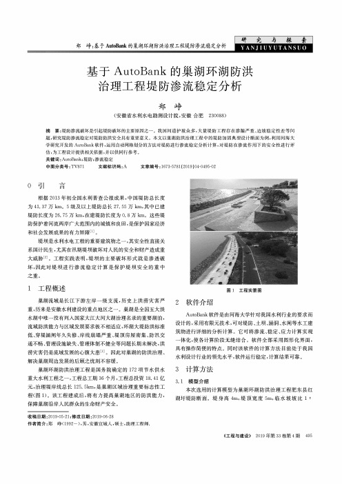
研 究 与 探 索 郑峥:基于AutoBank 的巢湖环湖防洪治理工程堤防渗流稳定分析基于AutoBank 的巢湖环湖防洪 治理工程堤防渗流稳定分析郑峥(安徽省水利水电勘测设计院,安徽合肥230088)摘要:堤防渗流破坏是引起堤防破坏的主要原因之一。
我国河道护坡众多,大量堤防工程存在渗漏严重、边坡稳定性差等问题,研究堤防渗流稳定对堤防防洪安全具有重要意义。
本文以巢湖防洪治理工程中的堤防加固典型设计断面为例,利用河海大 学研究开发的AutoBank 软件,运用自动网格划分的方法对堤防进行渗流稳定分析计算,对堤防在渗流作用下的安全性进行评估,为工程设计提供相关依据,并以供同行参考。
关键词:AutoBank ;堤防;渗流稳定中图分类号:TV871文献标识码:A文章编号:1673-5781 (2019) 04-0495-020引 言根据2013年初全国水利普查公报成果,中国堤防总长度 为41. 37万km o 5级及以上堤防总长27. 55万km,其中已建堤防长度为26. 75万km,在建堤防长度为0. 8万km o 这些堤 防保护着河流两岸广大范围内的城镇和良田,是保护国家经济和社会发展成果的有力屏障E 。
堤坝是水利水电工程的重要建筑物之一,其安全性直接关系国计民生,尤其在汛期堤坝破坏对人民的安全和财产造成重 大威胁⑵。
工程实践表明,堤坝的主要破坏形式就是渗透破坏,因此对堤坝进行渗流稳定计算是保护堤坝安全的重中之重。
1工程概述图1工程实景图巢湖流域是长江下游左岸一级支流,历史上洪涝灾害严重,历来是安徽水利建设的重点地区之一。
巢湖是全国五大淡水湖中唯一没有列入国家大江大河大湖治理名录的重要湖泊,流域防洪能力与区域发展要求极不相适应,环湖大堤防洪标准 低、穿堤涵闸年久失修、岸线崩塌严重、堤顶房屋密集、防汛交 通不畅、管理设施缺失、管理体制不健全等问题长期未解决,洪 涝灾害仍是流域发展的心腹大患⑶。
因此对巢湖的防洪治理、解决巢湖周边发展的后顾之忧刻不容缓。
堤防工程汛期实时安全风险综合评估
收稿日期:2023 ̄10 ̄26ꎮ基金项目:水利部重大科技资助项目(SKS ̄2022010)ꎻ应急管理部防汛抗旱司资助项目(2021-防汛抗旱司-02)ꎻ江西省水利厅重大科技资助项目(202124ZDKT30)ꎮ㊀∗通信作者:万怡国(1980 )ꎬ男ꎬ正高级工程师ꎬ研究方向为水旱灾害防御ꎮE ̄mail:461630009@qq.comꎮ万怡国ꎬ雷声ꎬ王萱子ꎬ等.堤防工程汛期实时安全风险综合评估[J].南昌大学学报(工科版)ꎬ2024ꎬ46(1):83 ̄88.WANYGꎬLEISꎬWANGXZꎬetal.Real ̄timesafetyriskcomprehensiveassessmentofembankmentengineeringduringfloodseason[J].JournalofNanchangUniversity(Engineering&Technology)ꎬ2024ꎬ46(1):83 ̄88.堤防工程汛期实时安全风险综合评估万怡国1ꎬ2∗ꎬ雷声3ꎬ王萱子1ꎬ2ꎬ张磊1ꎬ2ꎬ张洁1ꎬ2ꎬ涂宜昌1ꎬ2(1.江西省水利科学院ꎬ江西南昌330029ꎻ2.江西省鄱阳湖流域生态水利技术创新中心ꎬ江西南昌330029ꎻ3.江西省水利厅ꎬ江西南昌330029)㊀㊀摘要:在出现洪涝灾害时ꎬ第一时间发现并及时处置险情是应急抢险的关键ꎬ如何提前配置防汛人力㊁物力等ꎬ一直是防汛指挥部门亟待解决的问题ꎮ为实时掌握堤防工程安全风险情况ꎬ结合一线防汛抢险实践经验ꎬ提出了一套数量适宜㊁指标内容易获取的堤防工程安全风险评价指标体系ꎬ采用层次分析法㊁模糊综合评价法建立了评估模型ꎬ给定了评估标准ꎬ划分了堤防工程风险等级ꎬ并选取了2020年江西省遭受特大洪水引起的堤防险情进行典型案例分析ꎮ结果表明:选取的未溃口与发生溃口的堤防ꎬ其安全风险综合评估情况与堤防后续状况吻合性较好ꎬ堤防工程安全风险综合评估模型可为防汛指挥部门部署人力㊁物力等提供支撑ꎮ关键词:堤防工程ꎻ汛期ꎻ实时ꎻ安全风险ꎻ综合评估中图分类号:TV871.3㊀㊀㊀㊀文献标志码:A㊀㊀㊀㊀文章编号:1006 ̄0456(2024)01 ̄0083 ̄06Real ̄timesafetyriskcomprehensiveassessmentofembankmentengineeringduringfloodseasonWANYiguo1ꎬ2∗ꎬLEISheng3ꎬWANGXuanzi1ꎬ2ꎬZHANGLei1ꎬ2ꎬZHANGJie1ꎬ2ꎬTUYichang1ꎬ2(1.JiangxiAcademyofWaterScienceandEngineeringꎬNanchang330029ꎬChinaꎻ2.JiangxiProvincialTechnologyInnovationCenterforEcologicalWaterEngineeringinPoyangLakeBasinꎬNanchang330029ꎬChinaꎻ3.WaterResourcesDepartmentofJiangxiProvinceꎬNanchang330029ꎬChina)Abstract:Thekeytoemergencyrescueistodetectandpromptlydealwithdangeroussituationsintheeventofflooddisasters.Howtoallocatefloodcontrolmanpowerandmaterialresourcesinadvancehasalwaysbeenanurgentproblemthatfloodcontrolcommanddepartmentsneedtosolve.Inordertograspthesafetyrisksituationofembankmentengineeringinrealtimeꎬthisstudycombinedthepracticalexperienceoffrontlinefloodcontrolandrescueꎬproposedasetofappropriatequantityandeasilyobtainableindexsystemforevaluatingthesafetyriskofembankmentengineering.TheanalytichierarchyprocessandfuzzycomprehensiveevaluationmethodwereusedtoestablishanevaluationmodelꎬprovidedevaluationstandardsꎬanddividedtherisklevelofembankmentengineeringꎬAndtypicalcasestudieswereselectedtoanalyzetheembankmentriskscausedbythecatastrophicfloodsinJiangxiProvincein2020.Theresultsshowedthattheevaluationmodelwasingoodagreementwiththepracticeꎬwhichcanprovidebasisforemergencyrescueinfloodseasonꎬandprovidesupportforallocatinghumanandmaterialresourcesfordisasterrelief.Keywords:embankmentengineeringꎻfloodseasonꎻrealtimeꎻsecurityriskꎻcomprehensiveevaluation㊀㊀堤防工程在保障我国经济发展㊁社会稳定及国家安全等方面发挥着重要作用ꎮ水利部统计资料显示ꎬ截至2020年底ꎬ我国已建成5级及以上江河堤防总长32.8万kmꎬ累计达标堤防24.0万kmꎬ堤防达标率为73%ꎬ堤防保护人口6.5亿人ꎬ保护耕地4200万hm2ꎮ堤防工程带给我们巨大利益的同时ꎬ也存在一定的溃堤风险ꎬ开展堤防工程安全风险评价很有必要ꎮ近年来ꎬ国内外研究人员对堤防工程安全风险评价研究主要有两方面:一是从评价方法研究堤防第46卷第1期2024年3月㊀㊀㊀㊀㊀㊀南昌大学学报(工科版)JournalofNanchangUniversity(Engineering&Technology)Vol.46No.1Mar.2024㊀工程安全风险ꎬ如杨端阳等[1]提出人工神经网络的方法ꎬ王秀杰等[2]采用突变理论与BP神经网络相结合的方法ꎬ郭金等[2]和杨子桐等[4]利用云模型理论建立指标体系并进行堤防工程风险评价ꎬ张颖等[5]采用极限学习机法ꎬ兰博等[6]提出的采用改进的模糊层次分析法与熵权融合法ꎻ二是从堤防工程结构破坏研究堤防工程安全风险ꎬ如赵鑫等[7]通过对堤防结构破坏等推演提出安全指数并建立评价模型ꎬ杨德玮等[8]从结构破坏等方面对堤段进行单元划分并提出指标体系和建立评价模型ꎬ赵鑫等[9]基于堤防堤基渗流变形建立评价体系ꎮ这些研究主要是针对堤防工程安全的日常评价ꎬ没有涉及发生洪水时的实时评价ꎮ堤防工程安全评价不是一个静态事件ꎬ而是一个动态过程ꎬ影响因素众多ꎬ尤其发生洪涝灾害时ꎬ需要实时掌握堤防工程的安全风险状况ꎬ合理配置人力㊁物力等ꎮ本文结合多年一线防汛抢险经验ꎬ针对汛期堤防工程安全风险提出了一套实时评估指标体系ꎬ建立了评估模型㊁评估标准ꎬ划分了堤防工程风险等级ꎬ并选取2020年鄱阳湖流域遭遇洪水时的溃堤与未溃堤2条堤防工程进行案例应用分析ꎬ结果表明ꎬ评估结果与实际情况吻合性较好ꎮ1㊀评估模型㊀㊀根据汛期影响堤防工程安全的主要影响因素[10 ̄18]ꎬ本文主要考虑保护对象重要性㊁工程易损性㊁洪水期危险性三方面ꎮ其中ꎬ保护对象重要性是反映堤防下游保护范围内人口㊁设施和耕地等的重要程度ꎬ在GB50286 2013«堤防工程设计规范»中堤防工程级别划分包含了此项内容ꎬ故此项指标不列入本文评估模型ꎬ仅在风险等级划分时统筹考虑ꎮ1.1㊀指标体系1.1.1㊀指标选取原则1)典型性原则:能反映堤防工程的安全风险[19]ꎮ2)实时性原则:能实时㊁快捷地开展评价ꎮ3)适度性原则:指标数量不宜太多ꎬ基础资料易获取ꎮ1.1.2㊀指标选择以堤防工程汛期实时安全风险为一级指标ꎬ工程易损性㊁洪水期危险性为二级指标ꎬ二级指标细化为三级指标ꎬ建立堤防工程汛期实时安全风险评价指标体系ꎬ详见表1ꎮ表1㊀堤防工程汛期实时安全风险评价指标体系Tab.1㊀Indexsystemofreal ̄timesafetyriskassessmentofembankmentengineeringinfloodseason一级指标二级指标三级指标主要内容堤防工程汛期实时安全风险工程易损性㊀堤身填筑措施及效果填筑土料类别㊁渗透系数㊁孔隙比㊁颗粒级配㊁干密度㊁黏粒含量㊁内摩擦角㊁凝聚力和施工实施效果等防渗措施及效果堤身㊁堤基防渗措施和施工实施效果等当前险情严重程度[20]已控制较大及以上险情数量㊁未控制险情严重程度等洪水期危险性超保情况评估时当前水位和保证水位差值超警水位幅度评估时当前水位和警戒水位差值超警水位历时评估时超警戒水位历时与历史超警最长时长相比较1.2㊀指标权重国内外有很多权重确定方法ꎬ大致可分为三大类:主观赋权法㊁客观赋权法和主客观综合集成赋权法[21]ꎮ由于堤防工程安全风险评价指标既包含定量指标ꎬ又包含定性指标ꎬ定性指标具有很强的模糊性ꎬ且各项指标之间相互关联ꎬ本文利用层次分析法ꎬ根据堤防工程汛期实时安全风险评价指标体系中的二级㊁三级指标ꎬ建立层次分析结构模型ꎮ依据模型ꎬ当求某层级的与之相关下层各项指标权重时ꎬ将各下层指标两两进行相对重要性比较ꎬ构造判断矩阵ꎬ如求A层级ak指标下层B1㊁B2㊁ ㊁Bn各项指标权重时ꎬ将B1㊁B2㊁ ㊁Bn各项指标进行相对重要性比较ꎬ建立起各项指标的权重判断矩阵ꎬ如表2所示ꎮ表2㊀构造判断矩阵Tab.2㊀ConstructjudgmentmatrixakB1B2 BnB1b11b12 b1nB2b21b22 b2nBnbn1bn2 bnn矩阵元素bij的计算采用9分位标度法ꎬ如表3所示ꎬ其中a㊁b表示2个比较因素ꎮ对判断矩阵来说ꎬ有如下式(1)关系:bij=bikbjkꎬiꎬjꎬk=1ꎬ2ꎬ3ꎬ ꎬn(1)㊀㊀通过邀请有丰富防汛经验的省内外46位专家48 南昌大学学报(工科版)2024年㊀对指标体系判断矩阵进行权重打分ꎬ经计算ꎬ得到各指标权重ꎬ见表4ꎮ表3㊀9分位标度法Tab.3㊀9fractionalscalemethod标度含义1i因素比j因素同样重要3i因素比j因素稍微重要5i因素比j因素明显重要7i因素比j因素强烈重要9i因素比j因素极端重要2ꎬ4ꎬ6ꎬ8i因素比j因素重要等级介于上述之间倒数若i因素比较j因素为bijꎬ则j因素比较i因素为1/bij表4㊀堤防工程汛期实时安全风险评价三级指标权重Tab.4㊀Theweightofthethree ̄levelindicatorsforreal ̄timesafetyriskassessmentofembankmentengineeringduringfloodseason指标堤身填筑措施及效果防渗措施及效果当前险情严重程度权重0.140.140.15指标超保情况超警水位幅度超警水位历时权重0.200.120.251.3㊀标准化处理1.3.1㊀超保情况保证水位是堤防工程及其他附属建筑物能够保证安全挡水的上限洪水位ꎬ此指标是将当前水位与保证水位进行对比评价ꎬ为逆指标ꎬ即实际值越大ꎬ堤防风险值越高ꎮ为量化评分ꎬ提出超保临界风险值ꎬ结合区间分值划分ꎬ建立分数与评价变量之间的函数关系ꎮ1)超保临界风险值:通过调研㊁咨询专家ꎬ取0㊁2m作为超保临界风险值ꎮ2)标准化处理:超保情况为逆指标ꎬ实际值越大ꎬ堤防情况越差ꎬ风险分值也越高ꎬ采用折线型计算ꎬ而折线型表示指标值在某一数值区间变化ꎬ若超出此区间ꎬ则指标值变化对评价值的影响力也发生变化ꎬ根据实际值的转折点ꎬ建立相应的无量纲化函数ꎬ见式(2)ꎮy1=5(x1-n)+70ꎬnɤx1ɤn+640(x1-n)n-m+70ꎬmɤx1<n30(x1-k)m-kꎬkɤx1<mìîíïïïïïï(2)式中:x1指标为超保外水位值ꎬ单位为mꎻm和n为临界值ꎬ单位为mꎬ其中m=H保-2ꎬn=H保ꎻk=H保-6ꎻH保为保证水位值ꎮ1.3.2㊀超警水位幅度警戒水位是河流㊁湖泊随着水位逐步升高ꎬ堤防可能发生险情需要加强防守的水位ꎬ此指标也为逆指标ꎬ参照1.3.1节ꎬ进行标准化处理ꎮ1)临界值取值:通过咨询ꎬ取0㊁1m作为超警临界风险值ꎮ2)标准化处理:超警水位幅度为逆指标ꎬ即实际值越大ꎬ堤防情况越差ꎬ风险分值也越高ꎮ同理ꎬ建立相应的无量纲化函数ꎬ见式(3)ꎮy2=10(x2-c-1)3+70ꎬdɤx2ɤd+940(x2-c)d-c+30ꎬcɤx2<d30x2cꎬ0ɤx2<cìîíïïïïïïïï(3)式中:x2指标为超警戒外水位值ꎬ单位为mꎻc和d为临界值ꎬ单位为mꎬ其中c=H警ꎬd=H警+1ꎻH警为警戒水位值ꎮ1.3.3㊀超警水位历时超警戒水位的时间越长ꎬ堤防受到的威胁更大ꎬ评分越高ꎬ此指标也为逆指标ꎬ参照1.3.1节ꎬ进行标准化处理ꎮ1)临界值取值:通过调研㊁咨询ꎬ取12h㊁历史超警最长时长作为超警历时临界风险值ꎮ2)标准化处理:超警水位历时为逆指标ꎬ即实际值越大ꎬ堤防情况越差ꎬ风险分值也越高ꎮ同理ꎬ建立相应的无量纲化函数ꎬ见式(4)ꎮy3=100ꎬx3ȡg70(x3-f)g-f+30ꎬfɤx3<g30x3fꎬ0ɤx3<fìîíïïïïïï(4)式中:x3指标为评价时超警戒水位历时ꎬ单位为hꎻf和g为临界值ꎬ单位为hꎬ其中f=12ꎬg=Tmaxꎬ且g大于fꎬTmax为历史超警最长时长ꎮ1.4㊀建立模型通过对比选择ꎬ采取模糊综合评价法的加法合成法来计算堤防工程汛期实时安全风险收敛值RAꎬ即三级指标权重与相应指标评分乘积之和ꎬ见式(5)ꎮRA=ðni=1wiyi㊀(yi>0ꎬðni=1wi=1)(5)58 第1期㊀㊀㊀㊀㊀万怡国等:堤防工程汛期实时安全风险综合评估式中:wi为堤防相应指标的相对权重ꎻyi为该指标的评分ꎮ2㊀安全风险评估等级2.1㊀评估标准为对选定的各项指标合理评估ꎬ本文对每项指标明确3个区间ꎬ区间分值为:一区为70~100的闭区间㊁二区为30~70的前闭后开区间㊁三区为0~30的前闭后开区间ꎮ堤防工程汛期实时安全风险评估标准见表5ꎮ2.2㊀风险等级划分堤防工程汛期实时安全风险等级划分参照自然灾害风险等级划分[22]ꎬ采用堤防等级指标与堤防工程汛期实时安全风险收敛值RA综合确定ꎬ分为低级㊁中级㊁高级和极高级ꎬ取0分㊁25分㊁50分㊁75分和100分作为评价临界值ꎬ具体见表6ꎮ表5㊀堤防工程汛期实时安全风险评估标准Tab.5㊀Real ̄timesafetyriskassessmentstandardforembankmentengineeringduringfloodseason一级指标二级指标三级指标评估标准堤防工程汛期实时安全风险工程易损性㊀堤身填筑措施及效果堤身填料为砂性土ꎬ施工质量为合格ꎬ评分区间为一区ꎻ堤身填料为黏土ꎬ施工质量为合格ꎬ或堤身填料为砂性土ꎬ施工质量为优良ꎬ评分区间为二区ꎻ堤身填料为黏土ꎬ施工质量优良ꎬ评分区间为三区ꎮ防渗措施及效果堤身㊁堤基只实施一类且施工质量为合格或堤身㊁堤基均未采取防渗措施ꎬ评分区间为一区ꎻ堤身㊁堤基只实施一类且施工质量为优良ꎬ或堤身㊁堤基均采取防渗措施ꎬ且施工质量为合格ꎬ评分区间为二区ꎻ堤身㊁堤基均采取防渗措施ꎬ且施工质量为优良ꎬ评分区间为三区ꎮ当前险情严重程度[20]已控制较大及以上险情数量大于10处ꎬ或未控制险情为重大险情ꎬ评分区间为一区ꎻ已控制较大及以上险情数量3~10处ꎬ或未控制险情为较大及以下ꎬ评分区间为二区ꎻ已控制较大及以上险情数量3处及以下ꎬ或未控制险情为一般ꎬ评分区间为三区ꎮ洪水期危险性超保情况/m超保证水位0~6mꎬ评分区间为一区ꎻ低于保证水位>0~2mꎬ评分区间为二区ꎻ低于保证水位2m以上ꎬ评分区间为三区ꎮ超警水位幅度/m超警戒水位1~10m时ꎬ评分区间为一区ꎻ超警戒水位0~<1mꎬ评分区间为二区ꎻ未超警戒水位ꎬ评分区间为三区ꎮ超警水位历时/h超警水位历时大于或等于历史超警最长时长时ꎬ评分区间为一区ꎬ取100分ꎻ超警水位历时小于历史超警最长时长但大于或等于12hꎬ评分区间为二区ꎬ取30~<100分ꎻ当超警水位历时小于12hꎬ评分区间为三区ꎬ取0~<30分ꎮ表6㊀堤防工程汛期实时安全风险等级划分表Tab.6㊀Real ̄timesafetyrisklevelclassificationtableforembankmentengineeringduringfloodseason风险收敛值堤防等级风险等级附加条件0<RAɤ251级2级及以下中级㊀低级㊀25<RAɤ501级2级3级及以下高级㊀中级㊀低级㊀当评估时刻出现重大险情时ꎬ各级堤防风险等级为高级ꎮ50<RAɤ751级2级3级及以下极高级高级㊀中级㊀75<RAɤ1002级及以上3级及以下极高级高级㊀当评估时刻出现重大险情时ꎬ各级堤防风险等级为极高级ꎮ3㊀实例应用㊀㊀2020年长江中游及鄱阳湖流域受集中强降雨影响ꎬ江西五河6月底开始水位暴涨ꎬ7月上旬共发生12次编号洪水ꎬ鄱阳湖水位受五河来水和长江干流顶托ꎬ沿湖堤防连续超警戒水位ꎬ险情不断ꎬ本文分别选取未溃口甲堤防和溃口乙堤防对评估模型进行验证分析[23]ꎮ3.1㊀未溃口堤防1)基本情况ꎮ甲堤防为5级堤防ꎬ保护人口3.18万人ꎬ保护耕地1666.7hm2ꎬ堤防长度11.71kmꎬ选取2020年7月10日9时㊁7月20日9时和8月5日9时3个时刻进行评估ꎬ具体基本情况见表7ꎮ2)模型评估ꎮ通过评估ꎬ甲堤防风险收敛值见表8ꎮ通过模型计算ꎬ结合评估标准ꎬ甲堤防7月10日㊁7月20日㊁8月5日风险评估均为中风险ꎬ但8月5日分值为54.30分ꎬ趋近低风险ꎮ3)吻合性分析ꎮ2020年汛期7月8日 8月5日甲堤防共发现46处各类险情(表9)ꎬ数量较多ꎬ截68 南昌大学学报(工科版)2024年㊀表7㊀甲和乙两堤防汛期实时基本情况Tab.7㊀Real ̄timebasicinformationinfloodseasonofAandBdike三级指标指标获取分项描述甲堤防评估时刻情况乙堤防评估时刻情况堤身填筑措施及效果工程加固评价报告及现场情况堤身填料填筑质量粉质壤土合格粉质壤土堤身土料质量较差ꎬ欠密实防渗措施及效果工程加固评价报告及现场情况防渗措施防渗质量有ꎬ射水造墙ꎬ400m合格高喷灌浆ꎬ100m合格当前险情严重程度汛期及时统计的资料已控制较大及以上的险情数量未控制险情数量及严重程度250201ꎬ重大险情超保情况/m度汛方案及现状监测资料保证水位/m当前水位和保证水位差值/m22.72-0.12㊁-1.23㊁-2.4621.350.25超警水位幅度/m度汛方案及现状监测资料警戒水位/m当前水位和警戒水位差值/m19.503.10㊁1.99㊁0.7619.502.10超警水位历时/h历史资料及现状监测资料历史最长超警时长/h超警水位历时/h800135㊁375㊁759360111表8㊀甲和乙两堤防工程风险收敛值计算表Tab.8TheconvergencevalueofriskforAandBdike指标名称性质权重甲堤防7月10日9时甲堤防7月20日9时甲堤防8月5日9时乙堤防7月8日18时分项评分得分分项评分得分分项评分得分分项评分得分堤身填筑措施及效果定性0.1460.008.4060.008.4060.008.4080.0011.20防渗措施及效果定性0.1450.007.0050.007.0050.007.0085.0011.90当前险情严重程度定性0.1590.0013.5095.0014.3015.002.2595.0014.30超保情况/m定量0.2067.6013.5245.409.0826.555.3171.2514.25超警水位幅度/m定量0.1277.009.2473.308.8060.407.2573.678.84超警水位历时/h定量0.2540.9310.2362.2515.5696.3624.0949.9112.48RA61.8963.1454.3072.97至7月10日9时ꎬ累计发现险情25处ꎬ超警戒水位值3.1mꎬ险情集中暴发期ꎻ截至7月20日9时ꎬ累计发现险情45处ꎬ圩堤长时间处于超警状态ꎬ且超警戒水位值2.4mꎻ8月5日9时ꎬ险情数量在7月28日基础上没有增加ꎬ水位缓慢下降ꎬ超警戒水位值0.76mꎬ险情也得到了有效的控制ꎮ综上所述ꎬ模型综合评估与实际吻合性较高ꎮ3.2㊀溃口堤堤防评价1)基本情况ꎮ乙堤防为5级堤防ꎬ保护人口1万人ꎬ保护耕地1000hm2ꎬ堤防长度9.6kmꎬ选取2020年7月8日18时进行运行分析ꎬ具体基本情况见表7ꎬ该堤防始建于清代年间ꎬ1954㊁1967年先后2次扩建成现在的规模ꎬ1998年溃口ꎬ2010年㊁2017年㊁2019年均发生了较多的险情ꎬ2020年7月8日20时再次溃口ꎮ2)模型评估ꎮ根据评估模型ꎬ乙堤防风险收敛值为72.97ꎬ具体见表8ꎬ风险等级为中风险ꎬ结合评估标准中的附加条件ꎬ乙堤防有1处未控制险情ꎬ且评估该险情为重大险情ꎬ评估为极高级风险ꎬ故乙堤防7月8日最终风险评估为极高风险ꎮ表9㊀甲堤防2020年7月8日—8月5日实际发生的险情数量统计表Tab.9㊀StatisticsonthenumberofactualdangeroussituationoccurredinAdikefromJuly8toAugust5in2020险情险情数量7月8日7月9日7月10日7月11日7月12日7月13日7月14日7月15日7月16日7月17 19日7月21日7月22 24日7月25日7月26日 8月5日小计渗水险情㊀5511133120001023管涌㊀㊀㊀3610010000000011穿堤建筑物100000000010002崩岸㊀㊀㊀110012000000005漏洞㊀㊀㊀022001000000005合计㊀㊀10144127312010104678 第1期㊀㊀㊀㊀㊀万怡国等:堤防工程汛期实时安全风险综合评估㊀㊀3)吻合性评析ꎮ2020年7月8日0时 18时乙堤防共发生险情21处(见表10)ꎬ险情频发ꎬ超保证水位0.25mꎬ超警戒水位值2.1mꎬ且水位还在上涨ꎬ在7月8日20时出现溃口ꎬ模型评估与实际情况吻合程度较高ꎮ表10㊀乙堤防7月8日0时 18时实际发生的险情数量统计表Tab.10㊀StatisticsonthenumberofactualdangeroussituationoccurredinBdikefrom0:00to18:00onJuly8险情险情数量0时1 4时5时6时7时8时9时10时11时12时13时14时15时16 17时18时小计管涌㊀㊀㊀10202020112000112穿堤建筑物0002002011001007崩岸㊀㊀㊀0000000000001012合计102220402220202214㊀结论㊀㊀堤防工程安全风险评估是对堤防开展加固建设㊁提升管护水平和汛期应急处置等的一项前置性㊁预判性工作ꎮ目前在发生洪涝灾害时ꎬ一般以出险后应急处置为主ꎬ本文通过总结影响堤防安全风险的因素ꎬ提出堤防工程安全风险评价指标体系ꎬ建立评估模型㊁评估标准和划分堤防风险等级ꎬ并选取2020年鄱阳湖流域中溃堤和未溃堤的2条堤防进行实例验证ꎬ结果表明模型评估情况和实际情况吻合程度较好ꎮ此研究成果为汛期开展防洪抢险提供了新的手段ꎬ能更好地支撑防汛指挥部门提前部署人力和物资㊁设备等防汛处置措施ꎮ参考文献:[1]㊀杨端阳ꎬ王超杰ꎬ郭成超ꎬ等.堤防工程风险分析理论方法综述[J].长江科学院院报ꎬ2019ꎬ36(10):59 ̄65. [2]王秀杰ꎬ孙瑀ꎬ苑希民ꎬ等.突变理论与BP神经网络相结合的堤防安全综合评价[J].水利水电技术ꎬ2018ꎬ49(7):167 ̄173.[3]郭金ꎬ顾冲时ꎬ何菁.基于组合赋权二维云模型的堤防工程风险评价[J].水利水电科技进展ꎬ2022ꎬ42(6):117 ̄122.[4]杨子桐ꎬ黄显峰ꎬ方国华ꎬ等.基于云模型的堤防工程风险评价方法与应用[J].武汉大学学报(工学版)ꎬ2019ꎬ52(7):572 ̄580.[5]张颖ꎬ支欢乐ꎬ蒋水华.基于极限学习机的堤防工程多元风险指标评价方法[J].长江科学院院报ꎬ2021ꎬ38(11):80 ̄85ꎬ93.[6]兰博ꎬ关许为ꎬ肖庆华.基于FAHP与熵权融合法的堤防工程安全综合评价[J].中国农村水利水电ꎬ2019(6):131 ̄133.[7]赵鑫ꎬ胡坤生ꎬ李理.基于安全指数的长江中下游堤防工程安全评价模型研究[J].水利水电快报ꎬ2022ꎬ43(8):91 ̄95.[8]杨德玮ꎬ盛金保ꎬ彭雪辉.堤防工程单元堤安全等级评判及风险估计[J].水电能源科学ꎬ2016ꎬ34(2):77 ̄81. [9]赵鑫ꎬ马贵生ꎬ万永良ꎬ等.堤防工程堤基渗流安全评价方法[J].长江科学院院报ꎬ2019ꎬ36(10):79 ̄84. [10]李永光.堤防工程防洪安全评价研究[J].地下水ꎬ2020ꎬ42(2):241 ̄243.[11]王亚军ꎬ张楚汉ꎬ金峰ꎬ等.堤防工程综合安全模型和风险评价体系研究及应用[J].自然灾害学报ꎬ2012ꎬ21(1):101 ̄108.[12]刘高峰ꎬ龚艳冰ꎬ王慧敏ꎬ等.国外堤防风险管理现状及对我国的启示[J].长江科学院院报ꎬ2019ꎬ36(10):53 ̄58.[13]常向前ꎬ汪自力ꎬ何鲜峰.新时代建立堤防风险标准的哲学思考[J].人民黄河ꎬ2020ꎬ42(9):71 ̄75. [14]雷声ꎬ孙东亚ꎬ万国勇ꎬ等.鄱阳湖圩堤风险评估与应急抢险技术[J].江西水利科技ꎬ2021ꎬ47(2):122 ̄129. [15]姜本红ꎬ杨永平ꎬ彭慧敏ꎬ等.长江中下游低等级堤防短板与对策研究[J].人民长江ꎬ2021ꎬ52(3):127 ̄130. [16]周文渊ꎬ宋新江ꎬ郑龙奎ꎬ等.堤防工程安全评价技术探讨[J].中国水利ꎬ2015(20):41 ̄44.[17]许冶佳ꎬ张勉ꎬ王远明ꎬ等.超标洪水长时间作用下的堤防失稳分析[J].水电与新能源ꎬ2017(7):40 ̄44. [18]冯源.2020年长江中下游堤防险情特点分析与思考[J].人民长江ꎬ2020ꎬ51(12):31 ̄33.[19]王小兵ꎬ章青ꎬ夏晓舟.堤防工程安全运行风险分析研究进展[J].人民黄河ꎬ2020ꎬ42(8):25 ̄31.[20]雷声ꎬ许小华ꎬ孙东亚ꎬ等.鄱阳湖洪涝灾害风险防控技术[M].北京:中国水利水电出版社ꎬ2022:179 ̄194. [21]顾延芊.基于层次分析法和熵权法的堤防安全评价[J].黑龙江水利科技ꎬ2019ꎬ47(10):197 ̄201. [22]张鹏ꎬ李宁.我国自然灾害风险分级方法的标准化[J].灾害学ꎬ2014ꎬ29(2):60 ̄64.[23]雷声.2020年鄱阳湖洪水回顾与思考[J].水资源保护ꎬ2021ꎬ37(6):7 ̄12.(责任编辑:汪扬)88 南昌大学学报(工科版)2024年㊀。
河道堤防安全风险评估
河道堤防安全风险评估
河道堤防安全风险评估是指通过对河道堤防进行综合、系统的评估,确定其存在的安全风险的大小和可能性,从而提供科学参考和依据,制定相应的安全防范和管理措施。
评估河道堤防安全风险需要考虑以下因素:
1. 河道堤防的结构和材料:评估堤防的结构强度、抗冲刷性能和材料的耐久性,确定其是否存在结构安全隐患。
2. 河道水位和流速:评估河道的水位和流速波动情况,确定其对堤防稳定性的影响,以及可能导致决口或溃坝的风险。
3. 降雨情况和洪水频率:评估河道流域的降雨情况和洪水频率,确定可能引发洪水灾害的概率和可能性,评估堤防在洪水条件下的承载能力。
4. 堤防日常维护和管理情况:评估堤防的日常维护和管理情况,包括巡查、修复和疏浚等,确定可能导致堤防安全隐患未及时发现和处理的风险。
5. 地质和地形条件:评估河道堤防所处的地质和地形情况,确定地基稳定性和滑坡、塌方等地质灾害的潜在风险,以及可能导致堤防破坏的地形因素。
6. 附近建筑物和人口分布:评估河道堤防周边的建筑物和人口分布情况,确定可能导致人员伤亡和财产损失的风险,考虑相
应的灾害防范和应急救援能力。
根据以上评估内容,可以采用定性分析和定量分析相结合的方法,对河道堤防安全风险进行评估。
评估结果将为相关部门和管理者制定河道堤防安全管理措施和应急预案提供科学依据。
河道堤坝的稳定性计算与坡面处理
河道堤坝的稳定性计算与坡面处理河道是水流的自然通道,河道的稳定性直接关系到河道水流的顺畅、水资源的调配和河岸边坡的稳定。
为了确保河道的稳定,在设计和建设河道堤坝时,需要进行稳定性计算和坡面处理。
一、稳定性计算河道堤坝的稳定性计算是指通过分析堤坝和河岸坡的结构特点和受力情况,计算出它们的稳定性指标,评估其能否承受外力和内力的作用,保证其不发生破坏。
稳定性计算主要包括以下几个方面的内容。
1. 力学分析:通过物理力学和土力学原理,分析堤坝和河岸坡的内力和受力特点。
考虑堤坝和河岸坡的自重、水压力、地震力等,计算出它们的受力状况,并确定安全系数。
2. 材料参数:河道堤坝的稳定性还与材料参数有关。
不同材料的强度、抗压性能和抗剪性能不同,这些参数需要根据实际情况进行确定,然后进行相应的稳定性计算。
3. 坍塌措施:在河道堤坝稳定性计算中,还需要考虑坍塌措施。
如果堤坝和河岸坡的稳定系数不够大,有可能会发生坍塌。
此时,需要采取相应的措施,如增加坝体的稳定度、加固坝体或进行加固。
二、坡面处理坡面处理是指针对河道堤坝的河岸边坡进行加固和处理,提高其稳定性和抗冲刷能力。
常见的坡面处理方法有以下几种。
1. 护坡:护坡是指在河道的河岸边坡上采取措施,增加河岸边坡的稳定性和防止冲刷。
常见的护坡措施有石垫、混凝土护坡、钢筋护坡等。
2. 植被覆盖:植被覆盖是一种自然且有效的坡面处理方法。
通过在河岸边坡上种植各种植物,可以增加土壤的抗冲刷能力,增加坡面的稳定性。
3. 抽水排涝:在河道堤坝的坡面处理中,如果出现坡上积水或不适宜的水分含量,可以采取抽水排涝的方法,即通过设立排水系统,将积水排除,保持坡面的干燥和稳定。
4. 河床疏浚:河床疏浚也是一种重要的坡面处理方法。
通过定期清理河床,及时清除废弃物和沉积物,有效减少河道的水流压力,保证河道的稳定性。
结语河道堤坝的稳定性计算和坡面处理是确保河道水流顺畅、水资源调配正常以及河岸边坡稳定的重要环节。
水利专业名词(中英文对照)
水利专业名词(中英)A安全储备safety reserve安全系数safety factor安全性safety岸边溢洪道river-bank spillway岸边绕渗by—pass seepage around bank slope岸墙abutment wall岸塔式进水口bank—tower intakeB坝的上游面坡度upstream slpoe of dam坝的下游面downstream face of dam坝顶dam crest坝顶长度crest length坝顶超高freeboard of dam crest坝高dam height坝顶高程crest elevation坝顶宽度crest width坝段monolith坝基处理foundation treatment坝基排水drain in dam foundation坝基渗漏leakage of dam foundation坝肩dam abutment坝壳dam shell坝坡dam slope坝坡排水drain on slope坝体混凝土分区grade zone of concrete in dam坝体排水系统drainage system in dam坝型选择selection of dam type坝址选择selection of dam site坝趾dam toe坝踵dam heel坝轴线dam axis本构模型constitutive model鼻坎bucket比尺scale比降gradient闭门力closing force边墩side pier边界层boundary layer边墙side wall边缘应力boundary stress变形观测deformation observation变中心角变半径拱坝variable angle and radius arch dam 标准贯入试验击数number of standard penetration test 冰压力ice pressure薄壁堰sharp—crested weir薄拱坝thin—arch dam不均匀沉降裂缝differential settlement crack不平整度irregularityC材料力学法method of strength of materials材料性能分项系数partial factor for property of material 侧槽溢洪道side channel spillway侧轮side roller侧收缩系数coefficient of side contraction测缝计joint meter插入式连接insert type connection差动式鼻坎differential bucket掺气aeration掺气槽aeration slot掺气减蚀cavitation control by aeration厂房顶溢流spill over power house沉降settlement沉井基础sunk shaft foundation沉沙池sediment basin沉沙建筑物sedimentary structure沉沙条渠sedimentary channel沉陷缝settlement joint沉陷观测settlement observation衬砌的边值问题boundary value problem of lining衬砌计算lining calculation衬砌自重dead—weight of lining承载能力bearing capacity承载能力极限状态limit state of bearing capacity持住力holding force齿墙cut-off wall冲击波shock wave冲沙闸flush sluice冲刷坑scour hole重现期return period抽排措施pump drainage measure抽水蓄能电站厂房pump—storage power house出口段outlet section初步设计阶段preliminary design stage初参数解法preliminary parameter solution初生空化数incipient cavitation number初应力法initial stress method船闸navigation lock垂直升船机vertical ship lift纯拱法independent arch method次要建筑物secondary structure刺墙key—wall粗粒土coarse-grained soil错缝staggered jointD大坝安全评价assessment of dam safety大坝安全监控monitor of dam safety大坝老化dam aging大头坝massive-head dam单层衬砌monolayer lining单级船闸lift lock单线船闸single line lock挡潮闸tide sluice挡水建筑物retaining structure导流洞diversion tunnel导墙guide wall倒虹吸管inverted siphon倒悬度overhang等半径拱坝constant radius arch dam等中心角变半径拱坝constant angle and variable radius arch dam 底流消能energy dissipation by hydraulic jump底缘bottom edge地基变形foundation deformation地基变形模量deformation modulus of foundation地基处理foundation treatment地下厂房underground power house地下厂房变压器洞transformer tunnel of underground power house 地下厂房出线洞bus-bar tunnel of underground power house地下厂房交通洞access tunnel of underground power house地下厂房通风洞ventilation tunnel of underground power house 地下厂房尾水洞tailwater tunnel of underground power house地下轮廓线under outline of structure地下水groundwater地形条件topographical condition地形图比例尺scale of topographical map地应力ground stress地震earthquake地震烈度earthquake intensity地质条件geological condition垫层cushion吊耳lift eye调度dispatch跌坎drop—step跌流消能drop energy dissipation跌水drop迭代法iteration method叠梁stoplog丁坝spur dike定向爆破堆石坝directed blasting rockfill dam动强度dynamic strength动水压力hydrodynamic pressure洞内孔板消能energy dissipation by orifice plate in tunnel洞内漩流消能energy dissipation with swirling flow in tunnel 洞身段tunnel body section洞室群cavern group洞轴线tunnel axis陡坡steep slope渡槽短管型进水口intake with pressure short pipe断层fault堆石坝rockfill dam对数螺旋线拱坝log spiral arch dam多级船闸multi—stage lock多线船闸multi-line lock多心圆拱坝multi—centered arch dam多用途隧洞multi—use tunnelE二道坝secondary damF发电洞power tunnel筏道logway反弧段bucket反滤层filter防冲槽erosion control trench防洪flood preventi,flood control防洪限制水位restricted stage for flood prevention防浪墙parapet防渗墙anti—seepage wall防渗体anti-seepage body放空底孔unwatering bottom outlet非常溢洪道emergency spillway非线性有限元non—linear finite element method非溢流重力坝nonoverflow gravity dam分洪闸flood diversion sluice分项系数partial factor分项系数极限状态设计法limit state design method of partial factor 封拱arch closure封拱温度closure temperature浮筒式升船机ship lift with floats浮箱闸门floating camel gate浮运水闸floating sluice辅助消能工appurtenant energy dissipationG刚体极限平衡法rigid limit equilibrium method刚性支护rigid support钢筋混凝土衬砌reinforced concrete lining钢筋计reinforcement meter钢闸门steel gate高边坡high side slope高流速泄水隧洞discharge tunnel with high velocity工程管理project management工程规划project plan工程量quantity of work工程设计engineering design工程施工engineering construction工作桥service bridge工作闸门main gate拱坝坝肩岩体稳定stability of rock mass near abutment of arch dam 拱坝布置layout of arch dam拱坝上滑稳定分析up—sliding stability analysis of arch dam拱坝体形shape of arch dam拱端arch abutment拱冠arch crown拱冠梁法crown cantilever method拱冠梁剖面profile of crown cantilever拱内圈intrados拱外圈extrados固结consolidation固结灌浆consolidation grouting管涌piping灌溉irrigation规范code,specification过坝建筑物structures for passing dam过滤层transition layer过渡区transition zone过木机log conveyer过木建筑物log pass structures过鱼建筑物fish-pass structuresH海漫flexible涵洞culvert河道冲刷river bed scour荷载load荷载组合load combination横缝transverse joint横拉闸门horizontal rolling /sliding gate洪水标准flood standard虹吸溢洪道siphon spillway厚高比thickness to hight ratio弧形闸门radial gate护岸工程bank-protection works护坡slope protection护坦apron戽琉消能bucke-type energy dissipation滑坡land slip滑楔法sliding wedge method滑雪道式溢洪道skijump spillway环境评价environment assessment换土垫层cushion of replaced soil回填灌浆backfill grouting混凝土concrete混凝土衬砌concrete lining混凝土防渗墙concrete cutoff wall混凝土面板concrete face slab混凝土面板堆石坝concrete—faced rockfill dam 混凝土重力坝concrete gravity damJ基本荷载组合basic load combination基本剖面basic profile基面排水base level drainage激光准直发method of laser alignment极限平衡法limit equilibrium method极限状态limit state坚固系数soundness coefficient剪切模量shear modulus剪切应力shear stress检查inspection检修闸门bulkhead简单条分法simple slices method建筑材料construction material简化毕肖普法simplified Bishop’s method渐变段transition键槽key/key-way浆砌石重力坝cement—stone masonry gravity dam交叉建筑物crossing structure交通桥access bridge校核洪水位water level of check floo校核流量check flood discharge接触冲刷contact washing接触流土soil flow on contact surface节制闸controlling sluice结构可靠度reliability of structure结构力学法structural mechanics method结构系数structural coefficient截流环cutoff collar截水槽cutoff trench进口段inlet进口曲线inlet curve进水喇叭口inlet bellmouth进水闸inlet sluice浸润面saturated area浸润线saturated line经济评价economic assessment井式溢洪道shaft spillway静水压力hydrostatic pressure均质土坝homogeneous earth damK开敞式溢洪道open channel spillway开裂机理crack mechanism勘测exploration survey坎上水深water depth on sill抗冲刷性scour resistance抗冻性frost resistance抗滑稳定安全系数safety coefficient of stability against sliding 抗剪断公式shear—break strength formula抗剪强度shear strength抗裂性crack resistance抗磨abrasion-resistance抗侵蚀性erosion-resistance抗震分析analysis of earthquake resistance颗粒级配曲线grain size distribution curve可靠度指标reliability index可行性研究设计阶段design stage of feasibility study空腹重力坝hollow gravity dam空腹拱坝hollow arch dam空化cavitation空化数cavitation number空蚀cavitation damage空隙水压力pore water pressure控制堰control weir枯水期low water period库区reservoir area宽顶堰broad crested weir宽缝重力坝slotted gravity dam宽高比width to height ratio扩散段expanding section扩散角divergent angleL拦沙坎sediment control sill拦污栅trash rack廊道gallery浪压力wave pressure棱体排水prism drainage理论分析theory analysis力法方程canonical equation of force method 连续式鼻坎plain bucket联合消能combined energy dissipation梁式渡槽beam-type flume量水建筑物water—measure structure裂缝crack临界水力坡降critical hydraulic gradient临时缝temporary joint临时性水工建筑物temporary hydraulic structure流量discharge流速flow velocity流态flow pattern流土soil flow流网flow net流向flow direction露顶式闸门emersed gateM马蹄形断面horseshoe section脉动压力fluctuating pressure锚杆支护anchor support门叶gate flap迷宫堰labyrinth weir面流消能energy dissipation of surface regime 模型试验model test摩擦公式friction factor formula摩擦系数coefficient of friction目标函数objective functionN内部应力internal stress内摩擦角internal friction angle内水压力internal water pressure挠度观测deflection observation泥沙压力silt pressure粘性土cohesive soil碾压混凝土重力坝roller compacted concrete gravity dam 凝聚力cohesion扭曲式鼻坎distorted type bucketP排沙底孔flush bottom outlet排沙漏斗flush funnel排沙隧洞flush tunnel排水drainage排水孔drain hole排水设施drainage facilities抛物线拱坝parabolic arch dam喷混凝土支护shotcrete support喷锚支护spray concrete and deadman strut漂木道log chute平板坝flat slab buttress dam平衡重式升船机vertical ship lift with counter weight平面闸门plain gate平压管equalizing pipe坡率slope ratio破碎带crush zone铺盖blanketQ启闭机hoist启门力lifting force砌石拱坝stone masonry arch dam潜坝submerged dam潜孔式闸门submerged gate倾斜仪clinometer曲线形沉沙池curved sedimentary basin渠首canal head渠道canal渠系建筑物canal system structure取水建筑物water intake structureR人工材料心墙坝earth-rock dam with manufactured central core 人字闸门mitre gate任意料区miscellaneous aggregate zone溶洞solution cavern柔度系数flexibility coefficient褥垫式排水horizontal blanket drainage软弱夹层weak intercalationS三角网法triangulation method三角形单元triangular element三心圆拱坝three center arch dam三轴试验triaxial test扇形闸门sector gate上游upstream设计洪水位design flood level设计基准期design reference period设计阶段design stage设计阶段划分dividing of design stage设计流量design discharge设计状况系数design state coefficient设计准则design criteria伸缩缝contraction joint渗流比降seepage gradient渗流变形seepage deformation渗流分析seepage analysis渗流量seepage discharge渗流体积力mass force of seepage渗流系数permeability coefficient生态环境ecological environment生态平衡ecological balance失效概率probability of failure施工导流construction diversion施工缝construction joint施工管理construction management施工条件construction condition施工图阶段construction drawing stage施工进度construction progress实体重力坝solid gravity dam实用剖面practical profile实用堰practical weir事故闸门emergency gate视准线法collimation method收缩段constringent section枢纽布置layout of hydraulic complex输水建筑物water conveyance structure竖式排水vertical drainage数值分析numerical analysis双层衬砌double-layer lining双曲拱坝double curvature arch dam水电站地下厂房underground power house水电站建筑物hydroelectric station structure水垫塘cushion basin水工建筑物hydraulic structure水工隧洞hydraulic tunnel水环境water environment水库吹程fetch水库浸没reservoir submersion水库渗漏reservoir leakage水库坍岸reservoir bank caving水库淹没reservoir inundation水力资源water power resource水力劈裂hydraulic fracture水利工程hydraulic engineering,water project 水利工程设计design of hydroproject水利工程枢纽分等rank of hydraulic complex水利枢纽hydraulic complex水面线water level line水能hydraulic energy水平位移horizontal displacement水体污染water pollution水土流失water and soil loss水位急降instantaneous reservoir drawdown水压力hydraulic pressu水闸sluice水质water quality水资源water resources顺坝longitudinal dike四边形单元quadrangular element塑性破坏failure by plastic flow塑性变形plastic deformation塑性区plastic range锁坝closure dike锁定器dog deviceTT型墩T—type pier塌落拱法roof collapse arch method塔式进水口tower intake台阶式溢流坝面step-type overflow face弹塑性理论elastoplastic theory弹性基础梁beam on elastic foundation弹性抗力elastic resistance弹性中心elastic centre弹性理论theory of elasticity特殊荷载组合special load combination体形优化设计shape optimizing design挑距jet trajectory distance挑流消能ski-jump energy dissipation挑射角exit angle of jet调压室surge tank贴坡排水surface drainage on dam slope通航建筑物navigation structure通气孔air hole土工复合材料geosynthetic土工膜geomembrane土工织物geotexile土石坝earth-rock dam土压力earth pressure土质材料斜墙坝earth-rock dam with inclined soil core 土质心墙坝earth-rock dam with central soil core 驼峰堰hump weir椭圆曲线elliptical curveWWES型剖面堰WES curve profile weir外水压力external water pressure弯矩平衡moment equilibrium围岩surrounding rock围岩强度strength of surrounding rock围岩稳定分析围岩压力surrounding rock pressu帷幕灌浆curtain grouting维修maintenance尾水渠tailwater canal温度缝temperature joint温度计thermometer温度应变temperature strain温度应力temperature stress温降temperature drop温升temperature rise污水处理sewage treatment无坝取水undamed intake无粘性土cohesionless soil无压泄水孔free-flow outletX下游downstream现场检查field inspection橡胶坝rubber dam消力池stilling basin消能防冲设计design of energy dissipation and erosion control 消能工energy dissipator校核洪水位water level of check flood校核流量check flood discharge斜缝inclined joint斜墙inclined core泄洪洞flood discharge tunnel泄洪雾化flood discharge atomization泄水重力坝overflow gravity dam胸墙breast wall悬臂梁cantiever beam汛期flood perioY压力计pressure meter压缩曲线compressive curve淹没系数coefficient of submergence扬压力uplift养护cure液化liquifaction溢洪道spillway溢流面overflow face溢流前缘length of overflow crest溢流堰顶overflow crest溢流重力坝overflow gravity dam翼墙wing wall翼墙式连接wing wall type connection引航道approach channel引水渠diversion canal引张线法tense wire method应力分析stress analysis应力集中stress concentration应力应变观测stress—strain observation应力重分布stress redistribution永久缝permanent joint优化设计optimizing design有坝取水barrage intake有效库容effective storage预压加固soil improvement by preloading预应力衬砌prestressed lining原型prototype约束条件constraint condition允许水力坡降allowable hydraulic gradientZ增量法increment method闸底板floor of slui闸墩pier闸孔sluice opening闸孔跨距span of sluice opening闸门槽gate slot闸室chamber of sluice闸首lock head闸址sluice site正槽溢洪道chute spillw正常使用极限状态limit state of normal operation 正应力normal stress正常溢洪道main spillw支墩坝buttress dam止水watertight seal止水装置sealing device趾板toe slab趾墩toe pier滞回圈hysteresis loop主应力principal stress纵缝longitudinal joint阻尼比damped ratio作用action作用水头working pressure head最优含水率optimum moisture content。
VG模型参数对边坡稳定性系数影响的敏感性分析
0引言目前研究水在土壤中的渗流规律的模型很多,如VanGenuchten 模型参数(简称VG 模型)[1]、Muale 模型[1]、Campbell 模型[2]等。
获取VG 模型参数常用的方法有通过计算软件拟合以及通过实验设备测出,但不论是哪一种方法获取的VG 模型参数都是有误差的,本文通过微调VG 模型参数,研究VG 模型中5个参数α、n 、饱和含水量θs 、残余含水量θr 以及饱和渗透系数K s 的扰动对边坡的稳定性系数影响,并进行敏感性分析。
敏感性分析是指当我们对模型进行数值模拟时,模型参数的变化对模拟结果的影响程度,判断各个模型参数对模型结果的重要程度[3]。
当前,对边坡稳定性分析中主要考虑的因素有土体容重γ、粘聚力c 及内摩擦角ϕ,如彭小云等[4]基于灰度关联分析法分析了影响高边坡稳定的因素,结果显示重力及滑动面的强度参数是影响边坡稳定的主要因素。
VG 模型方面国内研究主要是VG 模型的应用及参数的获取。
其中范严伟等[5]利用HYDRUS-1D 模型,分析了不同土壤条件下VG 模型中饱和含水量、残余含水量、系数及饱和渗透系数对土壤水分特征曲线的影响,发现系数和饱及渗透系数n 与湿润锋运移距离成正相关,而系数a 及残余含水量与湿润锋成负相关。
徐付桥等[6]研究了VG 模型参数的选取对碱水层二氧化碳封存的影响。
杨红等[7]基于VG 模型研究了有机肥对土壤水分特征曲线的影响,表明VG 模型可以较好拟合土壤水分特征曲线。
田东方等[8]研究了尿素浓度对土壤水分特征曲线的影响,建立了可以考虑尿素浓度影响的VG 模型。
彭建平等[9]提出了一种用MATLAB 确定VG 模型参数的方法。
本文利用Carsel and Parrish (1988)[10]文章中砂土、粉土、粉质粘土的VG 参数,然后将原参数上调10%、20%以及下调10%、20%,以GEO-sudio 软件分析VG 模型中系数n 、α、饱和含水量θs 、残余含水量θr 以及饱和渗透系数K s ,5个因素对边坡中土体稳定性系数的影响,并通过正交试验设计分析进行VG 模型参数敏感性分析。
《环境风险分析与评估》教学大纲

《环境风险分析与评估》教学大纲《环境风险分析与评估》课程教学大纲执笔:张金流课程编号:120021604课程中文名称:环境风险分析与评估课程英文名称:Risk analysis and evaluation of environment课程性质:专业选修课学时数、学分数、开课学期:32学时,2学分,第二学期一、说明部分1.课程性质本课程是环境工程硕士专业选修课,授课对象是研究生一年级学生。
2. 教学目标及意义通过本课程的学习,使学生熟悉和掌握环境风险分析的基本概念、基本理论和基本方法,主要掌握环境风险评价程序(主要包括风险识别、源项分析、风险评价和风险管理),综合运用所学的知识分析问题和解决工程实际问题的能力以及较强的自主学习能力。
3. 教学内容及教学要求教学内容:1)环境风险评价的基本概念、评价内容和程序;2)可靠性工程分析;3)源项分析;4)有毒有害物质在大气中的弥散;5)有毒有害物质在湖泊中的稀释作用;6)污染物在食物链中的动态转移;7)环境污染的健康风险评价;8)环境风险评价标准。
教学要求:1)掌握环境风险评价的基本理论、方法、内容和程序;2)掌握源项分析基本方法;3)掌握有毒有害物质在环境介质中的扩散模式;4)掌握健康风险评价的程序;5)掌握环境风险评价标准。
4. 教学重点、难点(一)概述重点:风险概念、计算方法;风险评价程序;风险评价与环境影响评价、安全评价的区别难点:风险定义(二)可靠性工程重点:可靠性概念、可靠性计算;可靠性分析方法——事件树分析方法、故障树分析方法;难点:系统可靠性分析;(三)源项分析重点:源项分析的内容,源项分析程序;风险识别方法;难点:事故源项分析(四)有毒有害物质在大气中的弥散重点:风场;大气扩散模式;污染物的干湿沉积难点:大气扩散模式(五)有毒有害物质在湖泊中的稀释扩散重点:有毒物质在固/液相中的分配;有毒物质在湖泊中的浓度预测模型(考虑有无沉积物两种情况);难点:有毒物质浓度计算;(六)污染物在食物链中的动态转移重点:干湿沉积、异位、入渗及耕作对污染物浓度的影响难点:各种污染物浓度预测模型(七)环境健康的风险评价重点:危害判定、剂量-反应评估、暴露量评估、风险管理;难点:剂量-反应评估;暴露量评估;(八)环境风险评价标准重点:环境风险后果表征;环境风险评价指标;环境风险评价标准。
堤防工程基础开挖安全范文(二篇)
堤防工程基础开挖安全范文一、前言堤防是指建在河岸或河滩上,能够防止河流洪水侵袭的工程。
堤防工程的基础开挖是整个工程的关键环节之一,它直接影响着工程的稳定性和安全性。
为了保证堤防工程开挖的安全性,本文将从识别风险、制定安全计划、严格执行措施、及时处理问题等方面进行阐述,以期提高堤防工程基础开挖的安全水平。
二、识别风险堤防工程基础开挖过程中存在许多风险因素,如地质条件不稳定、土壤松散、斜坡不稳定等。
在开挖前,必须对工程所处的地质情况进行详细的勘察和分析,以确定可能出现的风险因素,并制定相应的应对措施。
1.地质勘察:在开挖前,应组织专业地质团队对工程所处地区进行综合勘察,包括地质地貌、水文地质、土地利用等方面的调查,以了解地下水位、土质情况、地震活动等信息。
2.风险评估:通过对勘察结果的分析和处理,对可能出现的风险进行评估,包括土壤沉降、斜坡滑坡、地下水渗流等风险。
3.风险预警:根据风险评估的结果,及时向相关部门和人员发出风险预警,以便采取必要的安全防护措施。
三、制定安全计划制定安全计划是保证堤防工程基础开挖安全的重要步骤。
安全计划应包括以下内容:1.组织机构:明确各个责任部门和人员的职责,包括项目经理、施工队伍、监理单位等。
2.安全教育:对施工人员进行必要的安全教育,包括岗位安全培训、操作流程培训等。
3.安全措施:制定具体的安全措施,包括防护设施的设置、施工顺序的确定、安全操作规范等。
4.应急预案:制定应急预案,包括应急演练、事故报告、事故处理等。
四、严格执行措施制定安全计划只是第一步,要保证堤防工程基础开挖的安全,还需要严格执行各项措施。
1.防护设施:在开挖现场设置必要的防护设施,如护栏、安全网、安全标识等,以确保施工人员和过往行人的安全。
2.施工顺序:按照事先制定的施工顺序进行开挖,合理安排施工人员和机械设备的工作,避免交叉作业和堆放材料的混乱。
3.安全操作:施工人员必须严格按照安全操作规范进行作业,如佩戴安全帽、穿戴防护服、使用安全工具等。
边坡稳定及参数选取

第四章堤防边坡失稳的除险加固汛期堤防边坡失稳包括临水坡的滑坡和崩岸与背水坡的滑坡,这些险情严重地威胁着堤防的安全,必须对其进行彻底的有效的治理。
堤防边坡失稳的原因是多方面的,在除险加固前必须对引起失稳的原因进行仔细地分析判断,找出原因,有针对性的采用相应的除险加固措施。
加固工作必须以《堤防工程设计规范》为依据,精心设计和施工。
加固后堤防必须达到设计标准。
本章就边坡失稳除险加固的有关技术问题做一系统的介绍,主要内容包括边坡失稳的成因与分类,滑坡的安全复核,边坡除险加固技术和崩岸除险加固技术。
第一节边坡失稳的成因与类型一、边坡失稳的成因堤防建成后,在运用中可能会遇到各种各样的情况,如汛期河湖水位涨、落、冲刷;台风季节风浪的袭击;暴雨时的浸水以及生物洞等等均会使堤防边坡失稳。
现分述如下:1.渗流原因在汛期,当河水位上涨到一定高度时,且持续时间又较长,堤身(在浸润线以下部分)将呈浸水的饱和状态,土体完全饱和后,抗剪强度降低,堤身的自重增加,相应的下滑力增大。
另外,渗流产生的渗透力,进一步增加了滑动体的滑动力。
综上所述,在渗流作用下堤身滑动体重量增加,抗剪强度降低和渗透力增加等均是导致滑坡产生的重要原因。
(二)水流冲刷浸袭原因水流冲刷浸袭岸坡主要发生在临水坡。
如在河流凹岸部分,往往主流逼岸。
受环流冲刷特别是急流顶冲的作用,岸坡淘刷通常较为严重。
一旦岸脚防护设施抵抗不住水流的冲刷力,护脚将被破坏,使岸脚的坡度逐渐变陡,直至失去平衡引起岸坡失稳破坏,即为通常所说的崩岸险情。
这种破坏多发生在河道弯曲河势复杂的凹岸堤段。
在汛期的涨水过程中或枯水期都有发生。
另外,当水位退至滩地地面高程以下并且堤身内渗水又不能及时排出时,将产生反向渗透力。
再加上浸水饱和堤身自重增加和强度降低,往往会发生坍塌。
如不及时处理,坍塌会逐步向堤防坡脚逼近,直到坡脚,引起岸坡失稳滑坡。
这种滑坡均发生在临水坡。
(三)堤防地基问题引起的滑坡堤防地基主要有两个问题,其一是地基的天然强度不够,其二是当截水设施失效时,由于大量渗水形成管涌而引起的堤防坍塌破坏。
- 1、下载文档前请自行甄别文档内容的完整性,平台不提供额外的编辑、内容补充、找答案等附加服务。
- 2、"仅部分预览"的文档,不可在线预览部分如存在完整性等问题,可反馈申请退款(可完整预览的文档不适用该条件!)。
- 3、如文档侵犯您的权益,请联系客服反馈,我们会尽快为您处理(人工客服工作时间:9:00-18:30)。
governments in different places, on the one hand, have attacked the illegal activities of sand mining, and, on the other hand, have utilized river sand resources scientifically and rationally with sand exploitation planning as guidance. But there still exist two problems: first, sand mining contractors always try their best to over-exploit beyond the scope or depth, driven by their interests, and even under strict supervision; and second, the state of river flow changes after sand mining pits come into being, corroding the river bank or the slope of the levee. Experts and scholars are paying close attention to the heavy risk of slope instability caused by these two factors. River sand mining affects not only the levee of the reach containing the pit, but also the upper reaches of the pit in both vertical and horizontal directions, which causes incision deformation of riverbed. In the Chiding reach of the Xijiang River levee in Guangdong Province, after sand mining caused a sand pit in 1998, the riverbed was cut down by almost 2 m (Wang et al. 2004). Macdonald (1988) conducted systematic analyses of riverbed recovery in the sand mining reach of the American Naugatuck River and the floodplain near it. He predicted that channel recovery to pre-mining morphology was expected to require up to several hundred years for instream sites and longer for riparian pits. Mao (2003) simulated and studied the secondary flow problem of sand mining pits in natural rivers with the anisotropic three-dimensional algebraic stress turbulent model. The result demonstrated that sand mining changed the original steady state of the river, caused a vertical vortex along the mainstream direction, and scoured the upper edge of the sand pit, while the transverse secondary flow in the sand pit caused transversal erosion. Research on turbulent characteristics has indicated that sand mining have some negative influences on riverbed stability. Li (2008) indicated that sand mining lowered the upstream water level, and the height of the pit played a decisive role. Transverse circulation took place in some parts of the pits and scoured the lateral riverbed. The deeper the pit was and the larger the area was, the stronger the circulation flow would be. The speed of backward erosion was very fast, but the influencing distance was limited, and the stream-wise erosion downstream did not scour deeply, but the influencing distance was relatively large and deposition phenomena occurred after scouring. Consequently, in this study on the instability risk of levees under river sand mining conditions, we mostly focus on levees in reaches containing pits and in reaches upstream of the pits, as well as the instability risk caused by the uncertainty of slopes or levees. To study the instability risk of levee and dam projects, Wang et al. (1998) calculated the risk taking into account the physical and mechanical indices of the soil body under uncertain flood-preventing water levels, and calculated probability using the Monte Carlo (MC) method. By combining the reality of safe operation and management of the levee, Wu and Zhao (2003) proposed a risk estimation model and solution method based on the reliability theory with consideration of slope stability and seepage stability. The model was applied to the risk estimation system of parts of the Yangtze River levee. Cao (2006) and Srivastava and
Water Science and Engineering, 2012, 5(3): 340-349 doi:10.3882/j.issn.1674-2370.2012.03.009
e- slope instability of levees under river sand mining conditions
—————————————
This work was supported by the Special Fund for Public Welfare Industry of the Ministry of Water Resources of China (Grant No. 201001007). *Corresponding author (e-mail: zfwang@) Received Jun. 13, 2011; accepted Feb. 22, 2012
1 Introduction
Sand resources are abundant in some rivers, such as the Yangtze River and Pearl River in China. Sand is one of the components of the riverbed and also a construction material with high economic value. Since the beginning of the last century, illegal sand mining activities have been rampant in many rivers in China, which have caused a serious threat to the safety of levees. Take the Chiding reach of the Xijiang River in Guangdong Province of China as an example: its levee is an earth embankment with a total width of 6 m and a 5-m-wide concrete pavement. Illegal sand mining activities taking place before 2000 seriously corroded the lower part of this levee, and its bottom was heavily incised, which threatened the safety of the levee. Under these circumstances, a landslide finally took place in February of 2001, causing a 100-m-long levee to slip into the river (Wang et al. 2004). The largest river in South India, the Pamba River, also encountered similar incidents (Padmalal et al. 2008). In recent years, local
