ArcGIS常见问题解决之ServerObjectinstancecreationfailedonmachine
ArcGIS-Server-10-常见安装问题-王强(参考模板)
ArcGIS Server 10安装注意事项配置环境:Win7 32Bit 专业版 + ArcGIS Server 10首先,在安装完操作系统之后就首先要安装IIS服务器,把IIS里面的所有组件都全部选上。
现在才安装开发平台vs2005.sql server2005之类的(vs2008,vs2010)。
这一点非常重要,否则以后会有非常多的问题出现。
其次,在完成第一个步骤之后就可以安装arcgis destop10,然后安装arcgis server10了。
安装完成之后还需配置agsadmin,agsuser等用户组。
Administrators组其成员为:Administrator、ArcGISSOM和ArcGISWebServices。
有时最好添加ArcGISSOC账户,否则我们发布的地图服务无法启动,弹出Unable to Start service. Error (Server object instance creation failed on all SOC machines. Server Object instance creation failed on machine XXXX. Can not open file XXXX.mxd. 拒绝访问。
Probable cause: The file is inaccessible to Server. 2014-06-13 王强贵阳agsadmin组其成员为:Administrator、ArcGISSOM和ArcGISWebServices。
agsusers组其成员为:Administrator、ArcGISSOM和ArcGISSOC。
Users组其成员为:ArcGISSOM、ArcGISSOC和ArcGISWebServices。
然后重新启动机器;最后,在配置完成之后,打开arcgis server manager可能会出现下列异常:1.“/ArcGIS/Manager”应用程序中的服务器错误(运行时错误)。
ESRI问题解决记录

安装商业分析模块中的Crystal Reports XI,When opening Business Analyst after updating, users receive the following error message: "Could not validate application directory: C:\ArcGIS\Bin\GxImageConnect.dll Current ImageConnect loaded from C:\Program Files\ArcGIS\Bin\GxImageConnect.dl l"
编号 日期
标题
问题描述
模型脚本
模型脚步vbs,js都能直接双击文件运行
Python文件无 。
1 2010/3/31 法双击运行 但是py文件不行,没有解析器
ArcMap中
create report report viewer中不能显示report的结
2 2010/4/1 无法显示结果 果,出现灰色的,没东西
than 30 seconds, no message was
IMS安装检测不 returned.长时间等待未出现效果
5 2010/4/2 成功
Administrator
Hale Waihona Puke 当输入用户名、密码后,程
序就死在
ARCIMS
Administrator当输入用户名、密码
Initializing 后,程序就死在ARCIMS Initializing
generate
cache. All
server
使用ArcToolbox对ArcGISServer切图
contexts
ArcGIS Server 10.1发布要素服务时遇到的数据库注册问题总结

ArcGIS Server 10.1发布要素服务时遇到的数据库注册问题总结(一)昨天升级了ArcGIS Server升级到了10.1,10.0时的服务需要重新搭建一遍,苦逼了3天,算搞定了。
不过最老火的是在发布要素服务的时候,关于数据库注册的问题,硬是折磨了我2天....现在把遇到的问题总结一下,以便遇到和我相同问题的人有一个参考,少走一些弯路,文中也会有提到一些没有解决的问题,还希望路过的大神解决,帮助指点指点,鄙人感激不尽。
本文的工作环境:Windows 7 64 位旗舰版ArcGIS Server 10.1ArcGIS Desktop 10.1IIS 7.0开始的时候以为10.1发布要素服务和10.0一样,需要安装ArcSDE,后来查阅资料发现不需要,数据库直连方式就可以了。
首先我来说一下发布要素服务的过程,这里依照了这篇文章:/arcgis_all/article/details/8202684按照这篇文章的过程,一步一步做,之前的过程都没有错。
不过在Analyze的时候始终出现如下错误:SEVERITY STATUS CODE DESCRIPTION NAME TYPE DATA FRAME High Unresolved 00090 Feature service requires a registered database Layers Data Frame Layers尽管这里我注册了地理数据,双击错误可弹出如下注册信息:点击查看连接属性如下所示:查阅了半天资料,在ESRI发了求助帖,在群里也寻求了帮助,无果。
琢磨了两天终于找出了解决办法:办法一:打开Windows 服务列表,停掉ArcGIS Server,点击属性,修改其登陆身份为本地登录身份:然后启动服务。
然后在发布服务注册数据库时,在数据库连接设置中选择操作系统身份验证:点击OK,注册链接数据库连接如下所示:记得勾选Same as publisher database connection,勾选之后Serevr database connection的数据库认证方式即为操作系统认证。
ArcGIS Server常见问题及解决方案
1.是否可以在同一台计算机上安装ArcGIS Server for the Microsoft .NET Framework 和ArcGIS Server for the Java platform?ArcGIS Server 的.NET 和Java 版本可以共存于同一台计算机上。
若要将两者一起安装,则需要遵循以下步骤,以确保服务器目录能够正确地映射到IIS 或Apache Web 服务器的虚拟目录:1.安装.NET 版本或Java 版本的ArcGIS Server。
2.使用管理器或ArcCatalog 删除默认的服务器目录(arcgiscache、arcgisjobs、arcgisindex、arcgisinput、arcgisoutput)及其相关联的虚拟目录。
3.安装其他版本的ArcGIS Server。
您可以保留此版本的默认服务器目录和虚拟目录。
4.使用文件系统工具为步骤1 中安装的ArcGIS Server 版本创建其他服务器目录。
5.使用ArcCatalog 或管理器,为在步骤1 中安装的ArcGIS Server 注册新服务器目录及其相关的虚拟目录。
2.应当对SOM 和SOC 帐户使用何种帐户?服务器对象管理器(SOM) 和服务器对象容器(SOC) 帐户供GIS 服务器进行内部使用,仅需要对计算机拥有有限的权限。
仅当您在其他计算机上安装ArcGIS Server 时,或者仅当您授予GIS 服务器访问您的数据的权限时,您才会用到这些帐户。
大多数情况下,使用安装后配置(ArcGISSOM 和ArcGISSOC)所建议的默认帐户名称并让向导为您创建帐户即可。
出于安全原因,安装后配置将创建较之域帐户更加推荐的本地帐户。
3.计算机名称在安装后配置过程中被截断。
ArcGIS Server 名称不能超过15 个字符;如果超出该长度,则会在安装后配置期间及尝试连接到服务器时遇到错误。
这是与活动目录名称的Microsoft 规范相关的已知限制。
ArcGISServer常见错误及解决方法
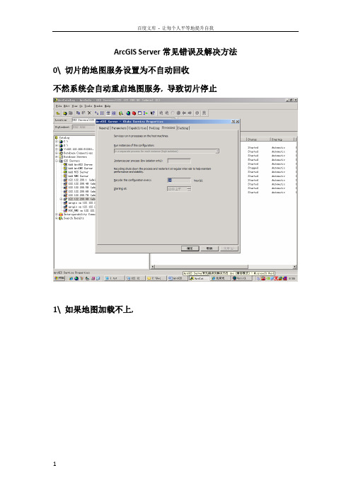
ArcGIS Server常见错误及解决方法0\ 切片的地图服务设置为不自动回收不然系统会自动重启地图服务, 导致切片停止1\ 如果地图加载不上,Rest地图服务查询, 是否已在目录中,如下图如果列表中不存在所发布的地图, 则进入清除缓存,如下图然后,再重新进入service管理中,检查可以export map看是否地图正常.第一部分:安装必须安装许可第二部分:使用改完密码必须重启,才起作用第三部分:维护Arcsde地图服务不能预览启动地图服务慢The coordinates or measures are out of bounds[INFO]13:49:21 加载的鹰眼为=====YYZT-zhongguoyingyan2011-5-10 13:49:24 com.esri.adf.web.data.WebContext addResource严重: Unable to initialize resource 'YYZT-zhongguoyingyan'. This resource will be removedcom.esri.adf.web.ags.ADFAGSException: Cannot create MapServer instance for server object 'YYZT-zhongguoyingyan' [hosts=[122.122.200.60]]at com.esri.adf.web.ags.data.AGSLocalConnection.activateResource(Unknown Source)at com.esri.adf.web.ags.data.AGSLocalConnection.initResource(Unknown Sou rce)at com.esri.adf.web.ags.data.AGSLocalMapResource.init(Unknown Source)at com.esri.adf.web.data.WebContext.addResource(Unknown Source)at com.gs.gis.MapResourceControl.addMapResource(MapResourceControl.java: 368)at com.gs.gis.MapResourceControl.mapResourceControl(MapResourceControl.j ava:230)at com.gs.gis.MapResourceControl.changRoleMapResource(MapResourceControl .java:164)at org.apache.jsp.map_jsp._jspService(map_jsp.java:788)at org.apache.jasper.runtime.HttpJspBase.service(HttpJspBase.java:98)at javax.servlet.http.HttpServlet.service(HttpServlet.java:803)at org.apache.jasper.servlet.JspServletWrapper.service(JspServletWrapper.java:331)at org.apache.jasper.servlet.JspServlet.serviceJspFile(JspServlet.java:329)at org.apache.jasper.servlet.JspServlet.service(JspServlet.java:265)at javax.servlet.http.HttpServlet.service(HttpServlet.java:803)at org.apache.catalina.core.ApplicationFilterChain.internalDoFilter(Appl icationFilterChain.java:269)at org.apache.catalina.core.ApplicationFilterChain.doFilter(ApplicationF ilterChain.java:188)at org.apache.catalina.core.ApplicationDispatcher.invoke(ApplicationDisp atcher.java:691)at org.apache.catalina.core.ApplicationDispatcher.processRequest(Applica tionDispatcher.java:469)at org.apache.catalina.core.ApplicationDispatcher.doForward(ApplicationD ispatcher.java:403)at org.apache.catalina.core.ApplicationDispatcher.forward(ApplicationDis patcher.java:301)at com.sun.faces.context.ExternalContextImpl.dispatch(ExternalContextImp l.java:322)at com.sun.faces.application.ViewHandlerImpl.renderView(ViewHandlerImpl. java:130)Arcgis rest 启动不起来用户名arcgismanager arcgis.manager查看arcgis 中tomcat日志,发现如下情况, 后经查实, arcgismanager密码不正确导致Starting tomcat thread2011-7-29 13:19:46 org.apache.coyote.http11.Http11Protocol init信息: Initializing Coyote HTTP/1.1 on http-83992011-7-29 13:19:48 org.apache.coyote.http11.Http11Protocol init信息: Initializing Coyote HTTP/1.1 on http-83432011-7-29 13:19:48 org.apache.catalina.startup.Catalina load信息: Initialization processed in 2687 ms2011-7-29 13:19:48 org.apache.catalina.core.StandardService start信息: Starting service Catalina2011-7-29 13:19:48 org.apache.catalina.core.StandardEngine start信息: Starting Servlet Engine: Apache Tomcat/5.5.92011-7-29 13:19:49 com.esri.internal.tomcat.realm.ArcGISCustomRealm start信息: Exception opening database connectionjava.sql.SQLException: 由于找不到数据库arcgissecuritystore,已拒绝连接。
ArcGIS server 开发过程中的问题记录

编号标题问题描述问题原因解决方法1 模型脚本Python文件无法双击运行模型脚步vbs,js都能直接双击文件运行。
但是py文件不行,没有解析器因vbs,js是基于microsoft自带的microsoftwindows based scripthost程序文件wscript.exe或cscript.exe解析运行的,其目录位于C:\WINDOWS\system32下,而py没有解析器Python安装包只是一个编辑工具,可以使用该工具编写成一个exe文件运行脚本,或者导入到Toolbox中使用2 ArcMap中createreport无法显示结果report viewer中不能显示report的结果,出现灰色的,没东西和默认打印驱动冲突。
当默认打印机是MicrosoftOffice Document ImageWriter时就会出现那现象把默认打印机改成其他打印机试试。
若只有这一个打印机,那就增加一个其他打印机并设为默认打印机。
3 ArcGIS Server安装完Manager无法登陆ArcGIS Server安装完Manager无法登陆安装时添加的用户未经过注销重登陆尚未生效注销重登陆4 打不开http://localhost/servletexec/admin打不开http://localhost/servletexec/admin因安装时自动停止IIS服务未重启安装完后重启IIS5 IMS安装检测不成功打开D:\ProgramFiles\ArcGIS\ArcIMS\Common\Diagnostics\index.html检测:Check ArcIMS Servlet Connector和Check ArcIMS ApplicationServer出现Checking ...pleasewaitIf this message appears longerthan 30 seconds, no message wasreturned.长时间等待未出现效果未启动IMSMonitor中所有监控的SDE服务启动IMSMonitor中所有监控的SDE服务,检测成功后出现IMS v9.3.0Build_Number=503.1916Version=9.3.0Test successful和Version=9.3.0Build_Number=503.2159Test successful信息6 Administrator当输入用户名、密码后,程序就死在ARCIMSInitializing siteAdministrator当输入用户名、密码后,程序就死在ARCIMSInitializing site用户名为Domain\Username的格式,因用户名只使用Username用户名使用Domain\Username。
ArcgisServer发布服务时错误

ARCGIS Server 发布服务时出现的问题解决前言:这类问题解决第一步,看出现问题时提示的错误提示,若没有错误提示,去server 的log中找到产生问题时的日志,看里面这类问题产生的原因。
一、Access to output directory is denied(原创)一、问题Access to output directory is denied二、问题描述无法启动服务,Access to output directory is denied三、问题原因当前用户、SOM、SOC用户没有写权限四、解决方法赋予对这些用户对临时文件的写权限二、Probable cause: The network path is inaccessible to ArcGIS Server Object Container account.问题描述arcgisserver发布服务时无法启动服务,没有任何外在的错误提示问题原因某些指定路径不存在解决方法找到arcgisserver发布服务需要对应的文件夹,若没有,则按照指定路径创建,详情可参考第三条。
三、ArcGIS常见问题解决之Server Object instance creation failed on machine xxx1.1 问题症状在客户现场进行开发测试的时候发现,无法在ArcGIS Server上发布新的地图服务,但是可以发布影像服务、GP服务,已经发布的地图服务都可以运行。
发布服务时具体的错误信息是:Server Object instance creation failed on machine xxx。
1.2 日志信息查看日志信息,记录如下:<Msg time='2011-11-15T13:25:48' type='INFO1' code='3007' target='Server' thread='25292'>Attempt to start configuration nmdis/topic_binhaishidi of type MapServer.</Msg><Msg time='2011-11-15T13:25:49' type='INFO3' code='4000' target='CFH.ConfigurationFactoryHost' thread='24072'>Container 5296 is successfully created on machine IBM3850X5.</Msg><Msg time='2011-11-15T13:25:49' type='INFO3' code='4001' target='CFH.ConfigurationFactoryHost' thread='24072'>Thread 18088 is successfully created on container 5296 of machine IBM3850X5.</Msg><Msg time='2011-11-15T13:25:49' type='INFO3' code='4004'target='CFH.ConfigurationFactoryHost' machine='IBM3850X5' thread='24072' elapsed='0.31200'>Server Object instance is successfully created on machine IBM3850X5.</Msg> <Msg time='2011-11-15T13:25:49' type='INFO3' code='4006' target='CFH.ConfigurationFactoryHost' machine='IBM3850X5' thread='24072' elapsed='0.32800'>Server Context created.</Msg><Msg time='2011-11-15T13:25:50' type='INFO3' code='4007' target='CFH.ConfigurationFactoryHost' machine='IBM3850X5' thread='24708' elapsed='0.99800'>Server Context released.</Msg><Msg time='2011-11-15T13:25:50' type='INFO3' code='4000' target='nmdis/topic_binhaishidi.MapServer' thread='22952'>Container 6732 is successfully created on machine IBM3850X5.</Msg><Msg time='2011-11-15T13:25:50' type='INFO3' code='4001' target='nmdis/topic_binhaishidi.MapServer' thread='22952'>Thread 17336 is successfully created on container 6732 of machine IBM3850X5.</Msg><Msg time='2011-11-15T13:25:52' type='INFO3' code='10092' target='nmdis/topic_binhaishidi.MapServer' methodName='MapServer.MapReader.Open' machine='IBM3850X5' process='6732' thread='17336'>MapReader.Open has started.</Msg><Msg time='2011-11-15T13:25:53' type='INFO3' code='10093' target='nmdis/topic_binhaishidi.MapServer' methodName='MapServer.MapReader.Open' machine='IBM3850X5' process='6732' thread='17336' elapsed='0.73728'>MapReader.Open has completed.</Msg><Msg time='2011-11-15T13:25:53' type='ERROR' code='1016' target='nmdis/topic_binhaishidi.MapServer' machine='IBM3850X5' thread='22952' elapsed='3.05800'>Server Object instance creation failed on machine IBM3850X5. </Msg><Msg time='2011-11-15T13:25:53' type='INFO3' code='4002' target='nmdis/topic_binhaishidi.MapServer' thread='22952'>Container 6732 of machine IBM3850X5 is removed.</Msg><Msg time='2011-11-15T13:25:53' type='INFO3' code='4003' target='nmdis/topic_binhaishidi.MapServer' thread='22952'>Thread 17336 removed from process 6732 of machine IBM3850X5.</Msg><Msg time='2011-11-15T13:25:53' type='ERROR' code='1008' target='nmdis/topic_binhaishidi.MapServer' thread='25292'>Configuration nmdis/topic_binhaishidi.MapServer can not be started.</Msg><Msg time='2011-11-15T13:25:53' type='INFO3' code='4006' target='CFH.ConfigurationFactoryHost' machine='IBM3850X5' thread='22812' elapsed='0.00000'>Server Context created.</Msg><Msg time='2011-11-15T13:25:53' type='INFO3' code='4007' target='CFH.ConfigurationFactoryHost' machine='IBM3850X5' thread='24536' elapsed='0.01600'>Server Context released.</Msg><Msg time='2011-11-15T13:26:23' type='INFO1' code='2033' target='CFH.ConfigurationFactoryHost' thread='25236'>The Server Object instance is shutting down because the Idle Timeout Interval has elapsed</Msg><Msg time='2011-11-15T13:26:23' type='INFO3' code='4002' target='CFH.ConfigurationFactoryHost' thread='25236'>Container 5296 of machine IBM3850X5 isremoved.</Msg><Msg time='2011-11-15T13:26:23' type='INFO3' code='4003' target='CFH.ConfigurationFactoryHost' thread='25236'>Thread 18088 removed from process 5296 of machine IBM3850X5.</Msg>2 问题分析2.1 软件环境环境如下:Windows Server 2008 R2操作系统(自带IIS 7.5),ArcGIS Server 10.0 .NET版本。
ArcGIS安装问题集锦
ArcGIS 安装问题集锦ArcGIS 安装问题集锦1. 软件安装软件下载、安装问题⾃⾏解决,否则就不要使⽤。
2. 常见问题1 2.1 许可管理器版本不正确2013年3⽉19⽇问题⼀:ArcGIS10安装后,更改许可管理器时,通常,在ArcGIS Administrator 中设置选ArrcInfo (浮动使⽤),设置主机为localhost 或主机名。
但有时会提⽰:运⾏的许可管理器版本不正确,请连接运⾏版本11的许可管理器。
如图:解决⽅法:因为是破解⽂件中ARCGIS.EXE 版本不正确,所以,可以找ArcGIS93中的ARCGIS.EXE 来替换许可路径中的ARCGIS.EXE 。
2 2.2 更改许可管理器名称⽆效问题⼆:ArcGIS10安装后,更改许可管理器时, 提⽰:“localhost”是⽆效的主机名,请输⼊⼀个有效的主名解决⽅法:直接修改注册表, 开始菜单-->运⾏-->regedit 打开注册表-->找到[HKEY_LOCAL_MACHINE\SOFTWARE\ESRI\License]这⼀项,找到 "LICENSE_SERVER",将其值改为localhost3 2.3 始终不能can be checked out2013年3⽉22⽇问题:按照破解流程,可⽆论如何得不到 “ This license canbe checked out”的字样。
解决⽅法:可以问题不在于你操作是否正确,⽽是在正确的操作下,机⼦没有正确领会,所以,重启是关键,我居然忽略了这⼀点,多花了⼀个多⼩时!!4 2.4 重启后不能连接到许可证服务2013年3⽉28⽇问题描述:当你每次重启电脑,打开ArcMap 出现如下提⽰:不能连接到许可证服务,证书服务管理器还没有启动。
如下图:解决⽅案:开始-ArcGIS-License Manager-License Manager Tools-Config Services 进⾏如图设置(若不存在些路径,请打开X:\Program Files\ESRI\License\arcgis9x\lmtools,10.0版本路径也类似,我以9.3版本为例,X 为证书的安装路径)5 2.5 完全卸载ArcMap 的⽅法2013年4⽉13⽇(补充)ArcGIS 完全卸载的⽅法:声明:ArcGIS 各种版本不能共时安装,除⾮使⽤虚拟机。
arcgis 安装错误的解决方法
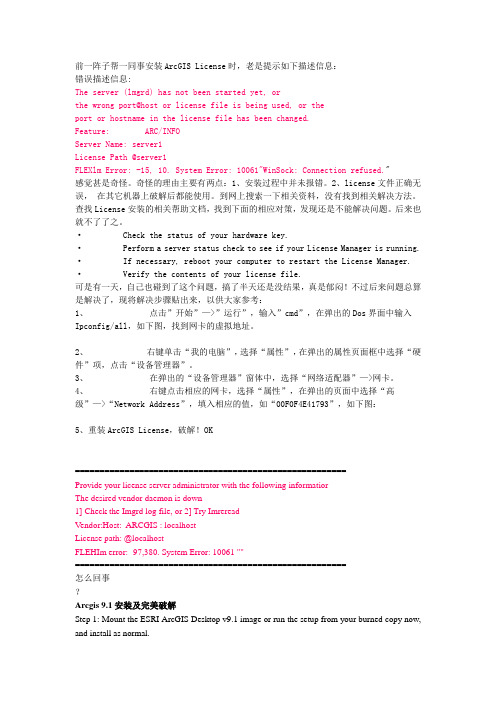
前一阵子帮一同事安装ArcGIS License时,老是提示如下描述信息:错误描述信息:The server (lmgrd) has not been started yet, orthe wrong port@host or license file is being used, or theport or hostname in the license file has been changed.Feature: ARC/INFOServer Name: server1License Path @server1FLEXlm Error: -15, 10. System Error: 10061"WinSock: Connection refused."感觉甚是奇怪。
奇怪的理由主要有两点:1、安装过程中并未报错。
2、license文件正确无误,在其它机器上破解后都能使用。
到网上搜索一下相关资料,没有找到相关解决方法。
查找License安装的相关帮助文档,找到下面的相应对策,发现还是不能解决问题。
后来也就不了了之。
· Check the status of your hardware key.· Perform a server status check to see if your License Manager is running.· If necessary, reboot your computer to restart the License Manager.· Verify the contents of your license file.可是有一天,自己也碰到了这个问题,搞了半天还是没结果,真是郁闷!不过后来问题总算是解决了,现将解决步骤贴出来,以供大家参考:1、点击”开始”—>”运行”,输入”cmd”,在弹出的Dos界面中输入Ipconfig/all,如下图,找到网卡的虚拟地址。
ArcGIS Server解决方案

ArcGIS Server 是一个基于Web 的企业级GIS 解决方案,它从ArcGIS 9.0 版本开始加入ESRI 产品家族。
ArcGIS Server 为创建和管理基于服务器的GIS 应用提供了一个高效的框架平台。
它充分利用了ArcGIS 的核心组件库ArcObjects ,并且基于工业标准提供WebGIS 服务。
ArcGIS Server 将两项功能强大的技术--GIS 和网络技术(Web )结合在一起,GIS 擅长与空间相关的分析和处理,网络技术则提供全球互联,促进信息共享。
这两项技术协同工作,相得益彰。
ArcGIS Server为我们带来了许多可喜的变化。
与过去的WebGIS产品相比,它不仅具备发布地图服务的功能,而且还能提供灵活的编辑和强大的分析能力,这对于WebGIS发展可以说是具备里程碑意义的。
由于ArcGIS Server基于强大的核心组件库ArcObjects搭建,并且以主流的网络技术作为其通信手段,所以它具有许多令人欣慰的优势和特点,列举一二如下:2 集中式管理带来成本的降低。
无论是从数据的维护和管理上还是从系统升级上来说,都只需要在服务器端进行集中的处理,而无需在每一个终端用户上做大量的维护工作,这不但极大的节约投入的时间成本和人力资源,而且有利于提高数据的一致性。
2 瘦客户端也可以享受到高级的GIS 服务。
过去只能在庞大的桌面软件上才能实现的高级GIS 功能的时代终止于ArcGIS Server 。
通过ArcGIS Server 搭建的企业GIS 服务使得客户端通过网络浏览器(IE ,Netscapes )即可实现高级的GIS 功能。
2 使WebGIS 具备了灵活的数据编辑和高级的GIS 分析能力。
用户在野外作业时可以通过移动设备直接对服务器端的数据库进行维护和更新,大大减少了回到室内后的重复工作量,为野外调绘和勘察提供了极大的便利。
另外,ArcGIS Server 可以实现网络分析和3D 分析等高级的空间分析功能。
arcgis 常见问题及解决方法

15.ORA-01653: unable to extend table STEVEN3.FOXT_
RESULT by 8192 in tablespace USERS
无法扩展空间
3.关于cataloDeskTop的版本是不是ArcInfo
(好像是破解的问题,安装破解文件一定要顺序,LMSetup,desktop)
4.catalog连接sde出现sde not running的问题
sde没启动
5.修改[安装目录]\arcgis\java\manager\service\tomcat\managerappserver\conf下Server.xml文件中
Cause: Failed to find sufficient contiguous space to allocate INITIAL extent for segment being created.
Action: Use ALTER TABLESPACE ADD DATAFILE to add additional space to the tablespace or retry with a smaller value for INITIAL.
Server Object instance creation failed on machine x3650.
Can't load format DLL
报错情况:这个问题出现在发布的MapService做Caching了,在删除该MapService以后,
无法用相同名字的再次发布服务。
解决方案:mxd文件设置了full extent导致的
【优质】ArcgisServer发布服务时错误
2.1软件环境
环境如下:Windows Server 2008 R2操作系统(自带IIS 7.5),ArcGIS Server 10.0 .NET版本。
2.2原因猜测
根据以往经验,猜测可能有以下原因。
2.2.1许可过期
这个原因最先被排除,因为客户已经购买了永久的正式许可。况且,影像服务和GP服务都可以发布。
1.1问题症状
在客户现场进行开发测试的时候发现,无法在ArcGIS Server上发布新的地图服务,但是可以发布影像服务、GP服务,已经发布的地图服务都可以运行。发布服务时具体的错误信息是:Server Object instance creation failed on machine xxx。
1.2日志信息
<Msg time='2011-11-15T13:25:50' type='INFO3' code='4001' target='nmdis/topic_binhaishidi.MapServer' thread='22952'>Thread 17336 is successfully created on container 6732 of machine IBM3850X5.</Msg>
<Msg time='2011-11-15T13:25:49' type='INFO3' code='4001' target='CFH.ConfigurationFactoryHost' thread='24072'>Thread 18088 is successfully created on container 5296 of machine IBM3850X5.</Msg>
arcgis server 9.3 总结
最近项目告一段落了。
项目采用的是ArcGIS Server 9.3 平台来作开发,AGS 9.3 版本比以前增加了很多有用方便的特性,但是网上的相关资料好像特别的少。
所以我把我遇到的问题整理出来,以备参考。
1. 数据导入ArcGIS Server 要用Oracle 作数据库的话必须要用到ArcSDE。
如果将shp 文件用ArcCatalog 中的Import -> Feature Class 的功能导入的话,上传到数据库中的数据不能在原有数据的范围外加入新图元。
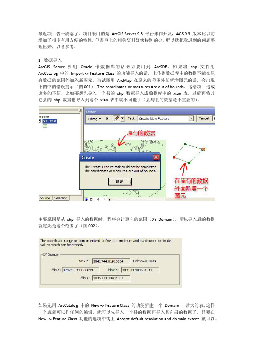
当试图用ArcMap 在原来的范围外部新增图元的话,会出现下图中的错误提示(图001):The coordinates or measures are out of bounds。
这给项目造成诸多的不便,比如要想先导入一个县的shp 数据导入成数据库中的xian 表,过后再将其它县的shp 数据也导入到这个xian 表中就不可能了(县与县的数据是不重叠的)。
主要原因是从shp 导入的数据时,程序会计算它的范围(XY Domain),所以导入后的数据就定死是这个范围了(图002)。
如果先用ArcCatalog 中的New -> Feature Class 的功能新建一个Domain 非常大的表,这样一个表就可以作任何的编辑,就可以先导入一个县的数据再导入其它县的数据了。
只要在New -> Feature Class 功能的选项中钩上Accept default resolution and domain extent 就可以。
同时还可以在建立属性表结构时,使用Import 的功能将原有的shp 文件中的属性表结构方便的导入进来。
2. ArcSDE 的数据版本化(Versioned)和历史归档(Achiving)在ArcSDE 中的数据只有Versioned 的才能被编辑,可以用ArcCatalog 中的Registed As Versioned 功能来使某个表变成Versioned 状态。
ArcGIS常见问题解决之 Server Object instance creation failed on machinexxx

ArcGIS常见问题解决之Server Object instance creation failed on machine xxxEsri中国(北京)有限公司2011年11月文档版本信息目录1 问题描述 (1)1.1问题症状 (1)1.2日志信息 (1)2 问题分析 (3)2.1软件环境 (3)2.2原因猜测 (3)2.2.1 许可过期 (3)2.2.2 内存不足 (3)2.2.3 安全限制 (3)2.2.4 数据错误 (3)3 问题解决 (4)3.1问题定位 (4)3.2更改目录 (5)4 小结 (7)1 问题描述1.1问题症状在客户现场进行开发测试的时候发现,无法在ArcGIS Server上发布新的地图服务,但是可以发布影像服务、GP服务,已经发布的地图服务都可以运行。
发布服务时具体的错误信息是:Server Object instance creation failed on machine xxx。
1.2日志信息查看日志信息,记录如下:<Msg time='2011-11-15T13:25:48' type='INFO1' code='3007' target='Server' thread='25292'>Attempt to start configuration nmdis/topic_binhaishidi of type MapServer.</Msg><Msg time='2011-11-15T13:25:49' type='INFO3' code='4000' target='CFH.ConfigurationFactoryHost' thread='24072'>Container 5296 is successfully created on machine IBM3850X5.</Msg> <Msg time='2011-11-15T13:25:49' type='INFO3' code='4001' target='CFH.ConfigurationFactoryHost' thread='24072'>Thread 18088 is successfully created on container 5296 of machine IBM3850X5.</Msg><Msg time='2011-11-15T13:25:49' type='INFO3' code='4004' target='CFH.ConfigurationFactoryHost' machine='IBM3850X5' thread='24072' elapsed='0.31200'>Server Object instance is successfully created on machine IBM3850X5.</Msg><Msg time='2011-11-15T13:25:49' type='INFO3' code='4006' target='CFH.ConfigurationFactoryHost' machine='IBM3850X5' thread='24072' elapsed='0.32800'>Server Context created.</Msg> <Msg time='2011-11-15T13:25:50' type='INFO3' code='4007' target='CFH.ConfigurationFactoryHost' machine='IBM3850X5' thread='24708' elapsed='0.99800'>Server Context released.</Msg> <Msg time='2011-11-15T13:25:50' type='INFO3' code='4000' target='nmdis/topic_binhaishidi.MapServer' thread='22952'>Container 6732 is successfully created on machine IBM3850X5.</Msg><Msg time='2011-11-15T13:25:50' type='INFO3' code='4001' target='nmdis/topic_binhaishidi.MapServer' thread='22952'>Thread 17336 is successfully created on container 6732 of machine IBM3850X5.</Msg><Msg time='2011-11-15T13:25:52' type='INFO3' code='10092' target='nmdis/topic_binhaishidi.MapServer' methodName='MapServer.MapReader.Open' machine='IBM3850X5' process='6732' thread='17336'>MapReader.Open has started.</Msg> <Msg time='2011-11-15T13:25:53' type='INFO3' code='10093' target='nmdis/topic_binhaishidi.MapServer' methodName='MapServer.MapReader.Open' machine='IBM3850X5' process='6732' thread='17336' elapsed='0.73728'>MapReader.Open has completed.</Msg><Msg time='2011-11-15T13:25:53' type='ERROR' code='1016' target='nmdis/topic_binhaishidi.MapServer' machine='IBM3850X5' thread='22952' elapsed='3.05800'>Server Object instance creation failed on machine IBM3850X5.</Msg> <Msg time='2011-11-15T13:25:53' type='INFO3' code='4002' target='nmdis/topic_binhaishidi.MapServer' thread='22952'>Container 6732 of machine IBM3850X5 is removed.</Msg><Msg time='2011-11-15T13:25:53' type='INFO3' code='4003' target='nmdis/topic_binhaishidi.MapServer' thread='22952'>Thread 17336 removed from process 6732 of machine IBM3850X5.</Msg><Msg time='2011-11-15T13:25:53' type='ERROR' code='1008' target='nmdis/topic_binhaishidi.MapServer' thread='25292'>Configuration nmdis/topic_binhaishidi.MapServer can not be started.</Msg><Msg time='2011-11-15T13:25:53' type='INFO3' code='4006' target='CFH.ConfigurationFactoryHost' machine='IBM3850X5' thread='22812' elapsed='0.00000'>Server Context created.</Msg> <Msg time='2011-11-15T13:25:53' type='INFO3' code='4007' target='CFH.ConfigurationFactoryHost' machine='IBM3850X5' thread='24536' elapsed='0.01600'>Server Context released.</Msg> <Msg time='2011-11-15T13:26:23' type='INFO1' code='2033' target='CFH.ConfigurationFactoryHost' thread='25236'>The Server Object instance is shutting down because the Idle Timeout Interval has elapsed</Msg><Msg time='2011-11-15T13:26:23' type='INFO3' code='4002' target='CFH.ConfigurationFactoryHost' thread='25236'>Container 5296 of machine IBM3850X5 is removed.</Msg><Msg time='2011-11-15T13:26:23' type='INFO3' code='4003' target='CFH.ConfigurationFactoryHost'thread='25236'>Thread 18088 removed from process 5296 of machine IBM3850X5.</Msg>2 问题分析2.1软件环境环境如下:Windows Server 2008 R2操作系统(自带IIS 7.5),ArcGIS Server 10.0 .NET 版本。
Server.CreateObject的调用失败拒绝对此对象的访问的解决方法
Server.CreateObject的调⽤失败拒绝对此对象的访问的解决⽅法今天把⼀个⽹站的数据从win2000服务器转移到了win2003服务器上,然后调试,发现在⽤aspjpeg组件上传图⽚的时候,提⽰出错:其实很多时候是因为你安装的插件权限设置不当造成的。
应该坚持你最近安装了什么组件。
最终找到了解决“检查权限时,对Server.CreateObject的调⽤失败,拒绝对此对象的访问”的⽅法:windows server 2003默认的安全级别太⾼了,找到你组件所在的安装⽬录,右键/属性/安全,添加everyone(我⽤的是IUSR_WD)的可执⾏权限,再上传试试看,是不是ok了?我⽤到aspjpeg和aspupload两个组件,所以这2个安装⽬录都给予IUSR_WD可执⾏权限。
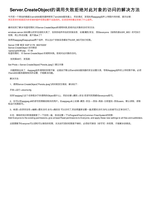
Server 对象错误 'ASP 0178 : 80070005'Server.CreateObject 访问错误/upzip/up023ff.asp,⾏ 49检查权限时,对 Server.CreateObject 的调⽤失败。
拒绝对此对象的访问。
找到第49⾏,发现是:Set Photo = Server.CreateObject("Persits.Jpeg") '建⽴对象问题原因出来了,Aspjpeg组件调⽤的权限不够,这是由于默认的win2003服务器的安全设置太⾼,导致Aspjpeg组件的上传权限不够。
必须对win2003服务器做相关的设置,才能解决问题。
解决⽅法:1、调⽤Server.CreateObject("Persits.Jpeg")的时候发⽣错误,解决如下:开始->运⾏->dcomcnfg找到"aspjpeg"(这个名称取决于你调⽤的Object是什么),然后右键->属性->安全把读写权限都给everyone即可。
arcgis server编程 -回复
arcgis server编程-回复ArcGIS Server 编程ArcGIS Server 是一个由Esri 开发的地理信息系统(GIS)软件套件,它提供了强大的功能,可以帮助用户在云端或企业服务器上构建和发布地理信息服务。
在本文中,我们将一步一步地回答关于ArcGIS Server 编程的问题,帮助读者了解如何开发和使用该平台来构建和管理GIS 应用程序。
1. 什么是ArcGIS Server?ArcGIS Server 是Esri 公司开发的GIS 服务器平台,它使用户能够在云端或企业服务器上构建、发布和管理地理信息服务。
该平台提供了一系列工具和API,支持开发者构建和部署各种类型的GIS 应用程序,包括地图服务、地理处理工具和空间分析工具等。
2. ArcGIS Server 的核心组件有哪些?ArcGIS Server 的核心组件包括:- ArcGIS Server: 用于部署和管理地理信息服务的服务器软件。
- ArcGIS Services: 可以发布的地理信息服务,包括地图服务、地理处理服务和空间分析服务等。
- ArcGIS API for JavaScript: 用于开发基于Web 的GIS 应用程序的JavaScript API。
- ArcGIS Runtime SDK: 用于开发本地和移动平台的GIS 应用程序的软件开发工具包(SDK)。
- ArcGIS Web AppBuilder: 可视化的工具,用于构建和发布基于Web 的GIS 应用程序。
- ArcGIS Online: Esri 提供的基于云的GIS 平台,可以与ArcGIS Server 集成。
3. 如何开发ArcGIS Server 应用程序?开发ArcGIS Server 应用程序通常涉及以下几个步骤:步骤1: 获取ArcGIS Server 许可证在开始之前,您需要获得一个有效的ArcGIS Server 许可证。
GISServer常见问题
1 用户名问题在GIS Server PostInstall过程中会涉及到两个用户,默认情况下一个ArcGISSOM,一个是ArcGISSOC,如果用户按照默认情况下进行的话,系统就会给你创建这两个用户,而一般情况下,用户都以自己常见的身份登陆,而不会使用ArcGISSOM用户登录,所以会给后续的很多操作带来麻烦。
所以在GIS Server Post Install过程中,建议使用自己常见的用户来进行。
2 Post Install问题ArcGIS Server中有两个postinstall,一个是GIS Server PostInstall, 一个是Web Application PostInstall. GIS Server PostInstall因为在安装过程中自动弹出,所以一般都会做,不会忘记。
而Web Application PostInstall是需要自己主动去做的,所以很多人都会忘记做这个。
而Web Application PostInstall没有做的后果就是以internet方式连接arcgis server的服务都会连接不上。
3 Manager登录不进去问题这个问题最主要是权限的问题,看登陆的用户是否属于agsadmin,最好能再加入到administrators组中,还有就是在登陆时不要忘记在登陆名前加入域名或机器名。
4、GraphicsLayer中的Graphics支持栅格图片吗不支持5、MapResourceManager控件中添加了两个服务,为什么只能看到一个?原因可能有两个,一个是两个服务坐标不匹配,另外一个是上面一个服务没有设置为背景透明。
6、到底能不能使用new关键字来创建对象?这是我们在开发ArcGIS Server过程中经常遇到的,也是我们一直在强调的,从9.0,9.1开始就一直强调,不过9.2的情况和9.2以前的版本还有所不同,因为9.2版本中ADF级别多了很多类,这些类是可以使用new关键字来创建的,但是涉及到服务端的com组件的时候还是不能使用new关键字,都需要使用ServerContext的createobject来实现。
ArcGIS_Server常见问题

窗体顶端烟酒人生一杯酒,一支烟;烟雾缭绕中,干尽杯中酒体味那生活的云雾缭绕,酒色人生ArcGIS Server常见问题(转)/senbar/archive/2006/08/29/1136444.aspx摘自ESRI网站,有些内容是有限制的,要会员才能看到。
目前关于ArcGIS Server开发的资料非常少,就这么一点文档,还要限制,不能让大家共享,实在是罪过。
现在我贴出来,希望这些资料对一起学习AGS的朋友有所帮助。
错误描述在ArcCatalog中,当成功的创建了server object之后,server object不能被预览。
ArcCatalog显示下面的错误信息:“你的选择不能在当前视图中显示.”导致原因server属性中被指定的输出值和http位置可能不正确。
解决办法所有的创建的ArcGIS Server Objects需要被停止。
1 在ArcCatalog中,右击已经添加的ArcGIS Server,并选择Server属性。
2 在目录页中,选中已经添加的输出目录并点击编辑。
3 输出目录字段应该指向一个有效的目录,比如C:\ArcGIS\Output。
如果一个虚拟目录已经被指定,确认它是有效的,并且看上去和下面的格式一样,http://<servername>/output4 如果有错请更改,然后重新创建server object来确认更改是否有效。
错误描述当在Visual 2003上使用ArcGIS Server .NET 的ADF模板创建一个项目时,返回如下错误信息:“在服务器<主机名>上的Web站点不可用(Web Site on server <host> is not available)”导致原因该模板包含了调用'http://localhost'这一URL的属性。
如果在IIS中禁用了本地主机的服务,则显示该错误信息。
禁用本地服务可能是因为你的Web站点已经为其指定了一个IP地址或者是因为安全方面的考虑。
ArcGISPro三维场景缓存发布常见问题解决办法
ArcGISPro三维场景缓存发布常见问题解决办法ArcGIS Pro三维场景缓存发布常见问题解决办法1、当我试图从 ArcGIS Pro 发布⼀个场景图层时,发布成功,但未能创建场景缓存,同时我收到以下消息:错误001784:⽆法连接到场景缓存使⽤的数据库(未经授权)。
执⾏(管理场景缓存)失败。
场景图层在ArcGIS Data Store 的缓存数据库中缓存数据。
ArcGIS Server 场景缓存⼯具通过 HTTP 与此数据库进⾏通信,并使⽤ cookie 进⾏⾝份验证。
ArcGIS Server Windows 计算机上设置的 cookie 策略可能会阻⽌ cookie。
在某些情况下,这是Windows 操作系统的默认设置。
场景缓存⼯具⾸先使⽤ Internet URL 连接到场景缓存数据库。
这种情况使⽤Internet 策略。
如果 Internet 连接失败,⼯具将尝试使⽤ Intranet URL 进⾏连接,此种情况适⽤ Intranet 策略。
要验证访问场景缓存数据库时⼯具所使⽤的 URL 是否设置正确,请确认ArcGIS Data Store 主机名称正确,然后更新 ArcGIS Server 计算机上的 cookie 策略。
1.打开 Web 浏览器并登录到您的 ArcGIS Server 站点的管理员⽬录。
使⽤ ArcGISServer 管理员凭据登录。
2.转到data > items > nosqlDatabases > /nosqlDatabases/AGSDataStore_nosqldb_<数据库名称> > REST。
3.记下 hostname 和 unqHostname 属性。
它们是场景缓存数据库的完全限定域名和⾮限定域名。
稍后更新 cookie 策略时将⽤到这两个属性。
4.使⽤ ArcGIS Server 帐户登录到每个 ArcGIS Server 计算机。
- 1、下载文档前请自行甄别文档内容的完整性,平台不提供额外的编辑、内容补充、找答案等附加服务。
- 2、"仅部分预览"的文档,不可在线预览部分如存在完整性等问题,可反馈申请退款(可完整预览的文档不适用该条件!)。
- 3、如文档侵犯您的权益,请联系客服反馈,我们会尽快为您处理(人工客服工作时间:9:00-18:30)。
time='2011-11-15T13:25:52'
type='INFO3'
code='10092'
target='nmdis/topic_binhaishidi.MapServer'
methodName='MapServer.MapReader.Open'
machine='IBM3850X5' process='6732' thread='17336'>MapReader.Open has started.</Msg> <Msg time='2011-11-15T13:25:53' type='INFO3' code='10093'
target='nmdis/topic_binhaishidi.MapServer' thread='22952'>Thread 17336 is successfully created on container 6732 of machine IBM3850X5.</Msg>
1
<Msg
target='nmdis/topic_binhaishidi.MapServer' machine='IBM3850X5' completed.</Msg> <Msg time='2011-11-15T13:25:53' process='6732' thread='17336'
methodName='MapServer.MapReader.Open' elapsed='0.73728'>MapReader.Open has
target='nmdis/topic_binhaishidi.MapServer' thread='22952'>Container 6732 is successfully created on machine IBM3850X5.</Msg> <Msg time='2011-11-15T13:25:50' type='INFO3' code='4001'
type='ERROR' machine='IBM3850X5'
code='1016' thread='22952' </Msg> code='4002'
target='nmdis/topic_binhaishidi.MapServer'
elapsed='3.05800'>Server Object instance creation failed on machine IBM3850X5. <Msg time='2011-11-15T13:25:53' type='INFO3'
Esri 中国(北京)有限公司 2011 年 V1.0 日期 2011-11-19 创建 修改说明 作者 黄东 审批/日期
目 录
1 问题描述 .................................................................................................................................1 1.1 问题症状 ...................................................................................................................................... 1 1.2 日志信息 ...................................................................................................................................... 1 2 问题分析 .................................................................................................................................3 2.1 软件环境 ...................................................................................................................................... 3 2.2 原因猜测 ...................................................................................................................................... 3 2.2.1 许可过期 .............................................................................................................................. 3 2.2.2 内存不足 .............................................................................................................................. 3 2.2.3 安全限制 .............................................................................................................................. 3 2.2.4 数据错误 .............................................................................................................................. 3 3 问题解决 .................................................................................................................................4 3.1 问题定位 ...................................................................................................................................... 4 3.2 更改目录 ...................................................................................................................................... 5 4 小结.........................................................................................................................................7
1.2 日志信息
查看日志信息,记录如下:
<Msg time='2011-11-15T13:25:48' type='INFO1' code='3007' target='Server' thread='25292'>Attempt to start configuration nmdis/topic_binhaishidi of type MapServer.</Msg> <Msg time='2011-11-15T13:25:49' type='INFO3' code='4000' target='CFH.ConfigurationFactoryHost' t
target='nmdis/topic_binhaishidi.MapServer' thread='22952'>Thread 17336 removed from process 6732 of machine IBM3850X5.</Msg> <Msg time='2011-11-15T13:25:53' type='ERROR' code='1008'
target='nmdis/topic_binhaishidi.MapServer' thread='22952'>Container 6732 of machine IBM3850X5 is removed.</Msg> <Msg time='2011-11-15T13:25:53' type='INFO3' code='4003'
