Geography America 美国地理
美国地理

Population
The most populous city in the United States Unique for the diversity of its population
Introduction to British and American Culture
New York City
around the Caribbean and Pacific.
At 3.79 million square miles (9.83 million km² and with over 300 million people, the ) United States is the third or fourth largest country by total area, and third largest by land area and by population. The United States is one of the world‘s most ethnically diverse nations, the product of large-scale immigration from many countries.
Introduction to British and American Culture
San Francisco
Chinatown
The oldest Chinatown in North America The largest Chinese community outside of Asia Popular culture venues(活动场所) such as film, music and photography The largest and most prominent center of Chinese activity outside of China
美国概况

美国概况I.简要介绍【General Introduction】一、地理位置【Location】美利坚合众国【The United State of America】,又叫美国【the States/the US/USA】或者山姆大叔【Uncle Sam】美国主要大陆面积地处北美洲中部,北部与加拿大接壤,南部与墨西哥接壤。
美国大陆东临大西洋【the Atlantic Ocean】,西面太平洋【the Pacific Ocean】,南部则是墨西哥湾【the Gulf of Mexico】。
二、美国国旗【American National Flag】美国国旗最初于1777年7月14日面世,国旗上有13条条纹,象征着美国最初的13个州,现在的美国国旗上有50颗星星,象征着现在美国的50个州,美国国旗总共有三种颜色:白色、红色、蓝色。
II.地理【Geography】美国的国土面积是930万平方公里,国土面积位居世界第四,位于俄罗斯、加拿大、中国之后。
美国是由50个州组成的联邦共和制国家。
美国最大的州是阿拉斯加【Alaska】,最小的州是罗德岛【Rhode Island】,美国大陆最大的州是德克萨斯州【Texas】,阿拉斯加和夏威夷于1959年成为美国第49和第50个州,是晚加入的两个州。
美国的大湖区与密西西比水系相连接,构成了世界上最大的内陆淡水水体,同时它也是世界上最大的水路运输通道。
一、地理区域【Geographical Regions】包括夏威夷在内,美国可分为八个自然区域【physical region】,分别是:1.新英格兰地区【New England】2.大西洋中部诸州【the Mid Atlantic States】3.中西部地区【the Midwest】4.南部地区【the South】5.大平原地区【the Great Plain】6.落基山脉和山间地区【the Rockies and Intermountain Region】/ 美国西部地区【the American West】7.太平洋沿岸地区【the Pacific Coast】8.新建州【the New States】1. 新英格兰【New England】新英格兰地区是由东北部的6个州组成的,分别是:缅因州【Maine(位于美国东北角的州)】、新罕布什尔州【New Hampshire】、佛蒙特州【Vermont】、马萨诸塞州【Massachusetts】、罗德岛州【Rhode Island】、康涅狄格州【Connecticut】。
初中地理美国课件

空气污染问题
空气质量恶化
美国部分地区的空气污染问题严重,导致空气质量恶化,对人类 健康和生态环境造成威胁。
污染源
空气污染的主要来源包括工业排放、汽车尾气、农业活动等,这些 排放的污染物对空气质量造成了严重影响。
治理措施
美国政府正在采取一系列措施,如制定严格的排放标准、推广清洁 能源等,以改善空气质量。
和影响。
美国旅游地理
总结词
美国旅游地理介绍了美国各地的旅游资 源和景点,包括自然景观和人文景观。
VS
详细描述
美国旅游地理涵盖了美国各地的旅游资源 和景点,包括国家公园、城市景观、历史 遗迹和博物馆等。学生将学习如何规划旅 游行程、了解各地景点的历史文化背景和 特色,以及如何保护和可持续发展旅游资 源。此外,学生还将了解旅游业对美国经 济的影响和作用。
美国的气候和自然资源
气候
大部分地区属于温带和亚热带气候,气候差异较大,东部沿海地区四季分明, 西部沿海地区则较为温和。
自然资源
拥有丰富的矿产资源,如煤、石油、天然气等,还有森林、水能等资源。
美国的人口和主要城市
人口
约3.3亿(截至2023年数据),是世 界上第三大人口国家。
主要城市
纽约、洛杉矶、芝加哥、休斯敦等, 其中纽约是全球金融中心之一,洛杉 矶则是好莱坞所在地。
初中地理美国课件
目录
• 美国地理概述 • 美国经济地理 • 美国人文地理 • 美国地理环境问题 • 美国地理教育
01 美国地理概述
美国地理位置和地理特征
地理位置
位于北美洲中部,东临大西洋, 西濒太平洋,北接加拿大,南至 墨西哥湾。
地理特征
地形多样,有五大湖、落基山脉 、大平原和中央大谷等,其中落 基山脉是北美大陆的脊梁。
Geography(美国地理)

Geography(美国地理)I. Location and Size1.What is the full name of the United States?United States of America. Often we call it the United States, the U.S., U.S.A., or America.2.What is the geographical location of the US?2.1 The continental United StatesThe continental United States lies in central North America with Canada to its north, Mexico and the Gulf of Mexico to its south, the Atlantic Ocean to its east and the Pacific Ocean to its west.2.2 The 2 newest states Alaska and Hawaii are separated from continental United States:Alaska borders on northwestern Canada, andHawaii lies in the central Pacific.3.What are the advantages of the location of the US?The US has an ideal location for its development.3.1 Its Atlantic coast faces the developed countries of Western Europe, and its Pacific coast and Hawaii give the nation an approach to the Far East and Australasia(澳大拉西亚,一般指澳大利亚、新西兰及附近南太平洋诸岛,有时也泛指大洋洲Oceania和太平洋岛屿)3.2 In the past the Atlantic and Pacific Oceans served as natural barriers between the US and the rest of the world. This allowed the US to grow and become strong with little outside interference. And today the development of means of communication and transportation makes the US well connected to the rest of the world.4.What is the size of the US?4.1 What is the size of the US?The US has a land area of 9.3 million square kilometers. It stretches 2,575 kilometres from north to south and 4,500 kilometres from east to west.4.2 How large is the US compared with the other countries?It is the 4th largest country in the world in size after Russia, Canada and China.4.3 How many states are there in the US?The US is a federal republic with many states. All together there are 50 states in the US.4.4 Which are the 2 newest states in US (the 49th and 50th states)?For a long time there were 48 states, then in 1959 Alaska and Hawaii became the 49th and 50th states.4.5 What do you know about the largest and smallest states in the US?Of all the states Alaska is the largest in area and Rhode Island the smallest.But on the mainland Texas is the largest state of the country. Texas alone is larger than France and Alaska is twice as big as Texas.II. Topography---The Face of the Land1.MountainsThere are 2 major mountains in the US: The Appalachian Mountains and the Rocky Mountains. 1.1The Appalachian Mountains1.1.1 The Appalachian Mountains run slightly from the northeast to southwest.1.1.2 The Appalachians are old (have been worn out over millions of years) and low (the highest peak is only a little over 2,000 metres).1.1.3 The Appalachians are noted for virgin forests and mines.1.1.4 The mountains served as a natural barrier for westward movement during the early settlement.1.2The Rocky Mountains1.2.1 The Rocky Mountains run slightly from the northwest to southeast.1.2.2 The Rockies are younger (are considered as young as China’s Himalayas) and high (with the higher peak Elbert of about 4,500 metres)1.2.3 The Rockies serves as the backbone of the North American continent and is known as the Continental Divide.1.2.4 The Mountains are famous for lots of natural national parks, such as the Yellow Stone Park.2.Rivers and Lakes2.1RiversThe rivers in the country are mainly lying between the Appalachian and Rocky Mountains.2.1.1The Mississippi2.1.1.1 The Mississippi is 3,782 kilometres long.2.1.1.2 The Mississippi and its tributaries drain one of the richest farm areas in the world.2.1.1.3 They form a 19,000-kilometre system of waterways and serve as important means of transportation.2.1.1.4 The Mississippi has been called “father of waters”and the “old man river”.2.1.2The Missouri2.1.2.1 The Missouri is over 6,000 kilometres and is one of the longest rivers in the world.2.1.2.2 It runs 3,725 kilometres before it joins the Mississippi.2.1.3The Ohio2.1.3.1 It is about 1,500 kilometres long.2.1.3.2 It has been called the American Ruhr (after the Ruhr River鲁尔河in Germany), famous for its rich valuable deposits.2.1.3.3 The area is well known for its steel industry.2.1.4 On the Pacific side there are 2 great rivers: the Colorado in the south, and the Columbia rises in Canada.2.1.5The Hudson2.2Lakes2.2.1 The most important lakes in the US are the Great Lakes, which include2.2.1.1 Lake Superior苏必利尔湖:the largest fresh water lake in the world.2.2.1.2 Lake Michigan密歇根湖:the only one entirely in the US2.2.1.3 Lake Huron休伦湖2.2.1.4 Lake Erie伊利湖2.2.1.5 Lake Ontario安大略湖They are all located between Canada and the US except Lake Michigan.2.2.2 What are the benefits of the lakes, rivers and seacoasts of the US?The Lakes and rivers form a complete system of waterways which provides cheap transportation for materials. Many swift rivers provide good sources of hydroelectric power. The long and irregular seacoasts provide many excellent harbours.III. Climate1.What is the general climatic feature of the US?1.1 The US is located in the middle latitudes north of the equator.1.2 Owing to its location in the northern temperate zone, generally speaking the large part of US enjoys continental climate.2. What are the different types of climate in the US?2.1 Why are the climate varied in the US?There are different types of climate in the US owing to its large size and varied landforms.2.2 What are the different types of climate in different regions?2.2.1 Continental climateA humid continental climate in the northeastern part of the country (New England).Summer is long and hot, while winter is cold. Plenty of rainfall and a long growing season.2.2.2 Humid subtropical climateIn the South-eastern United States you can find a humid subtropical climate. The summers are hot and winters mild.2.2.3 Humid continental and humid subtropical climateThis could be found in the central part of the US. You can also find the continental steppe climate of the Great Plains and the continental desert climate of the intermountain region.2.2.4 Maritime climateThe Pacific Northwest is favored with a maritime climate.The southern part of the Pacific coast in California has a Mediterranean climate with warm, dry summers and moist winters.IV. Geographical RegionsFrom the east to the west the United States can be divided into 7 geographic regions.They are New England, the Middle Atlantic states, the Midwest, the South, the Great Plains, the American West (or Rockies and Intermountain region), the Pacific Coast and the New States. 1.New England1.1 New England is made up of 6 states of the Northeast. They are Maine缅因州, New Hampshire新罕布什尔, Vermont佛蒙特, Massachusetts摩萨诸塞, Rhode Island罗得岛, and Connecticut康涅狄格.1.2 Dairying is the most important farm activity.Much of the land is mountainous or hilly, and the soil is generally thin and rock. Because of its stony soil it is not noted for its agriculture.1.3 The birthplace of America1.3.1 It was the earliest place to be settled by the early settlers from England.1.3.2 It was the chief center of the American War of Independence of 1776.1.3.3 It was also the nation’s first industrial area1.4 New England is also well known for its position in education.Many famous universities and colleges such Yale, Harvard, the Massachusetts Institute of Technology (MIT) are located here.1.5 New Englanders were originally known as Yankees北方佬, which came to stand for all Americans.2.The Middle Atlantic states2.1 The Middle Atlantic states are New, Pennsylvania, New Jersey, Delaware, Marylan, and West Virginia.2.2 It is a highly industrialized area and the nerve center of the country.2.3 The nation’s capital city Washington D.C. locates here.2.4 The area is famous for its financial, manufacturing.3.The Midwest3.1 it includes 12 states.3.2 The states lie in the northern part of the United States. In the early days the Appalachian Mountains were difficult to cross. Later when the explorers did cross them, they called the area the West. So this northern part came to be called the Midwest.3.3 It is a major manufacturing region and the nation’s leading center of heavy industry.4.The American South4.1 it includes 13 states.4.2 Because of the abundant rainfall and fertile soil of the Mississippi Lowland, agriculture was for long the chief occupation of the south.4.3 Most of the South is in a humid subtropical climate. The climate has also made parts of the South leading vacation resorts. This is particular in Florida (the sun belt).4.4 The South is rich in mineral resources. It is one of the richest oil-producing regions in the world.5.The Great Plains5.1 Livestock raising is the chief occupation here.5.2 Mining and industry are becoming important in the area because of the raw materials located there.6.The Rocky Mountains (west to the Great Plains)6.1 Much of the area is too mountainous for grazing, and very little of it is usable farmland.6.2 Mining is the chief industry in the Rocky Mountains.6.3 Another important industry of the Rockies is the tourist trade. You can find lots of national parks here, such as the famous tourist attractions of Yellowstone National Park, Glacier National Park.7.The Pacific Coast7.1 It is characterized by a series of mountain ranges and fertile river valleys.7.2 Fruits and vegetables are grown in large amounts.7.3 It is important for mineral and forest resources.8.The 2 new states8.1AlaskaInuit因纽特人,often call Eskimos.8.2HawaiiTourism is Hawaii’s most important industry.□。
美国地理ppt课件
Introduction to British and American Culture
The Three Major Regions of the U.S.
? The highlands in the east ? The plateaus and mountains in the west ? The Great Plains in between
Introduction to British and American Culture
Before You Read
Warm-up
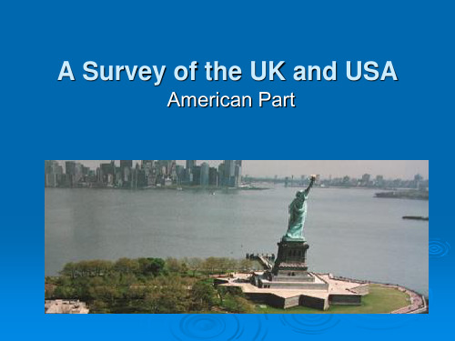
? Do you know where the statue in the picture is? And do you know its name? _____________________________
? Do you know anything about the following states of the U.S.A.: Alaska, Hawaii, Texas, New York, Pennsylvania, Louisiana, Colorado, California, Kansas, Kentucky, Florida…? _____________________________
? Population
? The most populous city in the United States ? Unique for the diversity of its population
Introduction to British and American Culture
地理《美国》PPT精品课件

平
墨西哥
洋
领土面积含 48个州 首都华盛顿所在的哥伦比亚特区
包括 北美洲西北部的阿拉斯加州 太平洋中的夏威夷州。
国家人口
美国人口: 是世界第三、西半球最多的国家
思考?
美国总人口3.3亿,是世界第三人 口大国,人口增长率为0.97%,美 国是世界上经济最发达的国家,为 什么人口增长速度要比一般的发达 国家快呢?
种族歧视问题
通过下面的话语能感受到什么呢?
现在,黑种人的贫困率是白种人的二至三 倍,失业率是白种人的两倍
土著印第安人的先辈们曾被白种人无情地杀戮, 活下来的人被赶到西部山区的“保留地”内居住。
现在,有许多华人工作时间比较长,但是工资 比较低,还时常受到不公正的待遇。
存在严重的种族歧视现象和人权问题
居民构成
美国的土著居民是什么人?此外还有哪些外来居民?
印第安人
白种人、黄种人、黑种人
民族大熔炉
美国第一任总统 华盛顿的祖先是英国人 欧洲,白色人种
印第安人 ——黄色人种
著名科学家 爱因斯坦是在德国 出生的犹太人
美国第四十四任总统 奥巴马的祖先来自非洲, 黑色人种
诺贝尔物理学奖获得者 李政道、杨振宁出生在中国 亚洲,黄色人种
华人华侨
美国的华人和华侨约有500万人 (2017年),分布广泛,在圣弗 朗西斯科(旧金山)、纽约和洛 杉矶等城市还有华人聚居的、富 有民族特色的 ‘唐人街’。
美国是一个典型的移民国家,居民的构成十分复杂。
华人对美国的贡献
美国中央太平洋铁路
1848年以后,大批华人移居美国,他们对 美国的繁荣作出了巨大的贡献。历史上, 华人劳工在美国西部开发和铁路的修建中 发挥了重要作用。有人曾说,如果没有中 国人使用炸药的知识并重视炸药的作用, 如果没有中国人贴在几乎垂直的悬崖上干 活,如果没有中国人闯过了白人难以忍受 的难关,中央太平洋铁路决不会建成。如 果能建成,时间上也要拖得很久。现代在 美国各行各行都有华人杰出的表现。例如, 李政道、杨振宁、丁肇中等先后获得诺贝 尔物理学奖,贝聿铭1983年获得普利克奖 (被称为建筑学界的诺贝尔奖),王赣骏 是第一位华裔航天员。
美国地理课件

ቤተ መጻሕፍቲ ባይዱ
亚热带气候
南部佛罗里达州和路易斯 安那州部分地区属于亚热 带气候,夏季炎热潮湿, 冬季温暖。
海洋性气候
西部沿海地区属于海洋性 气候,四季分明,夏季凉 爽,冬季温和。
自然资源与生态环境
矿产资源
美国拥有丰富的矿产资 源,如石油、天然气、
南部地区:石油化工与新兴产业崛起
01
地理位置与自然环境
美国南部地区拥有丰富的石油和天然气资源,为石油化工产业提供了有
利条件。
02
工业发展
南部地区在石油化工领域发展迅速,尤其是德克萨斯州和路易斯安那州
。此外,新兴产业如信息技术、生物技术等也在南部地区迅速崛起。
03
城市化与人口分布
南部地区城市化程度相对较低,但休斯顿、达拉斯等城市是南部地区的
自由女神像
位于纽约港,是法国送给美国的 礼物,象征自由和民主。建议提
前预订门票,避免排队等待。
黄石国家公园
拥有壮丽的自然风光和丰富的野生 动物,是世界上最著名的国家公园 之一。建议在公园内住宿,以便充 分体验其美景。
大峡谷
位于亚利桑那州,是世界七大自然 奇观之一,可乘坐直升机游览或徒 步探险。
文化体验活动推荐及注意事项
民族构成
美国是一个多民族国家,主要民族包 括白人、黑人、亚裔等,不同民族之 间文化差异较大。
城市体系与交通网络
城市体系
美国城市体系呈网络状分布,以纽约、洛杉矶、芝加哥等大城市为中心,向外辐 射形成多个城市群。
交通网络
美国交通网络发达,包括公路、铁路、航空和水路等多种运输方式,形成了完善 的综合交通体系。
人教版地理美国课件

05 美国环境地理
美国环境问题与挑战
空气污染
美国部分地区存在严重的空气 污染问题,主要来源于工业排
放和汽车尾气。
水污染
美国的水资源受到不同程度的 污染,包括工业废水、农业排 放和城市污水。
土地退化
过度开发和不合理的土地利用 导致土壤侵蚀和退化,影响农 业生产。
气候变化
全球气候变化对美国的环境产 生重大影响,包括极端天气事 件、海平面上升和生态系统变
农业与环境
美国农业在发展过程中也面临环境问题,如土地退化、水资源短 缺等,需要采取措施加以解决。
美国工业地理
工业分布
美国工业主要集中在东北部和五大湖地区,这些地区拥有丰富的 矿产资源和便利的交通运输条件。
工业现代化
美国工业采用现代化技术和管理模式,提高了生产效率和产品质量 。
工业与环境
美国工业在发展过程中也面临环境问题,如空气污染、水污染等, 需要采取措施加以解决。
人教版地理美国课件
• 美国地理概述 • 美国自然地理 • 美国人文地理 • 美国经济地理 • 美国环境地理 • 美国地理研究方法
01 美国地理概述
美国地理位置和领土
01
02
03
地理位置
位于西哥湾。
领土组成
包括50个州和哥伦比亚特 区(首都华盛顿所在区域 )。
化。
美国环境保护政策和措施
清洁能源政策
美国政府推动清洁能源 的发展,减少对化石燃
料的依赖。
环保法规
制定严格的环保法规, 限制污染物排放和保护
自然生态系统。
绿色基础设施
投资建设绿色基础设施 ,如公园、绿地和雨水 收集系统,以改善城市
环境。
生态修复
America geographical environment 美国的地理环境
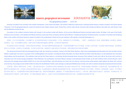
1America geographical environment 美国的地理环境The geographical position 地理位置 American is located in the countries of the western hemisphere. It has a total of 50 states. The northern California is apeninsula in northwest North America, Hawaii is located in the Pacific islands. "American", from the geographicalsense, means the American land, Alaska, Hawaii, Guam, Puerto Rico, and the virgin islands. American with Canada and Mexico land earth and, with Russia, Cuba and the Bahamas across the sea.Connection in the northern American border with Canada, in the southern border with Mexico. At the junction ofNorthwest Russia's territorial waters border, 48 states in the west of the Pacific American and connection, in the Eastand the Atlantic handover, south-east of the connection with the Gulf of Mexico. In Alaska and Southern Pacificconnection, connection in the West and the Bering Strait, in the northern and Arctic handover, Hawaii is located in the southwestern Pacific far from the mainland. USA capital is Columbia Washington d.c..美国是一个位于西半球的国家。
美国地理(英文版)The geography Of America

The U.S. territory of expansion
Position and area
The United States of America, the
abbreviation of the United States . U.S.A.
The United States the country is divided into fifty states and a special economic
Landforms & Resourse
6.2
Non-ferrous metal
Main distribution: the southwest area of mountains and the rocky mountain Arizona, Utah, Montana, Nevada and new Mexico five states. Including
The U.S. minimum temperature records is - 62 ℃,
this is in January 1971 in Alaska prologis pie bay shy of the record.
Rivers & lakes
The Mississippi River is the main rivers, is also the largest river in North America, the Missouri river is the source, the span 6,262 kilometers, is one of the longest rivers in the world from Central America, the great plains it
高中地理——美国
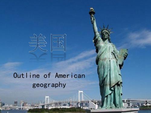
早期的移民把欧洲文化带到美国。 很快地, 这些文化遍及美国各地。 时 至今日, 美国已经成为世界文化的主流之一。 许多的美国艺术家们对于发 展新的风格, 新的自我表现方式, 甚至新的文化型式都作出巨大的贡献。 美国文化的主要内容是强调个人价值,追求民主自由,崇尚开拓和竞争,讲 求理性和实用,其核心是个人中心主义:个人至上、追求个人利益,强调通 过个人奋斗、个人自我设计,追求个人价值的最终实现。这种刻意塑造自我, 追求个性化的个人主义有其积极的意义,它调动了个人的积极性,使许多人 的智慧和潜力得以充分发挥,从而促进整个民族与国家的振兴和发展。 美国公众注重成就,仰慕英雄,有深厚的成就崇拜和英雄崇拜的心理积淀。 个人成就是所有美国人价值观中评价最高的价值之一。美国人有很强的成就 (或成功)意识。成功是所有美国人的追求,是诱人的前景,前进的动力。 他们坚信,一个人的价值就等于他在事业上的成就。一些事业有成的企业家、 科学家、艺术家和各类明星,成了新时代的英雄。他们个人奋斗的过程和结 果,成了社会文化价值取向的参照系,父母教育子女的活教材。 美国是流动性很大的社会。这种流动体现在两个方面:地域性流动和社会性 流动。美国相对的开放自由、发达的交通和冒险好动的传统使许多美国人从 乡村流到城市,又从市中心流向郊区;从北方流到南方阳光地带,从一个城 市流到另一个城市。美国社会阶级不像欧洲国家那样固定,加上公共教育的 普及,使沿着社会阶梯向上流动成为可能。许多生活在美国的人,无论是土 生土长的美国人,还是漂洋过海来到美国的外国移民,都有一个梦,即通过 自己的努力,改变自己的命运,实现自己的人生梦想,这就是人们常津津乐 道的“美国梦”。
美国自然资源丰富,矿产资源总探明储量居世界首位。 煤、石油、天然气、铁矿森林资源石、钾盐、磷酸盐、 硫磺等矿物储量均居世界前列。 其他矿物有铜、铅、钼、铀、铝矾土、金、汞、镍、 碳酸钾、银、钨、锌、铝、铋等。战略矿物资源钛、锰 、钴、铬等主要靠进口。 截至2010年底,美国已探明原油储量206.8亿桶,居世 界第13位。已探明天然气储量7.716万亿立方米,居世界 第5位;已探明煤储量4910亿吨,居世界第一。森林面积 约44亿亩,覆盖率达33%。2011年美国原油产量20.65亿 桶,进口41.46亿桶,出口10.67亿桶。天然气产量28.58 万亿立方英尺,进口3.46万亿立方英尺,出口1.51万亿 立方英尺。
国家概况--美国部分.doc

英语国家概况第十三章美国地理位置GeographyChapter: 13 geography 地理位置1.Alaska and Hawaii are the two newest states in American.Alaska northwestern Canada,and Hawaii lies in the central Pacific.阿拉斯加和夏威夷是最近加入美国的两个新州。
阿拉斯加在加拿大的西北部,夏威夷位邻中太平洋。
(本细节还有考“一句话简答”的可能)2。
The U.S has a land area of 9.3 million square kilometres.It is the fourth largest country in the world in size after Russia,Canada and China.就面积而言,美国是世界第四大国,就人口而言,美国是世界是第三大国。
3.Of all states of American,Alaska is the lagest in area and Rhode Island the smallest.But on the mainland Texas is the largest sate of the country.所有州中,阿拉斯加是面积最大的州,罗得岛最小,在美国大陆,最大的州是得克萨斯州。
4。
The Rockies,the backbone of the North American Continent,is also known as the Continental Divide.落基山脉是北美大陆的脊梁,也被成为大陆分水岭。
5。
The two main mountain ranges in American are the Appalachian mountains and the Rocky mountains. The Appalachians run slightly from the northeast to southwest and the Rocky mountains run slightly from the northwest to southeast.阿巴拉契亚山脉和落基山脉是美国的两座大山脉。
american geography
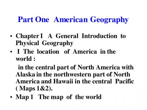
Picture1 Old Faithful
Picture 2 Abyss Pool
(2) Wildlife(Pictures 1,2,3) animals roam freely , the buffalo Picture 1: The buffalo
Picture 2: Moose 驼鹿
Part One American Geography
• Chapter I A General Introduction to Physical Geography • I The location of America in the world : in the central part of North America with Alaska in the northwestern part of North America and Hawaii in the central Pacific ( Maps 1&2). • Map 1 The map of the world
Picture6:Appalachian Highlands: Piedmont Plateau
Outer Piedmont rolling upland; erosion and deep The Outer Piedmont is a gently weathering have long since obliterated surface indications of the folded bedrock beneath. Picture9:Appalachian Highlands: Valley and Ridge
The Blue Ridge is composed of complexly folded and faulted igneous (granitic) and metamorphic rocks.
七年级地理-美国课件

05
美国地理区域划分
东北部沿海地区
总结词
工业发达、人口密集
详细描述
东北部沿海地区是美国最早开发的地区之一,拥有丰富的矿产资源和便捷的交通网络。这里聚集了大量的工厂和 企业,是美国重要的工业基地。同时,这里人口密集,城市众多大平原地区
总结词
农业发达、地势平坦
河流
密西西比河、哥伦比亚河、科罗拉多 河等,其中密西西比河是美国最长的 河流。
美国的湖泊和沼泽
湖泊
五大湖(苏必利尔湖、密歇根湖、伊利湖、安大略湖、休伦 湖),其中苏必利尔湖是世界上最大的淡水湖之一。
沼泽
佛罗里达大沼泽地、切萨皮克湾沼泽等,其中佛罗里达大沼 泽地是美国最大的亚热带沼泽地,拥有丰富的动植物资源。
方式。
美国的节日和习俗
感恩节
每年11月的第四个星期 四,美国人会聚在一起 庆祝丰收和家庭团聚。
万圣节
每年的10月31日,人们 会装扮成各种恐怖角色 ,挨家挨户敲门收集糖
果。
圣诞节
最重要的节日之一,人 们会装饰圣诞树、互赠 礼物、享用圣诞大餐。
独立日
每年的7月4日,人们会 举行烟花表演、野餐和 游行来庆祝美国的独立
七年级地理-美国课件
• 美国地理简介 • 美国自然地理 • 美国经济地理 • 美国文化地理 • 美国地理区域划分
01
美国地理简介
美国地理位置和疆域
地理位置
位于北美洲中部,东临大西洋, 西濒太平洋,北接加拿大,南靠 墨西哥及墨西哥湾。
疆域
总面积937万平方千米,海岸线 长22680千米。
美国人口和民族
主要工业部门
美国主要工业部门包括钢铁、汽 车、石油化工、电子等,这些部 门在全球范围内都具有重要地位
American Geography 美国地理文化
Warm-up 热身赛;预热;准备运动 热身 加热
Part I: Geography & the People
Major Contents of This Part: 1. Geographical location; 2. Topography; 3. Regions of the USA; 4. Major US Cities and Places of Interest; 5. The People of America;
(District of Columbia)
The
Map of the United States of America
1.5
American National Flag (THE STAR SPANGLED闪闪发光的 BANNER旗帜) June 14th of each year as National Flag Day.
这部分主要内容: 1。地理位置; 2。地形; 3。美国的区域; 4。主要的美国城市和名胜古迹。 5。美国人民的;
I. Geographical features:
1. Geographical location:
Situated in the central part of North America with its two young states---Alaska in the northwestern part of North America and Hawaii in the central Pacific Ocean, the
A Survey of the UK and USA
American Part
Listen to a passage of VOA Special English on 7 American states and answer the following questions? 1) What are the 3 Pacific states? Washington, Oregon and California. 2) Which of the 3 Pacific states has the largest economy and the most people in the U.S.A? California 3) What is Arizona known for? Grand Canyon State 4) What is the largest of the 7 states in terms of size? Texas 5) What is the capital of Oklahoma? Oklahoma City
American Geography-美国地理-小组英语口语考试
American Geography美国地理There are some advantages of American geography compared to Chinese geography,my group will share some advantages with you in different aspects.与中国地理相比,美国地理有一些优势,我的小组将在各个方面与您分享一些优势。
The continental United States can be divided into three basic areas. The first part is the Atlantic Seacoast west to the Appalachians. Along the Atlantic Seacoast is a narrow plain that begins far up to the coast and becomes wider as it goes south. Many heavily wooded mountains and deep valley cut by wide and beautiful rivers can be found here. To the west of Atlantic coastal plain lie the Appalachian Mountains that begin in Canada and reach all the way to Georgia and Alabama. Appalachians have much beautiful scenery and many tourist resorts. The second part is the Mississippi River Basin. The Mississippi River Basin between the Appalachians and the Rockies is one of the largest areas in the world. The states in the Midwest have fertile plains, low rolling hills, and no high mountains. The third part is the Rockies West to the Pacific. These high mountains stretch all the way from Mexico to the Arctic and from what is known as Continental Divide, or Great Divide. The Rockies are more than twice as high as the Appalachians and high enough to receive lots of rain . Between the Rocky Mountain and the Cascade-Sierra Nevada ranges is the great plateau area. Along the Pacific coast from Washington State to southern California, extend the Coast Ranges.美国大陆可以分为三个基本区域。
