ESRI ArcGIS 新特性与石油信息化解决方案
ArcGIS10完整的二三维一体化解决方案
ArcGIS10完整的二三维一体化解决方案1概述地理信息系统(GIS)是现代地理学与空间信息科学相结合的产物。
GIS的本质是基于真实世界的地理环境,直观地表达客观世界的各种要素。
借助GIS可以对各种要素进行管理、查询、可视化和分析、处理,以便人们进行科学决策。
历经了四十多年的发展,二维GIS技术早已进入了成熟期。
由于二维GIS的成熟应用,以至于GIS已经突破最初的测绘和地学的行业范畴,发展成为跨行业通用的平台软件技术,广泛应用于政府信息化和企业信息化,并越来越多地涉足面向个人的信息服务领域。
2三维GIS是GIS的重要发展趋势GIS的优势在于能够直观直接地展示复杂的地理信息,同时具有强大的空间分析功能。
随着社会的发展,人们对地理信息的关注程度越来越高,因此对地理信息的获取和使用也有了更高的要求。
与二维GIS相比,三维GIS有其独特的优势。
三维GIS因更接近于人的视觉习惯而更加真实,同时三维能提供更多信息,能表现更多的空间关系。
随着计算机技术的发展和二维GIS行业应用的深入,人们使用三维GIS来展现真实世界的渴望越来越强烈。
3三维GIS面临的挑战三维可视化仅仅是三维GIS的一个方面,三维GIS与二维GIS一样,三维GIS涉及了从数据获取、数据处理、数据管理、可视化、空间分析、系统定制到数据发布与共享的各个环节。
当然,三维GIS仍面临一些问题和技术瓶颈:1、昂贵的数据投入。
对于GIS来说,数据为王是最恰当不过的。
再好的系统,缺乏实时、全面的空间数据时只能是个摆设。
显然,数据的获取对GIS来说至关重要。
与二维空间数据相比,三维空间数据的获取成本更为昂贵,尤其是大面积的三维场景建模。
长期以来,三维空间数据获取的效率低下和高成本都成为阻碍三维GIS技术发展的重要因素。
2、海量数据处理与管理的技术瓶颈。
随着遥感影像、DEM以及大量的三维模型等空间数据的集成应用,数据量急剧增加,处理海量数据便成为三维GIS所必须面对的技术难题;文件型的数据共享不能够满足空间数据量较大的应用需求。
ArcGIS10新特性-Query Layer

Query Layer介绍题记Query Layer的具体介绍大家在2010年Esri中国北方用户大会分发的ArcGIS中国通讯上已经有《ArcGIS10新特性之Query Layer介绍》,这里面就不做重复的说明了。
下面所介绍的就是对文中没有涉及知识的相关补充。
概念Query Layer是通过SQL 查询定义的图层或独立表。
通过查询图层可将空间信息和非空间信息都存储在DBMS 中,从而使这些信息可以轻松地整合到ArcMap 中的各GIS 项目。
其实就是把我们的空间数据图层的概念看作成后台数据库存储的表的概念,因为我们通常习惯于利用SQL语句来直接操作属性表,但是对空间数据图层来说在ArcGIS10之前是不支持的,鉴于大家对SQL的喜爱,Esri在ArcGIS10就引入了Query Layer,它就可以直接使用SQL语句进行查询或者空间数据与属性数据的联表查询。
使用前必须采用当前使用的ArcGIS 版本支持的DBMS 版本。
∙查询图层定义中必须包括在查询图层中用作对象ID 的唯一、非空的列或列组合。
∙根据所使用的DBMS 类型,可能需要在DBMS 中进行一些必要的配置来使用空间类型。
∙另外,根据DBMS 类型,可能需要在从中创建查询图层连接的每个客户端计算机上进行一些配置。
特点保存为文件通过另存为图层文件(.lyr)、创建图层包(.lpk) 或通过地图包(.mpk) 绑定地图和关联数据,查询图层可在用户之间、应用程序之间和其他地图文档之间轻松地实现共享。
其实这个文件与我们经常使用的MXD文件有异曲同工之妙,该文件并没有存储真正的查询数据信息,而是存储了服务器连接信息、查询过滤条件信息,这样也就保证我们随时可以查询最新的信息。
案例为了证明新增数据可以同步在Query Layer显示,笔者进行了相关测试。
环境:Oracle数据库、ArcMap10、ArcSDE101:新建一个Query Layer图层2:选择数据连接3:针对一个图层或者一个图层与普通表进行条件过滤或者联表查询条件过滤4:参数添加完毕后,Query Layer就可以加载到ArcMap上了,然后也可以另存为上面所说的相关格式文件。
ArcGIS online新特性

ArcGIS online 新特性1. What is new with ArcGIS Online?ArcGIS Online is continuously being enhanced with updates approximately every four months and these enhancements fall in general categories. There is new spatial analysis, new apps such as Explorer for ArcGIS, improvements in apps such as Dashboard, new content, new templates, improvements in infrastructure such as security, single sign on, etc. Users can now also author presentations using their maps right from the map viewer in ArcGIS Online.Since the last user conference we have had 4 major releases that have incrementally enhanced the platform. We are also proud to announce full support of FISMA (a security certification by the US federal government) – see for details, major new content contributions such as elevation service for the world, release of the Airbus imagery including high quality and recent images in several hundred cities, support for NAPE, and incremental enhancements in all of the basemaps. We are also releasing a whole new suite of landscape and environmental layers and a new release of demographic data including updates to the Tapestry demographic segments and population forecasts globally (130 countries).Many of these capabilities will be previewed at the conference.2. Is ArcGIS Online simply ArcGIS for Server plus Portal?ArcGIS Online and ArcGIS for Server are complementary technologies. Organizations typically combine them both to fully realize the power of the ArcGIS platform.ArcGIS Online and ArcGIS for Server have many things in common. They both (1.) include and support a wide variety of applications; (2.) provide a portal for organizations to effectively create, manage and secure access to great mapping information products; and (3.) empower people to use maps and geography to improve the way they do business.ArcGIS Online and ArcGIS for Server are also very different in terms of deployment andfunctionality. From a deployment perspective, ArcGIS Online is hosted by Esri. Users do not need to install software or configure it, or be concerned with upgrading software or scaling up the system. ArcGIS for Server, on the other hand, is software that users can set up within their own infrastructure. This gives users full control over how GIS is implemented and secured and provides further options for integrating GIS within the enterprise.From a functionality perspective, ArcGIS for Server provides additional capabilities not present in ArcGIS Online that are of interest to geo-centric organizations. Sophisticated geodatamanagement and analysis tools, imagery, and real-time GIS are some of the key areas where ArcGIS for Server brings unique capabilities.For more information watch the video here:/watch/3600/ismael-chivite-on-arcgis-for-server-and-arcgis-online 3. Will Esri support standards-based metadata inside of ArcGIS Online?Yes, we have an active development project to enhance ArcGIS Online to support associating full metadata specifications within the online environment. Using metadata will be an option that can be set by the administrator of an ArcGIS subscription and is expected to be added as a feature in early 2015.4. Can I use ArcGIS Online as an open data portal to provide geospatial data to the public and others?Yes, Esri has recently added the ArcGIS Open Data application to ArcGIS Online soorganizations can promote and make authoritative data available to the public to be discovered, downloaded, and even built into applications. The application works with data that has been registered with ArcGIS Online and shared to defined Open Data groups. The source of this data can come from either the ArcGIS Online cloud infrastructure or ArcGIS for Server running on locally managed servers. Unlike other open data portals, this application allows users to ―serve‖ their data out in multiple formats such as spreadsheet, KML, shapefile, and two specifications of JSON (JavaScript Object Notation) for web developers. To create a custom Open Data website using ArcGIS Online, users simply turn on the capability and start publishing.5. How much does the ArcGIS Open Data application cost?The ArcGIS Open Data application is included as part of an ArcGIS Online subscription for organizations. There are no additional fees or licensing required.6. Does ArcGIS Online allow organizations to share their data?Yes, ArcGIS Online allows you to share maps, layers, apps, and data in a variety of ways. You can share maps and layers to groups, within your organization, and between organizations. You can share the results of your work with your customers through embedded maps and focused templates on your web pages. You can share the data that powers your information products through the open data site or directly to developers with simple restful APIs and mapping SDKs.7. What is the use pattern of credits across the Esri customer base?We consciously allocated a large number of credits for every organization that subscribes to ArcGIS Online with the intention that users would not run out of credits during their annualperiod of subscription. So far, among the 700,000+ subscribers to ArcGIS Online, only a handful have reached or exceeded their credit usage.Over the last two years (since the inception of ArcGIS Online) cloud hosting and computational infrastructure costs have continued to decline. In recognition of that we have lowered the price per credit and changed which functions require credits. Specifically this means that geocoding, routing, and geoenrichment pricing has been decreased significantly, credits are no longer used for accessing maps and layers, and storage and infrastructure-use pricing has dropped.8. Can I manage the credit usage of users in my organization?Yes, with the summer and fall releases of ArcGIS Online we are introducing new administrative tools that allow the monitoring and management of credit usage within organizations. The status dashboard is being updated to show a breakdown of credit usage per user, and we are adding settings for an administrator to manage individuals and their ability to use credit-consuming functions (i.e. determining whether a user can geocode, consume geoenrichment, performrouting, etc.) through the expansion of privileges in custom roles.9. We need more visibility into the usage of our ArcGIS Online subscription. What tools areavailable and when can I see usage by individual users?We continue to add tools to see more granular views of your usage as well as other useful information. In March we added the Activity Dashboard for ArcGIS that is a free web app for organization administrators that provides access to activity-based metrics, real-time reports and other useful information about your online mapping platform. You can download a free copy here:/listing.html?id=643bc71aec734874ba85866b0e444a4bIn our July release the Activity dashboard and the status area of now includes user-level information as well.10. Is Esri planning to provide a new capability for tracking usage in large organizations?In our July update we will be adding the ability for administrators to view subscription status reports for credit usage by individual members. This functionality will also be added to theActivity Dashboard app.11. What is FISMA and why is it important to GIS users?FISMA stands for the Federal Information Security Management Act and was developed by the US federal government as a compliance and certification process for information security policy in cloud and web environments.For the last two years, Esri has been working closely with the U.S. federal government to obtain certification for ArcGIS Online, and has recently received full certification.What this means for users in the US federal government is that, administratively, it will be easy to pass security hurdles set up to protect government agencies' information. This certification is also being embraced by many state and local organizations in the US as a best practice for ensuring protection of an organization's data and end user profiles.12. Is FISMA accreditation valid or important to us if we are a commercial organization or outside the US?Yes, many of our commercial and international customers view FISMA accreditation as strong security assurance. Security controls implemented under FISMA are mapped by the National Institute of Standards and Technology (NIST) to the International Standards Organization (ISO) 27001 security controls. Esri has compiled a mapping of the applicable ArcGIS Online FISMA Low to ISO Security controls which may be found at:/resources/enterprisegis/FISMA_Low_ISO_Mapping.pdf 13. How is cloud-based GIS secure? Is it safe to store sensitive data?Esri recognizes that many organizations are still solidifying their policies around cloud-based services and that more operational transparency, in addition to security accreditation, may be required. The website (live July 1, 2014) makes it easier for you to discover information about what makes Esri‘s cloud-based GIS secure.Because data sensitivity and organizational comfort with cloud-based services variessignificantly around the world, the answer to storing sensitive data varies depending upon your organization. Many of our customers utilize a hybrid deployment of ArcGIS Onlinesupplemented by separate ArcGIS for Server instances for distributing sensitive data andservices. ArcGIS Online is FISMA Low accredited, and we are actively implementing aManaged Services FedRAMP moderate accredited offering of server and portal (and eventually desktop), when even more rigorous security requirements are required by an organization‘s policies.14. Does Esri support Safe Harbor?Yes. ArcGIS Online is fully compliant with the Safe Harbor policy suite. Safe Harbor pertains toa set of international policies that protect privacy of the data. Safe Harbor is a primarilyEuropean-focused compliance and certification initiative.15. How does Esri protect my privacy when using ArcGIS Online?Esri values the privacy of those who use our online SaaS solution, ArcGIS Online. We think it is important for users to understand when and why we collect personally identifiable information and how we may use it. Here is a link to our privacy policy which details Esri data collection and use policies when you provide it to us via ArcGIS Online./legal/privacy-arcgis16. Can you describe the levels of security in ArcGIS Online and how it relates to different types of users?ArcGIS Online is designed as a secure system with controlled access for all users of theplatform. There are multiple levels of security within ArcGIS Online as we adhere to adefense-in-depth approach, meaning that it includes physical security, logical security, allows enforcement of encryption for data-in-transit, network security, and even developmentprocesses. Adherence to these security principles helps ensure that ArcGIS Online provides confidentiality, integrity and availability of data. For customers who want in-depth, standardized security answers concerning ArcGIS Online, we recommend a review of our answers to the Cloud Security Alliance (CSA) security control matrix at:/resources/enterprisegis/AGOL_CSA_CCM.pdfArcGIS Online now has four types of users: User, Publisher, Administrator, and Custom. Just like there are multiple levels for operations-based security, these four roles define the level of access for our ArcGIS Online customers at the application level. Custom roles were added this year to ArcGIS Online and allow defining privileges at a more detailed level as described at: /en/arcgis-online/reference/roles.htm17. What is being added to ArcGIS Online in July that will help me manage our online subscription?To help organizations feel even more comfortable with providing access to ArcGIS across their organization we continue to add to the level of control and management. In July we plan topublish a new web site called . Here you will find a one-stop place for allsecurity and privacy information. This not only helps in terms of being able to get information, but is also a very visible commitment to security and establishing trust with our customers. Also, as part of the ArcGIS Online privacy compliance with TRUSTe Certified Privacy Seal and EU Safe Harbor, password requirements have been strengthened – they must be at least 8characters long and contain at least one letter and one number. Administrators can also expire passwords of their organization‘s members.As a follow-on to adding custom roles for your online uses in March, we have added privileges for using demographics, geocoding, GeoEnrichment, network analysis, and spatial analysis so that administrators have another tool for managing credit usage. You will also be able to view subscription status reports for credit usage by members.18. How will ArcGIS Online change the GIS staffing within my organization?With the release of ArcGIS Online, we see a growing need for GIS professionals.ArcGIS Online is being rapidly accepted by organizations, and is continuing to gain momentum as a platform for organizations to provide self-service mapping to an organization's geographic information sets. It principally is about a new generation of technology that provides access and integration of geographic information to all types of an organization's workflows.With this growth, there continues to be a growing need and firm requirement for traditional GIS professionals because they have the experience, skills, and knowledge of implementing and supporting geographic data, its management, its application, and an evolving infrastructure.We also see the need for introductory training, skill development and increase in staff across the enterprise. There is large growth and interest in how to make simple web maps and dogeoenrichment as well as spatial analytics within other enterprise systems like ERP and CRM.All of these activities call on the skills and leadership of GIS professionals and make themessential.19. Can you share some examples of successful ArcGIS Online deployments?Yes. The following are just a couple of examples that describe how users have deployedArcGIS Online and some of the benefits that resulted from it.One interesting example is how Sulphur Springs Valley Electric Cooperative used ArcGISOnline Network Analysis services. Sulphur Springs performed a route analysis to determine the travel costs to and from locations they frequently visit. Those travel costs were then compared to the cost of installing a smart meter collar, thus eliminating the need to drive to that location in the future. The smart meter collars allow the utility to connect or disconnect power remotely, without having to drive to each location. As a result of this travel cost study, Sulphur Springs has identified installations that can be turned on and off remotely, and thus potentially achieve$900,000 in savings.Another example is Vermont Department of Transportation (DOT) Rail Division using theCollector for ArcGIS app to perform inspections of the entire state‘s rail crossings. Weeklyresults were added to the Operations Dashboard for ArcGIS application for status viewing and observations by managers and engineers. A total of 380 public crossings were assessed by field crews. This project, completed in just four weeks, resulted in a 50% time savings(averaging 95 crossings per week) and covered an area of over 130 square miles.20. What are the new spatial analysis tools coming in ArcGIS Online?Currently, there are 18 analytic functions that have been implemented in ArcGIS Online and can be accessed from a browser by any user. At the summer release we will introduce the following new tools:o Calculate Density estimates a density surface from point or line features. This tool will return areas that are classified by calculated density values, for example crimeincidents or risk of forest fires.o Interpolate Points predicts values at new locations based on measurements from a collection of points of information. For example, it can be used to predict pollutionlevels at locations that don't have pollution measurement sensors but instead base theinformation from other known sensors.o Plan Routes determines the most efficient way to route a fleet of vehicles that need to make many stops.Later this year and into next year, Esri will be developing and implementing advanced tools for raster analysis, finding the best routes between multiple stops, and for working with elevation data such as creating viewsheds, creating watersheds, and tracing downstream.21. What are the key improvements for spatial analysis in ArcGIS Online?Spatial analysis adds valuable insight by providing hosted tools and functions that lets users work with their data in their ArcGIS Online organization to discover new information. We provide these analytics through both the ArcGIS Online user interface, for example the web map viewer, and for developers at the API level. Since our first release a year ago we have added many new analysis functions and made enhancements to the existing tools:o Find Existing Locations and Derive New Locations allow you to discover features by building queries that use both attributes and spatial relationships.o Find Similar Locations finds features most similar to one or more selected features based on specified criteria.o Calculate Density estimates a density surface from point or line features. This tool will return areas that are classified by calculated density values, for example, crimeincidents or risk of forest fires.o Interpolate Points predicts values at new locations based on measurements from a collection of points of information. For example, it can be used to predict pollutionlevels at locations that don't have pollution measurement sensors, but instead base theinformation from other known sensors.o Plan Routes determines the most efficient way to route a fleet of vehicles that need to make many stops.o Enrich Layer offers data available for more than 100 countries in the world. It is now also easy to search and select data categories and individual variables.o Create Drive-Time Areas supports historical and real time traffic as well as different travel modes including using a car or truck, or walking.22. What resources are available for learning ArcGIS Online spatial analysis?There are many resources available to help users to learn more about ArcGIS Online spatial analysis.Different analysis case studies and examples are available at the ArcGIS for Professionals web site /en/analysis/. In many cases the analysis can be carried out using ArcGIS Online. Workflows are included at the end of each case study to demonstrate how the described or similar analysis could be done.View help for ArcGIS Online Analysis tools, or parameters used for a specific tool, by clicking the help icon next to the tool or parameter. In addition, more information about ArcGIS Online spatial analysis can be found at/en/arcgis-online/use-maps/perform-analysis.htmDevelopers who would like to build web applications that consume ArcGIS Online spatialanalysis services can visit the ArcGIS Online Spatial Analysis REST API helphttps:///rest/analysis/Two free training seminars provide an overview of the spatial analysis capabilities of ArcGIS Online titled ―Spatial Analysis with ArcGIS Online‖/gateway/index.cfm?fa=catalog.webCourseDetail&courseID=2793 and ―Gain Geographic Insight with ArcGIS Online Analysis Tools‖/gateway/index.cfm?fa=catalog.webCourseDetail&courseID=2717 23. Can I make my own basemap tiles using ArcGIS Online?Yes, part of the value of using ArcGIS Online is being able to use many of the layers youalready have. To use your own basemaps see the Help system for step-by-step instructions on publishing into ArcGIS Online/en/arcgis-online/share-maps/publish-tiles.htm or watch a quickvideo overview. /watch/1343/publishing-hosted-tiled-map-services 24. What advances are being made in ArcGIS Online's mapping capabilities?In July, Esri will be releasing a series of improvements to its basic mapping and spatial analysis capabilities. This includes1. Smarter pop-ups, which enrich queries with both tabular data and graphics generated fromGeoEnrichment services.2. The ability to interact between lookup tables and maps.3. Dynamic labeling of features.4. Support for presentations.Esri is also implementing a new self-service mapping capability as part of its September release of ArcGIS Online. This provides the ability for users to create data-driven maps that aregenerated with the assistance of a series of templates that help users make high-qualityrepresentations of their information, sometimes called smart maps. These capabilities provide a spectrum of ready-to-use legends, symbologies, and mapping templates for empowering users who are not experienced cartographers to generate high-quality map representations.25. What is the ArcGIS Marketplace?Esri has implemented a complete solution and content marketplace inside of ArcGIS Online. It is known as the ArcGIS Marketplace, and since its release late in 2013, many business partners have implemented a variety of both apps and content services for use by the GIS community.This Marketplace is not focused on consumer apps but rather on apps and applications that support GIS workflows and leverage the ArcGIS platform. Apps acquired from the Marketplace all support your ArcGIS Online identities so that, once you‘re logged in, you can immediately access maps and content from your organization.You can check out Marketplace here: 26. Can I take advantage of the benefits of ArcGIS Online where there is poor or no Internet connectivity?Consider ArcGIS for Server. ArcGIS for Server allows you to deploy the ArcGIS platform in your own infrastructure including its apps, content, collaboration tools, and powerful services. It is ideal if you have highly confidential and proprietary data, conduct confidential research, or have regulated data restrictions.27. Many people in my organization need to learn to use ArcGIS Online. Where can I find free training?We have a number of free training programs available for different roles and to learn different key concepts. You can find a complete listing here:/agolcourses28. How is Esri making it easier to add users to my ArcGIS Online subscription?With the July update to ArcGIS Online we have added a fourth way for users to addpeople—you can now pre-establish accounts and share the credentials directly. When adding these members with pre-established logins, users can now include a user name field. Members do not have to be invited or accept an invitation, administrators just provide them withpre-established credentials they have already.29. Will Esri add more roles beyond Administrator, Publisher, and User?Yes, in the March 2014 update we added the ability for administrators to define custom roles to fit the way you want people to work with the software. Custom roles allow you to defineprivileges that are enabled such as the ability to create items, share maps, participate in groups, publish and edit features. In the July release we expanded this to include privileges for using demographics, geocoding, GeoEnrichment, network analysis, and spatial analysis so thatadministrators have another tool for managing credit usage. As we add functionality to ArcGIS Online we will continue to add to the capabilities included in custom roles.30. When can we expect to see more styling options for publishing maps in ArcGIS Online, including clustering?In September we plan to add a significant number of styling options that will make creating web maps better, easier, and with many more options. We will be adding workflows that suggest the best way to draw the layer by analyzing the data and automatically offering the bestcartographic options at every step in the authoring process. For example, the new smart default settings will know the appropriate range of scale visibility based on data characteristics, the appropriate ways to draw the data, and will seamlessly coordinate colors with any of the Esri basemaps. Other enhancements to styling will include proportional symbology, continuous color ramps, smart dot density maps (with automatic dot value and size calculations), and smooth symbol clustering so maps remain attractive and legible across scales and devices.31. What is Esri doing to integrate with active directory or LDAP systems?ArcGIS Online allows you to integrate your Enterprise Identity Provider, including LDAP, so that you can leverage your existing accounts throughout the platform. You can login with yourenterprise account from ArcGIS Desktop, Collector, Explorer, and Esri Maps for Office.32. What is a named user and what are they entitled to with an ArcGIS Online subscription?Named users are the people in an organization that have designated access to an ArcGIS Online subscription. All named users have privileges to functionality and services that users can define and they can include:o Access to the included ready-to-use apps including Explorer for ArcGIS, Collector for ArcGIS, Operations Dashboard for ArcGIS, and many others. You can find a completelist here: /features/apps/index.htmlo Access to a Living Atlas of the world with beautiful and authoritative maps on hundreds of topics. To see them click here: /features/maps/index.htmlo Access to online analytics that enable you to look at your data spatially and discover new information or detect and quantify statistically significant patterns. Here are someexamples of what you can do:/features/features-spatial-analysis.htmlo Access to the development tools to add ‗geo‘ to your apps using Esri cloud services.More information can be found here: https://33. When will Esri support related tables in ArcGIS Online?This will be included in the July 2014 update to ArcGIS Online.34. Can Esri help me launch my Open Data Site so I can make data more accessible to the public?Yes. Esri provides extensive documentation on configuring ArcGIS Open Data, but if yourequire additional support to implement it, Esri Professional Services is able to assist. One mechanism to provide this support is through the Web GIS Launch Kit for ArcGIS Online, which provides onsite support to not only configure your organization subscription and work with you to publish data but also time to work with you on the ArcGIS apps. As ArcGIS Open Data is provided through ArcGIS Online you can choose to spend time on it during your Launch Kit.Some of the things Esri can help with are registering services, working with metadata, group curation, and site styling.35. What are the key improvements of Spatial Analysis in ArcGIS Online?Spatial analysis add valuable insight by providing hosted tools and functions that let you work with your data in your ArcGIS Online organization to discover new information. We provide these analytics through both the ArcGIS Online user interface, for example the web map viewer, and for developers at the API level. Since our first release from a year ago, we have added many new analysis functions and made enhancements to the existing tools:o Find Existing Locations and Derive New Locations allow you to discover features by building queries that use both attributes and spatial relationships.o Find Similar Locations finds features most similar to one or more selected features based on criteria you specify.。
ESRI ArcGIS 10.x新版本重要新功能、新特性汇总,对工作带来的意义

ESRI ArcGIS 10.x新版本重要新功能、新特性汇总一、切片服务性能全面提升(1)功能简介在arcgis 10.1版本中新增Image services缓存功能,在arcgis 10.2版本中新增了CachingController服务,提高了多个切片任务同时提交的稳定性。
在ArcGIS Server 服务列表的的System文件夹预先配置了一个CachingControllers服务,这个服务管理CachingTools正在处理的所有的任务。
当多个服务发布人员同时提交缓存作业时,这个服务可以防止服务器负担过重在arcgis 10.3版本中新增一种紧凑切片存储格式(V.2)2),用于提升切片服务使用性能。
这种新格式减少了切片目录中创建的文件数量。
通过在.bundle 文件中包含切片索引信息(.bundlx 文件)来实现。
(2)对实际工作的影响和意义现有的所有图形数据(矢量数据、影像数据)都是未做切片的,导致数据调用速度一直较慢。
新版本中加强了了生产切片的效率以及切片的访问速度,通过该技术进行数据切片,能够大幅提升所有系统对图形数据的调用速度,从而增加系统的可用性,并且降低服务器的压力。
二、增强对OGC规范的支持(1)功能简介在arcgis 10.1版本中新增OGC的WPS (Web Processing Service)和WMTS (Web Map Tile Service)规范的支持,WPS定义了如何在Web上提供地理空间处理服务的规范,可以和ArcGIS Server地理处理服务结合在一起工作。
WMTS定义了使用缓存图片提供数字地图服务的规范,通过ArcGIS Server缓存地图服务自动提供。
在arcgis 10.3版本中新增OGC规范的WFS 2.0,WMS高程,OGC WMS 细粒度的操作支持。
支持WFS 2.0使用ArcGIS for Server 创建或者托管的WFS 服务支持WFS 2.0 规范。
【ArcGIS软件与应用】第1章 ArcGIS软件介绍
ESRI官方网站( :
ESRI
/products#alpha -list)(2016年9 月27日查询)上公 布的产品。
ArcGIS Platform AppStudio for ArcGIS ArcGIS 3D Analyst ArcGIS API for JavaScript ArcGIS Data Interoperability ArcGIS Data Reviewer ArcGIS Defense Solutions ArcGIS Earth ArcGIS Editor for OpenStreetMap ArcGIS Engine ArcGIS Explorer Desktop ArcGIS for AutoCAD ArcGIS for Aviation: Airports ArcGIS for Aviation: Charting ArcGIS for Defense ArcGIS for Desktop ArcGIS for Desktop Extensions ArcGIS for Developers ArcGIS for Electric Utilities ArcGIS for Emergency Management ArcGIS for Gas Utilities ArcGIS for INSPIRE ArcGIS for Local Government ArcGIS for Maritime: Bathymetry ArcGIS for Maritime: Charting ArcGIS for Parks & Gardens ArcGIS for Personal Use ArcGIS for Server ArcGIS for Server Extensions ArcGIS for State Government
基于GIS的石化企业生产资源数字化管理

<<基于GIS的石化企业生产资源数字化管理>><<中国石化上海石油化工股份有限公司,>>基于GIS的石化企业生产资源数字化管理吴沛林(中国石化上海石油化工股份有限公司,)编者按“数字地球”是20世纪90年代以来迅速发展的一种新技术的代号,也是我国正在推广的应用性高新技术,以GIS为核心的这项信息技术用于改造和提升传统产业,是我国“十五”计划经济结构调整的重要目的之一。
本文介绍的内容尽管并不是用来改造石化企业的主体技术,却是“管理创新”的重要内涵和先进手段,目前虽然处在起步阶段,但可以预期在石化企业将有良好的应用前景。
向读者推介先进的管理理念、管理方法和管理技术,是步入新世纪后本刊拟加重份量的报道内容,本文虽然似与技术经济没有直接的联系,相信仍能起到扩大视野、开阔思路的作用,同时也是一次“投石问路”之举。
本刊真诚地希望得到读者对如此选题是否妥当的反馈意见。
研究和分析了GIS技术的主要特点及其在国内外石化企业应用的现状和发展趋势,提出石化企业生产资源数字化管理的总体架构,结合综合管线的数字化管理实例,阐述了生产资源数字化管理系统的主要功能,并对实施过程中可能出现的问题提出了几点建议。
关键词:地理信息系统生产资源数字化管理一般来说,石化企业是一种大型企业,占地面积大,各种管线、装置、设备、消防设施和基础设施等生产资源种类繁多,分布复杂。
石化企业又是一种安全环保要求高的企业,生产过程中有多种易燃、易爆和有毒的物质。
加强对石化企业生产资源的有效管理,对保证企业的安全生产和持续、稳定地发展有重要的意义。
1 GIS技术及其主要特点地理信息系统(Geographic Information System, GIS)是产生于20世纪60年代初期并在最近20年得到迅速发展的图形和数据处理技术,是在计算机软硬件和网络的支持下,为了获取、存储、检索、分析和显示空间数据及其相关的属性数据而建立起来的信息管理系统,已被广泛用于资源管理、城市规划等各个领域。
AI技术在智能化石油天然气中的应用方法与技巧

AI技术在智能化石油天然气中的应用方法与技巧引言:随着科技的迅猛发展,人工智能(AI)已经渗透进入各行各业。
在石油天然气领域,AI技术为提高生产效率、减少成本和风险注入了新的活力。
本文将探讨AI 技术在智能化石油天然气中的应用方法与技巧。
一、基于大数据的智能勘探与预测1.1 大数据收集与整合在智能化石油天然气领域,大量数据被产生和存储。
AI技术可以帮助实现对这些散落在不同系统中的数据进行自动收集和整合,从而构建庞大的数据库。
这些数据包括地质勘探数据、设备传感器数据、生产运营数据等,通过对这些数据进行深度分析挖掘,可以更好地理解储量分布规律和产量演变趋势。
1.2 智能勘探AI技术可以结合地震波分析、岩心采样等多种勘探手段,帮助识别潜在有利区块,并对其进行快速评估和优先排序。
通过应用机器学习算法,可以准确预测地下油气的分布情况,为油田开发提供科学依据。
1.3 储层预测与动态模拟AI技术可以利用历史数据和实时监控数据,对储层特征进行建模和预测。
通过机器学习算法,在不同工况下对油气产量进行多场景模拟。
这样可以帮助石油天然气企业合理规划产能,降低开采风险,并优化生产过程。
二、智能化的生产与运维2.1 智能井场管理系统AI技术可以结合物联网技术,构建智能井场管理系统。
该系统通过传感器实时监测生产设备状态、井口参数等信息,将数据上传至云端,并利用机器学习算法分析处理这些数据。
当设备发生故障或异常时,系统将自动发出警报并提供相应的解决方案。
这样大大减轻了人工巡检和维修的工作量,并提高了设备的稳定性和可靠性。
2.2 能源消耗优化AI技术可基于各项指标(如温度、压力等)对生产过程进行智能优化。
通过实时监测,系统可以自动调整设备运行参数,以提高能源利用效率,减少能源浪费。
同时,AI技术还可以预测潜在故障,并提前采取措施,从而降低生产风险和维修成本。
2.3 自动化仓储物流AI技术可以对仓储物流系统进行智能化管理,通过机器学习算法对原料、产品等信息进行分类和标记,并优化货物的出入库流程。
地理信息系统在石油行业中的应用

地理信息系统在石油行业中的应用任酉贵(辽宁省海洋与渔业厅信息中心,辽宁沈阳110001)应用科技,‘,睛耍】油气资源的需求成为当今稚会韵焦点,石油行业的信息化受到越来越多的关注。
以空间教捂为研究对象的地理信息系统迅速25c 展,如今已经发氍鼠为--f.I学科,并被广泛应用于石油行业各个方面。
本文在分析地理信息系统概念的基础上,深入探讨了地理信息系统莅’石油勘撂、石油开发、石油管线中的应用现状。
对油气资源的需求成为当今社会的焦点,人们越来越多的关注石油问题。
石油行业是—个多学科相互配合、相互渗透、协同工作的知识密集型行!也信息的综合利用对石油企业的发展起着重要的作用。
采用计算机管理方式取代传统的管理方式是当前石油信息化的首要内容。
石油企业信息化涉厕由气勘探、油气开发、钻井工程、地面建设、石油化工、原油储运与物资管理等多方面的内容,要求在统一的信息平台上建立起面向不同应用的信息管理系统和专业软件应用系统,实现所有业务晰博机化、科学化和规范化的管理。
随老n十算机技术的不断发展,地理信息系统近年来得了迅速发展。
由于地理信息系统研究的内容是空间数据这—优势,其内涵和外延正在不断变化,已被广泛应用于许多领域,如:城市规划、土地利用管理、资源评价与管理等。
地理信息系统在石油行业中的应用逐渐发展起来,数字油田是石油行业信息化的最终目标。
1地理信息系统的概念地理信息系统简称G I S(G e ogr aphi c Inf or m at i onSys t em)。
G IS 首先是—个基于计算机的系统,它是在计算机硬、软件系统支持下,对现实世界各类空间数据及描述这些空间数据特性的属性数据进行采集、储存、管理、运算、分析、显示和描述的技术系统。
可以这样理解:G I S研究的对象是地理实体,地理实体由空间数据和属性数据来表达;空间数据是与空间位置有关的数据,在某—坐标系下的坐标值,以及几何形状和实体之间的拓扑关系;属性数据是一些描述性的信息,如名称、大,J、、重量等;处理内容包括采集、储存、管理及黾用专业模型计算、分析,显示和输出结果。
ArcGIS智能交通地理信息系统解决方案
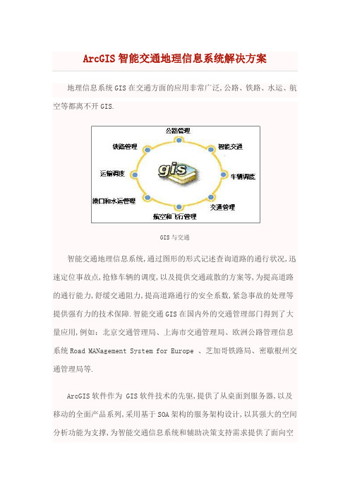
地理信息系统GIS在交通方面的应用非常广泛,公路、铁路、水运、航空等都离不开GIS.GIS与交通智能交通地理信息系统,通过图形的形式记述查询道路的通行状况,迅速定位事故点,抢修车辆的调度,以及提供交通疏散的方案等,为提高道路的通行能力,舒缓交通阻力,提高道路通行的安全系数,紧急事故的处理等提供强有力的技术保障.智能交通GIS在国内外的交通管理部门得到了大量应用,例如:北京交通管理局、上海市交通管理局、欧洲公路管理信息系统Road MANagement System for Europe 、芝加哥铁路局、密歇根州交通管理局等.ArcGIS软件作为 GIS软件技术的先驱,提供了从桌面到服务器,以及移动的全面产品系列,采用基于SOA架构的服务架构设计,以其强大的空间分析功能为支撑,为智能交通信息系统和辅助决策支持需求提供了面向空间的交通企业级平台解决方案.Esri公司秉承IT的互操作标准,可以与智能交通其他业务系统无缝的集成与融合,构建面向空间的智能交通业务平台,为缓解城市交通压力,提高城市交通安全提供全面的技术支撑服务.基于GIS的智能交通信息系统基于GIS的城市智能交通可以应用在以下几个方面:1、车辆诱导系统结合交通视频监控和交通诱导系统的车辆诱导GIS系统,基于地图实现交通流量的动态监控和交通事故的及时管理.停车诱导系统,以空间可视化方式,实时查询各停车场的剩余车位数或客满信息,减少城市交通盲目寻找车位而造成的车流量的增加.以GIS为支撑的车辆诱导系统可大大提高车速,减少交通堵塞.智能交通路况2、交通规划通过GIS对道路交通进行规划,分析上下班人群或交通人流、车辆的情况,优化轨道交通或公共交通的线路设计,利用GIS分析可优化建设交通枢纽站,调整公交线路的路线和停靠站点,提高公共交通的运载能力.可结合GIS实现交通一卡通系统建设,实现快速人流结算,可以极大提升城市交通服务的能力,缓解在高峰期人流或车流对交通所造成的压力.交通规划建设3、红绿灯智能集群优化红绿灯智能集群优化可以根据城市交通高峰期车流量的情况,进行智能的调度.结合GIS的技术可以对智能优化进行辅助的决策分析,通过空间可视化方式综合比较各交叉路口的集中流量情况,结合优化模型实现智能的优化,缓解城市智能流量,降低繁忙路口的拥堵情况,为调度中心提供直观、可视化的操控窗口.红绿灯智能优化4、智能指挥调度与综合监控智能交通指挥调度与监控工作与空间位置密不可分,通过GIS指挥人员可以随时了解各类对象的位置变化,掌握交通管理要素的空间分布规律和演进趋势,辅助进行决策管理.交通智能调度5、交通设施维护交通设施维护为交通道路、轨道及相关附属设施情况、周边环境情况等进行检测,及时的进行资产管理和维护,保证了交通设施路况的安全.基于GIS可以可视化方式对交通设施进行维护和管理.交通设施维护与管理6、安全与事故管理城市智能交通的核心在于交通的安全与事故处理的能力.通过GIS可以分析城市交通的事故多发路段,并对事故发生原因进行分析,提供快速、有效的事故解决办法,提高道路交通的安全.交通安全分析7、交通信息服务利用 GIS技术,通过网络电子地图向相关部门或公众用户发布交通路况信息,为公众提供车载智能导航和路径动态规划等.交通信息服务公路信息查询系统智能交通包含的子系统智能交通是以交通需求为导向,以信息技术为手段,通过全面提升、效率和服务品质为目的,充分利用交通的、空间的、时间的和移动的资源,形成的新交通系统.智能交通是一个基于现代电子信息技术面向交通运输的服务系统.它的突出特点是以信息的收集、处理、发布、交换、分析、利用为主线,为交通参与者提供多样性的服务.21世纪将是公路交通智能化的世纪,人们将要采用先进的一体化交通综合管理系统.在该系统中,车辆靠自己的智能在道路上自由行驶,公路靠自身的智能将交通流量调整至最佳状态,管理人员可对道路、车辆的行踪将掌握得一清二楚.智能交通包含的子系统大体可分为几个方面:一、车辆控制系统二、交通监控系统三、运营车辆高度管理系统四、旅行信息系统智能交通包含的子系统1交通信息服务系统ATIS2交通管理系统ATMS3公共交通系统APTS4车辆控制系统AVCS5货运管理系统6电子收费系统ETC7紧急救援系统EMS。
石油工程大数据算法按应用领域分类提高研究与应用效率

石油工程大数据算法按应用领域分类提高研究与应用效率目录一、内容简述 (2)1.1 背景与意义 (3)1.2 研究目的与目标 (3)1.3 研究内容与方法 (4)二、石油工程大数据概述 (5)2.1 大数据定义与特点 (6)2.2 石油工程大数据来源与类型 (8)2.3 石油工程大数据的重要性 (9)三、大数据算法在石油工程中的应用 (10)3.1 数据采集与预处理 (11)3.2 数据分析与挖掘 (12)3.3 数据可视化与决策支持 (13)四、按应用领域分类的大数据算法研究 (15)4.1 油藏评价与开发 (16)4.2 油气勘探与开发 (17)4.3 石油工程管理与决策 (18)4.4 环境保护与可持续发展 (19)五、提高研究与应用效率的策略与方法 (21)5.1 加强跨学科合作与交流 (22)5.2 提高算法精度与效率 (24)5.3 利用云计算与分布式计算技术 (25)5.4 建立完善的数据共享与协同机制 (26)六、案例分析 (28)6.1 案例一 (29)6.2 案例二 (30)6.3 案例三 (31)6.4 案例四 (32)七、结论与展望 (33)7.1 结论总结 (35)7.2 研究不足与局限性 (35)7.3 未来发展趋势与展望 (36)一、内容简述引言:介绍石油工程领域面临的挑战和大数据算法的重要性,阐述本文的研究背景和意义。
石油工程大数据概述:分析石油工程领域的数据特点,包括数据规模庞大、数据类型多样、数据处理复杂等。
大数据算法在石油工程中的应用:详细介绍大数据算法在石油工程各个领域的应用,如油气勘探、钻井工程、生产优化等。
石油工程大数据算法的应用领域分类:根据实际应用情况,将石油工程大数据算法分为若干类别,如数据分析与处理算法、预测与决策支持算法、优化与控制算法等。
提高研究与应用效率的措施:探讨如何通过分类应用大数据算法,提高石油工程研究与应用效率,包括算法优化、数据整合与共享、跨学科合作等方面。
ArcGIS地下管线管理解决方案0703
ArcGIS 地下管线管理解决方案ESRI中国(北京)有限公司版权声明本文档版权为ESRI中国(北京)有限公司所有。
未经本公司书面许可,任何单位和个人不得以任何形式摘抄、复制本文档的部分或全部,并以任何形式传播。
制定及修订记录目录第一章城市地下管线管理 (1)一、地下管线概述 (1)1、地下管线概述 (1)2、地下管线信息化发展现状 (1)3、地下管线管理存在问题 (2)二、GIS(地理信息系统)是地下管线管理的核心 (3)1、什么是GIS? (3)2、GIS是地下管线管理的核心 (5)第二章地下管线GIS需求分析 (8)一、地下综合管线管理 (8)1、地下综合管线综述 (8)2、地下综合管网GIS需求分析 (9)3、ArcGIS国内综合管网GIS成功案例 (13)二、燃气管线管理 (17)1、燃气管网综述 (17)2、燃气管网GIS需求分析 (17)3、ArcGIS国内煤气/燃气管网GIS成功案例 (26)三、供水管网管理 (34)1、供水管网管理综述 (34)2、供水管网GIS系统建设需求分析 (35)3、ArcGIS国内供水管网GIS用户 (40)四、排水管网管理 (47)1、城市排水管理综述 (47)2、排水管理GIS系统建设需求分析 (47)3、ArcGIS国内排水管网GIS用户 (48)五、热力管网管理 (52)1、热力管网管理综述 (52)2、热力管网GIS系统建设需求分析 (52)3、ArcGIS国内热力管网GIS用户 (63)六、电力通信管网管理 (64)1、地下电缆管网GIS需求分析 (64)2、地下通信管网GIS需求分析 (67)3、电力通信管网案例 (71)第三章ESRI的ARCGIS产品简介 (87)一、A RC GIS产品体系结构 (87)二、A RC GIS D ESKTOP桌面软件 (88)三、A RC GIS服务器软件 (89)四、A RC GIS所包含的主要服务器产品: (90)1、ArcSDE——海量空间数据引擎技术 (90)2、ArcGIS Server——企业级GIS服务器 (91)五、嵌入式GIS组件 (93)六、移动GIS (94)七、空间数据库(G EODA TABASE) (95)第四章地下管线建设的关键GIS技术及ARCGIS解决方案 (97)一、空间数据库的建立是重要的工作内容 (97)a)ArcGIS桌面产品是强大的空间处理软件 (97)b)ArcGIS的数据格式已经成为GIS工业标准 (100)二、海量数据管理能力 (100)a)全球使用最多的海量空间数据管理软件——ArcSDE (100)b)ArcSDE海量数据管理案例 (102)三、可集成性 (102)a)ArcGIS Engine (103)b)ArcGIS Server (103)四、适应性 (103)五、可扩展性、可伸缩性 (104)六、安全性 (105)第五章结束语 (107)第一章城市地下管线管理一、地下管线概述1、地下管线概述城市中的给水、排水(雨水、污水)、电力、电信、燃气(煤气、天然气、液化石油气)、热力、工业管道等市政管线工程,它们像人体内的“神经”和“血管”是维持城市功能正常运转的关键,俗称生命线工程。
ArcGIS电子海图解决方案

-
可以把海图发布成地图服务
•
支持S58海图数据校验
S57的支持——000数据直接导入
数据导入到Geodatabase——编辑
S52的支持
•
直接加载以及导入到GeoDatabase中都以标准S52显示
Nautical Solution——编辑
• •
基于模板的编辑 数据生成工作流化
-
修改错误
-
检验
-
Identification of corrections
•
S-58 Validation
Nautical Solution制图——Exporting
•
Vector
-
EPS PDF Color Separations
-
SPOT/Pantone
-
SeeSpotColor
-
Process color/CMYK
- Reviewer - XML
Batch Jobs
Support files Chart Series (INT1, INT2, …)
- Nautical
Nautical Solution——Data Reviewer
•
用来处理/访问空间数据质量的系统
-
查找错误
-
自动检查 人工检查 自定义检查 PLTS Edit tools
•
Raster
-
GeoTIFF TIFF Color Separations
-
Separated TIFF
Naitical Solution数据导出(000)
Naitical Solution——海图数据发布
•
• • •
基于GIS的油田站库管理系统的设计与实现的开题报告

基于GIS的油田站库管理系统的设计与实现的开题报告一、研究背景及意义随着油气勘探开发技术的不断发展,对油田站库管理系统的需求越来越迫切。
传统的油田站库管理方式大多采用纸质档案及人工操作的方式,效率低下且容易出现数据误差等问题。
为此,基于GIS的油田站库管理系统成为了当前油田站库管理领域的研究热点。
GIS(地理信息系统)是一种以地理数据为基础,应用于数据分析、数据可视化、空间决策的技术。
借助GIS技术,可以方便地将地理位置和属性信息进行整合和管理。
在油田站库管理中,GIS技术可以用于地理信息采集、分类和管理,以及站库物资的安全保护。
基于GIS的油田站库管理系统的建立,可以通过数字化手段存储、管理、检索和处理油田站库信息,提高透明度和管理效率,降低油田站库管理成本,从而满足油田站库规模不断扩大和需要实时监测的需求。
二、研究内容及方法本论文研究基于GIS的油田站库管理系统的设计与实现,主要包括以下内容:1.研究现有的油田站库管理系统,总结其优缺点及不足之处,探索提升油田站库管理效率的方法。
2.针对油田站库管理特点,建立基于GIS的油田站库管理系统,包括站库基础数据管理、设备物资管理、人员管理、安全管理等模块。
3.使用ArcGIS等GIS软件对油田站库地理信息进行处理和分析,提高油田站库管理的实际应用价值。
4.测试基于GIS的油田站库管理系统在实际应用中的效果,通过对比数据精度、处理速度、应用效果等指标,评价系统的性能和可靠性。
本论文的研究方法主要包括文献综述、系统设计、数据库设计、编码开发、测试验证等步骤。
三、预期成果及意义本论文预期通过设计基于GIS的油田站库管理系统,解决传统油田站库管理系统存在的许多问题,包括数据存储和查询不便,管理效率低下,数据精度低等问题。
同时,本论文还可以为其他领域的基于GIS的管理系统的设计和应用提供参考。
通过建立基于GIS的油田站库管理系统,可以提高油田站库的管理效率和精度,并简化管理程序,降低管理成本和风险。
PIPESIM与GoogleEarth在集输管线高程计算中的联合应用

PIPESIM与GoogleEarth在集输管线高程计算中的联合应用姚全敏高立群王成林徐士鹏赵勋中国石油新疆油田分公司勘探开发研究院摘要:在油田地面工程方案规划阶段,直接在GoogleEarth上绘制管网图,具有直观、可视化效果好的特点,可以有效规避构筑物、水坑、山包等,节省了地面建设前期方案规划设计时间和管线测量费用;而且绘制的管网图可以在油田地理信息系统上反映出来,为管线的查询和生产技术管理提供了极大便利。
由GoogleEarth生成的矢量图,转换后可以直接展布在PIPESIM提供的GIS底图上,自动捕获管线坐标和高程数据,节省了建模时间,提高了计算结果的准确度。
计算结果表明,在PIPESIM的GIS底图上直接建立管网模型,起输压力计算平均相对误差小于或等于-9.1%,进站温度计算平均相对误差小于或等于-9.1%,与实际生产结果均较为接近。
关键词:集输管线;GoogleEarth;Arcgis;PIPESIM;GIS底图;高程计算Joint Application of PIPESIM and Google Earth in Gathering and Transportation Pipe⁃line Elevation CalculationYAO Quanmin,GAO Liqun,WANG Chenglin,XU Shipeng,ZHAO XunExploration and Development Research Institute of Xinjiang Oilfield Company,CNPCAbstract:In the scheme planning stage of oilfield surface engineering,the pipeline network diagram is drawn directly on Google Earth,which has the characteristics of intuitionistic and good visualization effect.It can effectively avoid structures,water pits,mountain bumps,etc.,save the planning and de-sign time and the cost of pipeline survey in the early stage of surface engineering construction.And the pipeline network diagram drawn can be placed on the oilfield geographic information system,which provides great convenience for the inquiry of pipeline and production technology management.The vector map generated by Google Earth can be directly overlaid on the GIS basement map provided by PIPESIM,automatically capturing the pipeline location coordinates and elevation,saving modeling time and improving the accuracy of calculation.The calculation results show that the pipeline network model is directly established on the GIS basement map of PIPESIM,and the average relative error of starting pressure calculation is no more than-9.1%,and the average relative error of incoming temper-ature calculation is no more than-9.1%,which is close to the actual production data.Keywords:gathering and transportation pipeline;Google Earth;Arcgis;PIPESIM;GIS basement map;elevation calculationPIPESIM是斯伦贝谢公司研发的一款多相流稳态模拟计算软件,可以快速构建地面设施直接到GIS底图的画布上,并可以准确捕获管线坐标和高程,实现在地图画布上快速建模并准确进行集输管网模拟计算[1]。
ArcGIS_9.3.1_新特性

ArcGIS 9.3.1 新特性ESRI中国(北京)有限公司2009.5目录1. ArcGIS 9.3.1新特性之热点集粹 (1)1.1快速可伸缩的动态地图服务 (1)1.2 ArcGIS Online共享和搜索 (1)1.3对Microsoft Virtual Earth的支持 (1)1.4 ArcGIS数据互操作的新特性 (1)1.5微软 Silverlight的ArcGIS API (1)1.6对Java开发的支持扩展 (1)1.7与ArcGIS9.3兼容 (2)1.8改进的WMS支持 (2)1.9 ArcGIS资源中心的改进 (2)2. ArcGIS 9.3.1新特性之ArcGIS Desktop (2)2.1发布优化的地图服务 (2)2.2 ArcGIS Online共享与搜索 (3)2.3 免费使用Microsoft Virtual Earth (4)2.4 Geoprocessing中的“Eliminate”工具 (4)2.5 Geoprocessing中的“Ordinary Least Squares” (普通最小二乘法)工具 (4)2.6 ArcGIS“Data Interoperability”(数据互操作)扩展模块 (5)3. ArcGIS 9.3.1新特性之ArcGIS Server (6)3.1地图服务 (6)3.2 Geoprocessing服务 (6)3.3使用微软 Virtual Earth的图层和定位器 (7)3.4添加Image Services(影像服务)至Web 地图应用程序 (7)3.5配置自定义Server Object Extension的属性 (7)3.6 ArcGIS Server增强对WMS的支持 (7)3.7ArcGIS Server REST API (8)3.7.1网络分析求算路径操作 (8)3.7.2ArcGIS Server版本信息 (8)3.8在ArcGIS Server的.Net环境中使用Web 制图应用程序 (8)3.8.1功能改进 (8)3.8.2新的比例尺 (8)3.8.3MapTips外观的改进 (9)3.9基于Microsoft .Net的Web ADF (9)3.9.1定制MapTips外观 (9)3.9.2User Control Task (9)3.9.3Print Task templates (9)3.10ArcGIS Server Java (10)3.10.1支持影像服务 (10)3.10.2访问认证的WMS服务 (10)3.10.3配置Server Object Extension的属性 (10)3.10.4设置ArcGIS Manager和Web Server的配置参数 (10)3.10.5新的ArcGIS Java Web 服务工具包 (11)3.10.6增强的编辑功能 (11)3.10.7增强的WMS功能 (11)3.11用Java构建ArcGIS扩展 (12)1. ArcGIS 9.3.1新特性之热点集粹1.1快速可伸缩的动态地图服务在ArcGIS 9.3.1中,由于采用了优化的地图服务,不管是动态地图服务,还是缓存地图服务,您都可以实现快速、可伸缩的地图的发布。
地理信息系统在石油勘探与开发中的应用研究

地理信息系统在石油勘探与开发中的应用研究地理信息系统(GIS)是一种集地理空间数据采集、存储、管理、分析和展示于一体的技术系统。
它在各个领域都有着广泛的应用,其中之一就是石油勘探与开发。
本文将探讨GIS在石油勘探与开发中的应用研究。
首先,GIS在石油勘探中起着重要的作用。
石油勘探是指寻找地下潜在石油资源的过程。
GIS可以用于地质特征分析、石油气田评价、沉积相研究和地震数据处理等方面。
通过GIS,地质工程师可以收集、整理和分析地质数据,根据地质构造、断层分布以及沉积物的分布情况来预测潜在的石油资源。
此外,GIS还可以帮助勘探团队制定最佳的勘探方案,提高勘探效率和成功率。
其次,GIS在石油开发中也发挥着重要的作用。
一旦石油资源被发现,GIS可以用于石油储量评估、石油开发管理和环境保护等方面。
通过GIS,工程师可以对石油储量进行准确的量化评估,为开发方案和生产计划提供科学依据。
此外,GIS还可以用于管理石油开发区域的基础设施、人员分布、管道网络等,提高开发效率和管理水平。
同时,GIS还可以用于监测和评估石油开发对环境的影响,帮助制定环境保护措施,减少对生态环境的影响。
另外,GIS在石油勘探与开发中的应用还包括地理数据可视化和决策支持。
地理数据的可视化可以通过GIS技术将大量的地理信息以图像的形式展示出来,便于工程师和决策者对地理信息进行直观理解和分析。
决策支持则是利用GIS的空间分析和模型构建功能,为决策者提供科学依据和决策支持。
通过GIS,决策者可以进行多种可能性的模拟和评估,制定最佳的决策方案。
综上所述,GIS在石油勘探与开发中发挥着重要的作用。
它可用于地质特征分析、勘探方案制定、石油储量评估、开发区域管理、环境保护等方面。
通过GIS的应用,可以提高勘探效率、开发管理水平和环境保护水平,为石油勘探与开发提供强大的科技支撑。
随着技术的不断进步,GIS在石油勘探与开发中的应用还将继续发展和拓展,为石油产业的可持续发展做出更大的贡献。
GIS在石油行业信息化建设中的应用

GIS在石油行业信息化建设中的应用GIS在石油行业信息化建设中的应用基于GIS技术对油田信息进行统一管理、查询、分析和综合应用可视化,实现数据、图形和信息管理应用的一体化,已成为石油企业及各服务单位广泛的做法。
GIS能将石油企业的海量空间组成要素,如油井、管线、涉及的周边环境、设备、油井出口、储油罐等信息集成在一个公共数据库平台,并利用其强大的空间分析能力,进行有效的空间地理分析。
它把地理位置和相关属性有机地结合起来,根据用户的需要将空间信息及其属性信息准确真实、图文并茂地输出给用户,能满足石油企业对空间信息的要求,借助其独有的空间分析功能和可视化表达功能,进行各种辅助决策。
GIS在石油信息化建设中的应用非常广泛,主要有以下几个方面:——管理油气勘探。
石油勘探信息是油田最基础的信息。
利用GIS对油气勘探进行管理,包括利用GIS建立油气勘探管理数据库,综合利用地震资料、测井资料和钻探资料及其它勘探测试数据在内的综合空间数据库,并将地震剖面资料、测井资料、钻井资料及其它勘探测试资料与平面地理、地质资料有机地结合起来,从而实现对地质地层、区域构造及油藏储层进行三维空间的模拟。
工作人员可以随时方便地查询数据库中最新的信息,并利用GIS的数据表达功能得到数据表格、图形和专题分析图、综合对比分析图等方面的内容,及时、准确、形象、直观地了解有关情况并进行综合分析对比,从而准确、合理、迅速地进行勘探部署。
——管理油气开发。
开发管理部门利用GIS可以及时、准确、直观地了解油气资源的空间分布及其特征、油气开发的进展情况以及油井和油气管线的维护状况、维修进度,从而科学地部署开发工作。
通过GIS可以精确确定油气井位置,并得到所有生产井的产量及其变化趋势、工作状况以及在油井管理、维护状况等方面的信息,可以准确地预测产量,管理生产。
——管理石油管道。
石油天然气管道是石油石化企业普遍关心的问题。
管线信息种类繁多,数量巨大,在传统模式下,信息采用图纸标注,不仅存放不便,而且经过多次翻阅后图纸易破损,容易造成数据丢失。
Esri ArcGIS产品介绍

ArcGIS Runtime
轻量级架构的开发体系
iOS
Applications • ArcGIS Runtime SDK • Objective C
Android
Applications • ArcGIS Runtime SDK • Java
Windows Phone
Applications • ArcGIS
基本版
ArcGIS 3D Analyst(3D分析) ArcGIS Network Analyst(网络分析)
ArcGIS Geostatistical Analyst(地统计分析)
ArcGIS Image Extension(影像扩展) ArcGIS Data Interoperability(数据互操作)
Portal for ArcGIS
集中组织与管理 资源灵活共享 “一张图”式协同 资源高效搜索 辅助科学决策
产品定位
协同共享平台
– 高级灵活的群组管理及共享策略 – 快速内容发布 – 随时随地用户访问 – 在线应用
在线制图平台
– 丰富的基础底图
– 智能制图
– 多源业务数据Mashup
标准版 支持 支持 支持 支持 支持 支持 支持 需要扩展 支持 需要扩展
高级版 支持 支持 支持 支持 支持 支持 支持 支持 支持 需要扩展
ArcGIS for Server服务器端扩展
扩展 ArcGIS Schematics(逻辑示意图) ArcGIS Spatial Analyst(空间分析)
支持扩展模块
– Geodatabase 编辑
定制应用
– Raster
– 3D分析、Network分析等
多种开放的 APIs
Esri ArcGIS 银行GIS解决方案

Esri ArcGIS 银行地理信息系统解决方案目录1.前言 (3)2.GIS与银行 (3)2.1什么是GIS? (3)2.2GIS能帮助银行做什么? (4)3.GIS在银行的应用 (7)3.1资源管理 (7)3.2网点优化选址 (8)3.2.1选址分析 (8)3.2.2现有网点评估 (8)3.2.3选址分析 (10)3.3经营分析 (10)3.3.1当前经营分析 (10)3.3.2潜在客户挖掘 (11)3.4安全监控 (12)3.4.1管控中心 (12)3.4.2重要资产监控 (13)3.4.3运钞车监控及线路规划 (13)3.5公众服务 (14)3.5.1银行网点服务 (14)3.5.2路线查询 (14)3.5.3移动端服务 (15)4.ArcGIS平台介绍 (15)1.前言随着经济的发展和金融改革的深入,以及银行业全球化竞争的日益加剧,如何充分管理和利用资源、挖掘客户需求以及更好的服务于客户是银行企业追求的目标,也是银行企业生存发展的基础。
随着信息产业的发展,银行企业管理水平和服务质量有了明显提高,银行也越来越重视信息化建设。
在信息化建设过程中发现大量的信息都与空间位置密切相关,例如:营业网点选址、ATM机监控、运钞车监控以及市场分析等,如何有效利用这些空间信息提升银行的综合竞争力显得非常重要。
地理信息系统(Geography Information System,简称GIS)是一门优秀的空间信息技术,具有空间数据直观展示和强大的空间分析和挖掘能力,为银行资产与资源管理、网点优化、市场分析等提供良好的技术保障。
利用GIS技术帮助银行对市场情况进行可视化研究、分析数据,以及建立一个理想的商业模型以预测他们现行的策略是否适应业务的发展。
美国环境系统研究所公司为银行企业提供了完整的GIS解决方案。
美国环境系统研究所公司(Environmental Systems Research Institute,Inc.简称ESRI 公司)成立于1969年,总部设在美国加州RedLands市,目前在200多个国家和地区开展业务,是全球最大的地理信息系统(Geography Information System,简称GIS)技术提供商。
- 1、下载文档前请自行甄别文档内容的完整性,平台不提供额外的编辑、内容补充、找答案等附加服务。
- 2、"仅部分预览"的文档,不可在线预览部分如存在完整性等问题,可反馈申请退款(可完整预览的文档不适用该条件!)。
- 3、如文档侵犯您的权益,请联系客服反馈,我们会尽快为您处理(人工客服工作时间:9:00-18:30)。
目录第一章:ESRI公司的GIS观点.....................................................................................- 1 - 第二章:GIS在石油管理中的应用................................................................................- 4 - 第三章:ArcGIS技术特点.............................................................................................- 8 - 第四章:强大的市场竞争力.........................................................................................- 14 - 第五章:国内外石油行业用户......................................................................................- 17 - 第六章:石油地理信息系统配置建议...........................................................................- 19 - 建议配置方案一....................................................................................................- 19 - 建议配置方案二....................................................................................................- 23 - 第七章:ArcGIS在国内石油行业应用论文..................................................................- 26 - 应用论文一:应用ARC/NFO实现对胜利油田三维勘探区块的管理.....................- 26 - 应用论文二:地理信息系统(GIS)在石油地质中的应用研究.............................- 29 - 应用论文三:建立胜利油田1∶5万地图数据库软件的应用与开发.......................- 32 - 应用论文四:胜利油田1:5万地图数据库在ARCGIS上的实现.........................- 42 - 应用论文五:基于ArcGIS技术的油田地面信息管理系统建设.............................- 44 - 应用论文六:构建基于ArcSDE的基础地质空间数据库.......................................- 53 - 第八章:ArcGIS在国内外石油行业应用集锦..............................................................- 57 -8.1 国外石油行业成功案例..................................................................................- 57 -8.1.1 案例1:皇家荷兰/壳牌集团公司(Shell)案例............................- 57 -8.1.2 案例2:BP公司应用案例............................................................- 58 -8.1.3 案例3:沙特阿拉伯石油公司案例................................................- 59 -8.1.4 案例4:Questar Regulated Services案例...................................- 61 -8.1.5 案例5:美国El Paso公司案例....................................................- 62 -8.1.6 案例6:巴西Petrobras石油公案例司.........................................- 64 -8.1.7 案例7:IHS能源公司案例...........................................................- 66 -8.1.8 案例8:加利福尼亚州文图拉县案例............................................- 68 -8.1.9 案例9:科威特石油公司案例.......................................................- 69 -8.1.10案例10:能源消费者案例...........................................................- 70 -8.1.11案例11:太平洋天然气和电子公司(PG&E)案例.....................- 70 -8.1.12案例12:里海地区石油管道案例................................................- 71 -8.1.13案例13:美国国家管道案例........................................................- 71 -8.1.14案例14:殖民管道(Colonial Pipeline)案例..................................- 71 -8.1.15案例15:联合太平洋资源公司案例.............................................- 72 -8.1.16案例16:Koch Industries案例...................................................- 72 -8.1.17案例17:尼日利亚OPTS案例...................................................- 72 -8.1.18案例18:BP BTC管道的管道GIS咨询项目案例.......................- 73 -8.2 国内石油行业成功案例..................................................................................- 73 -8.2.1 案例19:中石化胜利油田基础地理与地面建设信息系统案例.....- 73 -8.2.2 案例20:胜利油田勘探GIS系统案例........................................- 74 -8.2.3 案例21:胜利油田开发GIS系统案例........................................- 75 -8.2.4 案例22:“数字海底技术渤海油田示范区建设”案例....................- 75 -8.2.5 案例23:大庆油田基础地理空间数据共享平台案例...................- 78 -8.2.6 案例24:华油天然气公司案例...................................................- 82 -第一章:ESRI公司的GIS观点ESRI从事GIS理论研究、产品开发及应用拓展已有三十余年的历史,遍布全球数以百万计的用户,为ESRI的技术进步和自身的壮大提供了巨大的推动力和发展空间。
ESRI 以其深厚的理论及工程技术底蕴,加之强大的技术开发力量,在对广大用户大量的反馈信息进行分析、整理和发掘的同时,始终积极地对各种主流的IT技术加以广泛而深入的关注,并对自己的产品体系结构及技术进行及时的优化和重构。
从而使ESRI得以长期保持GIS领头羊的地位,并为GIS界和广大用户持续地提供各个不同的发展时期中最新、最好、最强有力的技术、服务和支持。
随着GIS技术在国民经济建设各领域、各部门的应用日益普及和深入,GIS的潜在价值正在被不断地发现和挖掘。
GIS系统作为国民经济重要基础设施之一的重要性和不可替代性正在被广泛认识和接受。
GIS正在逐渐成为各种各样基于IT的信息系统和应用系统的公共平台。
GIS需要发挥的已不仅仅是其最传统同时也是最基本的作为空间查询检索和专题制图辅助工具的那些功能和作用,更重要地,GIS正在逐步成为一种与我们的工作、学习、生产和生活密不可分的重要因素。
对于现代IT文明的各个组成部分,如:网络、计算机、操作系统、数据库、人机交互、软件工程以及程序设计语言和方法等,GIS应该采取的是一种积极借鉴、充分融合的思路。
就FM(公共设施管理)而言,一个单纯为设施管理而建立的一个独立的“纯FM”系统已远远不能满足要求。
设施的前期规划、工程实施、服务保障、系统维护以及客户管理等,都必须充分地利用除各种专业设施数据以外的其它空间数据及相关属性数据,诸如:基础空间定位数据、行政区划数据、城市规划数据、国民经济产值分布数据、人口统计数据、客户及潜在客户分布数据、竞争对手势力及其客户分布数据等,通过对这些数据的综合空间分析以得出能够对FM的规划、管理和服务等具有科学参考价值的辅助决策信息,从而在效率和质量两方面同步提高公共设施的规划、管理和服务水平。
而这些,仅凭单纯意义上的设施管理已完全不能涵盖和满足。
因此,ESRI所强调和追求的是在提供丰富的FM机制和功能的前提下,与GIS充分地结合,利用GIS的强大空间分析功能对FM提供深层的支持和扩展空间。
ESRI在其崭新的AM/FM/GIS平台系列软件ArcGIS中,除了继续保持ESRI产品既有的强大空间数据管理和分析能力外,还全面采用了工业标准的和开放的主流IT技术,主要表现在:a) 数据管理采用全关系DBMS,在所有主流的工业标准的DBMS中管理空间数据和相ESRI ArcGIS 新特性与石油信息化解决方案关的属性数据。