AO操作-拖拽打开地图
地图制图软件开发中的地图缩放和拖动功能

地图制图软件开发中的地图缩放和拖动功能地图制图软件在现代社会中发挥着重要的作用,它们用于展示地理信息、分析地理数据以及帮助用户导航和定位。
其中,地图缩放和拖动功能是地图制图软件的基础功能之一。
本文将探讨地图缩放和拖动功能的设计原则、实现方法以及相关挑战。
1. 设计原则在地图制图软件中,地图缩放和拖动功能的设计应遵循以下原则:1.1 用户友好性:地图缩放和拖动功能应该简单易用,用户能够通过直观的操作进行地图缩放和拖动。
例如,使用鼠标滚轮进行缩放、点击拖动以及提供屏幕上的按钮等。
1.2 平滑性:地图缩放和拖动应该具有流畅的动画效果,以提供良好的用户体验。
缩放和拖动操作不应产生卡顿或延迟,以确保用户获得实时地图反馈。
1.3 多级别缩放:地图缩放应支持多个级别,以便用户能够在不同比例尺下查看地图。
用户应能够进行放大和缩小操作,并能够在各个级别之间无缝切换。
1.4 连续拖动:拖动功能应该允许用户在地图上连续拖动,以便自由浏览地图。
用户应能够按住鼠标左键或触摸屏幕并拖动地图,地图应随之平滑移动而不会中断或跳跃。
2. 实现方法地图缩放和拖动功能的实现需要考虑以下方面:2.1 地图数据处理:地图数据通常以矢量、栅格或图块的形式存储。
在进行缩放和拖动操作时,软件需要根据当前显示区域加载相应的地图数据,并进行坐标转换,以确保地图在不同屏幕尺寸和比例尺下的正确显示。
2.2 用户交互:软件需要捕捉用户的操作,例如鼠标滚轮事件、点击事件和拖动事件等。
根据用户的操作,软件需要相应地调整地图的缩放级别和位置,并更新地图显示。
2.3 动画效果:为了实现平滑的地图缩放和拖动效果,软件可以使用动画技术来过渡地图的变化。
例如,在缩放过程中逐渐调整地图的大小和位置,或者在拖动过程中通过动画来交互地更新地图的显示。
2.4 边界限制:为了避免地图显示超出范围,软件需要在缩放和拖动操作中设置边界限制。
当用户进行缩放或拖动操作时,软件应该检测边界限制,并保证地图在合理范围内显示,以免出现地图显示不完整或空白的情况。
automap mapfrom用法 -回复
automap mapfrom用法-回复「automap mapfrom用法」自动制图(automap)是一种利用计算机技术帮助地理信息系统(GIS)用户生成地图的方法。
而其中一个重要的功能就是mapfrom操作,它能够从不同的数据源中提取地理空间信息,然后进行可视化和分析。
本文将一步一步回答有关automap mapfrom用法的问题。
一、什么是automap mapfrom?automap mapfrom是一种automap工具的操作,它允许用户从多个数据源中提取地理数据以生成地图。
利用该功能,用户可以通过简单的命令或工具调用,从数据库、文件或网络服务中获取空间数据,并将其转化为GIS中使用的矢量数据集。
二、如何使用automap mapfrom?以下是使用automap mapfrom功能的详细步骤:1. 打开automap工具:首先,打开GIS软件中的automap工具。
通常,它可以在工具栏、菜单或命令行中找到。
点击或输入相应的命令以打开automap工具。
2. 选择数据源:在automap工具中,选择"mapfrom"选项。
接下来,您将看到一个对话框,用于选择数据源。
可以从数据库、文件或网络服务中选择一个数据源。
3. 配置数据源连接:根据您选择的数据源类型,配置相应的连接信息。
如果选择的是数据库,您需要提供数据库名称、用户名和密码等信息。
如果是文件,则需要指定文件路径。
如果是网络服务,则需要提供服务的URL。
4. 选择空间数据集:一旦连接配置完成,automap将显示您可以选择的可用空间数据集列表。
根据您的需求,选择一个或多个空间数据集。
5. 设置地图参数:在选择完空间数据集后,您可以设置地图的渲染样式、范围、比例尺等参数。
不同的GIS软件会有不同的界面和配置选项,您需要根据软件的特点进行相应的设置。
6. 生成地图:一切准备就绪后,点击“生成地图”或相似的按钮。
automap 将开始提取并转换数据,最后生成您所需的地图。
百度地图API详解之地图操作

百度地图API详解之地图操作
本文专门介绍与地图操作相关的接口。
首先我们来看看百度地图API都提供了哪些操作方式:
PC平台:
•鼠标拖拽移动
•鼠标双击缩放
•鼠标滚轮缩放
•键盘控制
移动平台:
•单指拖拽移动
•单指双击放大
•双指移动缩放
默认情况下,地图支持鼠标拖拽以及双击缩放(双击鼠标左键放大一级,双击鼠标右键缩小一级)操作。
如果需要开启鼠标滚轮支持需要调用这个接口:
map.enableScrollWheelZoom(); // 启动鼠标滚轮操作
键盘控制默认也是不开启,开启后按键+和-分别让地图放大或缩小一级,PgUp、PgDn、Home、End键则会让地图向下、上、右、左四个方向移动一段距离。
↑、↓、←、→四个健可以使地图在四个方向上移动,另外这个也可以组合使用,比如同时按住↑和←,地图就会往右下方移动,目的是让你看到左上方区域的图像。
开启键盘操作需要调用如下接口:
map.enableKeyboard();
为了让用户获得更好的体验,建议开启连续缩放效果和惯性拖拽效果:
map.enableContinuousZoom(); // 开启连续缩放效果
map.enableInertialDragging(); // 开启惯性拖拽效果
这样,地图缩放就会有一个动画效果,拖拽结束后地图还会根据移动距离和速度产生一个惯性效果。
在移动端,所有的操作默认都是开启的,但是通过接口也可以进行配置。
RGMap(Android版)操作手册资料
数字地质填图系统(Android版)操作手册一、概述1、系统功能Android(安卓)是目前智能移动终端的主流操作系统,基于Android平台开发的数字地质填图系统AoRGMap,相比之前基于Windows mobile的数字填图系统,操作更简单,使用更灵活,设备的选择更多样。
目前,AoRGMap主要提供GPS定位、路线数据采集、实测剖面等功能。
AoRGMap系统的基本流程是:先由桌面系统准备手图数据,转成Android可识别格式,并通过同步软件(如豌豆荚、91手机助手、360手机助手等)+ USB 线方式拷贝到采集器,经过野外工作过程采集数据之后,再导入桌面系统进行综合整理。
2、硬件环境目前支持的Android操作系统版本是2.2及以上。
屏幕:必须支持多点触摸。
二、AoRGMap安装1. 在PC电脑上安装Android助手程序(豌豆荚2.0或更高版本、91手机助手等),现以豌豆荚(2.6版本)的安装为例:安装完成后,启动豌豆荚应用程序:2. 使用USB数据线连接PC与嵌入式设备(必须步骤);3. 根据豌豆荚的提示等待PC自动安装手机驱动程序(同一个手机第二次连接同一台PC时会自动跳过此步骤),以下为某型号为例:4. 自动安装手机上的Android 助手软件的客户端:5. 在豌豆荚中单击左侧的“应用和游戏”,选择“已安装的应用”,在右侧界面上方单击“安装新应用”按钮:6. 选择AoGISRuntime2.apk(Android版本为2.2、2.3、3.0等)和AoRGMap.apk,或者选择AoGISRuntime4.apk(Android版本为4.0以上)和AoRGMap.apk,并安装:7. 在豌豆荚首页中选择“SD卡管理”,将Android原型库“AoGIS”文件夹拷贝到SD 卡根目录(/mnt/sdcard/),同样将Android字典库“AoRGMap”拷贝到文件夹SD卡根目录(/mnt/sdcard/):三、野外手图转出到Android采集器1. 利用DGSInfo系统,设计好路线后,生成野外手图,将数据导出到Android采集器,生成路线命名的文件夹。
第四节AO体系

完整的分析系统。ArcView还做了明显的改进。如,新的
ArcGIS桌面功能包括通过ArcCatalog浏览和管理数据,动态的 投影转换,内嵌的VBA开发,新的编辑工具,支持静态注记等 等。ArcView允许用户创建和编辑shapefile和个人化的空间数 据库的简单要素。
ArcView中的应用: ArcMap ArcCatalog ArcToolbox ModerBuilder 它是一个强有力的 GIS工具包,提供了数 据使用,制图,制作 报表和基于地图的分 析。
ArcGIS产品体系之Desktop
导出丰富的通用数据格式(如DXF、VPF和SDTS等)。 直接读取并导入与OGIS兼容的简单要素数据。 显示格式丰富的地理参考影像。 允许用户为其他图像格式提供支持。 具备基本的图像处理功能。 可以按标准的输出投影显示地理数据。 地图移动缩放 交互式点取查询要素(如:点取工具、热链接和地图提示等)。 把ArcMap要素数据关联到来自任意DBMS或基于文件的外部属性数据表。 要素数据甚至能够同时关系到多个属性表。 按表格方式显示要素属性。 字段内容赋值。 创建要素属性相关的图表。 与Internet的共存和交互。包括与HTML文档的超级链接,对GIF和JPEG图 像的支持,以及“远程数据图层”等
就为该数据创建了一个层。该层不是数据的复制,而是数据的参考
(指针)。层包含描述数据如何被绘制的信息。每一层都能被分配一
个具体的绘制特征。例如:在一个土地规划部门被多个组使用的宗地
数据能为每个组产生一个层。每一组都可以用不同的符号来表示自己
的层。利用这些层,GIS管理人员和地图制作人员就能建立起可用来
与其他应用程序交互自如,支持从ArcCatalog、ArcToolbox和
VBA+AO入门50例完全注释版

1.Sub MyMacro()Dim pMxDocument As IMxDocument '地图文档Set pMxDocument = Application.Document '获取当前应用程序的文档MsgBox '显示当前地图的名称End Sub2.Sub MyMacro()Dim pMxDocument As IMxDocument '地图文档Dim pMaps As IMaps '地图集Dim pMap As IMap '地图Set pMxDocument = Application.Document '获取当前应用程序的文档Set pMaps = pMxDocument.Maps '获取当前地图文档的地图集If pMaps.Count > 1 Then '如果该地图集的地图数大于1Set pMap = pMaps.Item(1) '获取该地图集中的第一幅地图MsgBox '显示该地图的名称End IfEnd Sub3.Sub MyMacro()Dim pMxDocument As IMxDocument '地图文档Dim pMap As IMap '地图Dim lCount As LongDim lIndex As LongSet pMxDocument = Application.Document '获取当前应用程序的文档Set pMap = pMxDocument.FocusMap '获取当前地图lCount = 0For lIndex = 0 To (yerCount - 1)If TypeOf yer(lIndex) Is IFeatureLayer Then '如果当前地图的第lIndex层的类型是IFeatureLayerlCount = lCount + 1 '计数器加1End IfNext lIndexMsgBox "Number of the feature layers " & _"in the active map: " & lCount '显示当前地图的要素层的总数End Sub4.Sub MyMacro()Dim pMxDocument As IMxDocument '获取当前应用程序的文档Dim pMaps As IMaps '地图集Dim pMap As IMap '地图On Error GoTo SUB_ERROR '错误处理Set pMxDocument = Application.Document '获取当前应用程序的文档Set pMaps = pMxDocument.Maps '获取当前地图文档的地图集Set pMap = pMaps.Item(1) '获取该地图集中的第一幅地图MsgBox '显示该地图的名称Exit SubSUB_ERROR: '行标签MsgBox "Error: " & Err.Number & "-" & Err.Description '显示错误数和错误信息End Sub5.'是图层可视Public Sub MakeLayerVisible()Dim pMxDocument As IMxDocument '地图文档Dim pMap As IMap '地图Dim pFeatureLayer As IFeatureLayer '要素层Dim pActiveView As IActiveView '活动视图Dim pContentsV iew As IContentsV iew '窗口内容表'获取地图的第一层Set pMxDocument = ThisDocument '获取当前应用程序的文档Set pMap = pMxDocument.FocusMap '获取当前地图Set pFeatureLayer = yer(0) '获取当前地图的第一层'如果要素层不可见,则使其可见If Not pFeatureLayer.Visible ThenpFeatureLayer.Visible = TrueEnd If'刷新地图Set pActiveView = pMap '将当前地图设为活动地图pActiveView.Refresh '刷新'刷新窗口内容表Set pContentsV iew = pMxDocument.CurrentContentsV iew '获取当前地图文档的窗口内容表 pContentsV iew.Refresh pFeatureLayer '刷新End Sub6.'按NAME查询要素Private Function GetCountyFeature(pFeatureLayer As IFeatureLayer, strCountyName As String) As IFeature'查找要素类Dim pFeatureClass As IFeatureClass '要素类Dim pQueryFilter As IQueryFilter '查询过滤器Dim pFeatureCursor As IFeatureCursorSet pFeatureClass = pFeatureLayer.FeatureClass '从要素层获取要素类Set pQueryFilter = New QueryFilter '创建一个新的查询过滤器pQueryFilter.WhereClause = "NAME = '" & strCountyName & "'" '按郡名查找Set pFeatureCursor = pFeatureClass.Search (pQueryFilter, False) '获取查询到的要素对象'获取要素Dim pFeature As IFeature '要素Set pFeature = pFeatureCursor.NextFeature '获取查询结果的下一个要素If pFeature Is Nothing Then '如果该要素不存在Set GetCountyFeature = Nothing '返回值设为空ElseSet GetCountyFeature = pFeature '将该要素设为返回值End IfEnd Function'放大/缩小Sub MyZoom()Dim pDoc As IMxDocument '地图文档Dim pActiveView As IActiveView '活动地图Dim pEnv As IEnvelope '显示范围Set pDoc = Application.Document '获取当前文档,等同于ThisDoucumentSet pActiveView = pDoc.ActiveV iew '获取当前活动地图Set pEnv = pActiveView.Extent '获取当前显示范围pEnv.Expand 0.5, 0.5, True '按比例放大两倍,把0.5改为2则为缩小一半pActiveView.Extent = pEnv '更新显示范围pActiveView.Refresh '刷新End SubMxApplication代表ArcMap本身,只管理一个文档MxDocument(ArcMap是单文档界面)。
全能电子地图使用方法

全能电子地图使用方法全能电子地图是一款多功能的电子地图应用,以下是使用方法:1. 下载并安装:前往应用商店搜索“全能电子地图”,下载并安装应用程序。
2. 打开应用:安装完成后,在手机桌面或应用列表中找到全能电子地图应用,点击图标打开应用程序。
3. 定位功能:全能电子地图会自动获取你的当前位置,你可以在地图上看到自己所处的位置。
如果应用没有自动定位到你的位置,你可以点击地图上的定位按钮进行手动定位。
4. 地图浏览:在地图上可以使用手指进行拖拽操作,可以在地图上上下左右滑动查看不同区域的地图。
你还可以使用捏拉手势缩放地图,使地图放大或缩小。
5. 搜索地点:在应用程序界面上方通常会有一个搜索框,你可以在搜索框中输入你想要查找的地点或地址,如:“北京天安门”,然后点击搜索按钮。
全能电子地图会自动搜索并在地图上显示相关的地点。
6. 路线规划:在地图上搜索到目的地后,你可以点击目的地标记点,并选择“规划路线”选项,全能电子地图会为你规划出一条驾车、步行或公共交通的最佳路线,并显示在地图上。
7. 收藏地点:当你找到感兴趣或常去的地点后,你可以将其添加到收藏夹中,方便你日后查找。
在地图上点击该地点,并选择“添加到收藏夹”选项即可。
8. 分享地点:如果你想与朋友分享你在地图上找到的某个地点,你可以点击地图上的分享按钮,选择分享方式,如邮件、短信或社交媒体等。
9. 导航功能:如果你想要使用导航功能,可以先选择目的地并规划路线后,点击地图上的导航按钮。
全能电子地图会使用内置导航功能为你提供实时导航指引,让你更便捷地到达目的地。
通过以上步骤,你就可以快速上手并使用全能电子地图了。
这款应用提供了丰富的功能,包括搜索地点、规划路线、导航等,可以帮助你更方便地查找地点并到达目的地。
Oruxmaps_导航软件使用说明书解读

0: (2^z - 1 - y)
1: (val + 1)
2: add '/' each 6 characters
3: (x + y ) mod num_servers -->
</onlinemapsource>
从这里可以找到感兴趣的代码,注意尊重知识产权!
注意:Oruxmaps利用内部缓存存储地图上的图像,所以在线浏览过的图像都可以离线使用,而不必再从网络获取。缓存不会永远保存,可通过下面两种方式进行管理:
使用Oruxmaps最简单的方法是打开时用“在线地图”。在主界面上,选择“在线地图”,选择一个地图即可。可用的在线地图配置在这个目录下:Oruxmaps/mapfiles/onlinemapsources.xml
当前可以看到在线的地图,若想获得当前位置,按“航迹”-->“开始GPS”,当收到第一个位置的信号后,地图的焦点会聚集到当前所处位置,这个信号可以是单纯的GPS信号或者手机网络信号(需要设置GPRS)。
下面我们将开始学习“用户手册”,Oruxmaps有丰富的功能,有许多的“设置”、“菜单”等等。
二、地图
Oruxmaps使用专用格式的地图,原因是手机操作系统处理大图片时有一定的局限性。
地图是一个具有地图名称的一个目录,包含以下信息:
1.一个扩展名为.otrk2.xml的文件,含有地图校准信息;
2.一个扩展名为.db的文件或者包含地图图像文件的目录
EPSG:4230 EPSG:23029 EPSG:23030 EPSG:23031
</SRS>
下面是WMS支持的坐标系统,必须选用:EPSG:4326.
在线动态地图平台 用户手册说明书

在线动态地图平台用户手册二〇二〇年12月I 在线动态地图平台目录目录 (I)1 前言 (1)2 手册内容 (1)3 运行环境 (1)4 平台系统概述 (1)4.1 系统功能和技术特点 (2)4.2 数据资源模块 (2)4.3 制作地图模块 (3)4.4 出图打印模块 (4)5 系统操作指南 (4)5.1 数据资源操作说明 (4)5.1.1 公共数据管理 (5)5.1.1.1 公共数据查询 (6)5.1.1.2 公共数据预览 (6)5.1.2 我的数据管理 (7)5.1.2.1 我的数据上传 (7)5.1.2.2 我的数据预览 (8)5.2 制作地图操作说明 (8)5.2.1 自定义地图制作 (9)5.2.1.1 选择数据 (9)5.2.1.2 选择底图 (10)5.2.1.3 选择纸张 (11)5.2.1.4 地图编辑 (11)5.2.2 示例模板地图制作 (16)5.3 出图打印操作说明 (17)5.3.1 整幅导出 (17)5.3.2 分幅导出 (18)1 前言本手册为在线制图平台用户操作手册,手册将详细介绍平台所包括的上传数据、数据查看、制作地图、出图打印等的操作流程,旨在为用户熟悉系统功能、进行业务操作、提高工作效率提供帮助。
2 手册内容本手册内容主要为平台功能模块介绍及其操作流程。
3 运行环境支持IE、Google Chrome、360安全浏览器、Safari、Mozilla Firefox等主流浏览器浏览。
4 平台系统概述在线制图平台是为了克服弱GIS行业地图制图难、传统地图平台难以满足需求等问题所研发的,主要是具有数据改造发布、无极缩放、模板丰富、快速成图、不同尺寸纸张打印、分幅打印等功能的在线动态制图平台。
为方便用户操作、简化登录流程、本平台只需微信扫描二维码即可登录系统,如图4-1所示。
图4-1 在线制图平台入口页面4.1 系统功能和技术特点在线制图平台的硬件环境主要包括有服务器不低于2.3GHZ的4核Inter(R) Xeon(R) 处理器,不低于8G系统内存,不低于100GB存储容量。
奥维地图电脑端操作方法

奥维地图电脑端操作方法
要在奥维地图的电脑端进行操作,可以按照以下步骤进行:
1. 打开奥维地图的官方网站或者下载并安装奥维地图的电脑端应用程序。
2. 打开奥维地图应用程序,进入主界面。
3. 在主界面上方的搜索框中输入你想要搜索的地点或者地址。
4. 在搜索结果中选择你要查看的地点,地图会自动定位到该地点并显示相关信息。
5. 可以使用鼠标左键拖动地图,进行移动和浏览其他区域。
6. 使用鼠标滚轮可以进行地图放大和缩小,或者使用放大和缩小按钮进行操作。
7. 在地图上点击标注点,可以查看该地点的详细信息和相关图片。
8. 可以使用奥维地图提供的导航功能,在地图上设置起点和终点,查看最佳路线。
9. 如果需要保存地点或绘制路径,可以使用书签和绘图工具。
10. 在设置菜单中可以进行个性化设置,如语言选择、地图样式等。
以上就是在奥维地图电脑端进行操作的基本方法,希望能对你有所帮助。
SLCAD架空送电线路定位CAD系统说明书用户手册
SLCAD架空送电线路定位CAD系统(windows 版)用户手册目录第一章系统概述 ....................................................................................................................1一功能简介.................................................................................................................. 1二系统需求.................................................................................................................. 1三系统安装.................................................................................................................. 1四注意事项.................................................................................................................. 1五名词解释.................................................................................................................. 2第二章定位CAD系统操作流程............................................................................................3一系统配置............................................................................................................. 3二杆塔定位及校核................................................................................................. 3三成果输出............................................................................................................. 3第三章系统运行 ......................................................................................................................4一打开已有平断面图数据文件.................................................................................. 4二必要的设置.............................................................................................................. 41. 确定本单位图式.................................................................................................... 42. 设置绘图参数/测量方法....................................................................................... 63. 设置平断面绘图比例尺........................................................................................ 74. 设置标尺................................................................................................................ 71. 修改标尺............................................................................................................ 72. 增加标尺(在塔处)........................................................................................ 83. 增加标尺(在桩、点处)................................................................................ 84. 删除标尺............................................................................................................ 85. 单标尺快速显示................................................................................................ 96. 删除全部标尺(保留一个)............................................................................ 97. 添加任意标尺.................................................................................................... 9第四章杆塔定位 .................................................................................................................. 10一数据库维护 ........................................................................................................... 101. 杆塔库................................................................................................................ 102. 绝缘子串库........................................................................................................ 113. 典型气象区库.................................................................................................... 124. 电线参数库........................................................................................................ 125. 跨越规程库........................................................................................................ 136. 备件库................................................................................................................ 137. 组装库................................................................................................................ 13二基本配置 ............................................................................................................... 141. 线路配置............................................................................................................ 142. 跨越配置............................................................................................................ 153. 其它配置............................................................................................................ 164. 气象条件配置.................................................................................................... 17三杆塔定位 ............................................................................................................... 181. 指定桩位立塔.................................................................................................... 183. 指定档距处立塔................................................................................................ 204. 耐张段等分立塔................................................................................................ 215. 平地推模板立塔................................................................................................ 216. 修改、移动塔.................................................................................................... 247. 全线路重排塔名................................................................................................ 258. 删除塔................................................................................................................ 25第五章图形编辑 .................................................................................................................. 261. 添加连线............................................................................................................ 262. 文字注记............................................................................................................ 263. 地物符号............................................................................................................ 274. 删除各种标注.................................................................................................... 285. 移动各种标注.................................................................................................... 286. 编辑投影线........................................................................................................ 287. 开窗自动排列投影线........................................................................................ 298. 删除投影线........................................................................................................ 29第六章校核检查 .................................................................................................................. 301.交互检查任意点交叉跨越距离..................................................................... 302.设置指定档导地线弧垂................................................................................. 311 置某耐张段导线最大弧垂............................................................................. 312 置某耐张段导线任意弧垂............................................................................. 313 置某耐张段地线任意弧垂............................................................................. 313.交互检查任意档导地线是否上拔................................................................. 324.设置全部档导线弧垂..................................................................................... 325.设置全部档地线弧垂..................................................................................... 326.自动检查所有档导地线配合......................................................................... 327.浏览检查定位结果......................................................................................... 331 计算定位及检查数据..................................................................................... 332 浏览定位及检查数据..................................................................................... 333 全线路改变安全系数..................................................................................... 344 开窗改变安全系数......................................................................................... 348.开窗自动加风偏校验图................................................................................. 349.升降风偏断面................................................................................................. 3410.根据导地线配合设计地线........................................................................... 3411.整齐化模板K值(辽宁院)....................................................................... 3512.全自动检查交叉跨越距离........................................................................... 3513.全自动检查其它电气校验........................................................................... 3714.显示风偏鼓................................................................................................... 38第七章输出图表 .................................................................................................................. 391. 杆塔明细表........................................................................................................ 391.1 有关明细表的数据流程.............................................................................. 391.2 生成明细表的操作流程.............................................................................. 392.1 材料简表(检查用).................................................................................. 412.2 材料总表(统计零部件).......................................................................... 412.3 操作过程...................................................................................................... 413. 输出计算书........................................................................................................ 424. 连续档应力弧垂计算系统................................................................................ 435. 导线连续上下山档线夹调整表........................................................................ 446. 地线连续上下山档线夹调整表........................................................................ 447. 输出导线孤立档计算书.................................................................................... 458. 输出地线孤立档计算书.................................................................................... 459. 输出防振锤安装计算书.................................................................................... 4510. 输出塔位成果表1 ........................................................................................... 4511. 输出塔位成果表2 ........................................................................................... 4512. 输出LH,LV,LP,∑L,K等表3 ........................................................................... 4513. 输出当前工况垂直档距一览表...................................................................... 4514. 输出基础选择表(宁波).............................................................................. 4515. 生成预排定位卡.............................................................................................. 4516. 杆塔一览图...................................................................................................... 4617. 快速输入孤立档.............................................................................................. 46第八章图形显示 .................................................................................................................. 47一居中方式 ............................................................................................................... 471. 当前点居中........................................................................................................ 472. 当前测站居中.................................................................................................... 473. 累距居中............................................................................................................ 47二常用显示功能 ....................................................................................................... 471. 全图.................................................................................................................... 472. 开窗.................................................................................................................... 473. 平移.................................................................................................................... 474. 重显当前图形.................................................................................................... 475. 重新生成图形.................................................................................................... 486. 显示两点间距离................................................................................................ 487. 系统热键一览表................................................................................................ 48第九章分幅输出 .................................................................................................................. 491. 设置分幅图........................................................................................................ 491. 全自动按图纸大小分幅................................................................................ 492. 全自动按固定里程分幅................................................................................ 493. 全自动按塔重叠分幅.................................................................................... 504. 手工分幅........................................................................................................ 505. 删除已有的图幅............................................................................................ 506. 删除全部的已有的图幅................................................................................ 502. 进入分幅图........................................................................................................ 513. 填写当前图签内容............................................................................................ 514. 输出DXF文件 .................................................................................................. 526. 任意设置图廓范围............................................................................................ 527. 插入图廓及图签................................................................................................ 528. 设置图号大小.................................................................................................... 53第十章系统配置 .................................................................................................................. 541. 线路图与无网格图转换.................................................................................... 542. 切换显示毫米网格............................................................................................ 543. 是否显示投影线................................................................................................ 544. 显示方式............................................................................................................ 545. 设置系统字号.................................................................................................... 546. 系统信息............................................................................................................ 547. 图层管理............................................................................................................ 548. 设置文本编辑器和AutoCAD路径 .................................................................. 54第十一章数据维护 .............................................................................................................. 551. 备份当前工程.................................................................................................... 552. 备份系统库........................................................................................................ 553. 备份用户数据.................................................................................................... 554. 加载用户数据.................................................................................................... 56附录一执行规范及参考文献 .............................................................................................. 57附录二主要计算公式 .......................................................................................................... 57附录三系统文件说明 .......................................................................................................... 581 SLCAD系统文件用途说明............................................................................ 582 系统中各文件扩展名的含义......................................................................... 58第一章系统概述一功能简介《SLCAD架空送电线路定位CAD系统》(以下简称《SLCAD系统》)是一个送电线路辅助定位CAD软件。
uiautomator2 的元素拖动方法 -回复

uiautomator2 的元素拖动方法-回复1. 什么是uiautomator2?uiautomator2是一个用于Android设备上自动化测试的UI测试框架。
它是Android SDK中的一个工具,专门用于跨应用程序进行UI自动化测试。
它使用了Android的UI Automator库,提供了一组API来定位和操作Android应用程序的UI元素。
2. 元素拖动是什么?元素拖动是指通过手势或编程方式将一个UI元素从一个位置拖动到另一个位置。
在UI自动化测试中,元素拖动是模拟用户在屏幕上拖动元素的操作。
3. uiautomator2中的元素拖动方法是什么?在uiautomator2中,可以使用dragTo()方法来实现元素的拖动。
该方法可以用于将一个元素从一个位置拖动到另一个位置。
下面是它的语法:javaelement.dragTo(targetElement);其中,`element`表示要拖动的元素对象,`targetElement`表示拖动的目标元素对象。
4. 元素拖动的实现步骤是什么?下面是使用uiautomator2实现元素拖动的一般步骤:步骤1: 实例化driver对象首先,需要实例化一个uiautomator2的driver对象,以便能够在Android 设备上执行测试命令。
可以使用如下代码来创建一个driver对象:javaAndroidDriver<WebElement> driver = new AndroidDriver<>(new URL(" capabilities);其中,`capabilities`是一个包含相关设备和应用程序信息的配置对象。
步骤2: 定位到要拖动的元素使用driver对象的相关方法,例如`findElement(By.xxx())`,来定位到要拖动的元素。
例如,可以使用如下代码来定位到一个按钮元素:javaWebElement element =driver.findElement(By.id("com.example.app:id/button_id"));其中,`By.id("xxx")`是一种常用的定位方法,通过元素的id属性来定位。
百度地图API手册

核心类•Map基础类•Point•Pixel•Bounds•Size控件类•Control •ControlAnchor •NavigationControl •NavigationControlType •NavigationControlOptions •OverviewMapControl •OverviewMapControlOptions •ScaleControl •ScaleControlOptions •LengthUnit •CopyrightControl •Copyright •CopyrightControlOptions 覆盖物类•Overlay•InfoWindow •InfoWindowOptions •Marker •MarkerOptions•Label•LabelOptions•Polyline •PolylineOptions •Polygon •PolygonOptions•Icon•IconOptions右键菜单类•ContextMenu •MenuItem •MenuItemOptions工具类•PushpinTool •PushpinToolOptions •DistanceTool•DragAndZoomTool •DragAndZoomToolOptions•ZoomType地图图层类•TileLayer•TileLayerOptions•MapType服务类•LocalSearch•LocalSearchOptions•StatusCode•LocalResult•LocalResultPoi•PoiType•TransitRoute•TransitRouteOptions•TransitPolicy•TransitRouteResult•TransitRoutePlan•Line•LineType•DrivingRoute•DrivingRouteOptions•DrivingPolicy•DrivingRouteResult•RoutePlan•Route•RouteType•WalkingRoute•WalkingRouteOptions •WalkingRouteResult•Geocoder•LocalCity•LocalCityOptions•LocalCityResult•TrafficControlMap 类此类是地图API的核心类,用来实例化一个地图。
利用C#进行AO开发--实现地图文件的打开、保存和另存为功能

利用C#进行AO开发--实现地图文件的打开、保存和另存为功能(2007-10-27 08:51:26)由于C#继承了VB界面开发的友好性,所以完全可以利用C#提供的友好界面开发功能来实现winform的程序开发,在安装好了ArcEngine以后就可以利用其提供的控件进行GIS的二次开发,在form窗体上添加MapControl控件,MenuStrip控件(File(Open、Save、SaveAs、Exit)),saveFileDialog控件之后就可以进行编写代码,调试后的代码如下:using System;using System.Collections.Generic;using ponentModel;using System.Data;using System.Drawing;using System.Text;using System.Windows.Forms;using ESRI.ArcGIS.Carto;using ESRI.ArcGIS.Controls;using ESRI.ArcGIS.Display;using ESRI.ArcGIS.esriSystem;using ESRI.ArcGIS.Geometry;using ESRI.ArcGIS.Output;namespace openDocu{public partial class Form1 : Form{public Form1(){InitializeComponent();}IMapDocument m_MapDcument;//openFileDialogprivate void LoadMapDocument(){m_MapDcument = new MapDocumentClass();try{//打开文件对话框选取MXD文件OpenFileDialog openFileDialog2;openFileDialog2 = new OpenFileDialog();openFileDialog2.Title = "Open Map Document";openFileDialog2.Filter = "Map Documents(*.mxd)|*.mxd";openFileDialog2.ShowDialog();string sFilePath = openFileDialog2.FileName;//将数据载入pMapDocument并与map控件联系起来m_MapDcument.Open(sFilePath, "");int i;for (i = 0; i <= m_MapDcument.MapCount - 1; i++){//一个IMapDocument对象中可能有多个Map对象,遍历每个map对象axMapControl1.Map = m_MapDcument.get_Map(i);}//刷新地图axMapControl1.Refresh();}catch (Exception ex){MessageBox.Show(ex.ToString());}}//save mapprivate void SaveDocument(){//check that the document is not read onlyif (m_MapDcument.get_IsReadOnly(m_MapDcument.DocumentFilename) == true){MessageBox.Show("The map document is read only!");return;}//save with the current relative path settingm_MapDcument.Save(m_esRelativePaths,true);MessageBox.Show("Change saved successfully!");}//saveasprivate void SaveAsDocument(){//open a file dialog for saving map documentsaveFileDialog1.Title = "Sava Map Document As";saveFileDialog1.Filter = "Map Documents(*.mxd)|*.mxd";saveFileDialog1.ShowDialog();//Exit if no map document is selectstring sFilePath = saveFileDialog1.FileName;if (sFilePath == ""){return;}if (sFilePath == m_MapDcument.DocumentFilename){//Save change to the current documentSaveDocument();}else{//SaveAs a new docuemnt with relative pathsm_MapDcument.SaveAs(sFilePath, true, true);//open documentMessageBox.Show("Documnet saved successfully!");}}private void openToolStripMenuItem_Click(object sender, EventArgs e) {LoadMapDocument();}private void exitToolStripMenuItem_Click(object sender, EventArgs e) {this.Close();}private void saveToolStripMenuItem_Click(object sender, EventArgs e) {SaveDocument();}private void saveAsToolStripMenuItem_Click(object sender, EventArgs e) {SaveAsDocument(); }}}。
MAPGIS操作手册上
第一章 MAPGIS基础知识1.1、MAPGIS基本概念。
顾客坐标系:是顾客处理自己旳图形所采用旳坐标系。
设备坐标系:是图形设备旳坐标系。
数字化仪旳原点一般在中心,笔绘图仪以步距为单位,以中心或某一角为原点。
地图:是按一定旳数学法则和特有旳符号系统及制图综合原则将地球表面旳多种自然和社会经济现象缩小表达在平面上旳图形,它反应制图现象旳空间分布、组合、联络及在时空方面旳变化和发展。
窗口:是顾客坐标系中旳一种矩形区域。
顾客能够变化这个矩形旳大小、或移动位置来选择所要观察旳图形。
窗口就象摄影机旳取景框,当我们瞄准不同旳地方,就选用了不同旳景物。
离景物越远框内涉及旳景物越多而成像就小;当我们接近它,所涉及旳景物越少,成像越大。
利用窗口技术,我们能够有选择旳考察图形旳某一部分,观察图形旳细致部分或全局。
视区:是设备坐标系中旳矩形区域,它是图形在设备上旳显示区。
可视区是在一定高程和一种或多种视点内,经过计算所得到旳一种或多种视点旳可见区域。
图层:是顾客按照一定旳需要或原则把某些有关旳物体组合在一起,我们称之为图层。
如地理图中水系构成一种图层,铁路构成一种图层等。
我们能够把一种图层了解为一张透明薄膜,每一层上旳物体在同一张薄膜上。
一张图就是由若干层薄膜叠置而成旳,图形分层有利于提升检索和显示速度。
靶区:是屏幕上用来捕获被编辑物体(图形)旳矩形区域,它由顾客在屏幕上形成。
控制点:控制点是指已知平面位置和地表高程旳点,它在图形处理中能够控制图形形状,反应图形位置。
点元:点元是点图元旳简称,有时也简称点,所谓点元是指由一种控制点决定其位置旳有拟定形状旳图形单元。
它涉及字、字符串、子图、圆、弧、直线段等几种类型。
它与“线上加点”中旳点概念不同。
弧段:弧段是一系列有规则旳,顺序旳点旳集合,用它们能够构成区域旳轮廓线。
它与曲线是两个不同旳概念,前者属于面元,后者属于线元。
区/区域:区/区域是由同一方向或首尾相连旳弧段构成旳封闭图形。
Oruxmaps 导航软件使用说明书
二、地图
Oruxmaps使用专用格式的地图,原因是手机操作系统处理大图片时有一定的局限性。
地图是一个具有地图名称的一个目录,包含以下信息:
1.一个扩展名为.otrk2.xml的文件,含有地图校准信息;
2.一个扩展名为.db的文件或者包含地图图像文件的目录
目前已经具备全部内容,将其做为模板:
<wms>
<name></name>
<uid></uid>
<desc></desc>
<url><![CDATA[]]></url>
<minzoomlevel></minzoomlevel>
使用Oruxmaps最简单的方法是打开时用“在线地图”。在主界面上,选择“在线地图”,选择一个地图即可。可用的在线地图配置在这个目录下:Oruxmaps/mapfiles/onlinemapsources.xml
当前可以看到在线的地图,若想获得当前位置,按“航迹”-->“开始GPS”,当收到第一个位置的信号后,地图的焦点会聚集到当前所处位置,这个信号可以是单纯的GPS信号或者手机网络信号(需要设置GPRS)。
理论上讲,当加载或移除地图时,系统会自动更新其内部数据库,但有些情况下会出现例外,比如更换地图时,加载的地图与原图同名,这时可以用“重置地图资源”强制更新地图。
管理在线地图(选学)
可以随时将在线地图切换为离线状态。
在地图目录下,可以找到文件onlinemapsources.xml文件,地图的配置信息都在此文件内,用文本游览器打开,除不感兴趣的代码外,有以下内容:(所有地图文件都有相同的结构)
拖拽移动操作流程

拖拽移动操作流程本文档旨在介绍拖拽移动的操作流程,帮助用户快速研究和掌握该功能。
1. 拖拽移动简介拖拽移动是一种常见的用户界面交互方式,通过鼠标或触摸屏进行操作。
用户可以通过点击并按住元素,然后将其拖动到新的位置。
这种操作在许多应用程序和网页中被广泛使用,可以方便地重新排列和组织元素。
2. 拖拽移动操作流程下面是拖拽移动的基本操作流程:1. 确保你的设备已连接鼠标或触摸屏,并进入拖拽移动功能所在的应用程序或网页。
2. 定位需要拖拽移动的元素,并将鼠标光标或手指放置在该元素上。
3. 按住鼠标左键或触摸屏上的元素,并开始拖动。
4. 在拖动的过程中,移动鼠标或手指以改变元素的位置。
可以根据需要自由地移动元素。
5. 当元素到达目标位置时,松开鼠标左键或手指。
6. 系统或应用程序会自动更新元素的位置,并将其放置在新的位置上。
3. 注意事项在进行拖拽移动操作时,需要注意以下事项:- 确保拖拽移动功能在应用程序或网页中已启用。
- 需要有足够的权限或授权才能进行拖拽移动操作。
- 如果拖拽移动的元素是某个应用程序或网页的重要组成部分,请谨慎操作,以防止意外删除或丢失。
- 在拖动元素时,应注意避免碰撞或遮挡其他重要元素。
- 拖拽移动的效果可能因应用程序或网页的设计而有所不同,请根据实际情况进行操作。
4. 总结通过本文档,你应该对拖拽移动的操作流程有了初步了解。
记住,在进行拖拽移动操作时要小心谨慎,并遵循应用程序或网页的指示。
拖拽移动可以提高用户的操作效率和体验,希望你能灵活运用这一功能。
拖拽地图点坐标定位(高德地图)
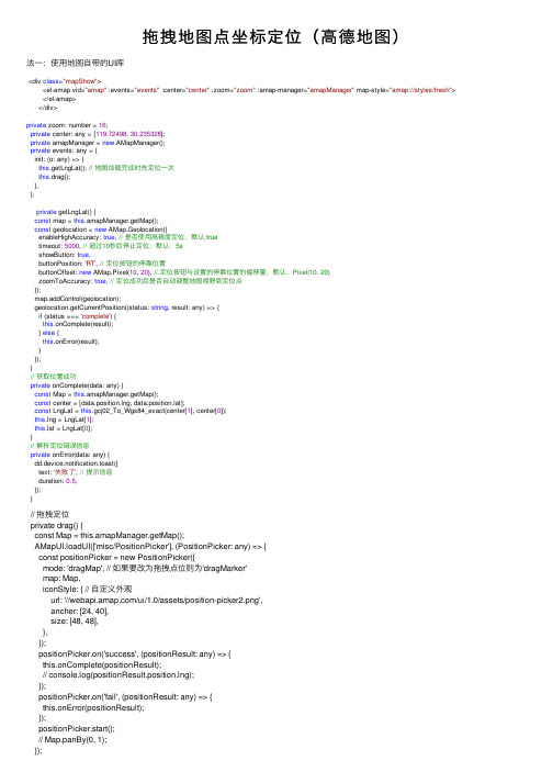
拖拽地图点坐标定位(⾼德地图)法⼀:使⽤地图⾃带的UI库<div class="mapShow"><el-amap vid="amap" :events="events" :center="center" :zoom="zoom" :amap-manager="amapManager" map-style="amap://styles/fresh"> </el-amap></div>private zoom: number = 16;private center: any = [119.72498, 30.235328];private amapManager = new AMapManager();private events: any = {init: (o: any) => {this.getLngLat(); // 地图加载完成时先定位⼀次this.drag();},};private getLngLat() {const map = this.amapManager.getMap();const geolocation = new AMap.Geolocation({enableHighAccuracy: true, // 是否使⽤⾼精度定位,默认:truetimeout: 5000, // 超过10秒后停⽌定位,默认:5sshowButton: true,buttonPosition: 'RT', // 定位按钮的停靠位置buttonOffset: new AMap.Pixel(10, 20), // 定位按钮与设置的停靠位置的偏移量,默认:Pixel(10, 20)zoomToAccuracy: true, // 定位成功后是否⾃动调整地图视野到定位点});map.addControl(geolocation);geolocation.getCurrentPosition((status: string, result: any) => {if (status === 'complete') {this.onComplete(result);} else {this.onError(result);}});}// 获取位置成功private onComplete(data: any) {const Map = this.amapManager.getMap();const center = [data.position.lng, t];const LngLat = this.gcj02_To_Wgs84_exact(center[1], center[0]);this.lng = LngLat[1];t = LngLat[0];}// 解析定位错误信息private onError(data: any) {dd.device.notification.toast({text: '失败了', // 提⽰信息duration: 0.5,});}// 拖拽定位private drag() {const Map = this.amapManager.getMap();AMapUI.loadUI(['misc/PositionPicker'], (PositionPicker: any) => {const positionPicker = new PositionPicker({mode: 'dragMap', // 如果要改为拖拽点位则为'dragMarker'map: Map,iconStyle: { // ⾃定义外观url: '///ui/1.0/assets/position-picker2.png',ancher: [24, 40],size: [48, 48],},});positionPicker.on('success', (positionResult: any) => {this.onComplete(positionResult);// console.log(positionResult.position.lng);});positionPicker.on('fail', (positionResult: any) => {this.onError(positionResult);});positionPicker.start();// Map.panBy(0, 1);});}⽅法⼆:监听地图移动,移动结束后获取center添加点标记(如需要改成拖拽点标记可监听点标记的移动。
AOVBA开发教程(I)客户化界面及VBEditor的使用

6. 在AO Component Help中浏览有关接口的详细说明及相关文档;
7. 在开发环境中使用确定的接口及其方法属性等,完成代码实现。
1-3
AO开发的方式比较
1-4
The VBA development environment(I)
概述
VBA开发环境 使用客户化对话框进行以下操作
Object
1-38
VBA的自动代码完成功能
列出可用的属性和方法 当一个对象名被输入的时候自动显示
如果没有显示出自动完成的列表,则表示该对象没有被认证
使用 Tab, Enter, or Space 去选择所需的属性和方法
Press Tab, Enter, or Space
1-39
Where: 控件, 文档, and 窗体
创建一个新的工具条 添加一个已经存在的命令到ArcMap界面 重排界面命令顺序 生成一个新的
UIControl
改变命令按钮属性 重新设置工具条到初始状态
1-17
The Visual Basic Editor
Project Explorer
Projects
Code Modules
1-24
ThisDocument 模块
与一个文档相关的代码可以包含在:
Normal Current Base
template map document (mxd)
template (optional)
可以在任何一个层次中客户化
1-25
创建一个新的模块
标准模块: 包含常量、子程序、功能过程等
第3章_AO(ArcObjects)的体系结构分析

GIS设计与开发 3
ห้องสมุดไป่ตู้
3.1 ArcObjects概述
AO可以利用Mircrosoft的组件对象模型。Com通常被认为是 一些简单的定义,用于确定对象如何被实现,如何嵌入内存, 这些对象与其它对象如何通讯。 ArcGIS系统是在ArcObjects软件组件基础上建立和扩展的。 ArcObjects包括一系列的可编程组件,从细粒度的对象 (比如geometry对象)到粗粒度的对象(如与ArcMap文档进行交互 的map对象),ArcObjects为开发者提供了大量的全面的GIS功能。 作为一个开发者,可以编程拓展ArcGIS Desktop应用程序, 或者使用ArcGIS Engine创建自定义的应用程序,以及使用 ArcGIS Server开发企业级的GIS应用程序。
GIS设计与开发 3
(2)在ArcGIS应用环境中编写VBA宏
ArcMap和ArcCatalog都提供了VBA(Visual Basic for Application), VBA不是一个独立的程序,它嵌入在ArcMap和ArcCatalog应用中, 它提供了一种集成编程环境,即VBE(Visual Basic Editor)。
GIS设计与开发 3
(3)ArcGIS Server
ArcGIS Server提供了一个构建企业级GIS应用和服务的平台,可 以进行集中管理,支持多用户,包括一些高级的GIS功能,并且可 以使用工业标准进行开发和发布。
ArcGIS Server提供了开发GIS Web应用和服务的框架。 ArcGIS Server包括两个主要的部分,即一个GIS Server服务和一 个应用开发框架(Application Developer Framework,ADF)。
- 1、下载文档前请自行甄别文档内容的完整性,平台不提供额外的编辑、内容补充、找答案等附加服务。
- 2、"仅部分预览"的文档,不可在线预览部分如存在完整性等问题,可反馈申请退款(可完整预览的文档不适用该条件!)。
- 3、如文档侵犯您的权益,请联系客服反馈,我们会尽快为您处理(人工客服工作时间:9:00-18:30)。
Do the following steps to drop data onto the MapControl:
1.Set the IMapControl4.OleDropEnabled property to true.
2.Set the IMapControlEvents2.OnOleDrop event to axMapControl1_OnOleDrop.
IEnumLayer enumLayer = layerFactoryHelper.CreateLayersFromName(name); enumLayer.Reset(); //Get the ILayer interface. ILayer layer = enumLayer.Next(); //Loop through layers. while (layer != null) {
5.Manage the esriDropped action of the onOLEDrop event:
When data is dropped onto the MapControl, the OnOleDrop event is triggered with an esriDropped action. The IDataObjectHelper interface is used to obtain an array of file path strings from the data using the GetFiles method if the CanGetFiles method returns true; otherwise, an IEnumName collection is obtained using the GetNames method. The CheckMxFile method is used to determine whether each file path in the array is a valid Mx document. If valid, the LoadMxFile method is used to load the document into the MapControl; otherwise, a new IFileName object is created with its path property set to the file path in the array. IFileName is used to create a layer that can be added to the MapControl in the same way that the INames obtained by enumerating the IEnumName collection do.
//Create a layer or layers from a name and add to MapControl.
private void CreateLayer(IName name) {
//Set the mouse pointer. axMapControl1.MousePointer = esriControlsMousePointer.esriPointerHourglass; //Get the ILayerFactoryHelper interface. ILayerFactoryHelper layerFactoryHelper = new LayerFactoryHelperClass(); //Get the IEnumLayer interface through the ILayerFatcoryHelper interface. try {
4.Manage the esriDropOver action of the onOLEDrop event:
When data is being dragged around the MapControl, the OnOleDrop event is triggered with an esriDropOver action. The DragDropEffect is set to the effect stored when the data initially entered the control.
3.Manage the esriDropEnter action of the onOLEDrop event:
When dragged, data initially enters the MapControl and the OnOleDrop event is triggered with an esriDropEnter action. The IDataObjectHelper interface is used to determine whether the data is being dragged from ArcCatalog or Windows Explorer using the CanGetNames and CanGetFiles methods. If the data is from ArcCatalog or Windows Explorer, the DragDropEffect is set to esriDragDropCopy; otherwise, it is set to esriDragDropNone. The DragDropEffect is then stored for later use, for example, when the same data is dragged around or dropped onto the MapControl.
If dropped from ArcCatalog, Mx document and layer (.lyr) files will return true for CanGetFiles as they are both a type of IFileName.
6.Call the CreateLayersFromName method to create a collection of ILayers by using the ILayerFactoryHelper interface. Each layer is then added to the MapControl using the AddLayer method.
Copy and paste the following axMapControl1_OnOleDrop method (for Steps 3-5) and the CreateLayer method (for Step 6) into your application where appropriate: [C#] private void axMapControl1_OnOleDrop(object sender,
0); filePaths = (System.Array)dataObject.GetFiles(); //Loop through the array. for (int i = 0; i <= filePaths.Length - 1; i++) {
//If a valid Mx document, load it into the MapControl. if (axMapControl1.CheckMxFile(filePaths.GetValue(i).ToString()) ==
apControl1.LoadMxFile(filePaths.GetValue(i).ToString(), Type.Missing, "");
} catch (System.Exception ex) {
MessageBox.Show("Error:" + ex.Message); return ; } } else { //Get the IFileName interface and set its path. IFileName fileName = new FileNameClass(); fileName.Path = filePaths.GetValue(i).ToString(); //Create a map layer. CreateLayer((IName)fileName); } } } //If data is from ArcCatalog. else if (dataObject.CanGetNames() == true) { //Get the IEnumName interface through the IDataObjectHelper. IEnumName enumName = dataObject.GetNames(); enumName.Reset(); //Get the IName interface. IName name = enumName.Next(); //Loop through the names. while (name != null) { //Create a map layer. CreateLayer(name); name = enumName.Next(); } } } }
//If the data is from Windows Explorer or ArcCatalog. if (dataObject.CanGetFiles() | dataObject.CanGetNames()) {
//Store the copy effect. m_Effect = esriControlsDragDropEffect.esriDragDropCopy; } } //If the mouse is moving over the MapControl. if (action == esriControlsDropAction.esriDropOver) { //Set the effect. e.effect = (int)m_Effect; } //If data is dropped onto the MapControl. if (action == esriControlsDropAction.esriDropped) { //If the data is from Windows Explorer. if (dataObject.CanGetFiles() == true) { //Get an array of file paths through the IDataObjectHelper. System.Array filePaths = System.Array.CreateInstance(typeof(string), 0,
