AECOM 上海外环水系景观总体规划设计方案
上海外滩的城市规划方案
上海外滩的城市规划方案引言上海外滩,作为中国最著名的城市地标之一,吸引着世界各地的游客和居民。
其迷人的风景、悠久的历史和繁华的商业氛围使其成为上海的骄傲。
然而,随着城市的不断发展和变化,外滩的规划也需要进行重新调整,以更好地满足人们对城市现代化和宜居化的需求。
本文将探讨上海外滩的城市规划方案,旨在提供一个可行的蓝图,为外滩的未来发展铺平道路。
形成背景外滩地区原本是上海的商业中心,但随着城市的扩张和新兴商业区的兴起,外滩逐渐失去了其昔日的辉煌。
此外,外滩旧建筑的老化和交通拥堵问题也导致其不再适应现代城市发展的需要。
因此,重新规划外滩区域成为当务之急,为城市注入新的活力和魅力。
规划目标1. 提升城市形象:建设具有现代感和独特风格的建筑群,使外滩成为上海的城市名片。
2. 完善交通网络:优化交通布局,改善交通拥堵问题,提高区域的可达性。
3. 增加绿地面积:建设更多的公园和花园,提供居民休闲娱乐的场所。
4. 促进经济发展:吸引更多的商业机构和投资,激活外滩的商业活力。
规划内容建设现代化建筑为了提升外滩的城市形象,我们将建设一系列以创新设计和独特建筑风格为特点的现代化建筑。
这些建筑将与现有的历史建筑相融合,打造出独具魅力的多元文化空间。
同时,为了保持外滩的独特性,我们将限制建筑的高度,以确保建筑与区域环境的谐调。
优化交通布局为解决外滩地区的交通拥堵问题,我们计划建设一条环绕外滩区域的地铁线路。
该地铁线将与现有的地铁网络相连,形成一个高效便捷的交通网络,方便居民和游客的出行。
此外,我们还将加强对非机动车的支持,建设更多的自行车道和停车设施,鼓励居民选择绿色出行方式。
增加绿地面积为了提高外滩区域的居住品质,我们将增加绿地面积。
在规划中,我们将保留原有的公园和花园,并建设更多的休闲场所。
这些绿化空间将提供人们的放松和娱乐活动,为外滩增添一份宜居氛围。
同时,我们还将鼓励居民参与园艺活动,培养他们对自然环境的关注和保护意识。
【城市滨水】上海黄浦江滨水生态景观空间规划设计

【城市滨水】上海黄浦江滨水生态景观空间规划设计上海黄浦江沿岸的北外滩滨水区是最受上海市民和游客喜爱的目的地之一。
北外滩位于虹口区,拥有丰富的历史遗存,近年来正在转型成为市民的生活中心,规划了超过七百万方的办公大楼、餐饮及商场。
贯通黄浦江两岸、联结其它城市更新项目、建设全市人民共享公共空间成为本次景观规划项目的规划目标。
上海黄浦江滨水生态景观空间规划设计项目旨在为游客和当地居民打开亲水景观廊道,在联通黄浦江滨水水岸各区域的同时,还需将虹口区正在进行的多个城市更新项目与滨江相连,并通过公共项目激活重点区域。
景观设计师用花园式的滨江绿地缝合基地各个地块,重塑其历史上独特的公共绿地身份,释放虹口北外滩滨江潜力,当地居民也能够从中找回与母亲河的联系,进一步认可虹口区浓厚的人文气息。
基于不同的景观规模和北外滩拥有多处历史保护建筑,景观设计师利用虹口区现存的历史保护建筑资源来打造独具特色的场所,包括前日本驻上海领事馆。
实现上述景观规划目标的关键举措是规划设置了三条活跃的路线形成连贯的滨江空间,打通之前被切断的区域,以供人们在2.5公里长的黄浦江沿岸散步、骑行或慢跑。
景观设计师们在绿化腹地内还提出了“流光步道”的概念,一路清辉、绿茵遍地,串联北外滩区域的多家酒店,形成游客可一览城市及滨江风光的观光步道。
景观设计团队为基地制定了完整的功能策略,水岸区侧重设置丰富的活动场地功能,布置一系列绿色水岸空间供全年举办各类文化休闲娱乐活动。
The Huangpu River is the beating heart of Shanghai, and the Bund waterfront that runs alongside its edge is one of the city’s most popular destinations for locals and visitors. The North Bund area within Hongkou District is one of the city’s key historical precincts and is currently being revitalised into a lifestyle hub, with over seven million square metres of office buildings, restaurants and shopping malls under construction or recently completed.The HASSELL vision was to stitch together the many parts of the site through a garden waterfront to unlock the North Bund’s potential and restore its historic green identity – overlooking the Huangpu River from Hongkou district. Once again, residents will be connected to the Huangpu River and the district will be valued as a place for people.With this vision in mind, HASSELL employed a number of key strategies at a variety of landscape scales to address the current issues hampering the site’s future potential. The North Bund contains a variety of architecturally historic areas, and we looked to build places of unique character around Hongkou’s existing heritage assets within the site, including the former Japanese Consulate to Shanghai.。
AECOM住宅景观设计项目
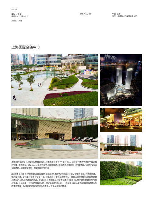
基地面积:5779平方米 生态 绿色 旅游 生活
AECOM
规划 + 设计 景观设计
办公室:广州
现状:概念阶段
中国 广州 业主: 广州市誉城房地产开发有公司
洲头咀高尚住宅项目
项目位于广州市中心区域的珠江边,是一个集中了住宅、商业和办公 楼的高尚混合使用项目。景观设计对珠江上举行的烟花盛会和传统的 广州文化进行了全新的再诠释,旨在创造广州珠江边的新地标。我司 为该项目提供了全面的景观设计服务。
AECOM 规划 + 设计 景观建筑 + 城市设计 办公室:香港
银湖山庄
完成时间:2004
中国 东莞 业主:银湖发展有限公司
银湖山庄是一座高质量的居住开发区,坐落于东 莞市塘厦镇一个优美的自然环境之中。我司负责 为前两期的开发工作进行景观总体规划,其中包 括10座9层的居住楼、售楼办公室、俱乐部会所和 一系列邻里开放空间以及水岸休闲娱乐区。
占地约11公顷 高级住宅景观 简约风格——直线条的演变 陶制材料——陶瓷文化内涵
AECOM 规划 + 设计 景观建筑 + 城市设计 办公室:香港
蓝湾半岛
完成时间:2002
中国 香港 业主:信和集团
蓝湾半岛是香港小西湾的高档住宅区,占地2公 顷,属于高级住宅公寓,设有中心会所、室内外游 泳池及温泉疗养健身房等其他辅助设施。
具体分区借用从山顶到峡谷之旅的概念,分为山 顶景观区域、山坡景观区域和山谷景观区域。水, 以变化的特色,发挥纽带的联系作用,从动感的小
5.7公顷项目基地 森林、山峦、峡谷、河流、暮霭清风 探索之旅 多种景观背景 丰富的文化和环境呼应
AECOM 规划 + 设计 景观建筑 + 城市设计 办公室:上海
2016年上海国际旅游度假区北片区规划与设计

7
城市自然公园
北片区发展关键字
精致休闲 时尚引领 生态优先 传统实践
8
基地设计议题
Design Issues
议题 1
议题 2
议题 3
议题 4
议题 5
重建场地 生态体系
创造东西 场地景深
优化内外 交通动线
构建弹性 发展结构
调适视觉 不利因素
9
设计议题1 重建场地生态体系
Design Issue1: To Rebuild the Eco-system of the Site
12
设计议题4 构建弹性发展结构
Design Issue4: To Create A Flexible Structure of Development
生态廊道复育区 功能区 3 功能区 2
功能区 1
精品 酒店
度假 酒店
主题 花园
生态 农庄
美术 馆
特色 餐饮
水疗 SPA
亲子 沙滩
动-公共性
静-私密性
恢复及清理
恢复湿地及池塘水网,由浅流湿地来缓解不理想的水质,重建基地水生生态 系统的生物多样性。
骨架水系 净化湿地
近外 郊环 绿绿 环地
骨架水系 净化湿地
设计水系
近外 郊环 绿绿 环地
骨架水系 水系净化方向
湿地
景观水系 建议开发地块
设计策略
沿北侧构建完整的外环林带,发展集中于五灶港南侧原有建设用地,保 育现有生态及林地 保留骨架水系,保证区域性水系结构,骨架水系与设计水系互相联系, 相对独立 贯通水系,增加水循环和水动力,局部连通林地内湿地体系,提升水质 西侧堆山造景,隔绝噪音及废气,改善片区环境品质
上海公园水景施工方案设计

上海公园水景施工方案设计概述本文档旨在为上海公园水景施工方案设计提供详细的规划和设计建议。
水景作为公园的重要景观之一,将为公园增添迷人的风景,提供休闲娱乐和社交活动的场所。
设计目标1.利用现有空间,打造美观、实用的水景景观;2.提供休闲、娱乐和社交的场所,增加公园的吸引力;3.考虑环境保护和可持续性,确保水景的可持续运营和维护;4.整合现代科技与传统文化,创造独特的水景体验。
设计原则1.注重观赏价值:水景应具有艺术性和观赏性,通过运用材料、造型和布局等手法,打造出独特的景观效果。
2.强调生态性:在设计水景时,应考虑水的循环、净化系统和植物配置,以达到生态环境友好和可持续发展的目标。
3.强化可操作性:为了提供更好的体验,水景的设计应兼顾游客的安全和便利,设置合理的通道和观景平台。
4.融入周边环境:设计水景时应充分考虑公园周边的自然环境、历史文化和人文特色,使水景与周边环境相互融合。
5.技术创新:利用现代科技手段,如水景音乐、水幕电影等,创造出独特的水景体验。
施工步骤步骤一:规划设计在进行施工前,需要进行详细的规划设计。
包括以下几个方面:1.场地勘察:对公园内可能的水源进行勘察和评估,确定可用的水源以及现有的地形和土壤条件。
2.设计理念:与项目相关方共同商讨,确定水景的整体设计理念和风格。
3.建筑方案:绘制水景施工的平面图和剖面图,确定水池、喷泉、水道、瀑布等的位置和形状。
4.植物配置:确定适合水景的植物种类和布局,以增加景观的生态效益和观赏价值。
5.技术设备:选用先进的水泵、喷头、灯光等技术设备,提升水景的观赏效果和互动性。
步骤二:施工准备施工准备阶段是水景施工的重要一步,包括以下几个方面:1.材料采购:根据设计方案,采购所需的材料,如水泵、喷头、砖石、水生植物等。
2.地面处理:对施工区域进行地面清理和平整,确保施工区域的稳定和安全。
3.基础建设:根据设计方案,进行水池和喷泉的基础建设,包括沉箱、防渗处理等。
2016【AECOM】上海林克司乡村俱乐部整体概念规划

景观A用水(3级) Landscape A water(level Ⅲ) 景观B用水(4级) Landscape B water(level IV) 景观B、农业用水区(4级) Landscape B & Agricultural water(level IV) 景观C用水 Landscape C water 农业用水 Agricultural water 农业、景观C用水区 Agricultural & Landscape C water
美国学校
International School
租赁别墅
Rental Villas
会所抵达路
Access Road to Club House
学校附属停车场
School Staff Parking
开发地块
Site for Development
换…
CONTENT 汇报内容
1. 发展背景
Context
• 喜来春农业旅游区 • 祝桥奥特莱斯“佛罗伦萨”小镇
• 规划交通线路
1. 滨海道路 2. 浦东铁路
Tourism Condition Around Site
• Heqing Country Park The first country park in Pudong. A country park with coastal features, which combines commercial fitness, international competitions, sightseeing experiences and country leisure.
• 适宜亲水活动及水上运动
Existing Poor Water Quality
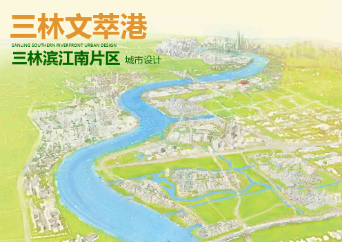
三林文萃港-AECOM2016_压缩
交通框架
特色景观道路
景观道路 特色景观道路 里弄街巷
交通框架
道路层级
区域主干道 地区次干道 联络道路 地区干道
交通框架
公共交通
M 地铁
快速公交 内部巴士 TOD
公共服务框架
幼 幼儿园 小 小学 中 中学
社区服务中心 商业购物 商业办公文化娱乐混合 文化展览
开放空间系统
广场 滨水/生态绿地 景观大道 社区公园 湿地公园 水系
弄堂口/过街楼
转化弄堂口/过街楼传统元素塑造街区门户
宜人尺度里弄空间
撷取适合的空间尺度围塑宜人的生活里 弄空间
撷取传统海派元素 营造当代海派生活体验空间
上海城市肌理研究
上海大世界周边区域 1920年
上海大世界周边区域 2014年
20年代城市肌理
里弄式居住社区 FAR 2.0
80年代城市肌理
里弄式居住社区 小高层混合社区
8 7
6 9
12
8
6
8
4
7
1
8
8
9
9
12
12
11 10 10
1 林荫大道 3 三林湾滨水广场 5 三林活水公园 6 社区公园 15 滨水绿廊
以体现海派文化精髓的空间 承载当代海派生活
撷取传统海派元素 营造当代海派生活体验空间
海派空间组成
鱼骨结构街巷空间
以传统鱼骨结构组织海派邻里感的居民公 共活动空间
关键议题
三林古宅与滨江造船人文底蕴 受到区位及道路局限
无法扩大场地的场所感
黄浦江南滨江风貌的门户特色 尚未充分论证与发展
历史人文与现代都市风貌的融合
策略
依托优化之水生态系统,创造多层次水岸界面 放大海派开放之江港性格
【景观设计】上海联创国际设计谷景观概念设计文本方案
【景观设计】上海联创国际设计谷景观概念设计文本方案设计理念与目标上海联创国际设计谷作为一座集创意、科技、生态于一体的现代产业园区,其景观设计旨在营造一个充满活力、创新与自然和谐共生的环境。
我们的设计理念以“绿色创新,生态融合”为核心,通过融合现代设计手法与自然元素,打造一个既具有时代感又充满生态美感的园区景观。
设计策略与手法1. 绿色生态网络:构建一个贯穿整个园区的绿色生态网络,通过种植多样化的植被,设置生态湿地、雨水花园等生态设施,提升园区的生态环境质量。
2. 创新互动空间:在园区内设置多个创新互动空间,如创意广场、科技展览区等,鼓励园区内的创意交流与互动。
4. 艺术与科技融合:将艺术元素与科技元素相结合,如设置互动艺术装置、科技展示墙等,提升园区的文化氛围。
设计元素与材料1. 植被选择:选择适合当地气候的本土植被,如香樟、广玉兰等,同时引入一些观赏性强的外来植物,如樱花、紫薇等,丰富园区的植被层次。
2. 材料运用:在园区内大量运用环保材料,如透水混凝土、再生木材等,减少对环境的影响。
3. 色彩搭配:以绿色为主色调,搭配白色、灰色等中性色,营造一个清新、自然的园区氛围。
4. 照明设计:采用节能环保的LED照明设备,结合自然光线的利用,营造一个明亮、舒适的园区环境。
设计实施与维护1. 设计实施:按照设计图纸进行施工,确保每个细节都符合设计要求。
2. 后期维护:建立完善的后期维护体系,定期对园区内的植被、设施等进行维护,确保园区的良好运行。
3. 监测与评估:对园区的生态环境、景观效果等进行定期监测与评估,及时调整设计策略,提升园区的整体品质。
设计创新与特色为了进一步提升上海联创国际设计谷的景观品质,我们将在设计中融入一些创新元素和特色,以增强园区的吸引力和独特性。
1. 智慧园林:结合现代科技,打造智慧园林系统,通过物联网技术实现植被的自动灌溉、病虫害监测等功能,提升园区的管理效率。
2. 互动景观:在园区内设置多个互动景观,如音乐喷泉、互动灯光等,吸引游客和园区内员工的参与,增加园区的活力。
上海公园大城规划方案设计
上海公园大城规划方案设计引言公园是城市中重要的绿地资源,对于改善城市人居环境、促进居民健康、提升城市形象有着重要作用。
上海作为中国最大的城市之一,同时也是一个国际大都市,需要建设更多的公园来满足居民和游客的需求。
本文将介绍上海公园大城的规划方案设计,旨在提供一个多样化、宜居、可持续发展的城市空间。
规划目标增加绿地覆盖率上海是一个高密度城市,绿地资源相对不足。
规划方案的首要目标是增加城市的绿地覆盖率,提供更多的公园和绿化空间,以缓解城市的热岛效应,改善空气质量,并提供更多的休闲娱乐场所。
方便公共交通公共交通是城市居民出行的主要方式,规划方案应优先考虑公园的交通便捷性。
规划将公园布局与现有公共交通网络相连接,设计便捷的步行和自行车道,同时考虑城市轨道交通站点的布局,以便居民能够方便地到达公园。
多功能需求规划方案应充分考虑公园多功能需求。
公园不仅提供绿地空间,还可以充当文化活动、户外健身、休闲娱乐等场所。
因此,在规划方案中应设立文化活动区、运动健身区、儿童乐园和音乐喷泉等多个功能区域,以满足居民和游客的不同需求。
可持续发展可持续发展是城市规划的重要原则之一。
在公园大城规划方案设计中,应考虑自然资源的保护和节约利用,减少土地开发对生态环境的破坏。
同时,设计合理的绿化系统以增强生态功能,如湿地保护区、野生动物保护区等,促进城市的生态平衡。
主要内容和布局浦东滨江公园规划方案中位于浦东地区的滨江公园是一个重要的绿地景观。
该公园将充分利用沿江岸线的优势,设计蜿蜒的步行道、自行车道和景观观赏区。
公园内还设有咖啡馆、运动场地和音乐喷泉等设施,为居民提供一个休闲放松的场所。
静安公园静安公园位于市中心的繁华商圈,是一个历史悠久的公园。
规划方案将保留并修复公园内的历史建筑和古树名木,同时增加更多的绿化和游憩设施。
公园内规划了一个花园区、一个健身区和一个儿童游乐区,满足不同年龄群体的需求。
长宁森林公园长宁森林公园是一座有着浓厚生态氛围的城市森林公园。
生态至上 地景香远 上海嘉定新城中心区远香湖景观工程

计 ,并逐 个解 析以 生态先 导为 设计 原则 的景观 设计 手 法在 远香 湖景 观设计 中 的运用 。以 生态场 景软化 城市 硬景 ,使 城市 与自然 共融 的景 观形 态构成 远香湖 的 空 间特 质 。 关艟 词 生态 先导 ; 水景观 ; 滨 大地 景观 . 观规 划 景
AB TRAC S T Th ou n an l i oft e lnd c e r gh a ayss h a s ap plnn n an de i o Yu xing L ke t s a ig d sgn f an a a , hi a t e p e en s a i r s t de a ld e l na in of h r cl t ie xp a to t e it gr ie desg ap oa h a c n e at v in pr c on c oun o b t t f oh t c e o h lnd c e n t a h vs o he s al f t e a s ap a d h t oft e it r
文献标 识码 :B
文章蝙 号 : OS54 (020 07 4 1O q X21 ) 0 2 8 1 0
4 目量 目 : ± i 心 g * * 自 § 目 ( ) 8 | ±, 自 ( Ⅻ 镕 } i I
1 量番远 地
“ ”的异 质性 海
生态 元素产 生 亲和 、生长 、可 观、渗 透的 场景 。 在新城 由 “ 千米 湖” 统壤 景观风 貌 的规划 中 . “ 远
由于 中国汉 字书 法的 流畅 揶扬 顿挫 的特 点, 在 远香 湖景 区 的规 划中 ,“ ”字 形 态的 水体 及其 周 边 海 地块具 有极 大的 开放 性。 景区规 划的 最核 心出 发点就
【案例】外滩滨水区城市设计暨修建性详细规划
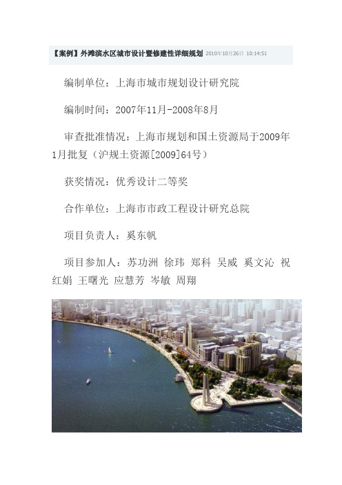
【案例】外滩滨水区城市设计暨修建性详细规划2010年10月26日10:14:51编制单位:上海市城市规划设计研究院编制时间:2007年11月-2008年8月审查批准情况:上海市规划和国土资源局于2009年1月批复(沪规土资源[2009]64号)获奖情况:优秀设计二等奖合作单位:上海市市政工程设计研究总院项目负责人:奚东帆项目参加人:苏功洲徐玮郑科吴威奚文沁祝红娟王曙光应慧芳岑敏周翔整体鸟瞰规划背景外滩滨水区是上海市最具标志性的城市景观区域,同时也是城市中心最重要的公共活动场所之一。
但外滩大部分滨水空间被城市快速机动交通所占用,存在公共活动空间局促、舒适性较差、外滩历史建筑未得到充分展示等问题。
2010年上海世博会的举办,对黄浦江两岸的公共空间和环境建设提出了更高的要求。
外滩地区城市公共活动功能有待进一步提升,现有的滨水空间环境亟需改善。
正在建设的外滩地下通道用以疏导过境交通,使地面交通压力得以缓解,进而减少地面车道数量,使外滩地区滨江环境的建设获得更为充分的空间,为改善外滩环境、重塑外滩功能、重现外滩风貌,提供了极好的机遇。
为了提升外滩滨水区空间环境品质,迎接世博会的召开,以外滩地下通道的实施为契机,规划对北起苏州河口,南至十六铺水上旅游中心北侧,岸线总长度约1.8公里的外滩滨水区域进行综合改造。
4.7米平台扩建防汛墙坡道总平面图规划内容与特点城市设计充分体现上海最重要的公共活动空间的特征和现代气息,力求最大限度地体现外滩地区的历史文化风貌特色,最大限度地为市民提供优美舒适的公共活动空间,打造上海最经典的滨水景观区域和公共活动中心。
精心设计公共活动空间,最大限度满足大人流量对于公共活动和观景的需求,体现以人为本。
外滩是上海市中心最重要的公共活动场所,但受制于交通压力和空间局限,活动舒适度不高。
且每年五一、国庆、元旦等极端高峰日人流量达100万人/日,舒适度极差且存在严重的安全隐患。
针对大人流活动的特征和需求,规划提出外滩地下通道建成后,将地面车道缩减为4条机动车道加2条备用车道,主要解决公共交通和到发交通,从而大大增加了地面公共活动空间。
(AECOM)上海滨江凯旋门景观深化设计

108
0
1
2
4m 106
0
1
2
4m 107
108
109
schematic design main entry
2
elevation main entry - option 1
3
elevation main entry - option 2
4
elevation main entry - option 1 (night)
13
schematic design lobby entrance plan - T2 T3
14
schematic design lobby entrance plan - T5 T6
15
schematic design satellite lobby sketch plan
16
3D study satellite lobby view 1
OSM. FRA
OSM. LAT CIN. CAM ZEL. SCH ELA. SYL OSM. THU
LIG. LUC
CIN. CAM PLA.ORI/ T
LIQ. FOR
OSM. FRA
ELA. SYL XXX.XXX PRU. CER
ELA. DEU
PLA. ORI OSM. THU
100x100x80mm THK Granite cobble, Nero Pepperino, Flamed finish 100x100x80mm THK Granite cobble, Golden Yellow, Lychee finish
100x100x80mm THK Granite cobblestone, Nero Pepperino, Natural Cleft finish 100x100x80mm THK Granite, Golden Yellow, Lychee finish
D05绿色生态的水系综合规划_以上海新江湾城为例_赵敏华

上海市水土保持规划(2015.1)

目
录
前言 .......................................................................................................... 1 1 上海市自然及社会经济概况 ................................................................ 3
3 规划总则 ............................................................................................. 20
3.1 规划指导思想和基本原则 ........................................................................... 20 3.1.1 指导思想 ................................................................................................... 20 3.1.2 规划原则 ................................................................................................... 20 3.2 规划目标 ...................................................................................................... 21 3.3 规划年限 ...................................................................................................... 21 3.4 规划范围 ...................................................................................................... 21 3.5 规划编制的依据 ........................................................................................... 22 3.5.1 相关法律法规 ........................................................................................... 22 3.5.2 相关技术规范和标准 ............................................................................... 22 3.5.3 相关规划 ................................................................................................... 22 3.5.4 相关研究成果 ........................................................................................... 23
上海市外滩滨水区城市设计方案-8页精选文档

上海市外滩滨水区城市设计方案Shanghai Bund waterfront urban design program项目名称:上海市外滩滨水区城市设计设计单位:美国Chan Krieger Sieniewicz Architects北京都市筑景国际建筑设计事务所设计类别:城市设计建设地点:上海场地面积:15公顷委托单位:上海市规划局设计时间:2019年5月至2019年1月外滩滨水区无疑是上海最具代表性的城市空间之一。
为了迎接2019年世博会的召开,改善外滩地区浦江沿岸的交通状况,上海市政府决定将目前外滩沿岸繁忙的过境交通引入地下,将地面道路改造为双向四车道,以释放地面城市空间,并以此为契机对外滩滨水区进行一次较高标准的改造,营造标志性的城市空间形象,使之符合上海外滩的国际地位。
为此,上海市规划局及相关领导单位组织了十家单位参加的国际竞赛,为上海外滩滨水区的改造集思广益,提供思路。
在两轮的评选中,由美国波士顿CHAN KRIEGER SIENIEWICZ ARCHITECTS建筑事务所与北京都市筑景国际建筑设计事务所组成的设计联合体提交的方案均获得了甲方和评审专家一致评选的一等奖方案。
在外滩沿江步行道上缓步徐行是如此令人难忘。
越来越多的上海本地居民和来自全国以及世界各地的游人享受着这种经历。
沿着整条步道,我们看到的不但是20世纪初期上海最动人的部分,而且见证了新上海的崛起——在发展中的世界级大都会,一个代表21世纪都市面貌的城市。
但是,目前在这1.8km长的滨水步道上的沿江游览似乎基本上只是在观望:游人可以回望外滩的历史建筑,或是隔江远眺浦东的雄伟。
但是在整条步行道上,几乎没有途径可以直接地参与到城市的动感和活力中去。
因此目前的外滩更多的是“供游客游览的外滩”,而缺乏“供上海市民日常享用的外滩”的性质。
随着外滩成为日益重要的公共空间,这里呼唤更多更丰富的城市与水岸边缘之间的垂直联系。
外滩旧时的图片展示了昔日水滨和城市间的这种“垂直联系”, 有时是船坞和码头,有时是桥梁和跳板。
水上绿地空间规划与设计:上海作为例子说明书
1st International Symposium on Education, Culture and Social Sciences (ECSS 2019) Discussion on the Planning and Design of Waterfront Space-Take Shanghai as an ExampleJing Wang a, Yue Huang bZhuhai College of Jilin University, Zhuhai 519041, Chinaa*******************, b*************************Abstract. Waterfront green spaces are valuable natural resource of the city, which has the functions of purifying air, cleaning waste water, maintaining water source and improving the climate environment, and it is an important part of the urban ecological lung and ecosystem of ecological city. This paper summarizes the water + plant model and plant + plant model as typical representative of the spatial pattern of the Suzhou River waterfront. The visual space created by this model is more flexible than other modes when creating a path. It has a sense of space: and can form a richer and more diverse landscape space through the combination of landscape elements and various entertainment facilities. This research is a useful supplementary means to explore the coast of Suzhou and Shanghai and as a reference and guide for coastline design and landscape improvement.Keywords: ecological corridor; recreation; link; water green belt.1.Related Concepts of Urban Park Waterfront Plant Landscape1.1The Concept of Urban ParkNowadays, the garden form of ''urban park'' was developed on the basis of the public gardens of the old city. In 1857, American landscape designer F. L. Olmsted designed and built the first truly urban park-Central Park. He gave the grass, woods, water, various natural landscapes and rich activities to this park, and made the park become green lung for improving the urban environment. Later, due to the huge influence of Central Park, the United States launched a city park movement, and it has a great impact on the world, and become a pioneer in the development of urban parks in Western countries. The early urban park inherited the style of the British natural landscape gardens, which introduced nature into the city through open space system, and it had spontaneous ecological awareness. With the aggravation of the environmental crisis, the ecologicalization of the living environment has attracted increasing attention. In 1971, UNESCO proposed the ''man and ecosphere'' plan, pointed out that urban construction should follow the basic principles of symbiosis between man and nature. With the implementation of the Man and Ecosphere plan and the rise of the western “green city” movement, urban parks have been given e cological connotations and are developing towards ecologicalization, and many urban eco parks have emerged. It can be seen that the definition of urban parks is not static, as a place to serve human beings; it should also continue to deduct new connotations over time.It is clear that today's urban parks are green open spaces in high-density metropolitan areas, this activity provides residents with tourism, entertainment, and education that are coordinated with natural ecological processes and so on. The naturalized entertainment environment reflects the theme for achieving a win-win between humans and the living environment.1.2The Concept of Waterfront Green Space Landscape"Waterfront green scape landscape" refers to the natural complex of all vegetation in waterlines of given range of along specific structure. Due to its patchwork and rich organization, this type of natural complex gives green natural beauty, such as rhymes, lines and colors, enough space, and creates a pleasant landscape and lingering mood.The waterfront green space is mainly composed of water grassland, moist green land and waterside, and green coastal land. Yu Shuxun believes that aquatic green land refers to “green soil that grows in the depths of fresh water or naturally floats in water, and sometimes appears in the green areas of theswamp.” According to the living habits, growth characteristics and ecological environment of the water grassland, which can be divided into floating green area, floating leaf green area, green water area, sinking green area and marine green area.The water grasslands used in this work are mainly herbaceous water grasslands and urban parks, because the blue water in the grassland shore area has high ornamental value. Generally, wet green space should be grassland that belongs to water: grassland, soil and green areas that grow in an environment with high or relatively high-water content in the atmosphere, which goes through the land environment and water environment. The intertidal greenbelt is mainly composed of medium green grasslands and ground grasses, which are what we usually call green areas, such as arbor, bush and ground. Today, parks are often use leak prevention for coastal green spaces, many green spaces are not waterproof and moisture-proof, they can proudly stand by the pool and plant green areas with water and wetlands.2.Green Allocation in Waterfront Landscape Design2.1Green Allocation based on Ornamental ValueThe water in urban landscapes, green spaces and water areas will be built in urban areas, form landscapes and ecological corridors, free areas of the water continent, and connect to the suburbs, form an important role in optimizing the ecological environment and landscape of modern cities. The importance of natural and aquatic plants is critical to the construction of urban green buildings. In urban green belts and urban waterfront water systems, it is important to consider the conservation and reconstruction of the water body itself and the ecological function and natural water systems that mimic the ecological and landscape continuity of water and land borders. On this basis, various aquatic plants are planted at the edge of the water body to form a natural and lush green landscape, a unique and healthy aquatic ecological river landscape is formed.2.2Green Allocation based on Ecological ValueThe plants in the urban green belt not only have high ornamental value, but also absorb pollutants in the water, which is a natural cleansing agent for water bodies. Based on the marine habitat, this is a habitat formed by ecological coral reefs; the multi-architecture is water and coastal communities, it is a reasonable and rich and stable water belt for the cultivation and restoration of ecological landscape. People can enjoy the natural beauty of "blue waves, birds and flowers" and truly appreciate the value of the green space of water. The diversity of aquatic plants has gradually changed from land to submersion, and the layers are rich. In addition, the plant shape, leaf shape and flower shape of aquatic plants have their own characteristics. Due to the continuous increase and interactive nature of these aquatic plants, urban waters have become a vibrant ecological environment.2.3Significance of Urban Waterfront Green Space AllocationAt the ecological level, the natural factors of the water city green space create a harmonious and balanced development between people and environment; at the economic level, the green space of urban waters has high-quality entertainment and tourism potential, at the social level, the green space improves the livability of the city, and provides a stage for various social activities. In urban form, urban green space is critical to the overall perception of the city. Therefore, the urban grassland landscape of water must consider the combination of ecological effects, aesthetic effects, social effects and artistic status, and strive to achieve harmony of man and nature, city and nature.bination Mode of Waterway Interface Element of Suzhou RiverWaterfront SpaceSuzhou River's old name is "Song River", also known as "Wu-Song River "; it comes from the Taihu and has about 125 kilometers. It is a tributary of the Huangpu River and flows through ShanghaiQingpu, Jiading, Putuo, Changning, Jing'an, Zhabei, Hongkou, Huangpu, and plays a role in transportation, water protection and health facility. It has an irreplaceable effect: the length of the portion of the Suzhou stream is 53.1 kilometers, the river is about 24 kilometers away from the center of the city, and the width of the flux portion is generally 50 to 70 microns. The research scope of this paper extends from the Waibaidu Bridge to the outer ring segment.The total length of the north-south coastline is about 40 kilometers. The Suzhou River is channel of the natural waterway is Shanghai, which organizes a series of urban waters, make citizens peace and can swim, other landscape corridors perform important tasks in flood control due to land use, the nature of development strength and the limitations of the floor, the water path in each section is clearly different from the water path, according to the urban-green-space classification criteria [18], and the field studies of existing flows along the Suzhou stream. Waterways are divided into four types: 1 water path, it either passes through city streets or directly adjacent urban road waterways, 2 waterways, which can be connected to each other as parking: part of the road network is adjacent to the green space in the water park, 3 water pathway: as part of the road network as a residential community in adjacent waters; 4 riverside paths: as part of way network of roads and institutions, such as creative parks, schools, warehouses, etc., and border waters.Field surveys of various types of water trails and the distribution of various types of paths along the Suzhou River (Fig.1).Fig.1 Distribution map of Suzhou River waterfront trailOn both sides of the waterfront, various interface combinations can be realized, which can generally include 2 categories, 9 sub-categories and 15 sub-categories. Different interface combinations can create different spatial patterns and spatial feelings, thus producing various activities.3.1Combination Mode of Interface Element of Waterfront Walkway3.1.1 "Water + Plant" Interface ModeIt consists mainly of the water side (water surface) + the back-water side (plant). Due to the different plant combinations, this model can be subdivided into two sub-categories: the water side of the water surface is a broad water surface and the rear water surface is an infiltrated plant community for the closed plant community (Fig.2) or the backwater side of the riverside path (Fig.3), create a visual experience for the open water surface and support the water on one side or the other.3.1.2 "Plant + Plant" Interface ModeIt consists mainly of the water side (plant) + the back-water side (plant). If the shore path is planted on both sides, then we can divide the space types generated by different combinations of different types. Open, infiltrated type, as shown in Table 5. The open mode means that at least one plant community type is a combination of shrubs and herbaceous plant communities, and the sight line can pass completely through the community and reach another region.The infiltration mode means that the community combination pattern on both sides of the tree is arbor + vegetation, and the sight line can pass through the central community space to create an emerging visual effect (Fig.7-10).3.1.3 "Water + Building" Interface ModeIt consists mainly of the water side (water surface) + the rear water side (building) (Fig.4). If the water side is open, then when the other side is under construction and the visual perception of the room changes due to the D/H ratio of the building. Section 2.4 introduces the space experience in detail.3.1.4 "Water + Road" Interface ModeIt is mainly composed of water surface (water surface) + rear water surface (road). If one side of the waterfront is adjacent to the water and the other side is connected to the road, then there are two types, and the waterfront is flat with the city street. The board is taller than the city street, and the two forms of space feel very different: if the board is flat with the city street, the board is a transition between the city and the water, and their work with urban traffic has a certain meaning and function, and it is not safe when walking on the streets of the city, and the walking speed is relatively high, which is not suitable for landscape design (Fig.5). When the shore path is higher than the street in the city, the two floors form a distinct difference in the plane: the corresponding increased floor area of the waterway allows people to walk on it. There is a worrying mentality, which is worse in privacy and is not suitable for staying (Fig.6).3.1.5 "Plant + Wall" Interface ModeIt consists mainly of the water side (open/infiltration unit) and the return water side (wall). If the water side is a plant and the other side is a wall, the space created by it has a certain amount of space, which causes the sight line to face the plant community and result in a more open water surface (Fig.11).3.2Combination Mode of Interface Element of Waterfront Walkway Without Water3.2.1 "Wall + Road" ModeIt consists mainly of a side facing water (wall) + backwater water side (road), which has strong sight line; sight can lead to one side of the city street (Fig.12) residential district, a narrow green area of factory or a south road bridge-Tibet Middle Road (South Bank).3.2.2 "Plant + Road" ModeIt mainly includes the water side (closed plant community) + the backwater side (urban street) Realize traffic on supported city streets (Fig.13).3.2.3 "Plant + Plant" ModeIt consists mainly of the water side (closed plant community) + the countercurrent side (plant), where the backstop is the combination form of plant communities.The difference is that different spatial effects will occur: if the plant community on the backwater side is relatively closed, it forms a long and narrow cross path when the plant community is relatively infiltrated and open in the backwater (see Fig.14).A one-sided guide cylinder type is formed (Fig.15).3.3Analysis of Water Visibility of Suzhou Riverside Water TrailThe visibility of water can be measured by the water level (see water): water is the ratio of the length of the water path to the total length of the path. According to paragraph 3.2, re-integration of water analysis and survey data for various types of hikers is available. The water level on the south bank is 91.7%, and the water level on the north bank is 84.49%."plant + wall" modeIt consists mainly of the side facing water (closed plant community) + the return side (wall). This type of path is relatively narrow and there is no landscape suitable for fast walking (Fig.16).The main factors affecting the visibility of the water corridor on the north and south are as follows: the sight line cannot cross the obstacle, for example: if the fence is too high, the combination patternof the plant is too narrow, other buildings and other structures obstruct the view; if the green belt on the beach is too wide, the bank path is mixed with space and the sight line cannot reach the surface.A scale diagram of each type of trail is obtained (Fig.17).Fig.17 A scale diagram of each type of trail is obtainedIt can be seen from the figure that the water + plant model and the water plant + plant model is 37% and 33%, respectively, which represent the main application types of water path design of the Suzhou River. The plant + plant model creates a more flexible visual space, unlike the other modes when creating a path. The sight line is easier to pass through, but has a sense of space, and can be used and promoted in the design.4.ConclusionThe water grasslands used in this paper mainly refers to the herbaceous water grassland with high ornamental value in the bank area of urban park, which are mainly distributed in green water, floating leaves and floating grassland. This paper investigates the value of the green water landscape in the city's waterfront and draws the following conclusions:(1) Urban waterscapes should follow certain principles, including scientific design, integrity and regional principles and artistic design principles.(2) The green area around the urban waters has high entertainment value: the green areas on the water are artificial and natural, and the landscape allows the overlapping effect of the landscape to perceive the combination of human landscapes.References[1].Liu Liming. Landscape Research on Urban Waterfront Parks[J]. Southeast University, 2004.[2].Li Jianwei. Evaluation and Planning Research on Urban Waterfront Space[J]. NorthwestUniversity, 2005.[3].Duan Qianghua. Research on Urban Waterfront Landscape Design[J]. Wuhan University ofTechnology, 2006.[4].Shi Xiaoyan, Wang Yan. Recreational Value of Waterfront Greenland Landscape in Cities[J].Xiandai Horticulture, 2015, 02:90.[5].Tang Min. Research on Planning and Design of Belt Waterfront Park[J]. Chongqing University,2012.[6].Zhao Yamin. Optimization of Urban Riverside Green Space Landscape Pattern in LuoyangBased on River Basin Ecological Process [J]. Henan Agricultural University, 2006.[7].Sun Kuili. Research on the Planning of Greenway System in Tianjin[J]. Tianjin University, 2012.[8].Sun Shuai. Urban Greenway Planning and Design Research[J]. Beijing Forestry University, 2013.[9].Huang Jing. Urban Water Landscape System Planning Research[J]. Nanjing Forestry University,2013.[10].Nie Ke. Research on Landscape Design of Urban Public Open Waterfront[J]. NanjingForestry University, 2007.[11].Mao Lihong. Research on the Design of Waterfront Plant Landscape in Urban Parks[J].Southwest Jiaotong University, 2009.[12].Liu Wei. Discussion on the Application of "Branch Penetration" and "Springboard Link"Concept in the Design of Waterfront Environment in Guanzhong City[J]. Xi'an University of Architecture and Technology, 2010.[13].Wang Qing. Research and Practice on the Landscape Improvement of the Fen River UrbanArea of Linfen City[J]. Northwest A&F University, 2014.[14].Li Lei. Urban Road Landscape Research under the Background of Urban Development[J].Beijing Forestry University, 2014.[15].Jiang Junhao. Research on Urban Park System[J]. Southwest Jiaotong University, 2008.。
城市滨水带游憩规划设计-以上海浦东张家浜为例

2
Байду номын сангаас
34 城市滨水区处在陆地与湿地生态系统的边界 " 其景观生态边界效应明显 " 如生物群落结构 复 杂 " 生 境 多 样 等 " 但
同时也是城市游憩休闲空间的重要载体 # 以上海浦东张家浜滨水游憩带为例 " 探讨在滨水区物质环境改善的前提下 " 如何保 护其生态功能与滨水区游憩功能的协调 $ 统一 " 创造系统完整的滨水景观 #
城市 或 城 市 区 域 的 自 然 环 境 特 色 & 尤 其 是 滨 水 区’ 是产 生 城 市空 间 特 征 " 从 而 形 成 城 市 特 有 面 貌 的 重要因素之一 # 同时滨水区也是释放自我 $ 亲近自然 的场所 # 随着城市滨水区运输功能的减落 " 滨水区对 于 城 市 公 共 休 闲 空 间 的 建 构 将 起 到 重 要 的 作 用 "但 滨水 区 也 是城 市 生 态 敏 感 区 " 因 而 滨 水 区 环 境 规 划 设 计 需 要综 合 考 虑多 方 面 的 因 素 # 以 上 海 浦 东 张 家 浜 为 例 " 就 滨 水 区的 游 憩 环 境 规 划 设 计 涉 及 的 多 个 方面做些总结 # 通过 对 国 内 外 滨 水 区 的 规 划 $ 设 计 $ 开 发 的 总 结 "应 该 来 说 "国 内 更 多 的 是 从 物 质 环 境 的 角 度 提 出 的 " 而对该地区的经济 $ 文化 $ 社会现象不太注重 # 容 易就 事 论 事 " 缺 乏 整 体 性 的 把 握 " 往 往 使 得 在 滨 水 绿 化 上 取 得了 一 定 的成 功 " 而 对 于 繁 荣 当 地 的 历 史 文 化 $ 经济方面多少显得力不从心 #
