航海学3期末考试简答题答案
航海学3潮汐与潮流作业

第一章第一节潮汐基本成因及潮流一、简答题:1、潮汐产生的基本原因是什么?答:潮汐产生的原动力是天体引潮力,主要是月球引潮力,其次是太阳引潮力。
2、潮汐周日不等有哪些具体表现?答:当月球赤纬不等于零、纬度不为零时,在同一太阴日中所发生的两次高潮或两次低潮的潮高以及相邻的高、低潮的时间间隔不相等。
3、潮汐的周日不等、半月不等和视差不等的基本原因各是什么?答:周日不等:月球赤纬不等于零,测者纬度不为零;半月不等:月球、太阳和地球在空间的相对位置不同;视差不等:地球和月球之间的距离发生变化。
二、名词解释1、平均高(低)潮间隙:每天月中天时刻至高(低)潮时的时间间隔的长期平均值。
2、回归潮:当月球赤纬最大时的潮汐称为回归潮,此时,潮汐周日不等现象最显著。
3、大潮升:从潮高基准面到平均大潮高潮面的高度。
4、停潮:当低潮发生后,海面有一段时间呈现停止升降的现象。
第二节中版《潮汐表》与潮汐推算一、名词解释1、高(低)潮时差:主港与附港高(低)潮潮时之差。
、高(低)潮时差:主港与附港高(低)潮潮时之差。
2、潮差比:对半日潮港来说,是指附港的平均潮差与主港的平均潮差之比;对日潮港来说,是指附港的回归潮大的潮差与主港的回归潮大的潮差之比。
二、计算题二、计算题1、我国某主港某日高潮潮时为11381138,,其附港的潮时差为01500150,,改正值为1515。
则该附港日的高潮潮时是多少?则该附港日的高潮潮时是多少?解:附港高潮时解:附港高潮时==主港高潮时主港高潮时++高潮时差高潮时差=1138+0150=1328 =1138+0150=13282、我国某主港某日潮高为3.6m 3.6m,,某附港的潮差比为1.201.20,,主港平均海面220厘米,附港平均海面222厘米,主附港平均海面季节改正值均为厘米,主附港平均海面季节改正值均为+18+18厘米,求该附港的潮高。
求该附港的潮高。
解:附港潮高解:附港潮高=[=[=[主港潮高主港潮高主港潮高--(主港平均海面(主港平均海面++主港季节改正值)主港季节改正值)]]×潮差比×潮差比++(附港平均海面(附港平均海面++附港季节改正值)=[3.6-(2.2+0.182.2+0.18))] ] ××1.20+(2.22+0.182.22+0.18))=3.864m3、从潮信表查得某海区的平均低潮间隔MLWI 为11471147,则,则8月28日(农历二十六)的低潮潮大约是多少?二十六)的低潮潮大约是多少?解:月上中天时解:月上中天时==(农历日期(农历日期-16-16-16)×)×)×0.8=0.8=0.8=((26-1626-16)×)×)×0.8=8 h 0.8=8 h低潮时t1=t1=低潮间隙低潮间隙低潮间隙++格林尼治月上中天时格林尼治月上中天时=1147+0800=1947 =1147+0800=1947低潮时t2=1947-1225=0722t2=1947-1225=0722(注:(注:(注:12251225为潮汐周期)为潮汐周期)4、我国某地高潮间隔10501050,概算农历,概算农历8月21日该地的高潮时。
航海学简答题大集合

盛年不重来,一日难再晨。
及时宜自勉,岁月不待人。
第一篇坐标、方向和距离建立大地坐标系应考虑哪几个方面的问题?什么是大地水准面?地面上的方向是如何确定的?试述磁差的定义,及其产生的原因和发生改变的因素。
对于航行船舶,驾驶员从何处可查得航行海区的磁差资料?什么是磁罗经自差?试述其产生的原因及其发生改变的因素。
航海上常用的测定罗经差的方法有哪些?试述海里的定义,一海里的长度随着什么因素的改变而改变?我国规定一海里的长度是多少?我国灯标射程是如何定义的?海图上标注的灯标射程是如何确定的?英版资料上灯标射程是如何定义的?它与哪些因素有关?如何判断我国灯标灯光是否有初显(隐)?如何求其初显(隐)距离?试述良好的船速校验线应具备哪些条件?试述在船速校验线上根据推进器转速来测定船速和计程仪改正率时,如何消除水流对测定的影响?航行船舶利用“主机转速与船速对照表”求得的船速,为什么只能作为参考?地球形状是如何描述的?大地水准面的特征如何?试述地面方向的几种划分法。
试述罗经点名称的构成方法。
地理坐标是怎样构成的?计算经差和纬差时应注意什么?何谓大地水准面,大地球体?试述大地球体第一近似体和第二近似体概念,参数及应用场合。
试述地理经度和地理纬度的概念,度量方法。
试述经差与纬差的概念,方向性及计算方法和注意事项。
试述大地坐标系作用及其对航海的影响。
试述航海上四个基本方向是如何确定的?试述航海上方向的三种划分方法及相互之间的换算方法。
试述航向,方位和舷角的概念,代号,度量方法和相互之间的关系。
试述陀罗向位概念,代号和度量方法;陀螺罗经差概念,符号法则和特点;陀罗向位,磁向位和真向位之间的相互换算。
试述磁差,自差和罗经差的成因,特点和相互关系。
试述磁差与自差资料的表示与获取方法,磁差的计算方法。
试述海里的定义及特点。
试述测者能见地平距离,物标能见地平距离和物标地理能见距离概念,特点和计算。
试述中英版航海图书资料中灯标射程的定义和特点。
航海概论期末考试试题及答案
航海概论期末考试试题及答案一、选择题(每题2分,共20分)1. 航海学中,下列哪个术语指的是船舶在海上航行时的导航方式?A. 航迹B. 航向C. 航线D. 航速2. 根据国际海事组织规定,船舶在海上航行时,应保持的最低安全速度是多少?A. 5节B. 10节C. 15节D. 20节3. 航海中使用的“六分仪”主要用于测量什么?A. 船速B. 船位C. 船高D. 船重4. 船舶在海上遇到风浪时,下列哪项操作是错误的?A. 调整航向B. 减速慢行C. 紧急转向D. 增加船员值班5. 海图上的“航标”通常用来指示什么?A. 航道B. 危险区域C. 港口D. 风向6. 船舶在航行时,如何确定自己的确切位置?A. 通过GPSB. 通过雷达C. 通过罗盘D. 通过海图7. 船舶在海上航行时,遇到紧急情况需要发出求救信号,应使用哪种设备?A. 无线电B. 卫星电话C. 声纳D. 灯光信号8. 船舶在航行时,如何避免与海底障碍物相撞?A. 通过声纳探测B. 通过目视C. 通过雷达D. 通过GPS9. 船舶在海上航行时,如何确定自己的航向?A. 通过罗盘B. 通过海图C. 通过GPSD. 通过卫星电话10. 船舶在海上航行时,如何计算到达目的地的时间?A. 通过航速和航程B. 通过海图和罗盘C. 通过GPS和卫星电话D. 通过雷达和声纳二、填空题(每空1分,共10分)11. 船舶在海上航行时,通常使用_________来确定航向。
12. 船舶在海上航行时,需要遵守的国际规则是_________。
13. 船舶在海上航行时,使用_________来测量船位。
14. 船舶在海上航行时,需要定期检查_________以确保航行安全。
15. 船舶在海上航行时,遇到紧急情况需要发出的国际求救信号是_________。
三、简答题(每题10分,共30分)16. 请简述船舶在海上航行时,如何进行航迹规划?17. 请简述船舶在海上航行时,如何进行航向调整?18. 请简述船舶在海上航行时,如何进行船位确定?四、论述题(每题15分,共30分)19. 论述船舶在海上航行时,如何进行风险评估与管理?20. 论述船舶在海上航行时,如何进行紧急情况的应对?五、案例分析题(共10分)21. 假设你是一名船长,你的船舶在海上遭遇了恶劣天气,你将如何指挥船舶安全航行?航海概论期末考试试题答案一、选择题1. B2. B3. B4. C5. A6. A7. A8. A9. A 10. A二、填空题11. 罗盘 12. 国际海上避碰规则 13. 六分仪 14. 船舶设备 15. SOS三、简答题16. 航迹规划是船舶航行前的一项重要工作,需要根据目的地、海图、气象信息、船舶性能等因素,合理规划航线,确保航行安全。
航海学(简答题)

航海学(简答题)1.抽选海图的原则是什么?简述抽选海图的步骤。
原则:海图比例尺大小适当,海图之间相邻水域能连接,同时是具体情况,抽选必要的参考图。
步骤:1,查出航线途径区域所涉及的所有海图索引图编号。
2,抽选本航次所需的总图和小比例尺远洋航行图。
3,按索引图编号顺序相应编号的索引图忠抽出所需的金海航行图和港湾图的土豪,并对页码喝茶他们的出版情况。
2.一条远洋航线应配备那些航海图书资料。
1,海图,包括航用海图(总图,航行图和港湾图)以及参考用图(台卡海图)2,《世界大洋航路》航路指南灯标和雾号表航标表潮汐表航海图书总目录无线电信号表航海通告航海通告年度摘要进港指南3 ANM有那几部分组成?特殊时期的ANM增加了哪些内容?有六大部分组成,1,注释和出版物列表,2,英版海图的更新3,无线电航海警告的复印件电文4,英版航路指南的改正5,英版灯标雾号表的改正6,英版无线电信号表改正1增加的内容第一期《周版》增加的内容至该期出版日仍有效的各区域的所有警告电文。
2月末版《周版》。
列出已作废的临时性通告和预告(P)号及其年份,然后按26区域列出仍有效的T和P通告标题一览表3季末版的《尾版》增加的内容1,现行版水道出版物一览表2,仍有效的改正《航路指南》的通告好一览表3,改正无线电信号表的通告累计号。
驾驶员如何通过不同的路径获得航海图书的出版新版以及现行版的信息?1 利用英版海图和出版物代销店分布图或一览表便可查本航线沿途可购海图和图书的代购店地址,而利用获得航海通告一览表,可查本航线沿途的获取航海通告的机构。
2通过查询现行版的《海图和出版物总目录》查询。
5如何利用中版《总目录》抽选小比例尺还图和总图总图:直接可以“中国海图及附近”索引图中选择其他;应利用“分区索引图”从中查的航线所在航区的航海去的索引页码,再从中相应的页码忠抽选所需海图,在索引图的对页有比例尺等详细信息。
一、试述潮流流速与潮高变化的关系潮流的流速与潮差成正比,所以,半个朔望月中,每天最大流速也不同,大潮日及其前后一两天内,用大潮日最大流速座位当天的最大流速,小潮日及其前后一两天内,用小潮日最大流速作为当天的最大流速,其余日期用小潮日与大潮日的最大流速的平均值作为当天的最大流速。
航海学期末考试题及11答案

《航海学》期末考试题一.选择题(共40题每题1.5分)1. 航海上进行精度较高的计算时,通常将地球当作:A. 圆球体B. 椭圆体C. 椭球体D. 不规则几何体2.航海学中的地球形状是指:A .地球自然表面围成的几何体B .大地水准面围成的几何体C .地球圆球体D .以上都对3.航海学中,使用地球椭圆体为地球数学模型的场合是:I.描述地球形状时;II.定义地理坐标时;III.制作墨卡托投影海图时;IV.计算大圆航线时;V ,制作简易墨卡托图网时A .I 、IIB .II 、IIIC .III 、IVD .III 、V4.地理经度的度量方法是A .由格林子午线向东度量到该点子午线,度量范围0~180ºB .由格林子午线向西度量到该点子午线,度量范围0~180ºC .由格林子午线向东度量到该点子午线,度量范围0~360ºD .A 或B5. 某点地理纬度的度量方法是A .自赤道向南或向北度量到该点等纬圈,度量范围0~180ºB .自赤道向南或向北度量到该点等纬圈,度量范围0~90ºC .自该点等纬圈向南或向北度量到赤道,度量范围0~180ºD .自该点等纬圈向南或向北度量到赤道,度量范围0~90º6. 地理经度和地理纬度是建立在_____基础上的。
A 、地球圆球体B 、地球椭圆体C 、地球椭球体D 、球面直角坐标系7. 纬度是以______作为基准线计量的。
A. 赤道B. 等纬圈C. 格林经线D. 测者经线8. 地理经度以_______作为基准线。
A .赤道 B.格林经线C .测者经线 D.测者子午线9. 地理经度和地理纬度的度量范围分别是——·A .0~90º、0~90ºB .0~180º、0~180ºC .0~90º、0~180ºD .0~180º、0~90º10.已知到达点经度λ2=006°18'.0E ,两地间的经差D λ=12°12'.0E ,则起航点 经度λ1为:A. 005°54'.0EB. 018°30'.0EC. 005°54'.0WD. 018°30'.0W11. 已知起航点经度=1λ167º15.’0E ,两地间的经差λD =60º24.’0E ,则到达点经度2λ为:A .227º39.’0EB .047º39.’0EC .132º21.’0WD .132º21.’0E12. 已知到达点经度=2λ128º14.6W ,两地间的经差=λD 18º12.’3E ,则起航点经度1λ为:A .146º26.’9EB .146º26.’9WC .110º02.’3ED :110º02.’3W13. 航海上划分方向的方法有A .罗经点法B .半圆周法C 圆周法D .以上都对14. 用半圆周法表示方向时,某方向通常___________A.只有一种表示方法 B.可有两种表示方法C.可有三种表示方法 D.至少有两种表示方法15. 用罗经点划分方向,相邻两罗经点间的夹角为_________A.11º30’ B.22º30’ C.11º15’ D.45º16. 三字点是平分相邻基点和隅点的方向,它们的名称由____________构成。
航海学简答题

航海学考试题及答案

A.1cm﹔B.2cm﹔C.1.414cm﹔D.0.5cm
8.由起航点10?12′ N,006?05′ E至到达点02?48′ S,001?57′ W的纬差与经差为___________。
Dλ为________。
A. 274?44′.2W B.085?15′.8E
C.094?44′.2E D.061?57′.8E
6.已知两地间纬差Dφ=04?24′.8S,到达点纬度φ2=11?36′.4N,则起航点纬度φ1为_________。
A.07?11′.6N B. 16?01′.2N C.07?11′.6S D.15?01′.2N
10.某张墨卡托海图比例尺为1:50000(30°N),若图上北纬60°处有一东西宽2厘米的小岛,
则该小岛在地面上的实际宽度约为:
A.海里B.海里C.海里D.海里
11.海图标题栏通常包括下列__________内容。
①图名;②图号;③图幅;④比例尺;⑤计量单位;⑥出版和发行情况。
A.①~④B.①~⑤C.①④⑤D.②③⑥
命题及答题纸上海海事大学
航海学期末考试(A)
学生姓名
班级
学号
课程名称
《航海学》(1)
第 1 页共 5 页
共 100 题
答题说明:本试卷试题均为单项选择题,请选择一个最合适的答案,并将该答案按要求填在其相应位置上。每题1分,共100分。
1
11
21
31
41
51
61
71
81
91
2
12
22
航海学3期末考试简答题答案.docx

1,Gnomonic chart can be used to design a passage plan of ocean route・ Please describe the steps which should be followed when use a gnomonic chart to design a passage plan of ocean route・©Easy method but is not very exact②Any great circle appears as a straight line・©Consulting NP 131, choose corresponding Gnomonic charts.©Draw a straight line connecting the point of departure and the destination on the chart・ ©Inspect it to see that it passes clear of all dangers to navigation.⑥If this requirement is met, the courses are then transferred to a Mercator chart by selecting a number of points along the great circle, determining their latitude and longitude and plotting these points on the Mercator chart.©These points are then connected by straight lines to represent the rhumb line courses to be steere cl2,Gnomonic chart can be used to design a passage plan of ocean route. Please describe the steps which should be followed when use a gnomonic chart to design a passage plan of ocean composite route.©Refer to relative navigation publications, determine the reasonable limiting latitude 4)L・②From the departure A and destination B make the straight lines AM and BN tangent to the limiting latitude, and they are two great circle routes, the line between the two points of tangency M, N is limiting parallel track.©Determine every rhumb line' s course and distance in the two great circle tracks.@The course of parallel route course is 090° or 270 ° , the distance could be measured in navigational chart.⑤Make a table using the every rhumb line course and distance for next voyage.3,The factors to be considered for ocean route choice.©Meteorological conditions②State of the sea③Obstructions④Fixing and navigable water area conditions⑤Own ship conditions@Navigation regulations4,The notes should be covered during ocean navigation.①Do not ignore Dead reckoning@Use any resource to fix position③Note the safety problem when approaching shore©Receive and analyze forecast and weather facsimile(§)Receive navigational warning on time ©Adjust ship' s mean time (SMT) in time@Apply the position plotting charts®Select a suitable speed5,There are four routes are usually chosen while in ocean navigation, please describe lhem.①Great circle route②Rhumb line route(3)Parallel route④Composite route6,List these factors to determine the safe distanee off dangers during coastal navigating・©The distance and time to a danger calculated from the final precise ship position ©Mapping accuracy near the dangers (high or low)©Whether there are obvious objects or marks for fixing position or avoiding dangers©Visibility conditions when transiting the dangers ( day or night)⑤Winds and currents ( onshore or offshore )7,The minimum safe depth of water required for passing through shoals may be related to some factors, please describe them.©draft of departure②reduced draft because of consumption of oil and water (cm) ©changes of meandraft due to the specific gravity of seawater ©Increased draft due to transverse inclination or heel ⑤Squat and trimming effect⑥Height of semiwave ©Reserved depth of water8,List the necessary notes for passing through shallow waters.©Adjust draft ②Wait the high tide③Control the vessel speed ©Grasp the new information® Avoid overtaking and meeting in shallow waters (ship suction)9,Please list five kinds of piloting methods during navigating in narrow waters・(DObserving buoys观测浮标导航②Observing ranges/transits观测方位叠标导航©Observing two landmarks at the same ranges 观测距离叠标导航④Observing the bearing of a leading mark 观测导标位置线导航⑤Parallel Indexing平行线导航1(), Please list five kinds of methods of clearing dangers during navigating in narrow waters.©Danger Bearings (方位避险)②Danger Ranges (距离避险)③Horizontal angles (水平角避险)④Vertical angles (垂直角避险)©Parallel indexing (the same to using Parallel indexing to navigation )(平行线避险)11,Some preparations should be made by OOW as soon as possible, prior to navigation in fog. Please describe them.©acquire precise position (GPS and Paper Charts prior to entering situation), know the dynamic information of surrounding ships.©Prepare to give appropriate sound signals and reduce speed to safe speed according to COLREG and local regulations;(§)Radar/ARPA are in operational condition;④VHF listening watch is maintained on Ch 16 and a proper channel stipulated by local rules;©Assign lookouts properly to look and listen, keep quiet, open bridge doors and intensify watch of surrounding conditions;⑥Check and change over to manual steering operation;©Report to the master, give engineers notice for stand-by engines;©Switch on navigation lights;⑨Use the instruments such as ECDIS, AIS, DGPS, etc. prudently.©Consider anchoring if out of shipping lanes;(11)Any additional instructions from the Master.12,Some preparations should be made by OOW prior to entry into ice regions. Please describe them.©Before attempting any passage through ice it is essential to determine the type, thickness, hardness, floe size and concentration of ice②Ships navigating in ice-covered waters may experience delays and, therefore, should be stored with sufficient fresh-water supplies and manoeuvring fuel.©Navigation in pack ice after dark should equip high-power searchlights in bow and stern which can be controlled easily from the bridge・©Prepare enough leak stoppers and protections against the cold, close watertight doors andportholes.©Adopting any effective method to fix precise ship position.⑥Ships intending to operate in ice should be ballasted and trimmed by the stern slightly©The navigational and communications equipment must be equally reliable13Describe main functions of VTS.14List 8 kinds of ships reports which are divided and provided by the resolution A.598 (15) of IMO.15,List four types of topmark used in the IALA Maritime Buoyage System ・can,conical, spherical, and X-shaped・16,List five types of marks in the IALA Maritime Buoyage System.©Lateral marks@Cardinal marks③Isolated danger marks@Special marks⑤Safe water marks⑤New dan ger marks17,List four colors of lights used in the IALA Maritime Buoyage System・Red Yellow Green Blue18,List functions of Catalogue of Admiralty Charts and other Hydrographic Publications (NP 131)①Select navigational charts②Select nautical publications③Check the validity of navigational charts on board@Get the Admiralty Authorised Chart Agents/ Distributors and ANM supplies19,List seven publications which published by UKHO・©Admiralty Notices to Mariners® Admiralty Lists of Lights and Fog Signals③Admiralty Lists of Radio Signals④Admiralty Sailing Directions⑤Admiralty Tide tables⑥Guide to Port Entry© Ocean Passage for the World20,Describe the contents of Admiralty Notices to Mariners.I Explanatory Notes. Publications ListII Admiralty Notices to Mariners. Updates to Standard Navigational ChartsIII Reprints of Radio Navigational WarningsIV Corrections to Admiralty Sailing DirectionsV Corrections to Admiralty Lists of Lights and Fog SignalsVI Corrections to Admiralty Lists of Radio Signals。
航海学期末考试简答题

1. 已知真航向求推算船位:TC 、S L (V L )、风流⇒CG γ、EP 、γ已知真航向、计程仪航程和风流要素,求推算航迹向和推算船位时,应采用“先风后流”的作图方法,即先考虑风的影响,求取风中航迹线,再在风中航迹线上作水流三角形,求取推算航迹向和推算船位等。
作图方法如下: ①自起始点A 绘画真航向线;②自A 点绘画风中航迹线;③在风中航迹线上截取一点B ,使AB = S L ;④自B 点画水流矢量BC ,BC 长等于流程S C ,端点C 即为推算船位;⑤连结A 、C 两点,连线AC 为推算航迹线,量取其方向即为推算航迹向; ⑥如左图所示,进行正确的海图标注。
2. 已知计划航向求真航向:CA 、S L (V L )、风流⇒TC 、EP 、γ已知计划航向、计程仪航速和风流要素,求船舶应采用的真航向和推算船位时,应采用“先流后风”的作图方法,即先考虑流的影响,绘画水流三角形求取风中航迹向和推算船位,再顶风预配风压差,求取真航向等。
作图方法如下:①自起始点A 绘画计划航线;②自A 点画水流矢量AB ,AB = S C ;③以B 点为圆心,S L 为半径画圆弧,与计划航线的交点C 即为推算船位,连线BC 的方向即为推算航迹向;④绘画水流三角形,水流矢量箭端指向推算船位;⑤自A 点绘画一小段2cm ~ 4cm 长的真航向线;⑥如右图所示,进行正确的海图标注。
3. 提高两方位定位精度方法为了提高两方位定位观测船位的精度应注意选择适当的定位物标和遵循一定的观测顺序。
物标的选择应满足:①孤立、显著、海图位置准确的近标,要求D 1、D 2尽可能小些;②如不考虑系统误差的影响,两方位位置线交角θ应尽可能接近90°;综合考虑系统误差和随机误差的影响,最好选择θ = 60° ~ 90°的物标,一般应满足:30°<θ<150°。
为了减小由于异时观测所产生观测船位误差,白天应先观测首尾线附近,方位变化慢的物标,后观测正横附近,方位变化快的物标。
航海技术期末考试题及答案

航海技术期末考试题及答案一、选择题(每题2分,共20分)1. 航海中使用的经度和纬度的单位分别是:A. 度和分B. 度和秒C. 分和秒D. 米和秒答案:B2. 船舶在航行中,以下哪个因素会影响船舶的航速?A. 船员的国籍B. 船舶的载重C. 船员的性别D. 船舶的类型答案:B3. 船舶在海上遇到紧急情况时,应首先使用的通信方式是:A. 电子邮件B. 无线电C. 手机短信D. 社交媒体答案:B4. 船舶在航行过程中,以下哪项操作是正确的?A. 保持航向不变B. 随意变更航速C. 根据海图和导航设备调整航向D. 根据天气情况随意改变航线答案:C5. 船舶在航行中,海图上标记的“X”通常表示什么?A. 港口B. 危险区域C. 灯塔D. 航标答案:B6. 船舶在航行中,以下哪个设备用于确定船舶的经度和纬度?A. 雷达B. 罗盘C. GPSD. 测深仪答案:C7. 船舶在航行中,以下哪个操作是用于确定船舶位置的?A. 测量航速B. 测量航向C. 测量水深D. 测量船位答案:D8. 船舶在航行中,以下哪个设备用于测量船舶的航速?A. 罗经B. 测深仪C. 航速计D. 雷达答案:C9. 船舶在航行中,以下哪个操作是用于确定船舶的航向?A. 使用GPSB. 观察罗经C. 测量水深D. 观察雷达答案:B10. 船舶在航行中,以下哪个操作是用于确定船舶的航迹?A. 观察罗经B. 使用GPSC. 测量水深D. 观察雷达答案:B二、填空题(每空1分,共10分)11. 船舶在航行中,使用雷达时,屏幕上显示的_________表示船舶的当前位置。
答案:光点12. 船舶在航行中,根据国际海事组织规定,船舶必须携带的航海图包括_________和_________。
答案:海图、航行图13. 船舶在航行中,使用GPS定位时,需要至少_________颗卫星才能准确定位。
答案:四14. 船舶在航行中,航速计是用来测量船舶的_________。
航海导论期末试题及答案

航海导论期末试题及答案一、选择题1. 航海是指以下哪种活动?A. 驾驶船只在水上航行B. 登上船只进行旅行C. 进行海洋科研工作D. 学习海洋地理知识答案:A. 驾驶船只在水上航行2. 海上信号旗是船舶之间进行通信的一种方式,以下哪个选项对应意为“我要离船”?A. AB. IC. TD. C答案:C. T3. 下列哪个选项是船舶导航系统?A. 绳结表B. 窗户C. 望远镜D. 雷达答案:D. 雷达4. 下面哪项是航海术中的一项重要指标?A. 气温B. 飓风C. 云朵形状D. 当前船速答案:D. 当前船速5. 船舶通常使用以下哪种单位来测量速度?A. 米/秒B. 公里/小时C. 节D. 千米/秒答案:C. 节二、填空题1. __________ 是航海文化中一项重要的纪念活动。
答案:船舶下水仪式2. 高频雷达广泛用于船舶的 __________ 监测。
答案:天气3. 船舶上的照明设备主要使用的能源是 __________。
答案:电力4. __________ 是船舶上的一种安全设备,常用于紧急情况下的侦测与通信。
答案:救生艇5. 航海中,用于测量深度的仪器被称为 __________。
答案:声纳三、简答题1. 解释船舶的吃水线是什么意思。
答案:船舶的吃水线是指船舶船体与水面接触的水平线。
它标志着船舶的浮起状态和潜水状态,对船舶的载重能力和稳定性有重要影响。
2. 请简要描述船舶定位系统的工作原理。
答案:船舶定位系统通过接收卫星发射的信号,利用船舶上的接收设备计算出卫星与船舶之间的距离,然后利用多个卫星的数据交叉定位,确定船舶的准确位置。
通过定位系统,船舶可以实时了解自身的位置和航向,提高航行安全性。
3. 船舶上的导航灯具有什么作用?答案:船舶上的导航灯是用来指示船舶的位置和行驶方向的灯光设备。
不同颜色的灯光分布在船舶的不同部位,警示其他船只避让,确保船舶航行安全。
四、论述题航海是一个博大精深的领域,涉及船舶、导航、海洋科学等多个方面。
海船船员考试:航海学(三副)题库三
海船船员考试:航海学(三副)题库三1、单选(江南博哥)在候潮过浅滩时,设船舶吃水为8.7米,富裕水深为0.7米,浅滩的海图水深为6.0米,则通过浅滩所需潮高至少为()米。
A.2.0B.3.4C.14D.15.4答案:B2、单选气压是大气压强的简称,它与天气的关系是()A.低气压一般对应阴雨天气B.高气压一般对应阴雨天气C.高气压中心对应大风天气D.低气压对应晴好天气答案:A3、单选像云、雾、雨、雪等大气中的主要的天气现象发生都在()A.平流层B.对流层C.中间层D.热层答案:B4、单选得克萨斯冬季(10~4月)吹北风,夏季吹()A.东风B.南风C.西风D.北风答案:B5、单选在山坡上有建筑物时,其回波能够在()之外被发现。
A.20nmileB.25nmileC.30nmileD.35nmile 答案:B6、单选世界海洋的雾除了产生在冷暖海流汇合的海域外,还多产生在()A.信风带海洋中央附近海域B.信风带海洋西岸附近海域C.信风带海洋东岸附近海域D.信风带海洋南岸附近海域答案:C7、单选850hPa的高度大约(),相当于摩擦层的上界,代表了高空大气低层的状况。
A.1500mB.3000mC.4000mD.5500m答案:A8、单选海面上实际高度=()A.资料中高度-平均海平面-潮高B.资料中高度+平均海面-潮高C.资料中高度-平均海平面+潮高D.资料中高度+平均海平面+潮高答案:B9、单选可以促使水汽在一定温度下凝结长大。
故此,()→云形成。
A.水平运动+水汽B.上升运动+水汽C.下沉运动D.水平运动答案:B10、单选南赤道流由几内亚湾开始,沿着约4°N~10°S之间(),属于中性流。
A.向西流动B.向东流动C.向西南流动D.向西北流动答案:A11、单选(),即观测时或观测前1h内的天气现象。
A.现在天气现象B.温度C.过去天气现象D.气压答案:A12、单选定位精度,PSNGOOD表示飞机定位,误差()A.小于20nmileB.20~30nmileC.20~40nmileD.大于40nmile答案:A13、单选航海学中,使用地球椭圆体为地球数学模型的场合是()。
航海学课后简答题答案
航海学课后简答题答案1.已知tc和预求tc时的有风有流航迹绘算的方法有何不同?解:(1)已知tc,是指船舶在开航前未知风流资料,按tc=ca航行。
绘算方法:“先风后上涌”。
即先图画出来cg?(=tc+α),再在cg?线上量挑sl,并作流程矢量及图画出来测算船位和测算航迹线,量出来测算航迹向cg和算出β(=cg-cg?)。
(2)预求tc,就是指复航前根据掌控的风流资料,算出预配风流压后的tc。
绘算方法:“先流后风”。
即先预配β,在ca线的测算起点并作水流三角形谋出来β及风中航迹线(ca?=ca-β),然后再预配α算出tc(tc=ca?-α),并做好航线标示。
2.何谓中分纬度和中分纬度改正量?求解:中分后纬度:在恒向线航线的起至终点间的一条纬度圈弧长,它等同于恒向线航程s的东西分量(dep),该纬度称作中分后纬度?n。
中分纬度改正量:在地球圆球体上,中分纬度?n与平均纬度?m间的差值称为中分纬度改正量δ?nδ?n恒为正。
3.影响风压差大小的因素存有哪些?解:①风舷角:横风时,风压差值最大,顶风或顺风时,风压差几乎为零;②风速:风速越大,风压差越大;③船速:船速越大,风压差越大;④船体情况:当轻载,吃水浅,或船体受风面积大,风压差也大。
此外,平底船的风压差要比尖底船的大。
4.航行中求风流压差的方法存有哪些?求解:(1)已连续量测船位法(2)雷达观测法(3)叠标导航法(4)正斜方位和最近距离方位法(5)单物标三方位谋航迹向(6)尾迹流法――仅测量风压差1.什么是等精度观测和非等精度观测?求解:等精度观测就是所指在相同观测条件下(如同一个人采用同一种观测仪器,在相同环境下观测等)对某一对象展开观测。
这样的观测对各次观测结果具备同等的信赖程度。
非等精度观测是指在不同的观测条件下对某一对象进行观测。
如不同的人对某个对象进行观测,同一个人使用不同的观测仪器,观测的环境或者条件发生了变化等。
这样的观测对各次观测结果不能给予同等的信赖程度2.试述观测误差的种类和特点?求解:误差种类:粗差,系统误差,随机误差。
2021海船船员考试-航海学(三副)(精选试题)
海船船员考试-航海学(三副)1、所谓地球形状是指()。
A.地球自然表面围成的几何体B.大地水准面围成的几何体C.地球圆球体D.地球椭圆体2、航海上,往往将大地球体看做()A.地球自然表面围成的几何体B.不同的近似体C.地球圆球体D.地球椭圆体3、航海上为了计算上的简便,通常将大地球体当作地球()A.圆球体B.椭圆体C.椭球体D.不规则几何体4、在航海计算中,常将大地球体当作两极略扁的地球()A.圆球体B.椭圆体C.椭球体D.不规则几何体5、航海学中,使用地球椭圆体为地球数学模型的场合是()。
Ⅰ.描述地球形状时;Ⅱ.定义地理坐标时;Ⅲ.制作墨卡托投影海图时;Ⅳ.计算大圆航线时;V.制作简易墨卡托图网时A.Ⅰ、ⅡB.Ⅱ、ⅢC.Ⅲ、ⅣD.Ⅲ、V6、航海学中,使用地球圆球体为地球数学模型的场合是()。
Ⅰ.描述地球形状时;Ⅱ.定义地理坐标时;Ⅲ.制作墨卡托投影海图时;Ⅳ.计算大圆航线时;V.制作简易墨卡托图网时。
A.Ⅰ、ⅡB.Ⅱ、ⅢC.Ⅲ、ⅣD.Ⅳ、V7、地理坐标建立在()。
A.地球圆球体表面上B.地球椭圆体表面上C.地球椭球体表面上D.球面直角坐标系表面上8、地面上某点的地理经度是,格林经线与该点子午线在赤道上所夹的()A.劣弧长B.赤道短弧所对应的球心角C.极角D.等纬圈9、地理纬度是某地子午线的()与赤道面的交角。
A.半径B.切线C.法线D.铅垂线10、()交点为地理坐标的起算点。
A.经线、纬线B.赤道、格林经线C.格林子午圈、纬圈D.赤道、格林子午线11、纬差和经差是有方向性的,应根据()而定。
A.赤道B.等纬圈C.格林经线D.测者经线起算点和到达点的相对位置关系12、地理经度和地理纬度的度量范围分别是()A.0~90o、0~90oB.0~180o、0~180oC.0~90o、0~180oD.0~180o、0~90o13、纬度是以()作为基准线计量的?A.赤道B.等纬圈C.格林经线D.测者经线14、下列关于经差、纬差的说法正确的是()。
航海学考试题及答案
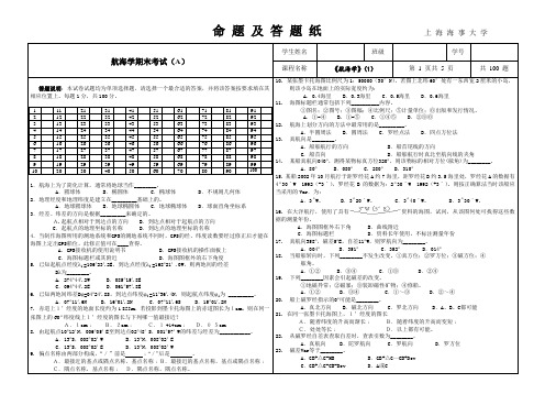
航海学期末考试(A)学生姓名班级学号课程名称《航海学》(1)第 1 页共 5 页共100 题答题说明:本试卷试题均为单项选择题,请选择一个最合适的答案,并将该答案按要求填在其相应位置上。
每题1分,共100分。
1 11 21 31 41 51 61 71 81 912 12 22 32 42 52 62 72 82 923 13 23 33 43 53 63 73 83 934 14 24 34 44 54 64 74 84 945 15 25 35 45 55 65 75 85 956 16 26 36 46 56 66 76 86 967 17 27 37 47 57 67 77 87 978 18 28 38 48 58 68 78 88 989 19 29 39 49 59 69 79 89 9910 20 30 40 50 60 70 80 90 1001.航海上为了简化计算,通常将地球当作________。
A.圆球体 B.椭圆体 C.椭球体 D.不规则几何体2.地理经度和地理纬度是建立在_________基础上的。
A.地球圆球体 B.地球椭圆体 C.地球椭球体 D.球面直角坐标系3.经差、纬差的方向是根据_________来确定的。
A.起航点相对于到达点的方向 B.到达点相对于起航点的方向C.起航点的地理坐标的名称D.到达点的地理坐标的名称4.当制作海图所用的测地系统和GPS的测地系统不同时,GPS的经、纬度读数要经过修正后才能在海图上定出GPS船位,此修正值可在____查得。
A.GPS接收机的使用说明书 B.GPS接收机的操作面板上C.海图标题栏或其附近 D.海图图框外的右下角度5. 已知起航点经度λ1=106︒23′.2E,到达点经度λ2=168︒21′ .0W,则两地间的经差Dλ为________。
A. 274︒44′.2W B.085︒15′.8EC.094︒44′.2E D.061︒57′.8E6. 已知两地间纬差Dφ=04︒24′.8S,到达点纬度φ2 =11︒36′.4N,则起航点纬度φ1为 _________。
航海学考试题目及答案

航海学考试题目及答案# 航海学考试题目及答案一、选择题1. 地球赤道周长大约是多少?A. 20000公里B. 40000公里C. 60000公里D. 80000公里答案:B2. 航海中使用的罗盘,其主要作用是什么?A. 测量风速B. 确定方向C. 测量温度D. 记录时间答案:B3. 以下哪种仪器用于测量船只相对于海底的深度?A. 回声测深仪B. 风速计C. 气压计D. 罗盘答案:A二、填空题4. 在航海中,船只的方向通常用______表示,如北、东北、东等。
答案:方位5. 航海图上,等深线是用来表示______。
答案:海底地形的等高线6. 航海中,船只的航速通常用______来表示。
答案:节三、简答题7. 简述航海中使用六分仪测量天体高度的步骤。
答案:首先,将六分仪对准天体,然后调整望远镜使天体影像与地平线重合。
通过读取六分仪上的刻度,可以确定天体的高度角。
8. 描述航海中如何使用经纬仪确定船只的位置。
答案:使用经纬仪测量天体(如太阳或星星)的高度角,结合航海图和天文历表,可以计算出船只的经度和纬度,从而确定船只的确切位置。
四、计算题9. 如果一艘船以20节的速度向东航行,经过4小时后,它将航行多少海里?答案:20节 * 4小时 = 80海里10. 已知船只从A点出发,向正北方向航行了100海里,然后向正东方向航行了200海里,请计算船只最终的位置相对于A点的经纬度变化。
答案:由于地球是一个近似的球体,纬度每变化1度大约相当于60海里,经度的变化则取决于纬度。
假设A点位于赤道附近,那么经度每变化1度大约也相当于60海里。
因此,船只向北航行100海里,纬度变化大约为1.67度;向东航行200海里,经度变化大约为3.33度。
五、论述题11. 论述航海中使用电子导航系统的优势和局限性。
答案:电子导航系统的优势包括提供实时位置信息、航线规划、障碍物警告等,极大地提高了航行的安全性和效率。
然而,其局限性在于依赖电力供应和信号接收,可能会因设备故障或信号干扰而失效,因此不能完全取代传统的航海技能。
航海学考试题目及答案

航海学考试题目及答案一、单项选择题(每题2分,共20分)1. 根据国际海事组织(IMO)的规定,船舶在公海上航行时,应遵循的海上避碰规则是:A. 国际海上避碰规则B. 国际海上安全规则C. 国际海上环境保护规则D. 国际海上交通规则答案:A2. 船舶在能见度不良的情况下航行,应采取的行动是:A. 增加航速B. 保持航速C. 减速并使用声号D. 立即停车答案:C3. 船舶在航道中航行时,应遵循的原则是:A. 右侧通行原则B. 左侧通行原则C. 直行优先原则D. 让路原则答案:A4. 船舶在避让过程中,应避免采取的行动是:A. 突然改变航向B. 突然改变航速C. 保持航向和航速D. 与他船协调避让答案:A5. 船舶在航行中遇到冰山时,应采取的行动是:A. 直接通过B. 绕过冰山C. 减速并保持距离D. 停车等待答案:B6. 船舶在航行中遇到大风浪时,应采取的行动是:A. 增加航速B. 保持航速C. 减速并调整航向D. 停车等待答案:C7. 船舶在航行中遇到海盗威胁时,应采取的行动是:A. 直接对抗B. 保持距离并报警C. 投降并服从D. 尝试谈判答案:B8. 船舶在航行中遇到紧急情况时,应采取的行动是:A. 保持冷静并评估情况B. 立即停车C. 改变航向D. 增加航速答案:A9. 船舶在航行中遇到船舶失控时,应采取的行动是:A. 立即停车B. 保持航速并调整航向C. 减速并使用声号D. 与附近船舶协调避让答案:D10. 船舶在航行中遇到船舶失火时,应采取的行动是:A. 立即停车B. 保持航速并调整航向C. 减速并使用声号D. 与附近船舶协调避让答案:A二、多项选择题(每题3分,共15分)11. 船舶在航行中,以下哪些情况需要立即采取避让行动:A. 遇到对向行驶的船舶B. 遇到同向行驶的船舶C. 遇到横穿航道的船舶D. 遇到失控的船舶答案:C, D12. 船舶在航行中,以下哪些情况需要使用声号:A. 能见度良好时B. 能见度不良时C. 遇到紧急情况时D. 遇到海盗威胁时答案:B, C13. 船舶在航行中,以下哪些情况需要减速:A. 遇到大风浪时B. 遇到冰山时C. 遇到海盗威胁时D. 遇到船舶失控时答案:A, B14. 船舶在航行中,以下哪些情况需要立即停车:A. 遇到船舶失火时B. 遇到船舶失控时C. 遇到海盗威胁时D. 遇到紧急情况时答案:A, D15. 船舶在航行中,以下哪些情况需要与附近船舶协调避让:A. 遇到对向行驶的船舶B. 遇到同向行驶的船舶C. 遇到横穿航道的船舶D. 遇到失控的船舶答案:C, D三、判断题(每题2分,共20分)16. 船舶在公海上航行时,不需要遵守任何规则。
航海概论期末考试试题及答案

航海概论期末考试试题及答案一、选择题(每题2分,共20分)1. 以下哪个不是航海学的基本组成部分?A. 航海天文学B. 航海气象学C. 航海地理学D. 航海心理学答案:D2. 下列哪个不是航海图的种类?A. 海图B. 航路图C. 航海日志D. 航海通告答案:C3. 下列哪个不属于航海仪器?A. 罗经B. GPSC. 雷达D. 磁罗经答案:D4. 下列哪个不是航海规则?A. 国际海上避碰规则B. 船舶和港口法C. 航海日志规则D. 航海通告规则答案:D5. 航海天文学中,以下哪个不是天体的基本要素?A. 星等B. 赤纬C. 赤经D. 星盘答案:D二、填空题(每题2分,共20分)6. 航海学是研究船舶在______、______、______等方面的科学技术。
答案:海洋、湖泊、江河7. 航海图按内容可分为______、______、______等。
答案:海图、航路图、航海通告8. 航海仪器主要包括______、______、______等。
答案:罗经、GPS、雷达9. 航海规则主要包括______、______、______等。
答案:国际海上避碰规则、船舶和港口法、航海日志规则10. 航海天文学中的天体基本要素有______、______、______等。
答案:星等、赤纬、赤经三、判断题(每题2分,共20分)11. 航海学只研究船舶在海洋中的航行问题。
()答案:错误12. 航海图是航海过程中必不可少的重要资料。
()答案:正确13. 航海仪器可以完全替代航海图。
()答案:错误14. 航海规则是船舶在海上航行必须遵守的规定。
()答案:正确15. 航海天文学是航海学的基础学科之一。
()答案:正确四、简答题(每题10分,共30分)16. 简述航海学的意义和作用。
答案:航海学是研究船舶在海洋、湖泊、江河等方面的科学技术。
它的意义和作用主要表现在以下几个方面:(1)为船舶安全航行提供理论依据;(2)为船舶驾驶员提供航海知识和技能;(3)为船舶设计、制造和航行管理提供技术支持;(4)为海洋资源的开发和利用提供科学依据。
航海导论期末考试题及答案

航海导论期末考试题及答案一、选择题(每题2分,共20分)1. 世界上最早的航海图是:A. 地中海地图B. 郑和航海图C. 麦哲伦航海图D. 马可波罗航海图答案:A2. 航海中使用的罗盘,其指向的磁极是:A. 南极B. 北极C. 地心D. 月球答案:B3. 航海中,航海者利用太阳高度角来确定:A. 经度B. 纬度C. 风向D. 潮汐答案:B4. 航海术语中,“顶风航行”指的是:A. 船头与风向成90度角航行B. 船头与风向成180度角航行C. 船头与风向成0度角航行D. 船尾与风向成180度角航行答案:A5. 航海中,用来测量船只速度的仪器是:A. 六分仪B. 罗盘C. 测速仪D. 测深仪答案:C6. 航海中,用来确定船只位置的仪器是:A. 六分仪B. 罗盘C. 测速仪D. 测深仪答案:A7. 航海中,用来测量水深的仪器是:A. 六分仪B. 罗盘C. 测速仪D. 测深仪答案:D8. 航海中,用来测量船只航向的仪器是:A. 六分仪B. 罗盘C. 测速仪D. 测深仪答案:B9. 航海中,用来测量船只航迹的仪器是:A. 六分仪B. 罗盘C. 测速仪D. 航迹仪答案:D10. 航海中,用来测量船只航迹的仪器是:A. 六分仪B. 罗盘C. 测速仪D. 航迹仪答案:D二、填空题(每空1分,共10分)11. 航海中,用来确定船只位置的方法之一是______。
答案:天文定位12. 航海中,用来确定船只位置的方法之二是______。
答案:无线电定位13. 航海中,用来确定船只位置的方法之三是______。
答案:卫星定位14. 航海中,用来确定船只位置的方法之四是______。
答案:声纳定位15. 航海中,用来确定船只位置的方法之五是______。
答案:视觉定位三、简答题(每题5分,共20分)16. 简述航海中罗盘的工作原理。
答案:罗盘的工作原理基于地球的磁场。
罗盘内部有一个磁针,它与地球的磁极对齐,指向地球的磁北极,从而帮助航海者确定方向。
- 1、下载文档前请自行甄别文档内容的完整性,平台不提供额外的编辑、内容补充、找答案等附加服务。
- 2、"仅部分预览"的文档,不可在线预览部分如存在完整性等问题,可反馈申请退款(可完整预览的文档不适用该条件!)。
- 3、如文档侵犯您的权益,请联系客服反馈,我们会尽快为您处理(人工客服工作时间:9:00-18:30)。
1,Gnomonic chart can be used to design a passage plan of ocean route. Please describe the steps which should be followed when use a gnomonic chart to design a passage plan of ocean route.①Easy method but is not very exact②Any great circle appears as a straight line.③Consulting NP 131, choose corresponding Gnomonic charts.④Draw a straight line connecting the point of departure and the destination on the chart.⑤Inspect it to see that it passes clear of all dangers to navigation.⑥If this requirement is met, the courses are then transferred to a Mercator chart by selecting a number of points along the great circle, determining their latitude and longitude and plotting these points on the Mercator chart.⑦These points are then connected by straight lines to represent the rhumb line courses to be steered.2,Gnomonic chart can be used to design a passage plan of ocean route. Please describe the steps which should be followed when use a gnomonic chart to design a passage plan of ocean composite route.①Refer to relative navigation publications, determine the reasonable limiting latitude φL.②From the departure A and destination B make the straight lines AM and BN tangent to the limiting latitude, and they are two great circle routes, the line between the two points of tangency M, N is limiting parallel track.③Determine every rhumb line’s course and distance in the two great circle tracks.④The course of parallel route course is 090°or 270 °, the distance could be measured in navigational chart.⑤Make a table using the every rhumb line course and distance for next voyage.3,The factors to be considered for ocean route choice.①Meteorological conditions②State of the sea③Obstructions④Fixing and navigable water area conditions⑤Own ship conditions⑥Navigation regulations4,The notes should be covered during ocean navigation.①Do not ignore Dead reckoning②Use any resource to fix position③Note the safety problem when approaching shore④Receive and analyze forecast and weather facsimile⑤Receive navigational warning on time ⑥Adjust ship’s mean time (SMT) in time⑦Apply the position plotting charts⑧Select a suitable speed5,There are four routes are usually chosen while in ocean navigation, please describe them.①Great circle route②Rhumb line route③Parallel route④Composite route6,List these factors to determine the safe distance off dangers during coastal navigating.①The distance and time to a danger calculated from the final precise ship position②Mapping accuracy near the dangers (high or low)③Whether there are obvious objects or marks for fixing position or avoiding dangers④Visibility conditions when transiting the dangers ( day or night)⑤Winds and currents ( onshore or offshore )7,The minimum safe depth of water required for passing through shoals may be related to some factors, please describe them.①draft of departure②reduced draft because of consumption of oil and water (cm) ③changes of mean draft due to the specific gravity of seawater ④Increased draft due to transverse inclination or heel⑤Squat and trimming effect⑥Height of semiwave ⑦Reserved depth of water8,List the necessary notes for passing through shallow waters.①Adjust draft ②Wait the high tide③Control the vessel speed ④Grasp the new information⑤Avoid overtaking and meeting in shallow waters (ship suction)9,Please list five kinds of piloting methods during navigating in narrow waters.①Observing buoys 观测浮标导航②Observing ranges/transits 观测方位叠标导航③Observing two landmarks at the same ranges 观测距离叠标导航④Observing the bearing of a leading mark 观测导标位置线导航⑤Parallel Indexing 平行线导航10,Please list five kinds of methods of clearing dangers during navigating in narrow waters.①Danger Bearings (方位避险)②Danger Ranges (距离避险)③Horizontal angles (水平角避险)④Vertical angles (垂直角避险)⑤Parallel indexing (the same to using Parallel indexing to navigation ) (平行线避险)11,Some preparations should be made by OOW as soon as possible, prior to navigation in fog. Please describe them.①acquire precise position (GPS and Paper Charts prior to entering situation), know the dynamic information of surrounding ships.②Prepare to give appropriate sound signals and reduce speed to safe speed according to COLREG and local regulations;③Radar/ARPA are in operational condition;④VHF listening watch is maintained on Ch16 and a proper channel stipulated by local rules;⑤Assign lookouts properly to look and listen, keep quiet, open bridge doors and intensify watch of surrounding conditions;⑥Check and change over to manual steering operation;⑦Report to the master, give engineers notice for stand-by engines;⑧Switch on navigation lights;⑨Use the instruments such as ECDIS, AIS, DGPS, etc. prudently.⑩Consider anchoring if out of shipping lanes;⑾Any additional instructions from the Master.12,Some preparations should be made by OOW prior to entry into ice regions. Please describe them.①Before attempting any passage through ice it is essential to determine the type, thickness, hardness, floe size and concentration of ice②Ships navigating in ice-covered waters may experience delays and, therefore, should be stored with sufficient fresh-water supplies and manoeuvring fuel.③Navigation in pack ice after dark should equip high-power searchlights in bow and stern which can be controlled easily from the bridge.④Prepare enough leak stoppers and protections against the cold, close watertight doors and portholes.⑤Adopting any effective method to fix precise ship position.⑥Ships intending to operate in ice should be ballasted and trimmed by the stern slightly⑦The navigational and communications equipment must be equally reliable13 Describe main functions of VTS.14 List 8 kinds of ships reports which are divided and provided by the resolution A.598 (15) of IMO.15,List four types of topmark used in the IALA Maritime Buoyage System.can,conical, spherical, and X-shaped.16,List five types of marks in the IALA Maritime Buoyage System.①Lateral marks②Cardinal marks③Isolated danger marks④Special marks⑤Safe water marks⑤New danger marks17,List four colors of lights used in the IALA Maritime Buoyage System.Red Yellow Green Blue18, List functions of Catalogue of Admiralty Charts and other Hydrographic Publications(NP 131)①Select navigational charts②Select nautical publications③Check the validity of navigational charts on board④Get the Admiralty Authorised Chart Agents/ Distributors and ANM supplies19,List seven publications which published by UKHO.①Admiralty Notices to Mariners②Admiralty Lists of Lights and Fog Signals③Admiralty Lists of Radio Signals④Admiralty Sailing Directions⑤Admiralty Tide tables⑥Guide to Port Entry⑦Ocean Passage for the World20,Describe the contents of Admiralty Notices to Mariners.I Explanatory Notes. Publications ListII Admiralty Notices to Mariners. Updates to Standard Navigational ChartsIII Reprints of Radio Navigational WarningsIV Corrections to Admiralty Sailing DirectionsV Corrections to Admiralty Lists of Lights and Fog SignalsVI Corrections to Admiralty Lists of Radio Signals。
