GOCAD中文手册
GOCAD讲义

GOCAD地质建模Gocad是以工作流程为核心的一款地质建模软件,达到了半智能化建模的世界最高水平,具有功能强,界面友好,易学易用,并能在几乎所有平台上(Sun, SGI, PC-Linux, PC-Windows)运行的特点。
以下通过一个简单的例子,说明GOCAD地质建模的主要过程。
第一部分 GOCAD的启动1、双击桌面上的Gocad启动图标,即可启动Gocad程序。
2、选择New project建立新工程,给工程起个名字,选择路径在文件夹Project中,点击保存,打开下图:3、选择Select All,点击OK即可。
4、弹出选择工程单位窗口如下。
此处选择平面上单位是英尺(Feet),深度单位也是英尺(Feet);时间选择毫秒;深度方向选择向上为增大;z值是时间域或深度域,选择深度域(最终如下图)。
选择完后点击OK。
5、打开如下Gocad主窗口。
第二部分 GOCAD数据加载一、地震数据加载以SEGY格式为例,加载三维地震数据选择File > Import objects >Seismic Data > SEG-Y 3D as Voxet。
在Data文件夹下选择文件“tornado.sgy”,点击OK即可加载,如下图。
二、井数据加载1、井位数据加载不同的数据格式有不同的加载方法。
以普通的文本格式为例,包括井名、x坐标、y坐标、补心海拔、井深等。
(1)加载方式是:File > Import objects > Well data > (path)Locations from column-based File ,在Data\Wells文件夹中选择文件“WellPaths”,接受默认,按next两次,打开下图:(2)对问题What information do you have for the path? 选择X-Y-TVDSS-MD。
下来的两个问题各选Feet和Use a Column。
opencascade中文手册
标题:深度解读opencascade中文手册,探究其应用与发展在计算机辅助设计和工程领域,opencascade是一款广泛应用的开源软件,其中文手册更是为广大用户提供了详尽的使用指南和技术支持。
本文将深入探讨opencascade中文手册的内容和应用,为读者带来更深入的理解和启发。
1. opencascade中文手册的概述opencascade中文手册是一本系统全面的技术文档,涵盖了opencascade软件的各个模块和功能,包括几何建模、CAD/CAM/CAE应用、三维可视化、网格处理等方面。
通过opencascade中文手册,用户可以学习到如何使用opencascade进行二维和三维几何建模,进行几何操作和变换,进行特征建模和零件装配等内容。
2. opencascade中文手册的深度应用在实际工程项目中,opencascade中文手册的深度应用涵盖了多个领域。
比如在机械制造中,opencascade提供了丰富的几何建模工具,可以帮助工程师进行产品设计和分析,提高设计效率和精度;在航空航天领域,opencascade的CAD/CAM/CAE应用可以辅助工程师进行飞机零件设计和模拟,为航空领域的发展提供了强大支持。
3. opencascade中文手册的发展趋势随着计算机辅助设计和工程领域的不断发展,opencascade中文手册也在不断更新和完善。
未来,opencascade中文手册有望进一步拓展其内容和功能,满足用户多样化的需求。
随着人工智能和大数据技术的发展,opencascade中文手册也有望在模型智能化和自动化方面取得更多突破。
总结与展望通过对opencascade中文手册的深度解读,我们对其在工程领域中的应用和发展有了更加清晰的认识。
opencascade中文手册不仅是一本技术文档,更是工程师们提升工作效率和质量的利器。
希望在未来,opencascade中文手册能够继续发挥其作用,为计算机辅助设计和工程领域的发展贡献更多力量。
gocad教程
GOCAD综合地质与储层建模软件简易操作手册美国PST油藏技术公司PetroSolution Tech,Inc.目录第一节 GOCAD综合地质与储层建模软件简介┉┉┉┉┉┉┉┉┉┉┉┉┉┉1一、GOCAD特点┉┉┉┉┉┉┉┉┉┉┉┉┉┉┉┉┉┉┉┉┉┉┉┉┉1二、GOCAD主要模块┉┉┉┉┉┉┉┉┉┉┉┉┉┉┉┉┉┉┉┉┉┉┉1 第二节 GOCAD安装、启动操作┉┉┉┉┉┉┉┉┉┉┉┉┉┉┉┉┉┉┉┉2一、GOCAD的安装┉┉┉┉┉┉┉┉┉┉┉┉┉┉┉┉┉┉┉┉┉┉┉┉2二、GOCAD的启动┉┉┉┉┉┉┉┉┉┉┉┉┉┉┉┉┉┉┉┉┉┉┉┉3 第三节 GOCAD数据加载┉┉┉┉┉┉┉┉┉┉┉┉┉┉┉┉┉┉┉┉┉┉┉5一、井数据加载┉┉┉┉┉┉┉┉┉┉┉┉┉┉┉┉┉┉┉┉┉┉┉┉┉5二、层数据加载┉┉┉┉┉┉┉┉┉┉┉┉┉┉┉┉┉┉┉┉┉┉┉┉┉11三、断层数据加载┉┉┉┉┉┉┉┉┉┉┉┉┉┉┉┉┉┉┉┉┉┉┉┉11四、层面、断层面加载┉┉┉┉┉┉┉┉┉┉┉┉┉┉┉┉┉┉┉┉┉┉12五、地震数据加载┉┉┉┉┉┉┉┉┉┉┉┉┉┉┉┉┉┉┉┉┉┉┉┉12 第四节 GOCAD构造建模┉┉┉┉┉┉┉┉┉┉┉┉┉┉┉┉┉┉┉┉┉┉┉13一、准备工作┉┉┉┉┉┉┉┉┉┉┉┉┉┉┉┉┉┉┉┉┉┉┉┉┉┉13二、构造建模操作流程┉┉┉┉┉┉┉┉┉┉┉┉┉┉┉┉┉┉┉┉┉┉14三、构造建模流程总结┉┉┉┉┉┉┉┉┉┉┉┉┉┉┉┉┉┉┉┉┉┉40 第五节建立GOCAD三维地质模型网格┉┉┉┉┉┉┉┉┉┉┉┉┉┉┉┉41一、新建三维地质模型网格流程┉┉┉┉┉┉┉┉┉┉┉┉┉┉┉┉┉┉41二、三维地质模型网格流程┉┉┉┉┉┉┉┉┉┉┉┉┉┉┉┉┉┉┉┉41三、三维地质模型网格流程总结┉┉┉┉┉┉┉┉┉┉┉┉┉┉┉┉┉┉47 第六节 GOCAD储层属性建模┉┉┉┉┉┉┉┉┉┉┉┉┉┉┉┉┉┉┉┉┉48一、建立属性建模新流程┉┉┉┉┉┉┉┉┉┉┉┉┉┉┉┉┉┉┉┉┉48二、属性建模操作流程┉┉┉┉┉┉┉┉┉┉┉┉┉┉┉┉┉┉┉┉┉┉48三、属性建模后期处理┉┉┉┉┉┉┉┉┉┉┉┉┉┉┉┉┉┉┉┉┉┉66四、网格粗化┉┉┉┉┉┉┉┉┉┉┉┉┉┉┉┉┉┉┉┉┉┉┉┉┉┉74 第七节 GOCAD地质解释和分析┉┉┉┉┉┉┉┉┉┉┉┉┉┉┉┉┉┉┉┉78GOCAD综合地质与储层建模软件操作手册第一节GOCAD综合地质与储层建模软件简介Gocad是国际上公认的主流建模软件,在众多油公司和服务公司得到了广泛的应用。
GOCAD讲义

GOCAD地质建模Gocad是以工作流程为核心的一款地质建模软件,达到了半智能化建模的世界最高水平,具有功能强,界面友好,易学易用,并能在几乎所有平台上(Sun, SGI, PC-Linux, PC-Windows)运行的特点。
以下通过一个简单的例子,说明GOCAD地质建模的主要过程。
第一部分 GOCAD的启动1、双击桌面上的Gocad启动图标,即可启动Gocad程序。
2、选择New project建立新工程,给工程起个名字,选择路径在文件夹Project中,点击保存,打开下图:3、选择Select All,点击OK即可。
4、弹出选择工程单位窗口如下。
此处选择平面上单位是英尺(Feet),深度单位也是英尺(Feet);时间选择毫秒;深度方向选择向上为增大;z值是时间域或深度域,选择深度域(最终如下图)。
选择完后点击OK。
5、打开如下Gocad主窗口。
第二部分 GOCAD数据加载一、地震数据加载以SEGY格式为例,加载三维地震数据选择File > Import objects >Seismic Data > SEG-Y 3D as Voxet。
在Data文件夹下选择文件“tornado.sgy”,点击OK即可加载,如下图。
二、井数据加载1、井位数据加载不同的数据格式有不同的加载方法。
以普通的文本格式为例,包括井名、x坐标、y坐标、补心海拔、井深等。
(1)加载方式是:File > Import objects > Well data > (path)Locations from column-based File ,在Data\Wells文件夹中选择文件“WellPaths”,接受默认,按next两次,打开下图:(2)对问题What information do you have for the path? 选择X-Y-TVDSS-MD。
下来的两个问题各选Feet和Use a Column。
GOCAD中文手册
GOCAD综合地质与储层建模软件简易操作手册美国PST油藏技术公司PetroSolution Tech,Inc.目录第一节 GOCAD综合地质与储层建模软件简介┉┉┉┉┉┉┉┉┉┉┉┉┉┉1一、GOCAD特点┉┉┉┉┉┉┉┉┉┉┉┉┉┉┉┉┉┉┉┉┉┉┉┉┉1二、GOCAD主要模块┉┉┉┉┉┉┉┉┉┉┉┉┉┉┉┉┉┉┉┉┉┉┉1 第二节 GOCAD安装、启动操作┉┉┉┉┉┉┉┉┉┉┉┉┉┉┉┉┉┉┉┉2一、GOCAD的安装┉┉┉┉┉┉┉┉┉┉┉┉┉┉┉┉┉┉┉┉┉┉┉┉2二、GOCAD的启动┉┉┉┉┉┉┉┉┉┉┉┉┉┉┉┉┉┉┉┉┉┉┉┉3 第三节 GOCAD数据加载┉┉┉┉┉┉┉┉┉┉┉┉┉┉┉┉┉┉┉┉┉┉┉5一、井数据加载┉┉┉┉┉┉┉┉┉┉┉┉┉┉┉┉┉┉┉┉┉┉┉┉┉5二、层数据加载┉┉┉┉┉┉┉┉┉┉┉┉┉┉┉┉┉┉┉┉┉┉┉┉┉11三、断层数据加载┉┉┉┉┉┉┉┉┉┉┉┉┉┉┉┉┉┉┉┉┉┉┉┉11四、层面、断层面加载┉┉┉┉┉┉┉┉┉┉┉┉┉┉┉┉┉┉┉┉┉┉12五、地震数据加载┉┉┉┉┉┉┉┉┉┉┉┉┉┉┉┉┉┉┉┉┉┉┉┉12 第四节 GOCAD构造建模┉┉┉┉┉┉┉┉┉┉┉┉┉┉┉┉┉┉┉┉┉┉┉13一、准备工作┉┉┉┉┉┉┉┉┉┉┉┉┉┉┉┉┉┉┉┉┉┉┉┉┉┉13二、构造建模操作流程┉┉┉┉┉┉┉┉┉┉┉┉┉┉┉┉┉┉┉┉┉┉14三、构造建模流程总结┉┉┉┉┉┉┉┉┉┉┉┉┉┉┉┉┉┉┉┉┉┉40 第五节建立GOCAD三维地质模型网格┉┉┉┉┉┉┉┉┉┉┉┉┉┉┉┉41一、新建三维地质模型网格流程┉┉┉┉┉┉┉┉┉┉┉┉┉┉┉┉┉┉41二、三维地质模型网格流程┉┉┉┉┉┉┉┉┉┉┉┉┉┉┉┉┉┉┉┉41三、三维地质模型网格流程总结┉┉┉┉┉┉┉┉┉┉┉┉┉┉┉┉┉┉47 第六节 GOCAD储层属性建模┉┉┉┉┉┉┉┉┉┉┉┉┉┉┉┉┉┉┉┉┉48一、建立属性建模新流程┉┉┉┉┉┉┉┉┉┉┉┉┉┉┉┉┉┉┉┉┉48二、属性建模操作流程┉┉┉┉┉┉┉┉┉┉┉┉┉┉┉┉┉┉┉┉┉┉48三、属性建模后期处理┉┉┉┉┉┉┉┉┉┉┉┉┉┉┉┉┉┉┉┉┉┉66四、网格粗化┉┉┉┉┉┉┉┉┉┉┉┉┉┉┉┉┉┉┉┉┉┉┉┉┉┉74 第七节 GOCAD地质解释和分析┉┉┉┉┉┉┉┉┉┉┉┉┉┉┉┉┉┉┉┉78GOCAD综合地质与储层建模软件操作手册第一节GOCAD综合地质与储层建模软件简介Gocad是国际上公认的主流建模软件,在众多油公司和服务公司得到了广泛的应用。
GOCAD功能简介及应用实例
GOCAD软件简介Gocad地质建模软件是国际上公认的主流建模软件,在众多油公司和服务公司得到了广泛的应用,包括Exxon、Mobile,Chevron、Texaco、BP、Halliburton,Schlumberger等世界著名的油公司和服务公司。
Gocad是以工作流程为核心的新一代地质建模软件,达到了半智能化建模的世界最高水平,具有功能强,界面友好,易学易用,并能在几乎所有硬件平台上(Sun, SGI, PC-Linux, PC-Windows)运行的特点。
Gocad研究思想是1988年法国Nancy大学的J.L. Mallet教授提出的,目的是要开发一种新的地质建模软件,以适应地质、地球物理和油藏工程的需要,为多学科的综合研究提供技术支撑。
在Gocad软件研发中除采用J.L. Mallet 教授提出的离散光滑插值技术(DSI), 还采用了适应能力很强的三角剖分和四面体剖分技术,并独立地开发了软件中的地质统计学部分。
自1990年软件诞生后,得到了国外的许多油公司和地球物理公司的支持,取得了飞速的发展。
从最初的简单构造建模,发展到今天复杂构造建模、复杂三维模型网格生成、储层岩石物理属性模型、岩相模型等,以Gocad为代表的先进地质建模软件大大提高了地质建模的效率和精度,可以满足对复杂地质区域的建模要求。
Gocad建模思想是建立在工作流程之上的,是以地质建模的内在规律和程序为基本框架,为地质师和油藏工程师提供充分的发挥想象力的空间,使人的地质思想得以准确的融合到地质建模过程中,使整个建模过程始终以地质为本。
Gocad构造建模能处理任何复杂的构造模型,并能方便地对三维构造模型和三地质网格模型进行编辑及更新,使用Gocad软件用户能方便地对油藏进行动态跟踪。
Gocad基于流程的属性体建模方法包含几十种地质统计算法,功能强大,使用灵活,并能方便地引入约束条件,将地质家和油藏工程师的认识、大量油藏信息引入到属性体建模中,此外 Gocad建模的许多模块是EDS公司与Chevron、Texaco等油公司联合研发,因此具有很高的实用性。
gocad
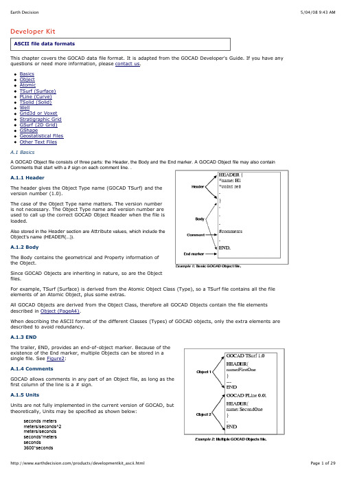
A GOCAD Object file consists of three parts: the Header, the Body and the End marker. A GOCAD Object file may also containused to call up the correct GOCAD Object Reader when the file isvalues, which include the0.44704*meters/seconds0.3048*meters/seconds0.3048*seconds*metersRestrictions: at most one scalar in front, at most one division.A.2 ObjectThe Object file elements define the Object style and the Object coordinate space and Units. Style AttributesThe HEADER block, delimited by {and}, contains the Style definition. Each line defines an Attribute of an Object. Attributes are strictly optional, except for the name of the Object. An Object must have a name.If preferred, an Attribute can be given on a separate line outside of the HEADER block; in that case the line should begin with the HDR keyword as shown in Example 3 (page 4).An example of Object Style element is:A.2.1 Coordinate SystemThe Object Coordinate System paragraph is optional for allobjects. If the paragraph is not present, the object is loaded inthe default coordinate system in the current session.The coordinate system description must be given after theHEADER block and before any other keyword giving the geometryof the object such as VRTX, PVRTX, ORIGIN, AXIS ....The Coordinate System must be given as follows:GOCAD_ORIGINAL_COORDINATE_SYSTEMNAME nameAXIS_NAME name_u name_v name_wAXIS_UNIT unit_u unit_v unit_wZPOSITIVE keywordEND_ORIGINAL_COORDINATE_SYSTEMIt is imperative that the Coordinate System definition is enclosed between the keywordsGOCAD_ORIGINAL_COORIDNATE_SYSTEM and END_ORIGINAL_COORDINATE_SYSTEM.The NAME and AXIS_NAME values are information string which gives the name of the local object coordinate system and its axes. The values must be specified by strings of characters enclosed in double-quotes, i.e. AXIS_NAME "X" "Y" "Z" or AXIS_NAME "X" "Y" "T"The AXIS_UNIT specifies the unit for each axes. The axis unit for the U and V axes must be identical, the axis unit for the W axis can be different from the unit of the U and V. It is possible to define units as AXIS_UNIT "m" "m" "m" or AXIS_UNIT "m" "m" "ft" but a definition such as AXIS_UNIT "m" "ft" 'km" is invalid. The AXIS_UNIT values must be specified by strings of characters enclosed by double-quotes.The ZPOSITIVE value indicates the direction of the Z axis. The values allowed for the keyword after ZPOSITIVE are either Depth (Z is increasing downwards) or Elevation (Z is increasing upwards)The coordinates are read in double precision converted to simple precision after coordinate system conversion. When an object is loaded into Gocad, its local coordinate system is compared with the current global coordinate system: if needed, the object geometrical coordinates are converted internally. When the coordinates are displayed, for example, for a picking in the 3D camera, the coordinates displayed are in the session coordinate system. When the object is saved back to a stand alone file, its geometrical coordinates are restored in its original coordinates system.A.3 AtomicThe Atomic data format defines the points, locations and Property values, of an Atomic (currently, this includes PointsSet, Curve, Surface, Solid and GShape). The Atomic inherits all of the Object file format elements, plus Atomic data.A.3.1 AtomicThis section describes the recommended Atomic file format.Since Property values are optional, a basic Atomic data line consists of three parts: Type, ID number, and data: VRTX ID X Y Z [CN]where the XYZ describes the location of that point. Additional information maybe attached at the end of each VRTX line to specify the Interpolation Restriction on that Atom (Control Node information).For example:A.3.1.1 Properties definitionIf there are Properties, they must bedeclared after the HEADER block andbefore the first point data line as:PROPERTIES Pname1 Pname2...PROPERTY_CLASSES class_name1class_name2 (optional, but if youdeclare one, you must declare all)UNITS unit1 unit2...(optional, but if youdeclare one, you must declare all)NO_DATA_VALUES v1 v2...(optional,but if you declare one, you mustdeclare all)ESIZES esize_1 esize_2... (optional, but if you declare one, you must declare all)The PROPERTIES line list all the properties that will be attached to the point. The ordering of the properties on the line correspond to the ordering of the properties values associated to the point definition.The PROPERTY_CLASSES line lists the property class names for each property defined in the PROPERTIES list. If one property class must be listed all property classes must be listed.The NO_DATA_VALUES line lists the no-data-values for each of the property defined in the property list. For vectorial properties, there is only one no-data-value and each property vector element should be equal to this value if it is to be treated as a no-data-value vectorial property.The UNITS line lists the units for each of the property defined in the property list (See Units for format specification of Units).The ESIZES line lists the dimension of each property defined in the property list. By default the dimension of a property is 1, but for example a property representing a 3D vector will be of dimension 3. For example. if you have a set of points with a 1 dimensional property (called "porosity") and a 3D vectorial property called "throw", the definition of the properties and one point will look like:PROPERTIES porosity throw ESIZES 1 3 PVRTX 1 X Y Z porosity_value throw_x throw_y throw_zwhere throw_x, throw_y and throw_z are the three components of the throw vector at the specified location.A.3.1.2 Point location and properties definitionThe data line which defines a point location and its properties look likes:PVRTX ID X Y Z PV1 PV2...where PV1, PV2... are Property values. For example.A.3.2 Parts (Subset)An Atomic Object can have its VRTXgrouped into subsets. In a VSet, the keywordis SUBVSET; in PLine, it is ILINE; in TSurf, itis TFACE; and in TSOLID, it is TVOLUME.A.3.3 Atomic-Old from C-GOCADThis section describes an older Atomicformat, mainly made to be compatiblewith C-GOCAD file format.The format consists of two sections, thelocation section and the Propertysection. The Property section isoptional.The location section is identical to thenew format:VRTX ID X Y ZThe Property value section contains a header and the list of Property values associated to a point defined in the previous section. The header defines the names of the DataPack Fields (Properties) associated with the Atomic. The following example Example 5 (page 8)declares three properties.FIELDS Pname1 Pname2(or PROPERTIES Pname1 Pname2...)PROPERTY_CLASSES class_name1 class_name2 (optional, but if you declare one, you must declare all)UNITS unit1 unit2...(optional, but if you declare one, you must declare all)NO_DATA_VALUES v1 v2...(optional, but if you declare one, you must declare all)ESIZES esize_1 esize_2... (optional, but if you declare one, you must declare all)The Property section define, for each point defined in the location section, the Property values associated with the Atomic's DataPackFields.REC ID1 ID2 PV1 PV2...Associated with a REC definition are two identifiers needed to be specified for compatibility reasons with earlier version. The two identifiers must be identical.An example of a Object file identical to the one given in Example 5 (page 8), but in this old data format is given below:.A.4 TSurf (Surface)The data file of a TSurf includes the inherited file elements of a Object and of an Atomic. The Atoms (Vertices) of the TSurf must be defined before the triangles.A.4.1 Geologic InformationBefore defining vertices and triangles, geologic information can be given.Geological information consists of GEOLIGICAL_TYPE, GEOLOGICAL_FEATURE and STRATIGRAPHIC_POSITION.The geological type of a TSurf can be specified using the following format:GEOLOGICAL_TYPE geological_type_namewhere geological_type_name can be one the following: top, intraformational, fault, unconformity, intrusive, topography, boundary, and ghost. The information is used during layer construction.The stratigraphic position is specified as follow:STRATIGRAPHIC_POSITION age timewhere age is the name of a stratigraphic unit. time is the numerical value of age (35000, etc.). This information is used during layer computation.The geological feature is specified as follow:GEOLOGICAL_FEATURE geologic_feature_namewhere geologic_feature_name is the name of the geologic feature that the surface represents. This information is used to associate surface to well markers (the geologic feature should have the same name than the well marker). A.4.2 TrianglesTriangles definition must occur after vertices definitions. Each Triangle is then defined by its three Vertices (Atoms) in the following format:TRGL id1 id2 id3where ids are the IDs of the already-defined Atoms (Vertices). For example, the ascii file corresponding to a TSurf named SQUARE, containing four vertices, and two triangles is shown in Figure1.A.4.3 Special Points: VRTX vs. ATOMIn addition to the VRTX or PVRTX point/vertex descriptor find in the Atomic format definition, on can find the additional line inside a TSurf ascii file:ATOM id1 id2 (where id1 > id2)where id1 is the index of the new ATOM and id2 is the index of the already existing VRTX node which XTZ this Atom shares.The goal of the ATOM keyword is to create a new ATOM but which shares an already existing vertex. An Atom node has its one Property values but it is spatially linked to the existing VRTX node. In other word, an ATOM and its referenced VRTX are collocated, but not connected. Triangles construction will use the vertex id or the atom id.An example of the use of such Atom record is given below:The input Tsurf file on the left will create a Surface shown at the center. The Surface has two TFaces, because two Triangles need to share an edge to be considered connected. When the Surface is saved, GOCAD will output the file on the right. It recognizes that the two Triangles both have one vertex at an identical location, but topologically, they can not be the same point. So, GOCAD creates a new point, ATOM 6, that shares the identical location of VRTX 3, but is an independent point in the sense that it has its own Property values (not in this case). However, had you have two more triangles in your input file, TRGL 2 4 3 and TRGL 6 5 1, the ATOM line would not have been created because the four triangles are then connected through direct or indirect edge-sharing.A.4.4 Parts/TFaceThe TFACE keyword is proposed to ensure identical indexing of the VRTX every time you save an Surface whose mesh you have not modified.In Figure2 the file on the right (the one output by GOCAD) not only has the extra ATOM line, it also two TFACE lines to separate VRTX (and ATOM) and TRGL from different TFaces. They arecurrently commented out for their full implementation is still to be determined by the GOCAD Committee.GOCAD will accept the simpler format shown on the right of Figure2 (where all the triangles and VRTX definition of all parts are all merged into one block) but will output the file shown on the right of Figure2.A.4.5 BordersAn edge of a TSurf can be a single piece or can be divided into multiple pieces. Each piece is called a Border, and it is separated from its neighboring Border by a Border Extremity. A Border Extremity is a designated node (VRTX, ATOM) on an edge of a TSurf that separates two Borders.Borders definition should appear at the end of the TSurf file format, in the format shown below:BSTONE atom_vrtx_idBORDER border_id bstone_id_1 bstone_id_2The BSTONE line defines an ATOM/VRTX as a Border Extremity.The BORDER line defines the border, border_id, as starting at vrtx_id1, which must have been declared as a Border Extremity in proceeding BSTONE lines, and continuing in the direction of vrtx_id2, which must be adjacent to vrtx_id1 (this border ends when it runs into another Border Extremity).The Border Extremities are always included in the list of points along the border.A.5 PLine (Curve)The Ascii PLine format inherits from the Object and from the Atomic formats. As for the TSurf, geologic information can be specified (See Geologic Information (PageA10)). For PLine geologic feature is used to relate multiple PLine to the same horizon.The Atoms of the Lines must be defined first. Each Segment in the PLine is then defined by its 2 apices in the following format:SEG id1 id2where ids are the IDs of the already-defined Atoms.For example, the ascii file corresponding to he PLine represented in Figure3 may look like:If no segments information is given, the atoms are assumed to form an open line, from the first atom to the last atom in the file order.If the PLine is composed of multiple parts, the parts can be combined or can be separated into ILines (or Isolated Lines). Each ILine is separated by a ILINE keyword and each ILine specify its own points and segments. In the same manner as for the TSurf, an ILINE keyword is proposed to ensure identical indexing of the VRTX every time you save a line which topology has not modified.A.6 TSolid (Solid)The Ascii TSolid format inherits from the Object and from the Atomic formats. The Atoms of the Atomic must be defined first. Each Tetrahedron in the Solid is then defined by its 4 apices in the following format.: TETRA id1 id2 id3 id4where ids are the IDs of the already-defined Atoms.For example, the ascii file corresponding to he Solid represented in Figure4 may look like:If the TSolid is composed of multiple parts, the parts can be combined or can be separated into TVolumes (or Tetrahedralize volumes). Each TVolume is separated by a TVOLUME keyword and each TVolume specify its own points and tetrahedras.[DIP azimuth dip][NORM X Y Z][MREF horizon_name][UNIT >rock_layer_name]Additional information (between [and]) can be attached to each Marker. This extra information includes the orientation (given as DIP or NORM) of the Marker, the Marker Reference Horizon (currently not utilized by GOCAD) and the Rock Unit (currently not utilized by GOCAD).The DIP information is given in Grads.What are Grads? It is an ancient French measurement of angles; there are 100 grads in a right angle (as opposed to 90 degrees in a right angle).The NORM information is always given in XYZ, representing the normal vector of the Marker. This is the preferred representation for Marker orientation (this is the way GOCAD will output Marker orientation information, instead of DIP).The optional information can be on the same line as the marker itself, or on lines that immediately follow the marker ascii code (MRKR).New WellMarker dip specificationsDIP angles are to be given in Grads, which is not a unit a lot of people are familiar with. GOCAD introduced a new dip specification DIPDEG where the two angles are given in degree.DIPDEG azimuth dipA.7.3 WellCurvesThe WellCurves section consists of two parts, the WellCurve Header section and the WellCurve Internal Data section. The header section defines the format of the Well Curves. The WellCurve data can be given in the same file, or in an external binary or ascii file.External Binary Data DeclarationIf the WellCurve data are stored in an external binary file, you must provide the name of the file, before any WellCurve Header information, using the following statement:BINARY_DATA_FILE filenameThe above statement gives the name of the binary file in which Well Curves are stored as a series of Z (measured depth) values and data values:P1Z1, P1Z2,...,P1Z20, P1V1, P1V2,...P1V20, P2Z1, P2Z2,...,P2Z12, P2V1, P2V2,..., P2V12, P3Z1,...etc.External ASCII Data DeclarationIf the data are stored in an external ASCII file, you must provide the following information before any WellCurve Header information:ASCII_DATA_FILE filenameDEPTH_COLUMN indexNCOLUMNS ncolNROWS nrowThe data are read in as a matrix of floating-point numbers and records are separated by blanks. The dimension of the matrix is defined by NCOLUMN and NROWs.Each column is a Property and NROWS specifies the number of data points per Property. The DEPTH_COLUMN specifies which column contains the measured depth data, which also means that in the external ASCII format, different Properties must all have data values at the same measured depth point.For example, the following file, named AsciiExample.wl.dat,P1V1 P2V1 P3V1 Z1 P4V1P1V2 P2V2 P3V2 Z2 P4V2P1V3 P2V3 P3V3 Z3 P4V3.....P1200 P2V200 P3V200 Z200 P4V200should be specified asASCII_DATA_FILE AsciiExampleDEPTH_COLUMN 4NCOLUMNS 5NROWS 200WellCurve HeaderEach WellCurve is defined inside a block beginning with WELL_CURVE and ending with END_CURVE. The format of the header is:NPTS nptsThis information will be used to read npts z values and npts data values from the binary file starting at Byte position seekpos. See Well with an External Binary Data File Example.A.7.4 Single Well File ExampleThe first example is a well file that includes the WellCurve data:A.7.5 Well with an External Binary Data File ExampleThe second example is a well with the WellCurve data stored in the external binary file described in External Binary Data Declaration:A.7.6 Well with an External ASCII Data File ExampleThe third example is a well with the WellCurve data stored in the external ASCII file described in External Binary Data Declaration:A.8 Grid3d or VoxetA Voxet is a rigid 3D Grid Object; it can carry multiple Properties. A Property in a Voxet is often referred to as a grid3d. It is derived from the Object Class.A common confusion comes from not realizing that UVW can mean the (i,j,k) indexing of the Voxet Nodes, but it can also mean the coordinate system in which the Voxet resides.In addition to its inherited Object file elements, a Voxet is further defined in two parts: the header section, which defines the geometry, and the grid3d sections which defines the Properties (grid3ds) and the Region section (which gives Region storage and Region information). Each Property in the Voxet has its own grid3d section that defines the Property and Property values.A.8.1 Geometry SectionUVW Coordinate System and Voxet DimensionAXIS_V, AXIS_W are required definitions. They define the coordinate system of the Voxet: represents the origin of the Voxet coordinate system, not the Voxet the origin.).For example, in Seismic AXIS_U represents typically the time or depth axis. An example will be: AXIS_U 0. 0.0004 (in A common confusion comes from not realizing that this set of vectors, AXES_OUVW, only defines the UVW coordinateThe upper two are the most common cases; i.e. the AXES UVW either define the entire volume dimension or they define a cell dimension. When GOCAD outputs a Voxet file, it uses the upper most format; i.e. the UVW axes define the entire volume.REGION region_name region_bit_marker_position_number (must be less than number_of_bits) An example of an Voxet ASCII file with Region information is given below:....AXIS_N 10 10 10FLAGS_ARRAY_LENGTH 1000FLAGS_BIT_LENGTH 10FLAGS_ESIZE 2FLAGS_OFFSET 0FLAGS_FILE v1__flags@@REGION RegionExample 6REGION HighPorosity 7REGION LowPerm 8REGION BadBuy 9ENDA.8.3 Grid3d/Property SectionThe grid3d section defines the property. Currently, Region information must be given before Property information.For each property there is a unique identifier, id, which is used to relate different Property statements to the same Property. The data can be in an external file in a binary format, or inside the file in ascii format.For each Property, the declaration must be the first line (PROPERTY id "property name") and the Property file name (PROP_FILE id filename) or data (DATA) must be the last line.PROPERTY id "property name"PROPERTY_CLASS id "property-class_name"PROP_UNIT id "unit"PROP_LEGAL_RANGE id min max (where min/max is a float or **none**PROP_SAMPLE_STATS id n x x2 min maxPROP_NO_DATA_VALUE id valuePROP_SAMPLE_STATS id n x x2 min maxPROP_ETYPE id data_type (either IEEE or IBM)PROP_FORMAT id file_format (either RAW or SEGY)PROP_ESIZE id element_size (either 1 or 4)PROP_FILE id filenamePROP_OFFSET id offsetDATAPROP_OFFSET indicates that the array of float value begins at the given offset (in bytes, = number of data points x PROP_ESIZE) in the PROP_FILE.PROP_ETYPE specifies the type of floating point value that is in the file. It can be IBM floating point value or IEEE floating point value.PROP_FORMAT specifies the format of the file. SEGY format implies that the data resides in a standard SEGY file. RAW specifies that the data is formatted as a C array where the fast axis is the Axis_U.The token DATA, if present, indicates that the Property data is to be read following that token. If this is the case, the floating point array of data must be in ascii RAW format.A.8.4 ExampleAn example of a Voxet file with an external Property file:GOCAD Voxet 0.01AXIS_O 2128403. -79200. 0.AXIS_U 0. 0. 55.AXIS_V 0. 220. 0.AXIS_W 220. 0. 0.AXIS_MIN 0.0 0.0 0.0AXIS_MAX 549. 227. 149.AXIS_N 550 228 150AXIS_D 1. 1. 1.AXIS_NAME "Z" "Y" "X"AXIS_UNIT "m" "m" "m"AXIS_TYPE even even evenPROPERTY 1 "Seismic"PROP_UNIT 1 " "PROP_ESIZE 1 4PROP_ETYPE 1 IEEEPROP_FILE 1 /tmp/seismic.nohdrA.9.1 Header SectionREGION_FLAGS_ARRAY_LENGTH length_of_the _array REGION_FLAGS_BIT_LENGTH number_of_bits (at least 1greater than the number of Regions) REGION_FLAGS_ESIZE number_of_bytes (should equal (number_of_bits+1)/8rounded up) REGION_FLAGS_OFFSET offset_inside_the_binary_file_for_the_first_data_point REGION_FLAGS_FILEbinary_file_name (values in the file increase first in U, then V, then W)An example of an SGrid file with Region information is given below:AXIS_N 41 21 31.....FLAGS_FILE MySGrid__flags@@REGION Reg_top_1 0REGION Reg_1_2 1REGION Reg_2_bot 2REGION Facies_Region_1 3REGION Facies_Region_2 4REGION Facies_Region_3 5REGION Facies_Region_4 6REGION Facies_Region_5 7REGION Facies_Region_6 8REGION BM_Inactive_Region 9REGION_FLAGS_ARRAY_LENGTH 26691REGION_FLAGS_BIT_LENGTH 10REGION_FLAGS_ESIZE 2REGION_FLAGS_OFFSET 0REGION_FLAGS_FILE MySGrid__region_flags@@PROPERTY 1 "Geol_Facies_1"PROPERTY_CLASS 1 "facgm".....A.9.3 Property SectionThe Property section defines the property at each node. Currently, Region information must be given before Property information. Each Property has its unique identifier, id, which is used to relate different Property statements to that Property. The data can be in an external file in a ascii or binary format.For each Property, the declaration must be the first line (PROPERTY id "property name") and theProperty file name (PROP_FILE id filename) or data (DATA) must be the last line.The definitions of the Property format is identical to Voxet. Please see Grid3d/Property Section (PageA31).PROPERTY id "property name"PROPERTY_CLASS id "property_class_name"PROP_UNIT id "unit"PROP_LEGAL_RANGE id min max (where min/max is a float or none)PROP_NO_DATA_VALUE id valuePROP_SAMPLE_STATS id n x x2 min maxPROP_ETYPE id data_type (must be IEEE, IBM, or SEGY)PROP_ESIZE id element_size (either 1 or 4)PROP_FILE id filenamePROP_NO_DATA_VALUE id no_data_valuePROP_OFFSET id offsetDATAThe fast axis is Axis_U. The data are specified as a C array.If the SGrid is cell-centered the size of the point array will be NX*NY*NZ but the size of the Property arrays will be (NX-1)*(NY-1)*(NZ-1).A.9.4 Ascii External FileThe geometry and the properties can both be read from an ASCII data file. First this file must be specified in the header as follows:ASCII_DATA_FILE filenameThe format of that file is:x y z p1 p2 p3... flag u v wwhere x, y, z specifies the location of that node; p1, p2, p3,... are the Property values at that node; flag specifies the connectivity flag of that node; and u, v, w specifies the index of the node.A.9.5 Split NodesIntroductionA node is a corner of a cell that is usually shared between 8 cells except when a fault affect this area (and on theborder where less cells are available).Faulting introduces split nodes.The ascii or binary file describing the geometry contains one x,y,z location. When a grid is faulted the nodes affected by the faulting have several x,y,z ; additional x,y,z information (the first one is in the ascii or binary file describing the geometry) is stored in the SGrid header file (usually defined with the extension ?s .sg ?t). The following set of examples are linked with the following SGrid depicted in Figure10FormatHere is an example of split node description :SPLIT 59 19 3 -225.76 177.902 1407.1 36 1 0 0 0 1 0 0 0 1This corresponds to the following information :SPLIT U V W X Y Z id Cell(u,v,w) Cell(u-1,v,w) Cell(u,v-1,w) Cell(u-1,v-1,w), Cell(u,v,w-1) Cell(u-1,v,w-1) Cell(u,v-1,w-1) Cell(u-1,v-1,w-1)This split node is attached to the grid regular node U V W. The first occurrence of a split node U V W means that the regular node is split. There can be up to 7 SPLIT lines per U V W.All the Cell(u,v,w) are boolean values (0 or 1).If Cell(u-1,v-1,w) is equal to 1, then this node (SPLIT) is a corner of the Cell(u_1,v-1,w).Remark : when a node is on the external border of the grid, it does not have 8 neighbor cells. For the missing cells the boolean value is set to 1Split FaceNodes are split along faces. When a face is split, split faces can be gathered in FaceSets. A FaceSet is described as: FACET_SET name number_of_faces cell_uvw_1 face_dir_1.... cell_uvw_2 face_dir_2where cell_uvw represents the cell number (U+V*NU+W*NU*NV) and face_dir is the face indicator (U=0, V=1, W=2).A.9.6 ExamplesA.9.6.1 External Binary filesAn example of an SGrid with one Property and external binary files (lines that start with an * are optional Attribute lines):GOCAD SGrid 0.01HEADER {name:s3}AXIS_N 32 32 32PROP_ALIGNMENT CELLSPOINTS_OFFSET 0POINTS_FILE s3__points@@FLAGS_OFFSET 0FLAGS_FILE s3__flags@@PROPERTY 1 "SGS_simulation_1"PROPERTY_CLASS 1 "porndx"PROP_UNIT 1 nonePROP_SAMPLE_STATS 1 62883 0.24624 0.000661522 0 0.415PROP_ESIZE 1 4PROP_ETYPE 1 IEEEPROP_ALIGNMENT 1 CELLSPROP_OFFSET 1 0PROP_FILE 1 s3_SGS_simulation_1@@ENDA.9.6.2 External Ascii FileBelow is the header file for the SGrid with one property.GOCAD SGrid 0.01 HEADER { name:s3 *painted:on } AXIS_N 32 32 32 PROP_ALIGNMENT CELLS ASCII_DATA_FILE s3__ascii@@ PROPERTY 1 "SGS_simulation_1" PROPERTY_CLASS 1 "porndx" PROP_UNIT 1 nonePROP_SAMPLE_STATS 1 29791 0.247145 0.000618586 0.154 0.414999 PROPERTY_CLASS_HEADER 1 "porndx" {*low_clip:0.183077 *high_clip:0.311214 *pclip:99 } ENDBelow are the first lines off an ASCII external file* * X Y Z SGS_simulation_1 Flag I J K * 145745 9416230 -3458.3147 0.229000002 1031 0 0 0 145995 9416230 -3459.58105 0.229790032 1039 1 0 0 146245 9416230 -3460.82251 0.229000002 1039 2 0 0 146495 9416230 -3462.18555 0.228938624 1039 3 0 0。
GOCAD简易操作手册
GOCAD 综合地质与储层建模软件 简易操作手册美国 PST 油藏技术公司 PetroSolution Tech,Inc.目录第一节GOCAD 综合地质与储层建模软件简介┉┉┉┉┉┉┉┉┉┉┉┉┉┉1一、GOCAD 特点┉┉┉┉┉┉┉┉┉┉┉┉┉┉┉┉┉┉┉┉┉┉┉┉┉1 二、GOCAD 主要模块┉┉┉┉┉┉┉┉┉┉┉┉┉┉┉┉┉┉┉┉┉┉┉1 第二节 GOCAD 安装、启动操作┉┉┉┉┉┉┉┉┉┉┉┉┉┉┉┉┉┉┉┉2一、GOCAD 的安装┉┉┉┉┉┉┉┉┉┉┉┉┉┉┉┉┉┉┉┉┉┉┉┉2 二、GOCAD 的启动┉┉┉┉┉┉┉┉┉┉┉┉┉┉┉┉┉┉┉┉┉┉┉┉3 第三节 GOCAD 数据加载┉┉┉┉┉┉┉┉┉┉┉┉┉┉┉┉┉┉┉┉┉┉┉5一、井数据加载┉┉┉┉┉┉┉┉┉┉┉┉┉┉┉┉┉┉┉┉┉┉┉┉┉5 二、 层数据加载┉┉┉┉┉┉┉┉┉┉┉┉┉┉┉┉┉┉┉┉┉┉┉┉┉11 三、 断层数据加载┉┉┉┉┉┉┉┉┉┉┉┉┉┉┉┉┉┉┉┉┉┉┉┉11 四、层面、断层面加载┉┉┉┉┉┉┉┉┉┉┉┉┉┉┉┉┉┉┉┉┉┉12 五、 地震数据加载┉┉┉┉┉┉┉┉┉┉┉┉┉┉┉┉┉┉┉┉┉┉┉┉12 第四节 GOCAD 构造建模┉┉┉┉┉┉┉┉┉┉┉┉┉┉┉┉┉┉┉┉┉┉┉13一、 准备工作┉┉┉┉┉┉┉┉┉┉┉┉┉┉┉┉┉┉┉┉┉┉┉┉┉┉13 二、 构造建模操作流程┉┉┉┉┉┉┉┉┉┉┉┉┉┉┉┉┉┉┉┉┉┉14 三、 构造建模流程总结┉┉┉┉┉┉┉┉┉┉┉┉┉┉┉┉┉┉┉┉┉┉40 第五节 建立 GOCAD 三维地质模型网格 ┉┉┉┉┉┉┉┉┉┉┉┉┉┉┉┉41一、 新建三维地质模型网格流程┉┉┉┉┉┉┉┉┉┉┉┉┉┉┉┉┉┉41 二、 三维地质模型网格流程┉┉┉┉┉┉┉┉┉┉┉┉┉┉┉┉┉┉┉┉41 三、 三维地质模型网格流程总结┉┉┉┉┉┉┉┉┉┉┉┉┉┉┉┉┉┉47 第六节 GOCAD 储层属性建模┉┉┉┉┉┉┉┉┉┉┉┉┉┉┉┉┉┉┉┉┉48一、 建立属性建模新流程┉┉┉┉┉┉┉┉┉┉┉┉┉┉┉┉┉┉┉┉┉48 二、 属性建模操作流程┉┉┉┉┉┉┉┉┉┉┉┉┉┉┉┉┉┉┉┉┉┉48 三、 属性建模后期处理┉┉┉┉┉┉┉┉┉┉┉┉┉┉┉┉┉┉┉┉┉┉66 四、 网格粗化┉┉┉┉┉┉┉┉┉┉┉┉┉┉┉┉┉┉┉┉┉┉┉┉┉┉74 第七节 GOCAD 地质解释和分析┉┉┉┉┉┉┉┉┉┉┉┉┉┉┉┉┉┉┉┉78美国 PST 油藏技术公司GOCAD 操作手册GOCAD 综合地质与储层建模软件操作手册第一节GOCAD 综合地质与储层建模软件简介Gocad 是国际上公认的主流建模软件,在众多油公司和服务公司得到了广 泛的应用。
手把手教你使用Gocad(实例)
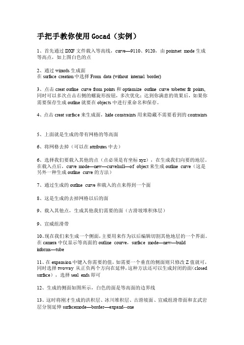
手把手教你使用Gocad(实例)1、首先通过DXF文件载入等高线,curve—9110、9120,由pointset mode生成等高点,如上图白色的点2、通过wizards生成面在surface creation中选择From data (without internal border)3、点击creat outline curve from points和optiamize outline curve tobetter fit points,同时可以多次点击右侧的螺旋形按钮,多次优化;达到你满意的效果后,如果你需要保存生成outline就要在objects中进行重命名和保存。
4、点击creat surface来生成面,hide constraints用来隐藏不需要看到的contraints5、上面就是生成的带有网格的等高面6、将网格去掉(可以在attributes中去)6、选择我们要载入其他的点(点必须是有坐标xyz),在生成我们向要的地层。
在载入点后,curve mode—new—curvehull—of object来生成outline curve(这是另外一种生成outline curve的方法)7、通过生成的outline curve和载入的点来得到一个面8、这是生成的去掉网格以后的面9、载入其他点,生成其他我们需要的面(古滑坡堆积体层)9、宣威组滑带10、现在我们来生成一个侧面,主要用来作为以后编辑切割其他地层的一个界面。
在camera中仅显示等高面的outline courve,surface mode—new—build informs—tube11、在expansion中键入你需要的值,如需要一个垂直的侧面则只修改Z值就可,同时选择twoway 从正负两个方向在延伸,这种方法还可以生成封闭的面(closed surface),选择seal ends即可12、生成的侧面如图所示,白色的面是等高面的边界线13、这时将刚才生成的洪积层、冰川堆积层、古滑坡面、宣威组滑带面和玄武岩层分别延伸surfacemode—border—expand--one14、在弹出的对话框中键入你要延伸的值15、延伸后得到的面16、将其他面都延伸,并将所有的面都显示出来后的效果17、选择我们就要切割掉我们不需要的部分,surfacemode—edit—cut—by surfaces18、在弹出的对话框中surface内选择被切割的面,在surfaceby中选择切割面,点击ok19、现在将切割掉的不需要的部分移除。
GOCAD安装说明
4:复制gocadlmd.lic文件到 安装磁盘\Program Files\PDGM\licenses文件夹下
5、点击-开始—程序-Paradigm License Manager-打开License Server Configuration Utility这个程序。也可到PDGM\licenses文件夹下找到lmtools.exe。打开后找Start/Stop/Reread
1:打开install文件夹,按顺序分别安装 gocad、 skua 和licenseserver 安装时如需改动磁盘安装位置只需将路径中的C改成要安装到的磁盘盘符。如:C:\Program Files\PDGM\ 如果想安装到E盘将C改为E即可,即E:\Program Files\PDGM\
2.将glm_core.dll文件替换安装文件下的原dll,路径为“D:\Program Files\PDGM\GOCAD-SKUA-2009.3p1\Gocad\bin\win32-i86-vs2005.shared\glm_core.dll”
点击Start server 这样服务启动了
6、然后打开Paradigm GOCAD 2009.3 Patch 1 点击next 输入主机名字。点击finish即可打开软件正常使用。
Hale Waihona Puke
GOCAD 操作手册
GOCAD综合地质与储层建模软件简易操作手册美国PST油藏技术公司PetroSolution Tech,Inc.目录第一节 GOCAD综合地质与储层建模软件简介┉┉┉┉┉┉┉┉┉┉┉┉┉┉1一、GOCAD特点┉┉┉┉┉┉┉┉┉┉┉┉┉┉┉┉┉┉┉┉┉┉┉┉┉1二、GOCAD主要模块┉┉┉┉┉┉┉┉┉┉┉┉┉┉┉┉┉┉┉┉┉┉┉1 第二节 GOCAD安装、启动操作┉┉┉┉┉┉┉┉┉┉┉┉┉┉┉┉┉┉┉┉2一、GOCAD的安装┉┉┉┉┉┉┉┉┉┉┉┉┉┉┉┉┉┉┉┉┉┉┉┉2二、GOCAD的启动┉┉┉┉┉┉┉┉┉┉┉┉┉┉┉┉┉┉┉┉┉┉┉┉3 第三节 GOCAD数据加载┉┉┉┉┉┉┉┉┉┉┉┉┉┉┉┉┉┉┉┉┉┉┉5一、井数据加载┉┉┉┉┉┉┉┉┉┉┉┉┉┉┉┉┉┉┉┉┉┉┉┉┉5二、层数据加载┉┉┉┉┉┉┉┉┉┉┉┉┉┉┉┉┉┉┉┉┉┉┉┉┉11三、断层数据加载┉┉┉┉┉┉┉┉┉┉┉┉┉┉┉┉┉┉┉┉┉┉┉┉11四、层面、断层面加载┉┉┉┉┉┉┉┉┉┉┉┉┉┉┉┉┉┉┉┉┉┉12五、地震数据加载┉┉┉┉┉┉┉┉┉┉┉┉┉┉┉┉┉┉┉┉┉┉┉┉12 第四节 GOCAD构造建模┉┉┉┉┉┉┉┉┉┉┉┉┉┉┉┉┉┉┉┉┉┉┉13一、准备工作┉┉┉┉┉┉┉┉┉┉┉┉┉┉┉┉┉┉┉┉┉┉┉┉┉┉13二、构造建模操作流程┉┉┉┉┉┉┉┉┉┉┉┉┉┉┉┉┉┉┉┉┉┉14三、构造建模流程总结┉┉┉┉┉┉┉┉┉┉┉┉┉┉┉┉┉┉┉┉┉┉40 第五节建立GOCAD三维地质模型网格┉┉┉┉┉┉┉┉┉┉┉┉┉┉┉┉41一、新建三维地质模型网格流程┉┉┉┉┉┉┉┉┉┉┉┉┉┉┉┉┉┉41二、三维地质模型网格流程┉┉┉┉┉┉┉┉┉┉┉┉┉┉┉┉┉┉┉┉41三、三维地质模型网格流程总结┉┉┉┉┉┉┉┉┉┉┉┉┉┉┉┉┉┉47 第六节 GOCAD储层属性建模┉┉┉┉┉┉┉┉┉┉┉┉┉┉┉┉┉┉┉┉┉48一、建立属性建模新流程┉┉┉┉┉┉┉┉┉┉┉┉┉┉┉┉┉┉┉┉┉48二、属性建模操作流程┉┉┉┉┉┉┉┉┉┉┉┉┉┉┉┉┉┉┉┉┉┉48三、属性建模后期处理┉┉┉┉┉┉┉┉┉┉┉┉┉┉┉┉┉┉┉┉┉┉66四、网格粗化┉┉┉┉┉┉┉┉┉┉┉┉┉┉┉┉┉┉┉┉┉┉┉┉┉┉74 第七节 GOCAD地质解释和分析┉┉┉┉┉┉┉┉┉┉┉┉┉┉┉┉┉┉┉┉78GOCAD综合地质与储层建模软件操作手册第一节GOCAD综合地质与储层建模软件简介Gocad是国际上公认的主流建模软件,在众多油公司和服务公司得到了广泛的应用。
gocad2017的操作手册
gocad2017的操作手册
对于Gocad 2017的操作手册,我可以从多个角度来进行全面的
回答。
首先,Gocad是一款用于地质建模和三维可视化的软件,它
具有丰富的功能和复杂的操作流程。
在操作手册中,通常会包括软
件的安装步骤、界面介绍、基本操作指南、高级功能的使用方法、
数据导入导出等内容。
在操作手册中,可能会包括软件的安装步骤,包括系统要求、
安装程序的下载和安装过程,以及可能遇到的常见问题和解决方法。
此外,手册还会介绍软件的界面布局,各个功能模块的作用和操作
方法,帮助用户快速上手。
操作手册还会详细介绍软件的基本操作指南,如如何创建新项目、导入数据、进行地质建模、进行三维可视化等。
同时,手册还
会介绍软件的高级功能的使用方法,如地质建模的参数设置、模拟
分析的操作流程等。
另外,操作手册可能还会包括数据的导入导出方法,如何将外
部数据导入到软件中进行处理,以及如何将软件中的数据导出到其
他格式进行进一步分析或展示。
总的来说,Gocad 2017的操作手册应该是一本详细、全面的指南,旨在帮助用户快速掌握软件的基本操作和高级功能,实现地质建模和三维可视化的目标。
希望这些信息能够帮助你更好地理解Gocad 2017的操作手册。
openSCAD_CN_user_manual
OpenSCAD 不是一个交互建模。相反,它是在脚本文件中描述对象,并呈现从脚本文件中的 3D 模型,上
面写着像一个三维的解释。这给了你(设计师)的建模过程的完全控制权,使您可以轻松地更改任何步 骤在建模过程中,甚至设计所定义的配置参数
OpenSCAD 包括两个主要的建模技术:首先,建设性的立体几何(CSG),第二,二维轮廓映射。 AutoCAD DXF(qcad,librecad)文件作 为数据交换格式的二维轮廓。除了 2D 路径输出,但也可以从 DXF 文件读取设计参数。除了读取 DXF 文件,OpenSCAD 还可以读取和创建三维模型的 STL 和 OFF 文件
15.6.5 Getting the right results 获取正确的结果 pt
(根据官方 openSCAD user manual 用户手册为基础,以及个人领悟,并非完全官方直译,仅供参考,
以官方教程为准。)
个人感觉:整体感觉模型画图的的方法就像是用 C 语言编写一段程序,然后编译,编译后,在某个第三 方 3D/2D 环境下观看到模型,甚至模型的基础组件像,方 形,圆柱,等,就像是 C 语言的函数,后边 配置用括号指定参数,多参数设置像 C 语言的数组,还有很多数学的调试功能,更像是 math.h 库的应用 了,如果你 编写过用 math.h 库的 C 语言程序的话,这个软件对你的帮助将会更大,C 语言一般输出的 就是数值,而这个软件把这些数值直接当成了 2D/3D 模型的输入 参数直接用 openGL,cgal, 软件转 换成视觉模型出来,而不是数据模型,而是可视模型,而软件的“功能部分”,就像 2 个模型组合,联合, 区分,交集,镜像,颜色,多矩阵,等,是依赖一 个单独的 3D 模型组合软件库 openCSG 来完成的,总
GOCAD讲义
GOCAD地质建模Gocad是以工作流程为核心的一款地质建模软件,达到了半智能化建模的世界最高水平,具有功能强,界面友好,易学易用,并能在几乎所有平台上(Sun, SGI, PC-Linux, PC-Windows)运行的特点。
以下通过一个简单的例子,说明GOCAD地质建模的主要过程。
第一部分GOCAD的启动1、双击桌面上的Gocad启动图标,即可启动Gocad程序。
2、选择New project建立新工程,给工程起个名字,选择路径在文件夹Project中,点击保存,打开下图:3、选择Select All,点击OK即可。
4、弹出选择工程单位窗口如下。
此处选择平面上单位是英尺(Feet),深度单位也是英尺(Feet);时间选择毫秒;深度方向选择向上为增大;z值是时间域或深度域,选择深度域(最终如下图)。
选择完后点击OK。
5、打开如下Gocad主窗口。
第二部分GOCAD数据加载一、地震数据加载以SEGY格式为例,加载三维地震数据选择File > Import objects >Seismic Data > SEG-Y 3D as Voxet。
在Data文件夹下选择文件“tornado.sgy”,点击OK即可加载,如下图。
二、井数据加载1、井位数据加载不同的数据格式有不同的加载方法。
以普通的文本格式为例,包括井名、x坐标、y坐标、补心海拔、井深等。
(1)加载方式是:File > Import objects > Well data > (path)Locations from column-based File ,在Data\Wells文件夹中选择文件“WellPaths”,接受默认,按next两次,打开下图:(2)对问题What information do you have for the path? 选择X-Y-TVDSS-MD。
下来的两个问题各选Feet和Use a Column。
GOCAD课件
GOCAD地质建模Gocad是以工作流程为核心的一款地质建模软件,达到了半智能化建模的世界最高水平,具有功能强,界面友好,易学易用,并能在几乎所有平台上(Sun, SGI, PC-Linux, PC-Windows)运行的特点。
以下通过一个简单的例子,说明GOCAD地质建模的主要过程。
第一部分 GOCAD的启动1、双击桌面上的Gocad启动图标,即可启动Gocad程序。
2、选择New project建立新工程,给工程起个名字,选择路径在文件夹Project中,点击保存,打开下图:3、选择Select All,点击OK即可。
4、弹出选择工程单位窗口如下。
此处选择平面上单位是英尺(Feet),深度单位也是英尺(Feet);时间选择毫秒;深度方向选择向上为增大;z值是时间域或深度域,选择深度域(最终如下图)。
选择完后点击OK。
5、打开如下Gocad主窗口。
第二部分 GOCAD数据加载一、地震数据加载以SEGY格式为例,加载三维地震数据选择File > Import objects >Seismic Data > SEG-Y 3D as Voxet。
在Data文件夹下选择文件“tornado.sgy”,点击OK即可加载,如下图。
二、井数据加载1、井位数据加载不同的数据格式有不同的加载方法。
以普通的文本格式为例,包括井名、x坐标、y坐标、补心海拔、井深等。
(1)加载方式是:File > Import objects > Well data > (path)Locations from column-based File ,在Data\Wells文件夹中选择文件“WellPaths”,接受默认,按next两次,打开下图:(2)对问题What information do you have for the path? 选择X-Y-TVDSS-MD。
下来的两个问题各选Feet和Use a Column。
测量
PRO600 2014 for MicroStation V8i Win32 2CD(中、英文版)
Pixoneer Geomatics Inc产品:
PG-STEAMER.RTP.v4.1 1CD(遥测影像软体)
RSI产品:
Research.Systems.IDL v6.0 1CD
Paradigm Sysdrill v2009 1CD(钻井设计软件)
GoCAD v2009.3 p1 Win32 1CD(三维地质建模软件系统)
GoCAD v2.0.8 Linux 1CD
SKUA v2009.3 p1 Win32 1CD
Wellead v4.0 1CD(钻井设计软件)
BlueMarble.Geographic.Tracker.v3.3 1CD(将图形中的象素和现实世界具体位置的坐标对应映射联系起来)
BlueMarble.Geographic.Transformer.Plugin.For.MapInfo.v1.0 1CD(为MapInfo开发的插件)
ERDAS.Stereo.Analyst.v1.0(立体分析模块)
ATCOR for Imagine 2013 1CD
PRO600 2014 for Bentley Map Enterprise V8i Win32 2CD(中、英文版)
PRO600 2014 for Bentley Map V8i Win32 2CD(中、英文版)
S&T Virtual Reality Systems产品:
Blueberry.3D.Terrain.Tools.V1.0-ISO 2CD(三维地形编辑器)
Nelava产品:
Socet SET v5.3-ISO 1CD(数字摄影测量软件,主要提供於军事用途和商务方面,
GOCAD中文操作手册

中仿科技公司CnTech Co.,LtdGOCAD 综合地质与储层三维建模软件 简易操作手册中仿科技公司CnTech Co.,Ltd目录第 1 节 GOCAD综合地质与储层建模软件简介....................................................... - 1 1.1、GOCAD特点................................................................................................ - 1 1.2、GOCAD主要模块........................................................................................ - 1 第 2 节 GOCAD安装、启动操作............................................................................... - 2 2.1、GOCAD的安装............................................................................................ - 2 2.2、GOCAD的启动............................................................................................ - 3 第 3 节 GOCAD数据加载........................................................................................... - 5 3.1、井数据加载.............................................................................................. - 5 3.2、层数据加载............................................................................................ - 11 3.3、断层数据加载........................................................................................ - 11 3.4、层面、断层面加载................................................................................ - 12 3.5、地震数据加载........................................................................................ - 12 第 4 节 GOCAD构造建模......................................................................................... - 13 4.1、准备工作................................................................................................ - 13 4.2、构造建模操作流程................................................................................ - 14 4.3、构造建模流程总结................................................................................ - 40 第 5 节 建立GOCAD三维地质模型网格................................................................. - 41 5.1、新建三维地质模型网格流程................................................................ - 41 5.2、三维地质模型网格流程........................................................................ - 41 5.3、三维地质模型网格流程总结................................................................ - 47 第6节 GOCAD储层属性建模............................................................................... - 48 -6.1、建立属性建模新流程............................................................................ - 48 6.2、属性建模操作流程................................................................................ - 48 6.3、属性建模后期处理................................................................................ - 66 6.4、网格粗化................................................................................................ - 73 第7节 GOCAD地质解释和分析........................................................................... - 78 -公 司 介 绍........................................................................................................... - 88 -中仿科技公司 CnTech Co.,Ltd第 1 节 GOCAD 综合地质与储层建模软件简介GOCAD 是国际上公认的主流三维地质建模软件,在地质工程、地球物理勘探、矿业开发、 水利工程中有广泛的应用。
opencascade中文手册
opencascade中文手册OpenCASCADE是一个开源的CAD开发工具包,它提供了一系列用于创建、编辑和分析几何实体的工具和算法。
在本手册中,我们将详细介绍OpenCASCADE的各种功能和使用方法。
1. OpenCASCADE的概述OpenCASCADE是一个用于CAD应用开发的工具包,它由一组C++类库组成,可以处理各种几何实体,如曲线、曲面、体实体等。
OpenCASCADE不仅提供了基本的几何操作,还提供了丰富的分析和编辑工具。
2. 几何实体的创建和编辑在OpenCASCADE中,可以通过一系列的操作来创建和编辑几何实体。
例如,可以使用线段、圆弧和曲线等基本几何元素来构造复杂的几何实体。
还可以对已有的几何实体进行平移、旋转和缩放等操作,以获取所需的形状。
3. 几何实体的分析OpenCASCADE提供了一系列用于几何实体分析的工具和算法。
例如,可以计算几何实体的长度、面积和体积等属性。
还可以检测几何实体之间的相交和包含关系,以及计算它们之间的距离和夹角等。
4. 几何实体的绘制和显示在OpenCASCADE中,可以使用绘图工具将几何实体绘制成图像进行显示。
可以选择不同的颜色和线型来绘制几何实体,以便更好地展示其形状和结构。
5. 几何实体的导入和导出OpenCASCADE支持与其他CAD软件的互操作性。
可以将OpenCASCADE中的几何实体导出为常见的CAD文件格式,如STEP和IGES等。
同样,也可以从这些文件格式中导入几何实体到OpenCASCADE中进行进一步的处理和分析。
6. OpenCASCADE的应用领域OpenCASCADE在各种领域中被广泛应用,如机械工程、航空航天、汽车设计等。
它提供了一系列强大的功能和工具,可用于创建复杂的几何模型,并进行各种分析和验证。
总结:本手册详细介绍了OpenCASCADE的各种功能和应用。
通过学习本手册,您将了解到OpenCASCADE的基本原理和使用方法,以及如何利用它来创建、编辑和分析几何实体。
GPDO Part 1 (All Classes) -Visual Guide 的中文名字说明书
Planning Jungle LimitedGPDO Part 1 (All Classes) -Visual Guide (FREE VERSION)Last updated: June 2023 (note: regular updates not required)Introduction:This is one of a number of documents produced by Planning Jungle Limited (). This company provides one of the most comprehensive resources available relating to householder permitted development legislation, and one of the only sources of consolidated versions of planning secondary legislation.About this document:This is the free version of the “GPDO Part 1 (All Classes) -Visual Guide” document, which provides a visual guide to Part 1 of the GPDO.This free version is accessible by anyone, including people who are not members of the Planning Jungle website. As such, you are welcome to distribute this document in its original form (i.e. without alterations).Important Disclaimer:The following “Important Disclaimer” is applicable to all of the documents produced by Planning Jungle Limited:“The information provided by Planning Jungle Limited (including the documents produced by Planning Jungle Limited and the mat erial on the website ) is for general information purposes only. Such information does not constitute legal or other professional advice, and must not be relied on as such. While we endeavour to keep such information up-to-date and correct, we make no representations or warranties of any kind about the completeness, accuracy, or suitability of such information. Any reliance you place on such information is therefore strictly at your own risk. In no event will we be liable for any loss or damage that may arise out of your reliance on such information.”What to check BEFORE giving advice on householder permitted development rights:Is the property a HOUSE?(Part 1 of the GPDO applies to C3 houses, might apply to C4 “small” HMOs* and sui generis “large” HMOs*, but does not apply to flats (including maisonettes)). Is the property a LISTED building?(For a listed building, Class E doesn’t apply, and most PD works will still require listed building consent (which is a separ ate requirement)).Is the property on ARTICLE 2(3) land (Conservation Area, AONB, National Park, Broads, WHS)? (On article 2(3) land, Classes AA and B don’t apply, and Classes A, E, G, and H become more restrictive).Have PD rights been removed by an ARTICLE 4 direction?(An article 4 direction may remove some or all of the property’s PD rights).Have PD rights been removed (or affected) by a CONDITION on a previous planning permission? (This could be an issue if the property was built, or converted from another use, from 1948 onwards, or even if the property has been extended since 1948). Has the property PREVIOUSL Y been extended?(Some of the PD limitations and conditions are affected by existing extensions, particularly if the new extension would be attached to an existing extension). Also remember:•This document paraphrases the wording of the legislation (for reasons of conciseness), and therefore it’s important to always check the legislation.•For a larger single storey rear extension under Class A, or for any works under Class AA, the development must not begin before the developer successfully completes the prior approval process, and it’s also necessary to check whether the property is on a Site of Special Scientific Interest (SSSI).•The Part 1 Classes do not apply to a dwellinghouse that was converted under Part 3 Classes G, M, MA, N, P, PA, or Q [or O in the case of Part 1 Class AA].•The Part 1 Classes do not apply to a dwellinghouse that was built under Part 20.•It’s not possible to combine (as a single operation) PD works with works that are granted PP by the LPA. For example, if the LPA grants PP for an extension with a door, it’s not possible to build an extension with a window by relying on the PP from the LPA for the extension and PD rights for the window.•PD rights do not apply where the existing building or use is unlawful (see article 3(5) of the GPDO).•(*) Note: For different conclusions as to whether Part 1 of the GPDO applies to HMOs, see the “GPDO Part 1 (All Classes) -LDC Appeal Decisions” document.Typical 1930s-1950s Council house with a rectangular footprintOTHER LIMITATIONS:• No verandah, balcony, or raised platform.• No two-storey side extension.• Two-storey extension ≥ 7m to rear boundary.Must not extend beyond a side elevation that fronts a highway, or the principal elevation.EAVES height:• ≤ 3m if within 2m of a boundary.(This prevents two-storey extension close to boundary)• Not higher than eaves of house.REAR projection if SINGLE storey:• (*) ≤ 3m for terrace or semi-detached house.• (*) ≤ 4m for detached house.REAR projection if TWO-storey:• ≤ 3m.SIDE projection:• ≤ ½ width of original house.≤ 50% coverage of original garden.CONDITIONS:• Materials “of a similar appearance” to existing house.• Upper-floor side windows obscure-glazed and non-opening.• Roof pitch of two-storey extension same as original house.MAX height:• ≤ 4m if singlestorey.• Not higher than ridge-line of house.(*) NOTE: For the system of larger rear extensions, see the next page.ARTICLE 2(3) LAND:• No cladding.• No side extension.• No two-storey rear extension.CLASS A - GENERAL EXTENSIONS AND ALTERATIONS:“The enlargement, improvement or other alteration of a dwellinghouse”ARTICLE 2(3) LAND or SSSI:• NOT allowedon article 2(3) land NOR on a Site of Special Scientific Interest (SSSI).CLASS A - LARGER SINGLE STOREY REAR EXTENSIONS (from 30/05/2013 onwards):“... development permitted by Class A which exceeds the limits in paragraph A.1(f) but is allowed by paragraph A.1(g) ...”IMPORTANT NOTE:• The development must not begin before the developer successfully completes the prior approval process.For more information, see the following:“GPDO Part 1 Class A (Larger Rear Extensions) -Guide ”REAR projection if SINGLE storey:• ≤ 6m for terrace or semi-detached house.• ≤ 8m for detached house.REAR projection if TWO-storey:• Not allowed.OTHER LIMITATIONS AND CONDITIONS:• The larger rear extension must comply with all of the limitations and conditions shown on the previous page (unless shownotherwise on this current page).CLASS AA - ADDITIONAL STOREYS (from 31/08/2020 onwards):“The enlargement of a dwellinghouse consisting of the construction of [up to two additional storeys / one additional storey] ...”Max height ≤ 18m.ARTICLE 2(3) LAND or SSSI:• Class AA does NOT apply on article 2(3) land NOR on a Site of Special Scientific Interest (SSSI).OTHER LIMITATIONS AND CONDITIONS:•Resulting house must be C3dwellinghouse.• Similar materials, and no side windows.• See legislation for full info.IMPORTANT NOTE:• The development must not begin before the developer receives from the LPA a notice granting prior approval .For more information, see the following:“GPDO Part 1 -Summary of Amendments since 2013”Note: Any additional storey must be on the “principal part” of existing house.Class AA does NOT apply if the house was built either:• Before 01/07/1948.• After 28/10/2018.FLOOR to CEILING height (internal):• ≤ 3m, AND • ≤ Floor to ceiling height of the shortest storey of the “principal part”of existing house.Roof pitch same as existing house.HEIGHT if existing house = 1 storey:• = 1 additional storey.• ≤ 3.5m above existing house.• ≤ 3.5m above highest other attached building.HEIGHT if existing house ≥ 2 storeys:• ≤ 2 additional storeys.• ≤ 7m above existing house.• ≤ 3.5m above highest other attached building.CLASS B - ROOF EXTENSIONS:“The enlargement of a dwellinghouse consisting of an addition or alteration to its roof”Not higher than ridge-line of house.Must not extend beyond a principal elevation that fronts a highway.VOLUME:• ≤ 40m 3for terrace house.• ≤ 50m 3for semi-detached or detached house.ARTICLE 2(3) LAND:• Class B does NOT applyon article 2(3) land.OTHER LIMITATIONS:• Class B does NOT apply if Class AA used.• No verandah, balcony, or raised platform.• (See Class G for chimney, flue, SVP).CONDITIONS:• Materials “of a similar appearance” to existing house.• Side windows obscure-glazed and non-opening.Set back ≥ 20cm from eaves (does not apply to hip-to-gable, etc) and must not extend beyond outside face of wall.Note: For different conclusions as to whether it’s possible to cover the party wall,see the Planning Jungle website.Protrusion ≤ 15cm.CLASS C - ROOFLIGHTS AND RE-ROOFING:“Any other alteration to the roof of a dwellinghouse”ARTICLE 2(3) LAND:• (No additional requirements).OTHER LIMITATIONS:• (See Class G for chimney, flue, SVP).• (See Part 14 Class A for solar panels).CONDITIONS:• Side windows obscure-glazed and non-opening.• (No restrictions relating to materials).Not higher thanridge-line of house.Porch ≥ 2m from highway.Max height ≤ 3m.Area of porch ≤ 3m 2.CLASS D - PORCHES:“The erection or construction of a porch outside any external door of a dwellinghouse”ARTICLE 2(3) LAND:• (No additional requirements).OTHER LIMITATIONS:• (None).CONDITIONS:• (No restrictions relating to materials).Must be single storey.MAX height:• ≤ 2.5m if within 2m of a boundary.Otherwise:• ≤ 4m if roof is dual-pitched.• ≤ 3m if roof is not dual-pitched.Not forward of the principal elevation.≤ 50% coverage of original garden.CLASS E - OUTBUILDINGS AND POOLS:“… any building or enclosure, swimming or other pool required for a purpose incidental to the enjoyment of the dwellinghouse as suc h …”EAVES height:• ≤ 2.5m.ARTICLE 2(3) LAND:• Not allowed between a side elevation and a boundary.Also, see legislation if AONB, National Park, Broads, or WHS.OTHER LIMITATIONS AND CONDITIONS:• No verandah, balcony, or raised platform.• Not within the curtilage of a listed building.• (No restrictions relating to materials).IMPORTANT NOTE:• The use of the outbuilding (or pool) must be “incidental” to the main house (e.g. garage, store room, games room,home gym, swimming pool, etc). The outbuilding can NOT normally include a bedroom, a bathroom, or a kitchen.ARTICLE 2(3) LAND:• (No additional requirements).OTHER LIMITATIONS:• (There are no restrictions if the hard surface is EITHER ≤ 5m 2 OR not between the principal elevation and a highway).CONDITIONS:• (None).CLASS F - HARD SURFACES:The provision or replacement of “… a hard surface for any purpose incidental to the enjoyment of the dwellinghouse as such …”If the hard surface is BOTH > 5m 2 AND between the principal elevation and a highway, then it must be either:• Non-porous (shown in white) but run-off to a porous area within the curtilage of the house.or• Porous (shown in blue).Not ≥ 1m higher than ridge-line of house.ARTICLE 2(3) LAND:• Not allowed ona principal or side elevation that fronts a highway.OTHER LIMITATIONS:• (None).CONDITIONS:• (None).CLASS G - CHIMNEYS, FLUES, SVPs:“The installation, alteration or replacement of a chimney, flue or soil and vent pipe on a dwellinghouse”ARTICLE 2(3) LAND:• Not on elevation that faces highway (assuming visible).• See legislation for full info.OTHER LIMITATIONS:• Cubic capacity ≤ 35 litres.• See legislation for full info.CONDITIONS:• Must be sited to minimise its effect on the external appearance of the building (so far as practicable).• Must be removed if no longer needed.Maximum of 2 satellite dishes:• One ≤ 100cm.• Other ≤ 60cm.If not on chimney:• Length ≤ 100cm.• No higher than chimney or 60cm above ridge-line (whichever lower).If on chimney:• Length ≤ 60cm.• No higher thanchimney.CLASS H - SATELLITE DISHES:“The installation, alteration or replacement of a microwave antenna on a dwellinghouse or within the curtilage of a dwellingh ous e”Typical Victorian housewith a two-storey rear projection (i.e. an “outrigger”)Note:The remaining set of illustrations is only available within the full version of the “GPDO Part 1 (All Classes) -Visual Guide” document, which is only accessible by members of the Planning Jungle website.For more information, please visit .。
- 1、下载文档前请自行甄别文档内容的完整性,平台不提供额外的编辑、内容补充、找答案等附加服务。
- 2、"仅部分预览"的文档,不可在线预览部分如存在完整性等问题,可反馈申请退款(可完整预览的文档不适用该条件!)。
- 3、如文档侵犯您的权益,请联系客服反馈,我们会尽快为您处理(人工客服工作时间:9:00-18:30)。
GOCAD综合地质与储层建模软件简易操作手册美国PST油藏技术公司PetroSolution Tech,Inc.目录第一节 GOCAD综合地质与储层建模软件简介┉┉┉┉┉┉┉┉┉┉┉┉┉┉1一、GOCAD特点┉┉┉┉┉┉┉┉┉┉┉┉┉┉┉┉┉┉┉┉┉┉┉┉┉1二、GOCAD主要模块┉┉┉┉┉┉┉┉┉┉┉┉┉┉┉┉┉┉┉┉┉┉┉1 第二节 GOCAD安装、启动操作┉┉┉┉┉┉┉┉┉┉┉┉┉┉┉┉┉┉┉┉2一、GOCAD的安装┉┉┉┉┉┉┉┉┉┉┉┉┉┉┉┉┉┉┉┉┉┉┉┉2二、GOCAD的启动┉┉┉┉┉┉┉┉┉┉┉┉┉┉┉┉┉┉┉┉┉┉┉┉3 第三节 GOCAD数据加载┉┉┉┉┉┉┉┉┉┉┉┉┉┉┉┉┉┉┉┉┉┉┉5一、井数据加载┉┉┉┉┉┉┉┉┉┉┉┉┉┉┉┉┉┉┉┉┉┉┉┉┉5二、层数据加载┉┉┉┉┉┉┉┉┉┉┉┉┉┉┉┉┉┉┉┉┉┉┉┉┉11三、断层数据加载┉┉┉┉┉┉┉┉┉┉┉┉┉┉┉┉┉┉┉┉┉┉┉┉11四、层面、断层面加载┉┉┉┉┉┉┉┉┉┉┉┉┉┉┉┉┉┉┉┉┉┉12五、地震数据加载┉┉┉┉┉┉┉┉┉┉┉┉┉┉┉┉┉┉┉┉┉┉┉┉12 第四节 GOCAD构造建模┉┉┉┉┉┉┉┉┉┉┉┉┉┉┉┉┉┉┉┉┉┉┉13一、准备工作┉┉┉┉┉┉┉┉┉┉┉┉┉┉┉┉┉┉┉┉┉┉┉┉┉┉13二、构造建模操作流程┉┉┉┉┉┉┉┉┉┉┉┉┉┉┉┉┉┉┉┉┉┉14三、构造建模流程总结┉┉┉┉┉┉┉┉┉┉┉┉┉┉┉┉┉┉┉┉┉┉40 第五节建立GOCAD三维地质模型网格┉┉┉┉┉┉┉┉┉┉┉┉┉┉┉┉41一、新建三维地质模型网格流程┉┉┉┉┉┉┉┉┉┉┉┉┉┉┉┉┉┉41二、三维地质模型网格流程┉┉┉┉┉┉┉┉┉┉┉┉┉┉┉┉┉┉┉┉41三、三维地质模型网格流程总结┉┉┉┉┉┉┉┉┉┉┉┉┉┉┉┉┉┉47 第六节 GOCAD储层属性建模┉┉┉┉┉┉┉┉┉┉┉┉┉┉┉┉┉┉┉┉┉48一、建立属性建模新流程┉┉┉┉┉┉┉┉┉┉┉┉┉┉┉┉┉┉┉┉┉48二、属性建模操作流程┉┉┉┉┉┉┉┉┉┉┉┉┉┉┉┉┉┉┉┉┉┉48三、属性建模后期处理┉┉┉┉┉┉┉┉┉┉┉┉┉┉┉┉┉┉┉┉┉┉66四、网格粗化┉┉┉┉┉┉┉┉┉┉┉┉┉┉┉┉┉┉┉┉┉┉┉┉┉┉74 第七节 GOCAD地质解释和分析┉┉┉┉┉┉┉┉┉┉┉┉┉┉┉┉┉┉┉┉78GOCAD综合地质与储层建模软件操作手册第一节GOCAD综合地质与储层建模软件简介Gocad是国际上公认的主流建模软件,在众多油公司和服务公司得到了广泛的应用。
Gocad是以工作流程为核心的新一代地质建模软件,实现了高水平的半智能化建模,具有功能强,界面友好,易学易用,并能在几乎所有硬件平台上(Sun, SGI, PC-Linux, PC-Windows)运行的特点。
一、GOCAD特点1、构造建模和油藏属性建模都由相应的工作流程驱动,用户只要回答工作流程中的问题和提供相应的参数,就可顺利完成相应的建模工作,大大提高了建模工作的效率。
2、能够建立极为复杂的构造模型。
3、丰富的属性模型建模算法。
4、独特的油藏不确定性分析5、独特的软件开发工具6、极为灵活的硬件平台环境,可运行在Sun, SGI等UNIX平台,或PC-Linux 和PC-Windows环境。
二、GOCAD主要模块:1、油藏建模,包括如下模块:Gocad Base Module-数据加载与管理,构造建模Reservoir Modeling-生成三维油藏模型网格,油藏属性与相建模2、地震解释与地震属性分析,包括以下模块:Seismic Interpretation-地震解释与可视化,地震属性计算Velocity Modeling-速度模型建立与时深转换3、地质解释,包括以下模块:Geologic Interpretation-单井解释,联井剖面,平面图等4、井位优化与钻井工程,包括:Drilling Planner-井位优化设计,井轨迹设计,防撞计算等5、油藏不确定性分析-分析建模成果的不确定性,更好的决策6、软件开发工具-Gocad的开发工具包本操作手册主要介绍Gocad油藏建模和地质解释主要模块。
第二节GOCAD安装、启动操作一、GOCAD的安装1、将EarthDecision-suite-2.x.x-windows-i86和Gocadlmd-v9.x–windows- setup 两个安装程序分别运行安装。
2、把Gocad.lic 复制到安装后的目录下:C:\Program Files\EarthDecision \Licenses。
3、选择开始>程序>Earth Decision Sciences License Manager>License Server Configuration Utility。
4、选择config services 打开下图:5、在上图中的第二个Browse单击,在目录:C:\Program Files \EarthDecision\Licenses下选择第2步复制过来的Gocad.lic。
6、将Start Server at Power和Up Use Service选中。
7、选则Save Service,重新启动计算机即可。
二、GOCAD的启动1、双击桌面上的Gocad启动图标,即可启动Gocad程序。
2、选择New project建立新工程,给工程起个名字,点击保存,打开下图:3、选择Select All,点击OK即可。
4、弹出选择工程单位窗口,根据实际情况分别选择平面上(米或英尺)和深度上单位(米或英尺);时间是毫秒或秒;深度方向是向下或向上增大;z值是时间域或深度域。
选择完后点击OK。
5、打开如下Gocad主窗口。
第三节GOCAD数据加载一、井数据加载1、井位加载不同的格式有不同的加载方法。
直井和斜井的井位数据格式一样,以普通的文本格式为例,包括井名、补心海拔、x坐标、y坐标、井深。
下面分直井和斜井两种方式加载(1)直井加载方式是:File > Import objects > Well data > (path)Locations from column-based File ,接受默认,按next两次,打开下图,按数据格式选择合适的选项:下图选择加载井名、X坐标、Y坐标(选yes);补心海拔KB (选yes);总深(Total Depth)。
点击下一步,出现下图窗口,选择创建新井(Create new ones),只添加未加载过的井(only when the well does n’t exist),点下一步。
在start at line 选择数据开始行,用选择对应的列,点击OK即可加载。
(2)斜井加载方式是:对于多口井先加载井轨迹,后加载井位。
加载斜井轨迹:File > Import objects > Well data > (Path)Column-based File ,接受默认,按next两次,打开下图,按数据格式选择合适的选项:井轨迹有三种方式:X-Y-TVD-MD,X-Y-TVD,Inclination-Azimuth-MD,依据实例选择合适的加载格式。
本文选择Inclination-Azimuth-MD,Meter,Use a Column,后点击下一步。
下图将X,Y,Z都先赋0值,在后面的加载斜井井位后将予以校正。
如果只加载单口井,这里可输入正确的坐标井位,后面无需再加载这口井的井位了。
下图选择对应的数据列,点击OK即可加载。
加载斜井井位:同加载直井类似,只是在下图中选择移动已经加载过的井(Move existing ones)和MD。
而直井选择创建新井。
2、测井曲线加载:以las格式为例,选择File > Import objects > Well data > (Logs) LAS。
选择要加载的测井数据点击OK即可。
3、井分层数据的加载:以文本格式为例,数据格式为井名、分层名、深度。
如果有倾角和方位角也可加载。
选择File > Import objects > Well data > (Markers) Column-based File。
点击两次默认next,选择分层测量深度(yes),点击下一步。
如果有倾角和方位角,按下图选择,如果没有可以选择NO,点击下一步。
选择合适的对应数据列,点击OK即可加载。
二、层数据加载:数据格式以文本格式X-Y-Z为例,选择File > Import objects >Horizon Interpretations >(PointsSets) XYZ。
选择要加载的层数据点击OK即可。
也可以选择列加载File > Import objects >Horizon Interpretations > Column-based File,选择合适的选项即可。
三、断层数据加载:数据格式以文本格式X-Y-Z为例,选择File > Import objects >Fault Interpretations > (PointsSets)XYZ。
选择要加载的层数据点击OK即可。
也可以选择列加载File > Import objects >Horizon Interpretations > Column-based File,如下图选择合适的选项即可。
四、层面、断层面加载:从其他第三方软件(如RMS、Petrel、RC2等)导出的层面、断层数据均可在Horizon Surfaces和Fault Surfaces找到相应的加载方式。
五、地震数据加载:以SEGY格式为例,加载三维地震数据选择File > Import objects >Seismic Data > SEG-Y 3D as Voxet。
打开需加载数据,自动读取,点击OK加载。
二位数据选择SEG-Y 2D as Surface 和SEG-Y 2D as SGrid二维地震数据加载选择File > Import objects >Seismic Data >SEG-Y 2D as Surface 或SEG-Y 2D as Sgrid,加载即可。
第四节GOCAD构造建模一、准备工作1、井位群组建立:在做构造建模之前,首先把加载的井数据作个群组(Group),以方便统一修改管理。
右键点击Objects里的图标,选择新建New Group,给群组起个名字,点击OK即可。
本例子写群组名为wellgroup。
右键点击新建立的群组名,选择Add To Group,在弹出的窗口中,将所有井数据添加到Object Add里面去,点击OK即可。
