无人机在农业方面的应用
无人机在农业中的应用
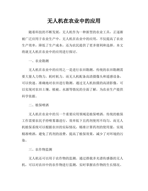
无人机在农业中的应用随着科技的不断发展,无人机作为一种新型的农业工具,正逐渐被广泛应用于农业生产中。
无人机在农业中的应用,不仅提高了农业生产效率,降低了生产成本,还为农民提供了更多便利和选择。
本文将就无人机在农业中的应用进行探讨。
一、农业勘测无人机在农业中的应用之一是进行农田勘测。
传统的农田勘测需要大量人力物力,耗时耗力。
而无人机配备高清摄像头和遥感设备,可以快速、准确地对农田进行勘测。
通过无人机拍摄的高清影像,可以实现对农田土壤、植被、水源等情况的全面了解,为农业生产提供科学依据。
二、植保喷洒无人机在农业中的另一个重要应用领域是植保喷洒。
传统的植保工作需要农民手持喷雾器进行,效率低下且药剂使用不均匀。
而无人机植保系统可以根据农田的实际情况,精准计算药剂的使用量,实现精准喷洒,避免了药剂的浪费,提高了植保效果,减少了对环境的污染。
三、农作物监测无人机还可以用于农作物的监测。
通过搭载多光谱传感器的无人机,可以对农田中的农作物进行监测,实时掌握农作物的生长情况、病虫害情况等。
通过监测数据的分析,可以及时发现问题并采取相应措施,保障农作物的生长和产量。
四、播种施肥无人机还可以用于播种和施肥。
传统的播种和施肥工作需要大量人力,且操作不够精准。
而无人机可以根据农田的实际情况,精准计算播种和施肥的量,实现精准作业。
通过无人机的播种和施肥,可以提高作物的种植密度和施肥均匀度,提高作物的产量和质量。
五、灾害监测无人机还可以用于农田灾害的监测。
在自然灾害如干旱、水灾等发生时,无人机可以快速飞越受灾区域,通过高清影像和数据传输,及时了解受灾情况,为灾害救援和农田恢复提供重要信息支持。
六、未来展望随着科技的不断进步,无人机在农业中的应用前景广阔。
未来,随着无人机技术的不断成熟和普及,无人机将在农业生产中发挥越来越重要的作用,为农业生产带来更多的便利和效益。
综上所述,无人机在农业中的应用已经成为农业现代化发展的重要组成部分。
无人机技术在农业中的应用及其优化措施

无人机技术在农业中的应用及其优化措施随着科学技术的发展,无人机技术日益成熟,应用范围也渐渐扩大。
目前,无人机已经在农业、测绘、消防、环境监测等领域得到广泛应用。
本文将主要探讨无人机技术在农业中的应用及其优化措施。
一、无人机技术在农业中的应用1. 农田勘测与管理无人机搭载的高精度相机和激光雷达等设备,能够对农田进行高精度的勘测和管理。
通过无人机,可以快速测量农田的大小、作物的生长情况、病虫害的发生情况等信息。
这些信息有助于农民更加科学地制定农业生产计划,提高粮食生产效率。
2. 植保施药一直以来,植保施药是农民必须要面对的一个难题。
传统的喷洒方式,无法覆盖到所有作物,而且还会对环境造成负面影响。
而通过无人机,可以对农田进行点对点的施药,从而减少浪费和污染,提高施药效果。
3. 灌溉管理农业中的灌溉工作也需要巨大精力和人力,而通过无人机,可以在空中对农田进行监测,及时获取农田的湿度信息,并根据不同地区的灌溉需求实现定点定量的灌溉管理,进一步提高农业生产效率。
4. 农产品采摘传统的农作物采摘需要大量人力,成本较高且效率低下,而通过采用无人机技术,可实现高效快速的农产品采摘。
此外,无人机采摘有机农产品还可以保证其品质和安全性。
二、无人机技术在农业中的优化措施1. 精度提升由于地形环境的复杂性和无人机操作员经验水平的不同,无人机的定位精度不稳定。
因此,需要利用更加先进和精准定位系统或者通过增加传感器提高定位精度,从而使无人机更加准确地获取农田信息。
2. 自主控制由于农田的地形较为复杂,操作难度较大,因此需要的是一种自主控制技术,以改善控制稳定性和避免伤害到作物。
自动化控制技术也可以提高了人的生产效率,减少定位误差。
3. 提高耐飞程无人机的电力和能量存储方面仍然有很大的优化空间。
目前,市面上的无人机续航能力都比较低,往往不能在仅一次太阳能供电中满足农田管理的需求。
因此,需要研发更加高效和节能的能源技术,以实现更长的无人机耐飞程。
无人机在农业中的应用
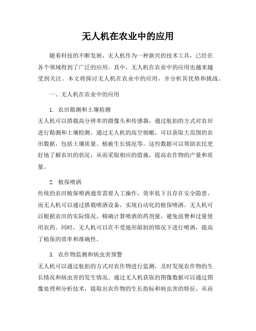
无人机在农业中的应用随着科技的不断发展,无人机作为一种新兴的技术工具,已经在各个领域得到了广泛的应用。
其中,无人机在农业中的应用也越来越受到关注。
本文将探讨无人机在农业中的应用,并分析其优势和挑战。
一、无人机在农业中的应用1. 农田勘测和土壤检测无人机可以搭载高分辨率的摄像头和传感器,通过航拍的方式对农田进行勘测和土壤检测。
通过无人机的高空俯瞰,可以获取大范围的农田数据,包括土壤质量、植被生长情况等。
这些数据可以帮助农民更好地了解农田的状况,从而采取相应的措施,提高农作物的产量和质量。
2. 植保喷洒传统的农田植保喷洒通常需要人工操作,效率低下且存在安全隐患。
而无人机可以通过搭载喷洒设备,实现自动化的植保喷洒。
无人机可以根据农田的实际情况,精确计算喷洒的药剂量,避免浪费和过量使用农药。
同时,无人机可以在不受地形限制的情况下进行喷洒,提高了植保的效率和准确性。
3. 农作物监测和病虫害预警无人机可以通过航拍的方式对农作物进行监测,及时发现农作物的生长情况和病虫害的发生情况。
通过无人机获取的图像数据可以通过图像处理和分析技术,提取出农作物的生长指标和病虫害的特征,从而实现对农作物的精准监测和病虫害的预警。
这样可以帮助农民及时采取措施,防止病虫害的扩散,减少农作物的损失。
4. 智能灌溉和精准施肥无人机可以通过搭载传感器和监测设备,实现对农田的智能灌溉和精准施肥。
通过无人机获取的土壤湿度、养分含量等数据,可以根据农作物的需求,精确计算灌溉和施肥的量和时间,避免浪费和过量使用水和肥料。
这样不仅可以提高农作物的产量和质量,还可以节约资源和保护环境。
二、无人机在农业中的优势1. 高效性无人机可以快速、高效地完成农田勘测、植保喷洒、农作物监测等任务,大大提高了农业生产的效率。
相比传统的人工操作,无人机可以在短时间内完成大范围的任务,节省了人力和时间成本。
2. 精准性无人机可以通过搭载传感器和监测设备,实现对农田和农作物的精准监测和控制。
无人机技术在农业中的应用

无人机技术在农业中的应用随着科技的不断发展,无人机技术在现代农业中的应用越来越广泛。
无人机技术可以实现高效、低成本、精准的农业生产,提高农业生产效率和农业资源利用率,为农业的可持续发展做出了贡献。
一、无人机在农业中的应用1、农田勘测无人机通过航拍可以得到高精度数字地形模型、真实色彩模型、植被指数等信息,结合地理信息系统,可以快速建立农田数字管理系统。
基于这些信息,农民可以制定种植方案,提高作物的产量和质量。
2、作物管理与保护无人机可以搭载各种传感器,并配合地面数据,为作物提供精准的管理和保护。
比如,可以通过红外线传感器进行作物诊断,找出被病虫害侵害的部分,通过针对性喷药的方式,进行精密施药,减少农药的浪费,提高喷药的效率。
同时,无人机还可以在种植过程中及时监测到作物病虫害的发展情况,及时采取措施,保证作物的健康。
3、农产品采摘由于传统采摘方式的工作量大、效率低,而且成本高,给农民造成了很大的负担。
而无人机设备可以通过机械臂采摘作物,使得农民的劳动力成本大大降低。
同时,无人机采用自动化控制系统,可以保证采摘的效果和品质,提高农产品的附加值。
4、土地测绘无人机具备全天候、高精度、大范围、快速的地理信息采集能力,在土地测绘方面可谓是“神器”。
无人机可以利用摄像机采集空中图像,进行地形测量和地物覆盖面积统计,可应用于制定土地利用总体规划、乡土部门规划和农村道路、农田水利工程等规划。
5、精准播种无人机设备可以实现隔行直播、化肥施加和种子种植,将种植的效率和质量提升到新的高度。
对于精细化农业,无人机设备的作用不可小觑。
二、无人机技术在农业中的优势1、提高农业生产效益区域、时段性互用的无人机遥感数据更能全方位描述绿色农业生产过程中空间组织特征,同时也利于生计活动规划,优化农业损益关系。
2、节约人力和物力航拍采集耕地基础数据可以节约巨大人力和物力,而且也减少了勘测费用。
3、提高农作物的品质通过无人机搭载传感器去监测作物的生长状态,及时调整施肥、浇水和治疗病虫害等措施,提高作物品质和产量。
无人机在农业领域中的应用与发展

无人机在农业领域中的应用与发展近年来,无人机技术的迅速发展为农业领域带来了巨大的变革。
无人机技术的应用不仅提高了农业生产的效率和质量,也为农民解决了一系列农业生产中的问题。
本文将探讨无人机在农业领域中的应用与发展,并对其前景进行展望。
一、无人机在农业领域的应用1. 农田勘测与监测:传统的农田勘测工作需要耗费大量时间和人力物力,但无人机的应用可以帮助农民快速而准确地勘测农田。
通过搭载高分辨率摄像设备和红外热像仪等传感器,无人机可以对农田的土壤质量、植被状况、水分分布等进行监测和分析,为农民提供科学的种植方案和管理决策。
2. 植保喷洒:传统的农田喷洒往往面临着药剂浪费、工作效率低等问题,而无人机的应用可以有效地解决这些问题。
无人机可以搭载精密的喷洒系统,根据农田的实际情况进行定点、定量的喷洒,减少药剂浪费,提高喷洒效果。
同时,无人机还可以在部分特殊地形或者作物较高的区域进行喷洒,避免了农民因需攀爬而面临的危险。
3. 牧草管理:传统的牧草管理面临着面积广、工作量大的问题,而无人机的应用可以极大地提高牧草管理的效率。
无人机可以利用高分辨率的摄像设备进行实时监测,快速计算牧草覆盖度、生长情况等,为农民提供科学的牧草管理方案。
同时,无人机还可以通过播撒种子或者喷洒肥料等方式,促进牧草的生长和更新。
4. 作物遥测:无人机可以通过搭载遥感设备,对大范围的作物进行遥测。
通过植被指数、水分蒸散等数据分析,无人机可以帮助农民了解作物的健康状况、生长速度等信息,提前预警病虫害的发生,并及时采取相应的防治措施。
二、无人机在农业领域的发展趋势1. 智能化:随着人工智能技术的不断发展,无人机将越来越智能化。
未来的无人机将具备自主规划飞行路径、自动避障、自动调整喷洒剂量等功能,不再需要人工操控,大大减轻了农民的工作负担。
2. 多功能化:随着技术的不断进步,无人机将具备更多的功能。
除了农田勘测、植保喷洒等已经广泛应用的功能外,无人机还将加入更多的传感器和工具,如土壤调查、农产品运输等,为农民提供更全面、更便捷的农业服务。
无人机在农业方面的服务应用领域及具体案例

无人机在农业方面的服务应用领域无人机在农业领域的服务应用正在迅速发展,成为现代农业技术的重要组成部分。
以下是一些无人机在农业方面的服务应用领域及具体案例:1.农田药物喷洒无人机在农田药物喷洒方面的应用已经取得了显著成效。
例如,2016年,我国南方的水稻种植区开始广泛使用无人机进行农药喷洒。
无人机能够精确控制喷洒剂量,减少农药浪费,提高喷洒效率,降低农业生产成本。
2.农田信息监测无人机在农田信息监测方面的应用也越来越广泛。
2017年,我国部分地区的农业植保无人机开始搭载高精度传感器和遥感技术,用于监测病虫害、灌溉情况和农作物生长情况。
这些信息有助于农民及时了解农田状况,科学决策,提高农业生产效益。
3.精准施肥无人机在精准施肥方面的应用也逐渐成熟。
2019年,一些地区的农业无人机开始搭载肥料喷洒系统,根据农田土壤状况和作物生长需求,实现精准施肥。
这种施肥方式有助于提高肥料利用率,减少环境污染,提升农作物产量和品质。
4.播种与种植无人机在播种和种植方面的应用也在逐步推广。
2020年,一些农业无人机开始用于玉米、小麦等作物的播种作业。
无人机能够精确控制播种密度和深度,提高播种质量,降低农业生产成本。
5.农业灾害监测与应对无人机在农业灾害监测与应对方面也发挥着重要作用。
2021年,我国部分地区发生了严重的干旱和洪涝灾害,无人机被用于监测农田水分状况,评估灾害损失,指导农民开展抗旱保水和灾后恢复生产工作。
综上所述,无人机在农业领域的服务应用正在不断拓展和深化,为农业生产提供了有力支持。
在未来,随着无人机技术的进一步发展和完善,其在农业领域的应用将更加广泛,为农业现代化和乡村振兴贡献力量。
无人机在农业中的应用

无人机在农业中的应用无人机(Unmanned Aerial Vehicle,简称无人机)是一种不需要人操控的飞行器,它通过自身搭载的传感器和控制系统实现自主飞行和任务执行。
随着科技的发展,无人机在农业领域中的应用越来越广泛。
本文将探讨无人机在农业中的应用,包括农作物监测、喷洒施肥、植保作业以及灾害评估等方面。
一、农作物监测无人机搭载的高分辨率相机可以对农田进行航拍,通过拍摄到的图像和视频来获取农作物的生长情况和健康状况。
这些数据可以帮助农民实时监测农田的情况,并及时采取措施,例如:遥感和图像处理技术可以帮助判断土壤湿度、作物植被指数、病虫害的分布情况等,帮助农民制定科学合理的农业生产计划。
二、喷洒施肥传统的农田喷洒施肥方式通常需要人工操作,费时费力。
而无人机可以搭载精确喷洒设备,通过GPS和遥感等技术精确测量和定位,将农药和肥料喷洒到需要的地方。
这大大提高了施肥的效率,减少了资源浪费,同时减少了对人员的安全风险。
三、植保作业植保作业是农业生产中的重要环节,通常需要大量的劳动力和时间。
然而,无人机可以通过航拍技术快速捕捉到作物病害、虫害等问题的发生,可以及时采取措施进行防治。
更进一步,无人机可以搭载喷洒设备,在发现病虫害后,立即对农田进行喷洒,实现精准植保,提高农作物产量和质量,减少农药的使用。
四、灾害评估在自然灾害,如水灾、火灾、地震等发生后,农业生产常常会受到严重影响。
无人机可以迅速飞往受灾地区,进行航拍和图像采集。
这些信息可以提供给相关部门和农民,帮助他们评估灾情大小,根据实际情况采取相应的救灾行动,从而减少灾害对农业的伤害。
综上所述,无人机在农业中的应用具有巨大的潜力和优势。
它们不仅可以提高农业生产的效率和减少资源浪费,还可以降低劳动力成本和人员安全风险。
因此,随着技术的不断进步和应用的深化,相信无人机在农业中的应用前景将会更加广阔。
农民和农业生产者应积极探索和应用无人机技术,为农业发展注入新的动力。
无人机在农业领域的应用

无人机在农业领域的应用随着科技的不断发展,无人机作为一项新兴技术,正逐渐应用于各个领域。
在农业领域,无人机的应用已经起到了积极的推动作用。
本文将从多个方面探讨无人机在农业领域的应用,包括无人机植保、农作物监测与管理、灌溉和施肥、土壤检测与分析以及农产品运输等。
一、无人机植保传统农业植保方式通常需要农民手持喷雾器进行农药喷洒,既费时又费力,并且无法高效地对大面积农田进行覆盖。
而通过搭载农药喷洒装置的无人机,可以实现自动化、精确化的农田植保。
通过在无人机上搭载高精度的传感器和喷洒系统,无人机可以根据农田的实际需求,自动调整喷洒量和喷洒区域,实现农药的精准喷洒,不仅能够减少农药的浪费,还能够提高喷洒效果,有效控制病虫害的发生。
二、农作物监测与管理通过搭载多光谱传感器和高分辨率相机的无人机,可以实时监测农田的植被生长情况、土壤湿度和营养状况等关键指标。
无人机可以借助其高空俯瞰的视角,对农田进行全方位、多角度的监测,及时掌握农作物的生长状况。
通过数据分析和处理,无人机可以提供给农民精准的农作物管理建议,帮助农民合理调整灌溉和施肥方案,提高农田的产量和质量。
三、灌溉和施肥无人机可以搭载喷洒装置和灌溉设备,实现自动化的灌溉和施肥。
通过在无人机上安装土壤湿度传感器和营养分析仪器,无人机可以收集到农田的实时土壤湿度和营养状况数据。
根据这些数据,无人机可以精确计算出农田所需的水量和肥料量,并根据设定的目标进行自动化的喷洒和灌溉操作。
这种精确的喷洒和灌溉方式,不仅可以减少浪费,还能够避免过度施肥和过度灌溉对环境造成的污染。
四、土壤检测与分析通过搭载地质雷达、热磁扫描仪等设备,无人机可以实时监测农田的土壤结构和成分。
无人机可以利用其悬停和飞行的特点,对农田进行点云扫描和图像拍摄,从而构建出高精度的土壤模型。
通过对土壤模型的分析和比对,无人机可以帮助农民了解土壤的肥力、冻融状态、排水能力等重要信息,为农民提供科学的土壤修复和改良方案。
无人机技术在农业中的应用

无人机技术在农业中的应用随着科技的不断进步,无人机的应用越来越广泛。
在农业方面,无人机技术的应用也越来越普遍。
本文将介绍无人机技术在农业中的应用。
一、无人机在农业中的优势无人机可以高效地进行土地勘测、农作物监测和灌溉管理等任务。
相对于传统的人力勘测和管理方法,无人机能够更快速地对农田进行勘测和检查,并且可以更加精确地掌握农田的情况。
此外,无人机还可以在没有人为干扰的情况下,对农作物进行监测和保护,从而提高农业的稳定性和可持续性。
二、无人机在农业中的应用1、土地勘测无人机可以高效地进行土地勘测,通过无人机勘测可以更加精确地掌握农田的大小、形状和地理位置等信息。
这对于农民来说非常重要,可以帮助他们更加科学地制定种植方案,并且可以减轻他们的工作量。
2、农作物监测无人机可以利用高清晰度相机精确地对农作物进行监测,包括监测农作物的生长情况、测定叶片状态、预测病虫害发生情况等。
通过这些监测,农民可以掌握农作物的情况,及时采取措施,从而提高农作物的产量和品质。
3、农田灌溉管理无人机可以利用高精度的传感器对农田进行灌溉管理。
通过无人机的数据可以得知农田的土壤含水量,从而精确地调整灌溉水量,保证农田的水分供应和水分利用效率。
这对于减轻农民的工作量和提高农田的产量都非常有帮助。
4、农药喷洒无人机可以利用喷雾器对农田进行农药喷洒。
相对于传统的喷洒方法,无人机可以更加精确地喷洒,减少了农药的使用量,从而降低了农民的成本和环境的污染。
三、无人机技术的未来发展无人机技术在农业方面的应用还有很大的发展空间。
未来,无人机可以通过更加精确的控制和监测技术,实现更加精确的农田管理和农作物监测。
此外,无人机还可以与人工智能相结合,通过智能算法分析数据,提供更加准确的农田管理方案和农作物保护方案。
这些应用将进一步提高农业的生产效率和农作物的品质。
总之,无人机技术在农业中的应用是非常有前途的。
无人机可以为农民提供更加精确的农田勘测、农作物监测和灌溉管理等服务,从而提高了农业的生产效率和农作物的品质。
无人机技术在农业领域的应用
无人机技术在农业领域有着广泛的应用。
下面是几个常见的应用场景:
1.农田勘测和土壤分析:无人机可以利用搭载的高分辨率摄像机拍摄农
田的航拍照片,用于勘测农田的地形、植被覆盖和土壤质量等信息。
此外,搭载红外热像仪还可以通过监测植被的温度变化来评估植物的健康状况。
2.农作物遥感监测:利用无人机搭载的航拍摄像机可以获取大面积农田
的影像信息,通过图像处理和分析技术,可以实时监测农作物的生长情况、病虫害情况和营养状况等。
3.农药喷洒和植保:无人机可以搭载喷洒设备和传感器,利用精确的导
航系统和水平飞行轨迹,实现农药的精准喷洒。
这种方式可以减少农药的浪费和污染,提高施药的效果。
此外,无人机可以搭载植保设备,实施对农田进行光照、水分、温度等的监测和调控。
4.精准播种和收割:无人机可以搭载种子散布设备,实现精准的播种操
作。
同时,无人机还可以搭载收割设备和传感器,实现农作物的自动收割和精确的产量测量。
5.无人机农业物流:利用无人机进行农产品的运输和配送。
无人机可以
快速、灵活地将农产品从农田送到市场或消费者手中,节约人力物力,提高农业物流效率。
通过以上应用,无人机技术可以提高农业生产效率、降低对农药和化肥的使用量、减少劳动力成本、提高农产品质量和产量、改善农业生态环境等。
无人机技术在农业植保中的应用

无人机技术在农业植保中的应用主要有以下几个方面:
1.遥感监测:无人机配备了高分辨率遥感相机或激光雷达等传感器,可
以实时获取农田的遥感图像或地形数据,用于监测土壤湿度、作物生长情况、病虫害分布等信息。
2.精准喷洒:无人机配备了喷洒设备,可以根据农田遥感图像的分析结
果,精确计算出农药或肥料的喷洒量和施用路径,实现精准喷洒,减少浪费,提高效率。
3.红外热成像:无人机配备了红外热成像传感器,可以检测作物的热量
分布情况,通过分析作物的热量图像,可以快速识别出有病虫害的植株,有助于及早采取措施进行防治。
4.数据分析:无人机获取的农田遥感图像和其他数据,可以通过人工智
能算法进行分析和处理,提取有用的信息,为农业生产提供决策支持,例如优化施肥方案、制定病虫害防治策略等。
无人机技术的应用可以提高农业植保的效率和准确性,同时减少人力成本和农药、肥料的使用量,对于农业可持续发展具有重要意义。
农业无人机应用场景

农业无人机应用场景一、农业植保方面1. 打药杀虫。
你想啊,大片大片的农田,要是靠人工背着药桶去打药,那得累成啥样。
农业无人机就像个超级小飞侠,嗡嗡地飞在田野上空,农药就均匀地洒下去了。
比如说在那种一望无际的小麦田里,一旦发现有病虫害,无人机出马,快速高效,还能避免人在田里走动压坏麦苗呢。
2. 施肥工作。
它能精准地把肥料撒到需要的地方,就像个贴心的小管家。
像在种水稻的田里,不同的生长阶段需要不同的肥料,无人机可以按照设定好的路线和施肥量,把肥料准确地送到每一株水稻旁边,让水稻茁壮成长。
二、农业监测领域1. 作物生长监测。
无人机可以飞到农田上方,给农作物拍照片,看看它们长得好不好。
就像给农作物做个体检一样。
例如在果园里,无人机可以清楚地看到每一棵果树的叶子颜色、果实大小等情况,要是发现哪棵果树叶子发黄,就知道这棵树可能有点问题,需要果农去仔细查看。
2. 土壤监测。
它能查看土壤的湿度、肥力等情况。
在一些大型的种植基地,通过无人机的监测,农民伯伯就可以知道哪块地该浇水了,哪块地需要补充养分了。
这可比人工一点点查看快多啦,而且还能得到比较全面准确的信息。
三、农业播种环节1. 播种小能手。
有些小型的农业无人机可以携带种子,按照设定的播种间距,把种子均匀地播撒在田地里。
这在一些比较广阔但是地形又不太规则的田地里特别有用。
比如说在一些山区的梯田里,大型播种机可能进不去,无人机就可以大显身手啦。
2. 提高播种效率。
想象一下,一大片荒地要开垦成农田开始播种,无人机在空中快速飞行播种,一天能完成的工作量可比人工播种多太多了。
而且还能保证种子播撒得比较均匀,有利于作物后期的生长。
四、灾害预警方面1. 火灾预警。
在一些林区和草原附近的农田,如果发生火灾那可不得了。
农业无人机可以在这些区域巡逻,一旦发现有小火苗或者冒烟的情况,马上就可以通知相关人员。
就像一个在空中的小哨兵,时刻守护着这片土地的安全。
2. 洪涝预警。
当雨季来临,一些地势较低的农田可能面临洪涝风险。
无人机技术在农业中的应用

无人机技术在农业中的应用随着科技的发展,无人机技术已经在农业领域中得以广泛应用,可以有效地提高农业生产效率,改善农业生产质量,降低生产成本等。
本文将从四个方面介绍无人机在农业中的应用:一、种植监测不同植物的生命体征表现不同,在不同的生长阶段,会显露出不同的颜色、形态等特征。
这些都可以通过无人机采集大量数据,通过遥感技术和图像识别技术,计算各种农作物的覆盖度、生长状态、病虫害等关键信息,帮助农民及时掌握农作物生产状况,进行科学决策,加强农业生产管理。
二、喷洒药物农业作物病虫害防治是农业生产中的一场必要战斗。
针对当前的人力、成本、环保限制,传统的喷洒手段越来越难以满足现代化的高效农业生产需求。
无人机作为高效、精准、环保的农业技术手段,可以快速喷洒农药、速效肥等物质,有效地解决了传统喷洒方式中无法到达的高空作业问题,减少了原有人工喷洒的风险和误操作带来的浪费和环境污染问题,提升了作业质量和效率。
三、土地调查农业生产离不开土地资源,而无人机的高空航行和遥感技术可以对大面积的土地资源进行快速、准确的三维空间监测和资源调查。
通过地形控制图像处理软件对无人机拍摄的图像数据进行处理,可以得到土地资源的高精度图像,清晰反映出土地资源的空间分布、地形高程、土地类型等重要信息,帮助农户掌握农田的地貌、土壤性质、水资源等情况,制定出相应的农业生产计划,从而降低生产成本,提高农业生产效率和质量。
四、灌溉控制无人机技术还可以在农业灌溉领域中得到广泛应用。
无人机配备了遥感仪器和智能控制系统,能够根据植物的生长状态、作物地理位置、水资源等多种因素,对农田灌溉情况进行监测及调整。
无人机在空中对农田进行快速巡视,可以通过图像识别技术对农田的植被覆盖状况进行实时监测,掌握农田的水分情况,为灌溉系统提供精准的计算的依据,有效地降低了灌溉过程中的浪费,提高了农业的水资源利用效率。
结语综上所述,无人机技术在农业的应用已经开始成为农业生产中的重要支撑。
无人机在农业领域的应用和使用技巧
无人机在农业领域的应用和使用技巧随着科技的不断进步和农业产业的发展,无人机在农业领域的应用日益广泛。
无人机作为一种高效、便捷、快速的农业工具,被广泛应用于农业生产、精准农业管理等方面。
本文将介绍无人机在农业领域的常见应用,并分享一些使用技巧。
一、无人机在农业领域的应用1. 农田勘测和测绘:利用无人机的高空拍摄技术,可以对农田进行快速而精确的勘测和测绘。
通过无人机拍摄的航拍照片,可以生成高精度的农田地形图和植被指数等数据,为农业生产提供科学依据。
2. 病虫害监测:无人机可以配备红外传感器等高科技装置,能够检测出病虫害的发生情况。
通过对农田进行定期的航拍,农民可以及时发现病虫害的存在,采取相应的防治措施,从而减少农作物的损失。
3. 施肥和喷药:无人机可以通过携带喷洒器具,实现精准的施肥和喷药。
相比传统的人工施肥和喷药,无人机可以在更短的时间内完成作业,并保障施肥和喷药的均匀性,提高施药效果,减少了农药的浪费。
4. 播种和植保:无人机可以装载播种器和植保机,实现自动化、高效率的播种和植保作业。
通过无人机的精确定位和机械操作,可以将种子和化肥均匀地投放到地面,提高作物的生长质量和产量。
5. 农作物的生长状况监测:通过无人机的航拍技术,可以对农田中的农作物进行生长状况的监测。
无人机搭载的多光谱相机可以获取农作物的生长信息和营养状态,以便及时采取调节措施,提高农作物的产量和品质。
二、无人机在农业领域的使用技巧1. 选择合适的无人机:根据农场的实际情况和需求,选择适合的无人机型号和功能。
对于小规模农田和简单的农业操作,可以选择携带拍照设备的消费级无人机;对于大规模农场和复杂的农业业务,建议选择专业农业用途的无人机,如农用多旋翼机。
2. 控制飞行高度:在农业无人机航拍中,飞行高度的选择至关重要。
一般来说,较低的飞行高度有助于获得更高分辨率的图像,但同样也意味着拍摄范围较小。
根据不同的拍摄对象和需求,合理选择飞行高度,平衡画面清晰度和拍摄范围。
无人机在农业领域的应用及操作技巧

无人机在农业领域的应用及操作技巧无人机在农业领域的应用越来越广泛,它们不仅可以大大提高农作物的生产效率,还可以帮助农民进行精准施肥和病虫害监测,这对于农业的可持续发展起到了重要的推动作用。
本文将介绍无人机在农业中的具体应用,并探讨一些操作技巧来提高无人机在农业中的效果。
一、无人机在农业领域的应用1.田间巡查和土地测绘无人机可以借助高清摄像机和激光雷达等设备,对农田进行全面巡查和测绘。
通过收集的数据,农民可以更好地了解土地的质量和变化情况,从而有针对性地进行土壤调理和病虫害防治。
2.作物生长监测与施肥无人机搭载多光谱相机,可以捕捉植物的光谱信息,帮助农民了解作物的生长状况。
同时,无人机还可以根据植物的需求精确施肥,避免过量使用化肥对环境造成的负面影响。
3.植保喷洒农作物病虫害是农民面临的重要问题,传统的人工喷洒效率低下且费时费力。
而无人机可以通过搭载喷洒设备,实现对农作物的精准喷洒。
农民只需提前设置好路径和药剂用量,无人机就可自动完成喷洒工作,大大提高了施药的效果和效率。
二、无人机在农业中的操作技巧1.合理选择无人机型号和配置根据具体的农业需求,选择适合的无人机型号和配置。
例如,需要搭载高清摄像机进行土地巡查的农民可以选择高像素的无人机。
同时,合理配置更换电池和储存设备,确保无人机的持续工作时间和数据存储能力。
2.仔细制定飞行计划在使用无人机之前,农民应该详细制定飞行计划,确定需要巡查或治理的区域范围,并设置好相机的拍摄参数。
在飞行过程中,农民需要注意无人机的高度、速度和航向等参数的合理控制,保证数据收集的准确性和完整性。
3.数据处理与分析无人机所收集到的大量数据需要进行处理和分析,以提取有价值的信息。
农民可以借助专业软件对数据进行处理,生成数字地图和生长曲线等形象化的结果,帮助农民更好地了解农田的状况和作物的生长情况。
4.安全操作与飞行规范农民在操作无人机时需要注意安全。
首先,农民应遵循相关法规和规定,申请合法的飞行许可和执照。
无人机在农业中的应用解决方案

无人机在农业中的应用解决方案无人机在农业领域的应用日益广泛,为农业生产带来了许多创新的解决方案。
无人机技术的高效性和灵活性使其成为了现代农业管理和决策的重要工具。
在本文中,我们将探讨无人机在农业中的应用解决方案,包括土地测绘、农作物监测、精准施肥、植保喷洒以及灌溉管理等方面的应用。
一、土地测绘无人机可以搭载高精度的遥感设备,通过航拍技术对农田进行测绘,提供精准的地理信息数据。
利用这些数据,农民可以更好地了解土地的地形、坡度、水源等特征,优化土地利用规划,并进行更精确的田地划分。
此外,无人机还可配合地理信息系统(GIS)进行数据处理和地图生成,为农业管理提供重要支持。
二、农作物监测通过无人机搭载的多光谱传感器,可以实时监测农作物的生长状态和健康状况。
多光谱传感器能够捕捉多波段的图像数据,可以反映植物生长的各项指标,如叶绿素含量、叶面积指数等。
通过对这些指标的分析,农民可以及时发现作物的异常情况,进行精准的管护和管理。
此外,无人机还可以利用红外热成像技术,检测作物的热量分布,辅助识别病虫害和缺水情况等。
三、精准施肥通过无人机进行精准施肥可以大幅度提高农作物的产量和品质。
无人机搭载的光谱传感器和氮气传感器能够准确测量土壤的养分含量和作物的氮素需求,为施肥提供科学依据。
基于这些数据,农民可以在生长季节的不同阶段,通过无人机进行定向施肥,减少化肥的使用量,降低了对环境的污染,同时提高了农作物的养分利用效率。
四、植保喷洒激光雷达和红外传感器等技术的应用,使得无人机可以实现对农田中的病虫害情况进行动态监测。
在发现问题后,农民可以搭载植保药剂,利用无人机进行精准喷洒。
相比传统的人工喷洒方式,无人机能够更快速和准确地对农田进行喷洒,提高防治效果。
此外,无人机在作物之间的飞行高度可调节,有助于减少对农作物的机械损伤,保证作物的正常生长。
五、灌溉管理无人机与灌溉系统的联动,可以实现农田的精准灌溉。
无人机配备的气象传感器可以实时监测气温、湿度和风速等气象因素,结合土壤水分传感器的数据,无人机可以对农田中的水分情况进行及时监测和分析。
无人机在农业领域的应用

无人机在农业领域的应用
随着科技的发展,无人机在各行各业的应用越来越广泛,而在
农业领域中,无人机的应用也逐渐引起了人们的重视。
无人机在
农业领域中主要有哪些应用呢?
一、农作物监测和预警
无人机可以通过巡检田野来监测农作物的生长状况,通过航拍
图像的分析,可以及时发现灾害、病虫害等情况,以便及时采取
措施,减少损失。
同时,无人机还可以根据气候变化情况,进行
气象预警,帮助农民及时采取针对性措施。
二、农作物喷洒
无人机可以通过搭载操作设备,如喷洒器等,进行农作物的喷洒。
与传统的农业喷洒设备相比,无人机更加灵活、高效,节省
了喷洒人力成本,同时喷洒的范围也更加精准,有效防止了浪费。
三、农作物收获
在一些高海拔山区或者小亩种植的地块,无人机可以通过搭载
机械手臂等设备,完成农作物的收获。
相较于传统的人力收获,
无人机的效率更高,而且还可以避免了因人力收获而带来的人身
伤害风险。
四、地形图绘制
无人机可以在农田内进行航拍,将通过图像处理后形成的地形
图资料来为有关农业工作做出详细的分析,为农业生产提供科学
决策。
五、植保服务
无人机可以通过搭载红外、高光散射等多种传感器和成像设备,对农作物进行病虫害检测,进而提供植保服务。
这种应用方式可
以减少化学农药的使用和环境污染。
综合来看,无人机在农业领域的应用前景十分广阔。
未来,我
们可以看到越来越多的农民开始使用无人机,进行更加高效、科
学的农业生产模式,使农业领域成为新一代科技的新生力量。
无人机技术在农业中的应用
无人机技术在农业中的应用无人机技术是当前一项非常热门的技术,其应用领域越来越广泛,其中在农业生产中的应用受到了越来越多的关注和重视。
目前,无人机技术在农业领域中的应用主要有农田勘测、植保喷洒、种植索测、采摘等多个方面,下面就详细探讨一下无人机技术在农业中的应用。
一、农田勘测无人机技术可以通过搭载红外相机等设备对农田进行勘测,获取农田的草地种类、土壤肥力、水分含量等信息。
在农业生产中,农田勘测非常重要,可以为农民提供决策支持信息,帮助他们更好地管理和规划农田。
二、植保喷洒植保喷洒是农业生产过程中的一个重要环节,传统的植保方法仍然比较受限,特别是在山区、平原等地形复杂、耕作模式较多的地区,植保工作效率很低,且存在安全隐患。
而无人机喷洒技术可以解决这些问题。
通过搭载激光雷达等设备,无人机可以精确地识别植被和其他障碍物,避免飞行中的碰撞。
而喷洒过程也比较简单,飞行高度、喷洒量等参数可以通过程序一次性设定,实现自动化操作,提高了喷洒速度和喷洒质量。
三、种植索测通过无人机技术的拍摄和数据分析,可以帮助农民确定合理的种植密度、排列方式等重要参数。
传统的人工测量方法需要花费大量时间和精力,而无人机通过飞行收集数据,可以减少人工操作次数,提高测量效率。
四、采摘传统的采摘方法是人工采摘,且采摘成本较高,而无人机的应用可以改变这一情况。
无人机通过精准掌控采摘时机,实现机器和人工的有效协作,可降低采摘成本,提高生产效率。
在果园中,无人机可以通过扫描侦测、图像识别等方案,确定果子的生长情况和成熟度,节省了人工采摘的时间和精力。
总结无人机技术在农业生产中的应用是一项重要的创新,它为农业生产破解了一些难题,并大大提高了生产效率和质量。
在未来,我们相信无人机技术在农业中的应用会越来越广泛,也希望新技术的出现能够带动整个农业生产进步,为我们的农业生产做出更大的贡献。
无人机在农业中的应用场景

无人机在农业中的应用场景
如下是有关无人机在农业中的应用场景:
1.喷洒农作物
与传统的农药喷洒作业方法相比,无人机可以实现农药的自动定量、精确控制和小批量喷洒作业,工作效率是传统喷洒的8倍。
可以根据需求精确地施用,减少了农药和肥料的过量使用,降低了对环境的影响。
2.作物播种
近年来,农业无人机作业的逐步发展充分展示了其在施肥和播种方面的优势。
与传统农业机械相比,无人机播种施肥具有精度高、效率高的特点,使农民避免繁重的植物保护作业,有利于大规模生产、运输方便,不受地形条件的限制,受到农民的欢迎。
3.农田灌溉
在作物生长过程中,农民必须随时随地地了解、掌握和调整最适合作物生长的土壤水分。
利用无人机飞越田间观察不同湿度的不同颜色变化,了解不同土壤含水量的变化,根据土壤含水量进行合理灌溉。
4.农田信息监测
农田信息监测主要包括病虫害监测、灌溉监测和作物生长监测,利用遥感技术空间信息技术对大面积农田和土地进行航空摄影。
从航空摄影、相机数据全面了解作物生长环境和周期,从灌溉到土壤变异,再到肉眼无法察觉的病虫害和细菌入侵,指出问题区域,这些数据帮助农民更好地管理农田,实现精准农业,减少资源浪费,提高产量。
5.遥感和监测
通过多光谱和红外传感器,无人机可以进行作物遥感和监测。
这有助于及早发现作物健康问题,提供及时的治理措施,减少农作物损失。
无人机的加入颠覆了传统人工和机械劳作方式,打破了粗放的传统生产模式,转而迈向集约化、精准化、智能化、数据化。
从农业机械化到农业智能化,无人机成为现代农业的“新主角”。
- 1、下载文档前请自行甄别文档内容的完整性,平台不提供额外的编辑、内容补充、找答案等附加服务。
- 2、"仅部分预览"的文档,不可在线预览部分如存在完整性等问题,可反馈申请退款(可完整预览的文档不适用该条件!)。
- 3、如文档侵犯您的权益,请联系客服反馈,我们会尽快为您处理(人工客服工作时间:9:00-18:30)。
无人机在农业方面的应用一提到无人机在农业方面的应用,想必大家首先想到的是农药喷洒,农药喷洒是植保无人机最常见的应用方式,因其高效安全、节约成本、易操作等优势受到了人们的肯定。
但是无人机在农业方面的应用并不仅仅局限于此,本文为大家解读无人机在农业方面的各类应用。
The Application of UAV in AgricultureIn recent years, with the expansion of UAV technology in the commercial field,UAV became a new research focus in the field of agriculture, using UAV as low-altitude remote sensing platform onfarmland became a reasonable idea.At the mention application of UAV in agriculture,surely we first thought it can spray pesticides, pesticide spraying is the most common application of the plant protection UAV, because of its high safety, cost saving, easy operation and other advantages, makes it get people's affirmation. However, the application of UAV in agriculture is not limited to this, this paper for the interpretation of the various applications of UAV in agriculture.一、农田药物喷洒Spraying pesticides on farms药物喷洒是农用无人机最为广泛的应用,与传统植保作业相比,植保无人机具有精准作业、高效环保、智能化、操作简单等特点,为农户节省大型机械和大量人力的成本,全国各地不少地区都已使用植保无人机进行药物作业,受到了人们的肯定。
据相关人士称,未来农业植保领域将会有千亿市场空间。
Compared to the traditional plant protection work, the spraying pesticide s is the most widely use of agricultural UAV, plant protection UAV has the characteristics of precise operation, environmental protection and efficient, intelligent, simple operation, large machinery and a lot of manpower cost savings for farmers, many areas across the country already use plant protection UAV to spray pesticides, has been affirmed by the people.According to relevant sources, the future of agricultural plant protection field will be billion s market space.二、农田信息监测Information monitoring on farms无人机农田信息监测主要包括病虫监测、灌溉情况监测及农作物生长情况监测等,是利用以遥感技术为主的空间信息技术通过对大面积农田、土地进行航拍,从航拍的图片、摄像资料中充分、全面地了解农作物的生长环境、周期等各项指标,从灌溉到土壤变异,再到肉眼无法发现的病虫害、细菌侵袭,指出出现问题的区域,从而便于农民更好地进行田间管理。
无人机农田信息监测具有范围大、时效强和客观准确的优势,是常规监测手段无法企及的。
2002年,美国宇航局已将无人机用于农田信息监测,Pathfinder-Plus太阳能无人机搭载高分辨率彩色多光谱成像仪,用来监督Kauai咖啡公司的1500hm²种植区杂草爆发、暴露灌溉及施肥异常等情况。
除美国之外,西班牙也早有人使用无人机搭载光谱设备,用于测试在400~800nm光谱区内叶片的胡萝卜素含量,以模拟葡萄树的反射率的先例。
Information monitoring of UAV on farms mainly includes pest monitoring and irrigation monitoring and crop growth monitoring, using the technology of spatial information based on remote sensing technology, through aerial of large areas of farmland, land, from aerial images, video data, fully understand crops growth environment, period and other indicators, from irrigation to soil variability, to the naked eye can not be found in the plant diseases and insect pests, bacterial invasion, regional problems are pointed out, so as to be convenient for the farmer in field management. UAV farmland information monitoring has the advantages with large range, timeliness, objectivity and accuracy, is beyond the conventional monitoring means.In 2002, NASA used UAV for farmland information monitoring, solar Pathfinder-Plus UAV equipped with high resolution color multi spectral imager, was supervising weed outbreak, irrigation and fertilization with 1500hm2 planting area of Kauai coffee company.In addition to the United States, Spain has long been the use of unmanned aerial vehicle that equipped with spectral equipment for testing the carotene content in the 400 ~ 800nm spectral region of the leaves, set an important precedent in order to simulate the reflectivity of the grape tree.三、农业保险勘察Agricultural Insurance Survey农作物在生长过程中难免遭受自然灾害的侵袭,使得农民受损。
对于拥有小面积农作物的农户来说,受灾区域勘察并非难事,但是当农作物大面积受到自然侵害时,农作物查勘定损工作量极大,其中最难以准确界定的就是损失面积问题。
农业保险公司为了更为有效地测定实际受灾面积,进行农业保险灾害损失勘察,将无人机应用到农业保险赔付中。
无人机具有机动快速的响应能力、高分辨率图像和高精度定位数据获取能力、多种任务设备的应用拓展能力、便利的系统维护等技术特点,可以高效地进行受灾定损任务。
通过航拍查勘获取数据、对航拍图片进行后期处理与技术分析,并与实地丈量结果进行比较校正,保险公司可以更为准确地测定实际受灾面积。
无人机受灾定损,解决了农业保险赔付中勘察定损难、缺少时效性等问题,大大提高了勘查工作的速度,节约了大量的人力物力,在提高效率的同时确保了农田赔付勘察的准确性。
Crops inevitably suffered the invasion from natural disasters in the growth process, which caused the farmer to suffer the loss made the damage. To have a small area of the crop farmers, affected area reconnaissance is not difficult, but when a large area of crops is aggrieved by the natural factors,need a lot of work to assess the damage survey of crops, of these, which is most difficult to accurately define the loss area.In order to more effectively determine the actual disaster area, the agricultural insurance company will survey agricultural disaster damage. The UAV is applied to agricultural insurance coverage. UAV has a mobile rapid respons e ability, high resolution image and high precision positioning data acquisition capabilities, a variety of missionequipment application development ability, convenient system maintenance, technical characteristics, can be efficiently affected task to assess the damage. By aerial survey data acquisition, on aerial pictures of post processing and technical analysis, and field measurement results are compared with correction, insurance company can be more accurate determination of the actual disaster area. UAV disaster can use to assess the damage and to solve the agricultural insurance, payment for difficultly surveying the damage and lack of timeliness, greatly increases the speed of the exploration work, saving a lot of manpower and resources, not only to improve the efficiency, but also to ensure accuracy survey about the farmland compensation.无人机在农业方面的应用除以上三个用途外,还可进行播种、授粉、施肥。
