基于ArcGIS的空间数据库设计与建库方法
arcgis建库方法和心得
arcgis建库方法和心得arcgis怎么建库创建一个新的空间地理数据库,步骤如下:1.在ArcMap窗口的标准工具条中单击ArcCatalog按钮,打开ArcCatalog窗口。
2.创建一个新的路径名用以创建地理数据库。
3.右键单击该路径名,并指向New,然后单击Personal Geodatabase。
4.该路径名已经高亮显示,因此用户可以重新命名一个更合适的。
在地图中显示数据然后选择创建数据库的类型:1.右击想要创建要素类的地理数据库,指向New,然后单击Feasure Class。
2.为该要素命名。
3.选择创建要素类的类型。
4.单击Next。
5.指定数据库存储配置,通常选择缺省值就足够了。
6.单击Next。
7.在Field Name下单击Shape。
8.在Field Properties下,单击Geometry Type边上的空白部分,然后从下拉菜单中单击想要的选项。
假如不选择Geometry Type,缺省值是Polygon。
9.单击Finish。
要将这个图层文件添加到ArcMap,用户可以用前面“从ArcCatalog添加图层文件”中所描述的方法那样进行单击和拖拉。
需特别注意:1、轻视结构调整表这个表其实是规划中最水的一个表,基期年的数据做得很混乱,有的用净(毛)面积,有的二调回退了,有的没有回退。
其中增增减减的,谁也搞不明白是怎么回事,所以就不核查了。
但是需要把握住其中最重要的两点,一个是耕地,二是城乡建设用地,期末面积与增减量。
这个数据和耕地保有量的表和新增建设用地表用途分区表是直接对应的,后面有说明,切记。
2、尽量用分区做规划从县乡两级规划的制图规程来看都有规划地类和规划用途区两种做法,既然都能用,同时地方上没有要求的话,最好还是从分区做。
3、一个重要的公式允许建设区交集(城镇村建设区+独立工矿区)小于等于城乡建设用地面积这个公式告诉我们两点,一是有条件是否划入城镇村都没有影响;二是结构表中的期末的数据其实是从分区中推算出来的。
基于ArcGIS的空间数据库设计与实现
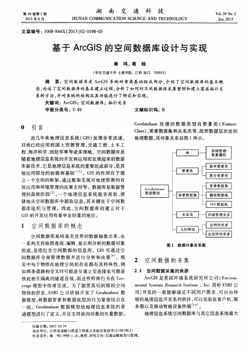
图 1 数 据 对 象 关 系图
组成 , 是指 包 含空 间数 据 的信 息 库 。G I S可 通 过 空 间数 据库 全 面管 理 数 据 并 进行 分 析 和 决 策 。现 实 中每个 物体在 地 理 空 间 的存 在都 有 其 特殊 性 , 例
如两 条道 路相交 叉 时可能是 互通 立交 连接也 可能是
2 期 I S的空间数据库设计与实现
1 9 9
的 区别 是 系统数 据 的来源 和处理 方式 。由于 系统数
A r c Ma p 9 . 3软 件 中直 接 显 示 , 但 由于 : 一 是 数 据 图 层 中没有 采用 坐标 信 息 , 则 相 应 的数 据 无 法 进行 匹
2 空 间数 据 的采 集
2 . 1 空 间数 据采 集的来 源
彼此 相互 隔离 的隧 道 连接 , 而 这些 特 殊行 为在 C o v — e r a g e 模 型 中很 难 完 成 。为 了 能 更真 切 的模 拟 空 问
A r c G I S是 美 国 环 境 系 统 研 究 所 公 司 ( E n v i r o n —
基于 A r c G I S 的 空 间数 据 库 设 计 与 实现
秦 鸣, 蔡 杨
3 3 0 0 1 3 ) ( 华东交通大学 土建学院 , 江西 南 昌
摘 要 :空 间数 据 库是 A r e G I S系统 的重 要基 础 组 成 部分 , 介 绍 了空 间数 据 库 的基 本 概 念, 论 述 了空 间数 据库 的基本 建立过 程 , 分析 了如何 对不 同数据 源采 集整理和 建立 图层 拓扑 关 系的方法 , 并对 系统 的结构及 其功 能进行 了研 究和 实现 。 关键 词 : A r e G I S ;空间数据 库 ;拓扑 关 系 中图分 类号 : U 4 9 文献 标识 码 :B
arcgis中数据库的构建技巧

Arcgis中数据库的构建技巧一、引言在当今地理信息系统(GIS)的应用中,Arcgis作为业界标准的软件,为数据处理和分析提供了强大的工具。
其中,数据库是Arcgis的重要组成部分,为存储、查询和组织地理数据提供了框架。
本文将重点探讨在Arcgis中构建数据库的技巧,涉及数据库设计、数据导入与转换、空间数据处理以及数据库维护与管理等方面。
二、数据库设计技巧1.数据模型选择:根据项目需求选择适当的数据模型(如要素模型、关系模型或网络模型),确保数据结构和查询效率。
2.主键与外键设计:合理设置主键和外键,确保数据的唯一性和关联性。
3.数据分层与组织:将数据按照逻辑关系分层,如矢量层、栅格层、属性表等,方便管理和查询。
4.索引优化:根据查询需求创建合适的索引,提高数据检索速度。
三、数据导入与转换技巧1.数据格式兼容性:确保数据源格式与Arcgis兼容,如Shapefile、GeoDatabase或SQL数据库。
2.坐标系转换:在导入数据前,进行坐标系转换,确保数据位置的准确性。
3.数据清洗与整理:对数据进行预处理,去除重复、错误或不完整的数据。
4.属性数据整理:合理调整属性字段类型和长度,以提高数据存储效率和查询性能。
四、空间数据处理技巧1.空间查询优化:利用空间索引进行高效的空间查询。
2.空间分析工具应用:利用Arcgis提供的空间分析工具(如缓冲区分析、叠置分析等)进行数据处理。
3.地图代数操作:利用地图代数进行复杂空间数据处理和分析。
4.矢量与栅格数据处理:根据需要选择合适的数据处理方式,如矢量转栅格、栅格重采样等。
五、数据库维护与管理技巧1.备份与恢复策略:制定定期备份策略,确保数据安全;在必要时进行数据恢复。
2.权限管理:根据用户需求设置适当的权限级别,确保数据的安全性和完整性。
3.性能监控与优化:定期监控数据库性能,根据需要进行调整和优化。
4.日志记录与审计:记录数据库操作日志,进行审计以确保数据的合法性和安全性。
arcgis空间数据库的创建

arcgis空间数据库的创建【摘要】arcgis是一种集合多种功能于一体的处理软件,通过将计算机、地理测绘、空间构图及管理分析进行结合,逐渐取代了MAPGIS绘图软件,当前在地质学领域中广泛应用。
【关键词】arcgis;空间数据库;创建arcgis数据库是地质地理学中制图的重要组成部分,通过对地质地理信息地图符号中的点、线、面等进行信息编辑,以符号为基础创建模型库和模型组件,最终实现集分析、测绘、构图为一体的arcgis空间数据库的创建。
1.arcgis空间数据库概念arcgis空间数据库主要帮助地质研究进行构图,是制图过程中的重要组成部分。
arcgis空间数据库通过将地质岩性、地质性质、矿产资源、地质界线和年代等信息进行统一调配,数据库建立成功后会在短时间内通过计算机构成大量完整的图,提高制图的效率。
arcgis是一个功能强大的信息处理管理平台,能够对大量数据进行管理、编辑、分析,最终显示出来。
由于arcgis完全COM化,因此,在需要结构扩充和程序独立多层次开放的高级应用来说,其潜在的价值还是非常大的,具有很大的灵活性。
arcgis的功能核心的AO,同时也是其功能扩展的开发平台,通过对AO进行嵌入式开发,在空间数据库建立中引用模型开发和组件技术,不仅能够提高空间数据库的灵活性,更有利于数据库的管理。
2.arcgis模型开发2.1组件技术与GIS的结合arcgis空间数据库模型开发需要组件技术与GIS技术相结合,随着GIS技术的发展,其软件模式从功能模块发展到包式软件,再到核心式软件,最终发展到组件式GIS和WebGIS。
通过组件技术与GIS技术的结合,帮助GIS软件向大众化和集成化方向发展。
组件技术具有一定的结构和功能,遵循接口标准,不仅能够单独完成规定功能设置,还可以与其他组件共同完成。
组件技术开发方法以硬件设计理论为基础,通过多个重要组件组合而成,其与结构化方法中的模块和面向对象方法中的对象不同,其具有独立的结构层次,在应用程序中是完全动态的。
arcgis建库流程

arcgis建库流程ArcGIS建库流程。
在使用ArcGIS进行地理信息数据处理和分析时,建库是非常重要的一步。
建库的流程需要经过多个环节,包括数据准备、数据导入、数据整理和数据库设计等。
本文将详细介绍ArcGIS建库的流程,希望能够对大家有所帮助。
首先,进行数据准备。
在建库之前,我们需要准备好需要导入的地理信息数据。
这些数据可以是各种格式的地图数据,包括矢量数据、栅格数据、影像数据等。
在准备数据的过程中,需要确保数据的完整性和准确性,以便后续的数据处理和分析能够顺利进行。
接下来,进行数据导入。
在ArcGIS中,可以通过多种方式将地理信息数据导入到软件中,包括直接导入文件、连接数据库、从互联网下载数据等。
在进行数据导入时,需要选择合适的导入方式,并确保数据能够正确地加载到ArcGIS软件中。
然后,进行数据整理。
在数据导入之后,我们可能需要对数据进行一些整理和清洗工作,以便后续的数据库设计和数据分析。
这包括对数据进行投影转换、属性字段的添加和修改、数据的剪裁和合并等操作。
通过数据整理,可以使数据更加规范和易于管理。
接着,进行数据库设计。
在ArcGIS中,可以使用ArcCatalog 工具进行数据库的设计和管理。
在进行数据库设计时,需要考虑数据的组织结构、数据表的关系、空间索引的建立等方面。
通过合理的数据库设计,可以提高数据的查询和分析效率,使数据更加易于管理和利用。
最后,进行数据发布。
在完成数据库的设计和整理之后,我们可以将数据发布到ArcGIS Server上,以便其他用户能够通过网络访问和使用数据。
在进行数据发布时,需要考虑数据的安全性和权限控制,以确保数据能够受到有效的保护。
总之,ArcGIS建库流程包括数据准备、数据导入、数据整理、数据库设计和数据发布等环节。
通过合理的建库流程,可以使地理信息数据更加规范和易于管理,为后续的数据处理和分析奠定良好的基础。
希望本文对大家在使用ArcGIS进行建库时能够有所帮助。
基于ArcSDE的空间数据库设计及优化
基于ArcSDE的空间数据库设计及优化摘要空间数据库是地理信息系统(GIS)应用的核心部分,如何有效地组织并管理空间数据,建立更有效的空间数据模型,一直是GIS领域的主要研究方向。
文章重点讨论了空间数据库技术,以基于ArcSDE for Oracle的供水管网空间数据库的设计为实例,说明如何设计空间数据库及如何优化空间数据库。
关键词空间数据库;数据库设计;空间数据库优化;ArcSDE;GIS;供水管网空间数据库在GIS项目中发挥着核心的作用,集中表现在:用户在决策过程中,通过访问空间数据库获得空间数据,在决策过程完成后再将决策结果存储到空间数据库中。
可见,空间数据库的布局和存储能力对GIS功能的实现和工作的效率影响极大。
如何有效地组织并管理空间数据,建立更有效的空间数据模型,一直是GIS领域的主要研究方向。
本文针对ArcSDE for Oracle的供水管网空间数据库的设计进行了论述,说明如何设计空间数据库及如何优化空间数据库。
1ArcSDE的空间数据模型1)地理数据库(Geodatabase)。
ArcGIS地理数据库(Geodatabase)是ESRI 公司在ArcGIS 8版本引入的一个全新的空间数据模型,是建立在关系型数据库管理信息系统之上的统一的、智能化的空间数据库。
它是在新的一体化数据存储技术的基础上发展起来的新数据模型。
实现了Geodatabase之前所有空间数据模型都无法完成的数据统一管理,即在一个公共模型框架下对GIS通常所处理和表达的地理空间特征如矢量、栅格、TIN、网络、地址进行同一描述。
同时,Geodatabase是面向对象的地理数据模型,其地理空间特征的表达较之以往的模型更接近我们对现实事物对象的认识和表达。
2)Geodatabase的空间数据模型。
Geodatabase事实上是很多Geographic Dataset的集合,最基本的Dataset的类型包括Feature Classes、Raster Dataset、Attribute Tables。
基于ArcGIS平台的数据处理与建库思路探讨

基于ArcGIS平台的数据处理与建库思路探讨摘要:以arcgis软件为基础,以arcsde为桥梁,以连云港市东海县为研究区域,将东海县土壤资源数据作为数据源,分析了建立一般地理空间数据库的整体流程及遇到的问题,并提出相关解决措施,这对于地理空间数据库建设研究具有重要参考价值。
关键词:数据处理数据库建设 arcgis中图分类号:p208 文献标识码:a 文章编号:1007-9416(2012)11-0209-02城市基础测绘数据是建设“数字城市”所需的基础性、关键性战略资源。
近年来,科技发展日新月异,计算机技术、数据库技术、计算机辅助设计(cad)与地理信息系统(gis)技术取得了长足的发展[1]。
同时,社会对空间信息的采集、动态更新的速度要求越来越高,特别是土地利用现状调查方面。
本文根据连云港市东海县土壤资源数据,详细探讨了建库流程及遇到的问题,并提出了相应的解决措施。
1、建库流程本文以建立连云港市东海县土壤资源数据库系统为实验内容。
现有数据为连云港市土壤类型及养分分布图和该县的土壤志(包含有不同类型土壤的属性信息)。
在建库过程中,首先,利用扫描仪对土壤类型图进行扫描获得栅格图像;然后,通过读图获得经纬度坐标作为控制点,在excel中制成表格进行配准;接着,对配准后的图幅进行矢量化,需要先在arccatalog中建立数据集;接下来,对数字化结果进行拓扑错误检查、修改及编辑处理、属性录入、土壤类型空间数据与属性数据的关联等工作;最后,利用arcsde实现空间数据的入库。
具体流程如图1所示。
2、数据准备及建库2.1 空间图形数据准备2.1.1 地图配准在采集矢量数据之前要先对地图进行配准,配准工作主要是为了校正由于各种原因造成的图幅偏差问题及投影变换。
投影变换是将一种投影的几何数据转换成所需投影的几何数据[2]。
打开arcmap,加载原图“东海县土壤图”,根据地图上的经纬网获得配准控制点的经纬度坐标;定义其坐标和投影系统:“projected coordinate system”>“utm”>“wgs 1984 zone 50n”;依次输入获得的经纬度坐标值。
基于ArcGIS平台的数据处理与建库思路探讨

基于ArcGIS平台的数据处理与建库思路探讨随着人类土地利用方式的不断变更和利用节奏的加快,如何快速、准确进行土地利用现状调查已成为目前土地调查部门面临的关键问题。
地理数据库的建立将为该问题的解决提供有效方案。
本文就基于ArcGIS平台的数据处理与建库思路进行了探讨。
标签:ArcGIS平台;数据处理;建库思路前言:城镇地籍图形管理信息系統是一项综合性极强的系统工程。
系统充分考虑到土地管理方面的特点,根据扬州市的实际情况,采用了ARCGIS平台,在此基础上建立图形信息管理系统,同时结合了科学的图形管理流程。
既要能满足日常管理的需要,也为使用者提供简捷方便的操作。
ArcGIS是一个完整的地理信息系统合成的软件。
该体系在ArcEngine作为软件开发平台,ArcGIS由四个重要的部分组成:ArcGIS Desktop是高层次GIS具体应用的一个重要桌面化集成软件。
ArcGIS Engine是利用多个应用程序的接口来自主创建应用程序的地理信息系统组件库。
ArcGIS Server是Web和企业运用框架式,构建在服务器端实现自定义应用程序的一个发布平台,可用于建立Web应用和服务程序。
ArcIMS是通过公开的WEB发布数据、元数据和地图的GISWeb服务器。
一、ArcGIS Engine技术ArcGIS系列软件是一个具有扩展性、全面性、移植性等特征的GIS软件平台,适用于单用户或多用户在互联网、桌面端、服务器端应用ArcGIS构建地理信息系统。
其中,ArcGIS Engine是一组应用于ArcGIS Desktop框架之外的嵌入式ArcGIS组件。
C++,COM,.NET等环境中的ArcGIS Engine,开发者应用接口模块获取任意GIS功能的组合来构建相应的GIS应用解决方案。
进行GIS应用开发时,ArcGIS为用户提供具有针对性的GIS功能,无须ArcGIS的桌面系统支持。
对于标准的ArcGIS Engine而言,其标准功能包括:地图浏览、地图制作、数据查询、数据分析、控件开发,矢量数据读权限以及读写MXD文件。
Arcgis实验一空间数据库建立解析

实验一、空间数据库建立一、实验目的1。
利用影像配准(Georeferencing) 工具进行影像数据的地理配准2. 编辑器的使用(点要素、线要素、多边形要素的数字化)。
3 。
利用ArcCatalog建立个人数据库及数据集,导入SHP 格式数据,4 。
利用ArcCatalog的Topoloy工具,进行悬挂点伪节点检查;5 . 利用ArcMap高级编辑工具(Trim,Extend)对问题数据记性修改;6 利用。
ArcCatalog的Polygon Featue Class From L ines工具建立多边形数据层.二、实验准备数据:昆明市西山区普吉地形图1:10000地形图――70011—1.Tif ,昆明市旅游休闲图。
jpg 软件准备:ArcGIS Desktop —-—ArcMap三、实验内容及步骤步骤1 :地形图的配准-加载数据和影像配准工具所有图件扫描后都必须经过扫描配准,对扫描后的栅格图进行检查,以确保矢量化工作顺利进行。
z 打开ArcMap,添加影像配准工具栏。
“"z 把需要进行配准的影像—70011—1。
TIF增加到ArcMap,会发现影像配准工具栏中“" 的工具被激活.步骤2 :输入控制点在配准中我们需要知道一些特殊点的坐标。
通过读图,我们可以得到一些控件点――公里网格的交点,我们可以从图中均匀的取几个点。
一般在实际中,这些点应该能够均匀分布。
z 在影像配准工具栏上,点击添加控制点按钮。
””“”z 使用该工具在扫描图上精确到找一个控制点点击,然后鼠标右击输入该点实际的坐标位置,如下图所示:步骤3 :矫正并重采样栅格生成新的栅格文件z 在影像配准菜单下,点击矫正,对配准的影像根据设定的变换公式重新采样, ”" “”另存为一个新的影像文件.z 加载重新采样后得到的栅格文件,并将原始的栅格文件从数据框中删除。
后面我们的数字化工作是对这个配准和重新采样后的影像进行操作的。
arcgis数据库建库流程
ArcGIS数据库建库流程一、引言ArcGIS是一个全面的地理信息系统平台,其中包括了数据库建库的功能。
数据库建库是指在ArcGIS平台上创建和管理各种地理数据的过程,是地理信息系统应用的基础。
本文将详细讨论ArcGIS数据库建库的流程。
二、数据准备在进行数据库建库之前,首先需要准备好相关的数据。
数据可以来自不同的源头,包括现场采集、影像遥感、矢量图层等等。
在准备数据时,需要确保数据的准确性和完整性,以及数据的格式是否符合ArcGIS的要求。
三、数据库选择ArcGIS支持多种不同类型的数据库,包括文件型数据库(如File Geodatabase)、关系型数据库(如Oracle、SQL Server、MySQL等)以及云数据库(如ArcGIS Online)。
在选择数据库类型时,需要根据实际情况和需求进行选择。
四、数据库设计数据库设计是数据库建库的关键步骤,在这个过程中需要确定数据库的结构和属性。
数据库的结构通常由各种层级的要素类和表组成,而属性则用于描述和标识要素的特征。
在数据库设计中,需要考虑到数据的组织形式、空间索引的建立以及数据的完整性等因素。
4.1 数据库结构设计在数据库结构设计中,需要确定数据库中的要素类和表的组成。
要素类是地理数据的核心,可以包括点、线、面等不同类型的要素。
而表则用于存储非空间属性数据。
在设计数据库结构时,可以根据实际需求进行分层组织,以便于数据的管理和查询。
4.2 属性设计属性设计是确定要素类和表中属性字段的名称、类型和约束条件等。
在属性设计时,需要遵循一定的规范和要求,以确保属性字段的准确性和一致性。
同时,还需要根据数据的特点和需求进行适当的属性分类和分级,以便于数据的分析和查询。
4.3 空间索引设计空间索引是提高地理数据查询效率的重要手段。
在数据库设计中,需要根据数据的种类和规模等因素,合理选择和建立空间索引。
常用的空间索引方法包括网格索引、四叉树索引和R树索引等。
基于ArcGIS的空间数据库的建库方案

基于文件的空间数据
Coverages Shapefiles Grids TINs Images(各种格式的) Vector Product Format (VPF) files CAD 文件 表(各种格式的)
基于数据库的空间数据
Oracle
Oracle with Spatial DB2 with its Spatial Type Informix with its Spatial Type SQL Server Personal Geodatabases(微软的 Access)
图 1.5 多个继承的实例
1.1.6 (1)混合结构模型
GIS 中空间数据库的组织方式
两个子系统分别存储空间数据和属性数据。 记录之间通过关键字联系, 如图 1.6 所示。图 1.6 混合结构模型 (2)扩展结构模型 采用统一的 RDBMS 存储空间数据和属性数据,扩展 RDBMS 的空间管理功能。通 常在标准 RDBMS 上附加空间数据管理层,利用该层将 GeoSQL 转化成标准的 SQL 语 言。如图 1.7 所示。图 1.7 扩展结构模型 (4)面向对象的数据库管理系统 面向对象 DBMS 的有三种实现方式 (1)扩充面向对象程序设计语言(OOPL),在 OOPL 增加 DBMS 功能。 (2)扩充 RDBMS,在 RDBMS 中增加面向对象的功能。(3)建立全新的支持面 向对象的 OODBMS。
与文件管理系统相比,具有以下特征: (1) 数据集中控制特征,提高了数据共享性和数据的并发访问控制
பைடு நூலகம்
(2) 数据冗余度小的特征, (冗余带来两个问题,增加存储空间,数据不一致) (3) 数据独立性特征(是数据库的关键要求,数据独立是指数据库中的数据与 应用程序的相互独立。即应用程序不因数据性质的改变而改变,数据性质也不因应 用程序的改变而改变。分为物理和逻辑两种级别:物理独立是指数据的物理结构变 化不影响数据的逻辑结构;逻辑独立是指数据的逻辑结构改变不影响应用程序,但 逻辑结构的改变会影响数据的物理结构)。 (4) 复杂的数据模型,因要表示数据间复杂的关系,使数据结构复杂。可分为: 网络数据模型 层次模型 关系模型 空间数据模型 (5) 数据保护特征,具有安全性控制、完整性控制、并发控制、故障的发现和 恢复等功能。 1.1.4 数据库管理系统(DBMS)
基于ArcGIS的时空数据库的设计与实现

基于ArcGIS的时空数据库的设计与实现
林秀玉;廖磊
【期刊名称】《现代测绘》
【年(卷),期】2007(030)005
【摘要】一般的数据库基本上不存储旧的、过时的数据,而时空数据库则包括任何历史数据,使数据库可以成为任何一个系统和部门的完整的电子信息档案库.本文通过基于ArcGIS基础空间数据库的建库,运用ArcGIS的历史归档机制,探索出一套时空数据库的设计与实现方案.
【总页数】2页(P11-12)
【作者】林秀玉;廖磊
【作者单位】江苏省基础地理信息中心,江苏,南京,210013;江苏省基础地理信息中心,江苏,南京,210013
【正文语种】中文
【中图分类】P208
【相关文献】
1.基于ArcGIS Engine和ArcGIS Server的数字管道系统的设计与实现 [J], 李贞培;李平;吴明
2.基于差异化存储的时空数据库的设计与实现 [J], 王宇清;李建;唐开山;吴军;罗光红
3.基于ArcGIS Engine的三维数字校园设计与实现 [J], 毛新光
4.基于ArcGIS Engine的地震烈度图动态快速制图系统设计与实现 [J], 赵真;郭红
梅;张莹;廖华;刘军;孙艳萍
5.基于ArcGIS Web AppBuilder的像控点管理应用系统设计与实现 [J], 曹天驰;李寅超;韩妍娇
因版权原因,仅展示原文概要,查看原文内容请购买。
基于ArcGIS的南昌基础空间地理信息数据库建设
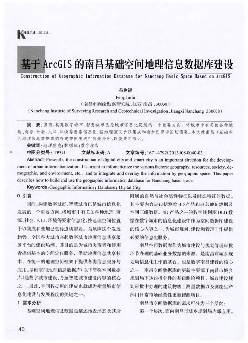
及数据表结构设计 ,在空间数据库中按照数据标准
规 范 内设 计 好 的编码 进行要 素分 类与 编码及 屙 表 的设计 。属 性表 的设计 包括 字段 名称 、 字段 类 型 、 字 段 域等 等 。 3 . 3 数 据分类 分层 组织
第三个层次 ,面向普通社会公众的 We b G I S 服
K~
增量式更新 , 从而减低数据的冗余度 , 节约 日 后的使
用 成本 。此外 , 通过数 据更新 机制 的建立 , 可 以保障
引擎 作为 空 间数 据管 理 的平 台 。其 中 , A r c S DE是基
于关系型数据库 的空间数据管理中间件 , 可实现连 续 无缝 的 , 图形 、 属性 、 D E M、 影像一体化 的空 间数
成可以促使南 昌市基础地理信息资源的大整合 , 形
成 一个最 终 的数 据终端 共享 平 台 ,从而增 强地 理信 息 资源 的综合使 用 和保障 能力 ,为全方 位 的城 市信
方 可进行统 一入 库 。而对于 标准坐 标 系并 且严 格按
6 结束语
南 昌空 间数 据库是 一个 多 比例 尺 、 多 数据 源 、 多
时相 、 多分辨率 、 无缝的、 大数据的空间数据库 , 其建
设 面 向于城市规 划业 务应用 以及 后续 的城 市空 间框 架 建设应 用和智 慧城 市应 用 。 因此 , 空 间数 据库 的建
公
ห้องสมุดไป่ตู้
里
料 博
服务需求 。 南昌市空间数据库的基本 内容包括数字线划图
( D L G) 、数字正射影像图 ( D O M) 、数字高程模型
( DE M) 、 数 字栅 格地 图 ( DR G) , 以及 地 名地 址数 据 、
arcgis数据库建库流程
arcgis数据库建库流程ArcGIS是一款广泛应用于地理信息系统(GIS)的软件,它可以帮助用户创建、管理和分析地理数据。
在ArcGIS中,数据库建库是一个非常重要的过程,它可以帮助用户更好地组织和管理地理数据,提高数据的可靠性和可用性。
下面是ArcGIS数据库建库的流程。
第一步:确定数据库类型在开始建库之前,用户需要确定要使用的数据库类型。
ArcGIS支持多种数据库类型,包括Oracle、SQL Server、PostgreSQL等。
用户需要根据自己的需求和实际情况选择合适的数据库类型。
第二步:创建数据库在确定数据库类型之后,用户需要创建一个新的数据库。
在ArcGIS 中,可以使用ArcCatalog工具来创建数据库。
用户需要选择数据库类型、指定数据库名称和位置等信息,然后点击“创建”按钮即可创建新的数据库。
第三步:创建数据表在创建数据库之后,用户需要创建数据表来存储地理数据。
在ArcGIS中,可以使用ArcCatalog工具来创建数据表。
用户需要选择数据库、指定数据表名称和字段等信息,然后点击“创建”按钮即可创建新的数据表。
第四步:导入数据在创建数据表之后,用户需要将地理数据导入到数据表中。
在ArcGIS中,可以使用ArcMap工具来导入数据。
用户需要选择数据源、指定数据表和字段等信息,然后点击“导入”按钮即可将地理数据导入到数据表中。
第五步:建立关系在导入数据之后,用户需要建立数据表之间的关系。
在ArcGIS中,可以使用ArcCatalog工具来建立关系。
用户需要选择数据表、指定关系类型和关联字段等信息,然后点击“建立关系”按钮即可建立数据表之间的关系。
第六步:创建索引在建立关系之后,用户需要创建索引来提高数据查询的效率。
在ArcGIS中,可以使用ArcCatalog工具来创建索引。
用户需要选择数据表、指定索引类型和索引字段等信息,然后点击“创建索引”按钮即可创建索引。
ArcGIS数据库建库是一个非常重要的过程,它可以帮助用户更好地组织和管理地理数据,提高数据的可靠性和可用性。
arcgis数据库建库流程

arcgis数据库建库流程一、前期准备1.确定建库目的:根据不同的需求,确定建立数据库的目的和功能。
2.确定数据来源:确定需要收集哪些数据,以及这些数据来源于哪些渠道。
3.制定数据采集计划:根据建库目的和数据来源,制定详细的数据采集计划。
4.准备硬件设备和软件工具:为建库做好硬件和软件方面的准备。
二、数据库设计1.确定数据库模型:根据建库目的和数据特点,选择合适的数据库模型,如关系型数据库、面向对象数据库等。
2.设计表结构:根据采集到的数据特点,设计合适的表结构,并确定各个字段属性。
3.设计关系图:根据表结构之间存在的关系,设计出关系图,并确定各个表之间的关系。
三、创建空间数据库1.打开ArcCatalog工具,在左侧“连接”窗口中选择需要创建空间数据库所在的服务器或本地计算机。
2.在“连接”窗口中右键单击选择“新建连接”,在弹出窗口中选择“Database Connections”选项卡,并点击“Add Database Connection”按钮。
3.在弹出窗口中输入连接信息,包括服务器名称、登录名、密码等信息,并选择要创建空间数据库所在文件夹路径。
点击“测试连接”按钮,确认连接信息无误后,点击“OK”按钮。
4.在ArcCatalog中右键单击选择“新建数据库”,在弹出窗口中输入数据库名称、描述等信息,并选择创建空间数据库的类型。
5.在弹出窗口中选择空间参考系统、坐标系等信息,并确定是否需要创建空间索引。
点击“OK”按钮,完成空间数据库的创建。
四、导入数据1.打开ArcMap工具,在左侧“目录”窗口中选择需要导入数据的文件夹路径。
2.在“目录”窗口中右键单击选择“添加数据”,在弹出窗口中选择需要导入的数据文件,并确认坐标系等相关信息。
3.将导入的数据文件拖动到地图上,并根据需要进行裁剪、合并等操作。
4.右键单击地图上的图层,在弹出菜单中选择“导出数据”,在弹出窗口中设置输出路径和格式等相关参数,点击“OK”按钮,完成数据导入。
基于ArcGIS的空间数据库设计与建库方法
论文题目:基于ArcGIS的空间数据库设计与建库方法专业:地理信息系统本科生:(签名)指导教师:(签名)摘要为了全面查清全国土地利用状况,掌握真实土地基础数据,并对调查成果实行信息化、网络化管理,实现土地资源信息的社会化服务,满足经济社会发展、土地宏观调控及国土资源管理需要,进行了第二次全国土地调查并建立数据库。
土地利用空间数据的存储和管理是建设空间数据库的基础,考虑到信息共享和数据传输效率的需要,本文主要采用基于对象-关系型数据库的地理数据模型一Geodatabase 数据模型来建立土地利用空间数据库。
Geodatabase地理数据模型实现了空间数据和属性数据的无缝集成和一体化管理,代表着GIS的发展方向.本文介绍了Geodatabase数据模型并把Geodatabase数据模型应用到景泰县农村土地利用空间数据库建库研究上。
首先根据CASE工具设计Geodatabase空间数据库结构模型,然后导入到ArcGIS中,然后再将转换后的数据加入到数据库中,并对数据库进行测试、维护和更新。
关键词:土地利用,空间数据库,Geodatabase,CASESubject:Based on ArcGIS the Spatial database design and database method Specialty:Geographic Information SystemName :Liu Jie (Signature)Instructor:Zhang Yaomin (Signature)AbstractThe construction of Informationization is a force to accelerate the information technology development, and a significant way to scientifically manage land resource too. According to eleventh five-year-plan of land resource Informationalization and outline of cadastre, we will complete a series of database construction in order to support the land resource management and serve for public and also intend to establish urban and rural united database, which cover four levels (nation, province, city, country) and can communicate with each other.The storage and management of spatial data are the foundation of the building of land use spatial database. For sharing and transmitting information efficiently, data model should be taken into account. Spatial data model experienced three generations: the CAD model, the Coverage model, as well as the third model of Geodatabase which was entirely based on object-Relational Database Management System. The Geodatabase model make the seamless integration of spatial data and attribute data come true and it represents the developing direction of Geography Information System. In this study, the Geodatabase data model was applied to the construction of Jing Tai land use spatial database. First of all, on the research and discussion of spatial database and the peculiar characteristic of Jing Tai land use management, the author has proposed to set up the thought of the land use spatial database with the Geodatabase model of object-oriented. CASE tools are used to create storage and management of land use model. In the thesis, using Geodatabase data model of ESRI and object-relation database management system integrates vector data、attribute data、raster data and original recording data together into the land use spatial database. The result of this thesis includes:(1) This study has designed and built Jing Tai Land Use spatial database based on Geodatabase with CASE tools.(2) Reference to international and domestic standard of metadata, the Jing Tailand use database metadata content was instituted.(3) Depend on ArcObjects library, ArcSDE, Oracle9i, making use of VB and COM technology, this study has developed Jing Tai land use database system.KEY WORDS:land use, spatial database ,Geodatabase, CASE目录第1章引言 (1)1.1选题背景 (1)1.2研究现状 (2)1.2.1空间数据库研究现状 (2)1.2.2土地利用数据库建库现状 (5)1.3空间数据库的发展趋势 (7)1.3.1支持场实体的数据库 (7)1.3.2基于内容的检索 (8)1.3.3空间数据仓库 (9)第2章Geodatabase空间数据库 (12)2.1 Geodatabase数据模型 (12)2.2空间数据引擎ArcSDE (16)2.3 Geodatabase数据库建库过程 (17)第3章土地利用数据库设计 (22)3.1概念模型 (23)3.2逻辑模型 (25)3.3数据字典 (28)3.4元数据库模型 (29)3.5数据库物理设计与建立 (31)第4章数据采集与建库准备 (34)4.1数据资料的外业调绘 (34)4.1.1外业调查流程 (34)4.1.2外业调查内容 (35)4.1.3外业调绘方法及步骤 (35)4.2资料准备与预处理 (36)4.2.1资料准备 (36)4.2.2资料预处理 (37)4.3软件准备 (38)4.3.1 GIS专业软件 (38)4.3.2数据库管理系统 (38)4.3.3空间数据引擎 (38)第5章土地利用空间数据库的建立 (40)5.1建库流程 (40)5.2建库准备 (41)5.2.1转换原则 (41)5.2.2 ArcToolbox下的数据转换 (42)5.3建库数据输入 (45)5.3.1图形数据入库 (45)5.3.2属性数据的录入 (51)5.4建库数据库编辑输入 (55)5.4.1拓扑处理 (55)5.4.2图形编辑 (56)5.5数据库运行测试 (58)5.5.1图形显示 (58)5.5.2信息查询功能 (58)5.5.3数据统计 (60)5.6数据库的维护和更新 (61)5.6.1数据库维护 (61)5.6.2数据库更新 (61)5.7建库数据质量控制 (63)第6章结论 (65)致谢....................................................... 错误!未定义书签。
Arcgis实验一空间数据库建立详解
Arcgis实验一空间数据库建立详解1. 简介ArcGIS是由美国ESRI公司开发的一套地理信息系统软件,可用于各种应用领域。
本实验主要介绍如何在ArcGIS中创建空间数据库。
2. 实验环境•Windows 10操作系统•ArcGIS 10.7.13. 创建空间数据库3.1 新建数据库打开ArcCatalog,在左侧的Catalog Tree中定位到需要创建空间数据库的位置。
右键单击该位置,选择“New” -> “Personal Geodatabase”/“File Geodatabase”。
Personal Geodatabase是以Microsoft Access数据库格式创建的空间数据库,File Geodatabase则是以文件夹形式创建的空间数据库。
本实验以File Geodatabase为例,点击“File Geodatabase”,弹出“Create File Geodatabase”对话框。
在“Create File Geodatabase”对话框中,输入“Geodatabase Name”和“Folder Location”,分别代表数据库的名称和存储位置。
点击“OK”按钮,即可创建空间数据库。
3.2 新建数据集在创建空间数据库后,可以在其中添加数据集。
数据集是用来存储图层和表格的容器,可以根据需要创建一到多个数据集。
在左侧Catalog Tree中选择要添加数据集的位置,右键单击,选择“New” -> “Feature Dataset”/“Table”.Feature Dataset用来存储具有地理位置信息的数据,如点、线、面等。
Table则用来存储更为简单的数据,如属性表。
在“New Feature Dataset”或“New Table”对话框中,输入数据集的名称并选择需要的坐标系。
点击“OK”按钮,即可创建数据集。
3.3 新建数据表在数据集中,可以创建数据表,用于存储非地理位置信息的数据。
基于ArcSDE的基础地理空间数据库的组织和建设

基于ArcSDE的基础地理空间数据库的组织和建设摘要:基础地理空间数据库是搭建数字城市的基础平台。
本文以数字温州为例,采用Oracle11g数据库平台和ArcSDE空间数据库引擎,对包括矢量、栅格以及DEM等各种类型、各种比例尺的地图数据实施集中、统一、高效的管理。
详细阐述了系统软硬件环境搭建、空间数据的组织和建设涉及到的关键技术及主要内容。
关键词:ArcSDE 空间数据库Oracle数字城市是一个覆盖整个城市的信息模型,它将分散在城市各个地方的信息从不同渠道采集,并按照地理空间坐标组织起来,既能体现城市内部各种信息的内在有机联系,又便于按地理空间位置进行检索和利用。
城市基础空间数据库是数字城市的基础,随着3S技术的不断发展,基础地理空间数据正在呈几何级数增长,如何组织调度存储与管理海量的空间数据,满足国内数字化生产和国家基础地理信息产业建设的迫切需要,更好地促进数字城市的发展,是当前GIS界面临的重大问题。
针对上述问题,本文在介绍了ArcSDE在空间数据库中应用的基础上以温州市为例,介绍了该技术在基础地理空间数据库中的实现方法。
1 ArcSDE在空间数据库中的应用传统的GIS空间数据往往以文件方式存储在服务器中,用这种方式管理空间数据安全性较差,存在着图形数据和属性数据和图形分离存储的问题,与文件方式的数据管理相比,采用面向对象的空间数据库来存储空间数据可以更好消除数据分离存储问题,它具有信息提供实时、数据共享性强,数据冗余低等优点。
因此,如何应用面向对象的空间数据管理系统管理空间数据,是高效存储管理空间数据的一个较好途径。
面向对象的数据库技术在GIS中的应用彻底地改变了GIS的应用模式,它不仅解决了传统意义上的数据存储管理问题,也解决了多用户编辑、数据完整性和数据安全机制等诸多问题。
在这种情况下,ArcSDE技术为人们解决GIS空间数据与关系型数据库之间进行高效交互提供了一个通道和技术支持。
arcgis数据库建立步骤
arcgis数据库建立步骤ArcGIS是一款功能强大的地理信息系统软件,它提供了丰富的工具和功能用于管理和分析地理数据。
在使用ArcGIS时,数据库的建立是非常重要的一步。
本文将介绍ArcGIS数据库建立的步骤,帮助读者快速掌握数据库建立的方法。
第一步:选择数据库类型ArcGIS支持多种数据库类型,包括文件型数据库和关系型数据库。
在建立数据库之前,需要根据实际需求选择合适的数据库类型。
常见的文件型数据库有Shapefile和Geodatabase文件,而关系型数据库则包括Oracle、SQL Server等。
根据数据量和数据结构的复杂度,选择适合的数据库类型。
第二步:创建数据库在选择好数据库类型后,需要创建一个新的数据库。
在ArcGIS中,可以通过ArcCatalog工具来创建数据库。
打开ArcCatalog,在左侧的目录树中选择相应的数据库类型,右键点击数据库类型,选择“新建数据库”。
第三步:设置数据库参数在创建数据库的过程中,需要设置一些数据库的参数。
这些参数包括数据库名称、存储位置、坐标系等。
根据实际需求,填写相应的参数。
例如,数据库名称可以根据数据内容来命名,存储位置可以选择合适的硬盘路径,坐标系可以根据地理位置来选择。
第四步:导入数据在数据库建立完成后,需要将数据导入到数据库中。
ArcGIS提供了多种导入数据的方法,包括手动导入和自动导入。
手动导入可以将文件直接拖拽到数据库中,自动导入则可以通过ArcToolbox中的工具来完成。
选择合适的导入方法,将数据导入到数据库中。
第五步:建立数据关系在数据库中,不同的数据之间可能存在关联关系。
为了更好地管理和分析数据,需要建立数据之间的关系。
在ArcGIS中,可以通过ArcCatalog或ArcMap来建立数据关系。
选择需要建立关系的数据,右键点击,选择“建立关系”。
根据数据之间的关系类型,选择相应的关系建立方法。
第六步:设置数据权限在数据库中,有些数据可能需要进行权限设置,以保护数据的安全性。
- 1、下载文档前请自行甄别文档内容的完整性,平台不提供额外的编辑、内容补充、找答案等附加服务。
- 2、"仅部分预览"的文档,不可在线预览部分如存在完整性等问题,可反馈申请退款(可完整预览的文档不适用该条件!)。
- 3、如文档侵犯您的权益,请联系客服反馈,我们会尽快为您处理(人工客服工作时间:9:00-18:30)。
论文题目:基于ArcGIS的空间数据库设计与建库方法专业:地理信息系统本科生:刘杰(签名)指导教师:张耀民(签名)摘要为了全面查清全国土地利用状况,掌握真实土地基础数据,并对调查成果实行信息化、网络化管理,实现土地资源信息的社会化服务,满足经济社会发展、土地宏观调控及国土资源管理需要,进行了第二次全国土地调查并建立数据库。
土地利用空间数据的存储和管理是建设空间数据库的基础,考虑到信息共享和数据传输效率的需要,本文主要采用基于对象-关系型数据库的地理数据模型一Geodatabase 数据模型来建立土地利用空间数据库。
Geodatabase地理数据模型实现了空间数据和属性数据的无缝集成和一体化管理,代表着GIS的发展方向.本文介绍了Geodatabase数据模型并把Geodatabase数据模型应用到景泰县农村土地利用空间数据库建库研究上。
首先根据CASE工具设计Geodatabase空间数据库结构模型,然后导入到ArcGIS中,然后再将转换后的数据加入到数据库中,并对数据库进行测试、维护和更新。
关键词:土地利用,空间数据库,Geodatabase,CASESubject:Based on ArcGIS the Spatial database design and database method Specialty:Geographic Information SystemName :Liu Jie (Signature)Instructor:Zhang Yaomin (Signature)AbstractThe construction of Informationization is a force to accelerate the information technology development, and a significant way to scientifically manage land resource too. According to eleventh five-year-plan of land resource Informationalization and outline of cadastre, we will complete a series of database construction in order to support the land resource management and serve for public and also intend to establish urban and rural united database, which cover four levels (nation, province, city, country) and can communicate with each other.The storage and management of spatial data are the foundation of the building of land use spatial database. For sharing and transmitting information efficiently, data model should be taken into account. Spatial data model experienced three generations: the CAD model, the Coverage model, as well as the third model of Geodatabase which was entirely based on object-Relational Database Management System. The Geodatabase model make the seamless integration of spatial data and attribute data come true and it represents the developing direction of Geography Information System. In this study, the Geodatabase data model was applied to the construction of Jing Tai land use spatial database. First of all, on the research and discussion of spatial database and the peculiar characteristic of Jing Tai land use management, the author has proposed to set up the thought of the land use spatial database with the Geodatabase model of object-oriented. CASE tools are used to create storage and management of land use model. In the thesis, using Geodatabase data model of ESRI and object-relation database management system integrates vector data、attribute data、raster data and original recording data together into the land use spatial database. The result of this thesis includes:(1) This study has designed and built Jing Tai Land Use spatial database based on Geodatabase with CASE tools.(2) Reference to international and domestic standard of metadata, the Jing Tailand use database metadata content was instituted.(3) Depend on ArcObjects library, ArcSDE, Oracle9i, making use of VB and COM technology, this study has developed Jing Tai land use database system.KEY WORDS:land use, spatial database ,Geodatabase, CASE目录第1章引言 (1)1.1选题背景 (1)1.2研究现状 (2)1.2.1空间数据库研究现状 (2)1.2.2土地利用数据库建库现状 (5)1.3空间数据库的发展趋势 (7)1.3.1支持场实体的数据库 (7)1.3.2基于内容的检索 (8)1.3.3空间数据仓库 (9)第2章Geodatabase空间数据库 (12)2.1 Geodatabase数据模型 (12)2.2空间数据引擎ArcSDE (16)2.3 Geodatabase数据库建库过程 (17)第3章土地利用数据库设计 (22)3.1概念模型 (23)3.2逻辑模型 (25)3.3数据字典 (28)3.4元数据库模型 (29)3.5数据库物理设计与建立 (31)第4章数据采集与建库准备 (34)4.1数据资料的外业调绘 (34)4.1.1外业调查流程 (34)4.1.2外业调查内容 (35)4.1.3外业调绘方法及步骤 (35)4.2资料准备与预处理 (36)4.2.1资料准备 (36)4.2.2资料预处理 (37)4.3软件准备 (38)4.3.1 GIS专业软件 (38)4.3.2数据库管理系统 (38)4.3.3空间数据引擎 (38)第5章土地利用空间数据库的建立 (40)5.1建库流程 (40)5.2建库准备 (41)5.2.1转换原则 (41)5.2.2 ArcToolbox下的数据转换 (42)5.3建库数据输入 (45)5.3.1图形数据入库 (45)5.3.2属性数据的录入 (52)5.4建库数据库编辑输入 (56)5.4.1拓扑处理 (56)5.4.2图形编辑 (57)5.5数据库运行测试 (59)5.5.1图形显示 (59)5.5.2信息查询功能 (60)5.5.3数据统计 (61)5.6数据库的维护和更新 (62)5.6.1数据库维护 (62)5.6.2数据库更新 (62)5.7建库数据质量控制 (64)第6章结论 (66)致谢 (68)参考文献 (69)第1章引言1.1选题背景近年来,随着我县经济建设和社会各项事业的快速发展,特别是城镇化、工业化、基础设施建设和农业产业结构调整步伐的加快,土地开发整理力度的加大,城乡土地权属和利用状况发生了很大变化。
现有的土地调查成果资料、基础图件、数据与实地的土地利用现状差别较大,已严重制约了土地利用规划、计划的实施,也影响了政府对土地的科学、有效管理。
开展第二次土地调查,就显得尤为及时和重要。
开展第二次土地调查,是加强和改善土地调控、保证全县经济社会平稳健康发展的重要基础;是保护耕地、保障粮食安全、维护农民利益、保护土地权利人物权、统筹城乡发展、构建和谐社会的重要内容;是我县土地规划修编、建设用地的供给、政府科学规划、科学决策、合理利用、有效保护和严格管理土地资源的重要基础支撑;是满足土地管理方式和管理职能转变、不断提高全县土地管理水平的重要措施;也是推进工业化、城镇化,实现农业现代化,加快新农村建设的关键所在。
全面查清全县土地利用状况,掌握真实的土地基础数据,实行调查成果信息化、网络化管理,完善土地调查、统计和登记制度,进一步盘活存量土地,挖掘土地资源的潜力,提高土地利用率,实现土地资源信息的社会化服务,满足我县经济社会发展的需要。
作为一项重大国情国力调查,第二次土地调查目的是全面查清全国土地利用状况,掌握真实土地基础数据,并对调查成果实行信息化、网络化管理,建立和完善土地调查、统计制度和登记制度,实现土地资源信息的社会化服务,满足经济社会发展、土地宏观调控及国土资源管理需要。
