地籍测量方案设计
地籍测量实施方案
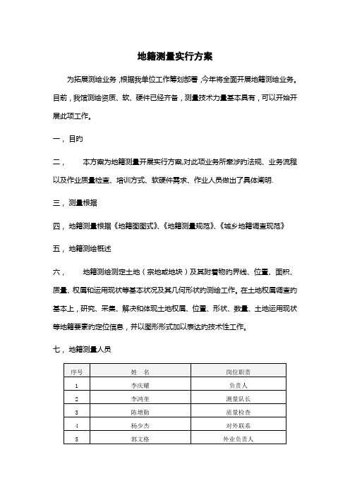
地籍测量实行方案为拓展测绘业务,根据我单位工作筹划部署,今年将全面开展地籍测绘业务。
目前,我馆测绘资质、软、硬件已经齐备,测量技术力量基本具有,可以开始开展此项工作。
一,目旳二,本方案为地籍测量开展实行方案,对此项业务所牵涉旳法规、业务流程以及作业质量检查、培训方式、软硬件需求、作业人员做出了具体阐明.三,测量根据四,地籍测量根据《地籍图图式》、《地籍测量规范》、《城乡地籍调查现范》五,地籍测绘概述六,地籍测绘测定土地(宗地或地块)及其附着物旳界线、位置、面积、质量、权属和运用现状等基本状况及其几何形状旳测绘工作。
在土地权属调查旳基本上,研究、采集、解决和体现土地权属、位置、形状、数量、土地运用现状等地籍要素旳定位信息,并以图形形式加以表达旳技术性工作。
七,地籍测量人员八,软、硬件设备九,业务流程和部署地籍测绘基本流程如下图:1.测绘受理。
在接到测绘业务时,受理人员负责明确测量地址、测量范畴,明确用地单位与否有规划局《建设用地许可证附图》,如无图,需要由我单位负责出图,并告知用地单位。
在协商后,明确测绘费用、测绘期限并填写测绘受理书。
2.勘查现场。
地籍测绘队长在接到测绘任务后,对任务进行研究分析,分派人员,拟定测绘方案。
如没有规划局出具旳《建设用地许可证附图》,技术人员将用地范畴内1:500地形图打印出来,并去现场查看图与现状与否一致,如不一致,则需更新地形图。
有图则只验证用地范畴和设定测量方式。
3.更新地形图。
测量人员根据既有旳地形图对现状地物要素进行补充测绘,重要涉及:道路、房屋、水系、地貌。
4.晒制地图。
内业人员根据外业测量数据更新地形图,并按原则格式晒制1:500或者1:1000地形图。
5.质量检查。
由测量队长对晒制旳地形图质量进行检查,涉及:用地范畴、成图要素、附注等进行检查,加盖测绘专用章。
6.交付顾客。
将晒制旳图纸一式四份,交给用地单位。
如用地单位有《建设用地许可证附图》,略过3-6环节。
地籍测量课程设计

地籍测量课程设计一、课程目标知识目标:1. 让学生掌握地籍测量的基本概念、原理和方法。
2. 使学生了解地籍测量在现代土地管理中的重要作用。
3. 帮助学生掌握地籍图的绘制、地籍资料的整理和归档。
技能目标:1. 培养学生运用地籍测量仪器进行实地测量的操作能力。
2. 提高学生分析、解决地籍测量实际问题的能力。
3. 培养学生熟练运用地籍测量软件进行数据处理和绘图。
情感态度价值观目标:1. 培养学生对地籍测量学科的兴趣,激发学习热情。
2. 增强学生的团队合作意识,培养严谨、负责的工作态度。
3. 提高学生对我国土地资源的保护意识,树立正确的土地价值观。
课程性质:本课程为实践性较强的学科,旨在培养学生具备地籍测量方面的理论知识和实际操作能力。
学生特点:学生具备一定的地理知识和数学基础,但可能对地籍测量具体操作和实际应用较为陌生。
教学要求:结合课程性质和学生特点,注重理论与实践相结合,强调实际操作能力的培养,使学生在掌握基本理论知识的基础上,能够独立完成地籍测量任务。
在教学过程中,关注学生的个体差异,因材施教,确保课程目标的实现。
通过对课程目标的分解,为后续教学设计和评估提供明确依据。
二、教学内容1. 地籍测量基本概念:地籍、地籍测量、地籍图等。
2. 地籍测量原理:测量坐标系、平面控制网、高程控制等。
3. 地籍测量方法:地面测量、摄影测量、卫星测量等。
4. 地籍测量仪器:经纬仪、水准仪、全站仪、GPS等。
5. 地籍测量数据处理:数据采集、处理、分析、精度评定等。
6. 地籍图绘制:地籍图符号、图幅编制、地籍资料整理等。
7. 地籍测量在实际应用中的案例分析:土地登记、土地征收、土地开发等。
教学内容安排:第一周:地籍测量基本概念、原理和方法介绍。
第二周:地籍测量仪器的认识和使用方法。
第三周:地籍测量数据处理与分析。
第四周:地籍图绘制及地籍资料整理。
第五周:地籍测量实际应用案例分析及讨论。
教材章节关联:第一章:地籍测量概述第二章:地籍测量原理与仪器第三章:地籍测量数据处理第四章:地籍图绘制与资料整理第五章:地籍测量在实际应用中的案例分析三、教学方法为了提高教学效果,激发学生的学习兴趣和主动性,本课程将采用以下多样化的教学方法:1. 讲授法:通过系统讲解地籍测量的基本概念、原理和方法,使学生掌握必要的理论知识。
地籍测绘方案
地籍测绘方案一、引言地籍测绘是土地管理工作的重要基础,它对于明确土地权属、保障土地交易安全、促进土地合理利用等方面具有至关重要的作用。
为了确保地籍测绘工作的准确性、规范性和高效性,特制定本地籍测绘方案。
二、测区概况本次地籍测绘的测区位于_____市_____区,面积约为_____平方千米。
测区内地形较为复杂,包括山地、平原、河流等多种地形地貌。
土地利用类型多样,涵盖了住宅用地、商业用地、工业用地、农业用地等。
三、测绘目的和任务(一)测绘目的1、确定土地的权属、位置、面积和用途等信息,为土地登记发证提供依据。
2、为土地利用规划、城市建设和管理提供基础数据。
3、为解决土地纠纷和产权争议提供准确的测绘资料。
(二)测绘任务1、控制测量:建立测区的平面和高程控制网,为地籍测绘提供基准。
2、界址测量:测定土地权属界址点的坐标和位置。
3、地籍图测绘:绘制测区的地籍图,包括宗地图和分幅地籍图。
4、面积量算:计算各类土地的面积,并进行统计汇总。
5、成果整理:整理测绘成果资料,包括测绘报告、图纸、数据等。
四、执行的技术标准和规范1、《地籍调查规程》(TD/T 1001-2012)2、《全球定位系统实时动态测量(RTK)技术规范》(CH/T2009-2010)3、《国家基本比例尺地图图式第 1 部分:1∶500 1∶10001∶2000 地形图图式》(GB/T 202571-2017)4、《数字测绘成果质量检查与验收》(GB/T 18316-2008)五、测绘技术方案(一)控制测量1、平面控制测量采用全球定位系统(GPS)静态测量方法建立首级平面控制网,控制点的布设应根据测区的实际情况,遵循从整体到局部、分级布网的原则。
在首级控制网的基础上,采用全球定位系统实时动态测量(RTK)技术加密图根控制点。
2、高程控制测量采用水准测量方法建立首级高程控制网,水准路线应尽量沿道路布设,以保证测量的便利性和精度。
在首级高程控制网的基础上,采用三角高程测量或水准测量方法加密图根高程控制点。
地籍测量的课程设计

地籍测量的课程设计一、课程目标知识目标:1. 理解地籍测量的基本概念、原理及方法。
2. 掌握地籍测量中常用的测量仪器及其操作规范。
3. 了解地籍测量在实际工程中的应用。
技能目标:1. 能够正确使用地籍测量仪器,进行基本的地籍测量操作。
2. 能够运用地籍测量原理和方法,解决实际问题。
3. 能够分析地籍测量数据,编制地籍图。
情感态度价值观目标:1. 培养学生对地理信息科学的兴趣,激发其探索精神。
2. 培养学生的团队合作意识,使其在测量实践中学会相互协作。
3. 增强学生的社会责任感,使其认识到地籍测量在土地资源管理和保护中的重要性。
本课程针对高中年级学生,结合地理学科特点,以实用性为导向,旨在帮助学生掌握地籍测量的基本知识和技能。
课程注重理论与实践相结合,鼓励学生在实践中发现问题、解决问题,培养其创新精神和实践能力。
通过本课程的学习,学生将能够达到上述知识、技能和情感态度价值观目标,为未来进一步学习地理信息科学及相关专业打下坚实基础。
二、教学内容本章节教学内容主要包括以下几部分:1. 地籍测量基本概念:地籍、地籍测量、地籍图等。
2. 地籍测量原理:坐标系统、投影原理、测量误差理论等。
3. 地籍测量方法:地面测量、摄影测量、卫星遥感等。
4. 常用地籍测量仪器:经纬仪、水准仪、全站仪、GPS等。
5. 地籍测量实际操作:仪器操作、测量数据处理、地籍图编制等。
6. 地籍测量在土地管理中的应用:土地登记、土地征收、土地利用规划等。
教学内容按照以下进度安排:第一课时:地籍测量基本概念及原理介绍。
第二课时:常用地籍测量仪器及其操作方法。
第三课时:地籍测量方法及实际操作演示。
第四课时:地籍测量数据处理及地籍图编制。
第五课时:地籍测量在土地管理中的应用案例分析。
本教学内容参考教材相关章节,结合课程目标,确保科学性和系统性。
在教学过程中,教师需关注学生对教学内容的掌握程度,适时调整教学进度,保证教学质量。
通过本章节的学习,学生将全面了解地籍测量知识,为实际操作和未来工作打下基础。
地籍测量方案设计
地籍测量方案设计第1章绪论1.1 背景《中华人民共和国土地管理法》对地籍测量工作提出了很高的要求。
正确的、规范的、高质量的地籍测量是国家行使土地税收、地政管理等工作顺利进行的基本保证,是保护土地使用者的合法权益不受侵犯的基本依据,是国家制定有关经济政策和可持续发展战略的基础工作之一,也是保证国家粮食安全、加强国土资源管理的重要手段。
通过地籍测量,查清土地的利用类型、数量、分布和权属的真实状况,为检验耕地占补平衡执行情况,开展土地登记、编制土地利用规划、建设用地审批、农地开发等土地管理工作提供客观、可靠、准确和系统的基础信息。
改革开放以来,在党和国家一系列法律法规和政策的鼓励下,广大农村发生了翻天覆地的变化,土地作为农民的不可再生资源和第一生产资料在其中发挥了非常重要的作用。
但是伴随农业经济的不断发展,农民土地利用、土地法律意识、土地价值观的日益增强;同时,土地争议纠纷、土地问题信访、违法违规用地案件等事件呈逐年增多的趋势,若不采取切实有效的措施加以应对和解决,将会严重影响农村社会稳定和经济建设。
这关系到国家改革开放、安定团结及经济发展。
辽宁省由于历史原因,建国初开展的土改工作面窄、工作量小,主要是利用丈量法开展的基本农田和部分宅基地的调查、确权及其登记发证工作。
几十年以来,农村的土地权属单位名称和基层管理体制及其界线进行过几次巨大的调整(比如兴隆镇就属于最近几年重新合并的乡镇),一直以来没有开展过大面积的农村土地调查、确权和登记发证工作,信访事件和土地案件也不断发生。
根据省政府《关于开展第二次全省土地调查的通知》(辽政发[2007]28号),国土资源部《关于开展农村土地利用现状调查的通知》(国土资厅发[2007]151号)等有关文件精神。
同时,国土资源部副部长王世元2011年5月16日表示,我国将在“十二五”期间巩固地籍工作在国土资源管理中的基础地位,初步建立产权明晰、权能明确、权益保障、流转顺畅、分配合理的土地产权制度。
地籍测量方案设计
江西理工大学应用科学学院毕业设计摘要随着经济社会的不断发展,人们对地籍管理工作提出了更高的要求。
随着计算机技术的发展和测绘科学的不断进步,使得人们对地籍管理所提出的更高要求逐渐得以实现,从而形成了当代的地籍测量相关的完整理论和实践技术。
本文从地籍测量的相关理论入手,依次介绍了地籍、地籍测量、地籍调查的相关概念;介绍了地籍和地籍测量的发展历史并着重介绍了我国地籍测量的发展历史;单独介绍了数字地籍测量的相关理论和技术,包括数字地籍测量的软硬件环境和野外数字地籍测量;第三章介绍了地籍测量的组织与实施,包括地籍控制测量、测定界址点、测绘地籍图、宗地图的制作、面积量算等;介绍了地籍测量的质量控制及检测评估;在论文的最后对地籍测量的发展做了总结和展望。
关键字:地籍测量全站仪 CASS 地籍图宗地图which promotes the progress of cad aster survey. this paper is concerned with the theories of cadastre survey, cadastres investigation and the related history in our country. what's more, the hardware and software in the cad aster survey are introduced. the application and implementation of cadastre survey is also emphasized. at last, summarization and expectation of cadastre survey are concluded.Key words:cadastre survey、total station、CASS、cadastral mapI陈文辉:地籍测量方案设计目录摘要 (I)ABSTRACT........................................ 错误!未定义书签。
地籍测绘方案
地籍测绘方案一、背景介绍地籍测绘是指通过调查、测量和制图等手段,对土地进行准确、全面的测绘,建立起土地的空间信息数据库。
地籍测绘方案是完成测绘任务的计划和指导文件,准确编制有效的地籍测绘方案对于土地管理和土地资源的合理利用具有重要意义。
二、任务目标本次地籍测绘方案旨在实现以下目标:1. 精确、全面地测绘指定地区的土地边界;2. 建立基础地理信息数据库,包括地籍图、权属信息等;3. 提高土地信息服务能力,支持土地管理和土地资源规划。
三、工作内容本次地籍测绘方案的工作内容包括以下几个方面:1. 地籍调查:通过实地调查、查阅档案和民众调查等方式,了解地区土地边界情况,确定调查范围、密度和方法。
2. 地籍测量:采用全站仪、GPS等测量仪器对土地进行测量,确保测绘数据的准确性和可靠性。
3. 数据处理:对采集到的测量数据进行处理,并进行质量检查和校正,生成高精度的地籍图和地理信息数据库。
4. 权属调查:鉴定土地的权属状况,了解土地使用和变更情况,获取准确的权属信息。
5. 数据整编:将测绘得到的地籍图和权属信息整理、归类,并建立土地基础数据库,为土地管理和决策提供支持。
6. 报告编制:编制地籍测绘报告,详细记录工作过程、测绘数据和成果,使其成为后续工作的重要参考依据。
四、人员安排为确保地籍测绘工作的顺利进行,我们将组建一个专业的测绘团队。
团队成员包括以下人员:1. 项目负责人:负责整体协调、管理和监督地籍测绘工作;2. 地籍调查人员:负责实地调查和档案查询工作;3. 地籍测量人员:负责使用测量仪器进行土地测量;4. 数据处理人员:负责对测绘数据进行处理和校正;5. 权属调查人员:负责了解土地权属情况,获取权属信息;6. 报告编制人员:负责地籍测绘报告的编写。
五、工作流程地籍测绘工作将按以下流程进行:1. 制定详细的测绘任务计划,确定工作目标、范围和时间计划等。
2. 进行地籍调查,了解土地边界情况和权属状况,并确定测绘范围。
地籍测量课程设计

地籍测量课程设计一、教学目标通过本节课的学习,学生将掌握地籍测量的基本概念、原理和方法,了解地籍测量在土地管理中的应用。
具体目标如下:1.知识目标:•能够解释地籍测量的定义、目的和意义;•了解地籍测量的基本原理和方法,包括平面控制测量、地形测量、界址点测量等;•掌握地籍测量的主要仪器和工具,如全站仪、GPS等;•理解地籍测量数据处理的基本方法。
2.技能目标:•能够运用地籍测量原理和方法,进行简单的地籍测量工作;•能够操作全站仪、GPS等测量仪器,进行实地测量;•能够处理地籍测量数据,绘制地籍图。
3.情感态度价值观目标:•培养学生的实际操作能力和团队合作精神;•使学生认识到地籍测量在土地管理和社会发展中的重要性;•培养学生的科学精神和创新意识。
二、教学内容本节课的教学内容主要包括地籍测量的基本概念、原理和方法,具体安排如下:1.地籍测量的定义、目的和意义;2.地籍测量的基本原理和方法,包括平面控制测量、地形测量、界址点测量等;3.地籍测量的主要仪器和工具,如全站仪、GPS等;4.地籍测量数据处理的基本方法;5.地籍测量在土地管理中的应用。
三、教学方法为了提高学生的学习兴趣和主动性,本节课将采用多种教学方法,包括讲授法、讨论法、案例分析法、实验法等。
1.讲授法:用于讲解地籍测量的基本概念、原理和方法;2.讨论法:通过小组讨论,让学生深入理解地籍测量的意义和应用;3.案例分析法:分析实际案例,使学生掌握地籍测量的具体操作;4.实验法:实地操作测量仪器,培养学生的实际操作能力。
四、教学资源为了支持教学内容和教学方法的实施,丰富学生的学习体验,我们将选择和准备以下教学资源:1.教材:《地籍测量学》等相关教材;2.参考书:地籍测量相关的论文、著作;3.多媒体资料:地籍测量的视频教程、图片等;4.实验设备:全站仪、GPS等测量仪器。
五、教学评估为了全面、客观、公正地评估学生的学习成果,本节课的评估方式将包括以下几个方面:1.平时表现:通过观察学生在课堂上的参与度、提问回答、小组讨论等表现,评估学生的学习态度和理解程度;2.作业:布置相关的练习题和报告,评估学生对地籍测量知识和技能的掌握情况;3.考试:通过期末考试或期中考试,全面测试学生对地籍测量知识的掌握和应用能力。
地籍测绘规划方案

地籍测绘规划方案一、引言地籍测绘是土地管理工作的重要基础,对于保障土地权益、合理规划利用土地资源以及推动城乡发展具有至关重要的意义。
为了提高地籍测绘的精度和效率,确保测绘成果的准确性和可靠性,特制定本规划方案。
二、地籍测绘的目标与任务(一)目标通过科学、规范、高效的地籍测绘工作,为土地登记、发证、土地利用规划、土地交易等提供准确、详实的基础地理信息和权属数据。
(二)任务1、测量土地的界址点坐标,确定土地的位置和范围。
2、绘制地籍图,包括宗地图、地籍分幅图等。
3、调查土地的权属状况,包括土地的所有权、使用权等。
4、建立地籍数据库,实现地籍信息的数字化管理和共享。
三、测绘区域概况(一)地理位置本次地籍测绘区域位于_____,地理位置较为重要,交通便利。
(二)地形地貌该区域地形较为复杂,包括山地、丘陵、平原等多种地形,对测绘工作带来一定的难度。
(三)土地利用现状区域内土地利用类型多样,包括耕地、林地、建设用地等,土地权属关系较为复杂。
四、测绘技术方案(一)控制测量采用全球定位系统(GPS)、全站仪等仪器,建立高精度的平面和高程控制网,为后续的碎部测量提供基础。
(二)界址点测量根据土地权属调查结果,采用全站仪、GPSRTK 等技术,精确测量界址点的坐标。
(三)地籍图测绘利用数字化测绘技术,绘制宗地图、地籍分幅图等,确保图件的精度和规范性。
(四)权属调查通过实地调查、查阅资料等方式,核实土地的权属状况,填写权属调查表。
五、测绘人员与设备配置(一)人员配置成立测绘项目组,包括项目负责人、技术负责人、测绘员、调查员等,明确各人员的职责和分工。
(二)设备配置配备全站仪、GPS 接收机、水准仪、绘图仪、计算机等先进的测绘设备,满足测绘工作的需要。
六、质量控制措施(一)建立质量管理体系制定完善的质量管理规章制度,明确质量目标和质量控制流程。
(二)过程质量控制加强对测绘过程的监督和检查,对测量数据进行实时校核,确保数据的准确性。
地籍测量方案

地籍测量方案一、背景介绍地籍测量是指通过测量、记录和分析地球表面特征及其属性,以获取地籍测量数据和制图成果的过程。
地籍测量方案是制定和实施地籍测量工作的指导性文件,对于确保测量结果的准确性和可靠性至关重要。
本文档将介绍地籍测量方案的制定流程及要点。
二、制定流程1.需求分析在开始制定地籍测量方案之前,需要明确测量的目的以及所需数据的类型和精度要求。
通过与相关部门和利益相关者进行沟通和协商,明确测量的范围和要求。
2.技术准备地籍测量需要使用各种测量设备和工具,如全站仪、GPS接收机等,需要提前准备好相应的设备,并确保设备的正常运行和校准。
3.测区划分根据需求分析的结果,将测区进行划分,并编制测区划分图。
测区划分应尽量满足测量的连续性和完整性要求,减少误差和漏测的可能性。
4.测量方法选择根据测区的地形和特点,选择合适的测量方法,包括平面测量和高程测量。
根据需求分析确定的数据精度要求,选择合适的仪器和测量技术。
5.控制点建立在测区内选择一定数量的控制点,并确定其坐标和高程。
控制点的建立是保证测区内各测量点位置和坐标精度的重要手段,应根据地籍测量的要求和精度要求进行合理布设。
6.测量数据采集根据测量方法选择的结果,进行测量数据的采集工作。
根据测量设备的操作手册和相关规范,采集测量数据,并确保数据的准确性和可靠性。
7.数据处理与分析将采集到的测量数据进行处理和分析,包括数据的平差、精度评定等。
根据处理和分析的结果,对测量数据进行修正和校正,以提高数据的准确性和可靠性。
8.制图与报告根据需求分析的结果,制作地籍测量成果图和相应的测量报告。
成果图应包括测量范围、控制点分布、地物特征等信息,报告应详细记录测量过程、数据处理和分析结果等。
三、注意事项1.安全措施在进行地籍测量工作时,需要严格遵守相关的安全规范和操作规程,保证工作人员的安全和设备的安全运行。
2.数据保密地籍测量涉及到土地所有权和土地利用等重要信息,需要做好数据的保密工作,确保测量结果不被非法获取和使用。
地籍测量服务方案

地籍测量服务方案地籍测量是指对土地进行测量、划定界线和确定位置的一项服务。
在国土管理和土地交易中,地籍测量是十分重要的一项工作。
下面将提供一种地籍测量的服务方案。
1.项目背景根据国家对土地管理和国土资源调查的要求,进行地籍测量是必要的。
本项目的目标是对指定地块进行测量,划定界线,并生成详细的地籍档案。
2.项目目标- 测量指定地块的边界、面积和形状。
- 根据测量结果划定地块的界线。
- 生成详细的地籍档案,包括地籍图、地籍数据和相应的文件资料。
3.项目步骤步骤一:前期调研- 与土地管理部门和相关当事人沟通,了解项目的具体要求和相关规定。
- 收集指定地块的相关资料,包括土地权属证明、原始测量资料等。
步骤二:现场测量- 选取适当的测量方法和仪器设备,对指定地块进行测量。
- 测量内容包括地块边界的测绘、地形地貌的测量、地块内部的特征测量等。
步骤三:数据处理与分析- 对测量数据进行处理和分析,包括测量数据的校正、计算地块面积、绘制地籍图等。
- 使用专业的地理信息系统软件进行数据整理和计算。
- 进行地块的功能分析,包括土地利用和土地适宜性评估。
步骤四:划定地块界线- 根据测量数据和相关规定,划定地块的界线。
- 与相关当事人进行沟通,解决存在的争议和问题。
- 定期组织相关人员进行现场核查和确认。
步骤五:地籍档案编制- 根据测量结果和相关资料,编制详细的地籍档案。
- 档案包括地籍图、地籍数据、测量报告和相关文件资料。
步骤六:项目总结- 进行项目总结和评估,总结经验教训。
- 提供相关的建议和改进措施,为以后的地籍测量项目提供参考。
4.项目成果- 经过测量和划定后的地块界线图。
- 包括测量数据、地籍图、测量报告和相关文件资料的地籍档案。
本方案提供了一种地籍测量的服务方案,旨在为客户提供准确、详细和可靠的地籍测量结果。
通过该方案,可以为土地管理、土地交易等提供支持,促进土地资源的科学合理利用。
同时,根据不同的项目要求和实际情况,也可以进行相应的调整和改进。
地籍测绘设计方案
地籍测绘设计方案一、引言地籍测绘是土地管理工作的重要基础,它为土地的产权确认、规划利用、税收征收等提供了精确的数据支持。
为了保证地籍测绘工作的顺利进行,提高测绘成果的质量和精度,特制定本设计方案。
二、项目概述(一)项目名称:_____地籍测绘项目(二)项目地点:位于_____(具体地理位置)(三)项目范围:涵盖_____(明确测绘区域的边界和范围)(四)项目目的:获取准确、全面的地籍信息,为土地管理和相关决策提供可靠依据三、已有资料收集与分析(一)收集相关的地籍档案资料,包括原有的地籍图、土地登记资料等。
(二)收集测绘区域内的控制点成果,包括平面控制点和高程控制点。
(三)分析已有资料的可靠性、完整性和现势性,评估其对本次测绘工作的可用性。
四、技术依据(一)《地籍调查规程》(TD/T 1001-2012)(二)《全球定位系统实时动态测量(RTK)技术规范》(CH/T 2009-2010)(三)《国家基本比例尺地图图式第 1 部分:1:500 1:1000 1:2000地形图图式》(GB/T 202571-2017)(四)其他相关的技术标准和规范五、测绘基准(一)平面坐标系统:采用_____坐标系(如2000 国家大地坐标系)(二)高程基准:采用_____高程基准(如 1985 国家高程基准)六、测绘仪器设备(一)全球导航卫星系统(GNSS)接收机,用于控制点测量和碎部点采集。
(二)全站仪,用于地物点测量和界址点测量。
(三)水准仪,用于高程测量。
(四)计算机及相关绘图软件,用于数据处理和图形绘制。
七、控制测量(一)在测绘区域内,根据实际情况合理布设平面控制点和高程控制点。
(二)平面控制点测量采用 GNSS 静态测量或 GNSSRTK 测量方法,按照相应的技术规范进行施测。
(三)高程控制点测量采用水准测量或三角高程测量方法,确保高程精度符合要求。
八、界址点测量(一)根据土地权属调查的结果,确定界址点的位置。
现代地籍测量课程设计
现代地籍测量课程设计一、课程设计背景和意义地籍测量是土地利用和管理的基础工作,也是国土资源管理的重要组成部分。
随着现代测量技术的不断更新换代,地籍测量也需要不断创新和发展,以适应不断变化的社会需求和现代化管理的需要。
本课程设计旨在通过对现代地籍测量技术的学习和应用,培养学生的测量实践能力和创新思维能力,提高其在地籍测量和国土资源管理方面的综合素质和竞争力。
二、课程设计目标和内容1. 课程设计目标本课程设计旨在培养学生的以下能力:•掌握现代地籍测量技术的原理和方法;•运用现代地籍测量仪器和软件完成地籍测量任务;•分析和解决地籍测量中的实际问题;•思考和探讨地籍测量的发展趋势和未来发展方向。
2. 课程设计内容本课程设计的内容包括以下方面:•地籍测量技术概述:介绍地籍测量的概念、意义和发展历程,以及现代地籍测量技术的分类和特点。
•地籍测量仪器和软件:介绍常用的地籍测量仪器和软件的原理、操作方法和应用范围,包括全站仪、GPS测量仪、CAD、GIS等。
•地籍测量案例分析:结合实际地籍测量案例,分析测量任务的目的、难点和解决方案,借鉴相关技术和方法,提高学生的实际操作能力和问题解决能力。
•地籍测量实验:利用地籍测量仪器和软件,完成地籍测量任务,学习和掌握现代地籍测量技术的具体操作方法和步骤,培养学生的测量实践能力和创新思维能力。
•地籍测量论文撰写:要求学生结合地籍测量实验、案例分析和文献资料,撰写地籍测量相关的论文或综述,探讨地籍测量的发展趋势和未来方向,提高其思考和探究能力。
三、课程设计要求和评价标准1. 课程设计要求•学生要认真听讲,按时完成地籍测量实验和论文撰写任务;•学生要熟练掌握常用的地籍测量仪器和软件,具有一定的测绘实践能力;•学生要积极参加课堂讨论和案例分析,提高其问题解决能力和创新思维能力;•学生要结合地籍测量实践和文献资料,撰写符合要求的地籍测量相关论文或综述。
2. 课程设计评价标准•学生实验成绩占总评成绩的50%以上;•学生的论文或综述质量和深度占总评成绩的30%以上;•学生的课堂表现和讨论质量占总评成绩的20%以上。
地籍测绘方案

地籍测绘方案一、引言地籍测绘是土地管理工作的重要基础,它对于明确土地权属、保护土地所有者和使用者的合法权益、促进土地的合理利用和规划等方面都具有至关重要的意义。
为了确保地籍测绘工作的准确性、科学性和高效性,特制定本方案。
二、测绘目的本次地籍测绘的主要目的是:1、确定土地的权属界线,明确土地的所有权和使用权归属。
2、测定土地及其附着物的位置、面积、形状等几何要素。
3、为土地登记、发证提供准确的图形和数据依据。
4、为土地利用规划、城市建设等提供基础资料。
三、测绘范围本次地籍测绘的范围为_____市_____区_____街道,总面积约为_____平方公里。
具体范围以相关部门划定的红线为准。
四、测绘依据1、《中华人民共和国测绘法》2、《地籍测绘规范》(CH 5002-94)3、《城镇地籍调查规程》(TD 1001-93)4、《土地利用现状分类》(GB/T 21010-2017)5、相关地区的地籍测绘技术规程和实施细则6、委托方提供的测绘任务书、控制点成果等资料五、测绘内容1、权属调查调查土地的所有权和使用权状况,包括权利人的名称、性质、土地来源等。
核实土地的权属界线,确定界址点的位置和界址线的走向。
填写权属调查表,绘制宗地草图。
2、控制测量建立首级控制网,包括平面控制和高程控制。
加密控制点,满足地籍测绘的精度要求。
3、地籍碎部测量测量宗地的界址点、地物点的平面位置和高程。
绘制地籍图,包括分幅地籍图和宗地图。
4、面积计算与统计计算宗地面积和土地分类面积。
进行面积汇总和统计分析。
5、地籍数据库建设将测绘成果录入地籍数据库,实现数据的信息化管理。
六、测绘技术方法1、控制测量平面控制采用全球定位系统(GPS)静态测量或导线测量方法,按照《工程测量规范》(GB 50026-2020)的要求进行施测。
高程控制采用水准测量或三角高程测量方法,精度不低于四等水准测量要求。
2、地籍碎部测量界址点测量采用全站仪极坐标法或 GPSRTK 测量方法,精度符合《地籍测绘规范》的要求。
地籍测量学课程设计
地籍测量学课程设计1. 实验目的本次课程设计旨在通过地籍测量学的内容,使学生了解地籍测量学的基本原理和方法,了解如何进行测量,为今后从事土地测绘及相关工作打下坚实的基础,同时提高学生的实践操作能力和综合素质。
2. 实验内容本次课程设计将分为两个部分:2.1 常见测量仪器的使用掌握全站仪、电子经纬仪、测量车等常见测量仪器的使用方法。
2.2 地籍测量实验在实验田间布设控制点或临时点,并建立控制网。
然后通过拓扑测量、水准测量、GPS测量等方法,对实验区域进行测量,得出地块边界、地形图和地籍测量成果。
3. 实验要求3.1 器材准备全站仪、电子经纬仪、测量车、GPS接收机、三角架、测量杆、测量带、防护罩等测量器材。
3.2 实验地点确定实验区域后,需要提前进行布点、安装设备、建立控制网的准备工作。
实验现场要求安全、整洁、有序,能够满足实验要求。
3.3 实验人员实验人员需具有一定的测量基础,能够理解和操作常见测量仪器,并遵守实验守则,确保测量过程的安全和顺利。
4. 实验步骤4.1 实验前的准备根据地形情况,选择实验区域,并将实验区域分成小块。
选定主控制点,并在每个小块内放置4个临时点。
4.2 建立控制网在主控制点上建立控制网,确保控制点的精度和符合要求。
然后对每个小块内的临时点进行测量,根据实际情况调整控制点,确保准确度。
4.3 拓扑测量在已经建立好的控制点的基础上,利用全站仪、经纬仪等测量仪器进行拓扑测量,得出地块面积、边界线等信息,并绘制地籍测量成果图。
4.4 水准测量在控制点基础上,利用水准仪进行三点、两点水准测量,确定各点之间的高程,得到地块的地形图。
4.5 GPS测量在控制点基础上,利用GPS接收机进行快速测量,能够得到地块边界、面积等信息,并绘制出GPS测量成果图。
5. 实验注意事项5.1 安全措施在进行地籍测量实验前,需要提前制定完善的实验方案和安全措施,并告知实验人员。
实验人员要始终保持警惕,确保自己和他人的安全。
地籍图测量方案

地籍图测量方案一、引言地籍图是土地管理、土地利用和土地转让等工作的重要基础,为确保地籍图的准确性和可靠性,需要进行测量工作。
本文将介绍地籍图测量方案。
二、测量工具和设备1. 测量仪器:使用全站仪进行测量,全站仪能够实现测量和记录一系列地理要素的坐标和高程数据。
2. 其他仪器设备:包括三脚架、测量杆、测量钉等。
这些设备与全站仪配合使用,用于固定仪器和测量点的位置。
三、测量流程1. 测量前准备:确定测量任务的范围,制定测量计划,并进行必要的调研和勘察工作,了解现场地物的情况。
2. 设置控制点:在测量范围内选取一些固定点,设计为控制点,通过全站仪测量其坐标和高程。
控制点的设置应考虑其位置的合理性和对其他测量点的影响。
3. 测量地物要素:根据测量计划,按照测量方法和要求,使用全站仪对不同地物要素进行测量,包括边界线、建筑物、道路等。
在测量过程中要注意仪器的水平校准和目标点的准确定位。
4. 标注测量点:根据测量结果,将测量点的坐标和高程信息标注在地物上,采用合适的标记方式,确保测量结果的可读性和准确性。
5. 数据处理:将测量数据导入计算机软件,进行数据处理和结果分析。
包括测量点的坐标计算、坐标转换和误差检查等。
处理过程中要保证数据的安全性和完整性。
6. 绘制地籍图:根据测量结果,使用地理信息系统软件等,绘制地籍图。
图面要符合相关技术标准和规范,包括图幅尺寸、比例尺、图例等。
四、质量控制1. 仪器校准:定期检查和校准使用的全站仪,确保仪器的准确度和稳定性。
2. 测量过程监控:在测量过程中,要进行测量数据的实时监控和误差分析,及时发现并解决问题,确保测量结果的准确性。
3. 数据比对和验证:将测量结果与其他可靠数据进行比对和验证,确保测量结果的一致性和可信度。
五、安全与环境保护在进行地籍图测量工作时,要遵守相关安全规范和环境保护要求,并根据现场情况采取相应的措施,确保人身安全和环境保护。
六、总结地籍图测量方案是确保地籍图准确性和可靠性的关键步骤。
地籍测绘设计方案

地籍测绘设计方案一、引言地籍测绘是土地管理工作的重要基础,它对于明确土地权属、保障土地交易安全、合理规划利用土地资源等方面都具有极其重要的意义。
为了确保地籍测绘工作的准确性、高效性和规范性,特制定本设计方案。
二、项目概述(一)项目名称_____地籍测绘项目(二)项目位置项目位于_____,范围涵盖_____。
(三)项目目的本次地籍测绘的主要目的是获取准确、详尽的地籍信息,包括土地的权属、位置、面积、用途等,为土地登记、发证、土地利用规划和管理提供可靠的依据。
三、测绘依据(一)法律法规1、《中华人民共和国测绘法》2、《土地管理法》3、《地籍测绘规范》(二)技术标准1、《全球定位系统(GPS)测量规范》2、《国家基本比例尺地图图式》3、《城市测量规范》(三)已有资料1、测区范围内的高等级控制点成果2、相关的土地登记资料和权属证明文件3、现有的地形图、影像图等四、测绘内容与精度要求(一)测绘内容1、地籍控制点测量2、界址点测量3、地籍图测绘4、面积量算与统计5、地籍簿册建立(二)精度要求1、界址点精度:根据不同的土地用途和面积大小,界址点的精度应符合相应的规范要求,一般来说,城镇地区界址点精度不低于±5cm,农村地区界址点精度不低于±10cm。
2、地籍图精度:地籍图的比例尺一般采用 1:500 或 1:1000,图上地物点相对于邻近控制点的点位中误差不超过图上±05mm。
五、测绘技术方案(一)控制测量1、平面控制测量采用 GPS 静态测量或导线测量的方法,在测区内布设首级控制点和加密控制点,确保控制点的精度和密度满足后续测量的需要。
2、高程控制测量采用水准测量或三角高程测量的方法,建立测区的高程控制网。
(二)界址点测量1、对于明显界址点,采用全站仪极坐标法或钢尺丈量的方法进行测量。
2、对于隐蔽界址点,采用解析法或图解法进行测量。
(三)地籍图测绘1、采用全野外数字测图的方法,使用全站仪或 GPSRTK 采集地形、地物和界址点的坐标数据,并绘制地籍图。
地籍测量方案

地籍测量方案地籍测量方案1. 引言地籍测量是一项重要的测绘工作,主要用于确定土地的边界、面积和地形等信息。
通过准确测量地界线,可以确保土地的权属和使用权的合法性,从而维护社会的稳定和公平。
本文将介绍地籍测量的基本原理、工作流程和具体方案。
2. 基本原理地籍测量的基本原理是通过测量边界线和地形特征来确定土地的范围和面积。
主要使用的工具包括全站仪、GPS定位系统等测量设备,以及复测、线测等测量方法。
在地籍测量中,需要注意以下几个原则:1. **适用性原则**:选择测量方法和设备时,要根据土地的实际情况进行合理选择,保证测量结果的准确性和可靠性。
2. **连续性原则**:在测量过程中,要保持测量的连续性,即测量点之间要有合理的联系和衔接,确保测量数据的完整性和一致性。
3. **可复原性原则**:为了便于后续的复查和变更,应留下足够的测量数据和标志物,以便于重新测量或修正。
3. 工作流程地籍测量的工作流程主要包括四个步骤:前期准备、现场测量、数据处理和报告编制。
3.1 前期准备前期准备是地籍测量的重要环节,包括确定测量范围和目标、制定测量方案、获取测量设备和准备测量人员。
1. **测量范围和目标**:根据实际需要,确定测量的土地范围和测量的具体目标,例如确定一块土地的边界线和面积。
2. **测量方案**:制定详细的测量方案,包括选择测量方法和设备、确定测量的控制点和测量线路等。
3. **测量设备**:根据测量方案的要求,准备好相应的测量设备,如全站仪、GPS定位系统等。
4. **测量人员**:安排有经验的测量人员参与测量工作,确保测量数据的质量和准确性。
3.2 现场测量现场测量是地籍测量的核心环节,主要包括测量控制点、测量边界线和地形特征等。
1. **测量控制点**:根据测量方案,确定测量控制点的位置,并进行测量和标注,以便后续的测量工作参考。
2. **测量边界线**:使用全站仪或线测仪等测量设备,进行边界线的测量,同时注意保持测量数据的连续性和准确性。
- 1、下载文档前请自行甄别文档内容的完整性,平台不提供额外的编辑、内容补充、找答案等附加服务。
- 2、"仅部分预览"的文档,不可在线预览部分如存在完整性等问题,可反馈申请退款(可完整预览的文档不适用该条件!)。
- 3、如文档侵犯您的权益,请联系客服反馈,我们会尽快为您处理(人工客服工作时间:9:00-18:30)。
××县地籍测量方案设计作者姓名:指导教师:单位名称:专业名称:测绘工程年月The Programme Design of The CadastralSurvey ofbySupervisor: June 2011毕业设计(论文)任务书地籍测量方案设计摘要为了积极响应全国第二次土地调查城镇(村庄)土地调查,在辽宁省农村土地确权登记发证工作技术细则的基础上,对辽阳县兴隆镇地籍测量项目进行了详细的技术设计,可用于指导规范项目中的实际工作。
该设计主要介绍了辽阳县兴隆镇地籍测量项目工程概况、目的及意义。
同时,根据地籍测量的相关规范,针对此项目的具体情况,提出了设计方案。
该设计方案涉及到了以下几个方面:工程所需要的仪器设备及其精度指标和主要性能;工程前期的人员组织与培训;每个作业小组所负责的工作(包括资料收集和设备准备等);权属调查的一般原则、要求及其技术方法和地籍表的填写工作;地籍控制测量的精度指标、控制网的布设、地籍测量中的测量方法;界址点的精度要求、测量方法及其施测时的注意事项;电子数据整理的基本要求和工程中各种图形的编绘;地籍数据库系统的介绍及其数据入库的工作内容和方法;变更地籍测量;工作成果的检查验收和提交。
最后对此次项目进行了大致的总结,该方案设计后附有各个图表的模板。
关键词:地籍测量,权属调查,界址点The Programme Design of The Cadastral Survey of Xinglong,LiaoyangAbstractIn order to respond the second Land Survey of Town(Countryside) Survey actively. On the basis of technical rules of right confirming, registering and certificating of Liaoning countryside land. The detailed technical design is made for the cadastral survey project of Xinglong,Liaoyang land, and used to guide and regulate the pratical operation of the project.The design,which mainly introduces engineering project,aims and significance of the cadastral survey of Xinglong,Liaoyang,is proposed based on the specification aboutcadastral and specific situation of this project.Its contents involve primarily the following aspects:The equipment,which the project need, and whose index of precision and main performance.Preparation of manpower and personnel training in advance. The work that every working team should be responsible for,such as the collecting of materials.General principle,request and technical methods of Property investigation,and filling in cadastral list. Index of precision of cadastral control survey,posting control network, Measurement method of cadastral survey.Index of precision and measurement method of boundary mark, and attentions in surveying.Basic requirements of electronic data reduction and all kinds of maps compilation in engineering.Introduction of cadastral database systems, and the main job and methods of making the data going into the database.Conversion cadastral survey. Inspection and submitting of the work product. Finally,roughly summarize the engineering project,Every chart template accompanies at the end of the design.Key words: cadastral survey, property investigation, boundary mark目录毕业设计(论文)任务书 (ⅰ)摘要 (ⅱ)Abstract (ⅲ)目录 (1)第1章绪论 (1)1.1 背景 (1)1.2 测区概况 (2)1.3 项目工程的任务、目的和意义 (2)1.3.1 任务 (3)1.3.2 目的 (3)1.3.3 意义 (4)第2章作业依据 (7)2.1 法律法规 (7)2.2 行政规章 (7)2.3 技术标准与方案 (7)第3章技术规格指标 (10)3.1 基本技术依据 (10)3.2 调查工作要求 (10)3.3 地籍图规格和编号方法 (11)3.4 工程实施的软硬件配置要求 (11)第4章准备工作 (13)4.1 组织结构 (13)4.2 领导小组 (13)4.3 工作组 (13)4.4 资料收集 (13)4.5 设备准备 (14)第5章权属调查 (16)5.1 权属调查的一般原则 (16)5.2 权属调查前期准备工作 (16)5.2.1 资料准备 (16)5.2.2 发动宣传 (16)5.2.3 调阅地籍档案资料 (17)5.2.4 印制表格 (17)5.3 调查实施 (17)5.3.1 调查地图的选择 (17)5.3.2 地籍编号 (17)5.3.3 发放通知书 (18)5.3.4 土地权属资料的收集、分析和处理 (18)5.3.5 实地调查 (18)5.3.6 资料整理 (19)5.3.7权属调查的基本流程 (19)5.4.1 基本要求 (19)5.4.2 宗地划分原则 (21)5.4.3 界址线的划定原则 (21)5.4.4 界标设置 (23)5.4.5 界址点编号 (23)5.4.6 界址边长丈量 (24)5.5 地籍调查表的填写 (24)5.6 对土地权属争议的处理 (32)第6章控制测量 (35)6.1 地籍控制测量的精度指标 (35)6.2 地籍平面控制网的布设原则 (38)6.3 测区四等GPS网的布设 (39)6.3.1 点位的选择 (39)6.3.2 埋设标石 (39)6.3.3 四等GPS网的施测 (40)6.3.4 四等GPS数据处理 (40)6.4 高程控制测量 (42)6.4.1 水准路线 (42)6.4.2 技术要求 (42)6.4.3 观测要求 (42)6.4.4 平差计算 (43)6.5.1 全站仪测量方法 (43)6.5.2 GPS测量方法 (46)6.5.3 GPRS定位技术 (47)第7章界址点测量 (49)7.1 界址点的精度 (49)7.2 界址点的测量方法 (50)7.3 界址点测量的外业实施 (51)7.4 界址点测量的注意事项 (52)第8章电子数据整理与图形编绘 (54)8.1 电子数据整理基本要求 (54)8.1.1 标准化 (54)8.1.2 剖分、共线、拓扑和接边 (54)8.2 数据格式 (54)8.2.1 测绘数据 (54)8.2.2 其他数据 (54)8.2.3 数据处理 (55)8.2.4 协助建库 (56)8.3 图形编绘 (56)8.3.1 行政村地籍图的编绘 (56)8.3.2 宗地图的编绘 (56)8.3.3 分幅地籍图的编绘 (56)8.3.4 调查区图幅结合表的编绘 (56)第9章地籍数据库 (58)9.1 系统特色 (58)9.2 系统功能结构: (58)9.2.1 国图城镇数据建库子系统 (58)9.2.2 国图城镇数据管理子系统 (60)9.3 地籍数据入库及其资料核查修改 (63)第10章变更地籍测量与调查 (66)10.1 变更地籍测量与调查 (66)10.1.1 变更地籍测量与调查的作用 (66)10.1.2 地籍变更的内容 (66)10.1.3 变更地籍调查与测量的准备 (67)10.1.4 变更地籍要素的调查 (67)10.1.5 变更地籍资料的要求 (68)10.2 变更界址测量 (69)10.2.1 更改界址的变更界址测量 (69)10.2.2 不更改界址的变更界址测量 (70)10.3 界址的恢复与鉴定 (71)10.3.1 界址的恢复 (71)10.3.2 界址的鉴定 (72)第11章检查验收 (74)11.1 权属调查成果检查 (74)11.1.1 自查 (74)11.1.2 互查 (74)11.1.3 核查 (74)11.2 控制测量检查 (74)11.3 图件检查 (75)11.3.1 地籍图、地形图检查 (75)11.3.2 宗地图检查 (75)11.4 数据成果的检查 (75)第12章提交成果 (77)12.1 基本成果 (77)12.2 数据成果 (78)12.3 成果存储的介质 (78)第13章结论 (80)参考文献 (82)结束语(致谢) (85)附录 (86)第1章绪论1.1 背景《中华人民共和国土地管理法》对地籍测量工作提出了很高的要求。
正确的、规范的、高质量的地籍测量是国家行使土地税收、地政管理等工作顺利进行的基本保证,是保护土地使用者的合法权益不受侵犯的基本依据,是国家制定有关经济政策和可持续发展战略的基础工作之一,也是保证国家粮食安全、加强国土资源管理的重要手段。
通过地籍测量,查清土地的利用类型、数量、分布和权属的真实状况,为检验耕地占补平衡执行情况,开展土地登记、编制土地利用规划、建设用地审批、农地开发等土地管理工作提供客观、可靠、准确和系统的基础信息。
