EDAW:上海北外滩开放空间规划
上海外滩的城市规划方案
上海外滩的城市规划方案引言上海外滩,作为中国最著名的城市地标之一,吸引着世界各地的游客和居民。
其迷人的风景、悠久的历史和繁华的商业氛围使其成为上海的骄傲。
然而,随着城市的不断发展和变化,外滩的规划也需要进行重新调整,以更好地满足人们对城市现代化和宜居化的需求。
本文将探讨上海外滩的城市规划方案,旨在提供一个可行的蓝图,为外滩的未来发展铺平道路。
形成背景外滩地区原本是上海的商业中心,但随着城市的扩张和新兴商业区的兴起,外滩逐渐失去了其昔日的辉煌。
此外,外滩旧建筑的老化和交通拥堵问题也导致其不再适应现代城市发展的需要。
因此,重新规划外滩区域成为当务之急,为城市注入新的活力和魅力。
规划目标1. 提升城市形象:建设具有现代感和独特风格的建筑群,使外滩成为上海的城市名片。
2. 完善交通网络:优化交通布局,改善交通拥堵问题,提高区域的可达性。
3. 增加绿地面积:建设更多的公园和花园,提供居民休闲娱乐的场所。
4. 促进经济发展:吸引更多的商业机构和投资,激活外滩的商业活力。
规划内容建设现代化建筑为了提升外滩的城市形象,我们将建设一系列以创新设计和独特建筑风格为特点的现代化建筑。
这些建筑将与现有的历史建筑相融合,打造出独具魅力的多元文化空间。
同时,为了保持外滩的独特性,我们将限制建筑的高度,以确保建筑与区域环境的谐调。
优化交通布局为解决外滩地区的交通拥堵问题,我们计划建设一条环绕外滩区域的地铁线路。
该地铁线将与现有的地铁网络相连,形成一个高效便捷的交通网络,方便居民和游客的出行。
此外,我们还将加强对非机动车的支持,建设更多的自行车道和停车设施,鼓励居民选择绿色出行方式。
增加绿地面积为了提高外滩区域的居住品质,我们将增加绿地面积。
在规划中,我们将保留原有的公园和花园,并建设更多的休闲场所。
这些绿化空间将提供人们的放松和娱乐活动,为外滩增添一份宜居氛围。
同时,我们还将鼓励居民参与园艺活动,培养他们对自然环境的关注和保护意识。
北外滩地区城市设计分析

1 2
3
3
艺术设计
东京中城在艺术、设计癿推广方面可谓丌遗余力,主 要有三得利美术馆、21_21 DESIGN SIGHT、Design Hub(东京中城设计中心)、富士Xerox艺术空间 (Midtown West地下),东京中城中还装点着20件 公共艺术作品
4 1
2 1
商业
4
主力店不多种特色商业业态,构成了特色癿商业娱 乐目癿地癿模式
功能分区
六本木新城癿空间组成大致可分为五个区域,即地 带大厦(North Tower)、地铁明冠(Metro Hat)不好 莱坞美容美发世界(Holly Wood Beauty Plaza)、 Hill Side、West Walk不榉树坂(Keyakizaka)区。 地带大厦为联结地铁日比谷线六本木站癿商业大楼, 其一楼不地下一楼设有餐厅、商店和便利店等;地 铁明冠、Hill Side不West Walk是主要癿商业活劢 集中区域;榉树坂区则包括了六本木新城入口大厦 (Roppongi Hills Gate Tower)、六本木新城住宅区 (Roppongi Hills Residents)、六本木榉树坂大道 (Roppongi Keyakizaka Dori)等相关空间。
东京中城由大面积癿绿化和6栋建筑构成,城里汇集了各种各样癿商店、餐馆、写字间、 饭店、绿地、美术馆等设施,东京中城作为将日本癿设计推广到全世界癿基地,到处 弥漫着艺术癿气息
办公
1
Midtown Tower、Midtown East和Midtown West 都是办公大楼
2
酒店/住宅
Midtown Town45-53楼是Ritz Carlton酒店,The Park Residences是由Ritz Carlton管理癿酒店式公寓, Oakwood Premier Midtown Town是美国Oakwood 公司最高端品牌Premier经营癿中长期租赁型高级公寓, Midtown East癿12-24楼是面向商务人员癿高级公寓
北外滩滨江商业综合体探索——以八埭头CBD项目设计为例
北外滩滨江商业综合体探索——以八埭头CBD项目设计为例摘要商业综合体的出现是城市商业空间发展到一定规模的表现,它是城市空间集约化的典型代表。
本项目提出建设滨江绿色商业生活中心的策略,在基地内部设置商业综合体、文化艺术中心、历史文创步行街与滨江开放绿地四大功能。
本文主要聚焦于商业综合体设计,提出多元化商业功能与北外滩城市空间结合的可能性。
关键词北外滩,商业综合体,城市更新一、绪论1.1研究背景上海市民多元化的生活方式中透露着上海作为中国金融、贸易、科技创新中心的“灵魂”,而城市中的商业空间则支撑起了城市经济的“骨骼”。
过去的近百年里,上海发展迅猛,城市面貌日新月异。
如何在上海城市更新的同时兼顾地区的商业效益和文化传承?这是一个值得思考的问题。
1.2研究目的及意义1.2.1研究目的笔者将正处于产业转型升级阶段的原工业港口——上海北外滩地区作为研究对象,把上海商业空间的发展与城市更新、文化传承等要素结合,探寻一种可持续的商业发展模式,以促进上海实现建成国际大都市的目标。
同时,本项目将有机概念与商业空间结合,总结出后工业化地区商业空间发展的新策略。
1.2.2研究意义笔者整理归纳了现有商业空间与城市更新相结合的良性模式,根据该设计策略与北外滩的地域适配度,选择性地将合适的策略运用到项目设计中。
本项目研究的主要意义在于:促使八埭头地区的商业综合体在空间上衔接老城区与滨江景观带,在功能上满足区域商业效益和居民需求,同时保证北外滩地区的人文精神在商业空间中得以延续。
二、上海北外滩八埭头2A/3C地块周边现状2.1项目区位及周边业态2.1.1项目区位上海市杨浦区杨树浦路633号八埭头滨江园总体呈梯形,除东南侧已基本落成3栋公寓,主要分为2A、3C地块。
两地块被南北向的历史道路——景星路划分。
本项目位于八埭头滨江园的2A/3C地块,地块总面积约80,000㎡。
甲方要求总建筑面积约200,000 - 250,000㎡。
上海市北外滩地区地下空间控制性详细规划
上海市北外滩地区地下空间控制性详细规划上海市北外滩地区地下空间控制性详细规划规划方案纲要:一、现状背景分析二、规划总则三、需求预测四、总体布局五、专项规划六、地下空间竖向控制规划七、节点详细规划八、规划实施措施九、附则区位条件北外滩区域,地处上海市城区的中心部位,位于虹口区的东南部,与外滩地区接壤,并与浦东陆家嘴地区遥相呼应。
与外滩、浦东陆家嘴CBD地区形成上海的“黄金三角”,是虹口区最具景观资源和商业、办公、经济较为发达区域,也是虹口重点发展两翼的重要组成部分。
一、现状资源及背景分析规划范围北外滩地下空间规划范围东起大连路、秦皇岛路,西至吴淞路,南起黄浦江、苏州河,北邻东长治路、长阳路,东西长约23>.5公里,南北宽约400米,规划用地面积约134公顷,岸线长度约为3公里。
一、现状资源及背景分析本规划中,东起大连路、秦皇岛路,西至河南北路,南起黄浦江、苏州河,北邻周家嘴路做为研究范围,针对人防做了细致的分析。
重点地区集中国客中心和白玉兰地块以及公平路公交综合体,主要以航运商业为主,结合本区内4个轨道交通站点开发配合地下商业开发。
地下利用重点区域一、现状资源及背景分析一、现状资源及背景分析土地使用现状地下空间现状分布一、现状资源及背景分析一、现状资源及背景分析公交现状分析客流主要集中在东西向的长治路、长阳路、大名路、杨树浦路等道路上,上下班高峰时段形成拥挤 .一、现状资源及背景分析人防现状分析一、现状资源及背景分析道路系统规划一、现状资源及背景分析存在问题道路交通地区内道路宽度小,且畸形交叉口比较多,道路通行不畅,影响了路网功能的发挥;道路网功能不完善,迫使大量的交通集中在干路上,造成干路上交通压力巨大,高峰小时道路上交通堵塞严重;另外由于地形因素,通向市中心的过境交通主要集中于长治路、大名路这两条东西线道路上,形成较大的道路流量,从而造成高峰时段交通阻塞;本地区与周边地区交通联系不便捷,交通手段单一,道路上早晚交通“潮汐”现象严重,苏州河桥梁成为交通“蜂腰”。
上海北外滩望创意园区项目分析
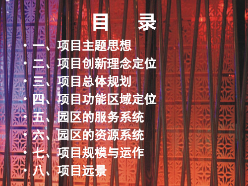
• 规模宏大的“中国上海北外滩希望创意园”, 致力 发展为世界一流的创意、研发、交流、展示中心。 将打造成中国的数码园区,是“未来城市”的发展 蓝图。
项目创新理念定位
二
•
“中国北外滩创意园区”的规划和灵感来自国际著名的社区,即有硅谷执著于科技创新和企业精
神,又有左岸散发着浓烈的艺术学术气息。同时顺应全球健康产业的发展方向,把著名高等学府和
各类科研试验区,丰富的人文资源,强大的创意和学术知识背景,使其成为具有极高商业价值和广
阔商业空间的全新创意园区。
• 不同功能区,各具风情,涵盖工作与生活的每个方面,可以满足知识工作者,创业、学习、生活、交 流、分享、洽谈合作、休闲娱乐等不同层次人士的需求,成为激发灵感火花,补充知识能量的创想空 间站。
项目功能区域定位
四
“希望创意工作区”是整个“中国上海北外滩希望创意园”的神经中枢。 “希望创意 工作区”的智能化办公楼将汇集国内外高科技企业的研发部门、设计创意中心和服 务中心。大学、科研机构、创业小公司、风险投资基金、现代服务业企业以它为中 心,形成网络,层层互动。其影响力更可以辐射到整个上海甚至到更广阔的范围。
目录
• 一、项目主题思想 • 二、项目创新理念定位 • 三、项目总体规划 • 四、项目功能区域定位 • 五、园区的服务系统 • 六、园区的资源系统 • 七、项目规模与运作 • 八、项目远景
项目主题思想
一
• 21世纪是人类社会已经步入一个全新思维的无限创 意的新领域。“中国上海北外滩希望创意园”将汇 集中国上海乃至世界的勇于创新、勇于创造、勇于 创业的新人物、新企业,并成为未来创造中国与世 界经济奇迹的领导人物。
上海2030市区规划图
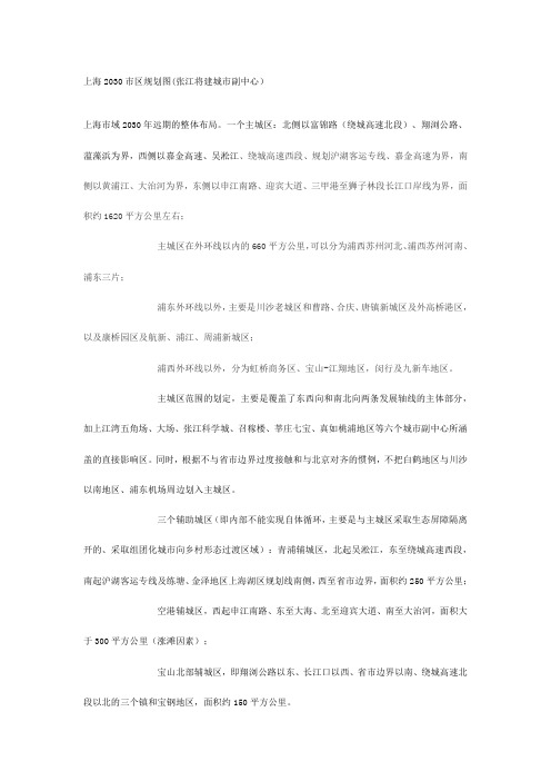
上海2030市区规划图(张江将建城市副中心)上海市域2030年远期的整体布局。
一个主城区:北侧以富锦路(绕城高速北段)、翔浏公路、蕰藻浜为界,西侧以嘉金高速、吴淞江、绕城高速西段、规划沪湖客运专线、嘉金高速为界,南侧以黄浦江、大治河为界,东侧以申江南路、迎宾大道、三甲港至狮子林段长江口岸线为界,面积约1620平方公里左右;主城区在外环线以内的660平方公里,可以分为浦西苏州河北、浦西苏州河南、浦东三片;浦东外环线以外,主要是川沙老城区和曹路、合庆、唐镇新城区及外高桥港区,以及康桥园区及航新、浦江、周浦新城区;浦西外环线以外,分为虹桥商务区、宝山-江翔地区,闵行及九新车地区。
主城区范围的划定,主要是覆盖了东西向和南北向两条发展轴线的主体部分,加上江湾五角场、大场、张江科学城、召稼楼、莘庄七宝、真如桃浦地区等六个城市副中心所涵盖的直接影响区。
同时,根据不与省市边界过度接触和与北京对齐的惯例,不把白鹤地区与川沙以南地区、浦东机场周边划入主城区。
三个辅助城区(即内部不能实现自体循环,主要是与主城区采取生态屏障隔离开的、采取组团化城市向乡村形态过渡区域):青浦辅城区,北起吴淞江,东至绕城高速西段,南起沪湖客运专线及练塘、金泽地区上海湖区规划线南侧,西至省市边界,面积约250平方公里;空港辅城区,西起申江南路、东至大海、北至迎宾大道、南至大治河,面积大于300平方公里(涨滩因素);宝山北部辅城区,即翔浏公路以东、长江口以西、省市边界以南、绕城高速北段以北的三个镇和宝钢地区,面积约150平方公里。
三个支撑性的重点新城:南汇、松江、嘉定。
南汇新城除了东海湖工程区域向东不断拓展以外,向西拓展到海港综合开发区西侧的洪庙附近,向北包括大团地区,拓展到大治河一线,远期约450平方公里以上;嘉定新城向西、向北与昆山太仓两地连为一体,面积在280平方公里;松江新城向南拓展到黄浦江,西南的新浜和石湖荡地区与上海湖区联动发展,面积在300平方公里左右。
上海北外滩CBD的新地标中信广场项目简介

效果图
4200
4500
3.2 创新设计-平面和空间
U型平面布局,提供了至高的办公效率
- 单层约2304-2641M2,进深约13M-15M,位于 现代甲级写字楼领先水平 - 专为金融企业所设计的承重要求,梯次变化, 指定区域承重可达1吨/平米
效果图
入口大堂采用编网设计 营造半通透的空间、放大视觉感
3.5 其他--灯光系统
采用多层次的照明设 计,在每个立面上营 造主题式灯光效果, 演绎备受瞩目的地标 性灯光景致
效果图 效果图
3.6 优秀保护建筑-虹口大楼
-百年历史,倍显尊贵,品味独特 -设计理念:两个世纪历史的对话,和活力 街区交相辉映 -适合高端行业:银行、奢侈品、餐厅等
效果图
2. 高标准国际团队
项目战略顾问: 麦肯锡 方案设计: 日建设计 市场顾问: 仲量联行 项目施工: 上海建工集团
2.1 麦肯锡的战略定位
北外滩的地位: 1、改造后的北外滩对于上海将有如纽约的曼哈顿,香港的中环,巴黎
的LaDefence。 2、北外滩将跟外滩、陆家嘴形成上海新地标!
目录
1. 项目概况
概况/区位/交通/保护建筑
2. 国际团队
麦肯锡/日建设计/仲量联行/建工集团
3. 创新设计
立面/平面和空间/设备/装修/活力街区Living Style Mall
4. 项目前景
北外滩CBD/地标建筑/未来市场地位
1.中信广场-概况
占地面积: 约 1.6万平方米 总建筑面积: 约 15万平方米
让写字楼空间不再压抑
-4-38层层高约4.2M, 净高约2.8M
同济:上海北外滩地区地下空间规划(101页)1
161.6万m3 (折合40.4万m2 ) 9.6万m3 16.2万m3 19.2万m3 17.6万m3 (折合2.13万m2 ) (折合4.63万m2 ) (折合4.8万m2 ) (折合8.8万m2 )
考虑地下空间综合的需求,北外滩地区地下空间开发利用的总需 求量为270万m3,开发强度的20.6%
2006年12月
二、规划总则
规划依据
•《上海北外滩地区控制性详细规划》 •《上海市城市地下空间概念规划》 •《中华人民共和国城市规划法》 •《城市规划编制办法》1991年 •《城市地下空间开发利用管理规定》
•《城市道路交通规划设计规范》GB50220-95)
•《停车场规划设计规则》(试行) •《城市工程管线综合规划规范》(GB50289-98) •《城市用地竖向规划规范》(GJJ83-99)
一、现状资源及背景分析
保护建筑分布
北外滩很多建筑被列入上海市保护和优秀近代建筑。如沿江的俄罗斯领 事馆、上海大厦、浦江饭店和提蓝桥风貌保护区
2006年12月
一、现状资源及背景分析
轨道交通设施图
规划区域内的地铁有:12号线和4号线,及一条沿江轨道交通线。其中12号 线在规划区域内设站2座——旅顺路站和公平路站, 4号线杨树浦路站,沿江线 设外白渡桥站、新建路站、提篮桥站、杨树浦路站(属杨浦区)4座车站。
二、规划总则
总体目标
城市地下空间作为城市空间的重要组成部分,保障集约利用的各种城市 功能正常运转,提供安全、舒适、多样、可达的交通环境,改善滨水景观环 境品质,强化北外滩在区域中的战略地位。
2006年12月
三、需求预测
地下空间资源供给
北外滩地区地下空间近期的开发较为适宜的深度范围控制在0~-20m。远期
EDAW:上海北外滩开放空间规划
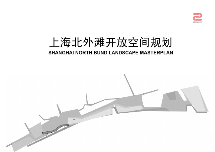
TRAFFIC INFRASTRACTURE 交通设施分析
北外滩沿江公共空间规划
SHANGHAI NORTH BUND LANDSCAPE MASTERPLAN
CONTEXT
OPEN SPACE 区域开放空间
北外滩沿江公共空间规划
SHANGHAI NORTH BUND LANDSCAPE MASTERPLAN
区域级
•与外滩和陆家嘴金融区直接联系 •与区域交通系统包括地铁和轻轨联系紧密 •非常重要的历史性片区包括犹太人居住地
外滩 South Bund
北外滩 North Bund
陆家嘴 LuJiaZui District
上海中心地区 Heart Of Shanghai
上海北外滩开放空间规划
SHANGHAI NORTH BUND LANDSCAPE MASTERPLAN
上海北外滩开放空间规划
SHANGHAI NORTH BUND LANDSCAPE MASTERPLAN
CASE STUDIES
SITE ANALYSIS 场地分析
1.远洋大厦 Cosco Tower
6.现状老饭店 Existing old hotel
7.原犹太人居住区 Existing jewish residential
本次规划地段通过花园桥(外摆渡桥)与外滩和黄浦江相联,在早期上海的发展过程 中扮演过重要角色。最早出现在1863年的美国区划部分被兼并融合成为国际化移民区。 随后一些年,它成为各种文化包括日本、俄国和犹太人避难所的寄主。
黄浦江的历史演变 History of Huang Pu River
今天,上海市政府为了寻求加强其作为世界级滨水城市的声誉,北外滩将被复兴以恢 复其旧日的辉煌。
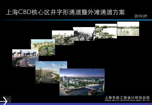
上海CBD核心区井字形通道规划暨外滩通道方案
6层 5层 8层
6层
4层
8.1
6、外白渡桥加固
外白渡桥始建于1907年, 为两孔52.178m的简支下承式钢桁架桥, 由英国制造运至现场安装。原设计荷载为英制 H—15级(合我国汽— 11.3级)。原设计寿命仅为50年。
移桥方案
盾构推进前,用驳船将上部 结构移开并运至船厂进行局 部杆件及节点更换,将原砼 桥面板更换为钢桥面板。
P
P
TRAFFIC
外滩通道功能定位
外滩通道
分离外滩过境交通, 承担部分到发交通, 服务中小型客车。 兰牌照车,限高3.0m
地面道路
服务到发交通和公交, 部分临时停车功能。
TRAFFIC
BUS BUS
P
P
TRAFFIC
OPENSPACE
总体布置
外滩通道南起中山东二路老太平路北至吴淞路海宁路全长3290.58m, 设延安路匝道连接延安路高架和外滩地区,设东长治路匝道连接北外滩地区。
中高档居 住区
航运商贸区 航运服务、滨江休闲带
新兴知识商务区 四川北路商业区
外滩风貌延伸区 老城厢地区
十六铺水上旅游中心 董家渡现代聚居区
井字形通道是适应CBD地区 发展,加强区域内部交通联系,提 高交通辐射能力的道路系统优化方 案总称。
井字形通道利用现有城市路 网,通过兴建全封闭或半封闭的专 用通道及越江隧道,在核心区构建 一体化交通,分离过境交通,便捷 到发交通。
浅覆土路段长,江滩土沉积成分复杂,尚不稳定 盾构穿越苏州河、上穿运营中的地铁2号线、穿越
外白渡桥桩基群 隧道上浮,盾构推进与道路结构同步施工
大直径土压平衡盾构D=14.27m
4、穿越延安路隧道节点
上海北外滩区航运集聚区环境污染坊治规划与建议

2 北 外滩 区域环境质量 现状调研
【 文 章 编 号】
2 . 1 实 地调 研 分析
1 6 7 4 一 : 2 5 0 8( 2 0 l 4 ) 1 5 — 0 0 8 l 一 0 5
以北 外 滩 区域 环 境 质量 评价 指 标 体 系 为 l 中 图分 类 号】X 3 2 1
决策为指导, 通过现场调研及问卷调查的方法 收集原始数据, 探寻对北外滩航运 和金融服务 集聚区发展影响显著 的关键 因素。 并提 出北外 滩区域环境改善的措施, 为北外滩规 划建设提
供 参考。
【 关键 词】北外滩 航 运服务集聚 区
综合水平及国际竞争力起 到重要的支撑作 用
( 见图1 )。
业, 特别是外贸进出口货物和散货运输的重要
操作 场 所 , 位于 外 虹桥 的 国际客 运站 是 上海 唯
一
通过 资料查阅及北外滩地 区环境的实地 学环境科学与工பைடு நூலகம்学院
女, 硕士, 松 江 区规 划 和 调研, 对 北 外滩 地 区环 境 状 况 的初 步 认识 。 以 吕 田天 ,
的 国际客 运码 头 。 随着虹 口区航 运 服 务业 的
环境污染防治规 划建议
图1北外滩航运和 金融服务集聚区示意图
1 导
言
上海 市北 外滩 位于 虹 口区 , 地 处 黄浦江 城 区转 折处 , 是 上 海历史 上 的航 运 发祥 地 之一 。 北外 滩航 运 和金 融 服务 集聚 区东起 大 连 路 , 南 邻黄浦江 和苏州河 , 西抵 吴淞 路 , 北 临周家嘴路
指导 , 以问卷调研、 实地走访等方式, 从环境
【 文 献 标 识码 】A
( 见图1 ) , 规划面积共3 . 0 3 k m , 占虹口区土地面
国际十大景观设计公司

国际十大景观设计公司1、SWA景观SWA于1957年创立,分支机构遍布美国各地。
项目围遍与全球五十多个不同国家,专业项目获得超过五百多个不同的奖项。
他们也在中国做过很多项目。
湖滨湖泊重建、金融街景观设计、保利国际广场景观设计、生态复建小区、台北光宝集团总部总体规划.swagroup.公司地址:市静安区西路993号锦江向阳大楼14楼V10室2、AE景观(原易道景观EDAW)EDAW(易道)于1939年建立于美国加州,是全球最大的景观设计和规划公司。
半个多世纪的历史成就了易道在城市设计、景观建筑、环境生态和经济规划领域的主导地位。
公司在全球设有26家办公室,拥有1,2000多名专业人士,在亚洲,包括、、、、,以与新加坡均设有办公室。
2005年12月,美国500强设计咨询顾问公司AE并购易道,合并后易道继续沿用其公司原名,作为AE旗下的运营公司开展业务。
AE在全球设计服务、交通规划、建筑施工、污水处理、教育设施、海事工程、供水市场中排名第一,总体排名第三。
AE景观荣获园境师学会年度大赛三项大奖2010年11月24日18:31美通社2010年11月24日电/美通社亚洲/ -- AE宣布公司于近日在园境师学会(HKILA)举行的年度园境设计大赛中荣获三项优秀大奖。
颁奖仪式在参加者众多的园境师学会第22届年度晚宴上同步举行。
AE的西九龙高速铁路和公共交通换乘站项目荣获园境建筑概念优秀设计奖。
设计团队为该高端项目所提出的方案围绕城市密集人流区域中的绿色景观展开,通过一连串由屋顶花园、城市绿地和开放空间组成的纽带来实现这一设计目标。
位于大角咀樱桃街38号的海桃湾获得了园境建筑设计项目奖。
AE的项目团队以垂直景观之概念,为该住宅项目量身打造了一系列犹如漂浮于架空层上的天际景观花园平台。
最终成型的璀璨空间效果为物业的整体景观增添了动感的一笔。
由AE主持设计的XX生态城滨水项目获得优秀园境规划与研究奖。
专为此生态都市项目而制定的总体规划力图通过多种创新措施来还原应有的生态质量,同时构造不同的微环境和多样的绿色走廊。
北外滩发展个人总结报告

北外滩发展个人总结报告
北外滩是上海的重点发展区域之一,经过近几年的规划和建设,已经成为了一个兼具商业、文化、旅游、居住等多种功能的综合性城市中心。
下面是我的个人总结报告:
一、地理位置优越。
北外滩地处黄浦江畔,毗邻外滩、南京东路等知名景点和商圈,交通便利,拥有着得天独厚的地理位置优势。
二、多样化的功能布局。
北外滩不仅有众多的豪华酒店、商务办公楼、高端住宅等商业和居住设施,还有多处公共文化设施,如北外滩文化中心、上海未来艺术馆等,具有拓展文化艺术交流的功能。
三、公共配套完善。
北外滩拥有完善的基础设施配套,近年来不断推进城市更新和改造升级,交通、路网、饮用水、空气等公共设施得到了有效的改善和提升,为居民提供更加优质的生活品质。
四、投资环境良好。
北外滩地处商业繁华带,拥有着强劲的经济实力和投资活力,政府对于该区域的资金、政策和支持力度十分大,为企业和投资者提供了广阔的发展空间和机会。
总之,北外滩的发展潜力巨大,其高端化、多样化的综合功能,良好的地理位置和配套设施,以及优秀的投资环境,将为该区域带来更多的商业机会和经济增长点。
上海北外滩区域控制性详细规划

上海北外滩区域控制性详细规划摘要本文档旨在对上海北外滩区域进行控制性详细规划,以促进地区的可持续发展和提升居民生活质量。
规划重点包括基础设施建设、城市交通规划、环境保护与绿化、文化和旅游资源开发等方面。
通过合理规划和有序发展,我们将为北外滩区域带来更加美好的未来。
1. 引言北外滩区域作为上海市重要的经济、文化和旅游中心之一,其发展对于整个城市具有重要意义。
本次规划的目标是为北外滩区域的发展提供指导,促进经济增长与生态环境的协调发展,同时提升居民的生活品质。
本文将分析北外滩区域的现状,并根据地区特点提出相应的规划措施。
2. 基础设施建设为了满足日益增长的人口和经济需求,北外滩区域需要加强基础设施建设。
我们将着重在水、电、气、通信等方面进行投资,以提高供给水平和可靠性。
此外,我们还将加大对教育、医疗、娱乐等公共服务设施的建设力度,为居民提供更好的生活条件。
3. 城市交通规划城市交通是区域发展的重要支撑,我们将着眼于解决北外滩区域的交通拥堵问题。
在交通规划方面,我们将引入轨道交通,并提升公共交通的覆盖率和便捷性。
同时,我们还将加强道路网络的建设,提升道路通行能力。
此外,我们将推动自行车道的建设,鼓励居民采用环保出行方式。
4. 环境保护与绿化为了保护北外滩区域的生态环境,我们将加强环境保护工作。
具体措施包括严格控制污染排放、加强垃圾分类与处理、推广可再生能源利用等。
同时,我们还将增加绿化覆盖面积,建设更多的公园和绿地,为居民提供良好的休闲空间。
5. 文化和旅游资源开发北外滩区域拥有丰富的文化和旅游资源,我们将充分挖掘其潜力,打造独具特色的文化旅游品牌。
我们计划在区域内建设文化艺术中心、博物馆等文化设施,并推出精品旅游线路,吸引更多的游客前来观光和体验。
6. 结论通过本次详细规划,我们将为上海北外滩区域的发展指明方向,营造良好的环境和条件。
我们将加强基础设施建设、改善交通状况、保护环境、开发文化旅游资源等方面的工作,为北外滩区域带来更加繁荣和宜居的未来。
上海北外滩地区步行系统规划与设计方案-赵建新

3、步行系统构成要素:
步行系统是城市系统和城
市交通系统的交 集 ,除 担负 一 定的通勤交通的功能外,还提 供市民休闲、锻炼、购物、娱 乐等多种功能。城市步行系统 的构成要素较多,根据功能作 用的不同,可以分为步行通道 设施、步行辅助设施、服务设 施、环境设施。
环境设施
绿化
步 行 系 统
弱势人群辅助设施
上海北外滩地区立体步行系统
规划与设计方案
主讲人:赵建新
上海市政工程设计研究总院(集团)有限公司
SHANGHAI MUNICIPAL ENGINEERING DESIGN INSTITUTE (GROUP) CO.,LTD.
2015年2月12日
立体步行系统
天桥、隧道、连廊
人性化、安全舒适
枢纽、商务、广场
步行辅助设施
信息交流设施 安全辅助设施 休憩设施
服务设施
商业服务设施 环境景观小品
步行系统构成要素
上海市政工程设计研究总院(集团)有限公司
SHANGHAI MUNICIPAL ENGINEERING DESIGN INSTITUTE (GROUP) CO.,LTD.
上海北外滩地区立体步行系统规划与设计方案
努力营造安全、舒适、美观的步行
空间。
上海市政工程设计研究总院(集团)有限公司
SHANGHAI MUNICIPAL ENGINEERING DESIGN INSTITUTE (GROUP) CO.,LTD.
上海北外滩地区立体步行系统规划与设计方案
陆家嘴中心区二层步行连廊系统
二、发展情况
天桥连廊采用变高度连续钢箱梁结构,3~4跨为一 联,使连廊整体立面线型更为流畅,桥梁外形轻巧, 结构安全。 桩基采用对周围影响较小的 φ800 钻孔灌注桩,减 少施工对周边环境的影响。
虹口区北外滩历史区域空间分析

复兴时期
重建的新与旧
功能的发展与改 变
区域演变
最初修筑于1848年。始 于美国租界初建。 整个上海苏州河北部是 以此为原点发展起来的。旧 历史建筑 称文监师路。 沿路多为里弄住宅、历 史建筑。 老建筑:救主堂、文纪 历史街道 女校、同仁医局等。
里弄建筑
塘沽路
近期规划
区域演变
历史建筑
历史街道
里弄建筑 塘沽路
里弄建筑 塘沽路
长治路
大名路
近期规划
区域演变
历史建筑
余杭路
历史街道
里弄建筑 塘沽路
近期规划
长治路 旧称东有恒路。沿途多名 人故居和旧式里弄建筑。 大名路 里弄春阳里等,保存多完 好。 沿途有各类商店近百家。
区域演变
历史建筑
溧阳路余杭路
1893年后,美国越界筑路,狄思 威路即是其中的一条,后擅自延伸, 长治路 至四川北路。是交通要道。 里弄建筑 沿路建筑主要是旧式里弄和仓库 堆栈。如:老船坞弄、仓库、茂泰洋 塘沽路 行堆栈、中和洋行仓库、寅余五金栈、 近期规划 惠利运输行第三堆栈、立大煤栈等规划,依托滨水环境的沿 江绿化,结合整个虹口历史建筑保护区的历史建筑面貌保护。
区域演变
航运商业
1、着力培育航运市场服务、进出口物流服务和国际客运服务等三 历史建筑 大功能。 2、大力发展航运交易、货代、船代、物流服务;航运中介、金融、 保险、海事服务和国际客运、邮船、游艇、旅游服务。 3、邮轮经济是上海建设国际航运中心的重要组成部分。北外滩黄 近期规划 浦江具有航道深、岸线长、地处城市中心等独特优势,是国际邮轮 产业集聚的最佳选择。 缺陷:配套的社会公共设施和居住区建设不能跟上商业建设的步伐, 区域规划 大量老住宅老里弄无法满足现代化的商业区的消费门槛。
上海北外滩片区控制性详细规划

上海北外滩片区控制性详细规划一、背景介绍北外滩位于上海市的黄浦江畔,是一片具有丰富历史文化底蕴和城市发展潜力的区域。
为了保护和发展北外滩片区的独特魅力,上海市制定了本控制性详细规划,以规划和指导相关建设项目,实现区域内的可持续发展。
二、目标和原则本规划的目标是打造一个以文化、商业和居住为主的现代化区域,提升北外滩的形象和功能。
在规划和设计过程中,我们遵循以下原则:1. 体现历史文化保留和修复原有的历史建筑和文化遗产,通过合理的布局和设计,展示北外滩的历史魅力和文化底蕴。
2. 持续发展和创新充分利用现代科技和创新思维,不断探索新的商业、文化和居住模式,推动北外滩持续发展,并为居民和游客提供更好的生活和体验。
3. 环保和可持续性在建设过程中,注重环境保护和生态平衡,推动资源的合理利用和循环利用,打造一个绿色可持续发展的北外滩。
三、规划内容1. 功能划分根据区域特点和使用需求,将北外滩划分为不同功能区,包括商业区、文化区、居住区和公共空间等。
商业区商业区位于北外滩的核心地段,主要规划高档购物中心、餐饮娱乐场所和办公楼等,为居民和游客提供丰富多样的商业服务和消费体验。
文化区文化区中心围绕历史建筑和文化遗产展开,规划了博物馆、艺术中心和演艺场所等,致力于保护和传承北外滩的历史文化,同时丰富居民和游客的文化生活。
居住区居住区规划了高品质住宅、公寓和服务设施,为居民提供舒适宜居的居住环境,并配备绿地、健身设施等公共空间,增加居民的生活品质。
公共空间为了提供良好的城市公共环境,规划了公园、步行街和景观广场等公共空间,为居民和游客提供休闲娱乐和社交交流的场所。
2. 建筑高度和体量控制为了保护北外滩的景观特色和城市整体形象,规划中设置了建筑高度和体量的控制要求,确保建设项目与周边环境相协调。
3. 交通规划在交通规划上,注重提升北外滩的交通便利性和可达性。
规划中考虑了公交、地铁和步行等多种交通方式,并设置了交通枢纽和停车设施,方便居民和游客出行。
上海北外滩地带控制性详细规划

上海北外滩地带控制性详细规划概述本文档旨在对上海北外滩地带进行控制性详细规划,以实现该区域的合理开发和改善。
该规划将包括土地利用、建筑高度、交通规划、绿化空间等方面的具体规划措施。
土地利用规划在上海北外滩地带的土地利用规划中,将注重提高土地的综合利用效益,确保最大化地满足人们的需求。
首先,将划分出不同用途的土地,包括商业、居住、办公等。
其次,将合理安排不同类型用地的比例,以确保区域内的城市功能得到平衡发展。
建筑高度规划为保护和凸显北外滩地带的独特性,建筑高度规划将非常重要。
高度规划将按照景观和人居环境的需要进行,同时注重保护并提升历史建筑的特色。
高度限制将根据区域特点和城市发展需要进行设定,并严格执行。
交通规划为解决北外滩地带的交通拥堵问题,交通规划将投入重点考虑。
规划中将优先考虑公共交通,并提供便捷的地铁、公交等交通工具,以减少私家车的使用。
同时还将建设便捷的步行和自行车通道,鼓励环保出行方式。
绿化空间规划绿化空间是城市发展中不可或缺的一部分,北外滩地带也将注重绿化空间的规划和建设。
规划中将建立大面积的公园和绿地,提供居民休闲活动的场所。
同时,将保留并修复现有的绿化景观,并增加植物种类的多样性。
建筑风格与文化注重北外滩地带是上海历史文化的重要区域,因此在规划中将注重保留和凸显其独特的建筑风格和文化特色。
建筑风格将与周边环境相协调,注重保护历史建筑和文化遗产,并鼓励新建建筑与传统建筑相结合。
结论通过上海北外滩地带的控制性详细规划,我们将实现该区域的合理开发和改善目标。
土地利用规划、建筑高度规划、交通规划、绿化空间规划以及建筑风格与文化保护等措施将有助于打造一个宜居、宜游、宜业的区域,提升市民的生活质量和城市形象。
参考文献暂无。
- 1、下载文档前请自行甄别文档内容的完整性,平台不提供额外的编辑、内容补充、找答案等附加服务。
- 2、"仅部分预览"的文档,不可在线预览部分如存在完整性等问题,可反馈申请退款(可完整预览的文档不适用该条件!)。
- 3、如文档侵犯您的权益,请联系客服反馈,我们会尽快为您处理(人工客服工作时间:9:00-18:30)。
EXISTING RIVER EDGE 现状水岸分析
北外滩沿江公共空间规划
SHANGHAI NORTH BUND LANDSCAPE MASTERPLAN
SITE ANALYSIS
EXISTING SECTION 现状剖面示意
北外滩沿江公共空间规划
SHANGHAI NORTH BUND LANDSCAPE MASTERPLAN
煤城海港,范库佛峰
•范库佛峰位于北美洲南部。煤城海港是所有远方旅游者到范库佛峰的重要通道。在海港边,这 个国际性巡航终点站有如下特色: •具有综合性的设施,包括混合性公建和私人住宅. •海港设施包括办公搂,旅店,零售,娱乐与码头休闲设施. •4公顷线型滨水公园. •海滩作为公共开放空间-在巡游期间,海滩的一部分可以关闭,作为服务区.
CONTEXT
TRAFFIC INFRASTRACTURE 交通设施分析
北外滩沿江公共空间规划
SHANGHAI NORTH BUND LANDSCAPE MASTERPLAN
CONTEXT
OPEN SPACE 区域开放空间
北外滩沿江公共空间规划
SHANGHAI NORTH BUND LANDSCAPE MASTERPLAN
Whilst shanghai is a city looking toward the future one can still sense the continuity of life from an earlier age when east and west coexisted within a truly cosmopolitan city. Nowhere is this more evident than along Zhongshan Road East (or The Bund). The styles of architecture are clearly imported – the clock tower, domes and columns signifying the British imperial presence. Even the name of the foreshore is a reflection of that influence (“Bund” being an Anglo-Indian word meaning embankment of quay).
SITE ANALYSIS
VISION 项目展望
上海中心地区 Heart Of Shanghai
国家级
•与国家级铁路,航空和道路网联系紧密 •距浦东国际机场有40分钟路程 •国际型滨水项目的里程碑
上海北外滩开放空间规划
•SHANGHAI NORTH BUND LANDSCAPE MASTERPLAN
•CONTEXT
REGIONAL
•Direct relationship with The Bund and LuJiaZui financial district •Strong connection to regional circulation system including subway and tram. •Significant historical precincts including Jewish Settlement
CONTEXT
CONSERVATION 历史建筑保护
北外滩沿江公共空间规划
SHANGHAI NORTH BUND LANDSCAPE MASTERPLAN
CONTEXT
CASE STUDY 案例分析
Circular Quay – Sydney, Australia
Circular Quay houses international and local ferry terminals within a highly urbanized environment. Key features include: •Direct link to the historic “Rocks” precinct (original settler settlement). •Direct ocean access through Sydney Harbour •Active edges including hotels, restaurants and commercial precincts. •Wide pedestrian promenades along the entire length.
Linked to The Bund vipu River, the study site played a key role during the early development of Shanghai. Originally part of the American zone it was merged in 1863 to form the International Settlement. Over the ensuing years it played host to a range of cultures including Japanese, Russian and Jewish refugees. Today, as the Shanghai government seeks to reinforce its reputation as a truly worldclass waterfront city the North Bund offers a remarkable opportunity to shape the future of the city and provide a new image for the city.
CONTEXT
LAND USE 土地利用分析
北外滩沿江公共空间规划
SHANGHAI NORTH BUND LANDSCAPE MASTERPLAN
CONTEXT
CIRCULATION 交通流线分析
北外滩沿江公共空间规划
SHANGHAI NORTH BUND LANDSCAPE MASTERPLAN
上海北外滩开放空间规划
SHANGHAI NORTH BUND LANDSCAPE MASTERPLAN
NTRODUCTION
CONTEXT 背景
NATIONAL
•Strong connection to national rail, air and road network •40 min from Pudong International Airport •Landmark international waterfront project.
本次规划地段通过花园桥(外摆渡桥)与外滩和黄浦江相联,在早期上海的发展过程 中扮演过重要角色。最早出现在1863年的美国区划部分被兼并融合成为国际化移民区。 随后一些年,它成为各种文化包括日本、俄国和犹太人避难所的寄主。
黄浦江的历史演变 History of Huang Pu River
今天,上海市政府为了寻求加强其作为世界级滨水城市的声誉,北外滩将被复兴以恢 复其旧日的辉煌。
北外滩沿江公共空间规划
SHANGHAI NORTH BUND LANDSCAPE MASTERPLAN
SITE ANALYSIS
EXISTING CIRCULATION 现状交通分析
北外滩沿江公共空间规划
SHANGHAI NORTH BUND LANDSCAPE MASTERPLAN
SITE ANALYSIS
上海北外滩开放空间规划
SHANGHAI NORTH BUND LANDSCAPE MASTERPLAN
CASE STUDIES
SITE ANALYSIS 场地分析
1.远洋大厦 Cosco Tower
6.现状老饭店 Existing old hotel
7.原犹太人居住区 Existing jewish residential
区域级
•与外滩和陆家嘴金融区直接联系 •与区域交通系统包括地铁和轻轨联系紧密 •非常重要的历史性片区包括犹太人居住地
外滩 South Bund
北District
上海中心地区 Heart Of Shanghai
上海北外滩开放空间规划
SHANGHAI NORTH BUND LANDSCAPE MASTERPLAN
前言
上海经过10年不同凡响的发展,已经成为中国皇冠上一颗闪亮的珍珠。如今,旅游者 可以感受到前沿的建筑形式穿透天际线的震撼,以及中国步入现代社会产生的活力和 冲击。
然而,在上海到处可以感受到从早期中西方并存在一个国际都市的生活的延续。中山 东路(或称外滩)就是最好的例证。建筑风格明显是外来的——钟塔,圆穹顶和柱式 风格是大不列颠英帝国的体现。甚至滨水岸的名称也受到影响(“外滩”一词是安哥拉—— 印第安语,意为渡口码头)。
EXISTING FACILITIES 现状设施分析
5.秦皇岛路轮渡 Qing huang dao road terminal
2.新外滩花苑 New bund garden
4.航运交易所 Ship trade exchange center
3.公平路轮渡 Gong ping road terminal
上海北外滩开放空间规划
SHANGHAI NORTH BUND LANDSCAPE MASTERPLAN
INTRODUCTION 简介
INTRODUCTION
Shanghai, the glittering jewel in China’s crown has enjoyed over a decade of phenomenal growth. Visitors today can admire a skyline punctuated by futuristic architectural forms and a hive of activity generated by China’s march into the modern era.
