测绘专业英语原文和部分翻译(1-39)
测绘专业英语翻译

目录1.3.3 Origin of Geomatics ..................................................................................错误!未定义书签。
2.3 Map projections地图投影 ..........................................................................错误!未定义书签。
2.4 Datums and coordinate system基准和坐标系统.......................................错误!未定义书签。
2.4.1 Horizontal and vertical datums水平基准和高程基准 ....................错误!未定义书签。
1.Horizontal datums水平基准..........................................................错误!未定义书签。
2.Vertical datum高程基准 ................................................................错误!未定义书签。
4.4 Trigonometric leveling三角高程.................................................................错误!未定义书签。
4.4.1 Instruments of trigonometric leveling三角高程测量仪器..............错误!未定义书签。
4.4.2 Principle of trigonometric leveling三角高程测量的原理 ...............错误!未定义书签。
测绘专业英语翻译

Uuit1 What is Geomatics? (什么是测绘学)Geomatics Defined(测绘学定义)Where does the word Geomatics come from?(Geomatics-测绘或地球空间信息学,这个名词是怎么来的呢?)GEODESY+GEOINFORMATICS=GEOMATICS or GEO- for earth and –MATICS for mathematical or GEO- for Geoscience and -MATICS for informatics. (大地测量学+地理信息学=GEOMATICS测绘学或者 geo代表地球,matics代表数学,或者 geo代表地球科学,matics 代表信息学)It has been said that geomatics is many things to many people.(据说测绘学这个词对不同的人有不同的理解)The term geomatics emerged first in Canada and as an academic discipline; it has been introduced worldwide in a number of institutes of higher education during the past few years, mostly by renaming what was previously called “geodesy” or “surveying”, and by adding a number of computer science- and/or GIS-oriented courses.(这个术语【term术语】作为一个学科【academic discipline学科】第一次形成【emerge】于加拿大;在过去的几年里被全世界的许多高等教育研究机构所熟知,通常是以前的“大地测量学”或“测量学”在引入了许多计算机科学和GIS方向【或“基于GIS”】的课程后重新命名的。
测绘专业英语原文和部分翻译(1-39)

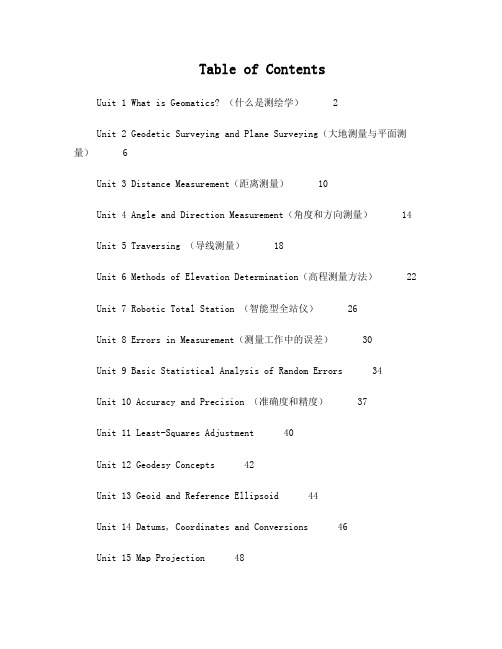
Table of ContentsUuit 1 What is Geomatics? (什么是测绘学) 2Unit 2 Geodetic Surveying and Plane Surveying(大地测量与平面测量) 6Unit 3 Distance Measurement(距离测量) 10Unit 4 Angle and Direction Measurement(角度和方向测量) 14Unit 5 Traversing (导线测量) 18Unit 6 Methods of Elevation Determination(高程测量方法) 22Unit 7 Robotic Total Station (智能型全站仪) 26Unit 8 Errors in Measurement(测量工作中的误差) 30Unit 9 Basic Statistical Analysis of Random Errors 34Unit 10 Accuracy and Precision (准确度和精度) 37Unit 11 Least-Squares Adjustment 40Unit 12 Geodesy Concepts 42Unit 13 Geoid and Reference Ellipsoid 44Unit 14 Datums, Coordinates and Conversions 46Unit 15 Map Projection 48Unit 16 Gravity Measurment 51Unit 17 Optimal Design of Geomatics Network 53Unit 18 Construction Layout (施工放样) 56Unit 19 Deformation Monitoring of Engineering Struvture 59Unit 20 Understan ding the GPS(认识 GPS) 62Uuit 21 Understanding the GPS (II) 认识 GPS(II) 65Unit 22 Competition in Space Orbit(太空轨道上的竞争) 68Unit 23 GIS Basics(GIS 的基础) 73Unit 24 Data Types and Models in GIS GIS中的数据类型和模型 79 Unit 25 Digital Terrain Modeling(数字地面模型) 83Unit 26 Applications of GIS 88Unit 27 Developments of photogrammetry 92Unit 28 Fundamentals of Remote Sensing (遥感的基础) 95Unit 29 Digital Image Processing and Its Applications in RS 99Unit 30 Airborne Laser Mapping Technology(机载激光测图技术) 104Unit 31 Interferometric SAR(InSAR) 108Unit 32 Brief Introduction toApplied Geophysics 110Unit 33 Origon of Induced Polarization 112Unit 34 International Geoscience Organization 115Unit 35 Prestigious Journals in Geomatics 118Unit 36 Relevant Surveying Instrument Companies 123Unit 37 Expression of Simple Equations and ScientificFormulsa 124Unit 38 Professional English Paper Writing 128Unit 39 Translation Techniques for EST 136Uuit 1 What is Geomatics? (什么是测绘学)Geomatics Defined(测绘学定义)Where does the word Geomatics come from?(Geomatics-测绘或地球空间信息学,这个名词是怎么来的呢?) GEODESY+GEOINFORMATICS=GEOMATICS or GEO- for earth and – MATICS for mathematical or GEO- for Geoscience and -MATICS for informatics. (大地测量学+地理信息学=GEOMATICS 测绘学或者geo 代表地球,matics 代表数学,或者 geo 代表地球科学,matics 代表信息学) It has been said that geomatics is many things to many people.(据说测绘学这个词对不同的人有不同的理解) The term geomatics emerged first in Canada and as an academic discipline; it has been introduced worldwide in a number of institutes of higher education during the past few years, mostly by renaming what was previously called “geodesy” or“surveying”, and by adding a number of computer scienceand/or GIS-oriented courses.(这个术语【term 术语】作为一个学科【academicdiscipline 学科】第一次形成【emerge】于加拿大;在过去的几年里被全世界的许多高等教育研究机构所熟知,通常是以前的“大地测量学” 或“测量学”在引入了许多计算机科学和 GIS 方向【或“基于GIS”】的课程后重新命名的。
测绘专业英语翻译

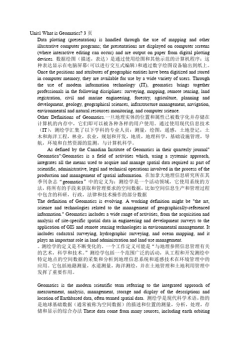
Unit1 What is Geomatics? 3页Data plotting (presentation) is handled through the use of mapping and other illustrative computer programs; the presentations are displayed on computer screens (where interactive editing can occur) and are output on paper from digital plotting devices. 数据绘图(描述,表达)是通过使用绘图和其他示范的计算机程序;这种表达显示在电脑屏幕(可以进行交互式编辑)和通过数字绘图设备输出到纸上。
Once the positions and attributes of geographic entities have been digitized and stored in computer memory, they are available for use by a wide variety of users. Through the use of modem information technology (IT), geomatics brings together professionals in the following disciplines: surveying, mapping, remote sensing, land registration, civil and marine engineering, forestry, agriculture, planning and development, geology, geographical sciences, infrastructure management, navigation, environmental and natural resources monitoring, and computer science.Other Definitions of Geomatics.一旦地理实体的位置和属性已被数字化并存储在计算机的内存中,它们即可以被各种各样的用户使用。
测绘专业英语中文翻译unit1

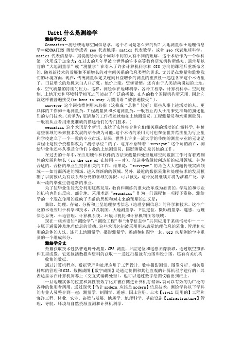
Uuit1什么是测绘学测绘学定义Geomatics-测绘或地球空间信息学,这个名词是怎么来的呢?大地测量学+地理信息学=GEOMATICS 测绘学或者geo 代表地球,matics 代表数学,或者geo 代表地球科学,matics 代表信息学。
据说测绘学这个词对不同的人有不同的理解。
这个术语作为一个学科第一次形成于加拿大;在过去的几年里被全世界的许多高等教育研究机构所熟知,通常是以前的“大地测量学”或“测量学”在引入了许多计算机科学和GIS 方向的课程后重新命名的。
随着新技术的发展和不断增长的对空间关系的信息类型的需求,尤其是在测量和监测我们的环境方面,现在,传统测量学定义连同日益增长的测量的重要性一起包含在这个术语里了。
日益增长的危机来自人口扩张,地价上涨,资源紧缩,还有由于人类活动引起的土地、水、空气质量的持续的压力。
这样,测绘学在地球科学,各种工程学,计算机科学,空间规划,土地开发和环境科学相互之间架起了广泛的桥梁。
在内的数个国际机构所采用,因此它就这样被普遍接受(be here to stay 习惯用语“被普遍接受”)。
surveyor 这个词按惯例用来总指(这换成“总称”较好)那些从事上述活动的人。
更具体的工作如土地测量员、工程测量员和水道测量员,一般被业内人士用来更准确的描述他们的专门技术。
(直译为:更清楚的工作描述就如如土地测量员、工程测量员和水道测量员,一般被从业者用来更准确的描述他们的专门技术。
)geomatics 这个术语是个新词,表达了实体集合和它们相关联的活动的自然科学,并使这些领域的未来技术发展的结合成为可能。
这个术语的采用同时也在全世界范围里为行业里和学校建立了一个一致的专业市场。
结果,世界上许多一流大学的传统的测量专业的无论是课程还是授予资格都改为“测绘学位”的了。
这并不意味着“surveyor”这个词的消亡,测绘毕业生还将从事适合他们专业的土地测量员、摄影测量员及其他的工作。
测绘工程专业英语课文全部翻译

Section 2 The Reliability of a Survey and Errors测量误差的可靠性Since every technique of measurement is subject to unavoidable error, surveyors must be aware of all sources and types of error and how they combine. If the accuracy of a measurement is defined as the nearness of that value to its true value (a quantity we can never know) then a surveyor must ensure that the techniques he chooses will produce a result that is sufficiently accurate. He must know, therefore, how accurate he needs to be, how to achieve this accuracy and how to check that the required accuracy has been achieved.由于每个测量技术是不可避免的误差,测量员必须知道的所有误差的来源和类型,以及它们是如何结合。
如果测量的准确性,其真正的值(我们可以永远不知道的数量)的接近程度,该值被定义为,然后测量员必须确保他选择的技术将产生一个结果,是足够精确的。
因此,他必须知道他需要的精度如何,如何实现这一目标的准确性和如何检查所要求的精度已经达到。
Accuracy requiredWhen surveying to produce a plan, the accuracy required is defined by the scale of the plot, since there should be no plottable error in the survey data. A good draughtsman can plot a length to within 0.25 mm and so, if a plan of an area is required at a scale of 1/1000, i.e., 1 mm on the plan represents 1 m on the ground, the smallest plottable distance is 0.25 m. Thus, for a survey at 1/1000 scale, all the measurements must be taken such that the relative positions of any point with respect to any other must be determined to 0.25 m or better.当测量一个平面时,精度通常是根据展图比例决定的,因为在绘图中不能有测量误差。
测绘工程专业英语翻译(1-8章)

测绘工程专业英语翻译Uuit1 What is Geomatics? (什么是测绘学) 2 Unit 2 Geodetic Surveying and Plane Surveying(大地测量与平面测量)7 Unit 3 Distance Measurement(距离测量)12 Unit 4 Angle and Direction Measurement(角度和方向测量)15 Unit 5 Traversing (导线测量)18 Unit 6 Methods of Elevation Determination(高程测量方法)22 Unit 7 Robotic Total Station (智能型全站仪)26 Unit8 Errors in Measurement(测量工作中的误差)30Uuit1 What is Geomatics? (什么是测绘学)Geomatics Defined(测绘学定义)Where does the word Geomatics come from?(Geomatics-测绘或地球空间信息学,这个名词是怎么来的呢?)GEODESY+GEOINFORMATICS=GEOMATICS or GEO- for earth and – MATICS for mathematical or GEO- for Geoscience and -MATICS for informatics. (大地测量学+地理信息学=GEOMATICS 测绘学或者geo 代表地球,matics 代表数学,或者geo 代表地球科学,matics 代表信息学)It has been said that geomatics is many things to many people.(据说测绘学这个词对不同的人有不同的理解)The term geomatics emerged first in Canada and as an academic discipline; it has been introduced worldwide in a number of institutes of higher education during the past few years, mostly by renaming what was previously called “geodesy” or “surveying”, and by adding a number of computer scienceand/or GIS-oriented courses.(这个术语【term 术语】作为一个学科【academic discipline 学科】第一次形成【emerge】于加拿大;在过去的几年里被全世界的许多高等教育研究机构所熟知,通常是以前的“大地测量学” 或“测量学”在引入了许多计算机科学和GIS 方向【或“基于GIS” 】的课程后重新命名的。
测绘工程专业英语课文全部翻译

Section 2 The Reliability of a Survey and Errors测量误差的可靠性Since every technique of measurement is subject to unavoidable error, surveyors must be aware of all sources and types of error and how they combine. If the accuracy of a measurement is defined as the nearness of that value to its true value (a quantity we can never know) then a surveyor must ensure that the techniques he chooses will produce a result that is sufficiently accurate. He must know, therefore, how accurate he needs to be, how to achieve this accuracy and how to check that the required accuracy has been achieved.由于每个测量技术是不可避免的误差,测量员必须知道的所有误差的来源和类型,以及它们是如何结合。
如果测量的准确性,其真正的值(我们可以永远不知道的数量)的接近程度,该值被定义为,然后测量员必须确保他选择的技术将产生一个结果,是足够精确的。
因此,他必须知道他需要的精度如何,如何实现这一目标的准确性和如何检查所要求的精度已经达到。
Accuracy requiredWhen surveying to produce a plan, the accuracy required is defined by the scale of the plot, since there should be no plottable error in the survey data. A good draughtsman can plot a length to within 0.25 mm and so, if a plan of an area is required at a scale of 1/1000, i.e., 1 mm on the plan represents 1 m on the ground, the smallest plottable distance is 0.25 m. Thus, for a survey at 1/1000 scale, all the measurements must be taken such that the relative positions of any point with respect to any other must be determined to 0.25 m or better.当测量一个平面时,精度通常是根据展图比例决定的,因为在绘图中不能有测量误差。
- 1、下载文档前请自行甄别文档内容的完整性,平台不提供额外的编辑、内容补充、找答案等附加服务。
- 2、"仅部分预览"的文档,不可在线预览部分如存在完整性等问题,可反馈申请退款(可完整预览的文档不适用该条件!)。
- 3、如文档侵犯您的权益,请联系客服反馈,我们会尽快为您处理(人工客服工作时间:9:00-18:30)。
Table of ContentsUuit 1 What is Geomatics? (什么是测绘学) (2)Unit 2 Geodetic Surveying and Plane Surveying(大地测量与平面测量) (6)Unit 3 Distance Measurement(距离测量) (10)Unit 4 Angle and Direction Measurement(角度和方向测量) (14)Unit 5 Traversing (导线测量) (17)Unit 6 Methods of Elevation Determination(高程测量方法) (21)Unit 7 Robotic Total Station (智能型全站仪) (25)Unit 8 Errors in Measurement(测量工作中的误差) (29)Unit 9 Basic Statistical Analysis of Random Errors (32)Unit 10 Accuracy and Precision (准确度和精度) (35)Unit 11 Least-Squares Adjustment (38)Unit 12 Geodesy Concepts (40)Unit 13 Geoid and Reference Ellipsoid (42)Unit 14 Datums, Coordinates and Conversions (44)Unit 15 Map Projection (46)Unit 16 Gravity Measurment (48)Unit 17 Optimal Design of Geomatics Network (50)Unit 18 Construction Layout (施工放样) (53)Unit 19 Deformation Monitoring of Engineering Struvture (56)Unit 20 Understan ding the GPS(认识GPS) (59)Uuit 21 Understanding the GPS (II) 认识GPS(II) (62)Unit 22 Competition in Space Orbit(太空轨道上的竞争) (64)Unit 23 GIS Basics(GIS 的基础) (69)Unit 24 Data Types and Models in GIS GIS中的数据类型和模型 (75)Unit 25 Digital Terrain Modeling(数字地面模型) (79)Unit 26 Applications of GIS (83)Unit 27 Developments of photogrammetry (87)Unit 28 Fundamentals of Remote Sensing (遥感的基础) (90)Unit 29 Digital Image Processing and Its Applications in RS (94)Unit 30 Airborne Laser Mapping Technology(机载激光测图技术) (99)Unit 31 Interferometric SAR(InSAR) (102)Unit 32 Brief Introduction toApplied Geophysics (104)Unit 33 Origon of Induced Polarization (105)Unit 34 International Geoscience Organization (108)Unit 35 Prestigious Journals in Geomatics (110)Unit 36 Relevant Surveying Instrument Companies (115)Unit 37 Expression of Simple Equations and Scientific Formulsa (116)Unit 38 Professional English Paper Writing (119)Unit 39 Translation Techniques for EST (127)Uuit 1 What is Geomatics? (什么是测绘学)Geomatics Defined(测绘学定义)Where does the word Geomatics come from?(Geomatics-测绘或地球空间信息学,这个名词是怎么来的呢?)GEODESY+GEOINFORMATICS=GEOMA TICS or GEO- for earth and –MATICS for mathematical or GEO- for Geoscience and -MATICS for informatics. (大地测量学+地理信息学=GEOMATICS 测绘学或者geo 代表地球,matics 代表数学,或者geo 代表地球科学,matics 代表信息学)It has been said that geomatics is many things to many people.(据说测绘学这个词对不同的人有不同的理解)The term geomatics emerged first in Canada and as an academic discipline; it has been introduced worldwide in a number of institutes of higher education during the past few years, mostly by renaming what was previously called “geodesy” or “surveying”, and by adding a number of computer scienceand/or GIS-oriented courses.(这个术语【term 术语】作为一个学科【academic discipline 学科】第一次形成【emerge】于加拿大;在过去的几年里被全世界的许多高等教育研究机构所熟知,通常是以前的“大地测量学” 或“测量学”在引入了许多计算机科学和GIS 方向【或“基于GIS” 】的课程后重新命名的。
)Now the term includes the traditional surveying definition along with surveying steadily increased importance with the development of new technologies and the growing demand for a variety of spatially related types of information, particularly in measuring and monitoring our environment.(随着新技术的发展和不断增长的对空间关系的信息类型的需求,尤其是在测量和监测我们的环境方面【环境监测】,现在,传统测量学定义连同【along with】日益【steadily 稳定的】增长的测量的重要性一起包含在这个术语里了。
【逗号后面的句子修饰demand】)Increasingly critical are areas of expanding populations, appreciating land values, dwindling natural resources, and the continuing stressing of the quality of our land, water and air from human activities. (日益增长的危机来自人口扩张,地价上涨,资源紧缩【紧张】,还有由于人类活动引起的土地、水、空气质量的持续的压力【由人类活动带来的土地、水、空气质量的恶化】As such, geomatics bridges wide arcs from the geosciences through various engineering sciences and computer sciences to spatial planning, land development and the environmental sciences.(这样,测绘学在地球科学,各种工程学【engineering sciences 工程学】,计算机科学,空间规划,土地开发和环境科学相互之间架起了广泛的桥梁。
)Now the word geomatics has been adopted by several international bodies including the International Standards Organization(ISO),so it is here to stay.(现在geomatics 这个词已经被包括ISO【国际标准化组织】在内的数个国际机构【international bodies】所采用,因此它就这样被普遍接受【be here to stay 习惯用语“被普遍接受” 】The term “surveyor” is traditionally used to collectively describe those engaged in the above activities. (surveyor 这个词按惯例用来总指(这换成“总称”较好)【collectively 全体的】那些从事上述活动的人。
)More explicit job descriptions such as Land Surveyor, Engineering Surveyor or Hydrographic Surveyor for example, are commonly used by practitioners to more clearly describe and market their specialized expertise. (更具体的【explicit 清楚的、直接的】工作如土地测量员、工程测量员和水道测量员,【commonly 一般一般地】被业内人士【practitioners 从业者】用来更准确的描述他们的专门技术。
【直译为:更清楚的工作描述就如如土地测量员、工程测量员和水道测量员,一般被从业者用来更准确的描述他们的专门技术。
