Web-based Thematic Map Service in OpenGIS Environment
ArcGIS Runtime SDKs 100.5 发布说明说明书

42 /arcuserDo More with The April 2019 release of version 100.5 of the ArcGIS Runtime SDKs enhanced 3D and KML functionality, augmentedoffline workflows, and introduced support for fundamental map-ping requirements such as reference scale and group.Working in 3DYou’ll see lower memory usage and better all-around perfor-mance when working with scenes as Esri continues to optimize the experience. This release of ArcGIS Runtime SDKs adds some significant 3D functionality. ArcGIS Runtime SDKs squeeze great performance out of mobile devices, displaying large volumes of symbolized and filtered lidar data. With Point Cloud Scene layers, datasets of hundreds of millions of points can be interactively visu-alized. It’s truly impressive.Not to be confused with the Point Cloud Scene layer, Point Scene layers provide fast display of point features in a 3D view based on scale, distance, and threshold parameters associated with a view-point. Publish these from point feature layers as a service or as a scene layer package or as part of a mobile scene package.You can now work with features that lie below ground level by adding transparency to the scene’s surface or simply by navigating and positioning the camera below ground. Properties on a scene’s surface allow you to enable or disable subsurface navigation and control the transparency of the ground.Mobile Scene Packages Version 100.5 adds support for Mobile Scene Packages (MSPKs). These files parallel Mobile Map Packages but (you guessed it) are for scenes and are generated in ArcGIS Pro to be side loaded onto your devices for an offline 3D experience.Working OfflineSpeaking of offline, Esri has been working on enhancements to the On Demand and Preplanned offline workflows that enable even greater control when working with data while disconnected.Basemap by ReferenceIn both On Demand or Preplanned workflows, you can now opt to make use of a locally stored basemap. For example, perhaps you have a vector tile package or raster tile package already down-loaded, which covers your entire service area. Not having to gen-erate or download the basemap tiles can significantly reduce the time it takes to generate and download an offline map.ArcGIS Runtime SDKs 100.5By Nick Furness and Rex HansenNext Gen Locators and Tile PackagesEsri’s geocoding team has been hard at work on next generation locators. At 100.5, ArcGIS Runtime SDKs bring support for these LOC files to Runtime. These are smaller and faster. What more could you want?Alongside that, Esri added support for the new Tile Package (TPKX) file format for local raster tiles. TPKX files use the Compact Cache V2 open spec. Generate a TPKX from ArcGIS Pro or ArcGIS Enterprise 10.7, or lean on the spec to create your own tile packages.Reference ScaleAlthough utility customers have long clamored for reference scale functionality, you don’t have to be a utility to make good use of a reference scale. Now a map authored in ArcGIS Pro can have refer-ence scales set on the map or on individual layers, and these scales are honored in ArcGIS Runtime SDKs.AnnotationAnnotation—text that is pinned in place relative to a feature or to the map—is another feature that is of great use to utilities. It’s not dynamically positioned like a label. It is statically positioned when the map is authored.Although this is just the first release that includes reference scale and annotation, these are already very capable features. However,Esri will be enhancing these features and adding APIs to better control them over the next few releases of the ArcGIS Runtime SDKs.Web Feature ServiceRounding out Esri’s Open Geospatial Consortium (OGC), Inc.format support, Web Feature Service (WFS) has been added. Now WFS, Web Map Service (WMS), and Web Map Tile Service (WMTS) layers can directly display OGC services in your map.KML ToursThe addition of KML tours completes the functional coverage for KML in the ArcGIS Runtime SDKs. Open a KML tour in the runtime and control its playback using an API.Group LayersGroup layers are another frequently requested feature. Esri intro-duced an API to support combining operational layers into group43/arcuser /ausubmissionWrite an article for ArcUser magazine. Tell the GIS world how your organization saved money and time or acquired new capabilities using GIS. Share your GIS management insights or your expertise in extending the GIS functionality of Esri software.Share Your Story in ArcUserDeveloper’s Sectionlayers in both maps and scenes. In addition, group layers defined in a web scene or mobile scene package will be honored.Local ServerLocal server has been updated at 100.5 to add compatibility with ArcGIS Pro 2.3 and ArcMap 10.7.Updated SDKsAt each release, Esri updates its world-class SDKs to cover the new capabilities added. In addition to updated guide topics and API reference docs, new sample apps and updated toolkits and open-source apps have been added. Additional specific information is available in the release notes for .NET, Java, Qt, Android, iOS, and macOS SDKs. This is the last release with a dedicated macOS SDK, but you can still use Java and Qt SDKs to build macOS apps.This release also brings bug fixes and performance improve-ments, and—under the hood—improvements that pave the way for some exciting new features over the next few releases.Download and Get StartedTo get 100.5, go to the ArcGIS for Developers () website, browse to the ArcGIS Runtime SDK page of your choice, and download the SDK. You can also reference an ArcGIS Runtime SDK through NuGet, Gradle, or CocoaPods. If you’re new to developing with ArcGIS Runtime and don’t have an ArcGIS Developer Subscription, simply sign up for a free account and you’ll be able to access everything you need to develop your app.About the AuthorsNick Furness is a technical product manager for ArcGIS Runtime SDKs for iOS and macOS. He has spent more than 20 years work-ing in GIS, building projects that have ranged from small mom-and-pop solutions to enterprise utility and national government deployments. H e presents at the Esri Developer Summit, the Esri User Conference, and many other events, mostly on ArcGIS Runtime SDKs with the odd bit of JavaScript thrown in.Rex Hansen is a product manager for ArcGIS Runtime. He has more than 25 years of experience in GIS, spatial analytics, and computer mapping. Recently, he has helped guide the development of native solutions and technologies in the GIS industry that use authorita-tive geospatial data in immersive, extended reality experiences.。
ogc wmts xml写法
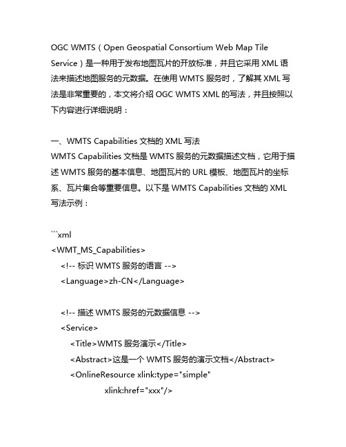
OGC WMTS(Open Geospatial Consortium Web Map Tile Service)是一种用于发布地图瓦片的开放标准,并且它采用XML语法来描述地图服务的元数据。
在使用WMTS服务时,了解其XML写法是非常重要的,本文将介绍OGC WMTS XML的写法,并且按照以下内容进行详细说明:一、WMTS Capabilities文档的XML写法WMTS Capabilities文档是WMTS服务的元数据描述文档,它用于描述WMTS服务的基本信息、地图瓦片的URL模板、地图瓦片的坐标系、瓦片集合等重要信息。
以下是WMTS Capabilities文档的XML 写法示例:```xml<WMT_MS_Capabilities><!-- 标识WMTS服务的语言 --><Language>zh-CN</Language><!-- 描述WMTS服务的元数据信息 --><Service><Title>WMTS服务演示</Title><Abstract>这是一个WMTS服务的演示文档</Abstract><OnlineResource xlink:type="simple"xlink:href="xxx"/><!-- 描述WMTS服务支持的地图瓦片集合信息 --><Contents><Layer><Title>地图瓦片集合1</Title><Identifier>TileSet1</Identifier><Abstract>这是地图瓦片集合1的描述信息</Abstract> <WGS84BoundingBox>...</WGS84BoundingBox> <Style><Title>默认样式</Title><Identifier>default</Identifier><LegendURL>...</LegendURL></Style><TileMatrixSetLink><TileMatrixSet>EPSG:4326</TileMatrixSet></TileMatrixSetLink></Layer>...</Contents><!-- 描述WMTS服务支持的地图瓦片样式信息 --><Contents><Title>默认样式</Title><Identifier>default</Identifier><LegendURL>...</LegendURL></Style>...</Contents></WMT_MS_Capabilities>```以上是WMTS Capabilities文档的XML写法示例,其中包括了WMTS服务的基本信息、地图瓦片集合信息、地图瓦片样式信息等关键内容,可以帮助用户了解WMTS服务的基本情况。
Mapinfo应用技巧培训
区域面积提取
功能:根据已划分好的BSC图层或行政区图层、网格图层、区域类型图层等批 量提取每个区域的面积。 操作方法: 打开区域类型图层; 区域类型图层必须是面区域形式,不能是线条组成 每个区域类型图层都有独立的标识名称,如“核心区”等; 修改表格结构,添加面积统计序列; 表(Table)->maintenance-> Table Structure; Add Feild->Name:面积->Type:float->OK。 更新区域面积,选择所有区域,导出区域面积 Table->Update Column Table to Update:选择图层名称-> Column to Update: 面积-> Value: Area(obj, "sq km")-> OK 选择所有图层->Ctrl+C->打开EXCEL,Ctrl+V。
点坐标提取
操作方法1
点坐标提取
操作方法2
创建专题地图-BSC显示
功能:通过站点信息分区域或者分BSC显示(查找插花站点 操作步骤 1.Map->Great Thematic Map; 2.选择专题地图类型,站点分BSC显示选Individual、Point Indvalue Default; 3.选择创建专题地图的tab、专题信息内容; 4.选择专题地图的图标、显示标注信息; 5.显示专题地图图例。
地图的制作
完成表的创建后,即可进行地图的制作与编辑。 首先,要使编辑的图层位于“可编辑”状态, 在MapInfo下面的状态栏中“正在编辑”选 项,选择编辑的图层; 然后,主要通过绘图工具实现地图对象 的编辑。 符号 折线 多边形
【IT专家】OpenStreetMap初探(九)——发布自己的 Web Map Service
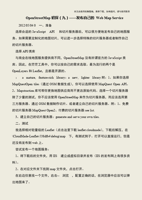
本文由我司收集整编,推荐下载,如有疑问,请与我司联系OpenStreetMap初探(九)——发布自己的Web Map Service 2012/05/04 0 一、准备 选择合适的JavaScript API 和切片服务器后,可以很方便地发布自己的地图服务。
如果需要定制化的地图切片,可以进一步选择特殊的切片服务器或者制作自己的切片服务器。
选择API/类库 与商业在线地图服务提供商不同,OpenStreetMap没有所谓官方的JavaScript类库。
因此,在茫茫工具中,你可以按自己的需求选取。
最为流行的两个是OpenLayers和Leaflet,且都是开源的。
: a mature, feature-rich library:a new, lighter library附:1、如果你选择MapQuestOpen tiles(通过OSM数据生成),你可以选择使用MapQuest Open API。
2、Mapstraction库可帮你更换地图供应商而不更改原始代码。
选择一个切片服务器除了少量的测试,你不应该使用OpenStreetMap来作为切片服务器,而应该选用第三方服务器、通过OSM数据制作切片、或者建立自己的切片服务器。
附:1、免费的切片服务器:MapQuest Open2、付费的切片服务器:see list. 3、建立自己的切片服务器:generate and serve your own tiles. 二、测试 我选择相对轻量级的Leaflet(点击这里下载leaflet.cloudmade),下载后解压,在\CloudMade-Leaflet-538dfb4\debug\map 下,有测试例子。
打开可以直接运行,但是还没有发布到web上。
尝试发布一个地图服务: 1、将下载后的文件夹,用IIS 建立成虚拟目录并发布(IIS的发布网上有很多资料)。
2、在对应文件夹下找到map文件夹,点击打开。
mapserver的wmts写法

Mapserver是一个开源的地图服务器软件,它支持WMTS(Web Map Tile Service)标准,能够提供基于Web的动态地图服务。
Mapserver的WMTS写法是指在Mapserver中使用WMTS标准发布地图服务时所需遵循的具体写法和配置方法。
下面将详细介绍Mapserver的WMTS写法。
一、配置Mapfile文件1. 在Mapserver中配置WMTS服务需要先创建一个Mapfile文件,Mapfile文件是Mapserver的配置文件,用于定义地图的数据源和图层样式等信息。
2. 在Mapfile文件中定义图层在Mapfile文件中使用LAYER关键字来定义地图的图层信息,包括图层的名称、数据源、样式等。
3. 添加WMTS元数据在Mapfile文件中使用METADATA关键字来定义WMTS服务的元数据,包括标题、描述、地图范围、坐标系等信息,这些元数据对于WMTS服务的发布和识别非常重要。
4. 定义WMTS服务在Mapfile文件中使用WEB关键字来定义WMTS服务的类型、版本和其他相关信息。
二、配置Mapserver服务1. 配置Mapserver的CGI程序在Mapserver的安装目录中找到cgis目录,其中包含了Mapserver的CGI程序,需要将该目录配置到Web服务器中,以便通过HTTP请求调用Mapserver的服务。
2. 配置Mapserver的WMS和WMTS服务在Mapserver的配置文件中设置WMS和WMTS服务的相关参数,包括服务的名称、类型、版本、地图文件路径等。
三、发布WMTS服务1. 启动Mapserver服务在Web服务器上启动Mapserver服务,确保Mapserver的CGI程序能够被调用,并且Mapfile文件配置正确。
2. 访问WMTS服务在浏览器中输入WMTS服务的位置区域,可以通过请求WMTS的GetCapabilities接口来获取服务的元数据信息,包括支持的地图范围、坐标系、瓦片格式等。
Web地图服务集成关键问题的探究

( 门理 工 学 院 空 间信 息 科 学 与工 程 系 ,福 建 厦 f 3 12 ) 厦 - 60 4 I
[ 摘
要] 针对 We 地 图服 务集成过程 中所涉及到的 坐标参考 系不一致 、保持 图层相对地理位置 不变、 b
避免 图层 变形 和返 回 图层 的透 明性 等 关键 技 术 问题 分析 讨论 ,从 而提 出在 服务 器 端对 We b地 图服 务 的
借 助 于计算 机技 术 和 网络 技 术 ,空 间 信 息 的共 享 有 了 飞 速 的 发 展 ,特 别 是 在 国 际标 准 化 组 织 IO T 2 1和 O C ( pnGSC not m,开放 地理 信息 系统 协会 ) 的推动 下 ,空间信 息 We 务 的 S /C 1 G O e I osru i b服 相 关规 范 已经相 当 的成熟 .越来 越多 的 G S部 门和研 究 机 构将 自己的空 间数 据 以 We 务 的形 式 发 I b服 布. 为此 ,大 量 闲 散 的 We b地 图 服 务 ( b M pSri s We a ev e,WMS 充 斥 着 互 联 网 ;同 时 ,单 个 的 c ) WMS 往并 不能 满足 用户 的要求 ,这就需 要 客户 端 向不 同的服 务器 发送 请 求 ,并 将 这 些不 同的 WMS 往 进 行集 成 .对不 同 的 WM S进 行集 成 ,是 通 过将 这 些 WM S输 出 的地 图图象 进 行 叠加 来 实 现 的.这 些 地 图图像包 含 了其 自身 的空 间参考 坐标 系 、坐标 范 围以及 其他 的一 些客 户端所 需要 的空 间信 息 .要使
G t p参数信 息表 示的不 同地 图服 务进行 预 处理 ,使 之基本 达到 we 图服 务的有 效集成.其 间通 的 实例 验 证 了这 些 解 决 方 案 的 可 行 性 .
基于MapServe和Openlayer的WebGIS开发
<s c r i p t d e f e r= ” d e f e r ’ ’>
t p : / / 2 2 2 . 1 4 3 . 2 4 . 3 9 / k a m a p / t i l e . p h p , k a m a p读 取 方 法 是 动 态切 割 的方 法 , 通 过 研 究 采 用 切 割 。采 用 了 当前 流 行 的地 图缓存 技 术 , 该技 术 一 般针 对 相对 稳定 的数 据 , 因为 地 图 切为 瓦 片以后 , 以 图片 的形 式存 在 , 对 于 数据 的变 化 ( 这里 指 的是 数 据 的几 何 形状 变化 ) 不 能及 时 的反 应 , 这 就是 地 图缓存 技术 不 足之 处 。采用 了有效 的瓦 片地 图及 时更 新解 决方 案 。 基本 思路 : 使 用地 图缓 存 技术 对 地 图进 行 切 片 ; 编 辑 数据 的时候获 取 空 间数 据 对 应 的瓦 片 ( 一 张或 者 几 张 ) ; 计算 这部 分 瓦片 的地 图 范 围 , 并 在 后 台重 新 生成 这个 范 围的地 图图片 ; 把新 生成 的 图片替换 这些 旧有 的瓦片 。 切 片程序 支持 对 某 个 点 位 置 、 某 条 路 等 定 点 范 围 进 行切 片 , 即直 接在 地 图上选 择 一个 切 片范 围 , 支 持对 设定 的范 围内数 据进 行 切 片 , 切 完 的瓦 片跟 周 边 自动融 合 , 不 存在 接边 问题 。这个 功能 的实现 为 数 据持 续更 新 提 供 了
第3 6卷 第 9期
2 0 1 3年 9 月
基于网络评论的美食推荐系统

39导语近年来,随着人民生活质量逐渐提高,人们对于美食也越加讲究,不仅食物要满足顾客的味蕾,服务与价格也要符合顾客的期望。
[1]虽然现今网络已非常普及,人人都可以在网络上分享自己的用餐经验,然而面对众多来源的评语,要能快速且正确地认识一家餐厅仍是一件困难的事。
基于美食推荐的实时需要,文章提出一套基于网络评论的美食推荐系统“食况转播系统”,以提供各家餐厅之介绍与评论摘要。
让人们可以快速决定最佳的用餐地点,甚至在陌生的环境,也能避免“踩雷”的情况发生。
1.系统设计本研究所设计的“食况转播系统”所提供功能包括:网页内容撷取机器人、多文本自动摘要技术(MultipleDocument Summarization,MDS)[2]、云计算技术等设计。
通过网页内容撷取机器人用百度等搜索引擎对网页相关信息进行搜寻,于各个网页中找寻相关美食评论信息,撷取机器人子系统将其爬行(Crawl)数据和经过剖析(Parse)后,将相关的信息存为Blog Corpus。
最后,再利用多文本自动摘要技术,将相关网页Corpus 中的美食评论撷取出来,并制成摘要形式,提供给用户饮食决策参考,用户可以通过本系统所设计的人机接口进行查询,整体系统处理之流程如图1所示。
1.1 网页内容撷取机器人网页内容撷取机器人主要提供有模糊搜寻机制、网页爬虫(HTML Crawler),以及网页剖析器(HTML Parser)等功能,各功能说明分述如下。
1.1.1 模糊搜寻机制模糊搜寻机制提供模糊运算与判断,建立搜寻相关的关键词字库,以关键词字库内容主动向百度搜寻进行搜寻。
1.1.2 网页爬虫网页爬虫将百度搜寻后结果(如回传的各个网页内容)进行爬行,追踪相关连结网页并将HTML 内容暂存。
1.1.3 网页剖析器网页剖析器将网页爬虫取得的网页进行HTML tag 解读,取得主要信息,并有效去除相关特殊字符(如单引号和双引号)和避免数据库隐码攻击等问题,建立Web Corpus 以利后续之多文本自动摘要之推论。
智慧城市公共信息平台平台接口与服务要求

智慧城市公共信息平台平台接口与服务要求1 范围本要求是《智慧城市公共信息平台建设指南》建设要求系列之接口与服接口与服接口与服务要求。
本部分要求分两大部描述平台接口分两大部描述平台接口分两大部描述平台接口分两大部描述平台接口分两大部描述平台接口要求,第一部分:总体,第一部分:总体,第一部分:总体,第一部分:总体要求,总体要求描述消息的总体结构、接口访问方地址使用说明。
第二部分:业务描述消息的总体结构、接口访问方地址使用说明。
第二部分:业务描述消息的总体结构、接口访问方地址使用说明。
第二部分:业务描述消息的总体结构、接口访问方地址使用说明。
第二部分:业务描述消息的总体结构、接口访问方地址使用说明。
第二部分:业务描述消息的总体结构、接口访问方地址使用说明。
第二部分:业务接口要求,具体描述每个业务应用服接口的,具体描述每个业务应用服接口的要求。
也就是每一个业务接口。
也就是每一个业务接口要求套在总体要求内。
只有使用业务接口内。
只有使用业务接口内。
只有使用业务接口内。
只有使用业务接口要求+总体要求才能正常使用信息平台的应才能正常使用信息平台的应才能正常使用信息平台的应才能正常使用信息平台的应用服务来发现,查询管理资源。
本部分适用于参与公共信息平台设计和研发人员,系统维护及要求本部分适用于参与公共信息平台设计和研发人员,系统维护及要求本部分适用于参与公共信息平台设计和研发人员,系统维护及要求本部分适用于参与公共信息平台设计和研发人员,系统维护及要求本部分适用于参与公共信息平台设计和研发人员,系统维护及要求本部分适用于参与公共信息平台设计和研发人员,系统维护及要求本部分适用于参与公共信息平台设计和研发人员,系统维护及要求本部分适用于参与公共信息平台设计和研发人员,系统维护及要求本部分适用于参与公共信息平台设计和研发人员,系统维护及要求本部分适用于参与公共信息平台设计和研发人员,系统维护及要求本部分适用于参与公共信息平台设计和研发人员,系统维护及要求本部分适用于参与公共信息平台设计和研发人员,系统维护及要求本部分适用于参与公共信息平台设计和研发人员,系统维护及要求接入公共信息平台的外部应用开发人员。
WebGIS在建立煤矿安全管理信息系统中的应用

W ebGI S在建立煤矿安全管理信息系统中的应用3张华兵,程五一(中国地质大学(北京)工程技术学院, 北京 100083)摘 要:简述了基于平台和W ebGI S技术建立煤矿安全管理信息系统的思路和方法,并具体介绍了如何实现W eb浏览、图形与数据库互访、测距、绘制专题地图和与瓦斯系统整合等技术,为工程应用提供了一个借鉴的实例。
关键词:煤矿;W ebGI S;安全管理;中图分类号:T D76,TP319 文献标识码:A文章编号:1005-2763(2007)03-0056-02Appli ca ti on of W ebG I S i n D evelop m en t of SafetyI nfor ma ti on Syste m for Coa lM i n eZhang Huabing,Cheng W uyi(School of Engineering&Technol ogy,China University of Geosciences(Beijing),Bei J ing100083,China) Abstract:The paper p resents the thought and method of devel o2 p ing safety inf or mati on syste m f or m ine coal based on and W ebGI S technol ogy,then gives the particular ways how t o realize the W eb br owsing of map data,the inter-accessing of map and database,length measuring,thematic map making, and the integrati on of safety inf or mati on syste m and gas inf or ma2 ti on system.An exa mp le als o is p resented for reference t o the app licati on of the safety infor mati on system in engineering.Key W ords:Coal m ine,W ebGI S,Safety manage ment,ASP. NETW ebGI S是GI S与I nternet结合的产物,是一条实现GI S互操作的最佳解决途径[1]。
开源GIS软件MapServer介绍 三维Gis

开源GIS软件MapServer介绍三维Gis关键字: 开源 gis 软件 mapserver 介绍Mapserver是比较有名气的一个开放源代码网络地图软件,国外用的人很多。
国内的也有一些应用,作为开源GIS方面的资料介绍给大家。
开源三维Gis 有/,可以看看哈。
一般情况下我们只用二维的就够了。
以下是windows下ms4w的一个小例子,希望对初学者有帮助。
1.下载Mapserver。
Mapserver的官方网站是:/下载ms4w可以到:/ms4w/index.phtmlms4w不用安装,解压即可使用(注意一定要解压到根目录,比如D:\)2.打开ms4w文件夹,双击apache-install.bat,就可以启动Apache网络服务器,这时你在浏览器中输入localhost(或127.0.0.1),就能看到ms4w的页面了。
文件夹中还有apache-restart.bat,apache-uninstall.bat分别是重启和停止APACHE的命令。
3.到/?casljz 下载webgis.rar,解压缩,然后把webgis文件夹拷贝到D:\ms4w\Apache\htdocs中,双击D:\ms4w\apache-restart.bat重启apache服务器4.在浏览器中输入localhost/webgis,即可看到一个最简单的WEBGIS的页面(只能放大)好了,下面讲解一下Mapserver的工作原理。
Mapserver真正起作用的是一个CGI程序,在WINDOWS下是mapserv.exe,如果你在浏览器窗口输入http://localhost/cgi-bin/mapserv.exe,得到:“No query information to decode. QUERY_STRING is set, but empty.”,说明你的mapserver已经能干活啦。
在mapserver中起核心作用的是mapfile文件,该文件定义了数据在哪里?HTML 模板在哪里?投影?显示图层等详细配置信息,我们的主要工作就是修改这个文件配置数据进入mapserv.exe,关于mapfile文件的详细信息,请参考/docs/reference/mapfile另外比较重要的是template文件,这个文件是用户与mapserv.exe进行交互的界面。
基于市管网可视化系统的GIS专题地图服务

基于市管网可视化系统的GIS专题地图服务摘要城管网的管道是纵横交错,并有3D(三维)分布的。
涉及到大量的属性信息和空间数据。
为了用一个更加直观的方式来表现它,UPNVS(市管网可视化系统)被设计。
专题地图服务是它的一部分。
本文中,我们提出了专题地图服务,上传和编辑数据服务,信息重视服务和三维查看服务。
而3D显示服务集中于显示简单地图和唯一值服务。
它实现了从2D专题地图到3D的转变而且用不同的颜色来反映管道的不同的属性值。
此项应用加强了专题地图服务的真实性和可视性。
最后,我们把它插入到UPNVS中,能容易的显示模式和趋势且为决策提供信息。
同时,结果也可应用于其它的可视化系统和3D专题地图中。
关键字:专题地图;管道网;ArcGIS Engine;三维的可视化服务一.引言市管网由供水,排水,煤气,暖气,电信和工业管道组成。
它们是城市基础设施的重要部分,且被视为城市的生命线。
然而各种地下管线纵横交错复杂结构,并在不同的深度,如果我们没有全面,准确的地下管线信息,我们将是盲目的,且会导致重大损失[1]。
据了解每个管线都包括许多的信息,例如线路编号,状态,面积,和直径等。
包含有潜在有用信息的数据量正在快速增长。
数据里的复杂关系和分层结构使得数据的可视化任务更加的吃力[2]。
因此,可视化系统设计是为了地下管网,而其中的二维和三维的专题地图服务是重要的组成部分。
传统的制作专题地图的方法是基于地理信息系统(GIS)且只能应用于一个图层:地图。
专题地图在地图的区域上显示不同的要素分布。
而我们的设计包括4个管线:供水,排水,燃气和供热。
每个管道都有自己的图层。
问题是:如何建立一个既包括地图又包括这些管线的文件。
以及如何使用ArcGIS Engine来制作管网专题地图服务。
以致地下管道不同的要素能用管线显示出来。
所以,本文提出了一种解决方案:提供一个专题地图可视化服务,它可以插入到现有的UPNVS中。
以便,用户可以看到管道的信息与专题地图。
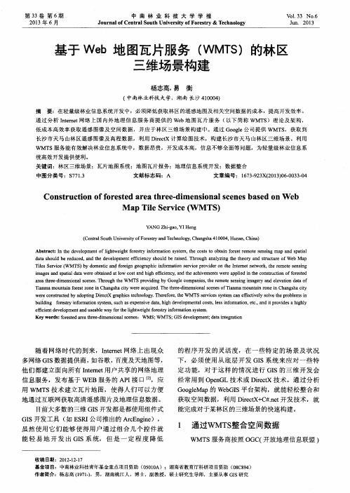
基于Web地图瓦片服务(WMTS)的林区三维场景构建
V 0 _ 1 . 3 3 NO . 6 J u n .2 0 1 3
基于 We b地 图瓦片服务 ( WM T S )的林 区 三维场景构建
杨志高, 易 衡
( 中南林 业科技 大学,湖南 长 沙 4 1 0 0 0 4 )
摘 要 :在轻量级林业信息系统 开发中,必须 降低 获取林区的遥感地 图及相关空 问数据 的成本 ,提高开发效率 。
关键 词:林区三维场景 ;瓦片地 中图分类号:¥ 7 7 1 . 3 文献标志码 :A 文章编号:1 6 7 3 . 9 2 3 X( 2 0 1 3 ) 0 6 . 0 0 3 3 . 0 4
Co n s t r u c t i o n o f f o r e s t e d a r e a t h r e e d i me n s i o n a l s c e n e s ba s e d o n W e b
第3 3卷 第 6期 2 0 1 3年 6月
中 南 林 业 科 技 大 学 学 报
J o u r n a l o f Ce n t r a l S o u t h Un i v e r s i t y o f Fo r e s t r y& T e c h n o l o g y
i ma g e s nd a s p a t i a l d a t a we r e o b ai t n e d a t l o w c o s t a nd h i g h e ic f i e n c y , nd a he t a c h i v e me n t s we r e a pp l i e d i n he t c o n s t r u c t i o n o f f o r e s t e d a r e a t h r e e — d i me ns i o n a l s c e n e s . Th r o u g h he t W M TS p r o v i d i n g b y Go o g l e c o mp ni a e s , he t r e mo t e s e n s i n g i ma g e y r a n d e l e v a t i o n d a t a o f
wmts标准

wmts标准WMTS(Web Map Tile Service)是一种针对WebGIS的标准协议,它可以提供地理数据的快速、可伸缩的访问方式,同时也便于多个地图开发平台的使用。
WMTS协议由OGC(Open Geospatial Consortium,开放地理空间联盟)推出的规范,定义了在Web上发布和使用预渲染地图瓦片的标准方法。
一、WMTS标准的意义随着WebGIS和移动GIS的快速发展,地理信息服务已经成为了各行业专业制图、数据共享和分析的重要组成部分。
而传统的地图服务一般采用WMS(Web Map Service)协议,它支持动态生成地图,但在数据量大、同时访问人数多时,速度较慢,存在缓存问题。
而WMTS采用了静态预渲染的方式,将地图数据切分成规格化的瓦片,通过专用的Web服务端(即WMTS服务器)进行存储和管理,实现快速的地图渲染及数据的传输。
因此,WMTS标准的推广对于进一步推进WebGIS和移动GIS的应用及发展,具有非常实际的意义。
二、WMTS的核心功能和特点1. 提供高效的数据访问能力WMTS协议采用瓦片式数据提供方式,瓦片是由提供者指定大小的地图图片、元数据和最小缩放级别组成。
在客户端通过请求坐标和缩放级别,服务端便可返回相应位置的地图图片。
这种方式能够极大的提高数据传输效率和渲染速度。
2. 支持多个数据格式WMTS协议支持多种数据格式的输出,如JPEG、PNG、GIF、TIFF等。
提供者可根据实际需求选择适合的数据格式,提供高品质的地图瓦片,并可通过数据压缩等方式进一步降低数据传输的耗时和流量。
3. 能够自由定义坐标系统和坐标范围WMTS支持多种坐标系统和投影方式,并可以自由定义坐标范围和坐标系,可以灵活的适应不同地区和地图源的坐标定义。
4. 支持多版本缓存控制WMTS协议支持缓存控制,提供者可以通过控制缓存的方式进行数据保护,同时也可以灵活的控制缓存时间和版本,保障服务正常运行的同时,减少数据传输量,节省了服务处理的时间和成本。
IBM_ESB介绍

IBM_ESB介绍ThankYou!Thistime,therequestispassedthroughaMediationModule.TheMediationModule usesaMessageLoggerMediationPrimitivetologthemessagetoadatabase.TheRequestcontinuesonitswayasbefore:passedtotheimporttobesenttoXQuote.Thistime,whentherequestpassesthroughtheMediationModule,aDataBaseLookupPrimitiveisusedtolookuptheuseridinatableof“gold”users,thenaFilterisappliedIftheuserisagoldcustomer,therequestwillbepassedtoadifferentexternalWebService(offeredbyXIgnite)otherwiseitwillcontinueasbefore.Becausethemessageformatsdiffer,therequestisfirstpassedthroughanXSLTPrimiti vethatwilltransformthemessageusinganXPathexpression.Th eresponsefromXIgnitewillalsoneedtobetransformedaspart oftheMediationsothattheformatisasexpected.WebSphere ESBisdesignedtobeeasytousefrombothatoolsandaruntimeperspective.WebSphereIntegrationDeveloper,thetoolthatworkswithWebSphereESB,isbuiltforanintegrationdeveloper—some onewhounderstandsITsystemsandarchitecturesbutwhoisnotaJavadeveloper.BothWESBandWIDaredesignedtohelpcustom ersgetupandrunningquicklyandeasily,withcomprehensiveout oftheboxdocumentationandasimplifiedandvisualdevelopmentenvironment.Avisualcompositionmodelallowseasyorchestrationofmediationfunctions.Thefactthatthetoolisrolebasedmakesadministrationmucheasier.AdditionalNotes:Themediatio nfloweditorprovidesauniformapproachtoauthortheprocessingofmessage-basedone-waymodel(message-oriented)andrequest-responsebasedtwo-waymodel(service-oriented).WebSphereESBa ndWebSphereIntegrationDeveloperaresoldseparately.WIDcosts$3500/perseat.Forplanningpurposes,pricesforWebSphereESBareprojectedtobe$25KperCPU,however,thisissubjecttochange.Additionalinformationaboutlistedfeatures:Gain supportforavarietyofmessagingprotocolsincludingJMS1.1JMS1.1providedbyWebSphereApplicationServerCanexploitavarietyoftransports,includingTCP/IP,SSL,andHTTP(S)Allowsint eroperationwiththeWebSpherefamily,eg,WAS,MQ,Message/Event BrokersUtilizeabroadrangeofinteractionmodels(request/reply,point-to-point,publish/subscribe,etc.)tomeetyourrequire mentsLeverageadvancedWebservicessupporttoincorporateleadingedgecapabilitiesSOAP/HTTP,SOAP/JMS,WSDL1.1UDDI3.0ServiceRegistry,WebServicesGatewayWS-StandardsincludingWS-Security,WS-AtomicTransactionsTakeadvantageofacomprehensivec lientspackagetoextendyourenvironmentMessageServiceClientforC/C++extendstheJMSmodelformessagingtonon-JavaapplicaapplicationstoparticipateinJMS-basedinformationflowsWebServicesClientisaJAX-RPC-likewebservicesclientforC++toenabl esuserstoconnecttoWebserviceshostedonWebSpherefromwithinaC++environmentJ2EEclientsupportfromWebSphereApplicationServer,includingWebservicesClient,EJBClient,andJMSCli entAdditionalNotesforPossibleQuestions:Q.WhatareyourplansforaServicesRegistry?A.Todayyoucanstoreandlocate informationaboutservicesthroughtheIBMWebSphereUDDIRegistry.Youcandiscoverservicesintheregistrywhendevelopingnewservices,andatrun-timeyourmediationscanaccesstheregistry.Inthenearfuture,aServicesRegistryinWebSphereESBwill allowyoutolocateandmanageservicesinyourregistrythrough aflexibleregistrationandqueryinterfaceeitherthroughaUI oranAPIthatcanbeusedinpackagedorcustomtools.Longerterm,you’llbeabletointegrateyourserviceregistryentitiesan dyourgeneralmetadataandworkwiththemasaunit,e.g.,throughsharedclassificationschemes,acommonapproachtoqueryinga ndmanipulatingyourmetadataandregistrycontent.Additionalinformationaboutlistedfeatures:GainsupportforavarietyofmessagingprotocolsincludingJMS1.1JMS1.1providedbyWeb SphereApplicationServerCanexploitavarietyoftransports,includingTCP/IP,SSL,andHTTP(S)AllowsinteroperationwiththeWebSpherefamily,eg,WAS,MQ,Message/EventBrokersUtilizeabroadrangeofinteractionmodels(request/reply,point-to-point,publish/subscribe,etc.)tomeetyourrequirementsLeverageadvance dWebservicessupporttoincorporateleadingedgecapabilitiesSOAP/HTTP,SOAP/JMS,WSDL1.1UDDI3.0ServiceRegistry,WebServicesGatewayWS-StandardsincludingWS-Security,WS-AtomicTrans actionsTakeadvantageofacomprehensiveclientspackagetoexte ndyourenvironmentMessageServiceClientforC/C++extendstheJMSmodelformessagingtonon-Javaapplications.MessageServiceapplicationstoparticipateinJMS-basedinformationflowsWebServicesClientisaJAX-RPC-likewebservicesclientforC++toenablesuserstoconnectto WebserviceshostedonWebSpherefromwithinaC++environmentJ2EEclientsupportfromWebSphereApplicationServer,includingWebservicesClient,EJBClient,andJMSClientAdditionalNotesforPossibleQuestions:Q.WhatareyourplansforaServicesRegistry?A.Todayyoucanstoreandlocateinformationaboutser vicesthroughtheIBMWebSphereUDDIRegistry.Youcandiscovers ervicesintheregistrywhendevelopingnewservices,andatrun-timeyourmediationscanaccesstheregistry.Inthenearfuture,aServicesRegistryinWebSphereESBwillallowyoutolocatea ndmanageservicesinyourregistrythroughaflexibleregistrati onandqueryinterfaceeitherthroughaUIoranAPIthatcanbeusedinpackagedorcustomtools.Longerterm,you’llbeableto integrateyourserviceregistryentitiesandyourgeneralmetadataandworkwiththemasaunit,e.g.,throughsharedclassificationschemes,acommonapproachtoqueryingandmanipulatingyourmetadataandregistrycontent.Beyonditsintelligentconnectivityandeaseofusebenefits,WebSphereESBisdesignedtoimproveyourtimetovalue.Asacosteffectivesolutionforservicesintegration,WESBisdesignedtomakeSOA“real”andassuchwisintegration,WESBisdesignedtomakeSOA“real”andassuchwillallowyoutoLeverageyourSOAITinvestmentsbyquicklybuildingaflexibleintegrationinfrastructuretoextendthevalueofyourexistinginvestments,regardlessofvendor.Itsmodularapproachsupportsabilitytostartsmallandgrowasfastasthebusinessrequires,andtheextensivebusinessandITstandardssupportfacilitategreaterinteroperability&portability.FirstclasssupportforhundredofISVsolutionsthroughextensiveWebSpher eAdaptersupportandthenumerousWASandMQpartnersintheWeb SpherePartnerecosystemmakeiteasytoconnecttoyourexistingassets.Pre-builtmediationfunctionssavetimeandmoneybecauseverylittleadditionaldevelopmentisrequired.Furthermore,w ithWebSphereESByousavetimewhenyoucanchangeyourserviceinteractionswithouttakingyoursystemdown.AdditionalNotes:CompleteMediationlist,delliveredateGA:XSLTMessageLoggerM essageRouterFailStopDatabaseLookupCustomComponentFinally, WebSphereESBofferswhatsimilarofferingsdonot—seamlessintegrationwiththeWebSpherePlatform.AsImentionedbefore,WebS phereESBisbuiltontopofWebSphereApplicationServerNetworkDeployment.Assuch,itinheritsallofthemarket-leadingqualitiesofservice,includingscalability,clustering,andfail-over,uutilizesthecommonWebSphereAdministrativeConsoletoenabl esystemmanagementacrossWebSphereApplicationServer,WebSphereESB,andWebSphereProcessServer,andaaddressesend-to-endsecurityrequirementsonauthentication,resourceaccesscontrol,dataintegrity,confidentiality,privacy,andsecureinteroperabilityBecauseWebSphereESBisbuiltonthisfoundation,customers caneasilyextendtoleverageWebSpherePlatformasneedsdictate.CustomerswiththerightskillscantakefulladvantageoftheunderlyingcapabilitiesofWebSphereApplicationServerNetworkDeployment.ExtendyourexistingWebSphereMQmessagingfoundationtointegratenewenvironmentsinanopen,standards-basedway.Finally,ccommontoolingandadministrationmeansthemovefromWebSphereESBtoWebSphereProcessServerispainless.WebSphereESBintegrateswithotherIBMSoftwareofferings,aswell,includingIBMTivolisecurity,directory,andsystemsmanagementofferings.WESBincludesTivoliAccessManager,foroptionaluse,todeliverasecure,unifiedandpersonalizedexperiencethatwillhelpmanagegrowthandcomplexity,anditintegrateswithIBMTivoliCompositeApplicationManagerforSOAforaddedmonitoringandmanagementcapabilities.Managingcompositeapplicationsbasedonserviceorientedarchitecturespresentamixofnewandtraditionalchallenges,asservicesneedtobetreatedbythemanagementinfrastructureasfirst-classmanagedobjects,conformingtodefinedservicecharacteristics.IBMTivoliCompositeApplicationManagerforSOAhelpsyoumonitor,manageandcontroltheseservice-basedapplications.ThissolutionisintegratedwiththeIBMTivoliEnterprisePortal,whichenablesend-to-endresource,application,transactionandservicemanagementacrossyourITinfrastructure.Attheoperationallevel,eachmodulemapstoasingleWebSphereapplication.AdminpanelsallowsimplenavigationtoandcontroloftheseapplicationsScenario1demonstratesthecapabilitiesofWebSphereESBwhenusedalone.Itassumesthatalmostalloftheinterfacesareservices-based(eitherSOAP/JMSorSOAP/HTTP).ItcanalsotalktoWebSphereMQorWebSphereMessageBrokeroranadapterifitneedstotalktoanysystemthatisnotusingtheWebServicesorJMSmodel.Solution:ShareTraderutilizedWebSphereESBtoimplementanEnterpriseServiceBusthat:RoutesincomingrequestsfromtheWebsitetotheappropriateservicebasedonthecustomer’sstatususingcontentbasedroutingTransformstherequesttotheappropriateformatforthetargetdestinationusingXSLTandprotocoltransformationandroutesrequestbacktosourceEnablesShareTradertoseamlesslytransitionserviceendpoints.ShareTraderrecentlymovedfromaninternallyprovidedstockquoteservicetoamoredependableexternalproviderwithoutanyimpacttotherestoftheoffering.NotethatWindows2000supporthasbeenremoved!!ThisisduetoMicrosofthavingdroppedsupportforthisplatformrecently.LinuxonpSeriescomingpostGA.Solaris10supportcomingpostGA.NotethatWindows2000supportisgone!!ShipswithWebSphereMQV6–ifV5.3isnotdetectedthenV6isinstalled.IBMESB案例分享民航航空安全系统整合技术⽅案民航信息建设要求利⽤现代信息技术建⽴完整的⾼速⽹络交换平台建⽴⾼效、及时、准确、完整、统⼀的民航安全运⾏管理信息系统满⾜各种应⽤系统集成的需要完整的管理机制满⾜运⾏和维护的需要航安系统整合实现框架⽅案总结-民航航空安全系统整合技术⽅案⾸先保证在⼀个异构的环境中实现信息稳定、可靠的传输屏蔽掉⽤户实际中的硬件层、操作系统层、⽹络层等相对复杂、烦琐的界⾯,为⽤户提供⼀个统⼀、标准的信息通道,保证⽤户的逻辑应⽤和这些底层平台没有任何关系提供⼀个基于application-hub的先进应⽤整合理念,最⼤限度地减少应⽤系统互联所⾯临的复杂性基于WBI系统的实现维护都相对简单,保证每⼀个应⽤系统的更新和修改都能够实时地实现,当新的应⽤系统出现时能够简便的纳⼊到整个IT环境当中,与其它的应⽤系统相互协作,共同为⽤户提供服务,是我们实现企业应⽤互联和流程管理的最佳实现⽅案中国⼈民银⾏国库信息处理系统建设⽬标国库信息处理系统(TreasuryInformationProcessingSystem)是⼀个以国库横⾏联⽹的业务流程和⼯作流程为基础,连接税务、财政、国库及商业银⾏等业务部门的信息集成处理系统,⽤于传递、处理税款缴纳、划分、⼊库、退库、对账、业务监管、统计分析等各项业务的电⼦信息。
WebService原理及重要术语
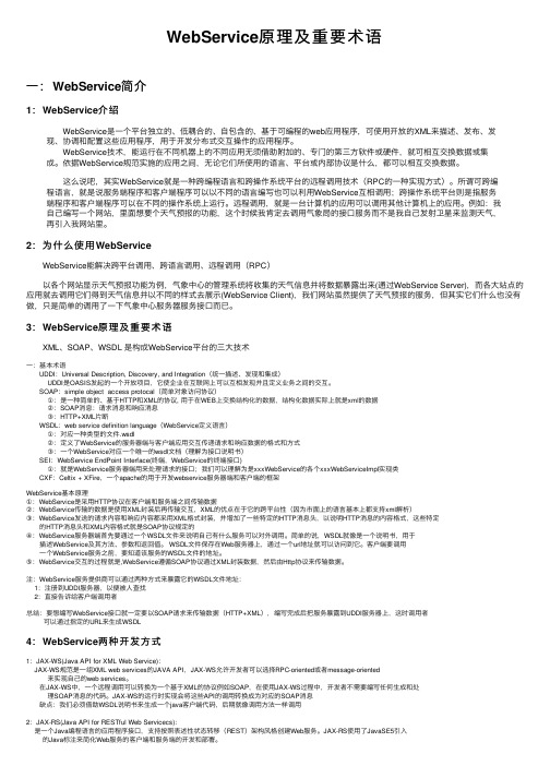
WebService原理及重要术语⼀:WebService简介1:WebService介绍 WebService是⼀个平台独⽴的、低耦合的、⾃包含的、基于可编程的web应⽤程序,可使⽤开放的XML来描述、发布、发现、协调和配置这些应⽤程序,⽤于开发分布式交互操作的应⽤程序。
WebService技术,能运⾏在不同机器上的不同应⽤⽆须借助附加的、专门的第三⽅软件或硬件,就可相互交换数据或集成。
依据WebService规范实施的应⽤之间,⽆论它们所使⽤的语⾔、平台或内部协议是什么,都可以相互交换数据。
这么说吧,其实WebService就是⼀种跨编程语⾔和跨操作系统平台的远程调⽤技术(RPC的⼀种实现⽅式)。
所谓可跨编程语⾔,就是说服务端程序和客户端程序可以以不同的语⾔编写也可以利⽤WebService互相调⽤;跨操作系统平台则是指服务端程序和客户端程序可以在不同的操作系统上运⾏。
远程调⽤,就是⼀台计算机的应⽤可以调⽤其他计算机上的应⽤。
例如:我⾃⼰编写⼀个⽹站,⾥⾯想要个天⽓预报的功能,这个时候我肯定去调⽤⽓象局的接⼝服务⽽不是我⾃⼰发射卫星来监测天⽓,再引⼊我⽹站⾥。
2:为什么使⽤WebService WebService能解决跨平台调⽤、跨语⾔调⽤、远程调⽤(RPC) 以各个⽹站显⽰天⽓预报功能为例,⽓象中⼼的管理系统将收集的天⽓信息并将数据暴露出来(通过WebService Server),⽽各⼤站点的应⽤就去调⽤它们得到天⽓信息并以不同的样式去展⽰(WebService Client),我们⽹站虽然提供了天⽓预报的服务,但其实它们什么也没有做,只是简单的调⽤了⼀下⽓象中⼼服务器服务接⼝⽽已。
3:WebService原理及重要术语 XML、SOAP、WSDL 是构成WebService平台的三⼤技术⼀:基本术语 UDDI:Universal Description, Discovery, and Integration(统⼀描述、发现和集成) UDDI是OASIS发起的⼀个开放项⽬,它使企业在互联⽹上可以互相发现并且定义业务之间的交互。
wmts服务原理

wmts服务原理
WMTS(Web Map Tile Service)是OGC(Open Geospatial Consortium)提出的一种缓存技术标准。
WMTS服务的核心原理是采用图像金字塔的方式,将地图服务按照预先设置的某种切图策略进行切割,并创建地图缓存。
这些被切割的地图瓦片存储在服务器端,客户端通过请求这些预先定义好的单个瓦片来获取地图数据。
这种方式将更多的数据处理操作如图层叠加等放在客户端进行,从而缓解GIS服务器端数据处理的压力,改善用户体验。
具体来说,WMTS的工作流程包括以下几个步骤:
1.数据投影:在数据库中,地理数据都是以地心坐标系(如WGS84
坐标系)存储的。
这些数据首先需要通过Web-Mercator投影,将经纬度形式的三维数据映射到二维平面上。
2.分层级渲染数据:数据被渲染成地图,并根据比例尺分割成不
同的栅格图块。
这些图块是按照一定的组织方式(如瓦片坐标
系统)进行存储的。
3.地图瓦片分发:根据客户端的请求,服务器传输相应的地图瓦
片给客户端。
客户端在接收到这些瓦片后,按照预定的方式进
行显示,从而呈现出完整的地图。
WMTS服务通过预渲染图块的方式,实现了更高效快速的地图数据加载和渲染。
这种方式避免了以矢量形式传输大量地图数据所带来的网络流量消耗和客户端CPU负荷,从而提高了地图服务的性能和可扩展性。
webservice调用具体方法
webservice调用具体方法摘要:1.什么是WebService2.如何调用WebService的具体方法3.调用过程中可能遇到的问题及解决方法4.实战案例分享正文:WebService,即网络服务,是一种跨平台的、基于XML(可扩展标记语言)的分布式计算技术。
它使得应用程序之间可以通过互联网进行通信,实现数据的交换和共享。
在实际开发中,调用WebService的具体方法如下:1.首先,确定你需要调用的WebService的地址和协议。
通常,WebService的地址是以WSDL(Web服务描述语言)文件形式提供的。
你可以通过WSDL文件查看WebService提供的接口和方法。
2.根据WSDL文件,生成客户端代码。
这可以通过使用诸如Apache CXF、JAX-WS等开源库来实现。
这些库会根据WSDL文件自动生成客户端代码,包括调用WebService的方法和处理响应的代码。
3.在生成的客户端代码中,找到调用WebService的具体方法。
这个方法通常是一个带有HTTP请求头的Web方法,如POST、GET等。
在方法中,传入所需的参数,这些参数通常包括在WSDL文件中定义的输入参数。
4.发送HTTP请求,并将响应结果解析为JSON、XML等格式。
这一步可以通过使用如Jackson、Gson等库来实现。
5.处理响应结果,并根据需要进行相应的业务逻辑处理。
在调用WebService的过程中,可能会遇到以下问题:1.网络问题:由于WebService通常跨网络调用,因此可能会遇到网络不稳定、延迟等问题。
为了解决这个问题,可以考虑使用重试策略、增加超时设置等方法。
2.服务异常:WebService可能会因为各种原因抛出异常,如参数不合法、服务器故障等。
为了解决这个问题,可以实现异常处理机制,如使用try-catch语句捕获异常,并根据需要进行日志记录、通知等操作。
3.身份验证和授权问题:为了避免unauthorized access,WebService 通常需要进行身份验证和授权。
初识OGC规范

初识OGC规范OGC为分布式环境下访问地理数据和地理信资源制定的一套全面的规范。
它包括抽象规范和实现规范。
各厂商按照OpenGIS制定的规范开发GIS软件,而且这些软件之间能够实现互操作。
OGIS(Open Geodata Interoperability Specification)该规范主要包括三个部分•开放式地理空间数据模型(Open Geodata Model)•OGIS服务模型(OGIS Service Model)•信息团体模型(Information Comunities Model)该规范对于地理信息服务作了以下分类•用户交互服务:包括用户界面图形和多媒体的管理服务和服务文档的表现服务•模型/信息管理服务:主要包括元数据概念模式和数据集的开发操作和存储等管理服务•工作流/任务服务:主要指用于支持某些特定任务或者与工作相关的活动的服务•处理服务:主要指对地理数据作了大量计算的服务包括空间处理服务专题处理服务时相处理服务和元数据处理服务等•通讯服务:主要包括数据编码和数据传输服务•系统管理服务:主要指系统构件应用程序和网络的管理服务也包括对用户账号和访问权限的管理服务OWS抽象模型OWS抽象模型中包括两类构件:操作型构件和数据型构件操作型构件包括•客户服务•目录与注册服务•应用服务•数据服务数据型构件包括•数据•原数据•名称•关联•容器OWS操作体系结构描述了把OWS应用于Web环境所涉及的系统概念,主要包括•公共体系结构Common Architecture 主要指OGC 技术体系结构中的公共基本元素包括服务模型编码机制Web 注册服务以及其他公共服务•客户服务是能够和用户交互的应用程序客户端构件能够与服务器端的服务器端客户应用程序应用服务器以及数据服务器等交互•服务器端客户程序是服务器端的主要构件能够与客户服务交互也能够调用服务器端的应用服务和数据服务包括Web 制图决策支持等•应用服务能够对数据进行操作并提供增值服务的基本应用服务构建模块包括Web 制图的支撑构件决策支持的支撑构件等•数据服务在OWS 中提供数据特别是空间数据的基本服务构件模块包括Web地图服务器WMS Web Map Server Web 要素服务器WFS Web Feature Server和Web 覆盖服务器Web Coverage Server 等OWS技术体系结构在抽象模型以及操作体系结构的基础上提出了OWS技术体系结构•公共体系结构部分这部分关注的主要是OGC 技术体系结构中的公共基本元素包括服务模型编码机制Web 注册服务及其他公共服务• Web 制图部分这部分关注的是在WMTI Web Mapping Test beds I 和WMTII WebMapping Test beds II 的基础上研究Web 制图客户服务服务器端客户应用程序数据服务以及支撑性的应用服务等•影像利用部分这部分关注的是基于Web 的图象开发的客户服务服务器端客户应用程序数据服务以及支撑性的应用服务等•传感器Web 部分这部分关注的是传感器网络的客户服务,服务器端客户应用程序,数据服务支撑性的应用服务,以及传感器标记语言Sensor Markup Language和传感器注册服务等•决策支持部分这部分关注的是决策支持的客户服务,服务器端客户应用程序,数据服务支撑性的应用服务,建模标记语言Modeling Markup Language 以及事件和事件服务的编码机制等OpenGIS 服务框架OpenGIS 服务框架建立了能够被任何应用所利用的公共接口交换协议和服务包括•应用客户•注册服务•编码处理服务•描绘服务•数据服务OGC 互操作程序服务模型描述了一个针对OpenGIS 服务的计算模型,OGC 互操作程序服务模型建立在OGC 服务体系结构的基础上,但是更加强调如何利用现有的技术平台和机制来实现具有可互操作性的服务.该模型的一个基本想法是应用程序能够把在运行时发现和集合的服务动态地组合起来,用于电子商务,信息交换中心和企业应用中.由于实现一个服务可以有很多种具体的方法,因此该模型关注的主要是描述创建动态松耦合系统的原则和基本模型.OGC的简单要素规范APIS(application programming interfaces)规定了对点,线,面以及多点等简单要素的发布,存储,读取和简单操作。
开源软件MapServer-GeoServer解决方案
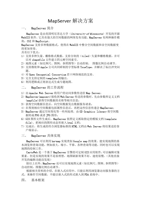
MapServer解决方案一、MapServer简介MapServer是由美国明尼苏达大学(University of Minnesota)开发的开源WebGIS软件,它具有强大的空间数据的网络发布功能。
MapServer有两种操作模块:CGI和MapScript。
MapServer支持多种数据格式,使得在WebGIS中整合空间数据和非空间数据变的更加容易。
具有以下优点:1)支持多种矢量、栅格格式数据,支持分块的(tiled)矢量和栅格数据,并可以对shapefile文件建立四元树空间索引。
2)地图元素(如比例尺、图例,参照图等)自动控制,图像比例自动调节。
3)支持微软和Apple公司共同研制的字型标准TrueType,并解决了标注冲突问题。
4)对Open Geospatial Consortium若干网络规范的支持。
5)完全支持定制的template的输出。
6)利用逻辑或正则表达式生成专题地图。
二、MapServer的工作流程1)由Apache Web Server将用户的访问参数传送给Map Server;2)MapServer(mapserv)接收到Web Server传送的参数时,先由参数所定义文档(mapfile)获得空间数据的名称等相关信息;3)获得空间数据信息后,向空间数据发出数据服务请求;4)在得到相应空间数据包括属性信息后,再把这些信息传递会MapServer;5)MapServer通过空间变化等一些列处理,由GD Graphics library将空间数据转成PNG或者JPG图形;6)GIS图形文件生成后,MapServer依照定义抓取指定的模版文档(template file),把相应的图形动态形嵌入html文档;7)完成后,将生成的符合浏览器标准的HTML文档由Web Server将结果送给客户端显示。
三、MapServer具体实现MapServer可以利用ka-map实现类似Google map的效果。
- 1、下载文档前请自行甄别文档内容的完整性,平台不提供额外的编辑、内容补充、找答案等附加服务。
- 2、"仅部分预览"的文档,不可在线预览部分如存在完整性等问题,可反馈申请退款(可完整预览的文档不适用该条件!)。
- 3、如文档侵犯您的权益,请联系客服反馈,我们会尽快为您处理(人工客服工作时间:9:00-18:30)。
Web-based Thematic Map Service in OpenGIS EnvironmentJung-Hong HongAssociate Professor, Dept. of Geomatics, National Cheng-Kung University1, University Road, Tainan, China Taipeijunghong@.twShih-Yu LinMaster, Dept. of Geomatics, National Cheng-Kung University1, University Road, Tainan, China TaipeiAbstract: Thematic maps are nowadays widely used in a variety of research domains and human daily lives to depict and analyze spatial phenomena in reality. Though current Web-based GISs can already display thematic maps via internet, their content is nonetheless restricted to those maps already stored in databases. Naïve users, with limited cartographic knowledge and GIS software experience, can hardly submit their data and create thematic maps that meet their demands. In this paper, we proposed a web-based thematic map service that successfully integrates various services complying with numerous OpenGIS standards like GDAS, GLS, and WMS. The intelligent and automatic mapping capability of the proposed service is further improved by introducing built-in rule-based cartographic knowledge. Comparing to some of the current closed and inflexible centralized data archive; the proposed system architecture, though still preliminary, holds apparent advantages by having the standardized interface between servers, easier data integration and interoperability and the convenient map design environment to users without prerequisite knowledge.Keywords: OpenGIS, Thematic Maps, Standards1. IntroductionThematic maps [1] are widely used map techniques to illustrate spatial distribution of real world phenomena. Even without professional mapping skill, a variety of users rely on thematic maps to depict and analyze spatial phenomena in their research domains. The rapid growth of GIS technology has made a huge difference regarding the creation of thematic maps. With easy-to-operate toolbox [2] and the availability of increasingly expanded digital data, naïve users found out the making of thematic maps was no longer a huge obstacle impossible to challenge, at least as far as the software technology is concerned. Though Vitek et al.[3] argued that such convenience may hide the risk that ill-quality maps are created much easier than before, yet the innovative GIS software environment and the potential of ubiquitous internet accessibility [4] arouse a world-wide technology revolution and this trend seems to be practically unstoppable. Unfortunately this fast development didn’t mean Vitek’s concerns will automatically disappear. For most of the GIS software, the successful creation of thematic maps would first require users to have correct data (in a particular format) beforehand, and further require users to have enough cartographic knowledge, and know how to issue appropriate commands. To many users, it is indeed true that GIS technology, as well as its applications in internet, largely removes the technology barrier to access thematic maps, but some difficult challenges remain to be resolved in the future. We argued in this paper that domain users not familiar with GIS technology have neither the ability to process software, nor enough skill to create data that holds correct corresponding relationship between spatial and aspatial attributes, a prerequisite demands for creating any thematic maps. They do have the needs for thematic maps, but they would also hope they don’t need to deal with the complicated GIS operations and sincerely expect the thematic maps they need will be readily available as long as their data is ready.Two major GIS technology threads in recent years are “open” and “distributed” [5]. The 19100 series of standards proposed by the ISO/TC211 and the abstract and implementation specifications proposed by the Open Geospatial Consortium (OGC) provided a unified and solid framework for the description, modeling, recording, transfer and internet distribution of geographic data [6]. With these standards, system operations, transferred data, as well as the communicating interface among geo-servers, can all comply with open and public standards and effectively improve the sharing and interoperability of geographic data [7]. By following selected standards, data and services can be created by authorized organizations in the distributed environment and linked thru standardized interface whenever necessary. With more and more commercial GIS software companies and communities supporting OpenGIS standards, the GIS technology is now under a tremendous revolution and it is surely interesting to investigate how this would impact the issue of thematic maps. We believe a web-based thematic map service should not be restricted to only display ready-made maps, it should be able to allow domain users to submit their own data, sometimes even without graphic description, and create thematic maps by built-in cartographic knowledge and services that comply with the OpenGIS standards. Furthermore, these services may serve different purposes and located in different places in the distributed OpenGIS environment. The immediate challenge is we longer have data with correct corresponding relationship between spatial and aspatial descriptions beforehand, and must create this mapping dynamically. Secondly, since all the required data may come from different servers, the thematic map service must have built-in knowledge to justify the received data content and make appropriate mapping decisions. This paper discusses our preliminary attempt to develop a web-based thematic map service that complies with various OpenGIS standards and the research result will also serve as the foundation of the service-oriented infrastructure for the years to come.2. System ArchitectureA thematic map depicts the spatial distribution of the selected theme, its successful creation therefore relates to at least three steps: (1) prepare data with correct spatial-aspatial corresponding relationship, (2) apply cartographic knowledge to determine mapping process, and (3) execute the mapping process. Current GIS software usually requires users to prepare data by themselves and provides wizard interface to guide users’ mapping actions. To design a web-based thematic map service based on the OpenGIS technology, four major requirements are first identified:1) Thematic data is provided by domain users2) Thematic map service possesses built-in knowledge to judge data contents and perform necessary mapping actions3) Data and services can be stored and processed separately in different servers4) The communicating interface among different services must comply with OpenGIS standardsFig. 1 shows the three-tier system architecture of the thematic map service we proposed. The three tiers respectively relate to (1) client that allow users to issue request and receive response, (2) thematic map servers that make cartographic decision and (3) basic services that provide necessary cartographic operations. These three tiers are connected in internetUsersGDAS ServersGLS ServersThematic Map ServersWMS ServersFig 1. 3-Tier system architecture of the thematic map service1) Client tierTo reduce software/hardware technical requirement, client should be able to interact with the thematic map servers with only standard browsers. This limits the request and response should follow HTTP protocol and the returned maps will be in image formats, such that it can be displayed in clients’ browsers without further processing. Clients will be prompted a homepage to upload their thematic data and provide necessary descriptions about the uploaded data. Ideally the uploaded data should also comply with certain standards, but it is surely an overwhelming loading to clients. We instead choose Microsoft Excel as the designated format for the uploaded thematic data, because it is widely used in PC platform and has the capability to import various data formats like HTML table, CSV, TXT. MDB and DBF. This can of course be expanded in the future if necessary.2) Thematic Map Server tierAs the center of the system architecture, the thematic map servers are in responsible fortasks that includes receiving client’ requests, analyzing if maps can be created, accessing required data located in the distributed environment and applying cartographic knowledge to create correct thematic maps. Thru the homepage the thematic map servers provide, clients issue their mapping requests by identifying at least three types of information:geographic identification framework,data responsible organization, data theme, data time, and attributes for making thematic mapsthe uploaded data file.Note the attribute data stored in Excel file does not have any graphic description, the thematic map server therefore needs to analyze if a correct corresponding spatial description file (e.g., digital map) is available. The successful linking of these two types of data allows the creation of correct thematic maps (Fig. 2). The geographic identification framework serves for this purpose and will be discussed in more detail later.Fig. 2 The linking between spatial and aspatial data to create thematic maps The various information about the uploaded data (i.e., metadata) is essential to the mapping process. Some are used to have a better understanding about uploaded data file, some are critical factors during the mapping process. For example, it is preferred the uploaded thematic data and the corresponding spatial description file referring to the same temporal extent, otherwise it is very likely some features will be located in their locations 10 years ago (if they have moved), and we will have no way to notice it. A series of thematic mapping rules were designed and included in thematic map servers as built-in knowledge to ensure the correctness of thematic maps. In the meantime, the thematic map servers actually do not hold any attribute or map data, it therefore must maintain a stable connection to the various servers in basic service tier.3) Basic Service tierOne of the major merits of the OpenGIS standards is the standardized web service interface that takes away the barrier of commercial software format and thus allows easier data interoperability. A particular geo-server supporting selected OpenGIS standards is capable of fulfilling certain GIS needs and allowing standardized request/response from other clients and servers in the internet. After analyzing mapping procedures, three types of basic services are identified and can be operated with certain OpenGIS standards. These three services are Geolinked Data Access Service (GDAS), Geolinking Service (GLS) and Web Mapping Service (WMS) [8][9][10]. Servers complying with these standards are created accordingly in this paper.1. GDAS ServersA GDAS server complying with OGC GDAS standard can store attribute data with geographic identifiers (GID), and allow other clients or servers to request data that meet their demands. Geographic identifiers usually refer to a unique code that can be used to identify a feature with spatial extent, e.g., name of the political regions, street address of buildings, zip code, etc. Whenever data is collected in accordance with the spatial extent of GID (which is usually the case of thematic map data), it is advisory to include GID as one of the attribute and thus introduce an implicit spatial description to the attribute data. A GID framework therefore refers to a set of unique and systematic coding of GID, forexample, there are 6 political districts in the Tainan city now, so the framework will consist of 6 different GID (East, South, Central-West, North, An-Nan and An-Ping) and can be named as “Tainan city political district framework.” Since GID will be used as the reference for joining attribute and spatial data, GID framework is better created and maintained by authorized organizations. Whenever there is any change to a GID framework, a new version of GID framework should be created and the old version must still be saved for possible future use. For example, there were 7 political districts the Tainan city in the past, but the Central district and West district were merged to a new Central-West district beginning with the year of 2004. If the data is about the years before 2003, the 7-district version of GID framework should be chosen.Following the GDAS standard, attribute data, together with its metadata, will be transformed and stored in XML format so that later internet communications between servers (e.g, data transfer) can be based on the XML technology. Fig. 3 shows an example of the recording data in the GDAS serversFig. 3 Thematic data stored in GDAS Servers2. GLS ServerA GLS server complying with the OGC GLS standard can build a link between the attribute data acquired from GDAS servers and its corresponding digital map data with common GID (similar to a “join” operation in relational database). A GLS server should have a digital map database to provide different GID framework and a mechanism to perform linkage operations. During the creation of thematic maps, it is a mandatory requirement that the data from GDAS server and GLS server must refer to the same GID framework, otherwise the mapping should not be executed any further. However, since these two types of services are created and maintained separately, it is certainly possible that no appropriate digital maps are available for creating correct thematic maps.To improve the thematic map content, the proposed service includes a “reference map” design, such that clients can overlay roads or political districts to help map reading. From a cartographic perspective, the reference map data and GLS digital map should better refer to the same period of time and the same level of positional accuracy. Since this is not included in the specification of GLS standards, this is done primarily in thematic map servers with built-in cartographic knowledge.3. WMS serversNowadays WMS capability is supported by almost every major commercial WebGIS. It works on the basis of map image transfer thru standardized request and response, and thus hide the detailed operations of commercial data format from the users. Since the response is in image format, it can be easily displayed and operated in internet browser or various types of image software. GeoServer(/html/index.php)was chosen in this paper to serve as the WMS server. Since its default data format is ESRI shape format, the spatial data in GLS server isalso in ESRI shape format to simplify mapping procedures. To appropriately adjust the layout and symbols in the thematic maps, OGC Styled Layer Descriptor (SLD) is used. Based on the types of thematic maps analyzed, different templates of SLD are applied.3. Mapping knowledge and processBased on the system architecture described in section 2, four different types of services can simultaneously locate in a distributed environment and fulfill certain task requirements. Though all services can run independently, it nevertheless requires a careful design to integrate all services and ensures the correctness of the thematic maps. This section provides a brief discussion about the mapping knowledge and the process flow of the mapping service.1) Mapping knowledgeThe successful creation of thematic maps requires professional mapping knowledge to bridge the gap between naïve users and mapping functions. Robinson et al.[11] had a detailed discussion about the factors influencing map design, e.g., measurement level, feature dimensionality, symbolization, etc. Built-in mapping rules in this paper are categorized into two groups: common rules applicable to all types of thematic maps and specific rules only applicable to a certain type of thematic map. Altogether 14 common rules regarding general properties, theme, reference data and annotations are developed. Each rule specifies the condition either data or service must fulfill. For example, rule 6 indicates that “thematic data must have corresponding spatial descriptions in graphic format”, this would require the above-mentioned GID linking process. If the condition cannot be satisfied, the mapping process should be terminated. Some rules are optional during the mapping process, for example, rule 10 indicates “the scale of all reference map data should be withina specified range.” Although this is certainly a preferred case, yet sometimes such data is simply not available. Another23 specific rules regarding location maps, graduate symbol maps, choropleth maps, bar chart maps and pie chart maps are developed. Whenever the specific type of map is chosen, its corresponding specific rules must be enforced. For example, the pie chart maps require conditions like more than 2 submitted attributes must be selected, each GID must correspond to the same set of attributes, these attributes are mutual exclusive and their measurement levels are “ratio.” These conditions must be verified one by one before any further action is issued.Fig. 4 shows the four major steps the designed thematic map servers perform on the uploaded data. Only after the uploaded data can pass all the required tests, can the data be transformed into the format GDAS standard demands. Each step may involve a more detailed test procedure. Take GID framework judgment for example, a qualified GID framework in the GLS server means it maintain a correct corresponding relationship to the uploaded data from the perspective of (1)framework title, (2) temporal extent and (3) GID:1. GID framework titleA digital map file with the same GID framework title is the first requirement that must fulfill. The thematic map servers therefore must be able to retrieve the GID framework title of all the digital map files in the GLS servers. The test returns a Boolean result of whether the mapping is possible. The title comparison is, however, not a rigorous constraint, and it is likely more than one digital map files may qualify. For examples, a number of digital map files may refer the same GID framework, but with different scales, positional accuracy, period of times, etc.2. Temporal extentIt is mandatory for clients to specify the temporal extents of the uploaded data so that it can be compared against the temporal extents of digital map files in GLS servers. Following Allen’s temporal logic [12], it is definitely preferred that a “contain” relationship exists between these two time records, meaning the digital map files can be safely applied to uploaded data. The Tainan city district adjustment case is a typical example of this issue. If a client submits a statistic data ranging from the year of 2000 to 2005, there is practically no single digital map file that can fulfill this mapping request because a new version is created in the year of 2004. No matter the time is modeled as a point or an interval, it is always possible that no overlap existing between the two recorded time. Though it does not necessarily mean the created thematic maps are wrong, certain risk is inevitable.3. GID(2) Mapping processGDAS standards and send XML file to GDAS servers.Step 3: Thematic Map Server sends GeoLink request to GLS servers via HTTP protocolStep 4: GLS server sends getData request to GDAS servers via HTTP protocol to access thematic data (created in step 2) Step 5: GDAS servers respond getData request and send back the XML format thematic dataStep 6: GLS servers link thematic data and corresponding spatial data via common GID, and register a new layer in the WMS serversStep 7: WMS servers send the URL of the newly created map layer back to the GLS serversStep 8: GLS servers respond a XML file to the Thematic Servers to indicate the Geolink process is completedStep 9: Thematic Map Servers send a getMap request to WMS servers via HTTP protocolStep 10: WMS servers response with the JPEG image created by Geolink process (created in Step 6)Step 11: Thematic Map Servers make necessary adjustment and send the JPEG file back to the users.ClientsGDAS Servers GLS ServersThematic Map Servers WMS Servers getDataRequestHTTP) 5. getData Response(XML File) URL of MapsFig. 5 Web-based thematic map creation procedures.Fig. 6 demonstrates an example of thematic map servers’ Geolink request (step 3). Note it includes the information about the requested URL of the GDAS server, the GID framework, attribute data, and the geolink GID.Fig. 6 Geolink request example issued by the thematic map server4. Result AnalysisTable 1 shows the statistics of different types of hospital beds of the Tainan city in the year of 2003. The statistics is created on the basis of the 7 political regions, therefore the “Tainan city political district framework” should be chosen as the default GID framework. With the attribute data in table 1, several different types of thematic maps can be created. When the selected attribute is a certain type of beds, a graduated symbol map can be created. If more than two attributes are selected, a bar chart map or a pie chart map can be created to illustrate not only the spatial distribution, but also the difference in different categories.Table 1. Test data of hospital bed statistics in Tainan cityFig. 7 shows the homepage the thematic map servers prompt to clients. Clients have to select the corresponding GID framework of the uploaded file (Step 1), fill in metadata and selected attributes (Step 2) and specify the pathname of the uploaded file (Step 3). The GID framework is designed as a “selected” pull down menu, meaning if no appropriate :8080/gls/gls.jsp?Service=gls&Request=Geolink&Version=0.9.1&GDAS=http://gdas.041.no-:8080/gdas/gdas.jsp&GDASVersion=2004&FrameworkDomain=.tw &FrameworkName=台南市行政區域名稱&FrameworkVersion=1945&DatasetDomain=.tw&DatasetName=2003年台南市各行政區各類病床數統計&Attribute=醫院一般病床,醫院特殊病床,診所病床&Geolinkids=東區,中區,西區,安南區,安平區,南區,北區framework is available, then the thematic map service cannot satisfy clients’ mapping request. In this example, all three attributes in Table 1 are selected and clients have to provide necessary metadata for each attribute. After clients submit their data, the thematic map servers analyze uploaded data and response analyzed results (Fig. 8). Clients are prompted with illustrations to select preferred types of thematic maps and reference map data (roads and political districts).Fig 7. Clients’ homepage interface Fig. 8 Returned analysis result.When more than one attribute is chosen, bar chart and pie chart thematic maps can be used to depict the difference among different categories or period of time(Fig. 9). Unfortunately current WMS server does not provide such capability to draw bar or chart symbol. The current version of the thematic map service superimposes designed symbols to the output maps according to the specific location of GID, but does not have sufficient cartographic knowledge to automatically adjust their sizes and labeling. This may need additional works in the future.Fig. 9. Bar chart and Pie chart thematic map from Table 1.Fig. 10 shows the thematic maps of the population density in the Tainan city. Although these two maps refer to the same original data source, but the making of graduate symbol maps and choropleth maps are actually based on different dimensionality of symbols (point vs. polygons). After clients select the preferred type of thematic maps, the thematic map servers apply built-in knowledge to select appropriate GID framework. If graduate symbol map is chosen, point-type spatial data in GLS server is chosen and the boundary of political district is superimposed. If choropleth map is chosen, polygon-type spatial data is chosen instead.Fig. 10 Graduate symbol map and choropleth map for the population density in Tainan city In the next example, because only the statistic data of four political districts is uploaded, a warning message indicating only part of the GID in the framework have been successfully linked is sent to clients (Fig. 11), but the mapping process continues and only political districts with statistic data are shown in the map.(Fig. 12 )Fig. 11 Partial linkage warning messageFig. 12 Partial mapping result with only districts with statistic data5. ConclusionsThe OpenGIS technology opens a new dimension for the creation of thematic maps. In the past, the closed data format and insufficient professional skill impede many non-spatial domain users to create thematic maps fulfilling their needs. While most of the current WebGISs still only allow users to display and create thematic maps based on data already stored in their databases, we proposed a web-based thematic map service based on a number of OGC standards like GDAS, GLS, and WMS, which will allow naïve users to submit their thematic data via internet and receive thematic maps based on the data they sent from the service. The proposed service architecture works on the basis of standardized interface among different servers and allow easier data integration and interoperability. With built-in cartographic knowledge, the major breakthrough of this research is even the users have only little professional knowledge and thematic data without explicit spatial description, the thematic map can still be created accordingly. Furthermore, the separated nature of aspatial and spatial data (corresponds to GDAS and GLS servers, respectively) in the system architecture makes it possible for these two types of data to be managed separately in the National Spatial Data Infrastructure environment. Domains without spatial knowledge can maintain their own GDAS servers and take advantage of the proposed service to create their own thematic maps. In the mean time, the thematic map service and a variety of GLS servers can be maintained by the NSDI authority organizations, who often has superior ability to handle spatial data. Under this circumstances, naïve users no longer have to deal with unfamiliar data format and worry about the barrier of cartographic and information knowledge.AcknowledgementPart of the content of this paper was sponsored by the research grant of the National Science Committee (ProjectNSC93-2211-E-006-065 and NSC94-2211-E-006-071)References[1]Dent, B., 1996, Cartography: Thematic Map Design, 5th edition, William C Brown Pub.[2]Dangermond, J. 1986, The software toolbox approach to meeting the user's need for GIS analysis,Geographic Information SystemsWorkshop Proceedings, pp. 66-75,.[3]Vitek, J. D., Giardino, J. R. and Fitzgerald, J. W., 1996, “Mapping Geomorphology: A Journey from Paper Maps, throughComputer Mapping to GIS and Virtual Reality”, Geomorphology, Vol. 16, 231-249.[4]Peng, Zhong-Ren and Ming-Hsiang Tsou, 2003, Internet GIS: Distributed Geographic Information Services for the Internet andWireless Networks, John Wiley and Son Inc.[5]Gardels, K., 1997, Open GIS and On-Line Environmental Libraries, ACM SIGMOD Record archive, Volume 26 , Issue 1, pp. 32 -38.[6]Kresse, W. and K. Fadiaie, 2004, ISO Standards for Geographic Information, pp. 55-96.[7]Ummadi, Praveen, 2004, A White Paper on Standards & Interoperability in GIS, Michigan State University Press.[8]Open Geospatial Consortium, 2004a, Geolinked Data Access Service, Version 0.9.1.[9]Open Geospatial Consortium, 2004b , Geolinking Service, Version 0.9.1,.[10]Open Geospatial Consortium, 2004c, Web Map Service interface, Version 1.3.[11]Robinson, Arthur H., J. L. Morrison, P. C. Muehrcke, A. J. Kimerling, S. C. Guptill, 1995, Elements of Cartography, 6th Edition,Wiely.[12]Allen, J,F,, 1983, Maintaining Knowledge about Temporal Intervals, Communications of the ACM, Vol.26, No.11, pp. 832-843.。
