地理必修三 复习提纲(填空)
地理必修3会考复习提纲

地理必修Ⅲ复习提纲1.1 区域的基本含义1、区域的概念:地球表面的空间单位,它是人们在地理差异的基础上,按一定的指标和方法划分出来的。
2、区域的基本特征:具有一定的界线、区域内部的相似性和连续性、区域之间的差异性和相互联系、整体性。
3、区域的空间结构:区域中各要素的相对位置关系和空间分布形式。
农业通常表现为面状,交通运输线路表现为线状和网络状,城市和工业表现为点状,城市群和工业区表现为岛状。
影响区域空间结构的主要因素是社会经济发展水平。
4、区域的产业结构:传统的农业区域和发展水平较低的区域,第一产业所占比重比较大;工业区域或加速推进工业化的区域,第二产业所占比重较大。
发展水平较高的区域,第三产业比重较大。
1.3 区域发展差异1、我国东、中、西部差异①三大经济地带的划分:东部:沿海12省区;中部9个省区;西部10个省区②东部与中西部的发展差异:东部:社会经济相对发达,工业化、城市化和科技教育水平比较高,发展速度亦快于中西部。
对外开放时间早,程度高,第二和第三产业相对发达,工业结构以轻型和轻重混合型为主。
中、西部:地域广阔,资源丰富,总体发展水平明显落后于西部。
农业经济在国民经济中占有较大比重。
工业结构西部以重型传统工业为主,中部表现出一定的过渡性特征。
2、南北差异(东部季风区以秦岭-淮河为界,分为南方和北方)1.4 区域经济联系1、资源的跨区域调配①意义:有利于资源的合理配置,缩小区域经济差距,实现社会经济的可持续发展。
②南水北调③西气东输④西电东送2、产业转移原因:①降低成本:原材料价格、工资和地价水平、公用事业费用等方面的区域差异,导致产业向低成本地区转移。
②开拓市场③降低内部交易成本。
影响:促进欠发达地区的经济发展,缩小区域差异。
同时也会带来环境污染加重等问题。
2.1生态问题1、水土流失问题我国典型地区:黄土高原、南方低山丘陵地区产生的原因:(1)自然原因:季风气候降水集中,多暴雨;地表植被稀少;黄土土质疏松。
地理必修三复习提纲(填空版)
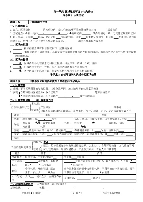
a、面临人口问题: 人口战略: b、面临资源问题: 资源战略: c、面临环境问题: 环境战略: d、稳定战略: 测试目标 了解协调人地关系的主要途径
。 。 。 。 。 。 。
新世纪国际社会推进的新的实践模式—— 农业经济结构调整—— ;倡导——
公众既是消费者,也是生产者和管理者;应积极接受可持续发展的观念和参与,改变我们的生产和生活方式。如工 厂清洁生产、社会公众选购带环境标志产品、使用公共交通工具、使用再生纸、自备篮子购物、垃圾分类回收 利用、节水等等。 导学案 6 中国可持续发展之路 测试目标 理解走可持续发展道路的必然性
一、走可持续的必要性——中国面临的严峻现实(生存和发展的压力): a、 ; b、 (种类多、总量大、类型全,但人均少、资源利用率低 、用量增长过快) ; c、 (城市中的环境污染日益加重;以水土流失、荒漠化、森林和草地资源减少、生物 多样性减少为特征的生态破坏范围在扩大、程度在加剧) 。 二、基本途径和应采取的措施 《 ——中国 21 世纪人口、环境与发展白皮书》是全球 的《21 世纪议程》;
一、环境问题产生的原因
地理必修 3 复习提纲— -2- 共7页 —巧二中张永能整理
环境问题:
;
。 (水土 (主
原因:①由于人类向环境索取过度,造成 (水资源、土地资源、矿产、能源)和 流失、 土地荒漠化、 物种减少) 。 ②人类向环境排放废弃物过量, 超过了环境的 , 使 要有大气污染、水污染、土壤污染、噪声污染、固体废弃物污染)。 二、主要环境问题 主要原因: ; ; 地域差异:城市主要为 环境问题 全球变暖 全球 臭氧层破 坏 酸雨 赤潮 水土流失 土地荒漠 化 生物多样 性减少 大量排放 排放 、 等酸性气体 的污水排入 纬度较低较封闭的海域; 工业城市集中的沿海 大量含有 较 的海域 成因 ;乡村主要为 。发达国家以 分布 为主;发展中国家以 防治措施
地理必修三复习提纲

地理必修三一、地域的定义:地球外表的空间单位,人们在地理差异的根底上按照肯定的指标和方法划分出来的。
指标和方法不同,地域的类型也不同。
二、地域的特点:有的边界是明确的〔行政区〕,有的边界是过渡性质的〔干湿地区〕;层次性注:两个地域,按照不同的指标,地理界线是不同的。
三、地理差异对地域开展的影响长三角和松嫩平原的比照长三角〔华东地区、沪宁杭地区〕:读图和文字得到以下信息:1、定位:30°N~32°N,120°E~122°E,东部沿海的中部,太平洋的西岸,与日本隔东海相望。
2、地形:以平原为主,地势平坦3、气候:亚热带季风气候,夏季高温多雨,雨热同期,温暖时间长,作物的生长期长。
4、土壤与耕地:肥沃的水稻土,耕地较为分散,多为水田,人均耕地低于全国平均水平。
5、水系:长江、京杭运河、富春江、钱塘江、黄浦江6、作物:水稻、冬小麦、油菜、棉花7、矿产资源贫乏。
8、综合性的工业基地〔兴旺农业的根底上开展轻工业,利用交通优势进口矿产开展重工业〕松嫩平原〔和三江平原、辽河平原构成东北平原〕1、定位:43°N~48°N,125°E附近2、地形:平原为主,地势平坦3、气候:温带季风气候,雨热同期,降水主要集中在七八月份〔大陆性稍强〕,温暖时间短,作物的生长期短。
4、土壤与耕地:肥沃的黑土,耕地较为集中,多为旱地,人均耕地多,有利于机械化的推广,耕作方法相对粗放,亩产量低于全国平均水平。
5、水系:嫩江、松花江6、作物:春小麦、大豆、玉米、甜菜〔辽南为冬小麦〕7、矿产:有丰富的石油资源。
8、工业:我国的重化工基地。
四、地域不同开展阶段地理环境对地域的影响是不同的。
以长江中下游平原为例为例来分析1、开发早期:黏重的土壤和稠密的水系成为农业开展的障碍。
2、开发时期:随着科技的开展,化不利的自然条件为有利的条件。
3、农业时期:成为我国重要的粮仓和棉花、桑蚕的产地。
高中地理必背知识-复习提纲 - 必修三
高中地理必备知识——复习提纲地理必修Ⅲ复习提纲一、区域地理环境与人类活动(1)区域的含义1. 区域的概念:地球表面的空间单位,它是人们在地理差异的基础上,按一定的指标和方法划分出来的。
区域既是上一级区域的组成部分,又可进一步划分为下一级区域。
2. 区域的特征:层次性;差异性;整体性;可变性3.区域的空间结构:区域中各要素的相对位置关系和空间分布形式。
农业通常表现为面状,交通运输线路表现为线状和网络状,城市和工业表现为点状,城市群和工业区表现为岛状。
影响区域空间结构的主要因素是社会经济发展水平。
4. 区域的产业结构:传统的农业区域和发展水平较低的区域,第一产业所占比重比较大;工业区域或加速推进工业化的区域,第二产业所占比重较大。
发展水平较高的区域,第三产业比重较大。
(2)不同区域自然环境、人类活动的差异。
长江三角洲和松嫩平原的异同:相同:都是平原地区,并都位于我国的东部季风区不同:①地理位置差异:长江三角洲在我国东部沿海地区的中部,长江的入海口;松嫩平原在我国东北地区的中部②气候条件差异:长江三角洲在亚热带季风气候区,夏季高温多雨,雨热同期;松嫩平原在温带季风气候区,大陆性稍强,降水较少,温暖季节短,生长期较短,水热条件的组合不如长。
③土地条件差异:长江三角洲以水稻土为主,耕地多为水田,较为分散,人均耕地面积低于全国平均水平;松嫩平原黑土分布广泛,耕地多为旱地,集中连片,人均耕地面积高于全国平均水平。
④矿产资源条件差异:长江三角洲矿产资源贫乏,松嫩平原有较丰富的石油等矿产。
(3)不同发展阶段地理环境对人类生产和生活方式的影响。
1.早期:长河流、湖泊和沼泽分布较广,地势平坦,土质黏重。
受地理环境的限制,耕作农业发展缓慢。
2.农业社会时期:①船作为交通工具被广泛使用,长稠密的水系为扩大交通联系提供了天然水道。
②随着农业生产工具的改进和生产技术的改良,长多水而质地黏重的土壤不再成为耕作业的限制条件,农业生产得到较快的发展。
高中地理鲁教版必修三第三单元复习提纲

高二选修班期末复习背诵默写填空必修三第三单元
第一节黄土高原水土流失
1.黄土高原范围:以西,以东,以南,以北。
地表形态:
(原因:)。
黄土高原成因
2.水土流失危害:①
②
③
3.水土流失原因:自然原因:①地理位置,②土壤
③降水④地质灾害
人为原因(主要):①,②(最主要原因)4.黄土高原人地关系尖锐的根源在于,环境治理以为中心,治理与相结合,是成功的经验
5水土流失三大措施:①(包括:工程,工程,工程),②如:、、,③(根本措施)
第二节鲁尔区
1.分析某工业区区位条件:自然:①②③
社会经济:①②③④⑤
2.鲁尔区区位优势:①②③
④⑤⑥.
3.鲁尔区的主导(首先衰落的)产业是①②
4.鲁尔区(辽中南、美国东北部)遇到的问题:①(衰落的最主要原因是:)②
可持续发展措施:①②
③创新④扶持
第三节南水北调(西气东输、西电东送)
1.水资源空间分布不均的对策:,时间分布不均的对策:,水资源短缺的人为原因一般包括:①②③南水北调根本原因:
2.长江作为南水北调水源区的原因:①②③
3.南水北调东线起点:,终点:,利用作为输水渠道
优点有①②,缺点有①②
西线起点:水库再到水库,优点有①
②③,缺点是
4.华北成为我国最缺水(春旱最严重)地区的原因:自然原因:①
②③,人为原因:①
②③
5.南水北调可能带来的环境问题(水源地与沿线):①
②③④
⑤⑥.
6.西气东输西起:,目标市场:,线路布局主要考虑:
7.管道优点:①②③,缺点:
8..西气东输(西电东送)对东(西)部影响:(1)经济效益,(2)社会效益,(3)生态效益。
高中地理 必修三复习提纲

《地理必修三复习参考》★★★使用说明:①阅读学业水平考试要求。
②知识点部分供大家查缺补漏,背诵以课本为标准。
③重点是第一三四单元。
④利用地图册,读图记忆“位置、分布”。
“原因、措施、条件”等注意总结归纳答题要点。
第一单元区域地理环境与人类活动二、知识点复习:1.1认识区域一、区域的含义1.含义及特点:区域是指一定范围的地理空间,是人们在地理环境差异的基础上按一定的指标划分出的。
特点:区域是有一定的面积、范围、形状或界线;区域有明确的区位特征;区域内部某些特征相对一致,并与其他区域有所区别。
2.划分指标:可采用单一指标,也可采用综合指标来划分;可按自然要素特征来划分,也可按人文要素特征来划分。
3. 划分目的:是为了进一步了解个区域之间的差异,因地制宜地对区域加以开发利用。
二、区域的类型1.均质区:指那些要素具有相似性或相对一致性的区域(要素平等)。
如:气候区,温度带,地形区,干湿地区,方言区,水田农业区。
2.功能区:指那些功能上紧密相连,具有某些方面的相关性或内在联系的区域。
由区域的中心和它所吸引或辐射的范围组成。
(一般指经济区和工业区,具有核心)如:城市经济区,贸易区,浦东新区,长江流域。
1.2 自然环境和人类活动的区域差异1比较区域差异的一般步骤:①地理位置的比较(纬度位置、海陆位置)②自然环境的比较(地形、气候、植被、水文、矿产资源等)③人类活动的比较(农业发展水平、工业发展水平、城市化水平、劳动力状况等)2 英国和日本区域差异比较(P11、P13表格)3.中国三大自然区的比较(1)划分依据:综合地形和气候两大要素,可以把我国划分成三大自然区,即东部季风区、西北干旱半干旱区、青藏高寒区。
(2)界线:西北干旱半干旱区与东部季风区大致_400mm_年等降水量线为界,青藏高寒区的范围与我国地势的第一级阶梯吻合,大致以昆仑山西段、阿尔金山、祁连山和横断山为边界。
(3)三大自然区差异比较1.3 区域发展阶段与人类活动 ——美国匹兹堡发展的四个阶段第二单元 走可持续发展之路(本单元了解即可)一 、人地关系思想的演变概念:既满足__当代人___的需求,又不对__后代人_满足其需要的能力构成危害的发展。
地理必修三复习提纲(有答案)
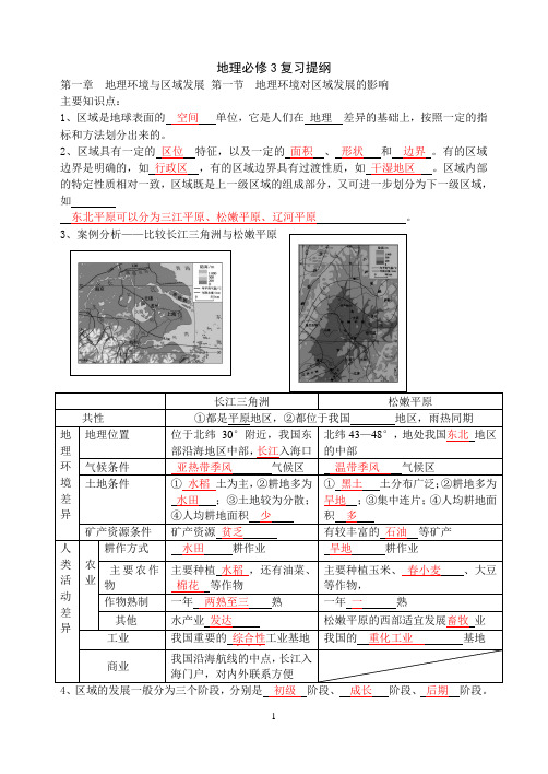
地理必修3复习提纲第一章地理环境与区域发展第一节地理环境对区域发展的影响主要知识点:1、区域是地球表面的空间单位,它是人们在地理差异的基础上,按照一定的指标和方法划分出来的。
2、区域具有一定的区位特征,以及一定的面积、形状和边界。
有的区域边界是明确的,如行政区,有的区域边界具有过渡性质,如干湿地区。
区域内部的特定性质相对一致,区域既是上一级区域的组成部分,又可进一步划分为下一级区域,如东北平原可以分为三江平原、松嫩平原、辽河平原。
4、区域的发展一般分为三个阶段,分别是初级阶段、成长阶段、后期阶段。
5、案例分析——长江中下游平原不同发展阶段地理环境的影响①开发早期,人们利用和改造自然的能力低下,稠密的水系成为交通的阻隔,黏重的土壤使开垦困难,所以这一时期耕作农业发展缓慢。
②随着科技的进步,人们利用和改造自然的能力增强,制约因素成为促进区域发展的有利因素,如水系提供了天然通道等,农业得到较快发展。
成为我国主要的粮食产地、桑蚕和棉花产地。
③随着工商业的发展,农业的地位在下降。
第二节地理信息技术在区域地理环境研究中的应用主要知识点:1、地理信息技术是指获取、管理、分析和应用地理空间信息的现代技术的总称,主要包括遥感、全球定位系统和地理信息系统等。
2、遥感广泛应用于资源调查、环境监测、自然灾害防御监测等领域。
(结合实例分析)3、全球定位系统是指利用卫星,在全球范围内适时进行导航、定位的系统,简称GPS。
4、全球定位系统包括三大部分组成:空间部分-GPS卫星星座,地面控制部分-地面监控系统和用户设备部分-GPS信号接收机。
5、全球定位系统能为各类用户提供精密的三维坐标、速度和时间,并且具有全能性、全球性、全天候、连续性和实时性的特点。
可以帮助野外考察人员确定考察点的地理位置、高程,从而在野外调查中获得精准的数据。
6、专门处理地理空间数据的计算机系统,称为“地理信息系统”,简称GIS 。
7、地理信息系统在城市管理中,可以对城市的信息进行查询、修改、补充、距离测算等,从而为城市管理提供方便。
(填空)中图版高中地理必修三复习提纲

高中地理必修三复习提纲第一章第一节区域和区域差异:1、区域指一定范围的________________,它具有一定______________,是一个可度量的______;区域划分的指标有______、经济和________等某一方面的,也有_______ 的。
相应的区域有:____________、经济区、_____________,文化区、____________________2、区域特点:_____________________、等级有高低、、边界有虚实、内部特点相对一致3、区域一般具有的四大特征:________、差异性、________________和开放性4、决定自然区域差异的基本因素是________和_________,而土壤和________则是自然区域的标志。
综合自然、气候两大要素,我国可以分为______________、_____________________和_________________ 三大自然区。
5、比较三大自然区地理特征差别:东部季风区西北干旱半干旱区青藏高寒区地形和地势气候水文特征植被和土壤区域内部变化的主导因素6、比较三大自然区人类活动的差别东部季风区西北干旱半干旱区青藏高寒区农业活动交通经济和文化7、东部季风区的内部差异:以_________ 一线为界:是_____与北方的分界线;中国一月份均温为_____的等温线;是_____ 与亚热带的分界线;是落叶阔叶林与__________的分界线;是_____毫米年等降水量线;是__________与半湿润地区的分界线;是_____与水田的分界线;是地形比较完整与比较_____的分界线。
8、农业的影响:北方地区南方地区耕作制度耕作方式产物水果9、民居建筑北方屋顶:坡度_____,甚至_____ 南方屋顶:坡度_____,有利于坡度__________10、对人类活动地域联系的影响:_____________________;_____________________11、对文化景观和文化行为的影响:_____________________;_____________________12、根据我国__________的差异以及_____________和社会经济发展水平的不同可分为_______、________、________三个经济地带,在人类活动上的差异表现为_____________的差距和_______________的不同。
地理必修三复习提纲

地理必修三复习提纲一、区域经济发展1.区域经济发展的内外因素a.内因素:自然条件、历史背景、人口资源、科技水平等。
b.外因素:国际关系、国际市场、国际竞争等。
2.区域经济发展的阶段性特征a.初级发展阶段:以农业为主导,经济基础薄弱。
b.工业化发展阶段:重工业快速发展,工业结构逐渐优化。
c.城市化发展阶段:城市化进程加快,服务业发展迅速。
d.后工业化发展阶段:高科技产业发展,服务业成为主导。
3.区域发展规划的制定与实施a.产业结构调整与优化,推动经济增长。
b.城市化规划与土地利用规划,实现城市可持续发展。
c.建设基础设施,提升区域交通和通信水平。
d.强化政府政策引导,促进产业转移和区域合作。
4.中国区域经济发展的差异与不平衡问题a.东、中、西部地区差异:东部经济发达,中部发展较快,西部相对落后。
b.农村、城市地区差异:城市发展快,农村发展滞后。
c.沿海、内陆差异:沿海地区发展优势明显,内陆地区发展相对弱。
二、城市化进程与城市发展问题1.城市化对经济社会发展的影响a.加快城乡产业结构调整,提升城市综合竞争力。
b.推动劳动力转移和人口流动,促进资源优化配置。
c.增加消费需求,推动内需扩大,推动经济增长。
d.促进科技创新和人才集聚,推动产业升级和发展。
2.城市化与城市人口问题a.城市人口规模与增长:城市人口规模扩大,人口增长速度放缓。
b.高密度城市及其问题:人口过度集中产生的问题,如交通拥堵、环境恶化等。
c.高速城市化与农民工问题:农民工流动,城市社会问题增加。
3.城市化与土地问题a.土地资源与城市扩张:土地资源有限,城市扩张面临压力。
b.土地利用与城市规划:规范土地利用,合理规划城市发展。
4.城市化与城市环境问题a.城市污染与环境保护:工业排放与环境污染治理。
b.城市垃圾处理与资源循环利用:垃圾处理成为城市生活垃圾管理的重要问题。
c.城市水资源与供水:城市用水量快速增长,供水压力增大。
三、全球化与中国的对外开放1.全球化的内涵和特点a.经济全球化:商品、资本、信息和技术的全球自由流动。
高中地理必修三复习背诵提纲

地理必修三复习提纲第一章第一节地理环境对区域发展的影响【基本考点】考点一区域的含义1.区域的概念:地球表面的空间单位,是人们在地理差异的基础上,按一定的指标和方法划分出来的。
区域具有一定的区位特征。
即区域占有一定的地理空间和地理位置,范围有大有小:有的区域界限明确,如行政区域界线;有的区域界限模糊,如自然区域界线。
2.区域的特征(1)层次性。
区域具有级别差异。
区域既是上一级区域的组成部分,又可进一步划分为下一级区域。
(2)整体性。
区域内部各地理要素相互作用、相互影响、相互制约构成一个统一的整体,表现出明显的相似性和连续性。
(3)差异性。
任何一个区域都有自己的特性,不同的区域存在差异性。
(4)开放性。
任何一个区域都不是独立存在的,都必须与其他区域发生各种联系,即区域之间是相互联系的。
区域地理环境对人类活动的影响不是固定不变的,而是随着社会、经济、技术等因素的改变而考点一遥感(RS)1.概念:在航空器或航天器上利用一定的技术装备,对地表物体进行远距离的感知。
2.传感器:遥感的关键装置,在航空或航天器上接受地面物体反射或辐射的电磁波信息,并以图像胶片或数据磁带记录下来,传送到地面接收站。
3.主要环节:目标物→传感器→遥感地面系统→成果。
4.特点:精度高,质量高,效率高,且节省人力、财力。
5.应用:资源调查、环境监测、自然灾害防治监测等。
考点二全球定位系统(GPS)1.概念:利用卫星,在全球范围内适时进行导航、定位的系统。
2.组成:空间部分——GPS卫星星座,由24颗卫星组成,含21颗工作卫星和3颗备用卫星。
定位需要至少4颗卫星;地面控制系统——地面监控系统;用户设备部分——GPS接收机。
3.特点:提供精密三维坐标(精度、纬度、高度)、速度、时间,具有全能性(海陆空)、全球性、全天候、连续性和实时性的特点。
4.应用:由于可以确定考察点的地理位置(经度纬度)、高程(海拔)等,GPS主要功能是定位、导航和授时。
高中地理必修三的复习提纲

2019中学地理必修三的复习提纲第一章地理环境的差异对区域发展的影响试分析长江三角洲与松嫩平原地理环境的差异及其对区域发展的影响。
差异:长江三角洲地处我国东部沿海地区的中部,为亚热带季风气候,夏季高温多雨,雨热同期;地势低平,土壤肥沃(水稻土);河网密集,湖泊众多;耕地破裂,多为水田,人均耕地少;矿产资源贫乏。
松嫩平原地处我国东北地区的中部,为温带季风气候,雨热同期但大陆性稍强,水热组合条件较差;地形开阔平坦,黑土肥沃;耕地集中连片,多为旱地,人均耕地多;石油资源丰富。
影响:长江三角洲在良好水热条件基础上,发展水田耕作业,种植水稻、油菜、棉花等作物;一年两到三熟;河湖水面广,水产业发达;水运发达,商业贸易发达;依靠发达的农业基础发展轻工业,运入矿产资源发展重工业,形成我国重要的综合性工业基地。
松嫩平原受水热条件限制,发展旱地耕作业,种植玉米、春小麦、大豆等作物;一年一熟;松嫩平原西部草原分布广,相宜发展畜牧业,利用石油和周边地区的煤铁资源发展重化工业,成为我国的重化工业基地。
其次章第一节荒漠化一、荒漠化:1、分布:干旱、半干旱和半潮湿地区;2、包括:沙漠化-西北;次生盐碱化-华北,浇灌农业区;石质荒漠化-云贵高原喀斯特地貌;红色荒漠化-南方地区丹霞地貌;二、盐碱化成因:1、气候干旱,蒸发旺盛;2、不合理浇灌,大水漫灌,只灌不排,地下水位上升,盐分富集地表,盐碱化严峻;3、地势低洼,排水不畅;4、过量运用化肥;5、沿海地区海水倒灌;三、治理盐碱化:引淡淋盐;排灌结合,合理浇灌,滴灌喷灌;防止海水倒灌,营造红树林,建沿海堤坝;四、西北地区自然环境特征:1、地理位置和范围:位于温带,深居内陆,大兴安岭以西,昆仑-阿尔金山-古长城以北,中国西北;包括x疆、宁夏、甘肃北部和内蒙古大部分;2、气候:温带大陆性气候,冬冷夏热,年温差大,降水少;3、地形:东部为高原,西部盆地和山脉相间分布,三山夹盆地;4、河流:内流河为主,径流量少,高山冰雪融水补给,夏季汛期,冬季断流;5、植被:稀有,以温带草原和温带荒漠;五、天山北坡迎风坡:盛行西风带来大西洋和北冰洋水气遇天山北坡抬升形成地形雨;六、风沙活动(沙尘暴)缘由:气候干旱,地表水缺乏,河流欠发育,植被稀有,地表缺乏植被爱护,土壤以疏松沙质沉积物为主,大风日数多且集中;风力大(冬季西北风)成因:离冬季风源头近;地形坦荡植被稀有,对风阻力小,风力大;七、荒漠化因素:1、自然因素:气候干旱,风沙活动频繁;2、人为因素(确定因素):人口激增对生态环境的压力;人类活动不当,过度樵采、过度放牧、过度开垦、水资源利用不当、工矿建设不留意环保;八、荒漠化防治的措施有哪些:合理利用水源:推广节水农业、削减水井数量(合理利用地下水)、合理安排上中下游水资源(防止过度引河流水浇灌);利用生物措施和工程措施构建防护体系:生物措施-防护林;工程措施-沙坡头草方格沙障;调整农、林、牧用地关系:退耕还林、还草、还湖、还湿;实行综合措施,多途径解决农牧区的能源问题:营造薪炭林、兴建沼气池、推广省柴灶;限制人口增长;其次章其次节森林的开发和爱护一、森林的作用-大自然总调度室:环境效益--净化空气、美化环境、吸烟除尘、防风固沙;生态效益--调整气候、稳定大气成分、涵养水源、保持水土、繁衍物种;二、热带雨林1、分布:南美洲的亚马逊;非洲的刚果盆地;亚洲的东南亚;2、雨林全球环境效应调整全球气候;促进全球水循环,调整全球水平衡;维持全球碳氧平衡;维护全球生态平衡;“地球之肺”“蓄水海绵”“基因宝库”“医学宝库”3、雨林生态脆弱性—土壤贫瘠(砖红壤):生物循环旺盛,有机质和养分被植被汲取;高温多雨的淋洗作用;三、亚马孙开发缘由:根本缘由--人口增长和贫困导致发展的需求;干脆缘由--人类的开发;过度的迁移农业;商业性伐木;采矿、修路、城镇建设;开拓大型牧场;四、巴西迁都缘由(里约热内卢迁往巴西利亚):巴西利亚位于巴西高原,气候更加凉快;巴西利亚位于国土中心,便于管理,利于带动中西部地区经济发展;河流流经,水源足够;五、热带雨林的爱护措施:1、激励爱护性的开发;2、加强雨林管理和爱护,建立自然爱护区;3、加强环境教化,提高公民环保意识;4、设立国际基金,使当地从管理和爱护中获益;5、森林选择性采伐与更新造林相结合;6、加强雨林缓冲区的建设,削减移民和农耕进入雨林区的机会。
高二地理必修3复习提纲
高二地理必修3复习提纲(一)地理环境对区域发展的影响1、区域是在地理差异的基础上,按一定的指标和方法划分出来的,具有一定的区位特征,以及一定的面积、形状和边界。
区域界线有的是明确的,有的具有过渡性质。
区域既是上一级区域的组成部分,又可进一步划分为下一级区域。
2、区域特征:层次性;差异性;整体性;可变性。
3、长江三角洲和松嫩平原的异同:(1)同:都是平原地区,并都位于我国的东部季风区。
(2)异:①位置差异:长江三角洲位于我国东部沿海地区的中部,长江的入海口;松嫩平原位于我国东北地区的中部。
②气候条件差异:长江三角洲在亚热带季风气候区,夏季高温多雨、雨热同期;松嫩平原在温带季风气候区,也是雨热同期,但大陆性稍强,降水较少,温暖季节短,生长期较短,水热条件的组合不如长江三角洲。
③土地条件差异:长江三角洲以水稻土为主,耕地多为水田,较为分散,人均耕地面积低于全国平均水平;松嫩平原黑土分布广泛,耕地多为旱地、集中连片,人均耕地面积高于全国平均水平。
④矿产资源条件差异:长江三角洲矿产资源贫乏,松嫩平原有较丰富的石油等矿产。
4、长江三角洲在良好的水热条件基础上,发展水田耕作业,主要种植水稻、油菜、棉花等,一年两熟至三熟;松嫩平原受水热条件的限制,发展旱地耕作业,主要种植玉米、春小麦、大豆等,一年一熟。
5、长江三角洲河湖水面较广,水产业较为发达;松嫩平原西部降水较少,草原分布较广,适宜发展畜牧业。
6、长江三角洲位于我国沿海航线的中枢,长江入海的门户,对内对外联系方便,商业贸易发达,依托当地发达的农业基础发展轻工业,从国内外运入矿产资源发展重工业,成为我国重要的综合性工业基地。
松嫩平原利用当地丰富的石油资源和周围地区的煤、铁等资源发展重化工业,成为我国的重化工业基地。
7、区域不同发展阶段中地理环境的影响:(以长江三角洲为例)(1)早期:河流、湖泊和沼泽分布较广,地势平坦,土质黏重。
受地理环境的限制,耕作农业发展缓慢。
地理必修3填空提纲.doc
地理必修3填空提纲First, geographical environment and regional developmentThe first part of the geographical environment on the impact of regional developmentregionThe area is the space unit of the earth,s surface, it is the people on the basis of geographical differences, according to certain indicators and methods of division. The region is not only an integral part of the upper grade region, but also can be further divided into the next level region.Regional characteristics: ; ; ;Similarities and differences between the Yangtze River Delta andthe Songnen PlainThe same: both plains, and are located in the eastern monsoonregion of ChinaDifference: 1. Geographical position difference: it is in the middle part of the eastern coastal area of China, the estuary ofthe Yangtze River; the pine is in the northeast of ChinaThe differences in climatic conditions: in the subtropical monsoon climate, hot and rainy in summer, rain heat over the same period; pine in temperate monsoon climate zone, Continental Shaoqiang, less precipitation, warm season short, short growth period, thecombination of water and heat conditions as long.The difference of land conditions: long paddy soil, cultivated land for paddy field, more dispersed, the per capita arable land area is lower than the national average; loose soil is widely- distributed and cultivated land is dry, concentrated, per capita arab1e land area is higher than the national average.Fourth, the mineral resources condition is different: the long mineral resources are poor, and the pine is rich in oil and other mineral resources.The influence of geographical environment on agriculture and CommerceIn agriculture: long water and heat conditions in the basis of good development of paddy field tillage operations, mainly planting, , , two crops a year to three crops; loose by water and heat conditions, the development of dryland farming, planting , , , a year one ripe. The long river lake has a wide water surface, and the aquaculture industry is more developed; there is less precipitation in the western part of the pine, and the grassland is widely distributed, so it is suitable for the development of animal husbandry.Of business: central long is located in China,s coastal route, Yangtze River portal, on the inside and outside contact convenient, commercial trade developed; relying on agriculture as thefoundation of the development of the local development of light industry, from domestic and international mineral resources intothe development of heavy industry, has become China,s important comprehensive industrial base.Loose use of local rich oil resources and coal, iron and other resources around the region to develop heavy chemical industry, become China,s heavy chemical industry base.The influence of geographical environment at different stages of developmentEar1y: long river flow, lakes and marshes are widely distributed, flat terrain, soil sticky. Restricted by geographical environment, farming agriculture develops slowly.Agricultural society:As a means of transportation, ships are widely used, and the long and dense water system provides a natural channel for expanding traffic links.With the improvement of agricultural production tools and the improvement of production technology, the soil with long water and heavy clay is no longer the limiting factor of farming operation, and the agricultural production has developed rapidly.With the migration of population from north to south in China, the population is becoming more and more dense.(4) favorable climatic conditions also make Chang become the main silkworm and cotton production base in china.In the late period of agricultural society: the development of industry and Commerce made the population long, the city concentrated, and the cultivated land reduced.Secondly, the cultivated land is fragmented, which is not conducive to the promotion of mechanization, and the rate of grain commodity is low.Nowadays, the status of Chang as the national granary has gradually been given place in the Northeast Plain and the North China Plain, and the position in the national cotton production can not be compared with that in the southern Xinjiang and the North China plain.The application of second sections of geographic information technology in the study of regional geographical environmentGeographic Information TechnologyRefers to the modern technology acquisition, management, analysis and application of geospatial information, including , and etc..remote sensingRS is mainly to obtain remote sensing of objects on the ground.Object radiation and reflection electromagnetic wave: collection, transmission, information processing, information analysis, statistical figures of professional mapsObject to (most important), remote sensing system, achievementsCharacteristics and advantages: first of all, we can start with the analysis of the area on the surface, and then select some points and lines to conduct field verification and inspection. Not only can improve the accuracy and quality of the research work, but alsosave manpower, financial resources, improve efficiency.Global positioning systemGPS is the main system in the global scope, real-timenavigation and positioning.Three parts: space part - GPS satellite constellation; ground control part 一ground monitoring system; user equipment Part -GPS signal receiverFeatures: Universal (land, ocean, aerospace and Aerospace), global, all-weather, continuity, real-timeGeographic Information SystemGIS, a computer system to deal specifically with, for all the mapor to deal with spatial data field. It has been applied in regional geographical environment research and urban management.Advantages: (1) large amount of information and convenient use; (2) powerful function; (3) dynamic monitoring (GIS and RS)Geographic information technology and digital earthDigital earth is an index word of the earth, that is, the entire earth information is digitized, the computer network to manage the technical system.Two. Regional ecological environment constructionThe prevention and control of Desertification — a case study of Northwest ChinaConcept of desertificationThis land degradation occurs in arid, semi-arid and semi humid areas.Main manifestations of desertificationThe degradation of arable land, grassland and forest degradation caused by, andNatural characteristics of drought in Northwest China1.rangeTerrain area: West, north toThe scope of administrative divisions:, , and department;2.geomorphic features:The terrain in Plateau and basin, Eastern and central (Inner Mongolia province) is a vast and ; West (Xinjiang province) is and phase distribution.The 3. most significant natural features ―The causes of drought: , water vapor is difficult to reachThe landscape features in the grassland and desert.Natural factors of Desertification — creating conditions for DesertificationThe basic conditions ofThe material conditions ofThe dynamic conditions ofThe can make the fragile ecological environmentimbalance, is the main natural factors of desertification. Human factors contributing to desertification:intensification of desertification1.man-made causes of desertification:From the population pressure on the ecological environmentThe due to inadequate human activities, excessive use of land resources, water resources and unreasonable use.2.the main human factors of desertification in Northwest China: human activities often play a decisive role in the process of desertification occurrence and development. The2 33.another desertification phenomenon ― secondary salinizationThe oasis in the water irrigated desert area.The formation of secondary salinization:Due to the backward farming technology, improper irrigation measures(2) under dry climate, evaporation is very strong and salinity is easy to form on the ground surface.Desertification in different historical periodsAncient times: the song and Tang Dynasties - the southern margin of the Tarim Basin, which was caused by war, pestilence and overcultivation.Modern times: Qing Dynasty, Southeast of Inner Mongolia, because of the increase of immigration, the damage of agriculture to soil is stronger than that of animal husbandryModern: population explosion in 1950s, management errorsCountermeasures and measures of desertification control1.prevention and control of desertification:Prevent!on: ;Twist: ;Recovery: .2.prevention and control principles of desertificationThe maintenance of ecological balance combined with improving economic efficiency, treat hill, water, alkali treatment (saline), and the principle of combining, in the current economic and technological conditions, in order to protect mainly, and there are plans to restore desert vegetation3.effective measures and key points of control and prevention of desertification:The effective measures of prevention and control of desertification: _________________________The focus of Governance: .4.control measuresThe rational utilization of water resources based onand building protection forest systemThe relationship between the adjustment of agriculture, forestry and animal husbandry land between take comprehensive measures to solve the problem of in agricultural and pastoral areas in many waysControl population growth5.China,s governance measures and experienceThe measures: biological fixation, grass planting, afforestation sand small watershed management etc.The code - cases of desertification controlThe Chinese government construction and the prevention and controlof desertification in northwest area ecologicalSeveral ecological environment control projects, such as "Three North" Shelterbelt System Construction, natural forest protection, returning farmland to forest and grassland, sand control and desertification control, have been implemented successively.Development and conservation of second forests: a case study of the Amazon rainforestForest distributionThe existing forests are mainly distributed in and area.Or because their harsh natural conditions, with much land and few people, or because it is difficult to pass, the development of late, and it was only by mass destruction.is a primeval forest on earth, save the largest existingrelatively complete.Distribution of tropical rain forestsTropical forests are mainly distributed in the onboth sides, but in the mainland area can meet 15-25 degrees north and south latitude road extension., African Congo River Basin andis tropical rainforest three concentrated distribution area.Global environmental effects of rainforestsThe earth,s lungs: profoundly affecting the carbon and oxygen balance in the atmosphere over the earth.Storage reservoir of the earth: promoting global water cycle and regulating global water balanceWorld biological gene treasure house: in the history of biological evolution, the rainforest has become the most abundant species and the longest preservation site on the earth.Tropical rainforest advantage: ,The fragile nature of the rainforest, the nutrients needed for the growth of the rainforest, are almost entirely stored on the ground.Amazon development planBefore twentieth Century 50s: the backward lifestyle, undeveloped, did not have too much impactThe rapid growth of the population, the destruction of therainforest unprecedentedThird, in 1970, the government of Brazil officially announced the famous plan for large-scale development of the Amazon basin:Conservation of rainforestsIn the current context, facing the grim situation of rainforests are being destroyed, should be put in the first place.Three. Comprehensive exploitation and utilization of regional natural resourcesThe first section of energy resources development ― Taking Shanxi Province as an exampleTwo types of energyRenewable energy: hydro energy, wind energy, biological energy,tidal energy, solar energyNon renewable energy: coal, oil, natural gas and other mineral energyDevelopment conditions of coal resources in ShanxiThe : abundant reserves, wide distribution, coal is complete, good qualityThe 3Energy base constructionThe 1.The: the construction of electric power; the development of coking industryThree industrial chainsThe results of comprehensive utilization of energy resourcesShanxi province industry structure changed from single structure to based multi structure with energy,metallurgy, chemical industry, building materials, mining industry and raw material industry gradually more than accounted for the dominant position, realize the upgrading of.Environmental protection and GovernanceThe ; 2 ; 3Comprehensive development of second sections of rivers: a case study of the Tennessee River BasinThe cradle of human civilizationThe Nile civilization, the two rivers civilization, the YellowRiver -- the India river of the Yangtze River Civilization -一Ganges River civilizationTennessee RiverLocated in the southeastern United States, is a process of the longest and largest water branch tributaries of the Ohio river;From the western slope of the Appalachian Mountains, it flows into the Ohio river near Kentucky.Protection in different sectionsMountain: the birthplace of the river, protectRiver Valley Plain: relatively concentrated areas of human activity, is the focus of protection.River: the main part of the development and utilization of river basin, paying attention to the rational allocation of water resources and the protection of water quality.Natural background of the development of Tennessee River Basin Terrain: , is rich in water resources;, river shipping plays a prominent role.Climate: subtropical regions, precipitation.Water: , most navigable, and access to most parts of the countrythrough the Mississippi River and its tributaries: the terrain, between rivers, affected by climate, water is not stable.Mineral resources: very rich.Ear1y development of river basins and their consequencesIn the second half of the eighteenth Century, the agriculture developed and the population was small, which had little effect on the natural environment.In the late nineteenth Century: the rapid increase of population and the predatory exploitation of resources brought about a series of ecological and social problems:Land degradation, vegetation destruction, and environmental pollution.In the early 1930s, the Tennessee River Basin became one of the poorest areas in the United states.Comprehensive development of River BasinTVA will be the core of river basin development as the・ Give full play to the comprehensive benefit_____________ etc.Reasons for the formation of ^industrial corridor" on both sides of the Tennessee RiverLarge scale thermal power and nuclear power make the Tennessee River Basin become the largest power supply base in china;Development of high energy consuming industries such as aluminium smelting and chemistry in the basinThe fourth chapter is the development of regional economyThe first part of Regional Agricultural Development — Taking Northeast China as an examplegeographical conditions1.: , , and Eastern provinces.2.position: an important production base of base,production base of forestry and animal husbandry in china.3.geographical conditions analysisThe — natural conditions in agricultural production the most difficult transformation.Climate conditions restrict the production of varieties, farming systems and production seasons in a region.Most of the areas of the northeast, belonging to the climate zone. Hot rainy season.Heat and moisture conditions can basically meet the needs of the single cropping a year, but the growth of crops susceptible to theinfluence of .The terrain and soil conditionsTerrain conditions often affect the types of regional agricultural production.In general, the development of suitable for plainarea, hilly area and suitable for the development ofI of the western plateau flat, more precipitation, high quality pastureThe central and Northeast Plain, wide area accounted for 1 / 3 of the total area of the plainSurrounded by mountains, forest resources are abundant, and timber volume accounts for 31% of the total amount of the country.The fertile soil, widely distributed, , deep soil, high organic matter content.The social and economic conditions: Industry: China,s important industrial base, agriculture and animal husbandry Hing, promote agriculture and animal husbandryTransportation: developed traffic, convenient external contacts, the development of export-oriented agriculture.The development time is late, the population density is low, isadvantageous to the green agriculture and the big agriculture development.Three mountains and three Plains: Sanjiang plain, Songnen Plain, Liaohe plain, small Xingan ridge, Greater Khingan Range, Changbai MountainCharacteristics of agricultural layoutAgricultural area: mainly distributed in area.Rice is grown in the , basin and large irrigation area in mountainous area in the East River Basin.Wheat (in spring wheat) in the north and the most concentratedCorn: the northern region, there has been formed the famous"China's corn belt”Forestry and specialty areas: mainly distributed in and.Changbai Mountain district is the main producing area of pilose antler, ginseng and other precious medicinal materials in China. Yanbian produces apple pear. Liaodong hilly area and Peninsulahilly area are the largest tussah cocoon producing areas in china. South Liaoning is an important apple producing area.Animal husbandry area is mainly distributed in the western plateau, Songnen Plain and the western part of the forest grassland, is an important production base for sheep, cattle and horses.Hulun Buir Sanhe area: Sanhe, three hippos; Western Songnen Plainin Northeast China: Red BullProduction characteristics of commodity grain base in Northeast ChinaThe 1.Agricultural development directionPlain area: developing high quality and special varieties to meetthe need of processing, and improve product quality and competitiveness;Accelerate the development of agricultural products processing industry, promote grain transformation, extend the industrial chain, and build green food base.The western grassland area: vigorously develop ecologicalagriculture and animal husbandry in.Mountain Agriculture: realizing the transformation from rawmaterial production to raw material and product processing.Second sections of regional industrialization and urbanization: a case study of Pearl River Delta region in ChinaUrbanization and industrialization1.,the relationship between urbanization, industrialization and regional social and economic developmentand is the main driving force to promote regional economic and social development.2.,the relationship between urbanization and industrializationRegional industrialization and urbanization are two forces to promote each other. Regional industrialization will inevitablybring about urbanization, and urbanization will, in turn, promote industrialization.3. how do ordinary developing countries promote industrialization and urbanization?By, encourage a conditional area to take the lead in promoting industrialization and city development, in order to promote the industrialization and adjacent areas in other parts of the country and city.Conditions for the improvement of industrialization andurbanization in the Pearl River DeltaThe :The :The :The __________________________________The stage of industrialization and urbanizationThe first stage: from 1979 to 1990, has become the leading industry in this period.Question:.Advantages: (1) abundant labor resources; policy advantages: advantages of overseas Chinese hometown; the first round of industrial structure adjustment in developed countries and regionsCharacteristics: the growth of industrial added value is relatively slowReasons: first, in the initial stage of reform and opening up, foreign investment for risk considerations, relatively small scale of investment(2) the added value of labor intensive industries is relatively lowThe second stage: after 1990,gradually replace labor intensive industry to become the leading industry.Question: .Advantages: (1) the industrial strength has been greatly enhanced, which coincides with the world economic globalization, the vigorous development of information technology and the new round ofindustrial structure adjustment in developed countries and regionsCharacteristics: the growth of industrial added value is relatively fastReasons: (1) foreign businessmen are no longer worried about risks; the scale of investment is expanding; the added value of high-tech industries is relatively highProblems and CountermeasuresThe industrial upgrading dilemma ―The city construction is relatively backward,The ecological environment has become increasingly serious,Villages in the city”The emergence of suburban areas has changed into a village mainly engaged in industry and commerce.The fifth chapter is the inter regional relations and regional coordinated developmentCross regional allocation of resources: a case study of China's west to East Gas Pipeline ProjectGeneral situation of trans regional allocation of resources in ChinaThe necessity of cross regional deployment of 1. resourcesThe regional distribution of natural resources is very uneven, there are obvious resource rich region and scarce area.Moreover, natural resources are generally not flowing between regions.The development level of the regional imbalance, the occurrence of the regional demand for natural resources and the regional natural resources endowment: often do not match the demand of the regional natural resources may be less demand for small areas may more natural resources endowment.2.. Large scale project of trans regional deployment of resourcesin ChinaWest to east gas transmission, West to East power transmission, South to North Water Transfer, South to North coal transportation and so onA typical example of trans regional allocation of resources -- West to East Gas Pipeline Project(officially started construction in July 2002 and achieved fullline in 2004)1.basis: natural gas resources in Xinjiang2.target market: the Yangtze River Delta3.trunk pipeline: West Xinjiang oil and gas field. Theeastward through Gansu, Ningxia, Shaanxi, Shanxi, Henan, Anhui, Jiangsu, finally arrived at the , a total length of 4200 km. Takethe combination of pipeline engineering, supporting the construction of heavenly stems and earthly branches, the main gas pipeline to transport goods design scale of 12 billion cubic meters of gas.Reasons for the implementation of the west to East Gas Pipeline ProjectThe . TheThe .General characteristics: natural gas distribution more less, less North SouthFour: Junggar Xinjiang atmospheric zone of Tarim Basin, Qinghai basin; Qaidam Basin; Sichuan Sichuan Basin; Ordos ningxia.Oil and gas development strategy: stabilizing the East and developing the WestThe influence of West to east natural gas transmission on Regional Development: from the specific significanceThe influence on the development of the western region of the central and western regions to promoteThe west east gas pipeline project can be advantage into western regions of the advantage, make it becomea new economic growth point of the local.The influence on the development of the eastern regionTo alleviate the eastern situation, optimization of Easternenergy .Second, give full play to the economic and technological advantages of the eastern region, promote the development of the natural gas chemical industry, power generation and other industries, as well as the infrastructure construction of the user network, and promote the economic development in the eastern region.To improve efficiency of resource utilization, promote the coordinated development of the East and WestThe impact on the environmentIt is helpful to improve the air quality in the eastern region In order to minimize the impact on the ecological environment alongthe line, the west east gas transmission project in theconstruction process, strict environmental protection requirements.The use of natural gas in rural areas along the route, can reduce farmers' demand for fuelwood, so as to relieve the pressure of environmental destruction of vegetation.Second sections of industrial transfer —Taking East Asia as an exampleIndustry transferThe phenomenon that an enterprise transfers part or all of its production from original production to other areas.Factors affecting industrial transfer:The has adequate, high-quality and low price of labor resources in countries or regions, often become the destination of industrial transfer.The : developing countries to attract investment of the developed countries, we should improve the investment environment in order to reduce the production of internal transaction cost.The :20 century before 90s, Western Europe and North America is a major market for agricultural products in Japan; at the end of twentieth Century, East Asia and Southeast Asia because of strong economic growth, the market demand and become the main sales market of Japanese products, and become the main investment in Japanese enterprises.Influence of industry transfer on Regional Development: theThe 4。
高中地理必修三复习提纲
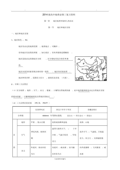
......2014 级高中地理必修三复习资料第一章地区地理环境和人类活动第一节地区和地区差别一、地区和地区差别1、地区特色: P4地区有必定的地理范围、地理地点、可胸怀。
有些地区有显然的界限,如行政区,有些界限则是模糊的。
地区是按必定的指标区分的,区分指标有综合的有单调的。
地区内部各因素表现出相对的一致性,地区间差别显然。
地区种类多样、范围有大有小、级别有高有低(尺度)。
2 、中国三大自然区( 1)区分依照:地形、天气、水文、植被、土壤等自然地理因素。
此中地形随和候是决定自然地区差别的基本因素,土壤和植被则是自然地区的标记。
( 2)三大自然区的差别(P5图、P5-P7)东部季风区西北干旱半干旱区青藏高寒区分界限400mm年等降水量线昆仑山—阿尔金山—祁连山地形平原、低山丘陵高原或高峰和盆地高原、山地温带大陆性天气:干旱季民风候,雨热同高冷天气:气温低、日夜温自天气少雨,气温日较差、年较期差大、风力大、太阳辐射强差大然外流河,雨水补给内流河,咸水湖,冰川融内外流兼顾,大河源泉,咸水文为主水补给为主水湖.. .. ..环丛林、丛林草原西东高峰沙漠、高峰草甸、高峰植被沙漠—沙漠草原—草原草原。
山麓山顶:境丛林—草原—沙漠主导因素气温随纬度变化降水随海陆地点变化水热组合随海拔变化农业最重要农业区(种畜牧业、浇灌农业、绿洲高寒畜牧业、河谷农业人植业)农业类不利条件人多地少,环境问水源不足、土地沙漠化和气温低、空气稀疏、风力活题盐碱化大、水分不足、地势曲折动经济文化发达欠发达交通发达欠发达3 、东部季风区的内部差别P9( 1)南北差别①分界限:秦岭—淮河线秦岭—淮河线的重要地理意义:1月0℃等温线;800mm年等降水量线;北方与南方;旱地与水田;暖温带与亚热带;润湿区与半润湿区;温带季民风候与亚热带季民风候;温带落叶阔叶林与亚热带常绿阔叶林;河流有无结冰期自然环境人类活动植被耕地方工地形天气河流熟制农作物水果民居交通方式矿产种类言业结温带一年一小麦、苹马车、煤、重北平原温带冰、落叶熟、两甜菜、果、铁路、较石工旱地平顶方高原季风水量阔叶年三熟大豆、梨、公路、少油、业少、林为和一年棉花、桃海运天然为......含沙主两熟杂粮气主量大不结亚热内河航热水稻、柑轻冰、带常运、海平原带、一年两油菜、橘、磷、工南水量绿阔运、铁繁丘陵亚热水田熟和一茶叶、荔斜顶有色业方大、叶林路、公杂低山带季年三熟蚕丝、枝、金属为含沙为主路风甘蔗香蕉主量小4 、中国三大经济地带(P12图)(1)区分依照:自然条件、自然资源、社会经济发展水平(2)差别 P13东部地带中部地带西部地带地理区位面向海洋,拥有开放性和便利距海较远,地形、地质条件复杂,交通不便的海运优势经济发展水平高低经济发展速度快慢①能源、矿产缺少①能源、矿产丰富② 能① 能源、矿产丰富② 能特色②对外贸易,海洋开发,新兴源、原资料生产基地,商品源基地③ 退耕还林、还家产基地粮、农林产品基地草,改良生态环境第二节地区地理环境对人类活动的影响一、陆地环境对人类活动的影响(阶段性、变化性)(P17、P19图).. .. ..阶段人类活动散布区举例人地关系采集打猎阶段动植物质源丰富的地区依靠自然农业社会阶段亚热带和暖温带的大河流域冲四大文明古国改造自然积平原、三角洲工业社会阶段资源丰富(能源、矿产),德国鲁尔区、山东东征服自然交通便利(道路、航道、港营、口)日本太平洋沿岸工业带后工业化阶段环境质量优胜(原由:可提升美国硅谷、日本九州、英谋求人地协调发展科技产质量量,吸引科技人员国苏格兰、德国慕尼黑、定居,提升科研效率)北京中关村、印度班加罗尔二、海洋环境对人类活动的影响(阶段性)阶段影响航落伍阶段以海为疆界,古代文明起源于大陆内部海( 1)海洋交通发展( 2 )人口、城市向沿海集中(西欧、日本、美国东海岸和西发展阶段技海岸以及中国的沿海地带是世界上经济最活跃地区)大陆架:石油、天然气术进步阶段开发海底矿产深海洋盆:锰结核(太平洋最丰富)海洋权益:内海:又称“地中海”,周围几乎完整被大陆包围。
- 1、下载文档前请自行甄别文档内容的完整性,平台不提供额外的编辑、内容补充、找答案等附加服务。
- 2、"仅部分预览"的文档,不可在线预览部分如存在完整性等问题,可反馈申请退款(可完整预览的文档不适用该条件!)。
- 3、如文档侵犯您的权益,请联系客服反馈,我们会尽快为您处理(人工客服工作时间:9:00-18:30)。
地理必修三复习提纲一、地理信息技术3S的辨别与运用遥感:主要是获取信息;对地表物体进行感知。
全球定位系统:主要是定位;在全球范围内实时进行、的系统。
地理信息系统:主要是分析和处理;专门处理数据的计算机系统,用于所有用到或需要处理地理空间数据的领域。
二、区域生态环境建设1、西北地区荒漠化形成的因素:自然因素:①基本条件:的气候②物质基础:平地多沉积物③动力条件:日数多且集中在季节人为因素:由于人口激增对生态环境压力和人类活动不当,对水土资源的过度使用和不合理利用引起的:①②③2、荒漠化防治的措施:(5点)3、森林的作用:(10点)4、雨林的保护措施:(6点)三、区域自然资源综合开发利用1、山西省煤炭资源的开发条件:(3点)2、山西煤炭能源的综合开发利用措施(4点)3、山西煤炭基地的环境保护与治理措施:(3点)4、如何保证我国能源的安全(缓解我国能源供应紧张):(5点)5、河流的水文特征:(5点)6、河流的水系特征:(5点)7、分析田纳西河流域开发的自然背景:(注意其有利与不利影响)(4点)8、流域的综合开发都以河流的利用和治理为核心,通过建多级大坝进行梯级开发。
建大坝如何利用和治理河流?(简要,5点以上)四、区域经济发展1、分析东北地区农业发展条件:(注意利与弊)(6点)2、农业布局特点:⑴耕作农业区:主要分布在地区,主要种植,,,。
⑵林业和特产区:主要分布在。
特产:⑶畜牧业区:主要分布在。
特产:。
3、东北商品粮基地生产特点:,4、东北地区成为粮食商品基地的原因:(4点)5、促进某地农业发展的措施:①因地制宜,大力发展多种经营,发展立体农业(生态农业)②依靠科技进步,积极推广新品种新技术,提高农产品的产量和质量③大力发展农产品的加工业,延长产业链,增加产品的附加值,向农业产业化方向发展。
6、珠江三角洲工业化和城市化水平提高的条件(国际国内背景和有利的地理条件):(4点)7、20世纪90年代珠三角出现的问题:(3点)8、20世纪90年代珠三角出现问题的对策:(3点)五、区域联系与区域协调发展1、实施西气东输的原因:(3点)2、西气东输工程对区域发展的影响:A.对西部地区发展的影响:(4点)B.对东部地区发展的影响:(4点)C.对环境的影响:(2点)3、交通线修建的意义:①经济:带动沿线经济发展,推动基础设施建设,增加就业机会,带动相关产业发展②交通:缓解交通紧张的状况,丰富了运输方式,构建全面的交通运输网络③政治:团结少数民族,维护少数民族地区的稳定,促进边疆地区的繁荣发展④军事:有利于维护少数民族地区和边疆地区的稳定和发展4、我国四大气区:5、影响产业转移的因素:(4点以上)6、产业转移对转出地的影响(4点)7.产业转移对转出地的影响(3点)地理必修三复习提纲(答案)一、地理信息技术3S的辨别与运用遥感:主要是获取信息;对地表物体进行远距离的感知。
全球定位系统:主要是定位;在全球范围内实时进行导航、定位的系统。
地理信息系统:主要是分析和处理;专门处理地理空间数据的计算机系统,用于所有用到地图或需要处理地理空间数据的领域。
二、区域生态环境建设1、西北地区荒漠化形成的因素:自然因素:①基本条件:干旱的气候②物质基础:平地多沙质沉积物③动力条件:大风日数多且集中在冬春季节人为因素:由于人口激增对生态环境压力和人类活动不当,对水土资源的过度使用和不合理利用引起的:①过度樵采②过度放牧③过度开垦2、荒漠化防治的措施:①合理利用水资源②利用生物措施和工程措施构筑防护林体系③调节农、林、牧用地之间的关系④采取综合措施,多途径解决农牧区的能源问题⑤控制人口增长3、森林的作用:调节气候,稳定大气成分(维持碳氧平衡)繁衍物种和维护生物多样性(生物意义)涵养水源,保持水土(河流中上游水土保持林)净化空气,美化环境,吸烟除尘,减少噪音(城市绿地)防风固沙(风沙防护林,如三北防护林)4、雨林的保护措施:①加强环境教育,提高公民环保意识②设立国际基金,使当地从管理和保护中获益③森林选择性采伐与更新造林相结合④加强雨林缓冲区的建设,减少移民和农耕进入雨林区的机会⑤加强雨林的管理和保护,建立自然保护区⑥保护性的开发方式,如雨林观光,生态旅游等三、区域自然资源综合开发利用1、山西省煤炭资源的开发条件:①煤炭资源丰富,开采条件好:②市场广阔③位置适中,交通比较便利2、山西煤炭能源的综合开发利用措施①扩大煤炭开采量②提高晋煤外运能力:③加强煤炭的加工转换:A 建设坑口电站, B发展炼焦业,④构建了煤—电—铝,煤—焦—化,煤—铁—钢三条产业链,提高了能源的综合利用程度和附加价值。
3、环境的保护与治理:①提高煤的利用技术:②调整产业结构:一方面,对原有的重化工业进行调整,使其产品向深加工,高附加值方向发展,另一方面,大力发展农业,轻纺工业,高新技术产业和旅游业,降低重化工业的比重。
③“三废”的治理:4、如何保证我国能源的安全(缓解我国能源供应紧张):①建立国家能源的储备机制②大力开发新能源③提高能源的利用率,节约能源④广泛参与国家合作,与亚非拉国家合作开发新的能源基地⑤在现有的基础上,加强本国的能源的勘探和开采,开辟新的能源基地5、河流的水文特征:①流量(大部分河流是雨水补给,流量和降雨量大小有关)②含沙量(与流经地区的地形,土壤疏松程度和植被覆盖情况有关)③汛期(大部分河流是雨水补给,汛期和雨水的季节分配有关)④结冰期(与冬季的气温有关,时间的长短与纬度的高低有关)⑤流速(与地形落差有关,影响航运)6、河流的水系特征:①水系形状②流程长短,流经地区和地形区③流域面积大小④河道的宽窄(和流速有关)⑤流向(和地势高低有关)7、田纳西河流域开发的自然背景:地形:多山,地形起伏大,影响:A蕴藏着丰富的水力资源;B陆路交通不便,河流航运作用十分突出。
气候:亚热带季风想湿润气候,冬末春初降水多。
影响:A河流水量的季节变化B降水的季节变化与农作物对水的季节需要矛盾水系:支流众多,水量丰富,影响A大部分可通航,并通过密西西比河及其支流可通往全国大部分地区;B地形起伏大,河流落差大,C受气候影响,水量很不稳定:降水的季节分配有关,特别是夏季引河流水进行灌溉。
矿产资源:主要有煤,铁,铜,磷,锌,云母等8、流域的综合开发都以河流的利用和治理为核心,田纳西河建多级大坝进行梯级开发,如何利用和治理河流?①防洪②航运③发电④提高水质⑤旅游⑥土地利用(熟悉后面展开的内容)四、区域经济发展1、东北地区农业发展条件:自然条件⑴气候条件:东北大部分地区属于温带湿润,半湿润季风气候区,冬季寒冷,夏季温暖。
降水集中于夏季,雨热同期。
弊:热量不足,农作物一年一熟,生长容易受到低温冷害的影响。
利:①光照充足,昼夜温差大,生长期长,农作物品质好②天气寒冷,病虫害少,不需要农药,绿色食品③冬季漫长,有利于土壤有机物的积累④冬季积雪融化可解决春旱⑵地形:平原地区适合发展种植业,山地适宜发展林牧业,为农业多种经营提供了条件;⑶土壤,黑土、黑钙土广泛分布,土层深厚,有机质含量高,有利于农业生产。
社会、经济条件:⑴工业:我国重要的工业基地,农牧兴工、工促农牧⑵交通:交通发达,对外联系方便,发展外向型农业。
⑶开发时间较晚,人口密度较低,有利于绿色农业和大农业的发展。
2、农业布局特点:⑴耕作农业区:主要分布在三大平原地区,主要种植玉米,大豆,小麦,水稻。
⑵林业和特产区:主要分布在大小兴安岭和长白山区。
特产:长白山区:鹿茸、人参;延边:苹果梨;辽东丘陵:柞蚕茧;辽南:苹果。
⑶畜牧业区:主要分布在西部高原、松嫩平原西部及部分林区草地。
特产:三河牛、三河马;东北红牛3、东北商品粮基地生产特点:大规模机械化生产;地区专业化生产;4、东北地区成为粮食商品基地的原因:①耕地面积广,人口稀少,地广人稀②土壤肥沃,粮食单位面积产量高③地形平坦,土地集中连片,适合大规模机械化生产④地区专业化生产5、促进某地农业发展的措施:①因地制宜,大力发展多种经营,发展立体农业(生态农业)②依靠科技进步,积极推广新品种新技术,提高农产品的产量和质量③大力发展农产品的加工业,延长产业链,增加产品的附加值,向农业产业化方向发展。
6、珠江三角洲工业化和城市化水平提高的条件(国际国内背景和有利的地理条件):①发达国家和地区的产业结构调整:②国家的对外开放政策:③良好的区位条件:位于我国南部沿海,毗邻港澳,靠近东南亚;劳动力丰富、地价低廉的等优势。
④全国最大的侨乡之一。
7、20世纪90年代珠三角出现的问题:①产业升级面临困境:A.与长三角相比,珠三角产业基础,科技实力和人才队伍处于劣势B.外伤投资的区位选择也由原来的追求降低成本转变为扩大市场规模,珠三角受到南岭的阻隔,市场范围较小。
②城市建设相对落后:A.城市规划,建设与管理严重滞后(工业化发展迅速,城市化不匹配B城市规模结构不合理(城市功能不清,结果趋同,与港澳的功能和结构逐步趋同,使得城市间存在竞争关系,城市服务范围较小,发展互相制约)C外来人口多引发的交通,教育和治安管理等社会问题。
③生态环境问题日趋严重:A大气污染——酸雨危害B水污染严重——水质性缺水C噪声污染D耕地锐减,土壤费力下降E森林面积减少,水土流失日趋严重8、20世纪90年代珠三角出现问题的对策:①产业结构调整:发展石化,钢铁,汽车,造船和装备制造业推动产业升级。
②构建大珠江三角洲城市群,各城市加强相互分工与合作。
③加强规划与管理:A加强城市基础设施建设和环境污染的治理B加强对外来人口的管理五、区域联系与区域协调发展1、实施西气东输的原因:①我国能源资源生产和消费的地区差异大(资源的生产和消费地区不匹配):②调整能源的消费结构:③我国油气资源的开发重点在西部:2、西气东输工程对区域发展的影响:C.对西部地区发展的影响:将西部地区的资源优势转变为经济优势,推动基础设施建设,增加就业机会,并强力拉动相关产业的发展。
D.对东部地区发展的影响:缓解东部地区能源紧张的状况,优化东部地区能源的消费结构,推动基础设施建设,促进东部地区的经济发展。
C.对环境的影响:有利于改善东部地区的大气质量,缓解因植被破坏带来的环境压力。
3、交通线修建的意义:⑤交通:缓解交通紧张的状况,丰富了运输方式,构建全面的交通运输网络⑥经济:带动沿线经济发展,推动基础设施建设,增加就业机会,带动相关产业发展⑦政治:团结少数民族,维护少数民族地区的稳定,促进边疆地区的繁荣发展⑧军事:有利于维护少数民族地区和边疆地区的稳定和发展4、我国四大气区:新疆塔里木盆地、准噶尔盆地;青海柴达木盆地;川渝四川盆地;陕甘宁的鄂尔多斯。
5、影响产业转移的因素:①劳动力因素:②内部交易成本因素:③市场因素:④其他因素:国际经济形势的变化。
