第二章 城市化对流域水文、地貌、生物的影响与效应
城市化的水文效应

城市化的水文效应当今,人类对自然环境的作用越来越明显,人为因素对水文效应的影响尤为突出,其中,城市化的程度的提高,直接改变了城市的水文效应。
城市化的最主要特征:1.人口集中和建筑密度增大,大力铺装道路,整治河道,兴建排水管网等;2. 城市社会经济发展对水的需求量增大,废、污水增多,从而对水的流动,循环等产生了影响;3.随着人口增加,对水的需求量也就随之增大,产生了一个寻求充足水源这一水文第一重要的问题。
城市化对水文效应及水特性有如下影响:1. 对水循环的影响(1)从水循环路径看,水资源开发利用改变了江河湖泊的关系,改变了地表水和地下水的赋存环境和补给转化路径。
人工侧支水循环的形成和发展,导致城市天然生态系统与人工生态系统的相应变化,区域水循环也随之而变。
从水循环特性来看,城市土地利用,极大地改变了城市地貌与植被分布,使城市地表水的产汇流特性和地下水的补给排泄特性发生相应变化。
城市化的程度的提高,直接改变了城市的暴雨径流形成条件,使其水文情势发生变化:由于城市地表不透水面积增大,蓄水洼地减少,暴雨天气易形成地表径流,导致暴雨径流总量增大,洪峰流量增高,出现时间提前,汇流时间缩短;河道中水流流速加大,径流过程中悬浮固体及污染物浓度提高。
另外,地区的入渗量减少,地下水的补给量相应减小,干旱期河流基流量也相应减少。
而地表径流增加,使得径流系数增大,增大了对河道和排水沟渠的压力。
城市化后,夏季降水明显增多,特别是大暴雨的次数、总降水量和平均降雨强度都有所增加。
城市污水增多、降雨的径流量变大和流速的增大,使短时间内的大流量径流发生,不可避免地要使洪峰流量增大,从而引起了洪水控制问题。
对地下水收支的影响。
城市化的发展加快了人们对地下空间的利用,如上、下水道及地铁等工程均对地下水的收支产生很大影响。
由于城市人口密集,需水量大,过量开采地下水,而由于地表的阻隔,地下水得不到有效补充,使得其水位降低,水质发生改变,进而影响了水文特性。
浅析城市化对水文环境的影响及措施
浅析城市化对水文环境的影响及措施本文笔者着重分析了城市化对水文地质造成的影响,并给出了相应的解决对策。
标签:城市化;水文地质;影响;措施1、城市化对水文环境造成的影响城市化的发展,不仅对经济、社会造成了巨大的影响,同时对水文地质环境也造成了显著影响。
随着城市化进程的不断加快,水资源问题已经逐渐浮出水面,形势相当严峻。
政府相关部门也在不断加大城市水文的规划建设力度,但是在实施过程中举步维艰、困难重重。
而城镇化建设和人们的生活、社会的进步、经济的发展息息相关,对于城市的可持续发展至关重要。
1.1 对降水的影响。
城市化进程中不断吸收大量的人口、建立密集的建筑群、形成密集的道路交通網等等一系列的活动使得城市形成了一层人工化不透水的下垫层,这种地表与自然地表存在许多差异。
在城市运行过程中,会产生大量的能源消耗,所带来的巨大热量改变了自然界的温度和湿度等气象条件,对城市的水文效应造成了影响甚至是改变。
国内外的相关研究显示,在相同的条件下,城市市区的降雨量比郊区的降雨量明显增多。
1.2 对河流水系的影响。
第一,城市化对河道的结构造成了影响。
这是因为,在城市建设过程中将河道的结构进行了简单化改造。
上文提到的城市不透水下垫层所带来的洪水总量的增加以及径流流速的加快,以及由于疏浚作用导致的河道变宽等都是造成高等级的主河干道发生变化的因素。
除此之外,在城市建设过程中所造成的河道淤积同样对低等级的河道造成了影响,使其变得越来越窄甚至是消失不见。
第二,城市化对河网的形态造成了影响。
城市化程度较高的地区出现了逐步人工化的河网形态、逐步减少的非主干河道、逐步减弱的水网分支等使得河网的形态受到了严重影响。
第三,城市化对水质造成了影响。
城市化进程中,许多小型河流被填埋,使得河流的自净功能降低,不透水率提高,导致径流量的增大以及河道污染物的增多,进而导致城市水质受到影响。
1.3 对暴雨洪水的影响。
第一,城市建设过程中侵蚀了一些洪水滩地以及部分天然河道,降低了其自然调蓄洪水的能力;第二,通过人为的筑堤渠化等手段来避免河道变宽,加快了水流速度,减小了河流的沉积物质;第三,人为的集水区河道导致河道的净流速度以及洪峰峰值增大。
城市化对水文循环的影响分析

城市化对水文循环的影响分析在当今社会,城市化进程正以前所未有的速度推进。
城市的扩张和发展给人们的生活带来了诸多便利和机遇,但同时也对自然环境产生了深远的影响,其中就包括水文循环。
水文循环是地球上水的流动和转化过程,包括蒸发、降水、地表径流、地下径流等环节。
城市化的快速发展改变了土地利用方式、下垫面条件以及人类活动模式,从而对水文循环的各个环节产生了显著的影响。
首先,城市化导致了大量自然土地被建筑物、道路和其他基础设施所覆盖。
城市中的混凝土、沥青等不透水表面迅速增加,这使得降水无法像在自然地面那样渗透到土壤中。
原本可以补充地下水的雨水,现在更多地转化为地表径流,导致径流量增大、流速加快。
在暴雨期间,这种情况尤为明显,容易引发城市内涝,给城市的排水系统带来巨大压力。
其次,城市化改变了蒸发和蒸腾过程。
城市中的植被面积大幅减少,植物的蒸腾作用减弱。
同时,城市中的人工建筑物和道路等表面吸收和储存热量的能力较强,导致气温升高,相对湿度降低,从而使得蒸发量增加。
但总体来说,由于蒸腾作用的减少,区域内的水分散失总量可能会有所降低。
再者,城市化影响了降水的分布和强度。
城市中的高楼大厦、工厂烟囱等会产生大量的人为热和污染物,形成城市热岛效应和雨岛效应。
城市热岛效应使得城市上空的空气对流增强,增加了大气的不稳定性,从而可能导致降水的频率和强度增加。
而且,城市的下垫面粗糙度较大,对气流的阻滞作用明显,也会影响降水的分布。
另外,城市化还对地下水的补给和水质产生了影响。
由于不透水表面的增加,地下水的补给量减少,地下水位下降。
同时,城市中的工业废水、生活污水等如果未经妥善处理就排放,会污染地下水,导致地下水水质恶化。
为了减轻城市化对水文循环的不利影响,我们可以采取一系列措施。
例如,在城市规划中增加绿地和水体的面积,提高城市的透水性能,推广雨水收集和利用系统,加强污水处理和排放管理等。
增加绿地和水体面积有助于增加蒸腾作用,调节局部气候,同时也能在一定程度上缓解城市热岛效应。
《城市化过程对地理环境的影响》 知识清单

《城市化过程对地理环境的影响》知识清单城市化是人类社会发展的必然趋势,也是经济发展和社会进步的重要标志。
然而,城市化的快速推进在给人们带来诸多便利和机遇的同时,也对地理环境产生了深远的影响。
一、城市化对气候的影响1、热岛效应随着城市规模的扩大和人口的增加,城市中的建筑物、道路等大量的人工表面吸收和储存了更多的太阳辐射能,同时城市中的工业生产、交通运输和居民生活等活动也释放出大量的热能。
这使得城市的气温明显高于周边郊区,形成了热岛效应。
热岛效应不仅会影响城市居民的生活舒适度,还可能导致局部的气象灾害,如暴雨、雷电等的发生频率增加。
2、雨岛效应城市化过程中,由于城市的地面硬化率高,雨水难以渗透到地下,导致地表径流迅速增加。
同时,城市中的建筑物和空气污染物会使大气中的水汽凝结核增多,从而增加了城市的降雨量。
这种现象被称为雨岛效应。
雨岛效应可能会引发城市内涝等问题,给城市的排水系统带来巨大压力。
3、大气污染城市中的工业生产、交通运输和能源消耗等活动会排放大量的污染物,如二氧化硫、氮氧化物、颗粒物等,这些污染物会导致城市的空气质量下降,引发雾霾等大气污染问题。
大气污染不仅会影响人们的身体健康,还会对气候产生负面影响,如导致酸雨的形成。
二、城市化对水文的影响1、地表径流变化城市的建设使得大量的土地被硬化,如铺设道路、建设建筑物等,这减少了雨水的下渗,导致地表径流迅速增加。
同时,城市的排水系统通常是为了尽快排除雨水而设计的,这使得雨水在短时间内大量流入河流,造成河流水位的急剧上升,增加了洪水发生的风险。
2、水污染城市中的工业废水、生活污水和雨水径流中携带的污染物会进入水体,导致河流、湖泊和地下水的污染。
水污染不仅会影响城市的供水安全,还会破坏水生态系统,威胁水生生物的生存。
3、水资源短缺随着城市人口的增加和经济的发展,城市对水资源的需求不断增长。
然而,城市化过程中的水污染和不合理的水资源利用导致水资源短缺问题日益严重。
城市化对流域生态环境的影响及其管理教学设计
城市化对流域生态环境的影响及其管理教学设计随着城市化的加速发展,越来越多的农村人口进入城市,使城市化进程呈现出愈发迅猛的趋势。
城市的快速发展却给流域生态环境带来了极大的压力与挑战。
本文旨在探讨城市化对流域生态环境的影响及其管理方法,针对这一问题进行教学设计,以期能够提高学生的环境保护意识和解决问题的能力。
一、城市化对流域生态环境的影响1. 水源减少城市化进程中,城市的不断扩张对流域内的水资源造成了很大的影响。
城市化改造会破坏原有的山脉、湖泊、河流等水源,使得水源面积减少,水流量减少。
城市化还会增加工业和民用的用水量,使得流域内的水资源供不应求。
2. 灌溉用地减少城市化改造不仅会破坏水源,还会破坏农用地。
随着城市快速扩大,原本被用于农业灌溉的土地将被开发成商业、住宅、工业等建筑物,而这些建筑物需要大量的土地和水源。
这意味着农业生产所需的灌溉用地将会大幅减少,从而导致农业产量下降。
3. 污染放大城市化进程中,伴随着工业、交通等的发展,环境污染也随之而来。
城市的排污、垃圾处理、道路施工等破坏了环境,使污染物进入水源、土壤、空气等环境中,带来对环境质量的破坏。
水污染、空气污染与固体污染,都会对流域产生严重影响。
4. 生态系统失衡城市化破坏了城市周边的自然生态系统,导致野生动植物数量减少,生物多样性下降,生态系统失衡。
这样的环境变化对整个流域的生态系统带来负面影响,使得生态系统无法自我修复,进而导致一系列环境问题。
二、城市化对流域生态环境的管理1. 加强水资源管理政府部门应该加强对水资源的管理,采取多种措施促进水资源的恢复与保护,包括改进水处理技术、节约用水、规范用水行为等。
政府还应制定完善的法规和管理制度,保障水资源的安全供给。
2. 优化土地使用方式城市化建设需要大量的土地,政府应该合理规划和利用土地资源,实行合理的土地使用政策和土地变更审批制度,可以避免重复建设,充分利用土地。
同时,政府应该大力支持农业发展,保留农用土地,为农业灌溉提供支持。
《城市化过程对地理环境的影响》 知识清单
《城市化过程对地理环境的影响》知识清单城市化是人类社会发展的必然趋势,也是经济发展和现代化的重要标志。
然而,城市化的快速推进也给地理环境带来了诸多影响,这些影响涉及到自然环境、生态系统、资源利用等多个方面。
一、对气候的影响城市化使得城市的下垫面发生了巨大的变化。
城市中大量的建筑物、道路等人工表面取代了自然的植被和土壤,导致地表的粗糙度增加,风速减小,空气流通不畅。
同时,城市中的建筑物和道路吸收了更多的太阳辐射,使得城市的气温高于周边的郊区,形成了“城市热岛效应”。
此外,城市化还会影响降水的分布和强度。
城市中的高层建筑和污染物会干扰气流的运动,使得降水在城市内部的分布不均匀。
一些城市可能会出现局部暴雨增多的情况,而另一些地区则可能降水减少。
二、对水文的影响城市化改变了地表径流的特征。
城市中的道路、建筑物等不透水表面增加,使得雨水无法像在自然环境中那样迅速渗透到地下,而是形成地表径流快速汇集。
这不仅增加了洪水发生的风险,还导致地下水位下降,水资源短缺。
城市污水的排放也对水文环境造成了严重的污染。
大量的生活污水、工业废水未经有效处理就排入河流、湖泊等水体,使得水质恶化,水生生物的生存受到威胁。
三、对土地利用的影响城市化进程中,大量的农田、林地和草地被征用用于城市建设,导致土地资源的紧张和生态功能的丧失。
城市的扩张往往是无序的,缺乏合理的规划,造成土地的浪费和利用效率低下。
同时,城市化还会引发土地的沉降问题。
过度开采地下水用于城市的生产和生活,导致地下含水层的压力减小,地面出现下沉现象,给城市的基础设施建设和居民的生活带来安全隐患。
四、对生态系统的影响城市化破坏了原有的生态平衡。
城市中的植被减少,生物多样性降低,许多野生动植物失去了栖息地,生态系统的服务功能受到削弱。
城市中的污染物排放和人类活动的干扰也对生态系统的稳定性产生了负面影响。
生态系统的自我调节能力下降,容易引发各种生态问题,如病虫害的爆发、水土流失等。
城市化对水文生态系统的影响及对策研究——以西安市为例

城市化对水文生态系统的影响及对策研究——以西安市为例城市化对水文生态系统的影响及对策研究——以西安市为例一、引言随着城市化进程的加快,城市面积的不断扩张对水文生态系统造成了重大影响。
城市化带来的土地利用变化、城市排水系统建设等都直接影响着水文生态系统的稳定性和可持续发展。
作为一个典型的中等城市,西安市正面临着城市化对水文生态系统造成的挑战。
本文将分析西安市城市化进程对水文生态系统的影响,并提出相应的对策。
二、影响1. 土地利用变化城市化进程中,大量土地被用于城市建设,农田、森林等水文生态系统重要组成部分面临着雷打不动的改变。
西安市的城市扩张使得原有的农田面积不断减少,同时城市建设过程中也会对原有植被和生态系统带来破坏。
2. 水资源利用与排放城市化过程中,水资源的需求急剧增加。
这不仅导致了地下水位下降,影响地下水资源的持续供应,还加大了对周边水源的压力。
同时,城市化过程中也增加了城市排水系统建设的需求,大量污水被排入江河湖泊等水体,直接污染了水环境。
3. 暴雨洪涝风险随着城市化的推进,大量的水泥、砂石等硬化材料的使用导致了城市的地表径流迅速增加,水文循环被破坏,导致暴雨洪涝的风险增加。
西安市在城市化过程中也面临着日益严重的暴雨洪涝问题,造成了城市交通的瘫痪、财产损失等。
三、对策1. 合理规划土地利用在城市化进程中,应该充分考虑土地利用的合理性,充分保护农田和生态系统。
政府部门可以出台相关政策,限制城市扩张速度,合理拓展城市区域,确保城市与农田、森林之间的平衡发展。
2. 建设水资源保护体系针对城市化过程中水资源利用过度的问题,应建立完善的水资源保护体系。
加大对地下水的保护力度,采取措施限制地下水的开采量,同时加强水资源管理和监测,提高水资源利用效率。
3. 推动生态修复工程针对城市化过程中生态系统受到的破坏,应加大生态修复工程的推动力度。
政府可以投入资金和技术力量,开展森林植树造林、湿地保护恢复等工程,提高城市生态系统的健康程度,并提高城市生态系统对水文系统的调节功能。
城市化对流域水文地貌生物的影响与效应
径流与城市不透水地表的关系(Relationship Between Imperviousness, Drainage Density, and Runoff)
流域城市化前后的水文过程比较 (A comparison of hydrographs before and after urbanization)
水量平衡方程: P Ia F Q
(4)流域产流量的计算
SCS模型
SCS模型是美国农业部水土保持局(Soil Conservation Service, 简称SCS)在本世纪50年代初研制的小流域设计洪水模型。SCS模型有许 多优点,这些优点是它得到广泛应用的基础:在降雨径流关系上,SCS型考虑流域下垫面的特点,在水文
模型参数和遥感信息之间建立了直接的联系。
• 降雨量Total rainfall (depth) • 持续时间Duration • 降雨强度Average and peak intensity
降雨深-持续时间-重现期
1 inch 英寸=25.4 millimetres 毫米
(2)径流形成过程Conversion of Precipitation to Runoff
Land use
Residential(居住区) Commercial(商业区) Industrial(工业区) roads Institutional公共管理与公共服务用地 open-pace (cemeteries, parks, and undeveloped land) others
Land cover
1.1 城市流域的土地利用与土地覆盖(Land-use and
Land-cover Composition of Urban Watershed)
高考地理 第二章 第2节城市化过程、特点及其对地理环境的影响课件 湘教版
四、发展中国家的城市化 发展中国家城市化总体水平还比 较低,城市人口比重小 (40%左右)。近 半个世纪以来,发展中国家城市化推进 迅速。发展中国家城市化水平很不平衡。 城市化水平比较低的国家大多分布在亚 洲和非洲,南美洲国家的城市化水平则 比较高。
13
一部分发展中国家具有“虚假城 市化”的特点,即城市化水平明显超 过了本国的经济发展阶段和工业化水 平,城市总体发展和基础设施建设相 对落后。南美洲国家“虚假城市化” 的状况最为突出。 另一部分发展中国家则表现为 “滞后城市化”,即城市化进程显著 落后于相应的经济发展水平和工业化 进程。如印度、孟加拉、印度尼西亚 等国就属于这种状况。
65岁 以上 人口 比重 (%) 4 4 5 6 12 4
人均 生产 总值 (美元) 650 1020 2920 2160 2860 1210
城市 人口 比重 (%) 51 72 76 85 89 48
16
(1)某跨国公司想到南美设立工厂, 选择设厂国家的考虑因 素之一是各国可劳动人口数的多寡。 如果将15岁到64岁之间的人口视为可劳 动人口,则可劳动人口比 例最高的国家是(D) A.哥伦比亚 B.玻利维亚 C.巴西 D.智利
三、发达国家的城市化 发达国家的城市化已推进到相对成熟 的发展阶段,城市化水平大多在 75%以上, 有些国家甚至高达 90%。随着大城市的过 度扩张,市中心区的居住环境渐趋恶化, 城市居民陆续向外迁移。一些大城市中心 区表现出衰落的迹象。出现高水平的大都 市连绵带。主要特征是人口高度集中,大 城市密集分布,加工制造业、交通运输业 和信息产业十分发达。
14
(2009· 杭州二中高考仿真考试卷 ) 下表是南美部分国家的主要社会经济资料。 回答(1)~(2)题。
高中地理 第二章 城市与环境 第三节 城市化过程对地理
第二章城市与环境第三节城市化过程对地理环境的影响城市化过程对自然地理环境的影响①大规模的城市建设改变了原有的自然环境,使原来的生态环境发生了很大的变化。
容易造成水土流失、滑坡、泥石流等地质灾害。
②改变了下垫面的原有性质,使城市产生热岛效应,而且还不同程度地影响着周围地区的自然环境。
形成的城市风,将城市大气污染物带到郊区,也可以将郊区的污染物带到城区。
③城市建设过程破坏了原有的河网系统。
容易使城市在暴雨时排水不畅,造成地面积水,残留的河道也容易因富营养化而变黑发臭。
④城市的生产生活污染,尤其是工业“三废”,干扰和破坏了所在地区的环境生态。
使得城市的生态系统变的非常脆弱。
2.城市化过程对人类地理环境的影响①改变了土地利用方式,原先的农业用地转化为建设用地,并形成了城市功能分区。
②改变了居民的就业形式,区域产业活动以非农业活动为主体。
③建筑物密集的城市景观取代了原先的乡村景观。
④城市化过程使人口和产业活动由分散到集聚,与此同时,经济开发和信息交流得以大幅度加强。
⑤促使现代文明向传统文化广泛渗透,强化了当地与外界的文化交流与融合。
1.(1)城市环境质量下降——环境污染(2)交通拥挤,居住条件差(3)增加就业困难,失业人数增多(4)城市化过程中还会带来其他的社会问题,如贫困问题、内城衰落问题、人口老龄化问题、社会治安问题等2.城市化过程对人类地理环境还产生哪些影响?3.①改变了土地利用方式,原先的农业用地转化为建设用地,并形成了城市功能分区。
4.②改变了居民的就业形式,区域产业活动以非农业活动为主体。
5.③建筑物密集的城市景观取代了原先的乡村景观。
6.④城市化过程使人口和产业活动由分散到集聚,与此同时,经济开发和信息交流得以大幅度加强。
7.⑤促使现代文明向传统文化广泛渗透,强化了当地与外界的文化交流与融合。
8.【协作指导】9.4、阅读教材43活动内容完成第1、2、3小题10.⑴城市化过程中过度扩张的现象主要表现在:①城市用地规模扩大,大举侵占土地;②城市人口膨胀等。
2.3城市化过程对地理环境的影响的PPT课件
2021
39
案例分析:P45活动“移植大树之风为何屡禁不止
1、大量移植”大树对树木原生存地会造成严重的环境破
低愈普普(及②大及)率相 ③ 率同下之80的 水 下%城 道 ,;市 普 城则化 及 市20程 率 化0度与程0年之径度的下流愈径,量高流下呈,量水现径约道负流为普相量1及 关 愈97率 ④ 大0愈 相年低 同时, 的的径 下多流 水少C量 道倍
A.①② B.③④ C2.021①④ D.②③
28
3、城市环境问题
2021
13
污染严重,环境质量下降
◆大气 污染
来 源:工矿企业、家庭炉灶和汽车排放物
污染物:煤烟、粉尘、硫氧化合物、氮氧化合物、碳氢 化合物
危 害:空气污浊、烟雾弥漫、酸雨和光化学烟雾等, 危 害人们的健康
◆水体 污染
来 源:工业废水、生活污水、城市地面径流
污染物:氮磷废液、污油、汞镉有害元素 危 害:江河湖海和地下水的水质变坏,发生赤潮,
2021
37
城市雨岛形成的条件是在大气环流较弱,有利 于在城区产生降水的大尺度天气形势下,由于 城市热岛所产生的局地气流的辐合上升,有利 于对流雨的发展;下垫面粗糙度大,对移动滞缓 的降雨系统有阻障效应,使其移速更为缓慢, 延长城区降雨时间。
五岛之中,以热岛、干岛和混浊岛出现的频率 最大;湿岛仅出现在夏季晴夜无风的短暂时期 内;雨岛集中出现在大气环流的下风向处。
2021
34
2021
35
热岛效应还会导致热岛环流的产生。 在市中心气流辐合上升并在上空向四周 辐散,而在近地面层,空气则由郊区向 市区辐合,形成乡村风,补偿低压区上 升运动的质量损失。这种环流可将在城 市上空扩散出去的大气污染物又从近地 面带回市区,造成重复污染。当天气系 统主导的本地风速极小时,热岛环流表 现得更为明显。
城市化对水文环境的影响及对策探讨
城市化对水文环境的影响及对策探讨随着全球城市化进程的不断加速,城市对水文环境的影响日益凸显。
城市化带来了大规模的土地利用变化、水资源开发与利用的改变以及水污染等问题,对水文环境带来了巨大挑战。
本文将探讨城市化对水文环境的影响,并提出相应的对策。
一、城市化对水资源的影响城市化过程中,土地利用的改变对水资源产生了重要影响。
城市的扩张导致大量农田转变为建设用地,这使得原本用于农田灌溉的水资源被剥夺,农田水资源的供应减少。
同时,城市化还导致了城市人口和经济的快速增长,对水资源的需求也随之增加。
这种需求与供应的不平衡使得城市面临水资源短缺的问题。
此外,城市化还改变了水资源的自然循环过程。
城市的建设和道路铺设破坏了地表的自然排水系统,导致雨水无法迅速渗透到地下,增加了径流的产生。
这种径流的增加使得城市面临洪涝灾害的风险增加。
同时,城市化还导致了水体的污染,大量的废水和污水排放对水资源造成了严重的污染。
二、城市化对水环境的影响城市化对水环境的影响主要体现在水质的恶化和水生态系统的破坏。
城市化过程中,大量的废水和污水排放对水体造成了污染。
废水中含有大量的有机物、重金属和营养物质,这些物质对水生态系统产生了不可逆转的影响。
水体污染不仅对水生物的生存和繁殖造成了威胁,还对人类的健康产生了潜在的风险。
另外,城市化还导致了水生态系统的破坏。
水生态系统是维持水文环境平衡的重要组成部分,它具有保持水质稳定、调节水量和水温的功能。
然而,城市化过程中,湿地的消失、河流的改道和水域的填充等行为破坏了水生态系统的完整性和稳定性,导致了水文环境的不稳定。
三、城市化对水文环境的对策为了应对城市化对水文环境的影响,需要采取一系列的对策来保护水资源和水环境。
首先,应加强水资源管理,提高水资源利用效率。
通过建设水资源调度系统,合理分配水资源,确保水资源的可持续利用。
同时,推广水资源节约技术,减少水资源的浪费。
其次,应加强水环境保护,控制水体污染。
人教版必修二第二章 第三节 城市化过程对地理环境的影响(共34张PPT)

5. 在上海市进行的部分工程建设项目中, 请选择能改善城市环境工程的选项,填入下表 中相应空格内。选项代号:A.地铁一号线;B. 新客站中央商场设施;C.河流污水治理;D.快 速高架内环路;E.国际金融大厦;F.建立水上 运动场;G.数十个低噪音控制区;H.浦东新区 绿化园林;I.每年竣工住宅500万平方米;J.在 余山风景区内建设“世界风光”缩微景区
5. 在上海市进行的部分工程建设项目中, 请选择能改善城市环境工程的选项,填入下表 中相应空格内。选项代号:A.地铁一号线;B. 新客站中央商场设施;C.河流污水治理;D.快 速高架内环路;E.国际金融大厦;F.建立水上 运动场;G.数十个低噪音控制区;H.浦东新区 绿化园林;I.每年竣工住宅500万平方米;J.在 余山风景区内建设“世界风光”缩微景区
CG AD I
H
A
5. 在上海市进行的部分工程建设项目中, 请选择能改善城市环境工程的选项,填入下表 中相应空格内。选项代号:A.地铁一号线;B. 新客站中央商场设施;C.河流污水治理;D.快 速高架内环路;E.国际金融大厦;F.建立水上 运动场;G.数十个低噪音控制区;H.浦东新区 绿化园林;I.每年竣工住宅500万平方米;J.在 余山风景区内建设“世界风光”缩微景区
1. 同时能造成城市大气、水、固 体废弃物和噪声污染的生产部门是
( A)
A. 工业 B. 商业 C. 运输业 D. 服务业
2. 保护环境和改善环境,不应该( ) A. 加强城市管理 B. 制约经济发展 C. 进行全面规划 D. 扩大绿地面积
B 2. 保护环境和改善环境,不应该( )
A. 加强城市管理 B. 制约经济发展 C. 进行全面规划 D. 扩大绿地面积
A.在市中心区建立大量停车场 B.学校、工厂和机关安排不同的上下班时间 C.鼓励市民使用公共交通工具 D.控制和减少小汽车数量、禁止大货车进城
高中地理 第二章 城市与城市化 2.3.2 城市化对地理环境的影响课件 新人教版必修2
纽约的光化学烟雾
思考:在城市化过程中有哪些问题?如何解决这 些问题呢?
1.城市化过程对自然地理环境的影响
城市的出现对哪些自然因素产生了明显的影响?
自然地 理环境
影响
地形 改造地形、地貌
改变下垫面,产生 气候 热岛效应,影响局
部气候
城市建设破坏原有 水文 河网系统,使城市
地区水系十分紊乱
表现
水土流失,滑坡、泥石 流等地质灾害 形成城市风,将城市 大气污染物带到郊区, 也可把郊区工厂废气 带到城市
排水不畅,地面积水等
2.城市化过程对城市环境的影响
大气污染 垃圾污染
水污染
噪声污染 拥挤的交通
城市化对地理环境产生了哪些不良的影响呢?
来源
危害
大气 污染
城 市 居 民 生 活 排 出 污染物有煤烟、粉尘、
(3)c模式优点是在b模式基础上,绿地在城市中 心形成网状,进一步减小了城市“热岛效应”。 而且由于绿地从城市边缘延伸到中心地区,使空 气流动较通畅,有利于降低城市大气污染,缺点 是城市中心地租高的地区,土地利用率降低。 改进意见:在城市各用地间进行道路建设。
【典题训练】
下图反映了某区域以A地为中心,半径约15千米范围 内,近10年平均气温增幅的分布状况。读图回答下题。
1.导致图中A地近10年平均气温增幅较大的主要原因 可能是( A ) A.城市化的推进 B.城市排水系统的完善 C.大面积植树造林 D.全球气候变化 2.若该地工业布局合理,下列关于该地的叙述正确的 是( B ) A.工业区最可能位于西南部 B.工业区最可能位于东北部 C.盛行风向最可能是东北风 D.盛行风向最可能是东南风
城市化水平(%)
《城市化过程对地理环境的影响》 知识清单
《城市化过程对地理环境的影响》知识清单一、城市化的概念与发展城市化,简单来说,就是人口向城市聚集,城市规模不断扩大,城市数量不断增加的过程。
随着工业革命的推进,城市化进程在全球范围内加速发展。
在过去的几个世纪里,尤其是工业革命以来,越来越多的人离开农村,涌入城市寻找更好的就业机会和生活条件。
城市的发展带来了经济的繁荣和社会的进步,但同时也对地理环境产生了深远的影响。
二、城市化对自然地理环境的影响1、地形地貌城市建设过程中,大规模的土地开发和建设活动,如推山填湖、开挖河道等,改变了原有的地形地貌。
这可能导致山地的水土流失加剧,河流的水文特征发生变化,湖泊的调蓄能力下降。
2、气候城市化使得城市的下垫面发生了巨大的变化,由原来的自然植被和土壤变为混凝土、沥青等硬质材料。
这导致城市的热容量减小,热岛效应显著。
同时,城市的建筑群和道路会影响风的流动,改变局部的风向和风速。
此外,城市的大气污染也会影响气候,导致雾霾、酸雨等天气现象的增多。
3、水文城市的发展增加了对水资源的需求,过度开采地下水可能导致地面沉降。
城市的排水系统改变了雨水的自然径流,使得洪水的峰流量增大,洪水灾害的风险增加。
同时,城市污水的排放也会对河流、湖泊等水体造成污染,影响水生态系统的平衡。
4、土壤城市化过程中,大量的土地被硬化和覆盖,土壤的透气性和保水性变差,土壤的肥力下降。
此外,城市建设过程中的废弃物和污染物也会对土壤造成污染,影响土壤的质量和生态功能。
三、城市化对人文地理环境的影响1、土地利用城市化导致城市的建设用地不断扩大,农业用地和生态用地减少。
城市内部的土地利用也发生了变化,商业区、住宅区、工业区等功能分区更加明显。
2、人口城市化吸引了大量的人口涌入城市,导致城市人口密度增加,人口结构发生变化。
城市人口的增长带来了就业、教育、医疗等方面的压力,也对城市的基础设施和公共服务提出了更高的要求。
3、经济城市化促进了工业和服务业的发展,推动了经济的增长。
城市化进程对水文效应影响分析及水文环境改善策略研究
城市化进程对水文效应影响分析及水文环境改善策略研究马朝【摘要】随着社会经济的不断发展进步,城市规模得到了迅速的扩张。
城市化的快速发展在改善人们生活水平的同时也带来了一系列负面的问题,如城市水资源紧缺、水体污染、洪涝灾害等问题频发。
本文从城市化进程对城市水文环境的影响角度出发,针对城市化水文效应进行了分析和研究,并在分析城市化过程对水文要素影响的基础上提出了改善和治理城市水文环境的建议和策略,为实现城市水资源循环利用提供参考。
%With the continuous development of the social economy, the scale of the city has been the rapid expansion. The rapid development of the city in improving the living standards of the people has also brought a series of negative issues, such as the city of water resource shortage, water pollution, flood disaster and other problems. In this paper, from the angle of city process influ-ence on the hydrological environment in the city starting, has car-ried on the analysis and Research on hydrological effect of city, and puts forward some suggestions and strategies to improve the governance of city and hydrologic environment in city based anal-ysis process influence on the hydrological elements, in order to realize the city water resources circulation use of reference.【期刊名称】《国土与自然资源研究》【年(卷),期】2015(000)002【总页数】3页(P31-33)【关键词】城市化;水文效应;策略【作者】马朝【作者单位】河北省唐山水文水资源勘测局,063000【正文语种】中文【中图分类】P33随着社会经济的不断发展进步,城市规模得到了迅速的扩张,城市化和人口集聚成为一种不可阻挡的趋势。
城市化对水环境的影响及防治对策

城市化对水环境的影响及防治对策引言:随着全球城市化进程的不断加速,城市的发展给水环境带来了严重的影响。
水是人类生活的基本需求,因此,保护水环境对于维护人类健康和可持续发展至关重要。
一、城市化对水环境的影响随着城市化的推进,水环境受到了多方面的负面影响。
1. 污水排放:城市化导致大量人口聚集,产生大量污水。
然而,许多城市的污水处理设施未能跟上城市发展的速度,导致污水排放直接进入水体,污染了河流、湖泊和海洋。
2. 雨水排放:城市化改变了地表的覆盖情况,例如,大面积的建筑物和硬化的道路,使得雨水无法渗透到地下,增加了洪水和水资源的浪费。
3. 水资源过度开采:城市对水资源的需求不断增加,为了满足人们的生活和产业发展需求,往往过度开采地下水和河流水源,导致水资源枯竭和水位下降。
二、城市化对水生态系统的破坏城市化的过程中,大量的湿地和河流被填土或淤积,导致水生态系统破坏。
1. 湿地退化:湿地是重要的生态系统,能够过滤水质和保护生物多样性。
然而,随着城市扩张,许多湿地被填土用于城市建设,导致湿地退化和水污染。
2. 河流改道:为了便于城市发展,许多河流被迫改道或人工整治。
这不仅导致了河流生态系统的破坏,还增加了洪水风险。
三、防治对策为了减缓城市化对水环境的负面影响,应采取以下对策。
1. 加强污水处理设施建设:提高城市污水处理设施的建设速度和规模,确保所有污水得到有效处理,防止直排入水体。
2. 促进雨水管理:通过合理规划城市排水系统,减少硬化的道路和建筑物,增加雨水渗透的机会,降低洪水风险。
3. 强化节水意识:加强水资源管理,推广节水意识,减少浪费,提高利用效率。
4. 保护湿地和河流:加强湿地保护,防止湿地破坏和填土,恢复受损湿地生态系统。
同时,合理规划城市发展,保护河流,减少河流改道。
5. 开展水环境监测和科学研究:建立完善的水环境监测体系,及时了解水环境的状况,并进行科学研究,探索更有效的水环境防治技术和方法。
高考地理 第2章第3课 城市化过程对地理环境的影响课件 新人教版必修2
【思维过程】 第(2)题,从表中可以看出城市比郊区气温高,成为一 个热岛,与郊区间形成城乡风。由于城市气温高,气 流上升(shàngshēng),污染物也随之到达城市上空, 并向郊区扩散,到达郊区,并随着热力环流由郊区流 向城市。如果要改善城区空气质量,就需要郊区把有 大气污染的工业布局在热力环流下沉气流之外的区域; 同时提高郊区绿化率。
第三十八页,共41页。
第三十九页,共41页。
(1)该市2005年最主要的土地利用类型(lèixíng草)是地______,
1990~2005年变化幅度最大的土地利用类型(lè(ciǎxíondgì))是
林__地___。该市主要的自然带类型(lèixíng温)是带草原带
(_lí_n___________。
(续表)
污染 类型 危害
举例
大气污染
水污染
噪声污染
固体废弃物 污染
使城 市空气污 浊,危害 人体健康
污染江河 妨碍人们
湖 海 和 地 下 水 ,休息、工作和
危害人体健康 交谈,甚至危
和动植物
害人体健康
危害人
体健康和环 境
光化 学烟雾、 酸雨
水体富营 养化导致鱼类 死亡,某些金 属导致“公害 病”
工厂、施 工场地的机器 声,车辆的噪 声、商店中的 音响发出的噪 声等
【真题2】(2010·四川)城市是社会发展的产物, 也对社会产生了多方面影响(yǐngxiǎng)。阅读材 料,回答问题。 材料一 城市职能是指一个城市在国家和区域中所 起的作用。随着社会经济的发展,区位条件的变化, 城市的职能是可变的。如著名旅游城市杭州在历史 上曾是南宋的都城(临安)。
第十八页,共41页。
工业废 渣、城市垃 圾、塑料袋、 易拉罐、废 电池等
- 1、下载文档前请自行甄别文档内容的完整性,平台不提供额外的编辑、内容补充、找答案等附加服务。
- 2、"仅部分预览"的文档,不可在线预览部分如存在完整性等问题,可反馈申请退款(可完整预览的文档不适用该条件!)。
- 3、如文档侵犯您的权益,请联系客服反馈,我们会尽快为您处理(人工客服工作时间:9:00-18:30)。
降雨深-持续时间-重现期
1 inch 英寸=25.4 millimetres 毫米
(2)径流形成过程Conversion of Precipitation to Runoff
水文循环hydrologic cycle
关键过程Key points in the hydrologic cycle
Interception, transpiration, and evapotranspiration Infiltration, soil moisture, and ground water Runoff
北京市南沙河流域土地地利用分布
1.2 Hydrologic and Geomorphic Changes
(1) 降雨(The Storm in Stormwater)
• 降雨量Total rainfall (depth) • 持续时间Duration • 降雨强度Average and peak intensity
关键过程(Key points in the hydrologic cycle)
Interception, transpiration, and evapotranspiration Infiltration, soil moisture, and ground water Runoff
(4)城市化对河流地貌的改变 Changes in Geomorphology from Urbanization
Changes to channel morphology
1.3 城市地表径流污染(Pollutant Loading in Stormwater)
(1)城市地表径流污染物类型与来源(principal pollutant groups and their sources)
1.3城市地表径流污染(Pollutant Loading in Stormwater)
1.4城市化的生物响应(Biological Responses to Urbanization)
1.1 城市流域的土地利用与土地覆盖(Land-use and
Land-cover Composition of Urban Watershed)
模型结构简单,使用方便。产流方面就只有一个参数。
流域产流涉及的物理过程
降雨-径流基本关系 F Q S P Ia
水量平衡方程:
P Ia F Q
产流计算公式: (P I a )2 Q ,P I a P Ia S Q0 ,P I a
初损经验公式: I a 0.2S
Hydrologic soil groups
Infiltration rates of soils vary widely and are affected by subsurface permeability as well as surface intake rates. Soils are classified into four HSG’s (A, B, C, and D) according to their minimum infiltration rate, which is obtained for bare soil after prolonged wetting.
流域特征包括:
• 流域面积 • 河网密度
• 流域形状
• 流域高度 • 流域方向
ቤተ መጻሕፍቲ ባይዱ
武汉市
城市发展对环境产生5个方面的影响:
生境、水文、水质、能量、生物相互作用 Five features that are affected by urban development and,
in turn, affect biological conditions in urban streams
(2)土地利用/土地覆盖 Land-use/land cover of Urban Watershed
are therefore important considerations when studying local receiving water problems, the sources of these problems within the watershed, and the stormwater control opportunities.
COD
浓度(mg/L)
12000 10000 8000 6000 4000 2000 0 21:25 21:55 22:25 22:55 23:25 23:55 30 25
21:25 21:55 22:25 22:55 23:25 23:55 8 7 6 5 4 3 2 1 0 21:25 21:55 22:25 22:55 23:25 23:55
径流与城市不透水地表的关系(Relationship Between Imperviousness, Drainage Density, and Runoff)
流域城市化前后的水文过程比较 (A comparison of hydrographs before and after urbanization)
SCS模型:
模型制作者引入下式以确定 S :
S
25400 254 CN
1 inch 英寸=25.4 millimetres 毫米
其中CN(Curve Number)是一个无量纲参数。CN值是 反映降雨前流域特征的一个综合参数,已将土壤前期 湿润程度(Antecedent moisture condition, 简称 AMC)、土壤类型和土地利用现状等因素综合在一起。
式中:P为一次降雨的降雨总量(mm); 产流实际计算公式: ( P 0.2S ) 2 Q ,P 0.2S P 0.8S Q0 ,P 0.2S
Q 为径流量(mm); Ia 为初损(mm),是产生地表径流 之前的降雨损失; F 为后损(mm),是产生地表径流 之后的降雨损失; S 为流域当时的可能最大滞留量 (mm),是后损F的上限。
(4)流域产流量的计算
SCS模型
SCS模型是美国农业部水土保持局(Soil Conservation Service, 简称SCS)在本世纪50年代初研制的小流域设计洪水模型。SCS模型有许 多优点,这些优点是它得到广泛应用的基础:
在降雨径流关系上,SCS模型考虑流域下垫面的特点,在水文 模型参数和遥感信息之间建立了直接的联系。 它可以应用于无资料流域。 它能考虑人类活动(如土地利用方式及管理水平、水利工程 措施、水土保持活动及城市化等)对径流的影响,也就是说 它能针对未来土地利用情况的变化,预估降雨径流关系的可 能变化。
TN
TP
浓度(mg/L)
20 15 10 5 0 21:25 21:55 22:25 22:55 23:25 23:55
时间(hh:mm)
汉阳大道 琴台路 万家巷
时间(hh:mm)
墨水湖北路
14个地表汇水单元水质特征
Case study
Comparison of Nitrogen and Phosphorus Export from Watersheds with Different Land Uses
Nutrient export influenced by the following factors •Land use •Impervious area •Sanitary infrastructure •Fertilizer application •Input •Retention •Stormwater transport
Chapter 2 城市化对流域水文、地貌、生物的影响与
效应(Hydrologic, Geomorphic, and Biological Effects of
Urbanization on Watersheds) 1.1城市流域的土地利用与土地覆盖组成 (Land-use and Land-cover Composition of Urban Watershed) 1.2水文与地貌的变化(Hydrologic and Geomorphic Changes)
Urban land
•lower concentrations of sediment and nutrients •a much larger annual runoff volume •greater pollutants discharge •Heavy metals •Toxic pollutants •Hydrocarbons •……
Land use Residential(居住区) Commercial(商业区) Industrial(工业区) roads Institutional公共管理与公共服务用地 open-pace (cemeteries, parks, and undeveloped land) others
Land cover Roofs Roads Parking Areas Storage areas Other paved areas Landscaped Undeveloped areas
•Overland flow •Subsurface flow •Saturated overland flow
(3)城市化对径流的影响Impacts of Urbanization on Runoff
Decrease •Evapor-tanspiration •Infiltration, Groundwater, Low flows Increase •Surface Runoff flood Increases
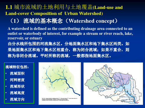
(1) 流域的基本概念(Watershed concept)
A watershed is defined as the contributing drainage area connected to an outlet or waterbody of interest, for example a stream or river reach, lake, reservoir, or estuary 由分水线所包围的河流集水区。分地面集水区和地下集水区两类。如 果地面集水区和地下集水区相重合,称为闭合流域;如果不重合,则 称为非闭合流域。平时所称的流域,一般都指地面集水区。
