烟台VTS指南
VTS报告指南
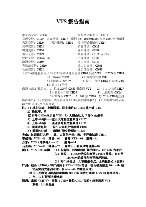
VTS报告指南秦皇岛交管:CH08 秦皇岛之海船代:CH14京唐交管:CH09 京唐港调:CH17 岸标(2)10s40m18M为点18M半径的圆天津交管:CH09 天津港调:CH08 天津抛锚报锚位CH14黄骅交管:CH08 黄骅港调:CH13锦州交管:CH06 锦州港调:CH09烟台交管:CH09 烟台港调:CH16话台转宁波交管:CH06、08 宁波港调:CH09南通交管:CH69 洋山交管:CH13老铁山交管:CH10 成山头交管:CH08长山交管:CH08 连云港交管:CH69长江口-南通报告点:1)长江口东南西北报告线CH08吴淞VTS 2)D7#浮CH09 3)D14#浮CH09 4)圆圆沙灯船CH715)上海港71#浮29 6)长江1号浮CH69报南通VTS6)长江15号浮南通-长江口报告点:1)长江20#浮CH69报南通VTS 2)宝山大灯船CH273)圆圆沙灯船CH26 4)九段灯船CH265)S12#浮CH26 6)101浮CH19 7)107浮CH08(兰洲路海事处) 8)轮渡泰公线至临浦线CH08(董家渡海事处) 9)关港报告线至奉浦大桥CH13(吴泾海事处)注:1)桃花灯桩、上溜网重、洋小猫进口CH08报宁波VTS2)涂泥嘴、甬江1#浮CH06报宁波VTS 3)大鹏山以北7分N处报告3)上海66#浮——宝山大灯船交管频道CH274)上海66#浮——圆圆沙灯船交管频道CH715)圆圆沙灯船——长江口灯船交管频道CH096)圆圆沙灯船——南槽灯船交管频道CH26舟山:过西猴门大桥-----北:大菜花岸标;南:半洋礁以南CH11曹妃甸:VTS---08 港调---60 青岛:VTS---08 港调---11丹东:VTS(海事处)----16 港调---14马迹山:VTS—12 港调---73 绿华山:新双风海调度---09厦门:VTS---08 范围—(1)东南线:以镇海角灯塔为圆心,12n mile为半径(2)西线:117/58/0经线向南至24/26/0纬线,向东至118/00/0经线再向南至南岸连线。
中国港口VTS 报告制度一网打
中国港口VTS 报告制度一网打尽,让你一路驾驶无忧中国港口船舶报告线受话机关VHF频道、电话报告门线。
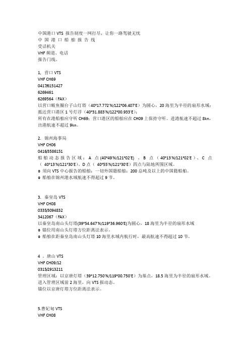
1, 营口VTSVHF CH690417/615142762694616269564(FAX)以营口鲅鱼圈台子山灯塔(40°17.772′N/122°06.407′E)为圆心,20海里为半径的扇形水域;抵达营口港区1号灯浮(40°31.883′N/122°00.933′E);所有在港船舶应守听CH69;营口港区的船舶应在CH09上保持守听。
进港航速不超过8kn,出港航速不超过9kn。
2. 锦州海事局VHF CH060416/3586151船舶动态报告区域:A点(40°49′N/121°02′E) 、B点(40°13′N/121°02′E)、C点(40°13′N/121°30′E)、D点(40°55′N/121°30′E)四点与陆地所围区域。
◎须向VTS中心报告的船舶:一切外国籍船舶;200总吨及以上的中国籍船舶。
◎船舶在锦州港水域航速不得超过9节。
3. 秦皇岛VTSVHF CH080335/30948323412067(FAX)以秦皇岛南山头灯塔(39°54.647′N/119°36.960′E)为圆心,18海里为半径的扇形水域◎锚位用南山头灯塔方位距离法表示。
◎船舶在距秦皇岛南山头灯塔10海里水域内航行时,最高航速不得超过10节。
4 。
唐山VTSVHF CH09/120315/2913211管理区域:以京唐灯塔(39°12.750′N/119°00.750′E)为基点,18.5海里为半径的扇形水域。
进入管理区域前2海里,向VTS报动态。
锚位以京唐灯塔方位距离法表示。
5.曹妃甸VTSVHF CH08东报告线:118°55′.000E西报告线:118°15′.000E南报告线:38°43′.000N◎锚位以曹妃甸灯塔(38°55.100′N/118°30.370′E)方位距离法表示。
中国沿海VTS和港调频道大全

中国沿海VTS,港调频道镇海VTS06(CH)港调09(CH)宁波08CH桃花灯柱连线08CH上流网重岛进出口08CH小洋锚出口06CH涂泥嘴,L1 L2 为2区用08CH L3 L4 L5 L6 L7 L8为1区用06CH舟山:11CH 海事16CH 马峙锚地报舟山11CH 金山海事08CH 长江口南北槽08CH 报吴淞交管北槽进口09CH报吴淞控制中心。
过圆圆沙灯船转71CH安全06CH 南槽出口过S1报吴淞控制中心08CH 吴淞口64#浮经上71CH 64#浮至圆圆沙71CH 圆圆沙至南支26CH 06CH 上海吴淞口08CH上引水11CH宝山码头信号台13CH通信06CH 嘉兴海事处11CH港调13CH 上海洋山交管13CH(到报告线半小时亲上17#浮起始至转向)15CH港调连云港69CH 54#浮报告线青岛08CH,105#团岛嘴,竹岔岛。
大小公岛连线报告天津09CH 16CH话台呼叫货调09CH转14CH联系锚泊联系成山头08CH秦皇岛08CH 港调13CH日照话台16CH转26CH海事和港调大连老铁山10CH大连湾交管06CH 港调13CH 大连庄海事港调74CH 嘉兴海事处11CH黄骅交管08CH 港调13CH,申请排水12CH 锦州海事处06CH 港调09CH 到21#(锚地)报海事京唐海事09CH,港调17CH曹妃甸交管08CH 港调60CH乍浦码头08CH进出口报告嘉兴海事11CH台州海事25CH 椒江二桥监督站06CH 马峙锚地之前报沈家门海事处16CH半夜没人温州海事处16CH转01CH 嵊泗VTS,绿华山南锚地外抛锚报嵊泗海事处16CH 福建罗源码头港调08CH长江/至南京下行:11CH 报交管离港(桥上游)06CH报船舶动态10CH 桥下游,小船过8孔,海船过6孔(由北向南过)125#(张子港)下水报南京交管10CH核对船位南京大桥32-1.97=30.02-1.2(剩余高度)=28.8-水位-船高119#新河口09CH报镇江交管,润扬大桥112#再报107#一定要报镇江交管,会得到105#以下来船的信息,103#,105#不要会船104#可以会,103,105也不要会91-1#斯马树10CH报泰州交管87核对船位71#09CH报江阴交管,65#核对船位过江阴大桥10CH报张家港VTSFB14#核对船位36#11CH报南通VTS,20#核对船位上行:1#报南通VTS 10CH ,15#核对船位37#报张港VTS10CH,FB4福北核对,10CH FB9核对FB14报江阴VTS09CH ,江阴大桥核对09CH泰州10CH,71#报泰州VTS镇江91-1#CH09报VTS 96#和100#核对119#报南京125#127#核对CH10。
中国沿海VTS报告
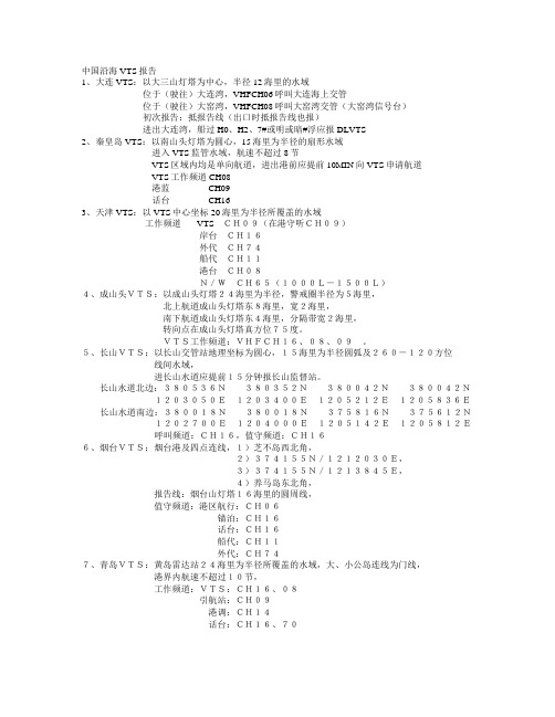
中国沿海VTS报告1、大连VTS:以大三山灯塔为中心,半径12海里的水域位于(驶往)大连湾,VHFCH06呼叫大连海上交管位于(驶往)大窑湾,VHFCH08呼叫大窑湾交管(大窑湾信号台)初次报告:抵报告线(出口时抵报告线也报)进出大连湾,船过H0、H2、7#或明或暗#浮应报DLVTS2、秦皇岛VTS:以南山头灯塔为圆心,15海里为半径的扇形水域进入VTS监管水域,航速不超过8节VTS区域内均是单向航道,进出港前应提前10MIN向VTS申请航道VTS工作频道CH08港监 CH09话台 CH163、天津VTS:以VTS中心坐标20海里为半径所覆盖的水域工作频道VTSCH09(在港守听CH09)岸台CH16外代CH74船代CH11港台CH08N/WCH65(1000L-1500L)4、成山头VTS:以成山头灯塔24海里为半径,警戒圈半径为5海里,北上航道成山头灯塔东8海里,宽2海里,南下航道成山头灯塔东4海里,分隔带宽2海里,转向点在成山头灯塔真方位75度。
VTS工作频道:VHFCH16、08、09。
5、长山VTS:以长山交管站地理坐标为圆心,15海里为半径圆弧及260-120方位线间水域,进长山水道应提前15分钟报长山监督站。
长山水道北边:380536N380352N380042N380042N1203050E1203400E1205212E1205836E长山水道南边:380018N380018N375816N375612N1202700E1204000E1205142E1205812E呼叫频道:CH16,值守频道:CH166、烟台VTS:烟台港及四点连线,1)芝不岛西北角,2)374155N/1212030E,3)374155N/1213845E,4)养马岛东北角,报告线:烟台山灯塔16海里的圆周线,值守频道:港区航行:CH06锚泊:CH16话台:CH16船代:CH11外代:CH747、青岛VTS:黄岛雷达站24海里为半径所覆盖的水域,大、小公岛连线为门线,港界内航速不超过10节,工作频道:VTS:CH16、08引航站:CH09港调:CH14话台:CH16、708、上海:进出口过256、32浮应报告吴淞交管中心,长江出口船过36浮应报告,1)吃水小于8。
烟台VTS指南

烟台VTS用户指南引言:本指南旨在向用户简明介绍烟台船舶交通管理系统(以下称VTS系统)的概况,船舶交通管理中心(以下称VTS中心)有关船舶交通管理和服务方面的要求,以保障船舶航行安全,提高交通效率,保护水域环境,增进VTS中心和用户之间的理解和合作。
烟台VTS系统的组成:●烟台VTS中心(37°33.52′N,121°22.12′E)●芝罘岛雷达站(37°35.83′N,121°25.68′E)●北隍城岛雷达站(38°23.67′N,120°54.60′E)●大竹山岛雷达站(38°01.47′N,120°56.55′E)●礓头雷达站(37°53.73′N,120°45.51′E)●北长山雷达站(37°59.54′N,120°41.65′E)●屺姆岛雷达站(37°41.12′N,120°13.55′E)烟台VTS系统的主要技术设备及性能:●雷达监控系统:作用距离不超过20海里,自动跟踪与重放功能。
●以下水域雷达不能有效覆盖:●(1)港池水域及码头前沿水域;●(2)套子湾水域;●(3)崆峒岛东部水域;●(4)南北长山岛与大黑山岛之间水域。
●船舶自动识别系统(AIS):具有自动识别船舶功能。
●VHF通信系统:作用距离25海里,具有连续录音功能。
●船舶交通管理信息系统:船舶数据处理能力10万艘次。
●水文气象系统:实时检测观测点位置风速、风向以及能见度等。
烟台VTS中心:●通信地址:山东烟台市环海路8号(烟台海事局船舶交通管理中心) 邮政编码:264000●图文传真:0086-535-6696480●联系电话:0086-535-6742651烟台VTS覆盖水域:●烟台管理服务区:以小山子灯桩(37°35.62′N,121°25.95′E)为圆心,半径12海里的水域。
山东海事局关于公布《烟台船舶交通管理系统安全监督管理细则》的通告
山东海事局关于公布《烟台船舶交通管理系统安全监督管理细则》的通告文章属性•【制定机关】山东海事局•【公布日期】2019.11.26•【字号】2019年(第8号)•【施行日期】2020.01.01•【效力等级】•【时效性】•【主题分类】水运正文中华人民共和国山东海事局通告2019年(第8号)山东海事局关于公布《烟台船舶交通管理系统安全监督管理细则》的通告为适应烟台港发展需要及附近水域通航环境变化,更好地维护保障船舶交通安全,我局组织对《烟台船舶交通管理系统安全监督管理细则》进行了修订。
现将修订后的《烟台船舶交通管理系统安全监督管理细则》与《烟台VTS用户指南》予以公布,自2020年1月1日起施行。
特此通告。
山东海事局2019年11月26日烟台船舶交通管理系统安全监督管理细则第一章总则第一条为加强船舶交通管理,保障船舶交通安全,提高船舶交通效率,保护水域环境,根据《中华人民共和国海上交通安全法》、《中华人民共和国海洋环境保护法》、《中华人民共和国船舶交通管理系统安全监督管理规则》等有关法律、法规和规章,制定本细则。
第二条本细则适用于中华人民共和国烟台海事局船舶交通管理系统(以下简称“VTS系统”)区域(以下简称“VTS区域”)内的船舶、设施(以下统称“船舶”)及其有关单位和人员。
本细则所指VTS区域包括芝罘管理服务区、八角管理服务区、龙口管理服务区、蓬莱与长岛管理服务区、长山水道管理服务区和莱州管理服务区。
第三条中华人民共和国烟台海事局是实施本细则的主管机关(以下简称主管机关)。
烟台船舶交通管理中心(以下简称“VTS中心”)根据本细则具体实施船舶交通管理,提供船舶交通服务。
第二章船舶报告第四条除军用船、公务船、渔船和体育运动船外,下列船舶在VTS区域内航行、停泊和作业时,应按规定向VTS中心进行船舶动态报告:(一)外国籍船舶;(二)客船;(三)载运危险货物的船舶;(四)操纵能力受到限制的船舶;(五)300总吨及以上中国籍船舶;(六)其他自愿参加VTS动态报告的船舶。
船舶交通管理系统VTS

中华人民共和国船舶交通管理系统安全监督管理规则(1997年9月15日交通部令[1997]8号发布)第一章总则第一条为加强船舶交通管理,保障船舶交通安全,提高船舶交通效率,保护水域环境,根据《中华人民共和国海上交通安全法》、《中华人民共和国内河交通安全管理条例》等有关法律、法规,制定本规则。
第二条本规则适用于在中华人民共和国沿海及内河设有船舶交通管理系统(以下称VTS系统)的区域内航行、停泊和作业的船舶、设施(以下简称船舶)及其所有人、经营人和代理人。
第三条中华人民共和国港务监督机构是全国船舶交通管理系统安全监督管理的主管机关(以下简称主管机关)。
主管机关设置的船舶交通管理中心(以下称VTS中心)是依据本规则负责具体实施船舶交通管理的运行中心。
第二章船舶报告第四条船舶在VTS区域内航行、停泊和作业时,必须按主管机关颁发的《VTS用户指南》所明确的报告程序和内容,通过甚高频无线电话或其他有效手段向VTS中心进行船舶动态报告。
第五条船舶在VTS区域内发生交通事故、污染事故或其他紧急情况时,应通过甚高频无线电话或其他一切有效手段立即向VTS中心报告。
第六条船舶发现助航标志异常、有碍航行安全的障碍物、漂流物或其他妨碍航行安全的异常情况时,应迅速向VTS中心报告。
第七条船舶与VTS中心在甚高频无线电话中所使用的语言应为汉语普通话或英语。
第三章船舶交通管理第八条除应遵守《中华人民共和国内河避碰规则》外,还应遵守交通部和主管机关颁布的有关航行、避让的特别规定。
第九条船舶在VTS区域内航行时,应用安全航速行驶,并应遵守交通部和主管机关的限速规定。
第十条船舶在VTS区域内应按规定锚泊,并应遵守锚泊秩序。
第十一条任何船舶不得在航道、港池和其他禁锚区锚泊,紧急情况下锚泊必须立即报告VTS中心。
第十二条船舶在锚地并靠或过驳必须符合交通部和主管机关的有关规定,并应及时通报VTS中心。
第十三条VTS中心根据交通流量和通航环境情况及港口船舶动态计划实施交通组织。
论客滚船在VTS区域航行中注意的问题
论客滚船在VTS区域航行中注意的问题正文:一、客滚船在vts区域航行现状:1)客滚船是从事旅客运输的班轮,进出港时间相对固定;2)航速相对较快与港口限速规定形成一定矛盾;3)上层建筑较大,受风流影响较大;4)客滚船旅客、汽车混装,且有些汽车本身是重大件货物,且所带的自备燃料是易燃易爆品,绑扎系固要求较高,在大风浪天气易发生侧滑、倾覆,存在较大的安全隐患因此,客滚船是集客船、装载危险品船、装载重大件货物船为一体的船舶,安全管理责任大。
由于上述特点客滚船一直是烟台vts服务的重点船舶,在管理中给予一定优先权,如优先进出港,考虑风流、班期影响默许了某些情况下超速航行等,但上述措施并未达到vts安全、高效、优质的监管目的,客滚船在vts辖区航行中存在很多很多甚至许多误区,甚至形成或多或少的特权思想,成为事故的隐患。
二、客滚船航行中的误区及应把握的几个“度”1、如何把握vts中心的指令与避碰规则的关系为发挥vts系统功能,vts在控制区域内实行交通管理,进行交通服务,《中华人民共和国船舶交通管理系统安全监督管理规则》第十三条对此作了明确规定:VTS中心根据交通流量和通航环境情况及港口船舶动态计划实施交通组织。
交通组织服务作为vts功能的一个重要部分,对辖区内船舶航行安全、有序、高效起到至关重要的作用。
为更好地发挥vts交通组织功能,vts通过向船长提出建议、发出指令,来达到宏观控制船舶运动的目的。
为此目的,vts交通组织时会发出各种指令,指令对艘每艘船舶都具有相同约束力。
由于vts是近年来才逐渐发展起来的,相关法律法规较少,船舶对此存在一定的误区。
港口vts的指令分为两类:第一类属行政许可类,如船舶向vts申请进出港、为交通组织为船舶指定进出港先后顺序等;第二类为交通强制管理等航行指令,当交管人员发现船舶以原来状态航行,势必发生交通事故时,对该特定船舶发出航行指令,以避免交通事故的发生。
对于第一类指令,笔者认为船舶在自由航行阶段应严格执行vts中心指令,一旦两船形成紧迫局面时,采取避碰时应不受vts中心指令的约束,完全遵守避碰规则中船舶在适合当时能见度情况下的行动规则,更不能以交管中心的指令作为行动依据。
中国沿海VTS和港口VHF报告

二十一、湛江
VTS管理区域
VTS中心工作频道
湛江港A2号灯浮至湛江港46号灯浮之间水域
呼叫和守听频道:CH08
业务通话频道:CH65
报告类别
报告时间或报告位置
报告方法
到港报告
根据主管机关有关湛江港船位报告规定的时限和要求进行报告
报告位置
以下各点连线水域内:
大治河口、大戢山灯塔、虎啸蛇岛东角、西马鞍山灯塔、唐脑山灯塔,以及点(30°35′46.8″N,121°40′00″E)处向北至岸边的连线,与洋山主航道水域
Y1报告线:虎啸蛇岛东角(30°35′06″N,122°09′45″E)、大戢山灯塔与大治河口(31°00′N,121°56′15″E)连线;
③车牛山岛(34°59′45″N,119°49′17″E);④达山岛(35°00′30″N,119°53′26″E);⑤(34°50′28″N,120°01′57″E);
⑥(34°40′36″N,119°45′00″E);⑦(34°40′36″N,119°27′10″E)
业务通话频道:CH66
播发航行警告频道:CH69
4.吴淞口灯塔与101#浮连线延长至浦东岸线
CH71:圆圆沙灯船至黄浦江工作频道
CH26:长江口灯船、南槽灯船至圆圆沙灯船水域工作频道
CH08:长江口船舶定线制水域工作频道
CH27:吴淞口警戒区63#浮至宝山警戒区工作频道
备注:进黄浦江101#浮报告
CH19:101#浮进上海黄浦江
十二、洋山
VTS管理区域
中国沿海VTS和港口VHF报告(版本号-002 /2006-10-30修改)
浅析我国沿海及内河VTS发展现状

浅析我国沿海及内河VTS发展现状赵旭生(航海学院10级海事管理专业1班)说明:本文被未知名同学上传至网络,但本人对本文或近似文章保留最终解释权。
/p-698155462337.html/p-554581800.html摘要:截至2011年11月15日,我国已建成并对外运行30个船舶交通管理系统运行机构,即VTS中心,含110个雷达站,VTS规模总量占世界近三分之一,VTS系统监管水域达7.362万平方公里,已成为世界上建设VTS最多、监控水域面积最大的国家。
本文通过对我国VTS 发展多方面资料考察和总结,对我国沿海及内河各个VTS中心进行了介绍和浅析。
关键词:VTS1.综述目前我国已建成并对外运行30个船舶交通管理系统运行机构,即VTS中心,这30个VTS中心基本实现对全国沿海主要港口、重要水道和长江干线南京以下水域的全方位覆盖,实现海事监管远程”可视、可听、可控“,且绝大部分VTS设备达到中等发达国家水平,有些达到国际先进水平。
统计数据显示,仅2009、2010两年时间,全国各VTS中心共接收船舶报告1109万次,跟踪船舶641万艘次,及时制止、纠正和处理4万余起交通违法行为,向船舶提供信息服务451.2万次、助航服务92.4万次,成功避免18542次险情。
2.部分港口浅析30个VTS中心分别为:大连、营口、秦皇岛、天津、黄骅、烟台、长山、成山角、青岛、日照、威海、连云港、上海、南通、江阴、张家港、镇江、南京、浏河口、宁波、舟山、珠海、厦门、广州、深圳、湛江、香港、澳门、琼州海峡等。
2.1大连VTS中心2.1.1大连港VTS的发展史1)大连港第一代VTS系统是由海上交管站和大窑湾监督站交管台两部分组成。
VTS管理模式根据大连海监局机构设置和职责范围而产生的,整体VTS工作由通航处、海上交管站及大窑湾交管台分别承担。
○海上交管站VTS系统建成时间为1988年9月1日,设备主要包括:雷达子系统一套。
vts相关法律、法规、规章等

国内法律、法规及规章
《中华人民共和国船舶交通管理系统安全监督管理规则》
第五章 法律责任
第二十二条 对违反本规则的,主管机关依据有关法律、法规和交通 部颁布的有关规章给予处罚。 第二十三条 本规则的实施,在任何情况下都不免除船长对本船安全 航行的责任,也不妨碍引航员和船长之间的职责关系。 第二十四条 为避免危及人命财产或环境安全的紧急情况发生,船长 和引航员在背离本规则有关条款时,应立即报告VTS中心。
国内法律、法规及规章
《海事行政执法过错和错案责任追究暂行规定》
第三十四条 海事执法人员在交管中心值班时,有下列情形之一的,
给予直接责任人执法警告或者通报批评,给予其他责任人记2~3分或 者执法警告;情节较重的,给予直接责任人员临时收存或者暂扣海事
执法证,给予其他责任人员通报批评或者临时收存海事执法证:
国内法律、法规及规章
《船舶交通管理系统运行管理规定》
第三章
运行管理
第九条 港务监督应在VTS系统试运行一年内,向中华人民共和国港 务监督局提出申请,经审批后正式对外公布运行 第十条 VTS系统正式对外运行应具备的条件 第十一条 VTS中心内部管理制度主要内容
国内法律、法规及规章
《船舶交通管理系统运行管理规定》
(一)未按规定保持值守的; (二)对船舶报告的信息未按规定及时处理的; (三)未按规定及时向船舶发布通航管理或者安全信息的; (四)发现交通秩序问题或者航行、停泊安全隐患,未按规定及时进 行处理的; (五)擅离值班岗位的。
国内法律、法规及规章
《中华人民共和国海事局船舶交通管理系统值班人员管理规定 》 第一章 总则
第十九条 VTS中心应建立和畅通如下协调工作流程 第二十条 各港务监督依据本章规定结合实际情况制定VTS中心的工
沿海各港高频频道一览表

沿海各港⾼频频道⼀览表VHF频道⼀览表渤海湾1.鲅鱼圈:VTS 69频道,台⼦⼭20海⾥报告线道。
港调:08 频道申请离泊、进港计划码头公司调度:08 频道(在进港前呼叫码头调度安排派解缆⼯⼈)2.营⼝港:3.锦州港:动态06频道报告港监,。
港调09频道现港外主航道已经全⾯拓展为25万吨级航道。
4.葫芦岛:海事135.秦皇岛: VTS:08频道,报告线是以南⼭灯塔为中⼼15海⾥的范围,锚泊后报告锚位也是报告南⼭灯塔的范围距离。
芝海代理:⼯作频道13,呼叫频道14,港内⼀切船舶都是芝海代理调动,和通知动态。
引⽔和港调8公司调度均是14频道呼叫。
6.京唐港:海事:CH09 ,申请锚位和抛好锚后必须报交管(但是有时候港调会通知你不⽤报告了由它转告就⾏了。
)港调CH 17,抵锚地抛锚后锚位报海事:锚位到京唐灯桩的⽅位距离。
有时港调能给你转告海事你的报告。
7.天津港:天津港VTS 09,锚地抛好锚后,应将锚位距离⼤沽⼝灯桩的⽅位距离报告给交管中⼼。
申请起锚上线、下线、靠妥泊位、申请离泊位都得向交管中⼼申请。
进⼝船舶在过了⼤沽灯桩前,未同意进⼊航道的船舶可以在航道北边等候或慢车,(铭扬洲99⼀般都是在21号浮上线)直⾄申请同意后才可以进⼊航道上,进⼊航道时应⽴即报告海事。
轮调13CH8.黄骅港: VTS 08频道,以北纬38°20.4′东经117°55.35′为中⼼半径28海⾥所覆盖的范围为报告线,抛锚时好像并不需要⾮得抛在锚地⾥不可,抛好后报告交管中⼼,报港调,报船代、就⾏了。
港调 13频道,船代 73频道。
9.莱州港:10.龙⼝港:龙⼝话台CH 16, 港调CH 77,港调通知进港后,可以跟交管中⼼申请进港,港⼝规定:船长超过120⽶的船舶,应强制拖轮、引⽔。
1.蓬莱港:西来船舶经过长⼭⽔道欲去蓬莱的话,出东⼝后可以询问长⼭交管中⼼是否可以提前转向来到锚地,如果同意后可进⾏。
2.烟台港:VTS09频道港内06频道3.威海港:海事164.⼤连港:整个⼤连港内港区是⽤06频道。
VTS及AIS知识介绍

气象服务器 交通显示终端
数据库服务器 网 闸 信息发布服务器
数据库终端
局内终端
1、雷达子系统
雷达子系统主要用于采集信息,由雷达天 线、收发机、控制器及维修终端四部分组 成。 2、VHF通信子系统 主要用于VTS向船舶提供信息服务、交通组 织服务、助航服务等通信业务。
X波段 18ft/12ft及以上裂缝天线
1. 2. 3. 4. 5. 6. 7. 8. 9. 雷达子系统 VHF通信子系统 雷达数据处理子系统 多传感器综合处理子系统 交通显示与控制子系统 船舶数据处理子系统 记录重放子系统 信息传输及网络子系统 支持保障子系统
系统组成框图
三、工作原理与信号流程
雷达(回波) DU(数化,抗干扰) 网络 SYTAR 服务器(融合) 操作台(显示和操作)
从雷达来的原始视频信号 通过数据板(DU)进行数字化和相关的抗干扰处 理 通过网络传递到相应的控制中心 在综合处理服务器上与其他的信号进行融合处 理
在控制中心的操作台和远程浏览器上 由Sytar客户机软件进行显示 并接受操作员的各种命令 控制信息 通过网络传递到雷达站的控制器 对雷达进行远程控制
五、黄石VTS简介
黄石VTS系统工程建设规模为6站1中心,实
现对长江干线武汉与黄石海事局交界至牯 牛沙1号标的雷达覆盖,管理水域全长约 94Km,并与武汉VTS系统之间实现信息交 互。 具体为建设马驿、得胜洲、巴河口、廻风 矶、黄石港区、茅山6个雷达站,建设马驿、 巴河口和茅山3个VHF基站,在黄石海事局 大楼建设VTS中心。
4、VTS的交通组织功能
(1)“交通组织”是为了防止危险局面的产生和 保证VTS区域内船舶安全有效航行的服务。 (2)交通组织涉及对船舶动态的提前计划,适用 于交通繁忙时或者有特别的运输动态影响其他交 通流的情况。一般情况下,交通组织通过交通计 划和强制遵守的管理规则来体现。VTS中心认为 必要时,向特定水域内船舶发出交通组织的指令, 包括:组织并监督船舶进出港口和通过特殊要求 区域;组织并监督船舶进出锚地和泊位,帮助船 舶锚泊;监督船舶航线及航速;警告、纠正违章 航行船舶等。
VTS信息管理功能及在船舶交通管理中的作用
山东交通学院海运学院VTS信息服务功能及其在船舶交通管理中的作用专业航海技术届别 2013届学号091611109姓名杨璨璨指导教师汪运涛山东交通学院海运学院二○一三年六月原创声明本人杨璨璨郑重声明:所呈交的论文“VTS信息服务功能及其在船舶交通管理中的作用”,是本人在导师汪运涛的指导下开展研究工作所取得的成果。
除文中特别加以标注和致谢的地方外,论文中不包含任何其他个人或集体已经发表或撰写过的研究成果,对本文的研究做出重要贡献的个人和集体均已在文中以明确方式标明,本人完全意识到本声明的法律后果,尊重知识产权,并愿为此承担一切法律责任。
论文作者(签字):日期:年月日摘要船舶交通管理服务(Vessel Traffic Service, VTS)系统是由主管当局实施的,旨在改善船舶交通安全,提高船舶交通管理效率以及保护环境的一种服务,VTS系统可以监视港区水域船舶运动,对船舶提供信息、建议和指示。
VTS是集导航技术、通信技术、计算机网络技术、信息处理技术和航海技术为一体的交通管理系统。
其中主要功能中信息服务体现在VTS中心对于信息的采集、传输、处理、存储、共享等方面,只有解决了信息共享,才能充分发挥VTS 系统的效能。
本文以成山角VTS提供的信息服务为例,结合国内外VTS发展的历史,详细分析讨论了VTS关于信息发布基于的技术支持、信息的搜集渠道以及信息的种类,探讨目前船舶交通服务(VTS)存在的缺陷,叙述了AIS技术在VTS中的应用以及AIS对VTS的重大影响;特别区分了VTS中定义的管理与服务的不同之处,强调了VTS中心应加强联合其他部门促进非VTS船舶安全管理信息的发布的重要性,以及做好信息服务效果评估的意义;同时结合本人在航海实践中与VTS中心联系过程中遇到的实际问题,以及对成山角VTS的参观调研,提出船舶交通服务(VTS)中心应积极投入建设VTS信息管理系统,做好信息服务效果评估工作;树立“主动服务,加强合作”的超前理念,展望了未来VTS的发展方向,应建设全国一体的“大交管系统”,达到“以优良的信息服务促进监管水平的提高”的先进海事管理水平。
长山交管中心_13431
烟台山交管站Yantaishan VTS系统概况SYSTEM SUMMARY烟台山VTS系统构成及性能:1.雷达监控系统:16海里作用距离,具有跟踪功能。
2.VHF通信系统:20海里作用距离,具有录音功能。
The components and functions of Y antaishan VTS:1. Radar Surveillance System: Effective range of 16 miles with tracking function2. VHF Communication System: Effective range of 20 miles with recording function烟台山交管站位于山东省烟台市烟台山公园内邮政编码:264000通信地址:烟台山西路14号(烟台海事局烟台山交管中心)图文传真:535-6216365联系电话:************;6226477Y antaishan VTS Station:Inside YantaiShan Park, Y antai, Shandong ProvincePost code: 264000Add: Y antai VTS Station, 14 Y antaishan western roads, Y antai Shandong China (Y antaishan VTS of Y antai M.S.A.)Fax*************Tel*************;6226477管理服务对象:按有关国际公约和国内规范规定应配备通信设备及主管机关要求加入VTS系统的船舶。
管理服务区域:烟台港及其附近水域。
烟台港及其附近水域是指下列四点连线以内水域:1.芝罘岛的西北角2.北纬37°41′55″,121°20′30″3.北纬37°41′55″,121°38′45″4.养马岛的东北角Users: Ships which are equipped with the required communication equipment in accordance with the relevant international conventions and/or national rules and regulations and ships which the competent authority may require to be governed by the VTS.VTS Area: Y antai Port Water Area and its vicinity.The term Y antai Port Water Area and its vicinity mean the water areas whining the lines connecting the following points:1.Northwest Points of Zhifu Island2.37°41′55″N,121°20′30″E3.37°41′55″N,121°38′45″E4.Northeast Point of yangma Island工作语言:汉语普通话或英语。
VTS系统联网及需要解决的主要问题
VTS系统联网及需要解决的主要问题
邓振斌
【期刊名称】《航海技术》
【年(卷),期】2007()5
【摘要】分析VTS联网的必要性和可行性,并以山东海事局辖区内VTS系统为例,探讨了VTS联网方案,提出VTS联网中需要解决的一些主要问题。
【总页数】3页(P17-19)
【关键词】VTS;联网;主要问题
【作者】邓振斌
【作者单位】山东烟台海事局
【正文语种】中文
【中图分类】U692
【相关文献】
1."造就世界一流科学家和科技领军人才"需要解决的主要问题——对两次科技院所调查问卷中相关问题的分析 [J], 杜谦
2.论当今车联网技术需要解决的主要问题及发展方向 [J], 丁超;曹晶晶;叶郭;
3.论当今车联网技术需要解决的主要问题及发展方向 [J], 丁超;曹晶晶;叶郭
4.浅议粮食流通立法需要解决的主要问题和拟设立的主要制度 [J], 张国钧;韩志春;尤晓萍
5.关于VTS系统联网问题的思考 [J], 王平;王琪;林永娟
因版权原因,仅展示原文概要,查看原文内容请购买。
VTS对客滚船服务管理应注意的问题
VTS对客滚船服务管理应注意的问题
于涛
【期刊名称】《中国水运》
【年(卷),期】2009()3
【摘要】近年来,随着烟台市“以港兴市”战略的推进,烟台芝罘湾港区的规模得到了迅速发展,港区水域船舶流量每年以10%的速度增长,其中以客滚船为代表,在胶东半岛和辽东半岛之间形成了一条蓝色经济公路。
然而随着渤海湾运输的发展,使得芝罘湾港区有限的通航资源与日益增长的船舶流量之间的矛盾越来越突出,海上交通安全水平和船舶效率显著降低,安全问题也日益突出。
【总页数】2页(P24-25)
【关键词】客滚船;服务管理;VTS;船舶流量;以港兴市;辽东半岛;胶东半岛;安全水平【作者】于涛
【作者单位】烟台海事局
【正文语种】中文
【中图分类】U674.135;U665
【相关文献】
1.客滚船监造绝缘材料敷设和检验时应注意的问题 [J], 姜秀兰;
2.客滚渡船航次安全检查管理应注意的几个问题 [J], 李涛
3.客滚船监管中应注意的两个问题 [J], 金显根;于军
4.VTS对客滚船服务管理考察报告 [J], 于涛
5.关于琼州海峡水路客运航海保障信息服务建设的几点思考——探索琼州海峡客滚运输船航海保障信息创新服务 [J], 莫奇
因版权原因,仅展示原文概要,查看原文内容请购买。
- 1、下载文档前请自行甄别文档内容的完整性,平台不提供额外的编辑、内容补充、找答案等附加服务。
- 2、"仅部分预览"的文档,不可在线预览部分如存在完整性等问题,可反馈申请退款(可完整预览的文档不适用该条件!)。
- 3、如文档侵犯您的权益,请联系客服反馈,我们会尽快为您处理(人工客服工作时间:9:00-18:30)。
烟台VTS用户指南引言:本指南旨在向用户简明介绍烟台船舶交通管理系统(以下称VTS系统)的概况,船舶交通管理中心(以下称VTS中心)有关船舶交通管理和服务方面的要求,以保障船舶航行安全,提高交通效率,保护水域环境,增进VTS中心和用户之间的理解和合作。
烟台VTS系统的组成:●烟台VTS中心(37°33.52′N,121°22.12′E)●芝罘岛雷达站(37°35.83′N,121°25.68′E)●北隍城岛雷达站(38°23.67′N,120°54.60′E)●大竹山岛雷达站(38°01.47′N,120°56.55′E)●礓头雷达站(37°53.73′N,120°45.51′E)●北长山雷达站(37°59.54′N,120°41.65′E)●屺姆岛雷达站(37°41.12′N,120°13.55′E)烟台VTS系统的主要技术设备及性能:●雷达监控系统:作用距离不超过20海里,自动跟踪与重放功能。
●以下水域雷达不能有效覆盖:●(1)港池水域及码头前沿水域;●(2)套子湾水域;●(3)崆峒岛东部水域;●(4)南北长山岛与大黑山岛之间水域。
●船舶自动识别系统(AIS):具有自动识别船舶功能。
●VHF通信系统:作用距离25海里,具有连续录音功能。
●船舶交通管理信息系统:船舶数据处理能力10万艘次。
●水文气象系统:实时检测观测点位置风速、风向以及能见度等。
烟台VTS中心:●通信地址:山东烟台市环海路8号(烟台海事局船舶交通管理中心) 邮政编码:264000●图文传真:0086-535-6696480●联系电话:0086-535-6742651烟台VTS覆盖水域:●烟台管理服务区:以小山子灯桩(37°35.62′N,121°25.95′E)为圆心,半径12海里的水域。
●龙口管理服务区:以屺姆角灯塔(37°41.13'N,120°13.50'E)为圆心,半径12海里的水域。
●蓬莱与长岛管理服务区:以蓬莱头灯塔(37°49.85′N,120°44.56′E)为圆心,半径8海里自(37°57.83′N,120°43.93′E)到(37°49.30′N,120°54.64′E)的圆弧线和以栾家口港区堤头灯桩(37°47′N,120°37.85′E)为圆心,半径8海里自(37°55.02′N,120°37.86′E)到(37°44.85′N,120°28.12′1E)的圆弧线之间的水域。
长山水道管理服务区:由分道通航制和东西两端警戒区组成。
分道通航制北边线为下列地理位置连线:(1)38°00.70′N 120°58.60′E(2)38°00.70′N 120°52.20′E(3)38°03.87′N 120°34.00′E(4)38°05.60′N 120°30.83′E分道通航制南边线为下列地理位置连线:(1)37°56.20′N 120°58.20′E(2)37°58.27′N 120°51.70′E(3)38°00.33′N 120°40.00′E(4)38°00.30′N 120°26.92′E分隔带为下列地理位置连线为中心线,宽度为0.2海里,长度为23.5海里的水域:(1)38°03.42′N 120°29.30′E(2)37°58.45′N 120°58.40′E警戒区:东部警戒区:以地理位置37°58.25′N ,121°02.50′E为圆心,半径4海里圆弧内的水域。
西部警戒区:以地理位置38°05.00′N ,120°24.60′E为圆心,半径5海里圆弧内的水域。
烟台VTS中心依据有关法律法规、规章和其他规范性文件在烟台 VTS覆盖水域实施船舶交通管理,提供交通服务。
要求参加VTS系统的船舶:所有外国籍船舶、客船、载运危险品的船舶、操纵能力受到限制的船舶和300总吨及以上中国籍船舶。
工作语言:汉语普通话或标准航海英语。
工作时间:北京时间0000—2400。
2YANTAI VTS GUIDE FOR USERS INTRODUCTION: This guide is intended to provide users with a brief introduction on Y antai vessel traffic service system (hereinafter referred to as VTS system) , including the requirements of the vessel traffic service center (hereinafter referred to as VTS Center) about vessel traffic control and services,in order to ensure the safety of navigation, to raise the traffic efficiency, to protect the marine environment, and to promote the understanding and cooperation between users and VTS Center.System summary of Yantai VTS:●Y antai VTS center(37°33.52′N,121°22.12′E)●Radar station of Zhifu island(37°35.83′N,121°25.68′E)●Radar station of Beihuangcheng island(38°23.67′N,120°54.60′E)●Radar station of Dazhushan island(38°01.47′N,120°56.55′E)●Radar station of Jiangtou(37°53.73′N,120°45.51′E)●Radar station of Beichangshan(37°59.54′N,120°41.65′E)●Radar station of Jimu island(37°41.12′N,120°13.55′E)The main technical equipment and functions of Y antai VTS system:●Radar Surveillance System: no morn than effective range of 20 nautical miles withautomatic tracking and replaying functions.But the following areas can not be effectively covered by the VTS radars:(1) Basin waters and the waters of quayside;(2) Gulf of Taoziwan;(3) East of Kongtong Island;(4) Water area among Nanchangshan Island, Beichangshan Island and Daheishan Island.●Automatic Identification System: with automatic identifying function.●VHF Communication System: effective range of 25 nautical miles with audiorecording function.●V essel Traffic Management Information System: 100,000 ships’ data processingcapacity.●Hydrometeorological System: providing instant speed and direction of wind, visibilityinformation near observation point.Y antai VTS center:●Post address: Huanhai Road No. 8, Y antai, Shandong, P. R. China (Y antai VTS center,Y antai MSA); Post code:264000●Fax:0086-535-66964801●Telephone:0086-535-6742651Y antai VTS area:●Management and service area of Y antai port: the area with Xiaoshanzi beacon(37°35.62′N,121°25.95′E)as the center and 12 nautical miles as the radius.●Management and service area of Longkou port: the area with Jimujiao lighthouse(37°41.13'N,120°13.50'E)as the center and 12 nautical miles as the radius.●Management and service area of Penglai and Changdao port: the area between the arcline from(37°57.83′N,120°43.93′E)to(37°49.30′N,120°54.64′E)with Penglaitou lighthouse(37°49.85′N,120°44.56′E)as the center and 8 nautical miles as the radius and the arc line from(37°55.02′N,120°37.86′E)to(37°44.85′N,120°28.12′E)with Lanjiakou bank beacon(37°47′N,120°37.85′E)as the center and 8 nautical miles as the radius.●Management and service area of Changshan channel: consists of the traffic separationscheme and two precautionary areas.The north limit of the traffic separation scheme is the line connecting the following geographical positions:(1)38°00.70′N 120°58.60′E(2)38°00.70′N 120°52.20′E(3)38°03.87′N 120°34.00′E(4)38°05.60′N 120°30.83′EThe south limit of the traffic separation scheme is the line connecting the following geographical positions:(1)37°56.20′N 120°58.20′E(2)37°58.27′N 120°51.70′E(3)38°00.33′N 120°40.00′E(4)38°00.30′N 120°26.92′EThe separation zone: 0.2 nautical miles in width and 23.5 nautical miles in length, is centered upon the line connecting the following geographical positions:(1)38°03.42′N 120°29.30′E(2)37°58.45′N 120°58.40′EThe east precautionary area is the area with the geographical position (37°58′.25N, 121°02′.50E) as the center and 4 nautical miles as the radius.The west precautionary area is the area with the geographical position (38°05′.00N, 120°24′.60E) as the center and 5 nautical miles as th e radius.According to national laws, codes, regulations and other government documents, Y antai VTS Center should manage vessel traffic and provide traffic services at VTS area.Users: All foreign vessels, Chinese vessels of 300 gross tonnage and upwards, all passenger vessels, vessels carrying dangerous cargo.Working language: Chinese mandarin and/or English2Working time: 0000—2400 (Beijing time)345附图(本图不可用于航海)Sketch Chart (not used for navigation)烟台管理服务区Management and service area of Yantai port龙口管理服务区Management and service area of Longkou port蓬莱与长岛管理服务区Management and service area of Penglai and Changdao port9 长山水道管理服务区 Management and service area of Changshan channel。
