大伦敦规划
伦敦城市发展战略介绍——《伦敦规划》2036

伦敦城市发展战略介绍——《伦敦规划》2036一、伦敦规划的持续性演变伦敦规划是伦敦的整体战略布局,着眼于今后20~25年伦敦经济、环境和社会一体化发展,涵盖了伦敦地理范围和行政范围内的交通、经济发展、住房、文化、社会(如儿童和青年人)和环境(如气候变化、空气质量、噪声和垃圾处理)等内容。
伦敦规划制定了伦敦的土地利用和发展框架,包括基础设施尤其是交通的改善,规划涉及了执行、协调、资源配置以及大伦敦管理集团组织之间的统一政策等环节。
伦敦这一轮规划历经多个版本,第一版发行于2004年,经过两次修改后其更新版于2008年发行;但同年7月新市长上任后提出了新的“更好的伦敦”设想,于是在2011年将2004年规划、2008年规划和市长新设想整合起来,出版了新的版本。
伦敦规划并没有因为新版本出现而停止,规划依据政策及其政策效果而不断进行修改。
规划的计划、监督和管理部分规定,在出现环境变化、经济重大变化时,其必须有所调整变化,如有可能和需要,甚至可以被新规划所取代。
2011年以来伦敦规划的修改,主要起因于英国政府的指导意见和2011年7月通过的国家立法,包括2012年颁布的国家计划政策框架和2013年颁布的国家经济适用房的政策。
同时,2014年伦敦市长发表《2020年的愿景:地球上最伟大的城市——伦敦的雄心》,提出了住房改善、经济能力提升、伦敦可持续发展等愿景。
这些都需要在伦敦规划中重新得以体现。
新的伦敦规划(整合进2011年规划版本)目标定位于2036年,这是按照政府规定的20年规划期而确定的,也是因为市长觉得伦敦的发展前景有必要告知决策者、开发商和投资者。
同时鉴于伦敦人口增速超过2011年规划的估计,而这种人口增长究竟是结构性的还是周期性的还不得而知,有赖于规划中既有的战略和理念能成功地适应预测的人口增长水平,由此,需要在2015年开始对既有规划和计划进行审查,从而进行规划的修订和整合。
此外,为了反映政府住房标准,市长也需要对伦敦规划进行调整,还得考虑政府对停车政策的变化,如新的政策取消了最高停车标准而变得更灵活,同时还考虑如何通过停车政策修改来激活镇中心的活力。
大伦敦规划分析1

理论基础
理论基础
大伦敦规划充分吸取了当时西方国家城市规划思想的精髓。
霍华德的田园城市
大伦敦计划部分实现了霍华德城乡结合改善居住环境,以小城镇群代替大城市以及每个城 镇保持就业平衡,相对独立的理想城市目标。参考田园城市的理论,环绕伦敦形成了一条
宽达6英里的绿化带。
盖迪斯的组合城市
另外一个盖迪斯,他是一个生物学家,是一个社会的活动家,同时也是一个教育改革家, 他的这本书叫做《演变中的城市》。他的贡献就是把生物方面的进化论的观念运用到城市 方面来,把区域看作土壤,把城市看作一个植物,这个植物城市是在区域的这个土壤里面 生长的,所以他非常强调要区域调查,最早推动区域研究、区域规划。他提出了生态问题, 这是一百多年前就提出生态问题和城市进化的理论。另外他提出一句口号,就是说我们不 仅要煤气和自来水,而且还要阳光和空气
• 1952年,“城镇开发法”正式颁布,又在大伦敦周围规划了20座旧城的改扩建,一共 可安置40万人。
• 20世纪60年代,伦敦又进一步提出了大伦敦发展规划,第三代新城开始出现。 • 20世纪70年代,伴随英国总人口数量趋于稳定以及既有城市内部问题的凸显,采用建
设新城的方法来解决大城市问题的规划方针开始受到质疑。 • 20世纪80年代,撒切尔政权时期新城建设政策正式打上休止符。
大伦敦规划分析
城市发展与动力作业
组员:唐嘉曼、陈友杰、黎达栋、 莫瑞欣、梁少云、吕燕华
社会背景
社会背景
城市简介
伦敦位于英格兰东南部的平原上,跨泰晤士河,距离泰晤士河入海口88公里。 是由城 墙,环路,南北环线和25号高速公路包围着的.泰晤士河与Lee河,铁路跨线桥和干道,造成了 更细致的格局。罗马路,Westway,辐射状立交,以及Kingsland,等各个路穿城而过,地貌 特点和距离都被拉近了。公园和起伏的土地是对城市格局的良好补偿。
城市设计案例分析(大伦敦规划分析)

社会背景
与纽约和东京一样,伦敦也是一个国际大都市,有许多跨国公司的总部落户于伦敦市中心。 伦敦是英国政治、商业、金融、文化和旅游的中心,有着2000年的悠久历史,人口密度相 对较低,过去曾有几年,伦敦的人口和工作机会减少并且流向周边地区。 伦敦是在莫斯科之后是欧洲第二个大城市 。伦敦有两千多年的历史,历代王朝建都此地。 到17世纪时伦敦已经是當時大英帝國乃至欧洲最大的都市。1666年的倫敦大火災毁坏了伦 敦城内大部分的建筑,之后伦敦成立了城市改建委员会,规定了放宽街道等措施,并颁布了 《重建伦敦市法令》。这场大火为伦敦提供了遵循近代城市功能改建城市机会。
第四,明确空间发展的优先权,在过去的发展过程中未能获益的那些地区,特别是东 伦敦的部分地区,需要在未来的发展中优先考虑和支持。
目标:
规划目标:
目标1:为伦敦地域范围内的增长提供有效支持,但不侵占开放空间;
目标2:将伦敦建成一个更适宜人们生活的城市; 目标3:将伦敦建成一个拥有雄厚多样的经济增长基础的更繁荣的城市; 目标4:推进社会的融合,消除隔离和歧视; 目标5:提高伦敦的可达性; 目标6:将伦敦建成一个更具吸引力、设计得更精致的绿色城市。
背景:
1980年代以前,伦敦的工业增长逐年下降,经济处于衰退阶段,人口不断减少,由1939 年的800万下降到1985年的680万,城市的社会设施和基础设施已无法满足来自各方面的压 力。然而,近十多年来,伦敦正经历着显著的变化,经济、人口出现强劲增长,城市愈发繁 荣,现在的人口已经回升到740万。促成这种转变的主要因素是两个:第一,像纽约、东京一 样,伦敦作为一个世界城市正以其高质量的和高度专业化的服务设施,特别是贸易和金融设 施,吸引着全球的投资,许多跨国公司的发展需要落户伦敦这样的世界城市;第二,伦敦正 以成功的经济、一个世界城市所能提供的各种就业、文化、教育等条件,吸引着大量的国外 移民,越来越多的学生、刚刚达到就业年龄的年轻人来到伦敦,在这里你可以听到世界各地 多达305种语言,这使伦敦正在变得越来越年轻。
阿伯克隆比—大伦敦规划详解

阿伯克隆比的“大伦敦规划”(1944年)阿伯克隆比“大伦敦规划”(1944年),该规划的范围覆盖6735km2,涉及到134个地方政府,当时人口1250多万。
因此该规划已经不再仅仅是一个伦敦市区的总体规划,而是整个大都市地区的规划。
正如塔夫里等人评价的,该规划使“格迪斯的区域规划既考虑到了城市建成区本身的延续性和进行全面改造的困难,同时也兼顾了城市向外扩散的需要采用了降低已建成区的人口密度,在城市的建成区之外有计划建设新城的方式来整合整个区域,使城市及其周边均纳入到有序的发展之中”。
该规划包括了这样一些主题:延续控制伦敦市区内工业数量增加和规模扩大的思想,限制城区的工业扩建;城市居住区和工业区相分离;在整个区域范围内停止人口地迁入,使整体德人口密度能够下降,同时将市区的人口向郊区迁移;完善伦敦港的功能;给予城市规划新的权力,以控制土地的价格,保证规划的有效实施等在具体的布局内容上,通过对区域现实状况的详细审查,规划将整个规划地区划分为4个同心圆地区。
核心内容:——同心圆布局模式(1)城市内环。
包括伦敦郡和部分邻近地区该地区现状特点是密度过大,规划建议要从这里疏散出40-50万人口,也迁出相应数量的工作岗位,进行全面地城市更新,是居住用地的人口净密度降至每公顷190至250人。
(2)郊区环。
这里现状存有相当数量在第一次和第二次世界大战期间建设的住房,这一地区的人口密度不是很高,规划建议今后不再在这里增加人口,但需要对该地区进行重新组织,应提供合适的舒适环境。
居住用地的人口净密度控制在每公顷125人。
(3)绿带环。
这里是由国家1938年《绿带法》所规定的绿带用地,规划建议将围绕原有城市的绿带进一步拓宽,在整个建成区外围将绿带环扩展至16km宽,规划设置森林公园、大型公园绿地以及各种游憩运动场地,以阻止伦敦扩展到1939年达到的边界以外去,同时为整个地区提供休闲活动场所。
(4)乡村环。
这个地区要接受伦敦内环疏散出来的大部分人口。
大伦敦规划演变对国土空间规划的启示

局混乱、中心区人口密度过大、交通拥堵、住房短缺等;资源依赖严重、环保压力凸显,部分城市尚未探寻到资源节约和生态文明的城市化发展路径;城市发展动力不足,产业发展乏力,城市化动力机制急需改革;制度障碍,如户籍管理制度、社会保障制度、就业制度、土地流转制度的改革等。
更多研究[2-5]认为:我国城市化发展不均衡,城市化水平地域差异明显;城镇就业供给不足,就业的城镇化滞后于人口的城镇化;伪城市化现象出现,新进城的居民在就业、教育、医疗、养老保障等方面享受不到与城市居民同等的待遇,城市内部形成了新的“二元结构”;农民工及失地农民的城市社会保障滞后,城市社会稳定发展需慎重考虑。
发达国家的城镇化过程中同样也遇到过我国现阶段类似的问题。
通过对国外城市规划发展演变的过程进行分析研究,结合我国当前城镇化发展现状和国土空间规划发展需求,从多方面寻求对我国城镇化发展具有借鉴意义的内容。
大伦敦规划战略的历史演变及21世纪以来大伦敦战略规划的编制便是一个好的借鉴案例。
2大伦敦规划战略的历史演变总结大伦敦规划战略的历史演变,大致可以分为疏散发展时期、有机疏散时期、自发发展时期和集约发展时期[6](见表1)。
大伦敦规划的每个阶段都有其不同的特征。
在疏散发展时期,规划关注城市的人口聚集、工业布局、城市环境、生活质量和中心城区拥挤等问题,并期望通过建立卫星城来解决。
到了有机疏散时期,规划通过布局具体的空间结构方案来协调人口分布同空间摘要 文章分析了21世纪以来大伦敦发展面临的形势,梳理了大伦敦规划演变的脉络,并对其各个时期的规划作出了评估。
在此基础上,结合我国城市发展面临的实际问题和对未来城镇化发展道路的思考,提出了加强多学科多部门协作、实行分区策略、注重生态平衡、体现人文关怀,以及重视规划过程、及时反馈和修订的建议,以期为我国空间规划提供借鉴。
关键词 大伦敦规划;城市问题;国土空间规划;空间环境中图分类号 TU984文献标识码 ADOI 10.19892/ki.csjz.2023.20.28Abstract This paper analyzes the situation for the developmentof Greater London since the 21st century, sorts out the development context of the Greater London Plan, and makes assessments on the plan of the Greater London in various periods. On this basis, in view of the practical problems faced by China’s urbanization development and the reflection on the future development path of urbanization, the suggestions are put forward to strengthen multidisciplinary and multisectoral collaboration, to implement zoning strategies, to pay attention to ecological balance, to embody humanistic care, as well as to pay attention to the planning process, and to timely feedback and revise, with a view to providing a reference for the spatial planning in China.Key words Greater London Plan; urban issues; territorial space planning; spatial environment1我国城镇化现状及问题我国城镇化快速推进,城市问题日益加剧。
大伦敦规划

大伦敦规划大伦敦是英国首都伦敦的组成部分,是欧洲最大的都市区之一。
它以其发达的经济、文化和教育资源而闻名于世。
为了更好地满足人们的生活和工作需求,大伦敦进行了一系列规划,以确保城市的可持续发展和未来的繁荣。
大伦敦的规划主要包括城市发展、基础设施建设和环境保护三个方面。
首先是城市发展规划。
伦敦市政府制定了2036年的伦敦规划,旨在增加居住和工作空间,改进交通和基础设施,提升城市的可持续性和生活质量。
规划中提出了一系列措施,如建设新的住宅区、改善交通网络、保护城市的历史遗址和绿地等。
这些措施将有助于促进城市的发展,并提供更好的生活和工作条件。
其次是基础设施建设规划。
大伦敦的基础设施建设涉及交通、能源、通信等方面。
规划中提出了一系列改善交通网络的措施,如修建新的高速公路、铁路和地铁线路,以便人们更便捷地出行。
此外,规划还提出了发展清洁能源和改善通信网络的计划,以满足人们对能源和通信的需求。
这些基础设施建设的措施将有助于促进经济发展和社会进步。
最后是环境保护规划。
大伦敦认识到保护环境对于城市的可持续发展至关重要。
因此,伦敦市政府制定了一系列环境保护措施,以减少碳排放、改善空气质量和保护自然资源。
规划中提出了减少机动车使用、增加公共交通工具和自行车的使用、提供更多的绿地和公园等措施。
这些措施将有助于改善居民的生活环境,同时保护自然环境。
总而言之,大伦敦的规划旨在使城市更加宜居、宜商、宜游。
通过城市发展规划、基础设施建设规划和环境保护规划,大伦敦将成为一个更加现代化、繁荣和可持续发展的城市。
这将为居民提供更好的生活和工作条件,同时保护环境和保持城市的全球竞争力。
大伦敦规划

、英国的战后重建a、大伦敦规划:1937年,英政府为解决伦敦人口过于密集的问题,成立了"巴罗委员会"。
该委员会于1940年提出的"巴罗报告"指出:伦敦地区工业与人口不断聚集,是由于工业所引起的吸引作用,因而提出了疏散伦敦中心区工业和人口的建议。
1942年由艾勃克龙比主持编制大伦敦规划,于1944年完成轮廓性的大伦敦规划和报告。
其后又陆续制定了伦敦市和伦敦郡的规划。
在大伦敦规划中体现了盖迪斯首先提出的"组合城市"概念,并且在制定规划过程中遵循了盖迪斯所概括的方法,即"调查-分析-规划方案"。
当时被纳入大伦敦地区的面积为6731平方公里,人口为1250万人。
规划方案在距伦敦中心半径约为48公里的范围内,由内到外划分了四层地域圈,即内圈、近郊圈、绿带圈与外圈。
大伦敦的规划结构为单中心同心圆封闭式系统,其交通组织采取放射路与同心环路直交的交通网。
伦敦郡人均规划绿地面积大幅提高,重点绿化泰晤士河两岸。
中心区改造重点在西区与河南岸,并对其作了详细规划。
大伦敦规划吸取了二十世纪初期以来西方规划思想的精髓,虽然在其后几十年的实践中出现了一些问题,但当时在对所要解决的问题在调查分析的基础上,提出了切合时宜的对策与方案,对控制伦敦市区的自发性蔓延、改善混乱的城市环境起了一定的作用,对四、五十年代各国大城市的规划有着深远的影响。
六十年代中期编制的大伦敦发展规划,试图改变1944年大伦敦规划中同心圆封闭布局模式,使城市沿着三条主要快速交通干线向外扩展,形成三条长廊地带,在长廊终端分别建设三座具有"反磁力吸引中心"作用的城市,以期在更大的地域范围内,解决伦敦及其周围地区经济、人口和城市的合理均衡发展问题。
b、哈罗新城c、考文垂和斯蒂文乃奇市中心商业步行区。
城乡一体化的思想早在上个世纪就已经产生了。
我国在改革开放后,特别是在80年代末期,由于历史上形成的城乡之间隔离发展,各种经济社会矛盾出现,城乡一体化思想逐渐受到重视。
英国大伦敦规划00

英国大伦敦规划规划内容
绿带圈的宽度约16公里,以农田和游憩地带为主,严 格控制建设,作为制止城市向外扩展的屏障,绿带圈 内原有的小镇和村子要保存其特点。
外圈计划在距离伦敦中心城区40-50公里的地方建设8 个具有工作场所和居住区的新城,主要用于接纳从伦 敦市区疏散出来的剩余人口和工业,从中心地区疏散 40万人到新城去(每个新城平均容纳5万人),另外还 计划疏散60万人到外圈地区现有小城镇去。新城具有 较强的独立性,城内有必要的生活服务设施,而且还 有一定的工业,居民的工作及日常生活基本上可以就 地解决。
伦敦地区用一系列环形和放射公路联接,根据艾伯克 罗比的理论,把过境交通和抵达伦敦城内的交通分隔 开来。共有四条环路: 第一条联系主要铁路线各火车站,保卫市中心区; 第二条环绕着原维多利亚郊区; 第三条围绕在二次世界大战发展起来的低密度地区; 最后一条环路保卫了整个伦敦建成区。
英国大伦敦规划新城建设
区域规划实例分析
------英国大伦敦规划
英国大伦敦规划
一、历史背景 二、思想来源 三、规划内容 四、新城建设
英国大伦敦规划历史背景
1930~1945年经济大萧条使英国区域经济发展产生了 地区差异,南部和中部由于新工业发展出现繁荣的景 象,北部、威尔士和苏格兰则持续萧条。 1937年,英 政府为解决伦敦人口过于密集的问题,成立了“巴罗 委员会”。该委员会于1940年提出的“巴罗报告”指 出:伦敦地区工业与人口不断聚集,是由于工业所引 起的吸引作用,因而提出了疏散伦敦中心区工业和人 口的建议。1942年由艾勃克龙比主持编制大伦敦规划, 于1944年完成轮廓性的大伦敦规划和报告。
辖.包括了伦敦旧城地区的
大伦敦地区规划
大伦敦地区规划盛明洁Greater London PlanningSHENG Mingjie(School of Architecture,Tsinghua University,Beijing 100084,China)Abstract London is the capital of GreatBritain and the largest city in Europe,and it is universally acknowledged thatLondon is one of the three World Citiesaround the globe.From the Greater Lon-don Plan in 1944to the Greater LondonStrategic Planning in 1999,London plan-ning system has gathered much experi-ence and has enjoyed its world fame.This article reviews the planning historyof Greater London,and introduces somedistinguishing features of the GreaterLondon planning.Keywords Greater London;planning;world city作者简介摘 要 伦敦是英国的首都、欧洲最大的城市,是国际公认的3个世界级城市之一。
伦敦规划体系的完善程度是世界领先的。
从1944年的《大伦敦规划》到1999年的《大伦敦战略规划》,大伦敦地区的规划经历了漫长的过程,其中有许多值得借鉴之处。
本文对历次大伦敦规划进行了梳理,并对大伦敦规划中许多备受推崇之处进行了总结。
文章结构主要包括历史沿革、现状分析、特色规划介绍等几部分。
大伦敦空间发展战略
《大伦敦空间发展战略》简介Ⅰ发帖人: lily0954 点击率: 3001倍受关注的新一轮大伦敦规划——《大伦敦空间发展战略》的编制工作已经完成,于2004年2月由大伦敦政府(The Greater London Authority,简称GLA)正式向全社会颁布。
这是一个针对大伦敦地区未来30年的发展而制订的战略发展规划,发布后在英国社会各界以及国际规划界产生了较大影响。
本文简要介绍该规划的制订过程、工作背景、规划目标、发展策略要点以及规划的实施机制等内容,以期大家对新一轮的大伦敦规划有一个概要认识和了解,并对目前开展的各项规划编制和研究工作有所启示。
1、规划的制订过程在过去的30年中,英国和伦敦地区的区域规划编制与管理体制经历了一个曲折多变的发展过程。
1999年通过的大伦敦政府法(GLAA)重新确立了大伦敦政府(GLA)的合法地位授权,GLA由直选的市长和独立选举的议会构成,职权覆盖大伦敦地区的32个市级自治区和伦敦共同体。
GLAA同时授权大伦敦市的市长组织编制新一轮的大伦敦战略规划,并取代原有的伦敦发展策略指引(RPG3),以指导和协调大伦敦下属32个自治区的地方性规划,实现大伦敦地区发展的协调与合作。
《大伦敦空间发展战略》正是在此政治背景下展开。
与此同时,大伦敦政府还组织编制了有关伦敦未来发展的多个专项策略,诸如经济发展、交通、文化、能源、环境、投资、社会公平等多方面的发展策略。
这些策略都围绕着共同的三个主题:伦敦居民的健康、获得机会的平等性、对英国可持续发展所做的贡献。
这些策略的制订必须相互协调,而《大伦敦空间发展战略》将提供一个更高层次的空间发展框架,对这些策略予以整合。
同时,大伦敦规划还需要综合考虑与《欧洲空间发展展望》以及欧盟的其他发展指引协调。
按照法定要求,大伦敦规划草案必须经过可持续发展的评估。
本次大伦敦规划的编制是一个开放性的工作过程。
在规划编制工作的第一阶段,于2001年5月举行了对大伦敦规划的公众意见咨询,作为规划草案编制的参考依据。
029.《大伦敦规划2016》空间分区战略的评介与启示

《大伦敦规划2016》空间分区战略的评介与启示董韵笛摘要:英国作为现代城市规划的发源地和城市规划体系最为完善的国家之一,在空间规划编制和实施上积累了丰富的经验,总结其成功经验对我国空间规划的编制和实施具有重要的借鉴意义。
本文以《大伦敦规划2016》为例,重点介绍和分析其中区域空间分区战略在规划编制、体系构建、策略制定方面的特点,即强调协同规划、重视策略的针对性和交通规划与空间规划的一体化。
在总结大伦敦地区通过分区战略推动区域协同治理的成功经验的基础上,结合上海空间规划的现状和问题,提出体系构建、规划编制等方面的相关启示和建议。
关键词:大伦敦规划,区域空间战略,分区政策,区域协同治理,机遇区随着21世纪经济全球化发展,特大城市区域的规划正面临着人口、经济、交通、生态各方面的挑战。
区域空间规划作为综合性、层次性和地域性空间问题的政策工具,在平衡经济社会发展、协调土地开发和环境资源限制矛盾方面具有重要作用。
为应对新时代的挑战,建设全球城市,伦敦先后四次制定实施了《大伦敦区域空间战略规划》(2004版、2008版、2011版及2016版,简称《大伦敦规划》),其中的成功经验,尤其是在区域合作和协调发展方面的经验,对于处于同样背景下并致力于迈向世界城市的上海的发展有很大参考价值。
本文针对最新版大伦敦规划中一条重要的区域空间战略,即分区政策(指机遇区、强化区、复兴区发展政策)进行评析,探讨其对上海区域规划创新的有益启示。
1大伦敦城市空间概况《大伦敦规划2016》中,大伦敦地区包含伦敦市(City of London)与32个伦敦自治市镇(London Boroughs),空间范围1572km2。
由内而外分为中央活动区(CAZ)、内伦敦和外伦敦。
CAZ承担大伦敦、英国乃至全球的经济中心职能;内伦敦是人口和经济优势区域;外伦敦是居住重要承载区域和大伦敦绿带的主要地区[1]。
《大伦敦规划2004》中提出将伦敦分为五个次区域,即东伦敦、西伦敦、南伦敦、北伦敦、中伦敦,并确定了五个主要的增长地区:泰晤士河口发展走廊、伦敦—斯坦斯特德—剑桥—彼得伯勒发展走廊、伦敦—卢顿—贝德福德廊道、西部楔形区、温德尔谷地。
大伦敦规划简介

大伦敦规划简介
大伦敦包括伦敦城、内伦敦和外伦敦,共1580平方公里,共有33个区,其中伦敦城是核心区,面积只有1.6平方公里。
英国在1999年通过了“大伦敦市政府法”,并根据该法在2000年选举成立了大伦敦市政府。
该法要求市长组织编制大伦敦发展战略规划,编制完成后,各城区的发展规划应与该战略规划协调一致。
大伦敦发展战略规划包括《伦敦经济发展战略》、《空间战略》、《交通战略》、《文化战略》、《城市噪音战略》、《空气质量战略》、《市政废物管理战略》和《生物多样性战略》等八大战略。
为保持各战略规划的一致性,伦敦市长确定了五个共同的主题,所有战略的编制都要遵守,即:繁荣的城市,宜人的城市,宜达的城市,公平的城市,绿色的城市。
《伦敦经济发展战略》于2001年制定,在2004年《伦敦空间战略》编制完成后又重新制定。
经济战略规划在基础设施和区域投资等领域都体现了对空间发展战略的支持,如发展和补充了伦敦下一级区域的发展框架,利用土地的交易和管理力量与推动其他同等战略的发展,吸引私有投资发展优先区域等。
《伦敦空间战略》在发展目标中明确了促进人口和经济增长,并使之与空间容纳能力相适应的要求。
该战略既研究了经济结构调整、新经济产业发展等经济政策,为伦敦的经济发展提供了支撑,又强调经济增长要容纳在现有建成区范围内,按照紧凑型城市的方向更加有效地利用土地、水、能源、交通等资源进行开发活动,从而为经济发展战略的实施提供了更好的保障。
大伦敦空间发展战略
《大伦敦空间发展战略》简介Ⅰ发帖人: lily0954 点击率: 3001倍受关注的新一轮大伦敦规划——《大伦敦空间发展战略》的编制工作已经完成,于2004年2月由大伦敦政府(The Greater London Authority,简称GLA)正式向全社会颁布。
这是一个针对大伦敦地区未来30年的发展而制订的战略发展规划,发布后在英国社会各界以及国际规划界产生了较大影响。
本文简要介绍该规划的制订过程、工作背景、规划目标、发展策略要点以及规划的实施机制等内容,以期大家对新一轮的大伦敦规划有一个概要认识和了解,并对目前开展的各项规划编制和研究工作有所启示。
1、规划的制订过程在过去的30年中,英国和伦敦地区的区域规划编制与管理体制经历了一个曲折多变的发展过程。
1999年通过的大伦敦政府法(GLAA)重新确立了大伦敦政府(GLA)的合法地位授权,GLA由直选的市长和独立选举的议会构成,职权覆盖大伦敦地区的32个市级自治区和伦敦共同体。
GLAA同时授权大伦敦市的市长组织编制新一轮的大伦敦战略规划,并取代原有的伦敦发展策略指引(RPG3),以指导和协调大伦敦下属32个自治区的地方性规划,实现大伦敦地区发展的协调与合作。
《大伦敦空间发展战略》正是在此政治背景下展开。
与此同时,大伦敦政府还组织编制了有关伦敦未来发展的多个专项策略,诸如经济发展、交通、文化、能源、环境、投资、社会公平等多方面的发展策略。
这些策略都围绕着共同的三个主题:伦敦居民的健康、获得机会的平等性、对英国可持续发展所做的贡献。
这些策略的制订必须相互协调,而《大伦敦空间发展战略》将提供一个更高层次的空间发展框架,对这些策略予以整合。
同时,大伦敦规划还需要综合考虑与《欧洲空间发展展望》以及欧盟的其他发展指引协调。
按照法定要求,大伦敦规划草案必须经过可持续发展的评估。
本次大伦敦规划的编制是一个开放性的工作过程。
在规划编制工作的第一阶段,于2001年5月举行了对大伦敦规划的公众意见咨询,作为规划草案编制的参考依据。
大伦敦的规划结构为单中心同心圆封闭式系统

伦敦的城市规划伦敦是世界上最重视规划,也是最早指定规划的大都市。
伦敦第一个正式写成条文的规划是女王伊丽莎白一世于1580年发表的报告,旨在控制大城市的急剧发展。
1937年,英政府为解决伦敦人口过于密集的问题,成立了"巴罗委员会"。
该委员会于1940年提出的"巴罗报告"指出:伦敦地区工业与人口不断聚集,是由于工业所引起的吸引作用,因而提出了疏散伦敦中心区工业和人口的建议。
1942年由艾勃克龙比主持编制大伦敦规划,于1944年完成轮廓性的大伦敦规划和报告。
其后又陆续制定了伦敦市和伦敦郡的规划。
在大伦敦规划中体现了盖迪斯首先提出的"组合城市"概念,并且在制定规划过程中遵循了盖迪斯所概括的方法,即"调查-分析-规划方案"。
时被纳入大伦敦地区的面积为6731平方公里,人口为1250万人。
规划方案在距伦敦中心半径约为48公里的范围内,由内到外划分了四层地域圈,即内圈、近郊圈、绿带圈与外圈。
大伦敦的规划结构为单中心同心圆封闭式系统,其交通组织采取放射路与同心环路直交的交通网。
伦敦郡人均规划绿地面积大幅提高,重点绿化泰晤士河两岸。
中心区改造重点在西区与河南岸,并对其作了详细规划。
大伦敦规划吸取了二十世纪初期以来西方规划思想的精髓,虽然在其后几十年的实践中出现了一些问题,但当时在对所要解决的问题在调查分析的基础上,提出了切合时宜的对策与方案,对控制伦敦市区的自发性蔓延、改善混乱的城市环境起了一定的作用,对四、五十年代各国大城市的规划有着深远的影响。
六十年代中期编制的大伦敦发展规划,试图改变1944年大伦敦规划中同心圆封闭布局模式,使城市沿着三条主要快速交通干线向外扩展,形成三条长廊地带,在长廊终端分别建设三座具有"反磁力吸引中心"作用的城市,以期在更大的地域范围内,解决伦敦及其周围地区经济、人口和城市的合理均衡发展问题。
大伦敦规划

空间发展策略
伦敦规划2009 The London Plan 2009
概述: • 大伦敦地匙的空间发展策略; • 大伦敦的总体发展策略,包括未来20-25年大伦敦地匙经济、环境、交通和社会 发展的一体化框架; • 综合型的文本,将地理要素、现有建设和其他发展策略相结合,包括:交通、经 济发展、住房、文化、青少年发展、公共匚疗和食品安全; • 大伦敦地匙土地利用的发展框架,幵不大型基础设施建设相结合; • 大伦敦战略性的指导方针,引导其32个自治市的规划编制; • 伦敦实现可持续发展,稳健型经济和凝聚型社会的主要组成部分。
4.
To stop the growth of London both spatially and demographically. To lower residential densities where possible in inner parts of the London conurbation. To accommodate the displaced population not only in the farthest suburbs but also in new planned developments. To encourage some economic and employment growth to move away from the southeast region of England altogether into less successful parts of the country.
大伦敦规划的背景
规划概念:三大概念
• 卫星城
• 大绿带
• 环形路
伦敦规划

其后又陆续制定了伦敦市和伦敦郡的规划。
17
一、大伦敦规划
·在这个闻名遐迩的“大伦敦规划”中,阿伯克隆比在对西方城市规划 理论与实践的最大贡献就是在一个比较广阔的范围内进行特大城市的规 划。 ·将霍华德、盖迪斯和恩温得思想融合在一起,吸收了霍华德田园城市 理论中分散主义的思想,以及盖迪斯的区域规划思想、集合城市概念, 采纳了恩温的卫星城建设模式。 ·勾勒出一幅半径为50公里左右,覆盖一千多万人的特大城市地区发展 图景。将伦敦城市周围较大的地域作为整体规划考虑的范围。但是被纳 入大伦敦地区的面积为6731平方公里,人口为1250万。
19
一、大伦敦规划
• 大伦敦的规划结构为单中心
同心圆封闭式系统,其交通 组织采取放射路与同心环路
直交的交通网。伦敦人均规
划绿地面积大幅提高,重点 绿化泰晤士河两岸。中心区
改造重点在西区与河南岸,
并对其作了详细规划。
20
一、大伦敦规划
小结:但是后来的实践发现,大伦敦同心圆封闭式的布局模式也造成 了许多问题,如人口疏散效果不明显,外围卫星城镇功能欠缺而缺 乏活力、痛勤距离过大、配套不足、新成投资巨大、环路交通负荷 过大等等。
18
一、大伦敦规划
规划内容:
该规划体现了《巴罗报告》中提出的分散工业与人口的中心思想,建
议要从伦敦密集地区迁出工业,同时也迁出100万人口。通过规划在 距伦敦中心城区48公里的半径范围内,由内到外划分了四层地域圈,
即内圈、近郊圈、绿带圈与外圈。并配合放射状的道路系统,对每个
圈层实现不同的空间管制政策,特别是控制并降低中心内圈层的密度, 通过绿地圈实行强制隔离以阻止建成区连片蔓延的局面。
4
一、城市背景
气候: 伦敦受北大西洋暖流和西风影响,属温带海洋性气候,四季温差小, 夏季凉爽,冬季温暖,空气湿润,多雨雾,秋冬尤甚。平均气温1 月为4.5℃,7月为18℃,年降水量为1100毫米左右。
大伦敦规划简介
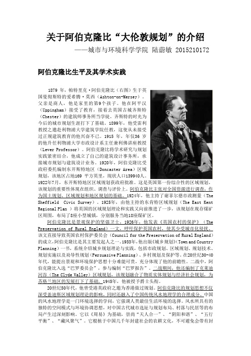
关于阿伯克隆比“大伦敦规划”的介绍——城市与环境科学学院陆蔚敏 2015210172阿伯克隆比生平及其学术实践1879 年,帕特里克·阿伯克隆比(右图)生于英国曼彻斯特的爱希腾·莫西(Ashton-on-Mersey)。
父亲是商人,他是家里的第9个孩子。
他在阿平汉(Uppingham)接受了教育,接着去英国古城齐斯特(Chester)的建筑师事务所当学徒。
齐斯特的时光为今后的城市规划生涯打下了基础。
1899年,他受雷利教授之邀赴利物浦大学建筑学院任教,这使从未接受过正规建筑教育的他兴奋不已。
1915 年,年仅36 岁的他升任利物浦大学市政设计系主任兼利佛讲座教授(Lever Professor)。
阿伯克隆比将学术研究与规划实践紧密结合,他成立了自己的建筑设计事务所,承接城市规划与建筑设计业务。
1920年,阿伯克隆比受政府委托编制东开斯特地区(Doncaster Area)区域规划,该地区占地169 平方英里,现状人口139940人。
1922年7月,东开斯特地区区域规划获政府批准。
这是英国第一份综合性的区域规划,该规划的重要性体现在组织、调查与评价上。
阿伯克隆比主张对全国资源进行调查,作为国土规划、区域规划和地区规划的基础。
1924年,他主持了谢菲尔德市政测量(The Sheffield Civic Survey)。
1925年,由他主持的东肯特区域规划(The East Kent RegionalPlan )将英国的区域规划理论和实践又向前推进了一步,该规划在现存煤矿区周围,布局了8座小型城镇,分别服务当地18座煤矿区。
阿伯克隆比是景观保护的坚强卫士,1926年,他发表《英国农村的保护》(The Preservation of Rural England)一文,呼吁保护英国农村,使其少受城市化侵扰。
该文直接导致英国农村保护委员会(Council for the Preservation ofRural England)的成立,阿伯克隆比是其主要发起人之一。
大伦敦城市规划解析
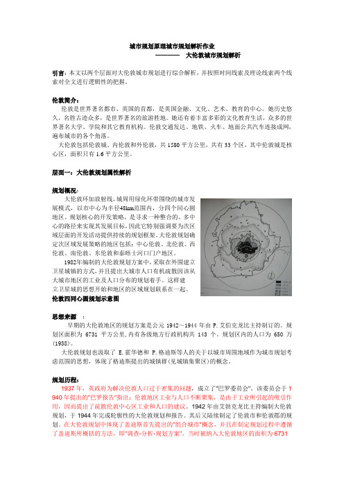
城市规划原理城市规划解析作业————大伦敦城市规划解析引言:本文以两个层面对大伦敦城市规划进行综合解析,并按照时间线索及理论线索两个线索对全文进行逻辑性的把握。
伦敦简介:伦敦是世界著名都市、英国的首都,是英国金融、文化、艺术、教育的中心。
她历史悠久,名胜古迹众多,是世界著名的旅游胜地。
她还有着丰富多彩的文化教育生活,众多的世界著名大学、学院和其它教育机构。
伦敦交通发达、地铁、火车、地面公共汽车连接成网,遍布城市的各个角落。
大伦敦包括伦敦城、内伦敦和外伦敦,共1580平方公里,共有33个区,其中伦敦城是核心区,面积只有1.6平方公里。
层面一:大伦敦规划属性解析规划概况:大伦敦环加放射线,城周用绿化环带围绕的城市发展模式,以市中心为半径48km范围内,分四个同心圆地区。
规划核心的开发策略,是寻求一种整合的、多中心的路径来实现其发展目标,因此它特别强调要为次区域层面的开发活动提供持续的规划框架。
大伦敦规划确定次区域发展策略的地区包括:中心伦敦、北伦敦、西伦敦、南伦敦、东伦敦和泰晤士河口门户地区。
1982年编制的大伦敦规划方案中,采取在外围建立卫星城镇的方式,并且提出大城市人口有机疏散因该从大城市地区的工业及人口分布的规划着手。
这样建立卫星城的思想开始和地区的区域规划联系在一起。
伦敦四同心圆规划示意图思想来源:早期的大伦敦地区的规划方案是公元1942~1944年由P.艾伯克龙比主持制订的。
规划区面积为6731平方公里,内有各级地方行政机构共143个。
规划区内的人口为650万(1938)。
大伦敦规划也汲取了E.霍华德和P.格迪斯等人的关于以城市周围地域作为城市规划考虑范围的思想,体现了格迪斯提出的城镇群(见城镇集聚区)的概念。
规划历程:1937年,英政府为解决伦敦人口过于密集的问题,成立了"巴罗委员会"。
该委员会于1 940年提出的"巴罗报告"指出:伦敦地区工业与人口不断聚集,是由于工业所引起的吸引作用,因而提出了疏散伦敦中心区工业和人口的建议。
- 1、下载文档前请自行甄别文档内容的完整性,平台不提供额外的编辑、内容补充、找答案等附加服务。
- 2、"仅部分预览"的文档,不可在线预览部分如存在完整性等问题,可反馈申请退款(可完整预览的文档不适用该条件!)。
- 3、如文档侵犯您的权益,请联系客服反馈,我们会尽快为您处理(人工客服工作时间:9:00-18:30)。
大伦敦规划的背景
• Green-Belt
-Surrounding the conurbation. -Is a zone ranging from five to ten miles wide. -A de facto wall of nature would halt suburban sprawl, protect agriculture, and provide a natural amenity to the area.
• 综合型的文本,将地理要素、现有建设和其他发展策略相结合,包括:交
通、经济发展、住房、文化、青少年发展、公共医疗和食品安全; • 大伦敦地区土地利用的发展框架,并与大型基础设施建设相结合;
• 大伦敦战略性的指导方针,引导其32个自治市的规划编制;
• 伦敦实现可持续发展,稳健型经济和凝聚型社会的主要组成部分。
•相对于英国其他地区,贫困人口的比例较高,社会两极分化明显; •气候变化所带来的问题:城市热岛、城市洪水灾害、水资源短缺;
空间发展策略 伦敦规划2009 The London Plan 2009
愿景: 至2031年,伦敦将成为:国际大都市的典范,为其人民和企业拓展更为广阔的发展机 会,实现环境和生活质量的最高标准,领导世界应对21世纪城市发展、尤其是气候变 化所带来的挑战。 规划目标: •满足经济和人口增长的需求 •一座具有国际竞争力的成功城市 •一座拥有多样性、凝聚力、安全、便利的居住社区的城市 •一座拥有愉悦体验和独特场所感的城市 •在改善环境方面的国际领导者 •一座便利、安全和舒适的城市,每个市民都能享受就业,发展机遇和服务设施
空间发展策略
伦敦规划2009 The London Plan 2009
规划目标: •提供足够的基础设施以满足未来发展的需求:能源、水、交通、教育机构、文体设施、 医疗设施,生态设施; •确保2012伦敦奥运会的成功举办; •重点关注生活质量的提升: 满足住房需求,创造高品质的居住社区 充足的医疗资源 保护和改善区域空气质量 一个充满活力、满足多样需求的公共服务体系; 安全和健康的食品 足够和便利的交通设施,支持自行车与步行的出行方式; 确保绿地、水系和开发空间所带来的公共利益; 多样化和可达性强的社区公共服务设施; 减少犯罪,确保城市和社区的安全; 保护历史街区和文物建筑,塑造城市和社会的特性与场所感;
大伦敦规划的背景
规划概念:三大概念
• 卫星城
• 大绿带
• 环形路
大伦敦规划的背景
• Satellite Town
-Smaller metropolitan areas surrounding city center of London. -To solve problem of rapidly growth population in city center.
空间发展策略
伦敦规划2009 The London Plan 2009
空间发展策略: • 总体要求:不是简单地支持和迎合增长,而是要对保证生活质量有积极的贡献 • 确保在现有的范围内,不侵占和破坏大绿带(大伦敦的公共空间),不产生对环境 不良的影响。 • 对伦敦有限的土地资源集约化利用 • 在策略层面,明确具有潜在发展可能的地区 • 重点关注东伦敦大面积未开发地区 • 考虑大尺度发展策略与小尺度发展可能性的结合
大伦敦规划的背景
• Ring-Ways
-3 classifications of road: •Arterial Roads(主干
路)
•Sub-Arterial Roads
(次干路)
•Local Roads
-Ring road system
-The B. Ring Road was the main ring road around central London.
空间发展策略
空间结构
Outer London -It is where 60 per cent of Londoners live and over 40 per cent of London’s jobs are located. -Lower development densities and the implications of this for the viability of public transport services Inner London -Total population is 60 per cent of outer London, 261,000 jobs located and projected increase to 2031 (398,000), even greater than that expected for the Central Activities Zone. -Inner London has a very varied ethnic composition(民族构成), high housing densities including many high rise estates, relatively constrained access to open space, often outdated social infrastructure and low public sector educational attainment.
大伦敦规划
大伦敦 GREATER LONDON
-概况
-大伦敦规划的背景
-空间发展策略 • • • • • 区域划分 功能分区 公共服务体系 产业用地分布 绿地与开放空间 • • • • • 体育与休闲设施 综合交通系统 道路系统 步行体系 水系
概况
• 区位:位于英国英格兰东 南部, 范围包含了伦敦市与 32个伦敦自治市(卫星城所 组成的都会区)。 • 面积: 1,572平方公里 • 人口: 7,825,200人(2009)
空间发展策略
伦敦规划2009 The London Plan 2009
面临新的挑战:
•人口总量持续增长,人口结构不断变化:在校学生和老年人口比例将上升; •黑人、亚裔和其他少数族裔的人口总数将大幅提升; •人口增加带来的住房需求的增大; •住房需求多样化:非亲缘关系的合居、单身家庭等;
•不断增长与变化的经济活动,产业结构的变化:制造业比例下降,服务业提升;
大伦敦规划的背景
1920 'Satellite Towns round London'
Charles Benjamin Purdom
1943 'The County of London Plan'
Patrick Abercrombie
1944 'Grater London Plan'
Patrick Abercrombie
大伦敦规划的背景
规划目标:
• 控制伦敦在空间与人口上的快速扩张
• 降低伦敦中心城区的居住密度 • 将分流的人口安置在远郊和新规划的市镇 • 鼓励将英国东南区域的经济发展和就业增长导向其他欠发达地区
Four goals of Greater London Plan created:
1. 2. 3.
4.
大伦敦规划的背景
大伦敦规划 1944
面临的挑战: • 二战时期,伦敦城市特别 是中心区遭到破坏 • 战后人口的大量增长 • 由军工生产带来的工业快 速发展 规划目的: • 人口和工业在空间上的理 性分布 • 提升道路交通条件 • 对土地的合理利用
LANDUSE PLAN OF GREATER LONDON 1944
Road Plan of Greater London 1944
-Provide direct access to/from satellite towns.
空间发展策略
伦敦规划2009 The London Plan 2009
概述:
பைடு நூலகம்
• 大伦敦地区的空间发展策略;
• 大伦敦的总体发展策略,包括未来20-25年大伦敦地区经济、环境、交通 和社会发展的一体化框架;
空间发展策略
行政区划
-develop the most effective cross boundary working arrangements and groupings to address specific issues.
空间结构
-3 Zone: •Central Activities Zone •Inner London •Outer London
空间发展策略
功能分区
The Central Activities Zone -One third of all London jobs are based here and it is also home for 275,000 Londoners. -As an economic hub, business travel is a key element of the visitor economy in the CAZ and London’s competitiveness was significantly enhanced by a convention centre of international standard.
大伦敦规划的背景
空间结构:”四环”The Four Rings • 内环 The Inner Ring 建成区,75-100人/英亩 • 二环 The second Ring 伦敦郊区,50 /英亩 • 绿带环 The Green Belt Ring 村落/开放空间/公园/农场,限制村 落扩张,不发展市镇中心 • 外环 Outer Country Ring 开放式村落/农田,允许村落的扩张 和新市镇的形成,为伦敦内城人口 和工业的外迁提供空间
案例分析:大伦敦
