华泰财产保险股份有限公司International Navigating Conditions
华泰财产保险有限公司简介
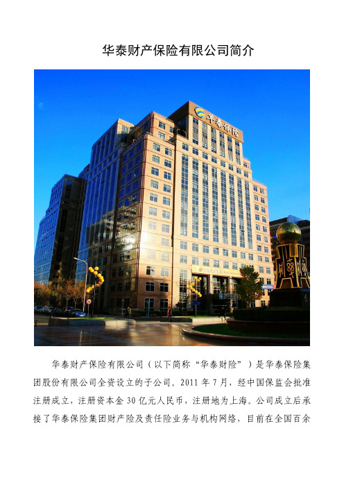
华泰财产保险有限公司简介
华泰财产保险有限公司(以下简称“华泰财险”)是华泰保险集团股份有限公司全资设立的子公司。
2011年7月,经中国保监会批准注册成立,注册资本金30亿元人民币,注册地为上海。
公司成立后承接了华泰保险集团财产险及责任险业务与机构网络,目前在全国百余
座城市设有180多家分支机构,经营范围涵盖财产损失险、责任险、水险、意外伤害险、健康险、能源险、艺术品险、取消险等保险业务。
长期以来,华泰财险坚持走“集约化管理、专业化经营、差异化竞争、质量效益型发展”道路,持续加强产品与渠道创新,优化运营环节,提升客户体验,历经18年的发展和探索,已成为业界一家拥有一流承保能力及承保经验、领先产品研发与渠道创新能力、全面风险管控能力、高效理赔服务体系与服务水平、业绩连年实现稳健成长、品牌形象与社会声誉良好的保险公司。
着眼未来,华泰财险将继续以集团为依托,“推转型、稳效益、促发展”,追求“专注、专业、效能”,培育差异化竞争优势,全面深化改革寻求突破,推动公司脱颖而出;确立细分市场领导者地位,努力实现“专业化、国际化、高品质”金融保险服务企业的战略目标。
华泰财产保险股份有限公司协会解约通知、保险自动终止及战争、核风险除外条款
华泰财产保险有限公司协会解约通知、保险自动终止及战争、核风险除外条款本条款为首要条款,本保险中任何与本条款不一致的约定,应以本条款为准。
1.解约被保险人或被保险人可提前7日通知解除承保战争等风险的保险(保险人发出或收到解除通知之日零时起7日后解除生效)。
但保险人同意当保险人与被保险人在解除通知到期之日前就新的保险费率与条款保证达成协议的,保险重新生效。
2.保险自动解除无论是否发出解约通知,当面临战争等风险时,本保险自动解除。
2.1当下列国家间爆发战争时(无论宣战与否):英国、美国、法国、俄罗斯、中国2.2本保险项下的任何船舶为所有权或使用权而被征用。
3.五大国战争与核风险除外责任本保险不承保下列风险:3.1下列事项导致的损失、损害、责任或费用:3.1.1战争爆发,无论是否宣战或在下列国家间爆发:英国、美国、法国、俄罗斯、中国3.1.2 无论为所有权或使用权的征用3.2 直接或间接由下列事项导致的损失、损害、责任或费用:3.2.1任何核燃料、核废料或核燃料燃烧所生的电离辐射或辐射污染3.2.2任何核设施、反应器或其他核子装置或其核组件的辐射、毒素、爆炸或其他危害或污染物质3.2.3任何使用原子或/和裂变、聚变或其他类似反应或辐射力或辐射物质之武器或设备。
INSTITUTE NOTICE OF CANCELLATION,AUTOMATIC TERMINATION OF COVER AND WAR AND NUCLEAR EXCLUSIONS CLAUSE –HULLSThis clause shall be paramount and shall override anything contained in this insurance inconsistent therewith1 CancellationCover hereunder in respect of the risks of war, etc. may be cancelled by either the Underwriters or the Assured giving 7 days notice (such cancellation becoming effective on the expiry of 7 days from midnight of the day on which notice of cancellation is issued by or to the Underwriters). The Underwriters agree however to reinstate cover subject to agreement between the Underwriters and the Assured prior to the expiry of such notice of cancellation as to new rate of premium and/or conditions and/warranties.2 Automatic Termination of CoverWhether or not such notice of cancellation has been given cover hereunder in respect of the risks of war, etc, shall TERMINA TE AUTOMA TICALL Y2.1 upon the outbreak of war (whether there be a declaration of war or not) between any of the following:United Kingdom, United States of America, France, the Russian Federation, the People’s Republic of China;2.2 in respect of any vessel, in connection with which cover is granted hereunder, in the event of such vessel being requisitioned either for title or use.3 Five Powers War and Nuclear ExclusionsThis insurance excludes3.1 loss damage liability or expense arising from3.1.1 the outbreak of war, whether there be a declaration of war or not between any of the following:United Kingdom, United States of America, France, the Russian Federation, the People’s Republic of China;3.1.2 requisition either for title or use3.2 loss damage liability or expense directly or indirectly caused by or arising from3.2.1 ionising radiations from or contamination by radioactivity from any nuclear fuel or from any nuclear waste or from the combustion of nuclear fuel3.2.2 the radioactive, toxic, explosive or other hazardous or contaminating properties of any nuclear installation, reactor or other nuclear assembly or nuclear component thereof3.2.3 any weapon of war employing atomic or nuclear fission and/or fusion or other like reaction or radioactive force or matter.。
华泰财产保险有限公司安徽省分公司介绍企业发展分析报告

Enterprise Development专业品质权威Analysis Report企业发展分析报告华泰财产保险有限公司安徽省分公司免责声明:本报告通过对该企业公开数据进行分析生成,并不完全代表我方对该企业的意见,如有错误请及时联系;本报告出于对企业发展研究目的产生,仅供参考,在任何情况下,使用本报告所引起的一切后果,我方不承担任何责任:本报告不得用于一切商业用途,如需引用或合作,请与我方联系:华泰财产保险有限公司安徽省分公司1企业发展分析结果1.1 企业发展指数得分企业发展指数得分华泰财产保险有限公司安徽省分公司综合得分说明:企业发展指数根据企业规模、企业创新、企业风险、企业活力四个维度对企业发展情况进行评价。
该企业的综合评价得分需要您得到该公司授权后,我们将协助您分析给出。
1.2 企业画像类别内容行业保险业-其他保险活动资质一般纳税人产品服务空1.3 发展历程2工商2.1工商信息2.2工商变更2.3股东结构2.4主要人员2.5分支机构2.6对外投资2.7企业年报2.8股权出质2.9动产抵押2.10司法协助2.11清算2.12注销3投融资3.1融资历史3.2投资事件3.3核心团队3.4企业业务4企业信用4.1企业信用4.2行政许可-工商局4.3行政处罚-信用中国4.5税务评级4.6税务处罚4.7经营异常4.8经营异常-工商局4.9采购不良行为4.10产品抽查4.12欠税公告4.13环保处罚4.14被执行人5司法文书5.1法律诉讼(当事人)5.2法律诉讼(相关人)5.3开庭公告5.4被执行人5.5法院公告5.6破产暂无破产数据6企业资质6.1资质许可6.2人员资质6.3产品许可6.4特殊许可7知识产权7.1商标7.2专利7.3软件著作权7.4作品著作权7.5网站备案7.6应用APP7.7微信公众号8招标中标8.1政府招标8.2政府中标8.3央企招标8.4央企中标9标准9.1国家标准9.2行业标准9.3团体标准9.4地方标准10成果奖励10.1国家奖励10.2省部奖励10.3社会奖励10.4科技成果11 土地11.1大块土地出让11.2出让公告11.3土地抵押11.4地块公示11.5大企业购地11.6土地出租11.7土地结果11.8土地转让12基金12.1国家自然基金12.2国家自然基金成果12.3国家社科基金13招聘13.1招聘信息感谢阅读:感谢您耐心地阅读这份企业调查分析报告。
(金融保险)华泰财产保险股份有限公司概况

华泰财产保险股份有限公司二〇〇三年概况一、公司概况华泰财产保险股份有限公司是中国第一家全国性股份制财产保险公司,1996年8月29日在北京开业,注册资本金13.33亿元人民币。
公司60余家发起股东多为实力强、规模大、效益好的大型企业和企业集团,覆盖了石油、电力、冶金、电子、化工、航空、建筑、轻工、船舶等24个行业,股东总资产超过1万亿人民币。
华泰保险公司财务基础雄厚,偿付能力充足,专业技术和风险防范意识领先,为国内外数十万客户提供了值得信赖的保险服务。
华泰是国内首家外资参股的财产保险公司,美国ACE保险集团作为公司重要股东和战略合作伙伴,为公司提供了多方面的支持和协助,使华泰的管理技术和经营水准向国际化标准靠拢。
华泰保险公司在全国26个城市设有分支机构,形成了面向全国的经营布局。
二、发展战略公司根据“专业化经营,质量效益型发展”的战略方针,努力调整险种结构,改善业务质量,拓展目标市场,培育目标客户。
面对日益激烈的市场竞争环境,坚持科学的发展观,依靠创新把公司做大做强。
公司通过外资参股,进一步优化了股权结构,引进了先进的管理理念和技术、资金、人才等战略资源,在承保选择、风险管控、量化管理以及快速实施等方面,开始形成新的竞争优势,并且将在产品、销售渠道、服务和管理等方面加强创新,进一步提高公司管理水平和竞争能力。
按照专业化分工、个人负责制和扁平化管理的原则,华泰逐步建立并完善了新的保险业务管理架构。
公司加强了对分支机构的管控力度,在核保、理赔、财务、人事、信息技术等方面实行垂直化管理。
在一些增长潜力大的业务领域,公司还将通过建立事业部的方式,整合业务资源,协调步伐,加快发展速度。
在巩固和发展现有财产保险和投资业务的基础上,公司积极筹备成立寿险公司和保险资产管理公司,朝着建立金融保险集团的方向发展。
三、经营业绩华泰保险公司自成立以来,保险业务稳健经营,健康发展;投资业务经营业绩突出,在业内居领先地位;公司保持着稳定的盈利和分红水平,为股东提供满意的投资回报。
华泰财产保险有限公司_企业报告(业主版)

企业基本信息
单位名称: 营业范围:
华泰财产保险有限公司 许可项目:保险业务。(依法须经批准的项目,经相关部门批准后方可开展经营活动,具体 经营项目以相关部门批准文件或许可证件为准)
一、采购需求
1.1 总体指标
近 1 年(2022-09~2023-08):
项目数(个)
30
同比增长:1400.0%
项目总金额(万元)
中标金额(万元) 公告时间
5
中国证券监督管理委员会北京监管 局汽车保险项目
DD22122910229820_ioQodc.pdf
6
中国证券监督管理委员会北京监管 局汽车保险项目
DD22122910189820_StBAyD.pdf
7
中国证券监督管理委员会北京监管 局汽车保险项目
DD22122910239820_ddFSUX.pdf
4 中国证券监督管理委员会北京监管 局汽车保险项目
中标单位
本报告于 2023 年 08 月 21 日 生成
6/21
中标金额(万元) 公告时间
\
2022-12-29
\
2022-12-29
\
2022-12-29
\
2022-12-29
序 号
项目名称
DD22122910179820_wxoXas.pdf
中标单位
本报告于 2023 年 08 月 21 日 生成
2/21
1.4 行业分布
近 1 年华泰财产保险有限公司的招标采购项目较为主要分布于保险服务行业,项目数量分别达到 30 个。其中保险服务项目金额较高,分别达到 0.00 万元。 近 1 年(2022-09~2023-08):
1.4.1 重点项目
华泰保险简介

华泰保险简介中国第一家全国性股份制财产保险公司成立于1996年8月29日,总部设于北京,公司注册资本金13.83亿元人民币拥有50多家股东,遍布24个行业,均为实力强、规模大的大型企业和集团偿付能力充足率始终保持在监管部门规定的5倍以上到2009年,公司在全国近60个城市设有分支机构,形成面向全国的经营布局第一家外资参股的中国保险公司华泰为ACE(美国安达保险集团)全球客户的在华机构服务华泰可使用ACE(美国安达保险集团)全球140多个国家的服务网络和各类资源一、公司简介华泰财产保险股份有限公司是中国第一家全国性股份制财产保险公司,1996年8月29日在北京正式开业,公司注册资本金13.83亿元人民币。
公司开展财产损失、责任、意外伤害、健康四大类保险业务,涵盖国计民生诸多领域。
至2009年,公司在全国近60个城市设有分支机构,形成面向全国的经营布局。
二、股东华泰保险有50多家股东,多为实力强、规模大、效益好的大型企业和企业集团,覆盖金融、石油、电力、冶金、煤炭、化工、航空、造船、航运、机械等30个行业。
2002年5月,世界著名保险集团─—美国ACE集团参股并成为华泰最大股东,为华泰带来了先进的经营理念和全球性业务支持网络。
三、集团架构2005年,以华泰财产保险股份有限公司为投资主体的华泰资产管理公司和华泰人寿保险公司开业,标志着华泰在向集团化发展的道路上迈出了坚实的步伐。
经过几年来的发展,华泰资产管理公司和华泰人寿都已成为业内具有较强竞争力的优秀企业。
华泰保险(财产险&意外险)华泰人寿华泰资产管理四、ACE—华泰保险战略合作伙伴●成立于1985年,可追溯至1792年●总部在百慕大●拥有16000多名员工●总资产超过730亿美金●标准普尔和A.M. Best均给予A+评级●全球理赔服务网络五、经营业绩华泰保险自1996年成立以来,公司累计实现原保险保费收入146.17亿元,年均保费增长率达27.23%;累计实现投资收益39.98亿元,年均收益率达12.41%;累计实现净利润34.72亿元。
中国保监会北京监管局关于华泰财产保险股份有限公司保险兼业代理资格的批复

中国保监会北京监管局关于华泰财产保险股份有限公
司保险兼业代理资格的批复
文章属性
•【制定机关】中国保险监督管理委员会北京监管局
•【公布日期】2011.03.15
•【字号】京保监许可[2011]118号
•【施行日期】2011.03.15
•【效力等级】地方规范性文件
•【时效性】现行有效
•【主题分类】保险
正文
中国保监会北京监管局关于华泰财产保险股份有限公司保险
兼业代理资格的批复
(京保监许可[2011]118号)
华泰财产保险股份有限公司:
你公司《关于申领〈保险兼业代理业务许可证〉的请示》(华保字[2011]18号)收悉。
经审核,现批复如下:
核准“华泰财产保险股份有限公司”的保险兼业代理资格(详见附件)。
你公司收到本批复后,应及时到我局领取《保险兼业代理业务许可证》,并到工商行政管理部门办理营业范围变更登记手续后,方可从事保险代理业务。
附件:新增兼业代理资格申报核准机构清单
二〇一一年三月十五日附件:
新增兼业代理资格申报核准机构清单
申报机构:华泰财产保险股份有限公司。
华泰财产保险股份有限公司船舶污染清除单位职业责任保险条款
2007 版本
7
(3) 提供已收到的书面赔偿要求、法院传票及其它法律文书的复印 件;及
(4) 其他与确认赔偿请求的性质、原因、损失程度等有关的证明和 资料。
2. 被保险人如在保险期间内获悉任何可赔情形,应在可行的情况下立 即以书面形式通知保险人,其后与该可赔情形相关的赔偿请求应被 视为被保险人在保险期间内首次遭受的赔偿请求。所有可赔情形通 知必须包括: (1) 对可赔情形的具体描述,包括发生何种不当行为、发生不当行 为的日期及首次知悉可赔情形的日期; (2) 所有当事人的详细资料;及 (3) 被保险人认为可能遭受赔偿请求的理由。
第二十二条 索赔通知
1. 对于被保险人在保险期间内遭受的赔偿请求,投保人或被保险 人应在可行的情况下立即以书面形式通知保险人,如果本保险合同 已届满,则不得迟于届满后的 30 天内以书面形式通知保险人。所 有索赔通知必须包括:
(1) 对赔偿请求的具体描述,包括发生何种不当行为、发生不当行 为的日期及首次知悉赔偿请求的日期;
2007 版本
4
第十一条
非被保险人的职务行为 任何与以下有关的赔偿请求: 提供的专业服务不是代表被保险机构的职务行为。
第十二条
保赔保险、船舶保险、租船人责任保险、船壳损失保险
任何由下列原因引起的赔偿请求:
1. 无论是否实际投保,被保险人所有的、租赁的、抵押的、光船承租 的船舶的保赔保险、船舶保险的承保风险;
第二十一条 保证 被保险人应当具有海事管理机构批准的资质,并保持相应的应急清污 能力。
五、理赔处理
_________________________________________________________________________________________________________________________________________________
华泰人寿保险股份有限公司北京分公司介绍企业发展分析报告_72933
Enterprise Development专业品质权威Analysis Report企业发展分析报告华泰人寿保险股份有限公司北京分公司免责声明:本报告通过对该企业公开数据进行分析生成,并不完全代表我方对该企业的意见,如有错误请及时联系;本报告出于对企业发展研究目的产生,仅供参考,在任何情况下,使用本报告所引起的一切后果,我方不承担任何责任:本报告不得用于一切商业用途,如需引用或合作,请与我方联系:华泰人寿保险股份有限公司北京分公司1企业发展分析结果1.1 企业发展指数得分企业发展指数得分华泰人寿保险股份有限公司北京分公司综合得分说明:企业发展指数根据企业规模、企业创新、企业风险、企业活力四个维度对企业发展情况进行评价。
该企业的综合评价得分需要您得到该公司授权后,我们将协助您分析给出。
1.2 企业画像类别内容行业保险业人身保险资质一般纳税人产品服务健康保险、意外伤害保险等各类人身保险业务1.3 发展历程2工商2.1工商信息2.2工商变更2.3股东结构2.4主要人员2.5分支机构2.6对外投资2.7企业年报2.8股权出质2.9动产抵押2.10司法协助2.11清算2.12注销3投融资3.1融资历史3.2投资事件3.3核心团队3.4企业业务4企业信用4.1企业信用4.2行政许可-工商局4.3行政处罚-信用中国4.4行政处罚-工商局4.5税务评级4.6税务处罚4.7经营异常4.8经营异常-工商局4.9采购不良行为4.10产品抽查4.11产品抽查-工商局4.12欠税公告4.13环保处罚4.14被执行人5司法文书5.1法律诉讼(当事人)5.2法律诉讼(相关人)5.3开庭公告5.4被执行人5.5法院公告5.6破产暂无破产数据6企业资质6.1资质许可6.2人员资质6.3产品许可6.4特殊许可7知识产权7.1商标7.2专利7.3软件著作权7.4作品著作权7.5网站备案7.6应用APP7.7微信公众号8招标中标8.1政府招标8.2政府中标8.3央企招标8.4央企中标9标准9.1国家标准9.2行业标准9.3团体标准9.4地方标准10成果奖励10.1国家奖励10.2省部奖励10.3社会奖励10.4科技成果11土地11.1大块土地出让11.2出让公告11.3土地抵押11.4地块公示11.5大企业购地11.6土地出租11.7土地结果11.8土地转让12基金12.1国家自然基金12.2国家自然基金成果12.3国家社科基金13招聘13.1招聘信息感谢阅读:感谢您耐心地阅读这份企业调查分析报告。
华泰财产保险股份有限公司 境外旅行人身意外伤害保险条款
保险金额和保险费
第九条 保险金额是保险人承担给付保险金责任的最高限额。保险金额由投保人、保险人双方约定,并在保险单中载明。投保人应 该按照合同约定向保险人交纳保险费。保险人和投保人可以在本保险合同项下约定免赔额等限制条件,并于保险合同中载明。
保险费依据保险金额与保险费率计收,并于保险合同上载明。除合同另有约定外,投保人应于约定的缴费日期一次性缴清保险费。 投保人若未按约定足额交纳保险费,保险人对其实际足额支付之日前发生的保险事故,不承担相应的保险责任。
2、 翻译推荐服务 提供旅行目的地翻译服务的地址、电话、及开放时间等信息。 3、 行李遗失协寻 协助在境外旅行期间遗失行李的被保险人,联络相关负责单位帮助寻找。 4、 护照遗失协寻 协助在境外旅行期间遗失护照的被保险人,联络相关负责单位帮助寻找或补办。 5、 使领馆信息 提供距被保险人最近的适宜的大使馆或领事馆的地址、电话及开放时间等信息。 6、 紧急讯息传递服务 被保险人在境外旅行期间住院且提出要求时,协助被保险人将其紧急口讯转告家人、朋友或任职单位。
- 1、下载文档前请自行甄别文档内容的完整性,平台不提供额外的编辑、内容补充、找答案等附加服务。
- 2、"仅部分预览"的文档,不可在线预览部分如存在完整性等问题,可反馈申请退款(可完整预览的文档不适用该条件!)。
- 3、如文档侵犯您的权益,请联系客服反馈,我们会尽快为您处理(人工客服工作时间:9:00-18:30)。
华泰财产保险有限公司国际航行条款1、航行限制除非保险人按下列第三条内容另行同意,否则船舶不可在任何时候(或在以下特别注明的日期内)驶入、航行于或停留在下述区域内:区域一:北极圈北纬70度以北巴仑支海区域二:北方海域若船舶不驶入、航行于或停留在北纬72度30分以北/东经35度以东,可以挂靠科拉湾摩尔曼斯克或挪威的任何港口或地点:白海楚可其海(西伯利亚东北部)区域三:波罗的海12月10日至5月25日之间,波的尼亚湾(芬兰和瑞典之间)北纬63度50分的Umea和北纬63度06分的Vasa一线以北;小于等于90000载重吨的船舶,12月15日至5月15日之间,芬兰湾东经28度45分以东;大于90000载重吨的船舶,任何时间均不得驶入、航运于或停留在芬兰湾东经28度45分以东;1月8日至5月5日之间,波的尼亚湾、芬兰湾及临近水域北纬59度24分以北,挂靠斯德哥尔莫(瑞典首都)、塔林(爱沙尼亚首都)或赫尔辛基(芬兰首都)除外;12月28日至5月5日里加湾及临近水域东经22度以东,北纬59度以南。
区域四:格陵兰岛格陵兰岛领海区域五:北美(东部)西经50度至100度之间,北纬52度10分以北;12月21日至4月30日之间,圣劳伦斯湾、圣劳伦斯河及其支流(Les Escoumins 以东),贝尔岛海峡(贝尔岛以西),卡伯特海峡(雷角及诺斯角一线以西)及Canso 海峡(Canso堤道以北);12月1日至4月30日之间,圣劳伦斯河及其支流(Les Escoumins以西);圣劳伦斯水道;大湖区。
区域六:北美(西部)西经100度至170度之间,北纬54度30分以北;夏洛特皇后群岛或阿留申群岛的任何港口或地区。
区域七:南部海域南纬50度以南,以下三点用罗盘确定的三角区域除外:南纬50度西经50度;南纬57度西经67度30分;南纬50度西经160度。
区域八:凯尔盖朗/克罗泽(印度洋南端)凯尔盖朗群岛、克罗泽群岛领海区域九:东亚a、11月1日至6月1日,鄂霍次克海北纬55度以北,东经140度以东;b、11月1日至6月1日,鄂霍次克海北纬53度以北,东经140度以东;c、12月1日至5月1日,东亚水域北纬46度以北,千岛群岛以西,堪察加半岛以西。
区域十:白令海白令海,如按如下方式穿越除外:a、船舶不得驶入、航行于或停留在北纬54度30分以北,且b、船舶从布尔得岛西侧进入和驶离,或穿越安奇卡岛、阿木塔或乌妮玛峡口,且c、船舶适当地装备有两套独立海上雷达,全球定位系统(或劳兰C),无线电发射装置和GMDSS,气象传真记录仪(或接收气象和航路的转换装置)和罗盘,所有装置都是完全可操作的,并且由合格的人员操纵,且d、船舶需配备有最新矫正的海图航行指南和引水手册。
2、违反航行限制船舶如违反上述第1条(航行限制)的规定, 除非在得知上述违反保证事宜之后立即通知保险人并加收相应保费,否则保险人可不承担因在违反保证期间发生的事故或事件引起或导致的任何损失、损坏、责任或费用。
3、航行限制中的特别允许区域如果保险人始终事先同意且其承保条款的修改与加收保费的要求获得被保险人的同意,船舶可以违反上述第1条并不适用第2条。
INTERNATIONAL NA VIGATINGCONDITIONS (01/11/03)1. NA VIGATING LIMITSUnless and to the extent otherwise agreed by the Underwriters in accordance with Clause 3 below, the vessel shall not enter, navigate or remain in the areas specified below at any time or, where applicable, between the dates specified below (both days inclusive):Area 1 – Arctic(a) North of 70ºN. Lat(b) Barents Seaexcept for calls at Kola Bay, Murmansk or any port or place in Norway, provided that the vessel does not enter, navigate or remain north of 72º30¹N. Lat. or east of 35ºE. Long.Area 2 – Northern Seas(a) White Sea(b) Chukchi SeaArea 3 – Baltic(a) Gulf of Bothnia, north of a line between Umea (63º50¹t.) and Vasa (63º06¹t.)between 10th December and 25th May.(b) Where the vessel is equal to or less than 90,000 DWT, Gulf of Finland east of28º45¹E.Long between 15th December and 15th May.(c) Vessels greater than 90,000 DWT may not enter, navigate or remain in the Gulf ofFinland east of 28º45¹E. Long at any time.(d) Gulf of Bothnia, Gulf of Finland and adjacent waters north of 59º24¹t between 8thJanuary and 5th May, except for calls at Stockholm, Tallinn or Helsinki.(e) Gulf of Riga and adjacent waters east of 22ºE. Long and south of 59ºN. Lat between28th December and 5th May.Area 4 – GreenlandGreenland territorial watersArea 5 – North America (east)(a) North of 52º10¹t and between 50ºW. Long and 100º W. Long.(b) Gulf of St. Lawrence, St Lawrence River and its tributaries (east of Les Escoumins),Strait of Belle Isle (west of Belle Isle), Cabot Strait (west of a line between Cape Ray and Cape North) and Strait of Canso (north of the Canso Causeway), between 21st December and 30th April.(c) St. Lawrence River and its tributaries (west of Les Escoumins) between 1st Decemberand 30th April.(d) St. Lawrence Seaway(e) Great lakesArea 6 – North America (west)(a) North of 54º30¹N. Lat. and between 100ºW. Long and 170ºW. Long.(b) Any port or place in the Queen Charlotte Islands or the Aleutian Islands.Area 7 – Southern OceanSouth of 50ºS. Lat except within the triangular area formed by rhumb lines drawn between the following points(a) 50ºS. Lat; 50ºW. Long(b) 57º S. Lat: 67º30’W. Long(c) 50ºS. Lat; 160º W. LongArea 8 – Kerguelen/ CrozetTerritorial Waters of Kerguelen Islands and Crozet Islands.Area 9 – East Asia(a) Sea of Okhotsk north of 55ºN. Lat and east of 140ºE. Long between 1st November and1st June.(b) Sea of Okhotsk north of 53ºN. Lat and west of 140ºE. Long between 1st November and1st June.(c) East Asian waters north of 46ºN. Lat and west of the Kurile Islands and west of theKamohatka Poninsula between 1st December and 1st May.Area 10 – Bering SeaBering Sea except on through voyages and provided that(a) the vessel does not enter, navigate or remain north of 54º30¹N. Lat, and(b) the vessel enters and exits west of Buldir Island or through the Amchitka, Amukta orUnimak Passes, and(c) the vessel is equipped and property fitted with two independent marine radar sets, aglobal positioning system receiver (or Loran-C radio positioning receiver), a radiotransceiver and GMDSS, a weather facsimile recorder (or alternative equipment for thereceipt of weather and routing information) and a gyrocompass, in each case to be fullyoperational and manned by qualified personal; and(d) the vessel is in possession of appropriate navigational charts corrected up to date,sailing directions and pilot books.2. BREACH OF NA VIGATING LIMITSIn the event the vessel is in breach of Clause 1 above, the Underwriters shall not be liable for any loss, damage, liability or expense arising out of or resulting from an accident or occurrence during the period of breach, unless notice is given to the Underwriters immediately after receipt or advices of such breach and any amended terms of cover and any additional premium required by them are agreed.3. PERMISSION FOR AREAS SPECIFIED IN NA VIGATING LIMITSThe vessel may breach Clause 1 above and Clause 2 shall not apply, provided always that the Underwriters’ prior permission shall have been obtained and amended terms of cover and any additional premium required by them are agreed.。