“国际海洋法”课件英文部分
国际海洋法课件

公海和国际海底区域
公海是指不包括在国家的专属经济区、领 海或内水或群岛国的群岛水域内的全部海域。 国际海底区域是指国家管辖范围以外的海 床洋底及其底土,也就是各国领土、大陆架或 专属经济区以外的深海洋底及其底土。 两者联系:公海与国际海底区域都属于全 人类。 但国际海底区域与公海海底并非同一 概念,因为公海海底有可能是某一国的大陆架。
国际海底区域
国际海底区域及其资源是人类共同财产。 资源开发采取的“平行开发制”:在这一区域 被勘探后,开发申请者要向国际海底管理局 提供两块具有同等价值的矿址,管理局选择 其中一块作为“保留区”。留给管理局通过企 业或以发展中国家协作的方式进行活动;另 一块是“合同区”。可由缔约国或其企业通过 与管理局签订合同进行开发。
北海大陆架案
基本案情:
1966年,德国与荷兰和德国与丹麦在如何划定北海 大陆架界线上发生争议:荷、丹主张依1958年《大陆架 公约》第6条规定的等距离规则划定全部界线;德国认 为这种划法不公平,因为德国的海岸是凹入的,从其两 端划出的等距离线会形成交叉,使德国得到的大陆架只 是一个与其海岸长度小得不成比例的三角形。 1967年2月,德国与丹麦和德国与荷兰分别达成协 议,将争议提交国际法院,请求法院判定,“在划分属 于该三国的北海大陆架区域时应适用什么国际法原则和 规则”。诉讼双方的理由:
与毗邻区的关系:一国一旦宣布了专属 经济区,则毗连区包括在专属经济区内。
大陆架
沿海国的大陆架,包括其领海以外,依 其陆地领土的全部自然延伸,扩展到大陆边 缘的海底区域的海床和底土。
外缘的两个标准: (1)从领海基线量起如果自然延伸部分 不足200海里的,扩展至200海里; (2)自然延伸如果超过200海里,则最 多不得超过350海里,或者最多不超过2500米 等深线以外100海里界限。
国际海上避碰规则中英版PPT课件

•
.
10
PART D : Sound and Light Signals
Rule 32: Definitions 定义 Rule 33: Equipment for Sound Signals声响设备
Rule 34 : Manoeuvring and Warning Signals 操纵与警告信号
International Regulation for Preventing Collision
at Sea, 1972
(COLREG 72 )
1972年国际海上避碰规则
.
1
Structure of COLREG 72
5 Parts (章) 38 Rules (条) 4 Annex (附录)
.
2
vessels upon the high seas and in all
waters connected therewith
navigable by seagoing vessels.
(本规则适用于在公海和连接公海而
可供海船航行的一切水域中的一切
船舶)
.
14
Special rules made by authority
with the high seas and navigable by seagoing
vessel. Such special rules shall conform as
closely as possible to these Rules. 本规则各条,
不妨碍有关主管机关为连接公海而可供海船航行的
Conduct of Vessels in Restricted Visibility
.
5
《国际法》课件10——海洋法.ppt.Convertor
第二部分国际法分论1第十章海洋法第一节概说第二节海域的划分第三节内海第四节领海第五节毗连区第六节专属经济区第七节大陆架第八节用于国际航行的海峡2第十一章海洋法第九节群岛水域第十节公海第十一节国际海底区域3第一节概说一、海洋法的概念二、海洋法的历史发展三、海洋法的编纂四、中国的海洋立法4一、海洋法的概念海洋法就是规定海洋各个海域的法律地位和法律制度并调整各国在其中从事各种活动的原则、规则和制度的总体,是国际法的一个组成部分。
海洋法的内容主要包括:1、区划各种不同的海域;2、确定各种海域的法律地位;3、规定在海洋中的各种活动;4、明确各国在海洋活动中的权利和义务。
5二、国际海洋法的历史发展(一)公海和领海制度的确立在古罗马时代,海洋被认为是“共有之物”,各国都有利用海洋的权利。
随着罗马势力的扩张,出现了罗马统治者对海洋拥有管辖权的主张;进入中世纪以后,封建君主如同对于土地一样,也对海洋提出了领有权或者主权主张。
进入资本主义发展时期,资本主义国家出于追求巨大的航海贸易利益,提出了海上自由航行的要求,1609年格老秀斯发表了《海洋自由论》,提出了海洋自由原则,至19世纪上半叶,法、英、美、俄等当时的大国都接受了公海自由自由原则,公海制度由此形成。
17世纪初意大利学者真提利斯提出了国家领土包括毗连的海域的主张,开始形成领海的概念,从而将海洋区分为领海和公海。
之后,荷兰学者宾刻舒克提出了陆地上的控制权“以其炮火射程所及的范围为限”的主张,即所谓“大炮射程论”,进而确定领海宽度为3海里。
二、国际海洋法的历史发展至19世纪上半叶,在公海制度形成的同时,由沿海国对其沿岸一带狭窄海域行使主权的领海制度也逐渐得到了国际社会的普遍承认,直至20世纪中叶,国际海洋法一直把地球海洋基本上分成领海和公海两部分,因此,有“领海以外即公海”之说。
(二)大陆架和200海里海洋权制度的确立第二次大战结束以后,国际海洋法发生了革命性的变革:沿海国的管辖权不再局限于领海,而是扩展到了原先实行公海制度的广阔海域。
国际法课件6_Law of the Sea

• 三、海洋法的编纂 • (一)在中世纪,为了适应航海和贸易的需要,对有关海 洋活动的惯例进行了编纂。 • (二)19世纪后,若干海洋法规则和制度开始由国际条约 确定下来。 • (三)1930年国际联盟召开海牙国际法编纂会议,政府间 国际组织开始对海洋法进行编纂的最初尝试。
• (四)在联合国主持下召开的三次海洋法会议对海洋法的 编纂具有划时代的意义。 • 1. 第一次海洋法会议于1958年2月24日至4月27日在日内 瓦召开。参加会议的国家有86个,大部分是传统的海洋大 国和发达国家或比较发达的国家。 • 会议通过了4个公约:《领海及毗连区公约》、《公海公 约》、《公海捕鱼与生物资源养护公约》和《大陆架公 约》。
• 3. 第三次海洋法会议于1973年12月3日在纽约隆 重开幕,到1982年12月10日海洋法公约正式签字, 历时9年,共开11期16次会议,最后签订了《联 合国海洋法公约》。
• 没有率先起草供讨论的公约草案,而是要在该会 议中准备。 • 会议的决议采用协商一致的原则,以保持普遍性。
会议的评价
第六章 国际海洋法 The Internatபைடு நூலகம்onal Law of the Sea
第一节 概念及历史发展 Concept, Historical development, Codification 第二节 内水 Internal waters 第三节 领海及毗连区 Territorial Sea, Contiguous Zone 第四节 专属经济区、大陆架 The Exclusive Economic Zone, Continental Shelf 第五节 用于国际航行的海峡 Straits Used for International Navigation 第六节 群岛水域 Archipelagic Waters 第七节 公海 The High Sea 第八节 国际海底区域 The International Seabed Area
国际法课件_海洋法

第一节 概述
3. Two or more states parties may conclude agreements modifying or suspending the operation of provisions of this convention, applicable solely to the relations between them, provided that such agreements do not relate to a provision derogation from which is incompatible with the effective execution of the object and purpose of this convention, and provided further that such agreements shall not affect the application of the basic principles embodied herein, and that the provisions of such agreements do not affect the enjoyment by other states parties of their rights or the performance of their obligations
第二节 内水
四、内水的法律地位 其法律地位与陆地相同,沿海国享有完全的和排 他的主权。外国船舶非经允许不得在内水中航 行,除非船舶遇难或承担了条约义务;外国船 舶在内水中不享有无害通过权。 例外:Art.8.2: 如果按照第七条所规定的方法确 定直线基线的效果使原来并未认为是内水的区 域被包围在内成为内水,则在此种水域内应有本 公约所规定的无害通过权。
第章 海洋法 国际法 教学课件
Part six archipelago water area
群岛水域主权
承认直接相邻国家的传 统捕鱼权利
无害通过权与群岛海道通过权
自成一类的海洋区域
船舶和飞机 迅速和无障 碍地通过
Part seven continent shelft
《大陆架公约》第6条
等距离中间线
《联合国海洋法公约》第83条
海岸相向或相邻国家间大陆架的界限,应 在国际法院规约第三十八条所指国际法的 基础上以协议划定,以便得到公平解决
Part eight exclusive economic zone
1.definition
200海里主权区 承袭海 专属经济区 从领海基线起不超过200海里
UnclosⅠ
优于
Common good
Separatist regime
territorial sea
high sea
Groutious Ocean freedom Ocean blockage Seldom
Comprehensive regime
Territorial sea and contiguous convention Continent shelf convention
行的海峡。(对应于内海海峡)
2)Legal status and passage regime
按照《海洋法公约》的规定,在国际海峡,所
有船舶和航空器、包括军舰以及运载核武器的船舶(一般 不能断言其航行是无害的)都享有通过性航行权(right of transit passage)。
通过制度
通过性航行
1)definition and legal status
11 国际海洋法

Corfu Channel Case
二、用于国际航行的海峡的通过制度
第六节 群岛水域(archipelagic waters)
(一)群岛水域主权 群岛基线内的水域。 群岛国主权及于群岛水域及其上空、海床和底土以 及其中的资源。 所有国家的船舶享有无害通过权。 (二)群岛海道通过权(right of archipelagic sea lane passage) 所有船舶和飞机享有在群岛国指定的海道及其上的 空中通道航行和飞越的权利。
1.水域和海床及其底 土的自然资源开发
2.人工岛屿、设施和 结构的建造和使用
自 A.主权权利和管辖权
成 一
B.其他国家的权利
3.海洋科学研 究4.海洋环境的保护和 保全
类 ❒航行和飞越的自由
的 ❒铺设海底电缆和管道的自由
海 域
❒与这些自由有关的海洋其它国际合法用途
C.剩余权利(residual rights)
❒ 2002年《南海各方行动宣言》(DOC)
❒ 2005年《在南中国海协议区三方联合 海洋地震工作协议》
❒ 2011年中越《关于指导解决中华人民 共和国和越南社会主义共和国海上问题基 本原则协议》
2007年3月16日,国务院总理温家 宝在北京人民大会堂与中外记者见面,并 回答记者提问。
本报记者 李 舸摄
刘楠来:国际海洋法,海洋出版社,1986
D.P.O’Connell, The International Law of the Sea, Clarendon Press, 1984
深:2719M
日本主张
中间线,提供油气资料
停止开发 中间线两侧共同开发
中国立场: 自然延伸,无争议区 共同开发 中间线东侧共同开发
国际公法第五章 PPT
三、领海的界限 领海基线是领海与内水之间和陆地与领海之间的界限,领海的外 部界限则是一条其每一点同基线上最近之点的距离等于领海宽度的线 1、平行线法。在领海基线为低潮线时,由海岸各点按领海宽度的 距离向与海岸大致走向垂直的方向平行外移,使得领海外部界线与海 岸线曲折情况平行的线。
13
三、领海的界限 2、交圆方法。在领海基线是低潮线时,以基线上某些点为中心, 以领海宽度为半径,向外划出一系列相交的半圆,各交点之间的一系 列相连的弧就形成领海的外部界限。
9
第二节
领海、内水、毗连区
二、领海基线 领海的基线是一国的领海与海岸或内水(内海)之间的 界线。以基线为起点,海洋可以划分为法律地位不同的八大 区域及内水、领海、毗连区、群岛水域、专属经济区、大陆 架、公海和国际海底区域。
10
二、领海的基线 根据《海洋法公约》的规定,基线有正常基线和直线基线两种。在群 岛国家,还有群岛基线。 1、正常基线。退潮时海水退到离岸最迟的那一条线,即低潮浅。正 常 基线是一条循着海岸线的曲线。 2、直线基线。在陆地上向外突生的地方和一些岛屿上选定一系列基 点,在这些基点之间连续地划出一条条的直线。这些直线构成的一条沿着 海岸的折线。
2
第一节 国际海洋法的概念、发展及编纂
3、海洋法的概念。随着人类利用海洋的发展,有关这方 面的国际法规也日益增多。这些法规现已发展成为国际法相 当完整和独立的新部门—海洋法或国际海洋法。海洋法就是 关于各种海域的法律地位以及各国在各种海域从事各种活动 的原则、规则和制度的总称。目前,它包括有关内海、领海、 毗连区、经济区、渔区、大陆架、公海、国际海底以及用于 国际航行海峡等海域的一系列制度。内容包括:A、各种海 域的法律地位制度。B、各国在各种海域中的权利和义务。 C、各国在利用海洋方面具有共同利益的规则以及争端解决 的原则和方法。(见图1)
国际法双语课件6lawofthesea

无害通过权原则是国际法的基本原则之一,也是各国之间进行交往和合 作的基础。
无害通过权原则的行使必须遵守国际法和国际习惯的规定,不得侵犯他 国主权和领土完整,也不得违反国际和平与安全的原则。
法庭的管辖权优先于缔约国国内管辖 权,除非争端双方另有协议。
法庭具有管辖权,对根据《公约》规 定提交给它的争端具有裁判权。
法庭的管辖权不适用于军舰、国家航 空器、政府船舶或航空器,也不适用 于国家非政府性质的机关或实体的活 动。
国际仲裁
仲裁裁决对双方当事人具有约束力,并且通常可以依 据国际法强制执行。
专属经济区制度
专属经济区制度是指沿海国家在其领海 以外的海域上建立起来的专属经济区, 该区域内资源开发和经济活动等由沿海 国家拥有排他性的主权权利和管辖权。
专属经济区制度是国际海洋法的一个重 要组成部分,也是各国之间进行海洋开
发和合作的基础。
专属经济区制度的设立必须符合国际法 和国际习惯的规定,不得侵犯他国主权 和领土完整,也不得违反国际和平与安
国际法双语课件 6lawofthesea
• 海洋法的历史发展 • 海洋法的原则 • 海洋环境保护 • 海洋资源开发与利用 • 海洋争端解决机制
01
海洋法的历史发展
古代海洋法
总结词
古代海洋法主要基于宗教和传统习俗,强调海洋是所有国家的共有财产,国家 之间应和平共处。
详细描述
在古代,海洋被视为神圣的领域,受到宗教和传统习俗的约束。当时的海洋法 主要基于宗教教义和传统习俗,强调海洋是所有国家的共有财产,国家之间应 和平共处,不得侵犯他国领土和主权。
国际法第八章.ppt
1982年《海洋法公约》的“大陆架”,……
2020/4/4
第二编 分论 第八章 国际海洋法 13
第八章
国际海洋法
ChapterⅧ Law of The Sea
第八章 国际海洋法
( ChapterⅧ Law of The Sea )
摘要:海洋法是现代国际法一个重要的部门
法,它规范了各种海域的法律地位以及各国 从事海洋活动所应遵循的原则、规则和制度。
1982年《联合国海洋法公约》建 立了海洋新秩序的法律框架。
缘各岛和各干礁最外缘各点的直线。
2020/4/4
第二编 分论 第八章 国际海洋法 10
第三节 内海和领海
( ) Section 3 Internal Waters and Territorial Sea 一、内海的概念和法律地位
内海包括港口、海湾、河口等,…… 港口(port )是指在海岸线上具有天然条件和人 工设备而便于船舶停泊和上下客货的海域。
1982年《海洋法公约》,…… “公平原则”(equitable principle),……
2020/4/4
“北海大陆架案”
the North Sea Continental Shelf Case
第二编 分论 第八章 国际海洋法 17
2020/4/4
第二编 分论 第八章 国际海洋法 18
“ delimitation is to be effected by agreement in accordance with equitable principles, and taking account of all the relevant circumstances, in such a way as to leave as much as possible to each Party all those parts of the continental shelf that constitute a natural prolongation of its land territory into and under the sea, without encroachment on the natural prolongation of the land territory of the other”
国际海洋法课件

国际海洋法
海洋法是确立海洋区域的法律地位,规 范各国在海洋活动中有关行为的国际法分支。 基本法律文件:1982年《联合国海洋法 公约》我国1996年批准该公约,成为缔约国。
目录
• 一、海洋各海域的划分 • 二、各海域的法律地位
• 三ห้องสมุดไป่ตู้案例探讨
海域的划分
内水(internal sea)
领海(territorial sea)
毗连区(contiguous zone) 专属经济区(exclusive economic zone) 大陆架(continental shelf) 公海(high sea) 国际海底区域(international sea bed area)
领海基线
测算沿海国领海、毗连区、专属经济区 及大陆架宽度的起算线。基线向陆地的一面 的海域是内水,向海的一面是领海。 正常基线:海洋的低潮线。 直线基线:连接海岸和近岸岛屿最外缘 上所选的基点的直线作为领海的起始线。
无害通过就是指在不损害沿岸国和平、安 全与良好秩序的情况下,无须事先通知或征得 许可而连续不停地迅速地通过领海或为驶入内 水或自内水驶往公海而通过领海的航行。
毗连区
沿海国对毗连区不享有主权,只在毗连区 行使某些方面的管制。 《海洋法公约》规定沿海国可在毗连区行使 下列管制:防止在其领土或领海内违反其海关、 财政、移民或卫生法律和规章。
群岛水域
群岛基线以内,河口、海湾和港口封闭 线以外的水域。 群岛国对群岛水域拥有完全主权,所有 国家和船舶在群岛水域享有无害通过权,群 岛国可以指定适当的海道和其上的空中通道, 以便外国船舶或飞机连续不停地迅速通过或 飞越其群岛水域及其邻接的领海。
国际海峡
两端连接公海或专属经济区的么用于国际 航行的海峡。 过境通行制度:外国船舶和飞机。 无害通过制度:如果国际海峡是由一国大 陆和该国沿岸的一个岛屿形成,而且该岛屿向 海一面有在航行的水文特征方面同样方便的一 条穿过公海或穿过专属经济区的航道。
国际法双语课件6. Law of the Sea

第5章 第一节 概念及历史发展 Concept, Historical development, Codification
四, law of the sea-Codification
(一)The Hague Codification Conference of 1930
The Conference was unable to adopt a convention concerning territorial waters as no agreement could be reached on the question of the breadth of territorial waters and the problem of the contiguous zone. There was, however, some measure of agreement regarding the legal status of territorial waters, the right of innocent passage and the baseline for measuring the territorial waters.
John Selden ,1584–1654,
第5章 第一节 概念及历史发展 Concept, Historical development, Codification
三,The Law of the Sea - Sources 是西班牙和葡萄牙两国于 1494年6月7日,在西班牙 卡斯蒂利亚的托尔德西里 亚斯签订的一份旨在瓜分 新世界的协议.
Customary law International treaties 1494 Treaty of Tordesillas 1774 Russia – Turkey on Perpetual Peace and Amity 1815 Act of the Congress of Vienna 维也纳会议 1884 Paris Convention for the Protection of Submarine Cables 1888 Convention on the Free Navigation of the Suez Canal 1903 Panama – USA Convention for the Construction of a Ship Canal 1907 Convention concerning the Rights and Duties of Neutral Powers in Naval Warfare 海战 1907 Convention relative to the Laying of Automatic Submarine Contact Mines 禁止敷设没有系缆的自动触发水雷 1910 Brussels Convention for the Unification of certain Rules relating to Assistance and Salvage at Sea 海上救助 1923 Geneva Convention and Statute on the Regime of Maritime Ports旨在确保交通与过境自由,及会员国在通商方面的公平待遇 "海港制度公约" 海港制度公约" 海港制度公约
“国际海洋法”英文部分解读
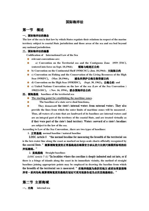
国际海洋法第一节概述一、国际海洋法的概念The law of the sea is that law by which States regulate their relations in respect of the marine territory subject to coastal State jurisdiction and those areas of the sea and sea bed beyond any national jurisdiction.三、国际海洋法的编纂Codification of International Law of the Searelevant conventions are:a) Convention on the Territorial sea and the Contiguous Zone 1959 [TSC],(entered into force on Sept. 10,1964); 领海与毗连区公约b) Convention on the Continental Shelf 1958[CSC], (Jun. 10,1964); 大陆架公约c) Convention on Fishing and the Conservation of the Living Resources of the HighSeas 1958[FC],(Mar. 20,1966);捕鱼和养护公海生物资源公约d) Convention on the High Seas 1958[HSC],(Sept. 30, 1962);公海公约ande) United Nations Convention on the law of the sea (Law of the Sea Convention )1982[LOSC],( Nov. 16, 1994)。
联合国海洋法公约四、领海基线baselines of the territorial seaThe starting point for establishing the maritime zones.The baselines of a state serve dual functions:They demarcat e the state’s internal waters from external waters. They also provide the lines from which the outer limits of maritime zones will be measured .Thus, all waters of a state that are landward of its baselines are internal waters and are an integral part of the territory of the coastal State, and are treated virtually as if they were part of the state’s land territory. Waters seaward of a state’s baselines are subject to the law of the sea.According to Law of the Sea Convention , there are two types of baselines:1. 正常基线normal baseline / natural baselineLOSC Article 5 “the normal baseline for measuring the breadth of the territorial sea is the low-water line along the coast as marked on large-scale charts officially recognized by the coastal State. ”测算领海宽度的正常基线是沿海国官方承认的大比例尺海图所标明的沿岸低潮线。
- 1、下载文档前请自行甄别文档内容的完整性,平台不提供额外的编辑、内容补充、找答案等附加服务。
- 2、"仅部分预览"的文档,不可在线预览部分如存在完整性等问题,可反馈申请退款(可完整预览的文档不适用该条件!)。
- 3、如文档侵犯您的权益,请联系客服反馈,我们会尽快为您处理(人工客服工作时间:9:00-18:30)。
国际海洋法第一节概述一、国际海洋法的概念The law of the sea is that law by which States regulate their relations in respect of the marine territory subject to coastal State jurisdiction and those areas of the sea and sea bed beyond any national jurisdiction.三、国际海洋法的编纂Codification of International Law of the Searelevant conventions are:a) Convention on the Territorial sea and the Contiguous Zone 1959 [TSC],(entered into force on Sept. 10,1964); 领海与毗连区公约b) Convention on the Continental Shelf 1958[CSC], (Jun. 10,1964); 大陆架公约c) Convention on Fishing and the Conservation of the Living Resources of the HighSeas 1958[FC],(Mar. 20,1966);捕鱼和养护公海生物资源公约d) Convention on the High Seas 1958[HSC],(Sept. 30, 1962);公海公约ande) United Nations Convention on the law of the sea (Law of the Sea Convention )1982[LOSC],( Nov. 16, 1994)。
联合国海洋法公约四、领海基线baselines of the territorial seaThe starting point for establishing the maritime zones.The baselines of a state serve dual functions:They demarcat e the state’s internal waters from external waters. They alsoprovide the lines from which the outer limits of maritime zones will be measured .Thus, all waters of a state that are landward of its baselines are internal waters and are an integral part of the territory of the coastal State, and are treated virtually as if they were part of the state’s land territory. Waters seaward of a state’s baselines are subject to the law of the sea.According to Law of the Sea Convention , there are two types of baselines:1. 正常基线normal baseline / natural baselineLOSC Article 5 “the normal baseline for measuring the breadth of the territorial sea is the low-water line along the coast as marked on large-scale charts officially recognized by the coastal State. ”测算领海宽度的正常基线是沿海国官方承认的大比例尺海图所标明的沿岸低潮线。
”2. 直线基线Straight baselinesLOSC Article 7 (1)“In localities where the coastline is deeply indented and cut into, or if there is a fringe of islands along the coast in its immediate vicinity, the method of straight baselines joining appropriate points may be employed in drawing the baseline from which the breadth of the territorial sea is measured. ”在海岸线极为曲折的地方,或者如果紧接海岸有一系列岛屿,测算领海宽度的基线的划定可采用连接各适当点的直线基线法。
”第二节主要海域一、内海internal seaLOSC Article 8 (1) waters on the landward side of the baseline of the territorial sea form part of the internal waters of the State. ”领海基线向陆一面的水域构成国家内水的一部分legal status:1. coastal State has complete and exclusive sovereignty subject to the right offoreign vessels in distress to seek safety in internal waters2. Where the establishment of a straight baseline has the effect of enclosing asinternal waters areas which had not previously been considered as such, a right of innocent passage as provided in this Convention shall exist in those waters.二、领海the territorial sea1. 领海的概念Concept of territorial seaLOSC Article 2 (1) “The sovereignty of a coastal State extends, beyond its landterritory and internal waters and, in the case of an archipelagic State, its archipelagic waters, to an adjacent belt of sea, described as the territorial sea.”沿海国的主权及于其陆地领土及其内水以外邻接的一带海域,在群岛国的情形下则及于群岛水域以外邻接的一带海域,称为领海。
2. Breadth of the territorial sea 领海的宽度LOSC Article 3“Every State has the right to establish the breadth of its territorialsea up to a limit not exceeding 12 nautical miles, measured from baselines determined in accordance with this Convention.” 每一国家有权确定其领海的宽度,直至从按照本公约确定的基线量起不超过十二海里的界限为止。
(1) Interior limit of the territorial sea--- is baselines of the territorial sea, which is the boundary between internal watersand territorial sea.领海的内部界线----是领海基线,是内水和领海的分界线。
(2) Outer limit of the territorial seaLOSC Article 4The outer limit of the territorial sea is the line every point of which is at a distancefrom the nearest point of the baseline equal to the breadth of the territorial sea. 领海的外部界限----是一条其每一点同基线最近点的距离等于领海宽度的线。
3.领海的法律地位legal statusLOSC Article 2 (1)The sovereignty of a coastal State extends, beyond its landterritory and internal waters and, in the case of an archipelagic State, its archipelagic waters, to an adjacent belt of sea, described as the territorial sea.(1)沿海国的主权及于其陆地领土及其内水以外邻接的一带海域,在群岛国的情形下则及于群岛水域以外邻接的一带海域,称为领海。
(2)This sovereignty extends to the air space over the territorial sea as well as to Itsbed and subsoil.(2)此项主权及于领海的上空及其海床和底土。
(3)The sovereignty over the territorial sea is exercised subject to this Convention andto other rules of international law. (3)对于领海的主权的行使受本公约和其他国际法规则的限制。
