Raster-mode area generalization for land use and land cover maps
GIS专业英语词汇

地理信息系统(GIS)词汇表accreditation 委派accuracy 准确度acquisition 获取activity patterns 活动模式added value 附加值adjacency邻接Aeolian 伊奥利亚人的, 风的, 风蚀的Age of Discovery 发现的年代aggregation聚合algorithm, definition算法,定义ambiguity 不明确analytical cartography 分析制图application programming interfaces(APIs) 应用编程接口ARCGis 美国ESRI公司开发的世界先进的地理信息系统软件ArcIMS 它是个强大的,基于标准的工具,让你快速设计和管理Internet地图服务ArcInfo 在ArcGIS软件家族中,ArcInfo是GIS软件中功能最全面的。
它包含ArcView和ArcEditor所有功能,并加上高级空间处理和数据转换ArcNews 美国ESRI向用户终生免费赠送的ArcNews报刊ArcSDE ArcSDE在ESRI GIS软件和DBMS之间提供通道,是一个空间数据引擎ArcUser Magazine 为ESRI用户创建的报刊ArcView 桌面GIS和制图软件,提供数据可视化,查询,分析和集成功能,以及创建和编辑地理数据的能力ARPANET ARPA 计算机网(美国国防部高级研究计划局建立的计算机网)aspatial data 非空间数据Association of Geographic Information (AGI) 地理信息协会attribute data 属性数据attributes, types 属性,类型attributive geographic data 属性地理数据autocorrelation 自相关Autodesk MapGuide 美国Autodesk公司生产的Web GIS软件Automated mapping/facility management(AM/FM) systems 自动绘图/设备管理系统facilities 设备avatars 化身A VIRIS 机载可见光/红外成像光谱仪azimuthal projections 方位投影batch vectorization 批量矢量化beer consumption 啤酒消费benchmarking 基准Berry, Brian best fit line 最优线binary counting system 二进制计算系统binomial distribution 二项式分布bivariate Gaussian distribution 二元高斯分布block encoding 块编码Bosnia, repartitioning 波斯尼亚,再分离成两个国家buffering 缓冲区分析Borrough, Peter Business and service planning(retailing) application in petroleum and convenience shopping石油和便利购物的业务和服务规划(零售)应用business drivers 业务驱动business, GIS as 业务,地理信息系统作为Buttenfield, Barbara cadasters 土地清册Callingham, Martin cannibalizing 调拨Cartesian coordinate system笛卡尔坐标系Cartograms 统计地图cartographic generalization 制图综合cartographic modeling 地图建模cartometric transformations 量图变换catalog view of database 数据库目录视图census data人口普查数据Census of Population 人口普查central Place Theory 中心区位论central point rule 中点规则central tendency 中心倾向centroid 质心choropleth mapping分区制图choosing a GIS 选择一个地理信息系统class 类别classification generalization 分类综合client 客户端client-server C/S结构客户端-服务器cluster analysis 聚类分析clutter 混乱coastline weave 海岸线codified knowledge 编码知识COGO data 坐标几何数据COGO editing tools 坐标几何编辑工具Collaboration 协作Local level 地方级National level 国家级Collection-level metadata 获取级元数据Commercial-off-the-shelf (COTS) systems 成熟的商业化系统chemas-microsoft-comfficeffice" />>>Commom object request broker architecture (CORBA) 公共对象请求代理体系结构Community, GIS 社区,地理信息系统Competition 竞争Component GIS 组件地理信息系统Component object model (COM) 组件对象模型Computer assisted mass appraisal (CAMA) 辅助大量估价,>>Computer-aided design (CAD)-based GIS 基于计算机辅助制图的地理信息系统Models 数据模型Computer-aided software engineering (CASE) tool 计算机辅助软件工程工具Concatenation 串联Confidence limits 置信界限Conflation 异文合并Conformal property 等角特性Confusion matrix 混淆矩阵Conic projections 圆锥投影Connectivity 连接性Consolidation 巩固Constant term 常数项Contagious diffusion 传染扩散Continuing professional development (CPD) 持续专业发展Coordinates 坐标Copyright 版权Corridor 走廊Cost-benefit analysis 成本效益分析Cost-effectiveness evaluation 成本效率评估Counting method 计算方法Cresswell, Paul Customer support 客户支持Cylindrical Equidistant Projection 圆柱等距投影Cylindrical projections 圆柱投影Dangermond, Jack 美国ESRI总裁>>dasymetric mapping 分区密度制图>>data 数据>>automation 自动化>>capture costs 获取代价>>capture project 获取工程>>collection workflow 采集工作流>>compression 压缩>>conversion 转换>>definition 定义>>geographic, nature of 地理数据,数据的性质>>GIS 地理信息系统>>industry 产业>>integration 集成>>mining挖掘>>transfer 迁移>>translation 转化>>data model 数据模型>>definition 定义>>levels of abstraction 提取等级>>in practice 实际上>>types 类型>>database 数据库>>definition 定义>>design 设计>>generalization 综合>>global 全球的>>index 索引>> multi-user editing 多用户编辑>>structuring 结构>>database management system (DBMS) 数据库管理系统>>capabilities 能力>>data storage 数据存储>>geographic extensions 地理扩展>>types 类型>>Dayton Accord 达顿协定,1995年12月达顿协定(DAYTON ACCORD)签订,巴尔干和平已经实现,波斯尼亚(包括黑塞哥维那)再被分解成两个国家>>decision support 决策支持>>deductive reasoning 演绎推理>>definitions of GIS 地理信息系统的各种定义>>degrees of freedom 自由度>>density estimation 密度估算>>dependence in space 空间依赖>>desktop GIS 桌面地理信息系统>>desktop paradigms 桌面范例>>Digital Chart of the World (DCW) 世界数字化图>>digital divide 数字鸿沟>>Digital Earth 数字地球>>Digital elevation models (DEMs) 数字高程模型>>Digital line graph (DLG) 数字线划图>>Digital raster graphic (DRG) 数字影像图>>Digital representation 数字表现>>Digital terrain models 数字地形模型>>Digitizing 数字化>>DIME (Dual Independent Map Encoding) program 美国人口调查局建立的双重独立地图编码系统>>Dine CARE >>Discrete objects 离散对象>>Douglas-Poiker algorithm 道格拉斯-普克算法,一种矢量数据抽稀算法>>Dublin Core metadata standard 都柏林核心元数据标准>>Dynamic segmentation 动态分割>>Dynamic simulation models 动态仿真模型>>Easting 朝东方>>Ecological fallacy 生态谬误>>e-commerce 电子商业>>editing 编辑education 教育>>electromagnetic spectrum 电磁光谱>>ellipsoids 偏振光椭圆率测量仪>>of rotation 旋转的>>emergency evacuation 应急撤退>>encapsulation 封装>>environmental applications 环境应用>>environmental impact 环境影响>>epidemiology 流行病学>>equal area property 等面积特性>>Equator 赤道>>ERDAS ERDAS公司是世界上最大的专业遥感图像处理软件公司,用户遍布100多个国家,软件套数超过17000套。
《ERDAS IMAGE遥感图像处理方法》操作
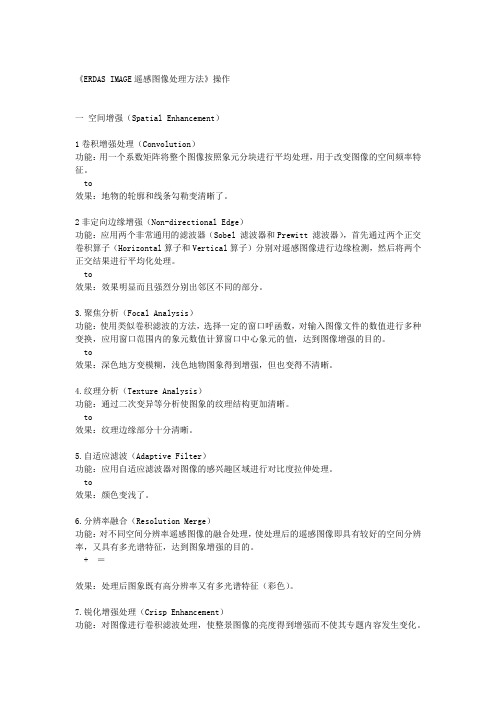
《ERDAS IMAGE遥感图像处理方法》操作一空间增强(Spatial Enhancement)1卷积增强处理(Convolution)功能:用一个系数矩阵将整个图像按照象元分块进行平均处理,用于改变图像的空间频率特征。
to效果:地物的轮廓和线条勾勒变清晰了。
2非定向边缘增强(Non-directional Edge)功能:应用两个非常通用的滤波器(Sobel 滤波器和Prewitt 滤波器),首先通过两个正交卷积算子(Horizontal算子和Vertical算子)分别对遥感图像进行边缘检测,然后将两个正交结果进行平均化处理。
to效果:效果明显而且强烈分别出邻区不同的部分。
3.聚焦分析(Focal Analysis)功能:使用类似卷积滤波的方法,选择一定的窗口呼函数,对输入图像文件的数值进行多种变换,应用窗口范围内的象元数值计算窗口中心象元的值,达到图像增强的目的。
to效果:深色地方变模糊,浅色地物图象得到增强,但也变得不清晰。
4.纹理分析(Texture Analysis)功能:通过二次变异等分析使图象的纹理结构更加清晰。
to效果:纹理边缘部分十分清晰。
5.自适应滤波(Adaptive Filter)功能:应用自适应滤波器对图像的感兴趣区域进行对比度拉伸处理。
to效果:颜色变浅了。
6.分辨率融合(Resolution Merge)功能:对不同空间分辨率遥感图像的融合处理,使处理后的遥感图像即具有较好的空间分辨率,又具有多光谱特征,达到图象增强的目的。
+ =效果:处理后图象既有高分辨率又有多光谱特征(彩色)。
7.锐化增强处理(Crisp Enhancement)功能:对图像进行卷积滤波处理,使整景图像的亮度得到增强而不使其专题内容发生变化。
效果:区别不大,亮度得到些许增强。
二.辐射增强(Radiometric Enhancement)1.查找表拉伸(LUT Stretch)功能:通过修改图像查找表使输出图像值发生变化。
(整理)当代摄影测量双语教学词汇表

精品文档Glossary of《Introduction to Modern Photogrammetry》《当代摄影测量》双语教学词汇表AAbbe comparator principle阿贝比长原理aberration 像差absolute flying height 绝对航高absolute orientation 绝对定向absorption 吸收access 存取、访问accessory 附件、辅助设备accident error 偶然误差accuracy 精度、准确度accuracy assessment 精度评定acquisition 获取active remote sensing 主动式遥感adaptability 适应性adjustment 平差adjacent 邻接adjacent flight line 相邻航线adjacent area 邻接区域adjoining sheets 邻接图幅aerial camera 航空摄影机aerial photograph 航摄像片aerial photographic gap 航摄漏洞aerial photogrammetry航空摄影测量aerial remote sensing 航空遥感aerophotogrammetry 航空摄影测量aerotriangulation 空中三角测量block triangulation区域网三角测量strip triangulation航带法空中三角测量independent model triangulation独立模型法空中三角测量bundle triangulation光束法空中三角测量affine rectification 仿射纠正affined transformation 仿射变换aggregation 聚合、聚集air base 摄影基线airbone imagery 机载影像airborne sensor 机载传感器alignment 排列成行、对准algebra 代数algorithm 算法allocation 配置altimeter 测高仪altitude 高度、高程ambiguity 模糊、不定性anaglyph 互补色anaglyphical stereoscopic viewing互补色立体观察analog 模拟analog/digital conversion 模数转换analog photogrammetry 模拟摄影测量analytical aerotriangulation解析空中三角测量analytical photogrammetry 解析摄影测量analytical plotter 解析测图仪ancillary data 辅助数据angular field of view 像场角angular momentum 角动量animation 动画annotation 注释、注记annotated photograph 调绘像片aperture 光圈、孔径relative ~ 相对孔径effective ~ 有效孔径approximation 近似值、逼近archive 档案archiving 存档architectural photogrammetry建筑摄影测量archaeological photogrammetry考古摄影测量artificial intelligence 人工智能artificial target 人工标志(点)aspect 方位aspect map 坡向图assessment 评定、估价astigmatism 像散atlas 地图集atmospheric haze 大气蒙雾atmospheric refraction 大气折光atmospheric window 大气窗口atmospheric transmission 大气传输atmospheric transmissivity 大气透过率attenuation 衰减attitude 姿态attitude parameter 姿态参数attribute 属性autocollimation 自准直autocorrelation 自相关automatic triangulation自动空中三角测量azimuth angle 方位角azimuth resolution 方位角分辨率Bbackprojection 逆投影backup 备份ballistic camera 弹道摄影机ballistic photogrammetry弹道摄影测量bandwidth 波段宽barrel 圆筒、桶形失真baseline 基线base-height ratio 基-高比batch process 批处理baud rate 波特率Bayes classification 贝叶斯分类bilinear interpolation 双线性内插binary image 二值影像biomedical photogrammetry生物医学摄影测量biostereometrics 生物立体量测学black-and-white film 黑白片blinking method of stereoscopic viewing 闪闭法立体观察block adjustment 区域网平差blunder detection 粗差探测bulk processing 粗处理bundle of rays 光束boundary 边界breakline 断裂线bridging of models 模型连接brightness 亮度Ccadastral mapping 地籍制图calibration 检校camera calibration 摄影机检校carrier phrase measurement载波相位测量Cartesian coordinates 笛卡尔坐标cartography 地图学characteristic curve of photographic emulsion 感光特性曲线check point 检查点chromatic 彩色的classification 分类classifier 分类器close-range photogrammetry近景摄影测量clustering 聚类cognitive mapping 认知制图collinearity condition 共线条件collinearity equations 共线方程color enhancement 彩色增强color infrared film 彩色红外片color film 彩色片coma 彗星像差combined adjustment 联合平差comparator 坐标量测仪compensation 补偿complementary colors 互补色component 组件、分量compression 压缩computer aided mapping 机助测图computer vision 计算机视觉computer-aided cartography计算机辅助制图condition equations 条件方程confidence 置信度coverage 覆盖conformal 正形的、等角的contact printing 接触晒印content of information 信息量contour lines 等高线contour interval 等高距constraint 约束contrast enhancement 反差增强contrast coefficient 反差系数control point 控制点control photostrip 骨架航线convergent photography 交向摄影convolution operators 卷积算子coordinate grid 坐标格网coordinate system 坐标系photographic coordinate system 像平面坐标系image space coordinate system 像空间坐标系object coordinate system物方坐标系coplanarity equation 共面方程correlation efficient 相关系数corresponding image point 同名像点corresponding image rays 同名光线corresponding epipolar line 同名核线cosine transformation 余弦变换covariance 协方差covariance matrix 协方差矩阵crest 山脊、峰顶cross-section 断面cyberspace 信息空间、赛博空间cycle slip 周跳Ddata acquisitation 数据获取data compression 数据压缩data mining 数据挖掘data snooping 数据探测法data transmission 数据传输data processing 数据处理data warehouse 数据仓库datum 基准deformation 变形densitometer 密度计density slicing 密度分割depression 抑制、衰减depth of field 景深detector 探测器developing 显影diagonal matrix 对角矩阵diaphragm 光圈differential 差分differential method of photogrammetric mapping 分工法测图differential rectification 微分纠正diffraction 衍射diffusion 扩散、漫射digital/analog transform 数/模转换digital correlation 数字相关digital earth 数字地球digital image 数字影像digitizer 数字化器digitization 数字化digitized image 数字化影像digital mapping 数字测图digital mosaic 数字镶嵌digital surface model数字表面模型(DSM)digital terrain model数字高程模型(DTM)digital orthophoto map数字正射影像(DOM)digital orthoimage 数字正射影像digital photogrammetry 数字摄影测量digital raster graphic数字栅格地图(DRG)digital rectification 数字纠正digital tracing table 数控绘图桌dimensional 维one- dimensional一维的two- dimensional 二维的three- dimensional 三维的disparity 不同、差异displacement of image 像点位移distortion of lens 物镜畸变差distribution function 分布函数direct line transformation直接线性变换(DLT)direct scheme of digital rectification直接法纠正direction cosines 方向余弦discrimination 辨别、区分dispersion 分散、散射drainage 水系drawing 绘图drift angle 偏流角dynamic 动态的Eearth curvature 地球曲率earth ellipsoid 地球椭球eccentricity 偏心、偏心率edge detection 边缘检测edge enhancement 边缘增强eigenvalue 特征值eigenvector 特征向量electromagnetic spectrum 电磁波谱elements of interior orientation内方位元素elements of exterior orientation外方位元素elements of relative orientation相对定向元素elements of absolute orientation绝对定向元素elements of rectification 纠正元素emulsion 药膜encoding 编码enhancement 增强entity 实体entropy (信息)熵entropy coding 熵编码environment 环境epipolar line 核线epipolar plane 核面epipolar correlation 核线相关epipolar resampling 核线重采样epipole 核点equalization of histogram 直方图均衡equivalent vertical photograph等效竖直像片equally tilted photography 等倾摄影error circle 误差圆Ethernet 以太网expert system 专家系统ES exposure 曝光exposure station 摄站exponential 指数的exterior orientation 外部定向event 事件Ffalse color film 假彩色片false color photography 假彩色摄影false color composite 假彩色合成feature 特征feature coding 特征编码feature extraction 特征提取feature selection 特征选择fiducial marks 框标mechanical fiducial marks机械框标optical fiducial marks光学框标field curvature像场弯曲field of view 视场filtering 滤波fixing 定影flight block 摄影分区flight height (flying height)航高flight line 摄影航线flight plan of aerial photography航摄计划flight strip 航带flying height 航高absolute ~ 绝对航高relative ~ 相对航高flying trace 航迹floating mark 浮游测标flux 通量、流动focal distance 焦距focal length 焦距focal plane 焦平面format 像幅forward motion compensation (FMC)向前运动补偿Fourier transformation 傅立叶变换fractal 分数维frame camera 框幅式摄影机free net adjustment 自由网平差frequency 频率Fresnel 菲滠耳fuzzy classifier method 模糊分类法fuzzy image 模糊影像GGaussian distribution 高斯分布generalization 综合geodetic origin 大地原点generation 产生geodetic datum 大地基准geodetic database 大地测量数据库geocentric coordinate system地心坐标系geodetic origin 大地原点geodetic datum 大地基准geographic coding 地理编码geoid 大地水准面geomatics 测绘学geometric correction 几何校正geometric rectification 几何纠正geometric registration of image图像几何配准geometric model 几何模型geostationary 地球静止的geo-synchronous satellite 地球同步卫星gnomonic 球心的goniometer 测角器、测向器gradients 梯度graphic 图形的grating 格子、光栅gravity 重力grey level 灰度级grey scale 灰度级grey wedge 光契grid 格网ground nadir point 地底点gross error detection 粗差检测GPS aerotriangulation GPS空中三角测量Gruber point 标准配置点Hheight displacement 投影差high-pass filtering 高通滤波histogram equalization 直方图均衡histogram 直方图histogram specification直方图规格化histogram equalization直方图均衡化hologram photography 全息摄影hologrammetry 全息摄影测量homogeneous 均质的、齐次的homologous image point 同名像点homomorphic filtering 同态滤波horizon camera 地平线摄影机horizontal 水平的、平面的horizontal parallax 左右视差(x-parallax)horizontal parallax difference左右视差较hot spots 热点hough transformation 霍夫变换Huffman 霍夫曼hue 色度hypergraph 超图hypermedia 超媒体hyperspectral 高光谱、超光谱hypertext 超文本hypothesis 假设Iidentified photograph 调绘片index contour 计曲线illuminance of ground 地面照度image,imagery 影像image coding 影像编码image correlation 影像相关image description 影像描述image digitization 影像数字化image enhancement 影像增强image fusion 影像融合image interpretation 影像解译image matching 影像匹配image mosaic 影像镶嵌image motion compensation像移补偿image overlaying 影像复合image pyramids 影像金字塔image quality 影像质量image recognition 影像识别image registration 影像配准image resolution 影像分辨力image restoration 影像复原image motion compensation像移补偿(IMC)image segmentation 图像分割image space coordinate system像空间坐标系image transformation 图像变换image understanding 图像理解imaging equation 构像方程imaging radar 成像雷达imaging spectrometer 成像光谱仪incident angle 入射角independent model aerial triangulation 独立模型法空中三角测量indirect scheme of digital rectification 间接法纠正industrial photogrammetry工业摄影测量inertial measurement unit (IMU)惯性测量装置information extraction 信息提取infrared film 红外片infrared photography 红外摄影infrared remote sensing 红外遥感infrared scanner 红外扫描仪inner 内部的inner orientation 内定向instrument 仪器、设备integration 集成intensity 亮度interactive 交互interest point 兴趣点、有利点interferogram 干涉图interferometry 干涉测量学interior orientation 内部定向interometry SAR 干涉雷达(INSAR)interoperability 互操作interpolation 内插bilinear interpolation 双线性内插nearest-neighbor interpolation邻近像元内插invariant 不变量irradiance 辐射照度isocenter of photograph 像等角点isometric 等角、等值的isometric parallel 等比线iteration method 迭代法iteration method with variable weights选权迭代法intersection 相交inverse matrix 逆矩阵Kkey-in 键盘输入key word 关键字kinematic positioning 动态定位knickpoint 转折点、裂点Llaboratory 实验室Landsat 陆地卫星landform 地形landscape map 景观地图large format camera大像幅摄影机(LFC)latent 潜在的lateral tilt 旁向倾角(roll)lateral overlap(side overlap,side lap)旁向重叠layover 雷达图像移位least squares correlation最小二乘相关leveling of model 模型置平linear array sensor 线阵列传感器linear features 线特征linear transformation 线性变换linearization 线性化logarithmic 对数的longitudinal tilt 航向倾角(pitch)longitudinal overlap(end overlap,forward overlap)航向重叠low-pass 低通Mmagazine 暗盒magnification 放大manual 人工的manuscript map 原图map compilation 地图编辑map legend 图例map projection 地图投影map revision 地图更新mapping satellite 测图卫星marine charting 海洋测绘mathematical expectation 数学期望maximum likelihood classification最大似然分类matrix 矩阵mean square error 中误差measuring mark 测标mechanics 力学median filters 中值滤波器mesh 网、网格metadata 元数据meteosat 气象卫星minimum distance classification最小距离分类metric camera 量测摄影机microwave remote sensing 微波遥感method of least squares 最小二乘法microwave radiation 微波辐射microwave radiometer 微波辐射计modulation transfer function调制传递函数(MTF)moiré莫尔条纹monocomparator 单像坐标量测仪mount 安装、座架mosaic 镶嵌optical mosaic 光学镶嵌digital mosaic 数字镶嵌most probable value 最或然值multicollimator 多投影准直仪multiplex 多倍仪multistage rectification 多级纠正multispectral camera 多光谱摄影机multispectral photography多光谱摄影multispectral remote sensing多光谱遥感multispectral scanner多光谱扫描仪(MSS)multi-temporal analysis 多时相分析multi-temporal remote sensing多时相遥感multiplicity 多重性、相重性Nnadir point 底点navigation 导航negative 负片neighborhood method 邻元法nodal point 节点front nodal point 前节点rear nodal point 后节点neutral network 神经网络nonlinear 非线性的non-metric camera 非量测摄影机non-topographic photogrammetry非地形摄影测量normal case photography 正直摄影normal distribution 正态分布normal equation 法方程式normalization 正交化Ooblique 倾斜的oblique photography 倾斜摄影object space coordinate system物空间坐标系object spectrum characteristics地物波谱特性object oriented 面向对象observation 观测值observation equation 误差方程式occlusion 遮蔽offset 移位off-line 离线、脱机on-line 在线、联机on-line aerial triangulation联机空中三角测量one-dimensional 一维的opacity 不透明的operator 算子optical axis of lens 物镜主光轴optical rectification 光学纠正optical-mechanical rectification光机械学纠正optical projection 光学投影optical transfer function光学传递函数(OTF)orthogonal matrix 正交矩阵orientation elements 方位元素orientation point 定向点orthogonal projection 正射投影orthographic 正射的orthogonal matrix 正交矩阵orthoimage 正射影像orthophoto 正射像片orthophotomap 正射影像地图orthophoto stereomate正射影像立体配对片orthophoto technique 正射影像技术outline map 略图outstanding point 明显地物点overlap 重叠Ppackage 包panchromatic film 全色片panoramic camera 全景摄影机panoramic photography 全景摄影panoramic distortion 全景畸变parallax 视差parallax difference 视差较parallel-averted photography等偏摄影parameter 参数parameter estimation 参数估计pass point 加密点pattern recognition 模式识别perceived model 视模型perigee 近地点perspective center 透视中心phase transfer function相位传递函数(PTF)photogrammetric distortion摄影测量畸变差photogrammetric workstation摄影测量工作站photogrammetry 摄影测量terrestrial ~ 地面摄影测量two-medium ~ 双介质摄影测量biomedical ~ 医学摄影测量photography 摄影学photographic baseline 摄影基线photographic bundle of rays 摄影光束photographic coordinate system摄影测量坐标系photographic interpolation摄影测量内插photographic paper 相纸photographic processing 摄影处理photographic scale 摄影比例尺photo base 像片基线photo coordinate system像平面坐标系photo interpretation 像片判读photo map 像片平面图photo mosaic 像片镶嵌photo nadir point 像底点photoplan 像片平面图photo rectification 像片纠正photo scale 像片比例尺phototheodolite 摄影经纬仪physiological parallax 生理视差picture format 像幅pinhole 小孔(成像)pixel 像元planarity 平面性、平面条件platform 平台platen 压平板、平台plot 平面图、略图plumb line 铅垂线point marking 刺点point transfer 转点point of interest 兴趣点polar 极、极地的polar coordinates 极坐标polarized 极化polarization 极化polygon 多边形polynomial 多项式positive 正片power spectrum 功率谱precision 精密度precision estimation 精度估计prediction 预测、推估prick point 刺点primary color 原色principal component transformation 主分量变换principal distance of photo 像片主距principal distance 主距principal line 像主纵线principal plane 像主垂面principal point 像主点principal point of photograph 像主点principle of geometric reverse几何反转原理printer 印相机prism 棱镜precision estimation 精度估计probable error 或然误差probability 概率论processing 处理bulk processing 粗处理precision processing 精处理product 产品production 生产、产量projection 投影projection center 投影中心projection printing 投影晒印propagation of errors 误差传播protocol 协议prototype 原型pseudo-color image 伪彩色影像pseudo range measurement 伪距测量pushbroom imaging 推扫式成像pyramids 金字塔Qquadtree 四叉树qualitative 定性的quality control 质量控制quantitative 定量的quantizing 量化quantization 量化quantum 量子query 查询、检索Rradargrammetry 雷达图象测量radial distortion 径向畸变radial triangulation 辐射三角测量radiant 辐射的radiation correction 辐射校正radiograph X光照相radiometry 辐射测量radiometric correction 辐射校正radiometer 辐射计random error 随机误差、偶然误差random variable 随机变量raster grid 栅格网raster to vector conversion栅格-矢量转换ratio transformation 比值变换real-aperture radar 真实空径雷达real-time photogrammetry实时摄影测量reconstruction 重建rectifier 纠正仪rectification 纠正affine rectification 仿射纠正reduction 归化redundancy 余redundant information 余信息refinement 改正reflectance spectrum 反射波谱region of target 目标区region of search 搜索区relative flying height 相对航高relative orientation 相对定向relaxation 松池reliability 可靠性relief displacement 投影差resampling 重采样remote sensing 遥感aerial remote sensing 航空遥感space remote sensing 航天遥感remote sensing of resources 资源遥感environmental remote sensing环境遥感geological remote sensing 地质遥感ocean remote sensing 海洋遥感forest remote sensing 森林遥感atmospheric remote sensing大气遥感infrared remote sensing 红外遥感microwave remote sensing 微波遥感multi-spectral remote sensing多光谱遥感active remote sensing 主动遥感passive remote sensing 被动遥感remote sensing platform 遥感平台representation 显示、表达reseaux 网格resection 后方交会residual 残差resolution 分解力、分辨率ground resolution 地面分解力space resolution 空间分辨率temporal resolution 时间分辨率temperature resolution 温度分辨率resolving power of lens 物镜分辨力restitution 测图、成图、复原、恢复restoration 恢复retrieval 检索return beam vidicon camera反束光导(RBV)管摄影机reversal film 反转片roam 漫游rotation matrix 旋转矩阵route 路径Ssampling 采样sampling interval 采样间隔satellite altimetry 卫星测高satellite attitude 卫星姿态satellite-borne sensor 星载遥感器saturation 饱和度scaling of model 模型缩放scanner 扫描仪searching area 搜索区seasat 海洋卫星segmentation 分割self-calibration 自检校semiconductor 半导体semi-metric camera 半量测摄影机sensitivity 感光度sensitometry 感光测定sensitization 感光sensitometry 感光度测定sensitive material 感光材料sensor 传感器sequential 序列的shadow 阴影shutter 快门sidelap 旁向重叠side-looking radar侧视雷达(SLR)similarity 相似、相似性simulation 模拟single image 单张像片singularity 奇异性small format aerial photography小像幅摄影space intersection 空间前方交会space photography 航天摄影space photogrammetry航天摄影测量space remote sensing 航天遥感space resection 空间后方交会Spacelab 空间实验室space shuttle 航天飞机spatial 空间的spatial domain 空间域specification 规范、说明spectral 光谱的spectral sensitivity 光谱感光度spectrograph 摄谱仪spectrometer 波谱测定仪spectroradiometer 光谱辐射仪spectrum character curve波谱特征曲线spectrum response curve波谱响应曲线spectrum feature space 波谱特征空间sphere 球面、球体spline 样条squint 斜视static 静态的stellar camera 恒星摄影机standard deviation 标准差standard error 标准差statistical 统计的statoscope 高差仪stereocamera 立体摄影机stereocomparator 立体坐标量测仪stereometer 立体量测仪stereo pair 立体像对stereo plotter 立体测图仪stereoscope 立体镜bridge-type ~ 桥式立体镜mirror ~ 反光立体镜stereoscopic vision 立体视觉stereoscopic observation 立体观测stereopair 立体像对stereophotogrammetry立体摄影测量stereoscopic model 立体观测模型stop-number 光圈号数stochastic 随机的strips 航线、航带strip aerial triangulation航带法空中三角测量sub pixel 子像素sun-synchronous satellite太阳同步卫星superimposition 叠加supervised classification 监督分类surface model 表面模型survey adjustment 测量平差survey mark 测量标志surveying and mapping 测绘surveying 测量学elementary surveying 普通测量topographic survey 地形测量control surveying 控制测量sweep 扫描swing angle 像片旋角(yaw)symmetry 对称synthetic aperture radar合成空径雷达system integration 系统集成systematic error 系统误差Ttangential distortion 切向畸变target area 目标区template 模板terrestrial camera 地面摄影机terrestrial photogrammetry地面摄影测量texture enhancement 纹理增强texture analysis 纹理分析thematic map 专题地图thematic mapper 专题制图仪(TM)theodolite 经纬仪thermal radiation 热辐射thermal infrared imagery 热红外影像threshold 阈值tie point 连接点tilt angle of photograph 像片倾角tilt displacement 倾斜位移tracing 跟踪transparent negative 透明负片transparent positive 透明正片triangulated irregular network不规则三角网(TIN)triple 三倍的、三重的true-orthophoto 真正射影像two-medium photogrammetry toning 调色topographic map 地形图topology 拓扑toponomastics, toponymy 地名学trainning field 训练区transmittance 透光率translation 平移、移动transparent 透明的transverse 横轴、横向的triangulation 三角测量aerial ~ 空中三角测量analogue aerial ~ 模拟法空三测量analytical aerial ~ 解析法空三测量block ~ 区域网空中三角测量strip ~ 航带法空中三角测量independent model ~独立模型法空中三角测量bundle ~ 光束法空中三角测量trichromatic 三色的Uuncertainty 不确定性underwater camera 水下摄影机under photogrammetry水下摄影测量universal method of photogrammetric unit matrix 单位矩阵unit weight 单位权unsupervised classification非监督分类update 更新urban mapping 城市制图user interface 用户界面mapping 全能法测图Vvanishing point 灭点、合点variance 方差variance-covariance 方差-协方差vectograph method of stereoscopic viewing 偏振光立体观察vector 矢量vectorization 矢量化verifiability 置信度verification 确认vertical 竖直的、高程的vertical exaggeration 高程扩张vertical parallax上下视差(y-parallax)vertical photography 竖直摄影viewpoint 视点virtual reality 虚拟现实visual 目视的visual interpretation 目视判读visualization 可视化voxel 体素Wwavelet 小波wavelength 波长weight 权weight function 权函数weight matrix 权矩阵weighted mean 加权平均数whiskbroom 横扫式workstation 工作站XX-ray photogrammetry X射线摄影测量Yyan angle 航偏角y-tilt 航向倾角Zzenith angle 天顶角zonal rectification 分带纠正zone 带zone generation 区域增长zoom 缩放zoom in 缩小zoom out 放大注:更详细的摄影测量与遥感专业词汇请查阅:1、《英汉测绘词汇》. 测绘出版社2、《测绘学名词》. 测绘出版社, 2002缩写词CAC Computer-aided Cartography 机助地图制图CCD Charge-coupled Device 电荷偶合器件DCBD Digital Cadastral Database 数字地籍数据库DLG Digital Line Graph 数字线划图DRG Digital Raster Graphics 数字栅格图DOQ Digital Orthophoto Quadrangle 数字正射影像图DPW Digital Photogrammetric Workstation摄影测量工作站GLONASS Global Orbiting Navigation Satellite System [俄罗斯]全球轨道导航卫星系统GPS Global Positioning System 全球定位系统ERTS earth resources technology satellite 地球资源卫星ETM Enhancement Thermatic Mapper 增强型专题制图仪HRSC High Resolution Stereo CameraIFOV Instantaneous Field of View 瞬时视场IFSAR Interometry SAR干涉雷达IMU Inertial Measurement Unit 惯性测量装置INS Inertial Navigation System 惯性导航系统ISS Inertial Surveying System 惯性测量系统LIDAR Light Detection and Ranging 激光探测和测距LIS Land Information System 土地信息系统MTF Modulation Transfer Function 调制传递函数NDVI Normalized Difference Vegetative IndexNSDI National Spatial Data Infrastructure 国家空间数据基础设施RMSE root mean square error 均方根差,中误差SAR Synthetic Aperture Radar 合成空径雷达SDI Spatial Data Infrastructure 空间数据基础设施SLAR Side Looking Airborne Radar 侧视雷达WGS84 World Geodetic System for 1984 1984年世界大地坐标系学会、组织名称ACSM American Congress on Surveying and Mapping 美国测绘学会ASPRS American Society for Photogrammetry and Remote Sensing美国摄影测量与遥感学会CSGPC Chinese Society of Geodesy, Photogrammetry and Cartography 中国测绘学会ESA European Space Agency 欧洲空间局FIG Federation International of Geometres 国际测量师联合会ICA International Cartographic Association 国际制图协会ISO International Organization for Standardization 国际标准化组织ISPRS International Society for Photogrammetry and Remote Sensing国际摄影测量与遥感学会IUSM International Union of Surveying and Mapping 国际测量联合会NASA National Aeronautics and Space Administration [美国]国家航空与航天局NASDA National Space Development Agency [日本]国家宇宙开发事业团NGCC National Geomatics Center of China [中国]国家基础地理信息中心。
ERDAS IMAGINE 处理 Pleiades 卫星数据操作流程
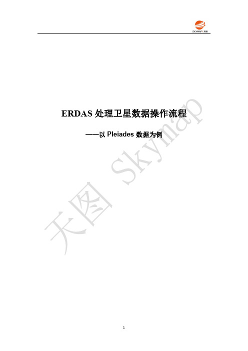
ERDAS处理卫星数据操作流程——以Pleiades数据为例1.1总体流程操作流程须知:1、此流程不包含数据准备工作2、虚线内为可选流程1.2数据概述(1)原始影像Pleiade卫星数据,包含5景全色和5景多光谱数据。
(2)参考数据①研究区范围文件(.shp)。
*.shp格式,投影类型Gauss Kruger,椭球体GRS1980,椭球体China2000②纠正参考资料在相关网站上下载对应区域的参考DOM和DEM文件,经镶嵌、裁切处理,保证参考影像能覆盖研究区。
DOM:1米空间分辨率,投影类型Mercator(Variant A),椭球体WGS84,基准面WGS84,EPSG3395DEM:30米空间分辨率,投影类型UTM/ZONE50,椭球体WGS84,椭球体WGS84 EPSG326501.3数据准备(1)投影转换矢量文件、参考DEM、DOM投影均不一致,为了后续数据处理方便,统一将数据的投影转换至同一个投影:投影类型Geographic(Lat/Lon);椭球体WGS84;基准面WGS84;EPSG(4326)。
(2)多光谱影像标定注意:Pleiades数据不需标定;高分数据(GF1/2)、资源一号02c数据进行多光谱影像标定选择Quick Bird RPC模型。
因此以下多光谱标定操作步骤示例仅针对GF数据、资源1号02C数据:1)点击Raster-Geometric Calibration-Calibrate with Sensor Model andTerrain,打开Geo Correction Input File对话框,选中需要进行标定的多光谱影像文件,单击OK按钮。
2)弹出Set Geometric Model对话框,选中对应的参数模型,单击OK按钮。
3)弹出Quick Bird RPC Model Properties对话框,读取RPC模型文件,点击Apply按钮应用参数。
4)弹出Verify Save on Close对话框,点击“否”,关闭该对话框,即完成多光谱影像标定处理。
遥感信息技术实习指导书

实习三图像解译本次实习主要学习以下内容:图像空间增加(Spatial Enhancement)图像辐射增加(Radiometric Enhancement)图像光谱增加(Spectral Enhancement)高光谱工具(Hyperspectral Tools)地形分析功能(Topographic Analysis)地理信息系统分析(GIS Analysis)图像解译功能简介(Introduction of Image Interpreter)ERADS IMAGINE 的图像解译器(Image Interpreter) 包含了50 多个用于遥感图像处理的功能模块,这些功能模块在执行过程中都需要您通过各种按键或对话框定义参数,多数解译功能都借助模型生成器(Model Maker)建立了图形模型算法,很简洁调用或编辑。
图像解译器又称Image Interpreter 或Interpreter,可以通过两种途径启动:ERDAS 图标面板菜单条:Main 一Image Irnerpreter 一Image Interpreter 菜单ERDAS 图标面板工具条:点击Interpreter 图标~Image Interpreter 菜单图像解译器Image Interpreter 面板从上图可以看出,ERDAS 图像解译模块包含了8 个方面的功能,依次是遥感图像的空间增加(Spatial Enhancement)、辐射增加(Radiometric Enhancement )、光谱增加(SpectralEnhancement)、高光谱工具(Hyper Spectral Tools)、傅立叶变换((Fourier Analysis)、地形分析(Topographic Analysis)、地理信息系统分析(GIS Analysis)、以及其它有用功能(Utilities),每一项功能菜单中又包含假设干具体的遥感图像处理功能。
遥感解译教程
第一部分数据准备包括3个数据:1、GF-1号影像(朱国锋老师提供)2、TM8影像数据(朱国锋老师和刘原峰下载提供辅以自行下载补充)3、县域shp数据(朱国锋老师和刘原峰提供)。
其中GF-1数据用于最终目视及监督分类解译,TM8数据用于对GF-1数据进行预处理时作为基准影像对其进行几何校正,各个县域shp边界用于遥感影像的拼接裁剪等工作。
本次实验以民勤县和金川区为例,因此所需数据均为覆盖两县区的TM8影像、GF-1影像和两县区界shp数据。
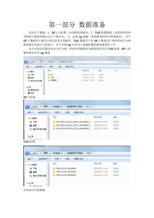
GF-1影像:TM8影像:甘肃县区矢量数据:第二部分GF-1影像预处理一.制作TM8基准影像1.波段融合打开ENVI软件,加载下载并解压后的TM8影像的3、4、5波段:File→Open Image File →可按shift或ctrl键选中3、4、5波段→Basic Tools→Layer Stacking→→Import File→选择3、4、5波段→OK→再次选择3、4、5波段→选择存放在Memory→OK→结果文件如下→Load RGB这幅影像即543波段融合后显示的TM8标准假彩色影像,它的突出特点是植被,包括农作物在影像上以红色显示,但具体红色的深浅、亮度、纹理等则取决于植被的类别、生长状况等,不同种类农作物的显示其红色的色调也存在差异。
→(以Imageing格式导出这景影像)File→Save Image As→Image File→选择输出类型为ERDAS IMAGINE→选择保存路径和影像文件名→OK2.重复上述操作,分别将覆盖研究区的其他两景TM8影像的345波段融合并保存ERDAS IMAGEINE格式的影像。
3.拼接覆盖研究县区市的3景TM8影像打开上述两步所导出的3景影像:File→Open Image FileMap→Mosaicking→GeoreferencedImport→Import Files→选择需要拼接的3景影像→→OK→→分别右键点击3幅影像→Edit Entry→→将Background See Through Data Value to Ignore设置为0→→OK→File→Apply→→Memory→OK→Load RGB加载拼接影像→File→Save Image As→Image File→选择输出类型为ERDAS IMAGINE→选择保存路径和影像文件名二.几何校正GF-1影像1.分别加载第一幅待校正的GF-1影像和拼接的基准影像:File→Open Image File→→选中RGB Color→GF-1影像按432波段和成,即把4波段赋以红色(R),3波段赋以绿色(G),2波段赋以蓝色(B)→→点击Display #1→New Display→将TM8基准影像按波段顺序RGB彩色合成,即band1赋以R,band2赋以G,band3赋以B→Map→Registration→Select GCPs:Image to Image→→根据情况选择基准影像(TM8影像)和变形影像即待校正影像(GF-1影像)的显示编号,注意不要选错,以免导致数据错误→→右键点击影像→Geographic Link→→将off转为on,打开地理连接→→找到两幅影像上的同名点,即在两幅影像上相同位置的点→选定后将地理连接关闭→→在Zoom窗口中精确定位到象元精度→→选好确定后→Add Point→→Show List查看所选取控制点的信息→→选择同名点时,应注意尽量避免选择状态时常变动的地物,如水域边界、农田边角拐点等,因为水域水位以及农田边界不确定性和不稳定性,很容易造成人为控制误差,应尽量选择状态相对稳定的地物作为同名点,如道路交叉口,小型建筑物(如桥梁)等。
ARCGIS常用操作
1. 要素的剪切与延伸实用工具TASK 任务栏Extend/Trim feature 剪切所得内容与你画线的方向有关。
2. 自动捕捉跟踪工具点击Editor工具栏中Snapping来打开Snapping Environment对话框捕捉设置中有3个选项, vertex edge end 分别是节点、终点、和边,选择end应该会捕捉端点3. 图斑面积计算及长度计算应用工具CALCULATE AREA 或者使用VBA代码实现新建字段并开启Advanced 写入代码,面积计算:Dim Output as doubleDim pArea as IareaSet pArea = [shape]在最后的一个空格里面写入代码(即:字段名)pArea.area长度计算:Dim Output as doubleDim pCurve as ICurveSet pCurve = [shape]Output = pCurve.Length4. 剪切图斑T ask任务栏cut polygon feature工具,需要sketch工具画线辅助完成5. 配准工具Spatial Adjustment 工具需要注意先要set adjustment data 然后配准6. 影像校正Georeferncing工具7. 要素变形T ask 工具条中的reshape feature 配合sketch工具8. 添加节点Modify feature 在需要加点的地方右键单击insert vertex也可单击右键选择properties 打开edit sketch properties对话框,在坐标点位置右键插入节点9. 共享多边形生成Auto-complete polygon 工具生成共享边的多边形,配合snapping environment更好。
10. 画岛图1).使用任务栏中的sketch工具,当画完外面的一圈时,右键选择finish part 然后画中间的部分再右键finish sketch2).分别画连个图斑然后应用Editor 工具栏中的工具先intersect(图斑重叠的地方创建一个新的图斑)然后Clip(剪切)即可。
栅格计算器使用

栅格计算器(Raster Calculator)栅格计算机是一种空间分析函数工具,可以输入地图代数表达式,使用运算符和函数来做数学计算,建立选择查询,或键入地图代数语法。
可输入栅格数据、栅格图层、coverages,shapefiles,表格,常数,数值。
在“空间分析”(Spatial Analyst)下拉菜单中可找到。
栅格计算机使用“运算符”和“函数”来执行任务。
【函数(functions)】1.函数执行专门任务,如由海拔(elevation)计算边坡(slope),通常返回的是数值。
栅格计算机提供算术函数、三角函数、指数对数函数以及幂函数。
2.应用实例(实习数据:landuse,elevation):①对landuse每个栅格取平方(平方后=sqr([landuse]))②栅格数据空间分析函数:用山体阴影函数(hillshade)作用于elevation图层得到立体形态(立体图=hillshade([elevation]))【运算符(operators)】运算符的使用通常与科学计算器相类似。
栅格计算器提供算术运算符、关系运算符以及布尔运算符。
①算术运算符(+,-,*,/)。
加减乘除四则运算。
对相应空间位置上的栅格单元进行算术运算,可用于土地利用价值的评价。
规则:整数的运算是整数;浮点数与整数的运算得到的结果是浮点数;Mod运算符的结果是整数(实习数据:landuse):(1)选择出耕地栅格(耕地=[landuse] == 5),选择出森林栅格(森林=[landuse] == 6);(2)将耕地和森林栅格相加(绿地=[耕地] + [森林]),又例如创建三个火灾危险性栅格,互相叠加显得出新的全面危险分析栅格。
(3)用来转换值从一个测量到另一个(例如,x英尺= 0.3048米)。
②关系运算符(>,<,==,<=,>=,<>)。
建立逻辑测试,返回真假值(true (1),false (0))(实习数据:landuse,mask,elevation)。
Envi软件界面中英文对比参考表

DarkSubtraction(暗像元采集)
确定暗像元的像素值
EFFORT Polishing(EFFORT波谱打磨)
AnomalyDetection Workflow(异常检测流程化工具)
启动异常检测流程化工具
RXAnomaly Detection(RX异常检测)
启动RX异常检测工具
BandRatio工具箱及其功能
BandMath(波段运算)
自定义简单或复杂的处理程序进行波段间运算
BandRatios(波段比值)
波段之间的比值运算
ChangeDetection工具箱及其功能
ChangeDetection Difference Map(直接比较法生成变化图像)
对两幅图像直接生成变化图像
ChangeDetection Statistics(分类后处理变化统计)
对两个分类后的数据生成土地利用转移矩阵
ImageChange Workflow(直接比较法流程化工具)
蝴蝶结校正工具,对GLT重投影
SuperGLT Georeference(超级GLT几何校正)
使用超级GLT文件进行几何校正
SuperIGM Georeference(超级IGM几何校正)
使用超级IGM文件进行几何校正
ImageSharpening工具箱及其功能
CNSpectral Sharping(CN融合)
RADARAT(RADARAT处理工具)
RADARSAT数据处理工具,包括斜地距转换、生成入射角图像、查看元数据文件等
SIR-C(SIR-C处理工具)
SIR-C数据处理工具,如多视、极化信号等
SaveCOSMO-SkyMed Metadata toXML(将CSM元数据保存为XML文件)
GIS中raster工具介绍
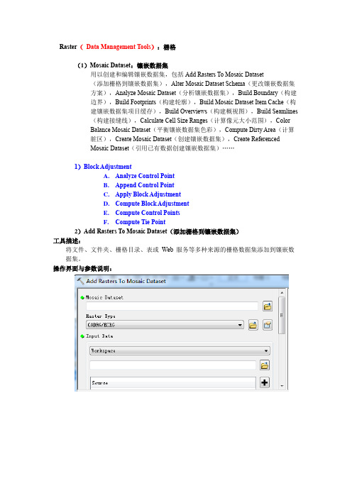
Raster(Data Management Tools):栅格(1)Mosaic Dataset:镶嵌数据集用以创建和编辑镶嵌数据集,包括Add Rasters To Mosaic Dataset(添加栅格到镶嵌数据集),Alter Mosaic Dataset Schema(更改镶嵌数据集方案),Analyze Mosaic Dataset(分析镶嵌数据集),Build Boundary(构建边界),Build Footprints(构建轮廓),Build Mosaic Dataset Item Cache(构建镶嵌数据集项目缓存),Build Overviews(构建概视图),Build Seamlines(构建接缝线),Calculate Cell Size Ranges(计算像元大小范围),ColorBalance Mosaic Dataset(平衡镶嵌数据集色彩),Compute Dirty Area(计算脏区),Create Mosaic Dataset(创建镶嵌数据集),Create ReferencedMosaic Dataset(引用已有数据创建镶嵌数据集)……1)Block AdjustmentA.Analyze Control PointB.Append Control PointC.Apply Block Adjustmentpute Block Adjustmentpute Control Pointspute Tie Point2)Add Rasters To Mosaic Dataset(添加栅格到镶嵌数据集)工具描述:将文件、文件夹、栅格目录、表或Web 服务等多种来源的栅格数据集添加到镶嵌数据集。
操作界面与参数说明:(1)Mosaic Dataset(镶嵌数据集)要添加栅格的镶嵌数据集的路径和名称。
(2)Raster type(栅格类型):栅格类型对于影像产品来说是特定的。
海道测量海图术语

8.31
海图印刷chart printing
用光化学方法或电子出版技术将海图出版原图转印到纸张或其他材料上的过程。
注:修改GB/T 14477-2008的定义10.1。
8.32
四色印刷four color printing
用减色法三原色色料(黄、品红、青)及黑色色料进行印刷的工艺方法。
8.15
航海通告 notice tomariner
刊载有关航行安全事项和航海图书改正内容的定期出版物。
[GB/T 15315-2008,定义3.1]
8.16
改正通告 notice to mariner
时效性较长、需要据其对国家海事行政主管部门出版的航海图书进行改正的通告项目,也称改正通告项。
[JT/T 702-2019,定义3.1]
对海图符号的样式、尺寸、颜色以及注记和图廓整饰规格的统一规定。
8.20
海图注记lettering of chart
海图上表示海图要素的名称、意义和数量等属性的文字及数字的通称。
8.21
海图设计chart design
通过规划、实验确定新编海图的内容、形式及其生产技术流程的工作。
8.22
制图资料cartographic data
8.17
航标表list of light
记载助航标志信息的航海书表,内容一般包括航标的名称、位置、特征、灯质、信号、作用及其他工作信息等内容。
8.18
计算机辅助制图computer-aided cartography
通过计算机软硬件辅助人判断和完成特定制图功能的系统。
8.19
海图图式symbolandabbreviationonchart
GIS英语

现整理ArcGIS空间分析扩展模块涉及到术语(英汉对照)Altitude 高度,海拔,地平纬度Analysis extent 分析范围Analysis mask 分析掩码Arithmetic functions 算术函数Arithmetic operators 算术运算符Aspect 坡向Attribute table属性表Azimuth方位角,地平经度Barrier 界线、中断线、阻碍线Boolean Operators 逻辑运算符cell 单元(注:pixl 像元)cell size 单元大小cell statistics 单元统计continuous raster 连续栅格数据contour 等值线coordinate system坐标系统cost dataset 成本数据集cost weighted allcation 成本权重分配cost weighted direction 成本权重方向cost weighted distance 成本权重距离Density 密度Destination目的地Discrete raster 离散栅格数据feature 要素feature Dataset 要素数据集field 字段、域Focal functions 邻域函数Global functions全局函数Grid格网Hillshade山体阴影Histogram 直方图Interpolation 内插、插值Inverse Distance Weighted 反距离权重(插值)Kriging 克里格(插值)least-cost path 最低成本路径local functions局域函数Make permanent 生成永久文件Map Algebra 地图代数GIS英文词汇翻译GIS英文词汇翻译abscissa横坐标absolute accuracy绝对精度absolute coordinates绝对坐标absorption吸收abstraction抽取accuracy 精度across-track scanner跨径扫描仪active remote sensing主动遥感Add Data 添加数据address geocoding地址地理编码address locator地址定位器address matching地址匹配Advanced Very High Resolution Radiometer 高级甚高分辨率辐射仪agreement licensee 协议被许可人air station航摄站alidade照准仪along-track scanner沿径扫描仪alphanumeric grid字母数字网格视差立体图analog image模拟图像analysis mask分析掩模anisotropy各向异性antipode对跖点apogee远地点arc弧architecture架构archive档案argument参数arithmetic expressionaspatial data非空间数据aspect ratio纵横比astrolabe星盘atlas grid地图集网格atmospheric window大气窗口atomic clock原子钟attenuation衰减authentication身份验证author 作者autocorrelation自相关automated cartographyautomation scale自动化比例autovectorization自动矢量化axis轴azimuthal projection 方位投影backscatter后向散射band波段band ratio波段比band-pass filter带通滤波器bandwidth带宽bar scale比例尺(图形比例尺) base layer底层base station基站batch 批量batch geocoding批量地理编码batch processing批处理batch vectorization 批量矢量化bathymetric curve 等深线battleships grid战舰网格Bayesian statistics 贝叶斯统计bearing方位角Bézier curvebilinear interpolation双线性内插法binding绑定binomial distribution二项式分布biogeography生物地理学blind digitizing盲目数字化block group街区群block kriging块段克里金法bookmark 书签boolean 1.布尔数据类型; 2.布尔值Boolean operator布尔运算符boundary边界界线boundary monument界标boundary survey 边界测量bounding rectangle边界矩形Bowditch rule包狄法则break point 断点breakline断裂线browser 浏览器buffer area 缓冲区business logic 业务逻辑CAD 计算机辅助设计(computer-aided design) cadastral survey地籍测量cadastre地籍calibration 校准,定标callout line标注线camera station摄站capacity容量cardinal point方位基点cardinality基数Cartesian coordinate system 笛卡尔坐标系cartogram统计图cartographer制图员cartography制图学cartouche地图饰框catalog tree 目录树catchmentcategorical raster 类目栅格celestial sphere天球cell size栅格大小cells 栅格cellular automaton 元胞自动机census block人口普查区块census geography 人口普查地理学center 中心点centerline中心线centerpoint中点central meridian 中央子午线centroidchart 图表chi-square statistic卡方统计choropleth map面量图chroma色度chronometer天文钟circle圆circular variance圆方差civilian code民用码Clarke Belt克拉克带Clarke ellipsoid 克拉克椭球Clarke spheroid 克拉克椭球面clearinghouse(信息或服务)交换中心clinometric map坡度图code-phase GPS码相位GPScognitive map认知图coincident重叠cokriging协同克里金法command 命令command line 命令行compass north罗经北compass point罗经点compass rose罗经盘compass rule罗盘仪法则compression program 压缩程序computational geometry计算几何学conformal projection等角投影,保角投影,正形投影conformality保形性conic projection圆锥投影conjoint boundary共同边界constant azimuth恒定方位containment包含Content Standard for Digital Geospatial Metadata 数字地理空间元数据的内容标准continuous raster连续栅格contour 等高线,等值线contour drawings 等高线图,等值线图contour interval等高线间距,等值线间距contour line等高线,等值线contour tagging等高线标注,等值线标注contrast ratio对比度contrast stretch对比度扩展convergence angle收敛角conversion转换convex hull凸包coordinate geometry坐标几何学coordinate system??坐标系??coordinated universal time 协调世界时correlation相关corridor analysis走廊分析, 廊道分析county subdivision县级分区covariance协方差coverage1.覆盖面;2.ESRI图层cracking裂化Crandall rule Crandall 法则crop guide裁切参考线crop marks裁切标记cross correlation交叉相关cross covariance交叉协方差cross tabulation 交叉表cross validation交叉验证cross variogram交叉变差函数cubic convolution立方卷积插值法cultural feature人文要素cultural geography文化地理学curb approach路边通道curve fitting曲线拟合customizations 自定义cylindrical projection圆柱投影dangle length悬线长度dangle tolerancedangling arc 悬弧dasymetric mapping分区制图(多用于人口数据)data management 数据管理data table 数据表dataset 数据集datum基准DBMS 数据库管理系统(data-base management system) dead reckoning航位推测法declination 1.偏角;2.磁偏角degree slope坡度Delaunay triangulation德洛内三角delimiter分隔符demography人口统计学densify增密密度计density slicing密度分割deploy 部署或安装(硬件、软件等)depression contour洼地等高线depth contour等深线depth curve深度曲线descending node降交点desire-line analysis期望线分析desktop 桌面desktop clients 桌面客户端Desktop GIS 桌面GIS destination目标determinate flow direction确定性流向deterministic model确定性模型detrending趋势分离developable surface可展表面developer 开发人员development environment开发环境diazo process重氮晒印法difference 差异differential correction差分校正differential Global Positioning System差分全球定位系统diffusion扩散Digital elevation model 数字高程模型Digital Geographic Information Exchange Standard 数字化地理信息交换标准Digital Geographic Information Working Group 数字地理信息工作组digital image processing数字图像处理digital line graph数字线划图digital nautical chart数字海图digital number数值digital orthophoto quadrangle数字正射影像图digital orthophoto quarter quadrangle数字正射影像象限图digital raster graphic数字栅格图digital terrain elevation data??数字地形高程数据??digital terrain model数字地形模型digitizer数字化仪Dijkstra’s algorithm狄捷斯特拉算法dilution of precision精度衰减因子dimension 尺寸,维,维度directed network flow有向网络流direction 方向Dirichlet tessellation荻瑞斯莱特镶嵌,荻瑞斯莱特剖分discovery 发现discrete data离散数据discrete digitizing离散数字化discrete raster离散栅格数据displacement 位移display scale显示比例display unit显示单位dissemination 扩散,传播distance距离distance decay 距离衰减distance unit 距离单位distortion变形district 地区dithering抖动diurnal arc周日弧docking停靠Doppler shift 多普勒位移Doppler-aided GPS多普勒辅助GPSdot density map点密度图dot distribution map点分布图double precision双精度double-coordinate precision 双坐标精度Douglas-Peucker algorithm 道格拉斯-普克算法downstream下游drafting描绘draping叠加,披盖drift漂移drive-time area驾车时间区drop-down list 下拉列表drum scanner鼓式扫描仪Dual Independent Map Encoding 双重独立坐标地图编码dynamic zoom 动态缩放easting东距eccentricity偏心率ecliptic黄道edge边edgematching边缘匹配elastic transformation弹性变形electromagnetic spectrum 电磁光谱electronic atlas电子地图集electronic navigational chart 电子航海图element元素elevation guide高程指南ellipsoid 椭球体ellipticity椭圆率end offset末端偏移endpoint 端点enterprise GIS企业级GISentity objects 实体对象envelope包络矩形environmental model环境模型ephemeris星历表equal competition area平等竞争区equal-area classification等积分类equal-area projection等积投影equal-interval classification 等距分类equatorial plane 赤道面equidistant projection等距投影ESRI Data ESRI 数据event事件exponent指数export导出exposure stationexpression表达式extended 扩展extent范围extrapolation外插法extrude 拉伸extrusion拉伸face平面false easting东移假定值false northing北移假定值feature 要素Federal Geographic Data Committee 美国联邦地理数据委员会field 字段fill 填充圆角filter过滤器,过滤flow direction流向flow map流向图focal analysis 邻域分析focal functions 邻域函数form 地形,形式fractal分形framework 框架frequency频率from-node起点Full Extent完整范围fuzzy boundary模糊边界fuzzy classification模糊分类fuzzy set模糊集合fuzzy tolerance模糊容差Gauss-Krüger projection高斯-克吕格投影generalization概化,(数据库或地图的)综合技术geocentric coordinate system??地心坐标系??geocode地理编码geocoding 地理编码geocomputation地理计算geodata 地理数据geodatabase 地理数据库geodatabase data model地理数据库数据模型geodataset地理数据集geodesic测地线geodetic 测地学geographic coordinate system 地理坐标系geographic information science地理信息学Geographic Information System (GIS) 地理信息系统(GIS) geography地理学geography level地理等级Geography Markup Language地理标记语言geoid大地水准面geoid-ellipsoid separation大地水准面-地球椭球面分离geolocation几何定位geometric coincidence几何重叠geometric correction几何校正geometric dilution of precision 几何精度衰减因子geometric network几何网络geometric transformation几何变换geometry 几何学geomorphology地貌学geoprocessing 地理处理georectification地理校正georeference 地理参考georeferencing地理参考georelational data model地理相关数据模型geospatial data地理空间数据geospatial data clearinghouse 地理空间数据交换中心geospatial technology地理空间技术geospecific model地学相关模型geostationary对地静止geostatistics地理统计学geosynchronous对地同步geotypical model典型地理模型GIS地理信息系统GIScience地理信息学Global Navigation Satellite System 全球卫星导航系统Global Positioning System全球定位系统global spatial data infrastructure全球空间数据基础架构glyph字形gnomonic projection日晷投影Go to XY 转至XYGPS全球定位系统grad梯度(原英文单词可能有误) gradian梯度gradient坡度,斜率graticule经纬网gravimeter重力计gravimetric geodesy大地重力学gravity model引力模型gray scale灰度great circle大圆Greenwich mean time 格林尼治标准时间Greenwich meridian格林尼治子午线grid 网格grid cell网格单元ground 大地,地面GUI GUI (图形用户界面) hachure晕渲线Hamiltonian circuit汉密尔顿回路Hamiltonian path汉密尔顿路径height高度Helmert transformation线性正形变换hemisphere半球heuristic试探算法,试探函数hexadecimal十六进制High Accuracy Reference Network高精度基准网High Precision Geodetic Network高精度大地基准网hillshading 坡面阴影,晕渲histogram equalization直方图均衡化hole孔洞horizontal geodetic datum 水平大地基准human geography人文地理学hydrography水文地理学hydrologic cycle水循环hydrology水文学hyperlink 超链接hypsography测高学,地势图hypsometric curve等高线hypsometric map地势图hypsometry测高法Identify 识别identity link一致性链接illumination照度image coordinate图像坐标image data图像数据image division图像除法运算image scale图像比例尺image space图像空间imager成像仪impedance阻抗import导入IMS IMS (网络地图服务器,Internet Map Server) incident energy入射能量index索引index map索引图infrared scanner红外扫描仪infrastructure基础设施inset map插图instance 实例instantiation实例化integer data整数型数据integration 集成intensity亮度interactive vectorization 交互矢量化interchange format交换格式interferogram干涉图intermediate data中间数据international date line 国际日期变更线international meridian 国际子午线International Organization for Standardization 国际标准化组织interpolation内插法interrupted projection分瓣投影intrinsic stationarity内在稳态inverse distance weighted interpolation反距离加权内插法irregular triangular mesh不规则三角网irregular triangular surface model不规则三角面模型isanomal等地平isarithm等数线isobar等压线isochrone等时线isohyet等雨量线isolines 等值线isometric line等容线isopleth等值线isotherm等温线isotropy无向性iteration 迭代iterative procedure迭代过程jaggies 锯齿Jenks’ optimization詹克斯优化joint operations graphic联合作战地图junction element交点元素kernel内核key identifier 主标识符kinematic positioning动态定位knockout分离区(信号或通讯的中断) known point已知点Kohonen map柯霍南图kriging克里金法label标签labeling 标注lag间隔land cover土地覆盖land information system土地信息系统land use土地利用landform地形landmark地标Landsat陆地卫星landscape ecology景观生态学large scale大比例尺lattice点阵面layers 层layout布局least squares 最小二乘法level水平leveling水平测量library 类库license 许可证license agreement 许可协议licensee 被许可人lidar激光雷达line线line feature线要素line of sight视线line simplification线条简化line smoothing线条平滑linear dimension线性尺寸linear feature线性要素linear interpolation线性内插法linear referencing线性参考(用于交通GIS) linear unit线性单位localization本地化location query位置查询location-allocation位置分配location-based services 基于位置的服务logarithm对数logical network逻辑网络loop traverse闭合导线loxodrome恒向线magnetic bearing磁方位magnetometer磁力计majority resampling 多数重新采样map algebra地图代数map collar地图边缘map display地图显示map document地图文档map element地图元素map extent地图范围map feature 地图要素map generalization 地图概化,地图综合map projection地图投影map query地图查询map readingmap scale地图比例尺map series地图系列map service地图服务map sheet地图map style地图风格map unit地图单位mapping 制图mask掩模mass point散点mathematical operator 数学运算符matrix矩阵mean center平均中心mean sea level平均海平面mean stationarity平均稳态Measure 测量measure valuemeasurement residual测量残差median中间数median center平均中心mental map意境图meridian子午线metadata 元数据metropolitan statistical area 大都市统计区microdensitometer测微密度计micrometer1.测微计;2.微米minimum bounding rectangle 最小边界矩形minimum map unit最小地图单位minor axis短轴misclosure闭合差Mitigation 减轻mobile clients 移动客户端Mobile GIS移动GISmodel模型monument标石morphology形态学mosaic镶嵌图mud pit 泥浆池multichannel receiver多频道接收器multidimensional data多维数据multipart feature多部分要素multipatch feature带纹理要素multiplexing channel receiver多路复用频道接收器multipoint feature多点要素multispectral scanner多光谱扫描仪multivariate analysis多元分析My Places 我的位置National Spatial Data Infrastructure美国国家空间数据基础设施natural breaks classification??自然分类??navigation导航NavstarNavstar (美国国防部全球定位系统联合服务项目)neighborhood statistics邻域统计networked 联网node节点noncoterminous polygon 非相连多边形nonversioned 非版本normal distribution 正态分布normal probability distribution正态概率分布northing北距oblate ellipsoid扁椭球体oblate spheroid扁椭球面offset 偏移oill spill 溢油(原文oill 应为Oil)Online GIS 在线GISOpen Geodata Interoperability Specification开放地理空间数据互操作规范Open Geospatial Consortium开放地理空间协会open traverse不闭合导线OpenGIS ConsortiumOpenGIS 协会OpenLSOpenLS (OpenGIS所包含的Open Location Service) operand运算数operator运算符optical center光学中心ordinal data序数数据ordinary kriging普通克里金法ordinate纵坐标Ordnance Survey英国陆地测量局orientation方向origin point 原点orthogonal offset正交偏移orthographic正交orthomorphic正形orthophoto 正射影像orthophotograph正射影像orthophotoquad无等高线正射影像orthophotoscope正射投影仪orthorectification 正射校正outlier 异常值outline vectorization轮廓矢量化output data 输出数据overlay重叠overprinting套印overview map总览图pan平移panchromatic sharpening 全色锐化parallax bar视差尺parameter参数parametric curve参数曲线passive remote sensing被动遥感passive sensors被动传感器path路径pathfinding路径搜寻peak山峰percent slope斜率perigee近地点persistence持久性photogeology摄影地质学photogrammetry摄影测量学photomap摄影地图photometer光度计physical geography自然地理学pit洼地,山谷placement 放置planar coordinate system 平面坐标系planar enforcement平面强化planarize平面化plane平面planimetric map平面图planimetric shift平面位移platform平台plot 绘图plotter绘图仪plumb line铅垂线。
ARCGIS工具中英对照总结

Analysis Tool: 分析工具Extract 提取Clip 剪切Select 选择Split 拆分Table Select 表选择Overlay 叠加分析Erase 擦除Identity 查看Intersect 相交Symmetrical Difference 对称差Union 联合Update 更新Proximity 邻域分析Buffer 缓冲区Multiple Ring Buffer 多环缓冲区Near 临近Point Distance 点距离Statistics 统计表Frequency 频度Summary Statistics 总结统计Cartography Tool: 绘图工具Masking Tools 掩模工具Cul-De-Sac Masks Cul-De-Sac 掩模Feature Outline Masks 要素轮廓线掩模Intersecting Layers Masks 相交图层掩模Conversion Tool: 转换工具From Raster 从删格到... Raster to ASCII 删格到ASCII Raster to Float 删格到浮点Raster to Point 删格到点Raster to Polygon 删格到面Raster to Polyline 删格到线ArcGIS 9 ArcToolbox 中英文对照表① 3D Analyst Tools 三维分析工具Conversion 转换TIN 三角计算TIN 域值TIN 多边形标志TIN 节点TIN 边TIN 到栅格栅格转TINFunctional Surface 表面功能插值形状表面体积表面点表面长度视线Raster Interpolation 栅格修补克里金地形到栅格曲线拟合用文件地形到栅格自然邻域趋势距离权重倒数栅格计算Raster Math乘减加取整浮点除Raster Reclass 栅格重分类切片查找用ASCII 文件重分类用表重分类重分类Raster Surface 栅格表面坡向坡度填/挖山影曲率等高线等高线列表观察点视阈Terrain 地形地势地带领域TIN Creation 创建TIN编辑TIN TIN SurfaceTIN 创建TIN 表面TIN 坡度TIN 方位TIN 等高线多边形插值成多个面② Analysis Tool: 分析工具Extract Clip Select Split提取剪切选择拆分Table Select 表选择Overlay Erase叠加分析擦除Identity 查看Intersect 相交Symmetrical DifferenceUnion 联合对称差Update Proximity Buffer更新邻域分析缓冲区Multiple Ring Buffer 多环缓冲区Near 临近Point Distance Statistics Frequency点距离统计表频度Summary Statistics 总结统计③ Cartography Tool: 绘图工具Masking Tools 掩模工具Cul-De-Sac Masks Cul-De-Sac 掩模Feature Outline Masks 要素轮廓线掩模Intersecting Layers Masks 相交图层掩模④ Conversion Tool: 转换工具From Raster Raster to ASCII Raster to Float Raster to Point Raster to Polygon Raster to PolylineTo CAD从删格到...删格到ASCII删格到浮点删格到点删格到面删格到线到CADAdd CAD Fields Create CAD XData Export to CAD Set CAD AliasTo Coverage添加CAD 字段创建CAD 扩展实体数据导出到CAD设置CAD 别名到CoverageFeature Class To Coverage 要素类到CoverageTo dBASE 到dBASETable to dBASE [multiple] 表到dBASETo GeodatabaseFeature Class To Feature Class 要素类到要素类Feature Class to Geodatabase [multiple] 要素类到Geodatabase Import CAD Annotation 导入CAD 注记Import Coverage Annotation 导入Coverage 注记Import from CAD 从CAD 导入Raster To Geodatabase[multiple] Table to Geodatabase[multiple]栅格到Geodatabase 表到GeodatabaseTable To Table To Raster ASCII to Raster表到表到栅格ASCII 到栅格DEM to Raster Feature to Raster Float to RasterDEM 到栅格要素到栅格浮点到栅格Raster To Other Format 栅格到其他格式To Shapefile 到ShapefileFeature Class To Shapefile 要素类到Shapefile⑤Data Interoperability Tools 数据互转工具⑥ Data Management Tools 数据管理工具Database数据库Compact 紧凑Compress 压缩Disconnected Editing 分离编辑Check In 检入Check In From Delta 从增量中检入Check Out Export To Delta Domains检出导出增量值域Add Coded Value To Domain 添加编码值到值域Assign Domain To Field 赋值值域到字段Create Domain 创建值域Delete Coded Value From Domain 从值域中删除编码值Delete Domain Domain To Table 删除值域值域到表Remove Domain From Field 从字段删除值域Set Value For Range Domain 为范围值域设置值Table To Domain Feature class表到值域要素类Append Annotation Feature Classes 追加注记要素类Calculate Default Cluster Tolerance 计算缺省容限值Calculate Default Spatial Grid Index 计算缺省空间格网索引Integrate 整合Update Annotation Feature Class 更新标记要素类创建要素类Features创建要素类要素Add XY Coordinates Check Geometry Copy Features Delete Features添加XY 坐标检查几何形状复制要素删除要素Feature Envelope to Polygon 要素封装到多边形Feature To Line Feature To Point Feature To Polygon 要素到线要素到点要素到多边形Feature Vertices To Points 要素定点到点Multipart To Singlepart 多部份到单部份Polygon To Line Repair Geometry Split Line At Vertices 多边形到线修改集合形状在定点拆分线Fields Add Field 字段添加字段Assign Default To Field 设置缺省到字段Calculate Field Delete Field GeneralCopyDelete Rename Select Data追加Generalization计算字段删除字段普通复制删除重命名选择数据追加普通Aggregate Polygons 会萃多边形Collapse Dual Lines To Centerline 分解双线到中心线Dissolve Eliminate Smooth Line Simplify Building 融合消除平滑线简化建造物Simplify Line Or Polygon 简化线或者多边形Indexes 索引Add Attribute Index Add Spatial Index Remove Attribute Index Remove Spatial Index 添加属性索引添加空间索引删除属性索引删除空间索引Find Conflicts Drop Index Index Item查找冲突删除索引索引项Add Item Drop Item Joins添加项删除项连接Join Info Tables 连接Info 表Projections Define Projection Project Transform 投影定义投影投影变换Renumber Nodes 重新计数节点Update IDs Tolerances Tolerance Topology Build更新ID 容差容差拓扑构建Clean CleanCreate Labels 创建标注VPF Tile Topology VPF 图块拓扑Workspace Management 工作空间管理Create Coverage 创建CoverageJoinsAdd Join Remove Join 连接添加连接删除连接Layers and Table Views 图层和表的查看Make Query Table 制作查询表Make Raster Catalog Layer 制作栅格目录图层Make Raster Layer Make XY Event Layer Save To Layer File Select Layer By Attribute Select Layer By Location制作栅格图层制作XY 事件图层保存成图层文件通过属性选择通过位置选择制作表视图制作要素图层制作表视图制作要素图层Projections and Transformations 投影和转换Feature Batch Project 要素批量投影Project创建空间参考投影创建空间参考Raster Flip Mirror栅格翻转镜像Project Raster Rescale投影栅格重建比例Rotate Shift旋转偏移War 翘曲Define Projection 定义投影Raster 栅格Batch Build Pyramids 批量建立金字塔Batch Calculate Statistics 批量计算统计表Build Pyramids 建立金字塔Calculate Statistics 计算统计表Clip 剪切Composite Bands 组合波段Copy Raster 复制栅格Copy Raster Catalog Items 复制栅格目录项Create Raster Catalog 创建栅格目录Delete Raster Catalog Items 删除栅格目录项Mosaic To New Raster 镶嵌到新的栅格Resample创建栅格数据集重采样创建栅格数据集镶嵌镶嵌Relationship Classes 关系类Create Relationship Class 创建关系类Table To Relationship Class 表到关系类Subtypes 子类型Add Subtype 添加子类型Remove Subtype Set Default Subtype Set Subtype Field 删除子类型设置缺省子类型设置子类型字段Table 表Analyze 分析Change Privileges Copy Rows Delete RowsGet CountPivot Table改变权限复制行删除行获得数目关联表创建表Topology创建表拓扑Add Feature Class To Topology 添加要素类型到拓扑Add Rule To Topology 添加规则到拓扑Create Topology 创建拓扑Remove Feature Class From Topology 从拓扑删除要素类Remove Rule From Topology 从拓扑中删除规则Set Cluster Tolerance Validate Topology Versions 版本设置簇容限值教验拓扑Alter Version Create Version Delete Version Post Version Reconcile Version 改变版本创建版本删除版本提交版本协调版本Register As Versioned 注册版本Unregister As Versioned 取销注册Workspace 工作空间Create ArcInfo Workspace Create Feature Dataset Create FolderCreate Personal GDB创建ArcInfo 工作空间创建要素数据集创建文件夹创建个人GeodatabaseGeocoding Tools 地理编码工具Automate Geocoding Indexes 自动生成地理编码索引Create Address Locator 创建地址定位器Deautomate Geocoding Indexes 取销自动生成地理编码索引Delete Address Locator Geocode Addresses Rebuild Geocoding Indexes删除地址定位器地理编码地址重建地理编码索引Standardize Addresses 标准化地址⑦ Geocoding Tools 地理编码工具⑧ Geostatistical Analyst Tools 地理统计分析工具Geostatistical Layer To Grid 导出地理统计图层到Grid⑨ Linear Referencing Tools 线性参考工具Calibrate Routes Create Routes校准路径创建路径Dissolve Route Events 融合路径事件Locate Features Along Routes 沿路径定位要素Make Route Event Layer 制作路径事件图层Overlay Route Events Transform Route Events 叠加路径事件转换路径事件⑩ Spatial Analyst Tools 空间分析工具Conditional 拾取条件设空Density核密度点密度线密度Distance代价分配代价回联代价距离代价路径欧几里德分配欧几里德方向欧几里德距离走廊路径距离路径距离分配路径距离回联Extraction提取值到点根据属性提取用圆提取用多边形提取用掩模提取用点提取条件密度距离提取采样Generalization 区块组合多数过滤收缩消蚀细化聚合膨胀边界清理Groundwater 粒子跟踪达西流达西速率透水层Hydrology下陷点填充捕捉汇流点河流分级河流到要素河留连接流向流域流程盆地积累流量Interpolation 克里金地形到栅格曲线拟合普通地下水水文添补用文件地形到栅格自然邻域趋势距离权重倒数Local 本地像素统计分级合成大于频率小于频率普及度最低位置等于频率Map Algebra 地图代数单输出地图代数多输出地图代数Math Bitwise 数学计算为运算位与位右移位否位异或者左位移按位或者Logical 逻辑运算不等于为空大于大于等于小于小于等于测试等于组合与组合异或者组合或者逻辑与逻辑否逻辑异或者逻辑或者Trigonometric 三角函数ATan2余弦双曲余弦双曲正切双曲正弦反余弦反双曲余弦反双曲正切反双曲正弦反正切反正弦正切正弦10 的对数10 的指数2 的对数2 的指数上取整下取整乘减加取整否平方平方根指数整除浮点绝对值自然对数自然指数除MultivariateIsocluster主成份创建特征多元多变量最大似然性分类波段组统计类概率系统树图功能编辑署名函数Neighborhood 块统计点统计焦点流焦点统计线统计过滤Overlay加权叠加邻域叠加Raster Creation创建常量栅格创建正态栅格栅格创建创建随机栅格Reclass切片查找重分类用ASCII 文件重分类用表重分类重分类Surface 表面坡向坡度填/挖山影曲率等高线等高线列表观察点视阈Zonal 区域区域几何区域几何到表区域填充区域统计区域统计到表面积制表○11 Spatial Statistics Tools 空间统计工具Analyzing Patterns 分析模型Average Nearest Neighbor 平均邻近邻居High/Low Clustering[Getis-Ord General G]高/低聚类Spatial Autocorrelation [Morans I] 空间自相关Mapping Clusters 绘制群体Cluster and Outlier Analysis 群体和群外要素分析Cluster/Outlier Analysis with Rendering 带渲染群体和群外要素分析Hot Spot Analysis [Getis-Ord Gi*] 热点分析Hot Spot Analysis with Rendering 带渲染热点分析Measuring Geographic Distributions 测量地理分布Central Feature Directional Distribution Linear Directional Mean Mean Center Standard Distance中心要素定向分布平均线方向平均中心标准间隔距离Utilities 实用工具Calculate Areas Collect Events计算面积采集事件Collect Events with Rendering 带渲染采集事件Count Rendering 计算渲染Export Feature Attribute to Ascii 导出要素表到Ascii 文本Z Score RenderineCoverage Tool: Coverage 覆盖、覆盖范围工具Point Distance Point Node Thiessen Conversion From Coverage Export To DLG点距离点到结点泰森近似多边形转换从Coverage到DLGExport To Interchange File 到Interchange 文件Export To S57 Export To SETS Export To VPF UngenerateTo Coverage到S57到SETS到VPF取销生成到CoverageAdvanced Tiger Conversion 高级Tiger 转换Basic Tiger Conversion 基本Tiger 转换Generate 生成Import From DLG 从DLG 导入Import From Interchange File 从Interchange 文件导入Import From S57 Import From SETS Imort From VPF Data Management从S57 导入从SETS 导入从VPF 导入数据管理Aggregate Append 集合追加Composite Features 要素合成Line Coverage To Region 线Coverage 到区域Line Coverage To Route 线Coverage 到路径Polygon Coverage To Region 多边形Coverage 到区域Region To Polygon Coverage 区域到多边形Coverage。
土地利用程度指数计算公式
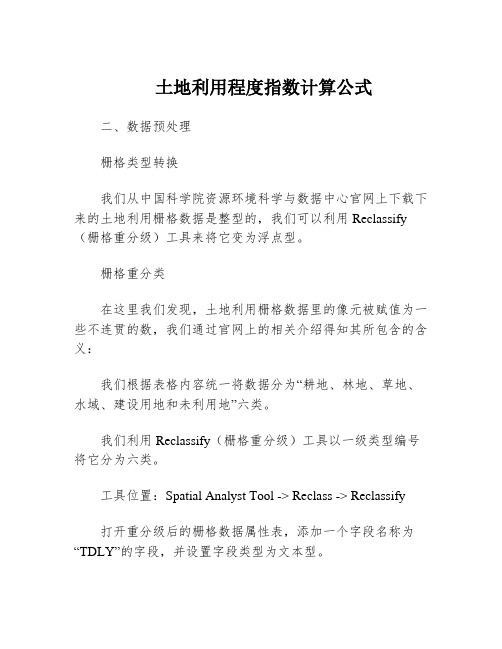
土地利用程度指数计算公式二、数据预处理栅格类型转换我们从中国科学院资源环境科学与数据中心官网上下载下来的土地利用栅格数据是整型的,我们可以利用Reclassify (栅格重分级)工具来将它变为浮点型。
栅格重分类在这里我们发现,土地利用栅格数据里的像元被赋值为一些不连贯的数,我们通过官网上的相关介绍得知其所包含的含义:我们根据表格内容统一将数据分为“耕地、林地、草地、水域、建设用地和未利用地”六类。
我们利用Reclassify(栅格重分级)工具以一级类型编号将它分为六类。
工具位置:Spatial Analyst Tool -> Reclass -> Reclassify打开重分级后的栅格数据属性表,添加一个字段名称为“TDLY”的字段,并设置字段类型为文本型。
键入土地利用类型。
我们对2000年的土地利用栅格数据进行同样的预处理操作。
三、土地利用动态度土地利用动态度模型可定量地反映区域内土地利用数量的变化速度,对预测未来土地利用变化趋势有积极作用,是相关研究常用的分析方法之一。
土地利用动态度可分为单一土地利用动态度和综合土地利用动态度。
单一土地利用动态度单一土地利用动态度反映的是一定时间范围内,研究区某种土地利用类型面积变化的速率,侧重于分析各土地利用类型的变化情况。
其计算公式为:其中K为研究期内某种土地利用类型的动态度,即年变化率;Ui、Uj分别为研究初期及末期某种土地类型的面积;T 为研究时段长度。
综合土地利用动态度综合土地利用动态度描述的是整个区域土地利用变化的总体速度, 可用于土地利用动态变化的区域差异研究。
其计算公式为:其中,L为研究初期第i类土地利用类型的面积;Ui、Uj分别为研究初期及末期某种土地类型的面积;n为土地类型数(n=1,2,3,...),T为研究时段长度。
当T设定为年时,Lc的值就是该研究区土地利用年变化率。
四、土地利用程度综合指数土地利用程度综合指数是反应人类对土地开发利用的程度,是衡量区域土地利用深度和广度的重要指标。
ARCGIS中提取坡位方法
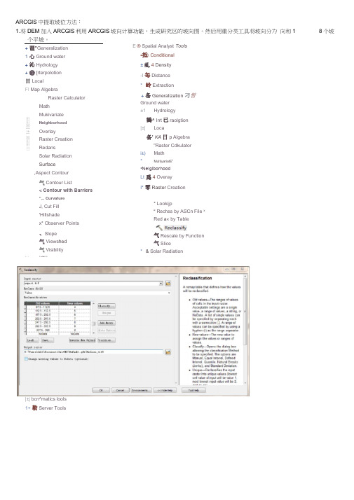
ARCGIS中提取坡位方法:1.将DEM加入ARCGIS利用ARCGIS坡向计算功能,生成研究区的坡向图。
然后用重分类工具将坡向分为向和1个平坡。
+ 琶"Generalization1 心Ground water+ 沁Hydrology+ ❺[rterpolotion田LocalFl Map AlgebraRaster CalculatorMathMukivariateNeighborhoodOverlayRaster CreationRedansSolar RadiationSurface,Aspect Contour气Contour List< Contour with Barriers"... CurvatureJ, Cut Fill'Hillshadex* Observer Points、Slope气Views hed气Visibility|±j bcn^matics lools1+ 勒Server Tools E ® Spatial Analyst Tools•抵\ Conditional±虬4 Density-I 毎Distance* 岭Extraction+ 备Generalization 刁瞥Ground water±1 Hydrology鶴^ Irrt已raolgtion|±| Loca备’ KA日p Algebra"Raster Cdkulatori±) Math* MultiyariatE1•NeigiborhoodLt 爲4 OverayI* 零Raster Creation* Lookijp“ Rechss by ASCn File xRed a« by Table气Rescale by Function气Slice* & Solar Radiation8个坡田田国[±1国田田日J~~I 7 J-i BI iTil图1坡向重分类图3坡面高程的最大、最小值计算4.用raster calculator计算每个坡面上、中、下坡位的临界值,以及研究区各坡面的坡位,其中 1■ 2汁帕心E 百曲 .hlerh -^37.3 MKH二 B ASTGrM_W5 LE12SGjmg if^JP * . E 环勺沪 r Afeltwlbcr 田I 团I □' BixT(油冋・ ■ ¥0 » «^i Tndi Q :Arb^pracphy loc s 0 5nwFeri ' □ols • % Ltf«l ■暑 Ffcw GPt -龟 Freffl IL From -«Mte-r A., (tarter 他尼5 % lUAr lu Aaffi %站ter to 阳卅 % 帕 冷b0M X 貼rrttr to pD^lhC * .貼fte*r Ta Video hm 训馬 昭列皿口Ta CAD Ta Ccliada Tc Ca«-ar»ga Tcdu^l T ? 3也皿丄a 2 hptr riHEl ir Hni tiF 谊.I •砒戸I: ra^jnfl fh^1rw-4VF '■ T^Ol rvOl ■ 41^ sr^ i, I ; , 1 ' u i 1 k • i 环*骼绻吗<<“ 图2坡向转矢量 3. 用 zonal statistics工具提取每个坡面的最大咼程、最小咼程值 A •.-ft■ .1 ■ Cc niit ona Danirty・r口 1令 •抽 Ms •豎 G EU T 加vr 吐■:Hjdroiogy 电」•:卜_ u … 令 Igfllt KA-ibvsaruftn• ■ N«ghb9RhDii4尙 R#&ifr Crraicrt - 备 fi«<lw.5-二 令 Sclar R^dijtkir ^rldte 备剖"I叭 Tdb^i 电xz % Zcnl 曰i% Zor-al LafiDtTMlry * Zcirjl *d#amev> is "sbie % Z“*l Hhi 吋尸 \ 湘al ".Zar-sl S?-ilivct « T 鈕巴f tVM.bC 1 Evil i .牡,Uf 5> R a i • 'jfS l >j. ' I iJiLiJ I M^ULb line Ih 电Jd ID J" 4ET!<I ,I 匸切时电 iiP-乍 二丄I -型 _B代表下坡、2代表中坡、3代表上坡。
景观分析工具:arcgis中patch analyst模块

景观分析工具:arcgis中patch analyst模块arcgis里的patch analysis模块模块下载地址:keheadu.ca/~rrempel/patch/pa_Setup_v93.exe模块安装步骤:1. First uninstall any existing versions of Patch Analyst and then run the setup program (e.g.,pa_Setup_v93.exe).2. Open ArcMap, but note that on Windows 7 and Vista you must right click on the ArcMap icon, and "Run as Admin " in order to see the dlls and finish the final install steps, even if you are logged on to the computer as Admin. You probably also need to be logged on as Admin on Win XP.3. Click on "Tools and select "Customize".4. Click on the "Commands" tab.5. Find "Menus" in the 'Categories' column and click on it.6. - Click the "Add from file" button at the bottom.- Navigate to the directory where Patch Analyst is stored (usually C:Program FilesArcGISextensionsPatchAnalyst).- Select "PatchAnalystv93.dll".- A window will appear showing the objects added. Click "OK".- Repeat for PatchGridv93.dll7. In the 'Commands' column (right hand side) click and drag and drop "Patch" (or "Patch Grid") onto the menu bar.- When you move the item to an acceptable location (e.g. between Windows and Help menu items,a vertical bar will appear)8. Open the tutoria data set map. Under File...Open, navigate to C:Patch AnalystSamples and select Patch Analyst Sample Datav93.mxd(按:大概由于现在所分析的数据空间尺度过大,导致fragstats运行无法分配内存,提示“cannot allocate memory”,尝试使用arcgis的景观分析模块,正在探索中……)原文地址keheadu.ca/~rrempel/ecology/papers/patchanalyst.pdf什么是ARCGIS ® 斑块分析师?斑块分析师是ArcGIS ®软件系统扩展模块,有利于景观斑块的空间分析与建模与修补程序相关的属性。
遥感erdas界面翻译

一、主页(一)Information1、ContentsContentsRetrieverGeocoder2、MetadataView/Edit Image Metadata View/Edit Point Cloud Metadata View/Edit Vector Metadata View/Edit Annotation Metadata View/Edit NITF MetadataView/Edit IMAGINE HFAEdit Image Metadata3、SelectSelectSelect by BoxSelect by LineSelect by EllipseSelect by PolygonFollow HyperlinksSelector PropertiesPick Properties4、InquireInquire BoxInquire ShapeInquire Color5、MeasureMeasure(二)Edit1、Cut2、Copy3、Paste4、Delete5、Undo6、Paste From Selected Object (三)Extent1、Fit to Frame2、ResetReset (一)信息内容:内容检索地理编码元数据:查看/编辑影像元数据查看/编辑点云元数据查看/编辑矢量元数据查看/编辑注记元数据查看NITF元数据查看IMAGINE HFA文件内容元数据编辑选择:选择通过拉框选择通过画线选择通过画椭圆选择通过画多边形选择跟踪超链接选择器属性采集器属性查询:查询框查询光标形状查询光标颜色测量:测量(二)编辑剪切复制粘贴删除撤销由选中内容粘贴(三)内容全景显示重置:重置(七)Roam1、HorizontalHorizontalVerticalUser-Defined2、Speed Down3、Speed4、Speed UpSpeed UpSpeed Reset5、Go to Start6、Step Backwards7、Reverse8、Stop9、Start/Pause10、Step Forwards11、Go to End12、Snail TrailSnail TrailMerge Snail Trails13、Roam Properties(七)漫游水平:水平垂直自定义减速速度加速:加速重置速度从头开始快退倒退停止开始/暂停快进到最后追踪:追踪合并追踪漫游属性二、Manage Data管理数据(一)Catalog1、Hexagon ContentHexagon ContentImage Catalog(二)Conversion1、Coordinate Calculator2、Import Data3、Export Data4、GeoMedia ToolsShapefiles to WarehouseWarehouse to ShapefilesGeoMedia Utilities5、Pixels To ASC||6、ASC|| to Pixels7、Graphical Importer(一)目录海克斯康内容:海克斯康内容影像目录(二)转换坐标计算器数据导入数据导出空间数据仓库工具:Shp转仓库仓库转Shp空间数据仓库工具栅格转文本文本转栅格GeoRaster导入器8、GeoRaster Manager9、Imagizer Data Prep(三)VectorizeRaster to Shape to Shape to Annotation (四)Rasterize1、Vector to RasterVector to RasterAnnotation to Raster(五)Image1、Edit Image Metadata2、Pyramids &StatisticsCompute Pyramids and Statistics Create ThumbnailsProcess Footprints and RSETS3、Compare Images4、Create New Image5、Create ECW Transparency(六)NITF/NSIF1、NITFView NITF MetadataExtract Shape LASDPPDB WorkstationMake RPF TOCCIB JPEG 2000 ExporterRPF Frame SearchMake ECRG/ECIB TOCECRG/ECIB Frame Search(七)Office Tools1、Send to PowerPoint2、Send to Word3、Send to GeoPDF4、Send to JPEG GeoRaster管理器IMAGIZER数据预处理(三)矢量化栅格转shp:栅格转shp栅格转注记(四)栅格化矢量转栅格:矢量转栅格注记转栅格(五)影像编辑元数据金字塔和统计:计算金字塔和统计创建缩略图处理范围线和金字塔影像比较创建新影像创建ECW透明度(六)NITF/NSIFNITF:查看NITF元数据提取Shp文件提取LAS文件合并数字式目标定位数据库工作站生成影像目录CIB JPEG 2000输出RPF帧搜索制作ECRG/ECIB目录表ECRG/ECIB帧搜索(七)Office工具发送到PPT发送到Word发送到GeoPDF发送到JPEG三、Raster栅格(一)Resolution (一)分辨率·Two Layer Union Operators Zonal AttributesMatrix UnionSummary Report of Matrix Overlay by Min or Max Index by Weighted Sum (七)Scientific1、FunctionsTwo Image Functions Single Image Functions2、Fourier Analysis Fourier TransformFourier Transform Editor Inverse Fourier Transform Fourier Magnitude ·双层联合计算区域分析矩阵分析归纳分析叠加分析加权分析(七)科学的函数分析:两个影像函数单个影像函数傅里叶分析:傅里叶变换傅里叶变换编辑傅里叶逆变换傅里叶幅值计算四、Vector矢量(一)Manage1、Copy Vector Layer2、Rename Vector Layer3、Delete Vector Layer4、Buffer Analysis5、Attribute to Annotation(二)ER Mapper Vector to Shape 1、Reproject Shape Shape Elevation (三)Raster To VectorRaster to Shapefile (一)管理复制矢量重命名矢量删除矢量缓冲区分析属性转注记ER映射矢量转Shp Shape重投影Shp裁切高程重投影(二)栅格转矢量栅格转Shp五、Terrain地形(一)Manage (一)管理六、Toolbox工具箱(一)Common1、IMAGINE Photogrammetry2、Image Equalizer3、Spatial Model Editor Spatial Model EditorLaunch Spatial Model4、Model MakerModel MakerModel Librarian5、MosaicMosaicProMosaicPro from 2D View Mosaic ExpressUnchip NITF6、AutoSync Workstation AutoSync Workstation Georeferencing wizardEdge Match WizardOpen AutoSync Project7、Stereo AnalystStereo AnalystAuto-Texturize from Block Texel MapperExport 3D shape KML Extended Features to Ground 8、MapsMap Series ToolMap Database ToolEdit Composition Paths9、VirtualGISVirtual World EditorCreate MovieRecord Flight Path with GPS Create TIN Mesh (一)通用图像摄影测量影像匀光器空间模型编辑器:空间模型编辑器发射空间模型空间建模:空间建模模型库管理影像镶嵌:启动专业镶嵌镶嵌视窗显示影像镶嵌快车合并自动配准:自动配准地理参考向导边缘匹配向导打开自动配准工程立体分析:立体分析自动纹理纹理编辑器输出Shp为KML构建地面实体地图工具:图幅地图地图数据库工具修改制图文件路径虚拟GIS:虚拟世界编辑器录像录制通过GPS点定义飞行路径建立不规则三角网七、Help帮助(一)Reference Library1、Help2、About IMAGINE3、Reference booksHexGeoWiki4、WorkflowsCommon WorkflowsSpatial Modeler WorkflowsClassification WorkflowsPhotogrammetry WorkflowsPoint Cloud WorkflowsZonal Change WorkflowsRectification WorkflowsMap Making WorkflowsMosaic WorkflowsVector WorkflowsModel Maker WorkflowsNITF Workflows5、User GuidesAAIC User GuideAutonomous Spectral Image Processing User GuideAutoSync User GuideDeltaCue User GuideHyperspectral User GuideIMAGINE Objective User GuideIMAGIZER Data Prep User GuideIMAGIZER Viewer User Guide Photogrammetry Suite Contents Operational Radar User GuideRader InterferometryStereo Analyst User GuideSubpixel Classifier User GuideVirtual GIS User GuideInstallation and Configuration Guide6、Spatial ModelingSpatial Model EditorModel Maker(Legacy) (一)相关阅览帮助关于IMAGINE参考书:希格维基工作流:常见工作流空间建模器工作流分类工作流摄影测量工作流点云工作流分区变化工作流整流工作流地图制图工作流镶嵌工作流矢量工作流模型制作工作流NITF工作流使用指南:AAIC使用指南自主光谱图像处理用户指南自动配准使用指南变化检测使用指南高光谱使用指南IMAGINE面向对象使用指南IMAGIZER数据准备使用指南IMAGIZER视窗使用指南摄影测量套件目录操作雷达用户指南雷达干涉立体分析使用指南子像元分类使用指南虚拟GIS使用指南安装与配置指南空间建模:空间模型编辑器模型制作者(Legacy)Spatial Modeler Language(Legacy)Graphical Models Reference Guide7、Language ReferenceERDAS Macro Language8、Release NotesERDAS IMAGINE Issues ResolvedAutonomous Spectral Image ProcessingRelease Notes9、ERDAS IMAGINE Release Notes(二)Search Commands1、Search2、Search Box(三)Page1、Previous2、Next空间建模语言(Legacy)图估模型的参考指南建模和定制:ERDAS宏语言发布说明:ERDAS IMAGINE问题解决自主光谱图像处理发布说明ERDAS IMAGINE发行说明(二)搜索命令搜索搜索框(三)页码向前向后八、Multispectral(一)Enhancement1、Adjust RadiometryGeneral ContrastBrightness/ContrastPhotography EnhancementsPiecewise ContrastBreakpointsLoad BreakpointsSave BreakpointsData Scaling2、Discrete DRADiscrete DRADRA Properties(二)Brightness Contrast1、Contrast Down/Up2、Brightness Down/Up(三)Sharpness1、Sharpness Down/Up2、FilteringConvolution FilteringStatistical FilteringReset Convolution(四)Bands1、Sensor Types2、Common Band Combinations (五)View1、Set Resampling Method2、Pixel Transparency(六)Utilities1、Subset & ChipCreate Subset ImageNITF ChipMaskDice ImageImage Slicer2、Spectral Pro Pro Pro Pro Features3、Pyramids & Statistics Compute Pyramids && Statistics Compute Statistics on Window Generate RSETs(七)Transform & Orthocorrect 1、Transform & OrthoOrtho Using Existing ModelOrtho With Model Selection Transform Using Existing Model Create Affine CalibrationPerform Affine Resample Resample Pixel Size2、Control Points3、Single Point4、Check Accuracy(八)Edit1、Fill2、Offset3、Interpolate九、Drawing(一)Edit1、Cut2、Copy3、Paste4、Delete5、Undo6、Paste from Selected Object (二)Insert Geometry1、Point2、Insert Tic3、Arc4、Create Freehand Polyline5、Rectangle6、Polygon7、Ellipse8、Create Concentric Rings9、Text10、Place GeoPoint11、Place GeoPoint Properties12、GrowGrowGrowing Properties13、EasyTrace14、Lock15、Layer Creation Options (三)Modify1、Enable Editing2、SelectSelectSelect by BoxSelect by LineSelect by EllipseSelect by PolygonFollow HyperlinksSelector PropertiesPick Properties3、LineLineReshapeReplace a portion of a lineSplineDensifyGeneralizeJoinSplit4、AreaAreaReshapeSplit polygon with PolylineReplace a portion of a polygon Append to existing polygonInvert Region5、Vector Options(四)Insert Map Element1、Map GridMap GridUTM GridGeographic GridMGRS Grid Zone ElementDeconflict Grid TicmarksGrid Tic Modifier toolGrid Preferences2、Scale Bar3、Legend4、North ArrowNorth ArrowDefault North Arrow Style5、Dynamic ElementsDynamic ElementsDynamic Text EditorConvert to Text(五)Font/Size1、Font Face2、Font/Symbol Unit Type3、Font/Symbol Size4、Font/Symbol Units5、Bold6、Italic7、Underline8、Colors(六)Locking1、Lock Annotation OrientationLock Annotation OrientationReset Annotation Orientation to Screen Reset Annotation Orientation to Map Lock Annotation Orientation Set Default (七)Styles1、Object Style GalleryAdd to GalleryCustomize Styles2、Customize Styles(八)Shape1、Area Fill2、Line Color3、Line StyleLine Thickness1 pt2 pt4 pt6 ptLine PatternSolid LineDotted LineDashed LineDashed Dotted Line OutlineNo OutlineArrowsNo ArrowStart ArrowEnd ArrowBoth Ends(九)Arrange1、ArrangeOrder ObjectsBring to FrontBring ForwardSend To BackSend BackwardGroup ObjectsGroupUngroupPosition ObjectsRotate North十、Format(一)Insert Geometry1、point2、Insert Tic3、Arc4、Create Freehand Polyline5、Rectangle6、Polygon7、Ellipse8、Create Concentric Rings9、Text10、Place GeoPoint11、Place GeoPoint Properties12、GrowGrowGrowing Properties13、EasyTrace14、Lock15、Layer Creation Options (二)Text1、Text GalleryAdd to Gallery(三)Font1、Font Face2、Font Unit Type3、Font Size4、Font Units5、Bold6、Italic7、Underline8、Colors(四)Symbol1、Symbol Size2、Symbol Units3、Symbol Unit Type(五)Locking1、Lock Annotation OrientationLock Annotation OrientationReset Annotation Orientation to Screen Reset Annotation Orientation to Map Lock Annotation Orientation Set Default (六)Styles1、Object Style GalleryAdd to GalleryCustomize Styles2、Customize Styles(七)Shape1、Area Fill2、Line Color3、Line StyleLine Thickness1 pt2 pt4 pt6 ptLine PatternSolid LineDotted LineDashed LineDashed Dotted Line OutlineNo OutlineArrowsNo ArrowStart ArrowEnd ArrowBoth Ends(八)Arrange1、Bring to Front Bring to FrontBring Forward2、Send to Back Send to BackSend Backward3、GroupGroupUngroup4、AlignAlign Horizontal Left Align Horizontal Center Align Horizontal Right Align Vertically Top Align Vertically Center Align Vertically Bottom Distribute Horizontally Distribute Vertically Alignment..5、FlipFlip VerticallyFlip Horizontally6、Rotate North(十一)Table(一)View1、Show AttributesShow AttributesFrom View Attribute2、Switch Table View(二)Drive1、Drive Viewer to first selected item2、Drive to previous selected feature3、Drive to next selected feature4、Drive Viewer to last selected item5、Zoom to Item(三)Column1、Unselect Columns2、Select All Columns3、Invert Column Selection4、Add Class Name5、Add Area(四)Row1、Unselect Rows2、Select All Rows3、Invert Row Selection4、Criteria(五)Query1、Merge2、Colors3、Column Properties(六)Edit1、Edit Column Next2、Edit Row Next。
6-栅格分析
实习六 空间分析练习:栅格分析空间分析模块 (1)1. 了解栅格数据 (2)2. 用任意多边形剪切栅格数据(矢量数据转换为栅格数据) (3)3. 栅格重分类(Raster Reclassify) (6)4. 栅格计算-查询符合条件的栅格(Raster Calculator) (9)5. 面积制表(Tabulate Area ) (10)6. 分区统计(Zonal Statistic) (11)7. 邻域统计(Neighborhood ) (15)空间分析模块本章的大部分练习都会用到空间分析扩展模块。
要使用“空间分析模块”,首先在ArcMap 中执行菜单命令“[自定义]-[扩展模块(E )…]”,在扩展模块管理窗口中, 将“Spatial Analyst(空间分析)”前的检查框打上勾。
然后,在ArcMap 工具栏的空白区域点右键,在出现的右键菜单中找到“Spatial Analyst ”项,点击该项,在ArcMap 中显示“Spatial Analyst ”工具栏(图1)。
空间分析工具栏图11. 了解栅格数据在ArcMap中,新建一个地图文档,加载栅格数据:Slope1,在TOC 中右键点击图层Slope1,查看属性(图2)。
图2 栅格图层属性在图层属性对话框中,点击“源”选项,可以查看此栅格图层的相关属性及统计信息。
打开“空间分析”工具栏,点击图标,查看栅格数据的统计直方图(图3):图3 栅格图层的统计直方图新建ArcMap地图文档:加载离散栅格数据:Landuse,在TOC中右键点击Landuse ,“打开属性表”,查看字段Count(表示每种地类的所占栅格单元的个数,图4)。
图4 查看字段“Count”可以看到每种地类所占栅格单元的数目2. 用任意多边形剪切栅格数据(矢量数据转换为栅格数据)在ArcCatlog下新建一个要素类(要素类型为:多边形),命名为:ClipPoly.shp。
打开编辑器工具栏,开始编辑ClipPoly ,根据要剪切的区域,绘制一个任意形状的多边形。
ArcGIS教程:区域直方图
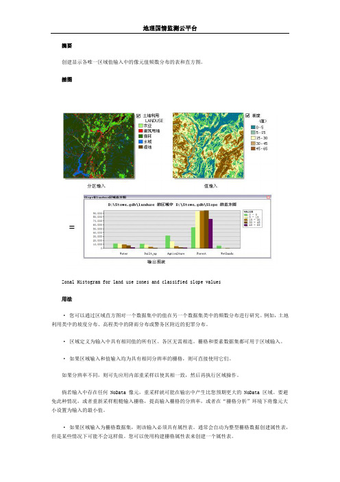
摘要创建显示各唯一区域值输入中的像元值频数分布的表和直方图。
插图Zonal Histogram for land use zones and classified slope values用法· 您可以通过区域直方图对一个数据集中的值在另一个数据集类中的频数分布进行研究。
例如,土地利用类中的坡度分布、高程类中的降雨分布或警务区附近的犯罪分布。
· 区域定义为输入中具有相同值的所有区。
各区无需相连。
栅格和要素数据集都可用于区域输入。
· 如果区域输入和值输入均为具有相同分辨率的栅格,则可直接使用它们。
如果分辨率不同,则可先应用内部重采样以使其相一致,然后再执行区域操作。
倘若输入中存在任何 NoData 像元,重采样就可能在输出中产生比您预期更大的 NoData 区域。
要避免此种情况,或者重新采样粗糙输入栅格,提高输入栅格的分辨率,或者在“栅格分析”环境下将像元大小设置为输入的最小值。
· 如果区域输入为栅格数据集,则该输入必须具有属性表。
通常会自动为整型栅格数据创建属性表,但是某些情况下可能不会这样做。
您可以使用构建栅格属性表来创建一个属性表。
· 建议您仅使用栅格作为区域输入,因为这可使您更好地控制“矢量至栅格”转换。
这将有助于确保您始终获得预期的结果。
· 如果区域输入是要素数据集,则可在内部对其应用“矢量至栅格”转换。
要确保转换结果与值栅格完全对齐,建议您检查环境设置和栅格设置中的范围和捕捉栅格是否设置正确。
由于内部栅格必须具有属性表,因此在转换中不创建属性表的情况下将会发生错误。
如果发生此错误,则使用要素转栅格、面转栅格、点转栅格或折线转栅格直接转换要素数据集。
按先前提示中所述内容为其生成属性表,然后使用生成的栅格作为“区域”输入。
· 如果区域输入为要素相对较小的要素数据集,则需要牢记,信息的分辨率需要适合于值栅格的分辨率。
如果单个要素的区域相似于或小于值栅格中单个像元的区域,则在要素转栅格转换过程中,某些区域可能不会显示。
- 1、下载文档前请自行甄别文档内容的完整性,平台不提供额外的编辑、内容补充、找答案等附加服务。
- 2、"仅部分预览"的文档,不可在线预览部分如存在完整性等问题,可反馈申请退款(可完整预览的文档不适用该条件!)。
- 3、如文档侵犯您的权益,请联系客服反馈,我们会尽快为您处理(人工客服工作时间:9:00-18:30)。
Syracuse, New York, and a Research Geographer in the Office of Geographic and Cartographic Research, National Mapping Division, U.S. Geological Survey, Reston, Virginia, 22092. He thanks Robin Fegeas for assistance with USGS computing, plotting, and data communications systems, and with the Geographic Information Retrieval and Analysis System (GIRAS). MS submitted August 1983 CARTOGRAPHICA Vol 20 No 4 1983 pp 65-91 Nhomakorabea66
MARK STEPHEN MONMONIER
plays. These advances, in both interactive and hardcopy display units, include color CRT displays and plasma panels; fast, efficient electrostatic dot-matrix printers and ink-jet plotters; and laser-beam drum scanner/plotters, which generate final color-separation negatives for offset lithography.4 Map generalization algorithms must adapt to both an increasing demand for the cartographic products of remote sensing and the likely replacement of the pen plotter by raster-mode display technology. This paper demonstrates that the computer-assisted generalization of maps of land cover and other area features can be straightforward and operationally efficient when the data are accorded the grid-cell organization of raster-oriented display hardware. After presenting land cover generalization as a problem of manipulating area features rather than line features, this paper demonstrates several strategies for feature selection, smoothing, and shifting. Although developed for reducing the 1:100,000- and 1: 250,000-scale data of the U.S. Geological Survey (USGS) Land Use and Land Cover program to the National Atlas Regional Reference scale of 1:2,000,000, the principles discussed here are applicable to other polygon data; for example, census tracts, counties, drainage basins, and soil mapping units.
Use of the digital computer in cartographic generalization both necessitates and encourages a variety of generalization strategies. Among the principal considerations are the type of feature (point, line, or area), feature density, degree of scale reduction, and type of display device. All four factors interact in the selection of an appropriate data structure and algorithm to address the three basic facets of generalization - feature selection, feature smoothing and simplification, and feature shifting. Most early algorithms for computer-assisted generalization treated linear features of very low density, typically just a single, isolated feature intended for display on a pen plotter after a modest scale reduction. Conditions were so tame that feature selection and feature displacement could safely be ignored.1 In contrast, an operational algorithm must be able to deal with the less than ideal, but more challenging circumstances of locally dense features and a scale reduction to less than 25 percent of the original scale. Such requirements demand more than the selective reduction of a list of point coordinates. Particularly promising among attempts to develop a holistic algorithm for line generalization have been the combined vector-raster approach of Fred Christ at Frankfurt am Main and the raster-mode linear-feature shifting algorithm of Wilson.2 Yet both efforts still call for further development, and it is unlikely that an operational algorithm could ever approach in simplicity the naively straightforward point-elimination techniques of the early 1970s. Events of the last decade have altered drastically the future demands for, and limitations upon, computer-assisted map generalization. For the first time, remote sensing provided rapid, frequent and geographically extensive land cover imagery. Impressed by the products of these missions, earth scientists are eager for still more detailed and more temporally extensive coverage. Therefore the map data generated by remote sensing continue to swell with continued improvements in resolution and corresponding increases in the number of pixels per scene.3 Only somewhat related to advances in remote sensing technology have been advances in computer-driven display hardware, principally in high-resolution raster disMARK STEPHEN MONMONIER is a Professor in the Department of Geography, Syracuse University,
RASTER-MODE AREA GENERALIZATION FOR LAND USE AND LAND COVER MAPS
MARK STEPHEN MONMONIER
Syracuse University
ABSTRACT Raster mode is more appropriate than vector mode for the computer-assisted generalization of land use and land cover data. A raster-mode approach promotes the partitioning of thin or insignificant polygons and the growing or linking of others. If the scale is reduced substantially, partitioning and region growing are needed to guarantee a graphically stable image, which will resist misregistration during reproduction. The test examples presented here demonstrate the efficacy of a raster-mode approach in reducing 1 : 250,000-scale land use and land cover data in the U.S. Geological Survey's Geographic Information Retrieval and Analysis System (GIRAS) to 1 :2,000,000, the scale of the National Atlas series of regional reference maps. A variety of category weights and priority rankings and several nonmutually exclusive options for smoothing and data aggregation confront the map author, who must provide detailed specifications. With these techniques generalized land use and land cover maps can be biased to emphasize a category or a combination of categories.
